Niagara Falls, New York. Friday, April 30, 2021
Breakfast at the Anchor Bar again, the service was spotty but well-intentioned. I asked if the maple syrup was real, and the waitress said sure, it’s real maple-flavored syrup. Oh well. The pancakes, eggs, sausage, bacon, blueberries, and home fries were hearty and filling, would be good for the rest of the day. Her name was Lindsay, like my cousin, and I almost asked if she spelled it with an “a” or the less-classy “e”. When the check came, her name was printed out: Lynnsi.
I gave her a big tip anyway.
Winter refuses to vacate the premises. Mid 40s, with wind gusts in the 40s also. Maybe a better day to walk than ride. I dug out my trail shoes and fanny pack for the first time, and set out on a mission: seeing the falls without spending a penny. No easy task.
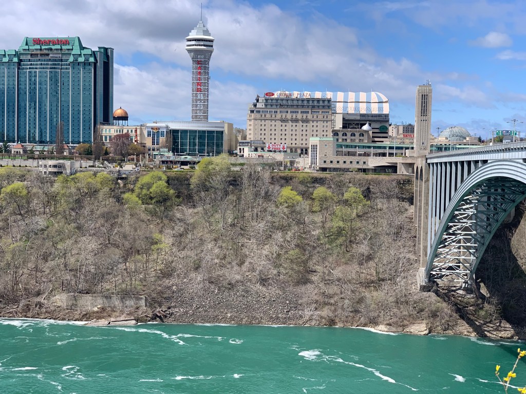
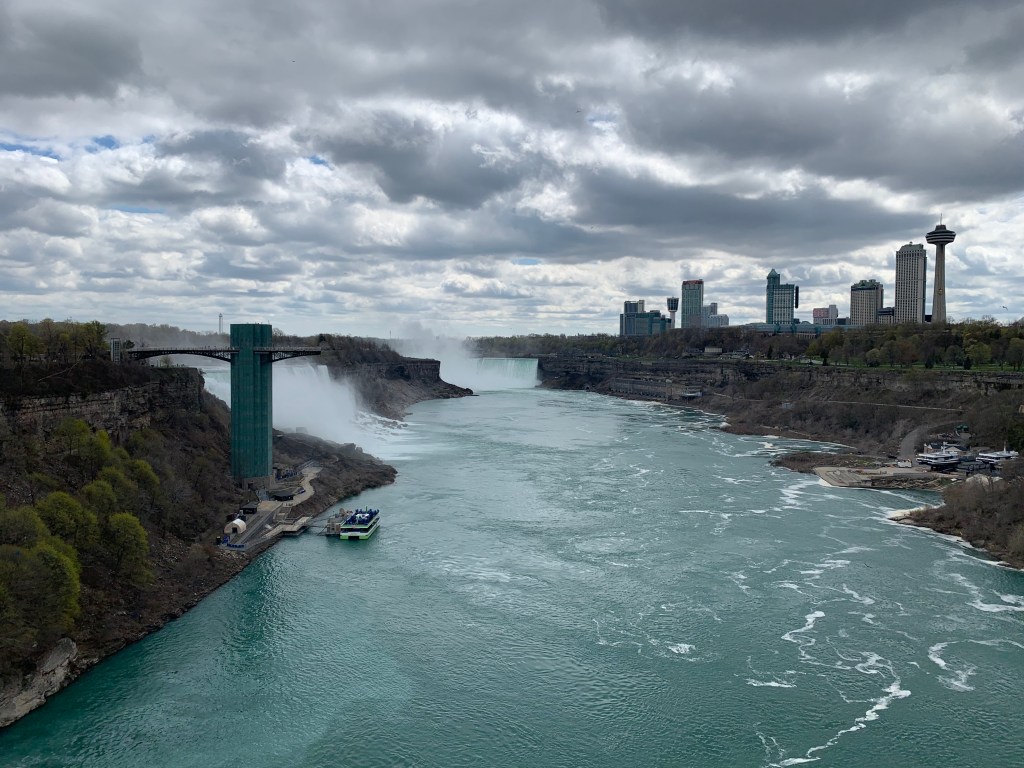
Niagara Falls, dazzling though it is, is one of the nation’s biggest tourist traps. And not just our nation. It straddles the border with Canada, and for once, Canada got the better of the deal. A bend in the river turns the falls facing away from the US and towards Canada. An island, Goats Island, splits the falls into the stupendous Horseshoe Falls on the Canadian side, and the much less impressive American Falls, which get a tenth of the water, falling onto a visible pile of boulders. Whenever we’ve gone in the past, we always go to the Canadian side, and the tourist facilities are much more developed there. Casinos, three observation towers, a huge Ferris wheel, and a strip packed with schlocky traps: Hard Rock Cafe, Ripley’s Believe It Or Not, wax museums, laser mazes, gloppy food as far as the eye can see—in other words, America. By contrast, the American side has older hotels and a much more subdued feel. It’s like the roles of the two countries were reversed.
Figuring the border was still closed during the pandemic, I decided to walk as many of the trails here as I could. Lindsay likes the American side better. Sure enough, Goats Island is in the US, and was landscaped by the great Frederick Law Olmsted. Here is the route I took.

The southern tip of the route took you to the Three Sisters Islands, with the pre-fall rapids swirling all around. You felt like you were in a small boat about to be swept over.
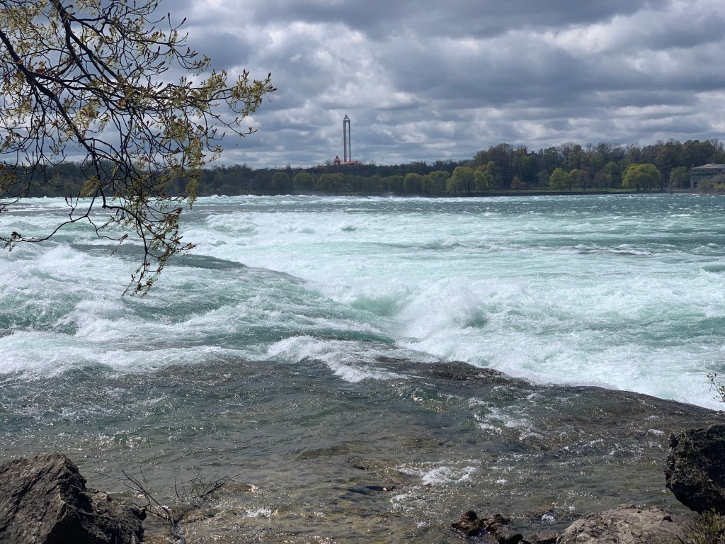
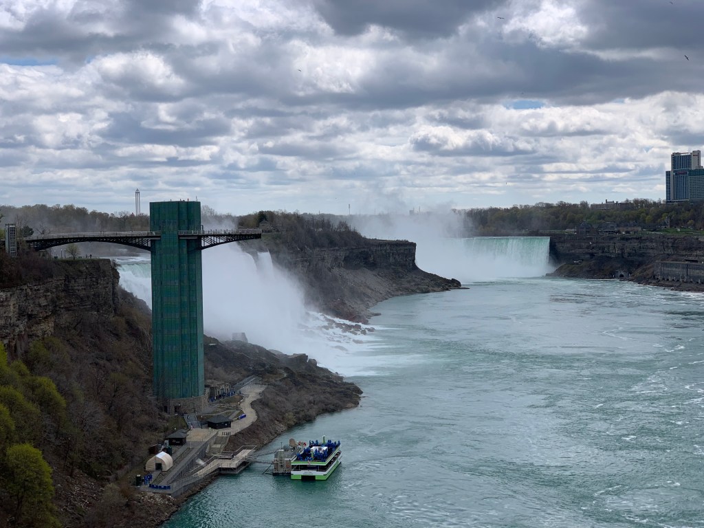
Next is Terrapin Point, the American edge of Horseshoe Falls, the main event, the most powerful waterfall in North America. It’s only 167 feet, but that’s four of the five Great Lakes going over the edge.

It brought back my physics lectures about power (watts) being a product of pressure (voltage, or in this case the height of the falls) and current (amperes, the volume of water going over). Thus Angel Falls, 2000 feet high but with much less water, might have as much power as Niagara. Or a static electricity spark (20,000 volts but minimal current) might equal a car battery, 12 volts but enough amps to crank a cold engine. Or a time exposure with a narrow aperture letting in the same light as a fast shuttter speed with a wide open lens.
All very interesting, but better just to stand silently and feel the energy thrumming in front of you, and marvel that the mist below makes its own rainbows.

Speaking of power, it was Nikola Tesla who first harnessed the power of Niagara into electricity. A vivid statue commemorates the achievement.
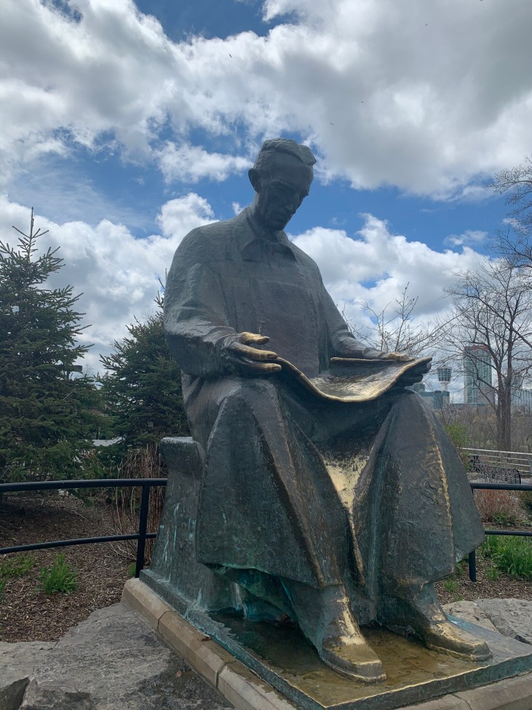
If only Elon Musk could be so humble.
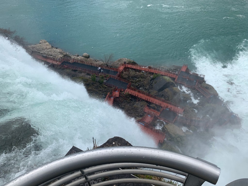
On to the other side of Goat Island, where American Falls is actually split by Luna Island into Bridal Veil Falls, plunging down to the tourist trap Cave of the Winds, where you take a elevator down to be buffeted by the spray, protected by these dry-cleaning-bag ponchos they give you.
On the other side of Luna Island is American Falls proper, poor cousin to Horseshoe but no slouch, you can see how the US side only gets a sidelong view, although that weird observation tower looked promising. Or maybe the Rainbow Bridge to Canada behind it.
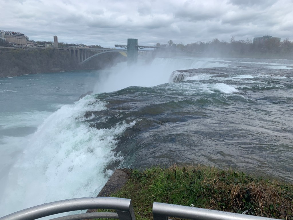
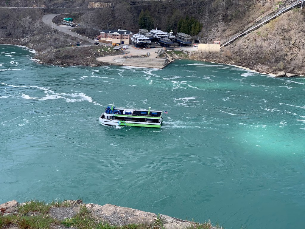
I tried to get up there but no, the cantilevered platform is closed, and the bridge is only for customers going to the elevator down to the Maid of the Mist boats, still running in this frigid weather.

OK, maybe the Rainbow Bridge, could I sneak across the border? Um no.
I hiked another mile or so downstream, looking for a better vantage point, but this was the best I could do. You can see the cluster of development in Canada, with their superior view.

Back to the Rainbow Bridge, could I get through legitimately?
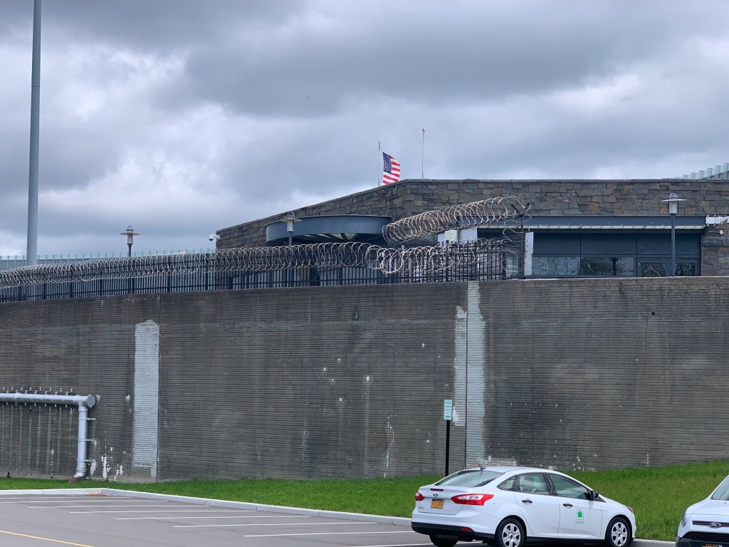
What have I got to lose? The pedestrian gate was not exactly welcoming.

I tested those subway gates, and to my surprise they turned. They would let me through, but not back. Nobody at the window, but I pushed the buzzer and the customs lady said they couldn’t stop me from going through, but I’d have to go through customs to get back in. Thank heavens I got that enhanced driver’s license a few years back.
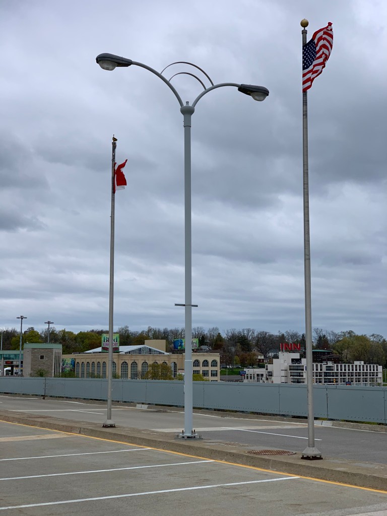
I went halfway across the bridge, where flags ands a sign marked the actual border. I sneaked just a toe across to Canada—it occurred to me that on this whole huge trip this was as close as I planned to get to another country—and finally got the picture I was looking for.

By now I’d been at it for almost four hours; The Hawk (our childhood name for an icy wind) was unrelenting. Time to end my Niagara-on-the-cheap tour. Went to the 7-11 for groceries for dinner and breakfast, I’ve got a big day tomorrow.
Lindsay was right, the American side is pretty cool. Sure glad I didn’t try to bike today.
Distance 6.6 miles, (walking only, not added to total) Time 3 3/4 hours with stops. Elevation gain 833 feet.

Thanks for a fantastic tour of the Falls!
LikeLike