Cape May, New Jersey to Chincoteague, Virginia. Monday, March 9, 2026
OK, show of hands. How many of you have read the book Misty of Chincoteague? Those of you with your hands up, how many of you are women? I’m not saying, I’m just saying.
Conversely, I suspect the male/female ratio would be reversed among those who have seen the Clint Eastwood movie, Play Misty For Me. But I might be wrong. This was the first movie where Clint played against type as a sensitive radio disc jockey being stalked by an obsessed fan.
We played Misty ourselves, as an audiobook since we were headed for Chincoteague. The story of the intrepid foal sired by wild Assateague ponies was touching, but a little too syrupy for our tastes. We did want to see the ponies though.
So it was in the summer of ’78, when I backpacked with two friends the entire length of Assateague Island National Seashore,
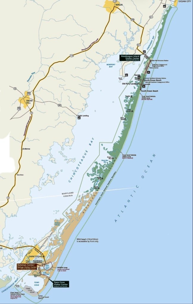
Assateague Island, with Chincoteague at the bottom
28 miles of pristine beach with no roads or facilities in between, we each carried 2 gallons of water. We thought for sure we would see those fabled wild ponies. But we saw none until the end, where a herd of them were clustered around a feeding trough by the road.
Legend has it that the ponies were descended from fine Spanish horses that were the only survivors of a galleon shipwrecked off the island in the 1500s, who swam to shore and lived there for generations, gradually growing smaller because of the poor nutrition from seagrass. More likely, they were just escapees from local farmers who pastured some of their herd on the island.
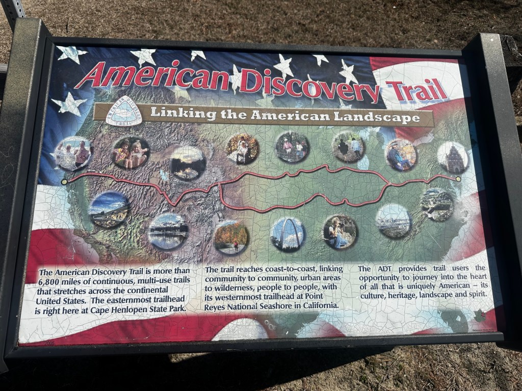
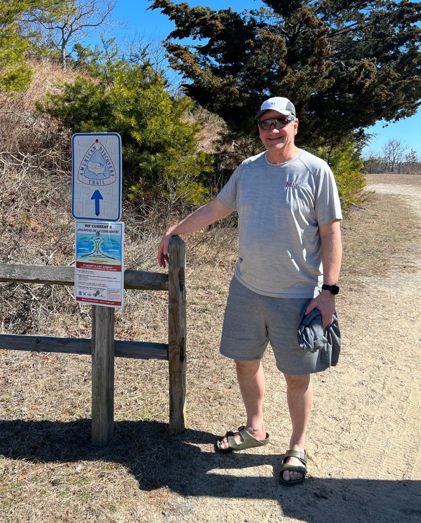
Growing up in DC, Assateague was the only beach I ever went to. Most of my friends went to Rehobeth or Bethany Beaches, or Ocean City. I saw Rehoboth for the first time today, quite nice, but way too commercialized. Cape Henlopen was more like it, and also an important landmark, the end of the American Discovery Trail. My friends Eric and Ellen had scouted this coast to coast trail back in 1990, and it was cool to see where they finished, 5,057 miles after leaving Point Reyes, California. Funny, I’d only crossed it twice on my coast to coast route, in Indiana and Colorado.
Eric and Ellen had scouted the southern route, 5057 miles.
The final quarter mile. That last “victory” photo is only half fraudulent, I did bike across the country, but not on the ADT.
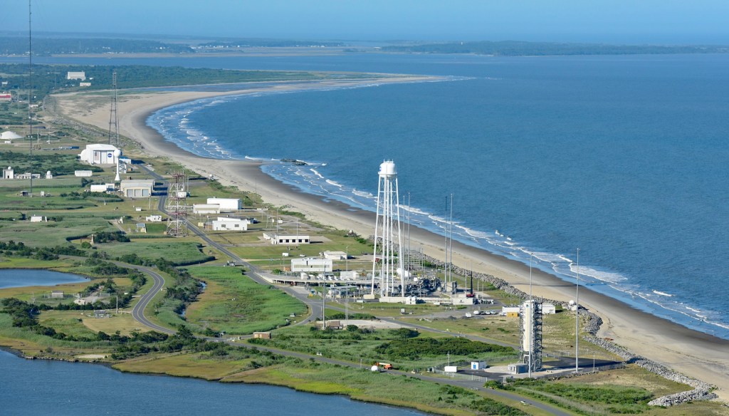
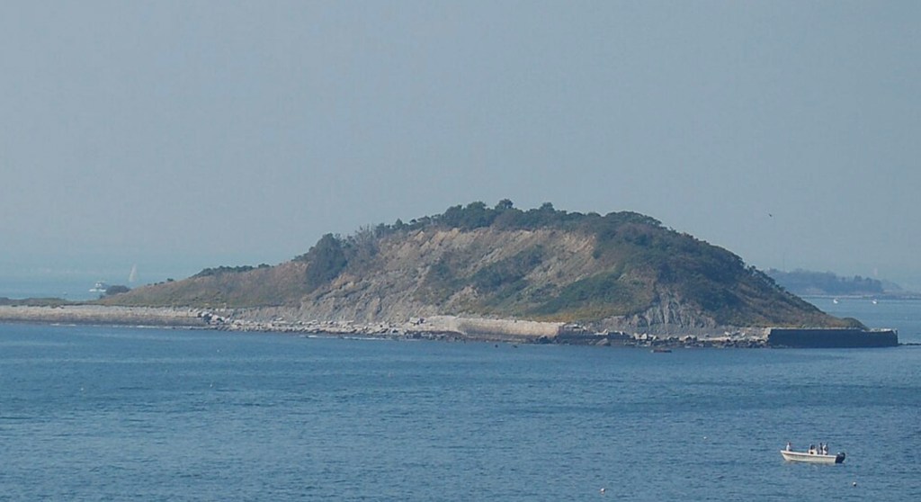
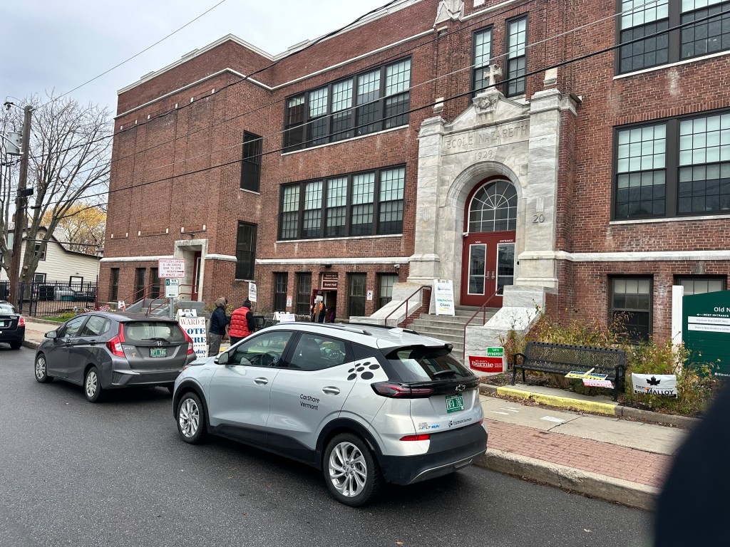
Just before arriving at Chincoteague, we passed Wallops Island Flight Facility, where NASA launches satellites and weather balloons, but it was closed today. This is a web photo.
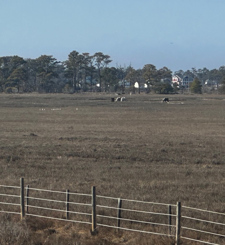
Assateague Island is in the background
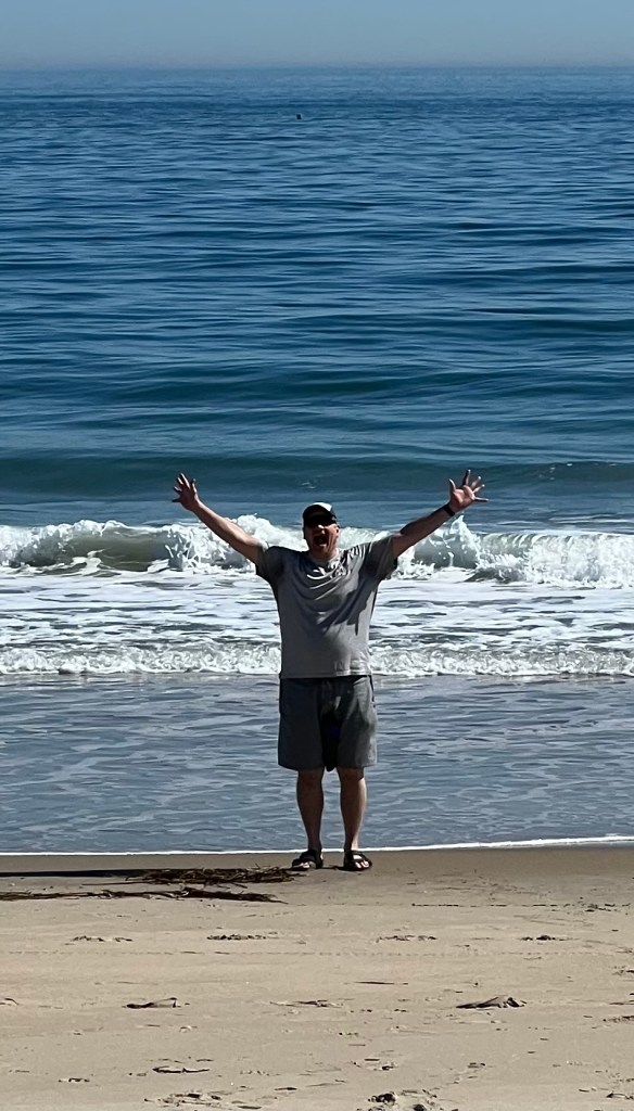
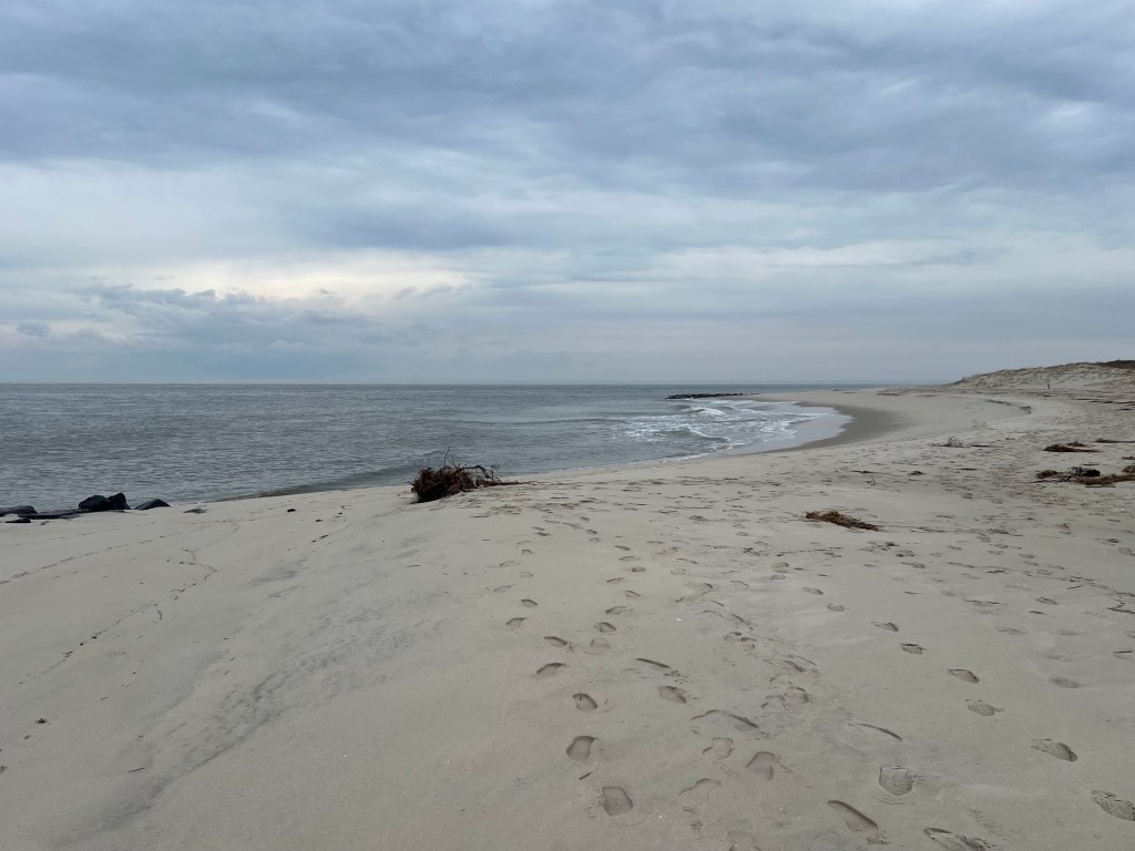
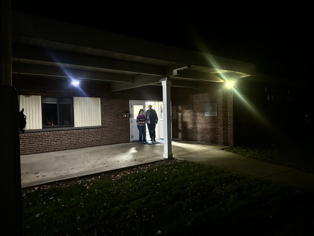
It was foggy and windy when we arrived on Chincoteague, we took a 24 mile bike loop through the dunes, marshes, and the small town, but the only view we got of the ponies was this one, far in the distance and penned up by the Park Service for the winter. Not so wild after all.
I guess in the end, my romantic visions of Misty fared no better than Cliff’s did.
24 miles, 75 total. 68 feet climbed, time 3 hours with stops.
Philadelphia to Cape May, New Jersey. Sunday, March 8, 2026
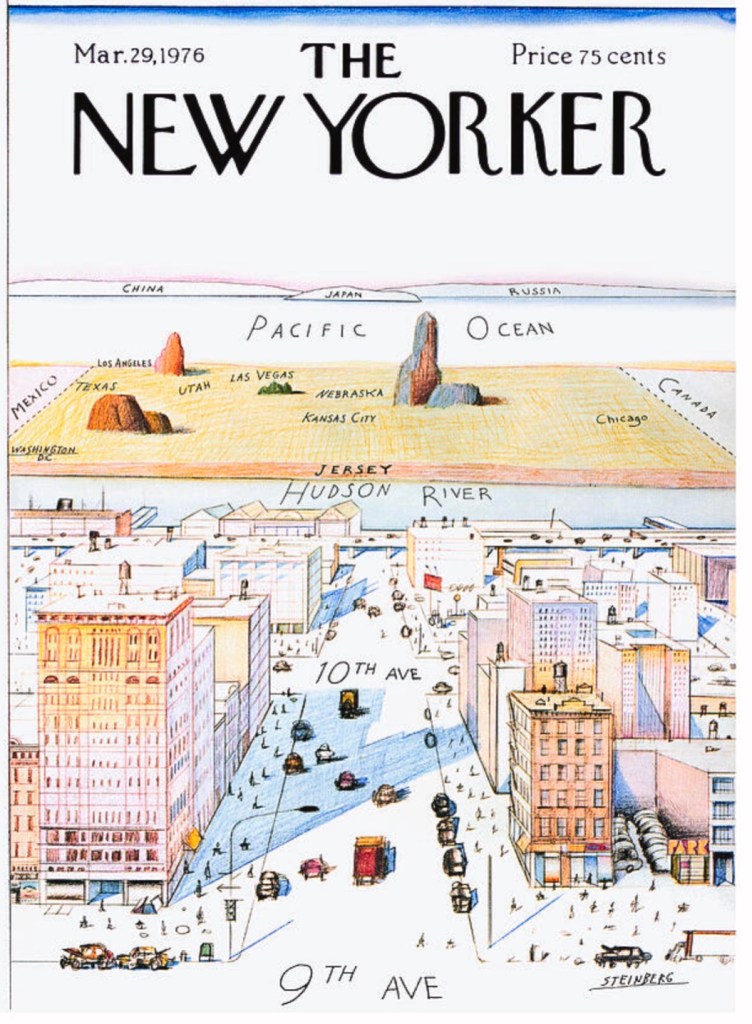
Like Philadelphia, New Jersey has an image problem. To outsiders, it’s a big suburb, bedroom community to New York City, and a place to go through, not to get to. To the city itself, well this iconic New Yorker cover says it all.
But let’s be fair. The state that gave us Bruce Springsteen, the state whose very name is a corruption of “Caesar”, must have more to it than urban decay, organized crime, and the “Joisey Shore.” Today we plan to see the other New Jersey.
We hoped to visit a bunch of East Coast sites as we head to the Deep South, but we’re determined to avoid the dreary New Jersey Turnpike and I-95. That means hugging the Atlantic coast as closely as possible, which in turn means crossing the mouth of Delaware Bay, rather than the Delaware Memorial Bridge.
So instead we’ll follow the Garden State Parkway to the southernmost tip of New Jersey, Cape May, reputedly the oldest seacoast resort town in the US, and the nation’s best place for migratory birdwatching. The funnel-like shape of the Cape concentrates the autumn flyways into a narrow point, before the birds make the leap across the bay.
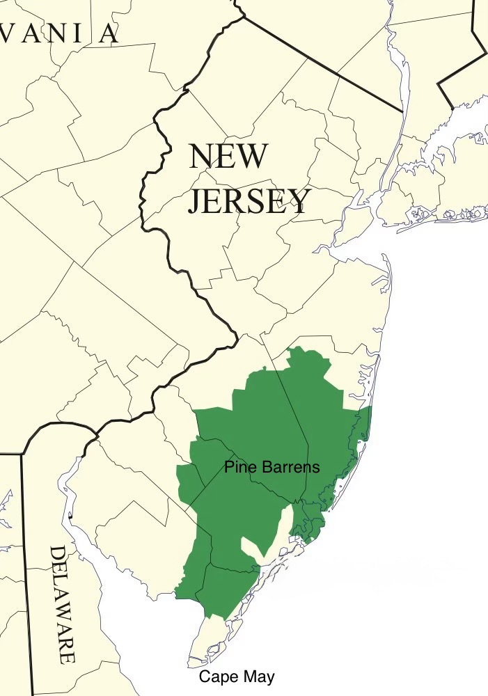
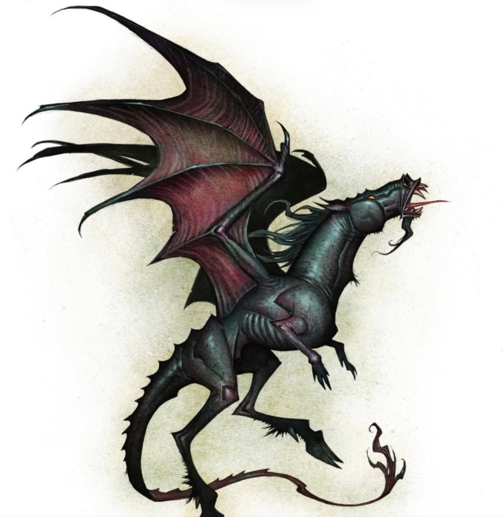
To get there, we have to cross one of the most bizarre anomalies of the Atlantic seaboard, the Pine Barrens. A vast, sparsely populated plain whose sandy soil supports little more than endless pine forests, which occupies almost a quarter of the most densely populated state in the country, whose water is said to be the purest in America. Featured in a memorable Sopranos episode, home to the cryptid Jersey Devil
The ghost of Captain Kidd? A vagrant sandhill crane? A rogue NHL player?
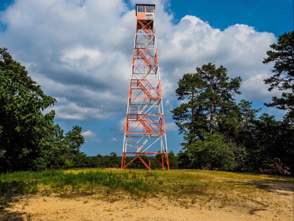
and so flat that its highpoint is Apple Pie Hill, elevation 200 feet.
Apple Pie Hill
On a previous trip, the hill afforded an awesome view, I could see from Philadelphia to Atlantic City. But today is Sunday and the fire tower is closed, so we just drove through.
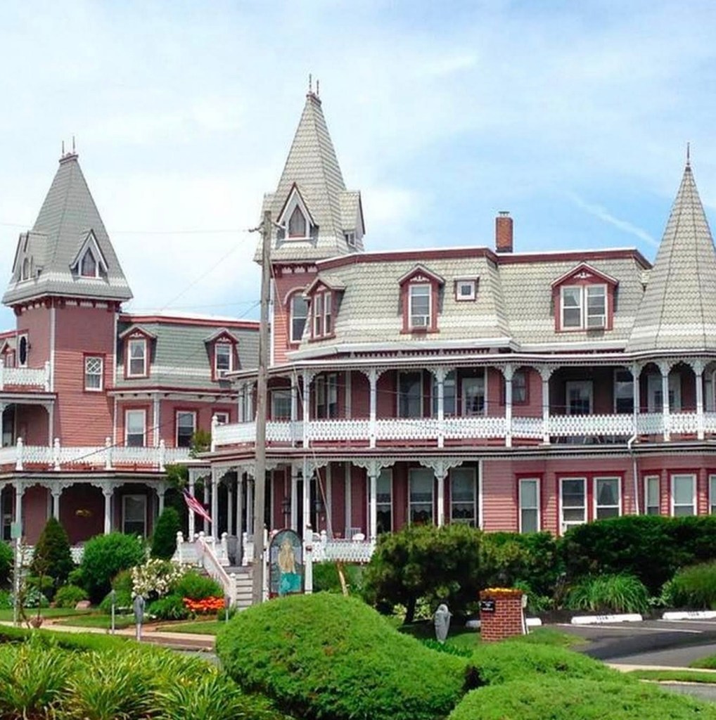
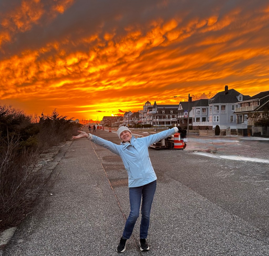
In Cape May, we checked in to our Victorian hotel, the Angel of the Sea,
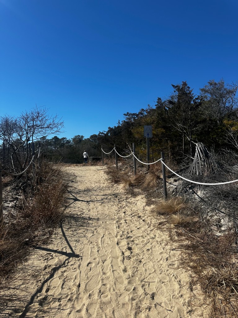
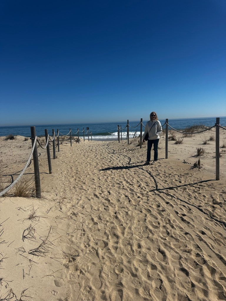
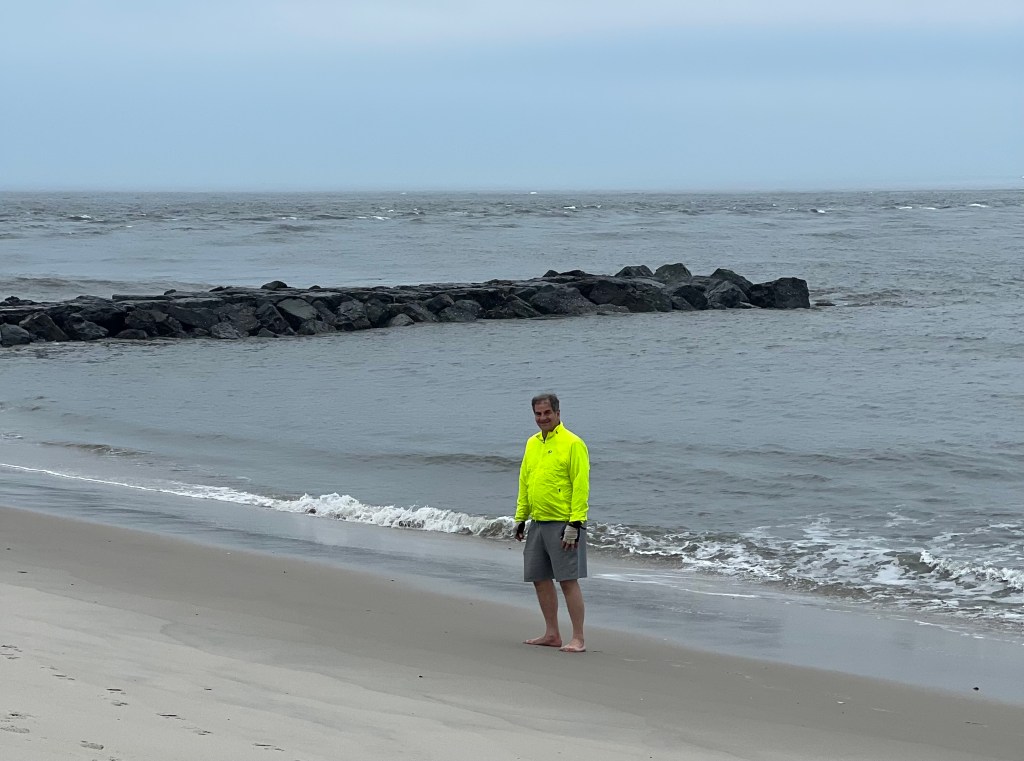
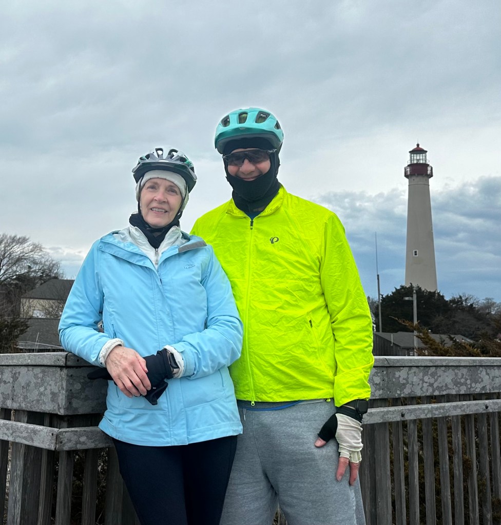
did an 11 mile bike ride to Cape May Point itself, and walked along the deserted beach.
The birds weren’t there this time of year, and the lighthouse was closed,
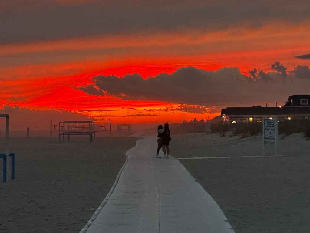
but the city was full of gingerbread inns, and sunsets to die for.
14 miles, 51 total. 200 feet climbed, time 5 hours with stops.
The City of Brotherly Love Saturday, March 7, 2026
Poor Philly! Can’t get no respect. Mocked by WC Fields, who wanted his epitaph to read “I’d rather be in Philadelphia”, ironically dissed by the TV series “It’s Always Sunny in Philadelphia”, and even badmouthed by a favorite musical, 1776, complaining it’s hot as hell in Philadelphia, and later referring to it as foul fetid fuming foggy filthy Philadelphia. Knocked off the list of the nation’s five biggest cities by the likes of Houston and Phoenix. Oh the shame!
My mother‘s favorite movie was The Philadelphia Story, but that was really about its glitzy suburbs along the infamous Main Line. Another Oscar winning movie, Philadelphia, was all about AIDS. At least on the bicentennial itself, the Best Picture winner was Rocky.
Yeah, well. It’s still Philadelphia, and this is the semiquincentennial. 50 years ago I tried to bike from Boston to Philadelphia in time for the festivities on July 4, 1976, but only got as far as Hartford. Just as well, I heard the shindig was so commercialized that people called it the Buycentennial. Today I was in my sister-in-law’s house in Gladwyne, a full-fledged member of the Main Line, and figured I might as well “complete” those plans by visiting the city before it got too crowded for the date itself.
My tour took me down the beautiful Schuykill River bike path, past the storied Boathouse Row, home of some of our nation’s great crew rowing clubs
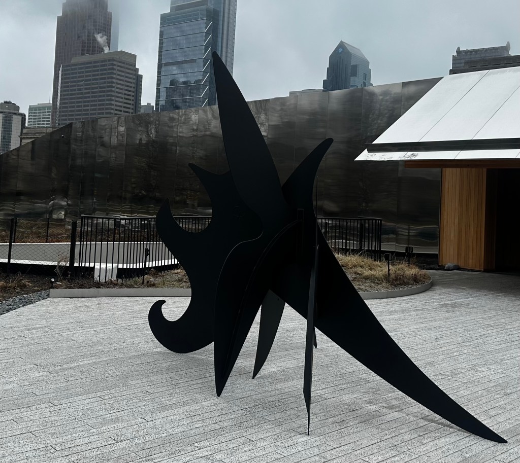
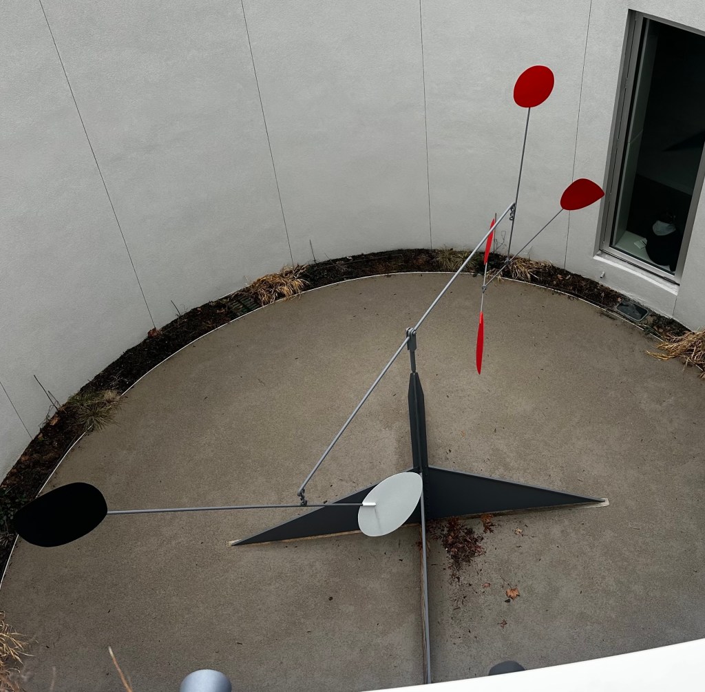
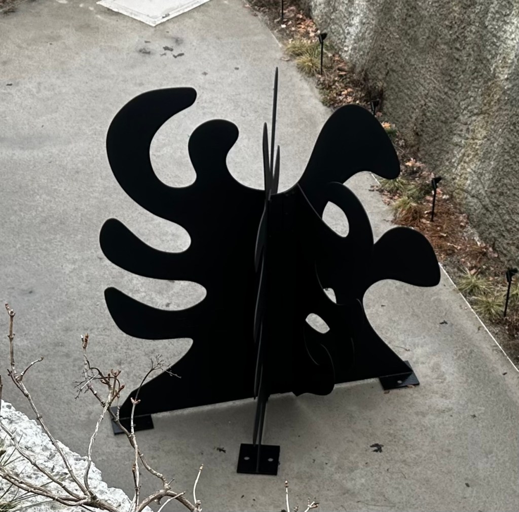
to my first stop, the Calder Gardens. I balked at the steep admission fee, and caged a few glimpses of his signature stabiles and mobiles visible from the outside.
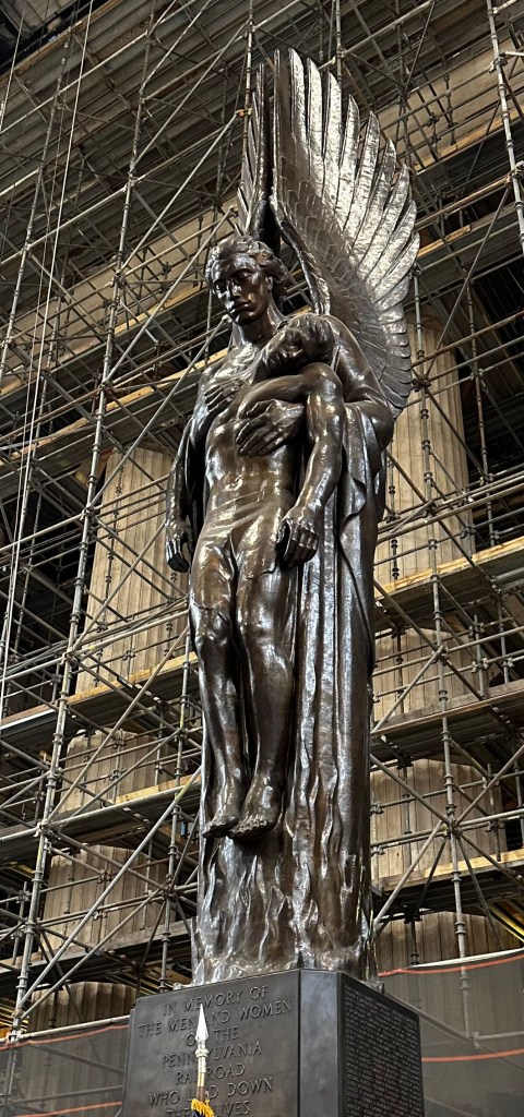
One of my most vivid images of Philadelphia was in the movie Witness, where a little Amish boy, in the city for the first time, is transfixed by a statue of the Archangel Michael in the 30th St. Station, right before he witnesses a brutal murder. https://youtube.com/watch?v=nPvELimqLTg&si=aJnNcN2pVXmFvoC_ This is a memorial to Pennsylvania Railroad workers who were killed in World War II, the angel is lifting a fallen soldier out of the flames. I rarely pass through the city without taking the time to see it. Haunting, even with the backdrop columns obscured by scaffolding.
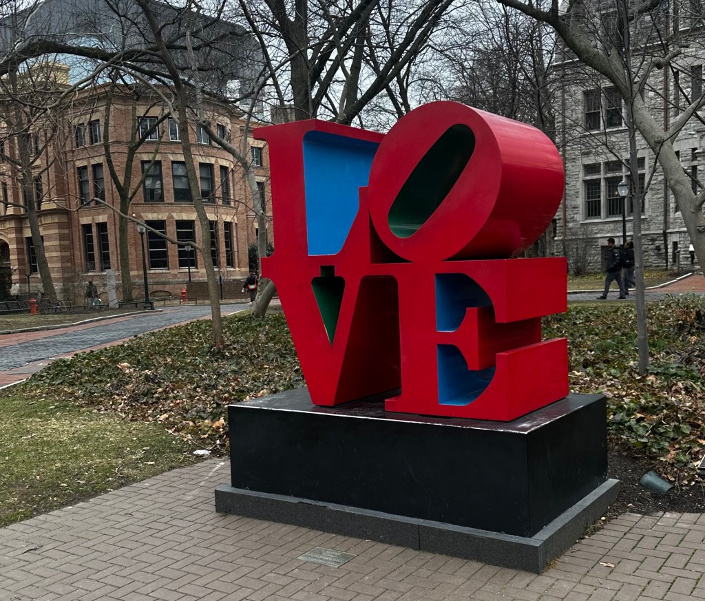
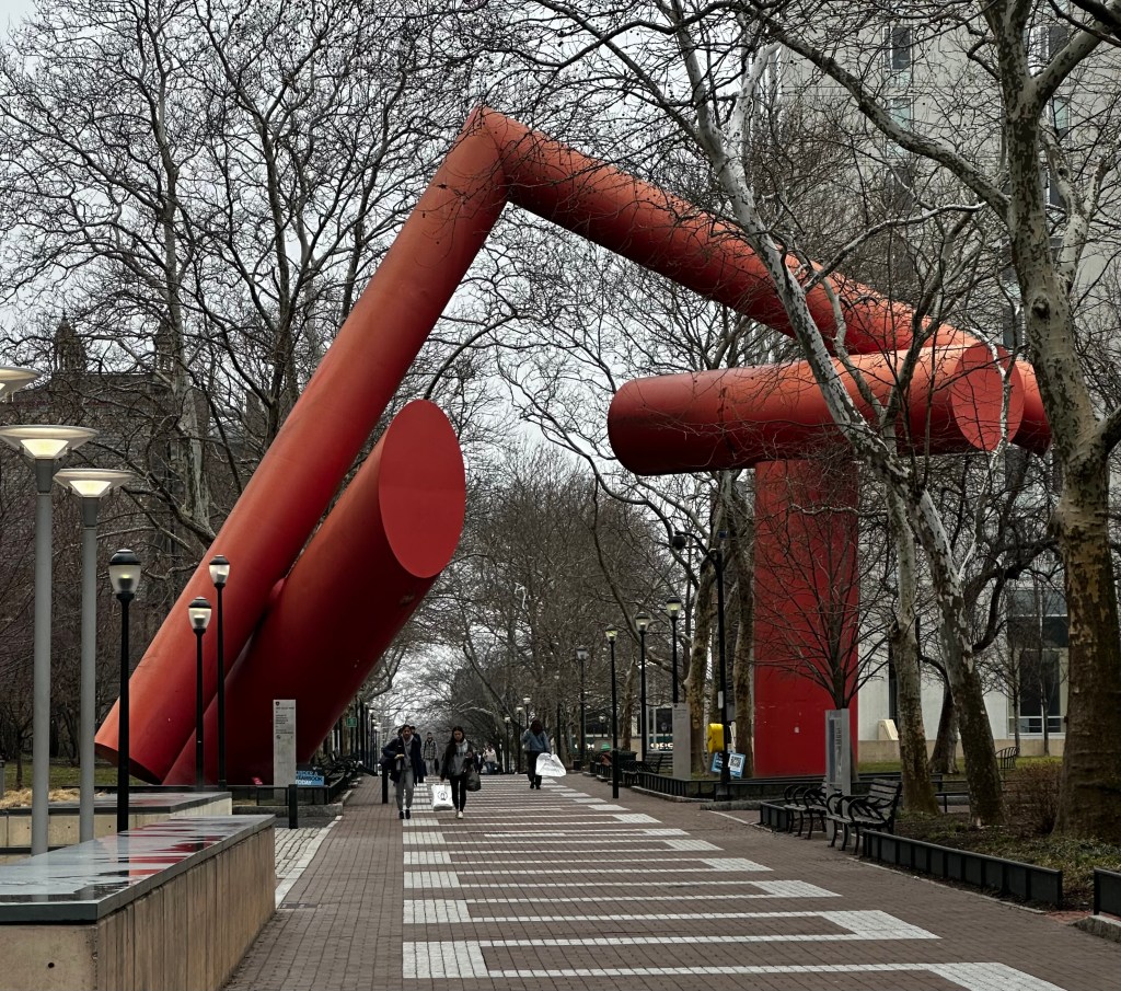
On to the ivy-covered campus of the University of Pennsylvania, with its quirky sculptures
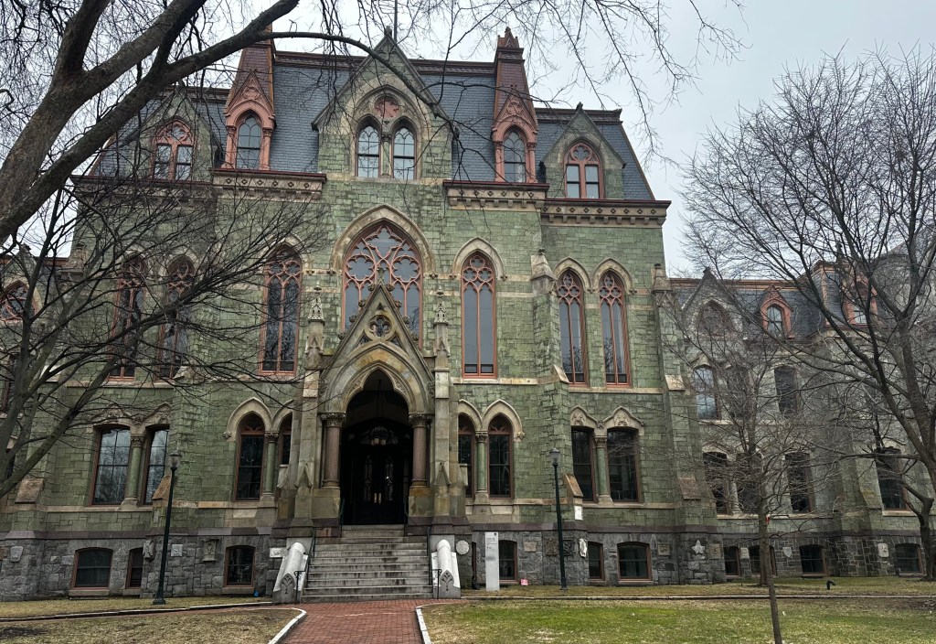
and the oldest building, hoary College Hall, faced with green marble, used for the exterior shots for the Addams Family mansion
You rang?
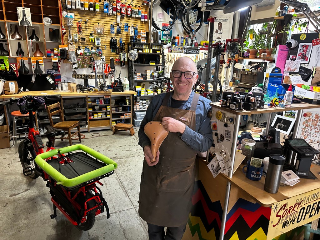
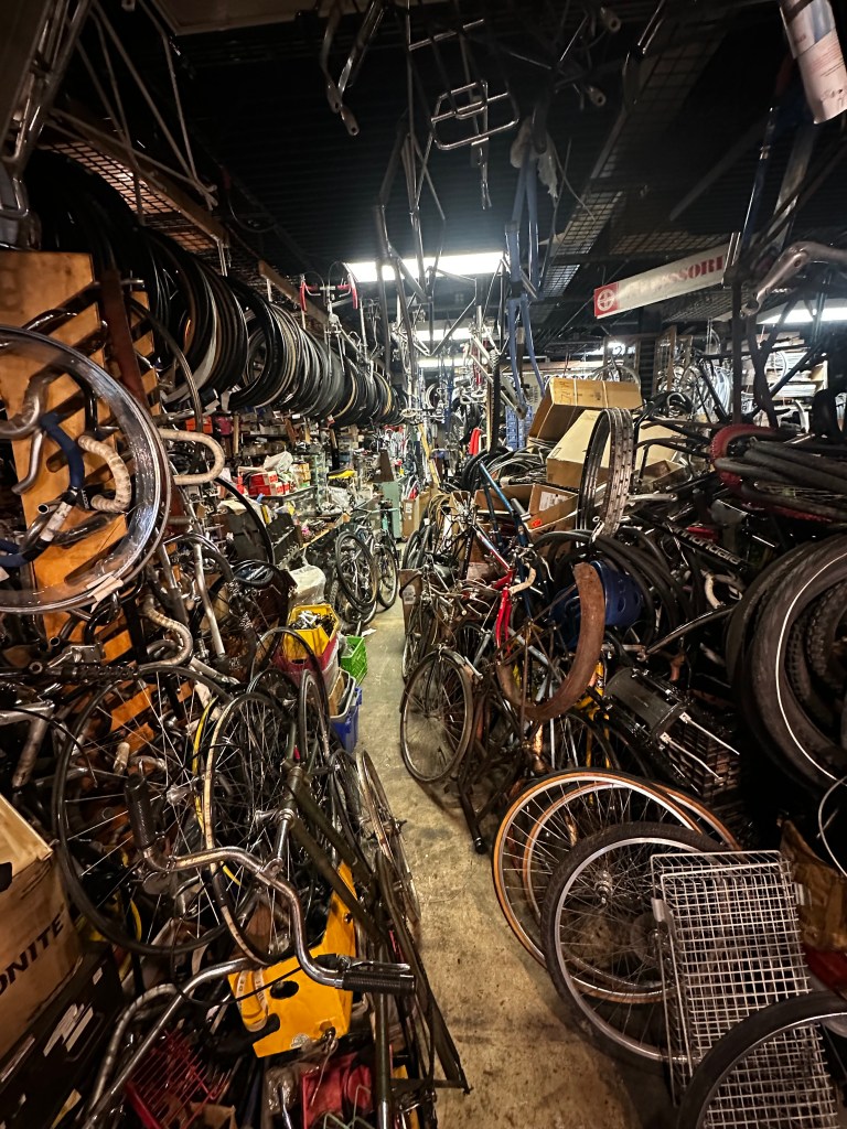
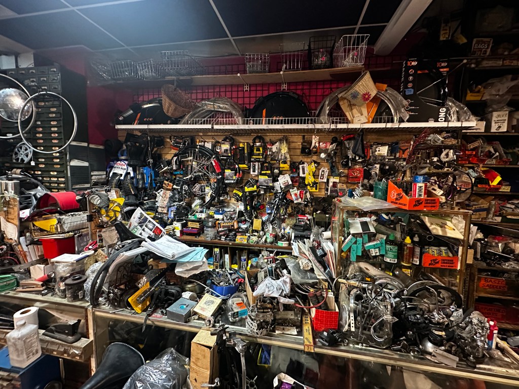
I’ve mentioned Simon Firth of Firth and Wilson Transport Cycles in Philadelphia in previous posts, the sole North American service provider for the great Brooks saddles, a number of times, but never met the man. Here was my chance. His shop is in the Bok Center, deep in gritty South Philly, a repurposed high school founded by the grandfather of Derek Bok, Harvard president during my Cambridge years. Urban renewal in the best sense. https://www.buildingbok.com/about. It took miles of dodging potholes and inner-city blight to reach it, but was serenaded by Springsteen’s anthem en route. https://youtu.be/aViW5QQoVko?si=Ah_2180wZCz2B88z. Great fun visiting with Simon
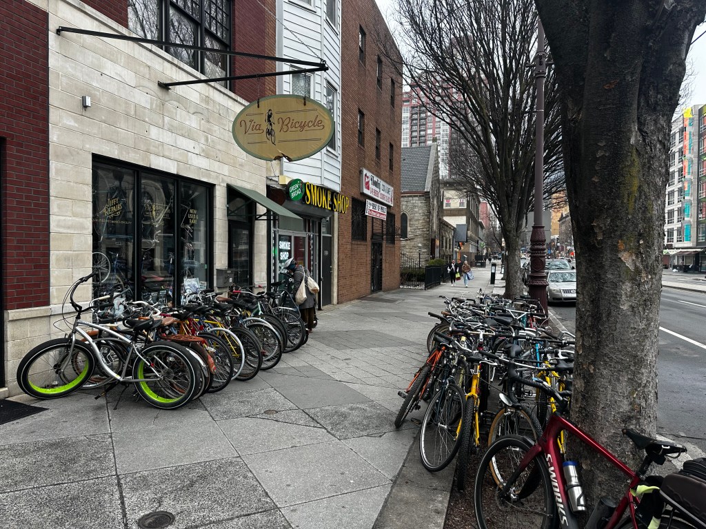
a Birmingham native who has saved my hide (literally) countless times as my beloved leather Brooks saddles succumbed to my corpulence. His shop and the Bok Center was classic enough, but he directed me to an even more iconic bike shop, Via Cycles nearby.
you don’t get much more “authentic” than that.
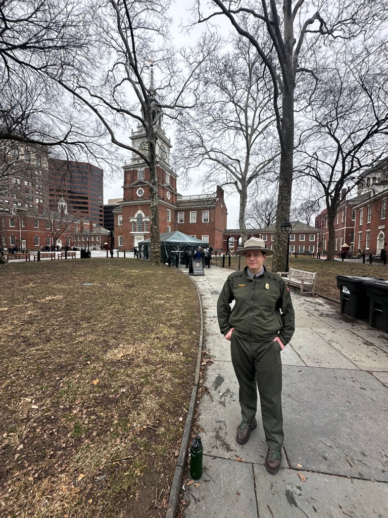
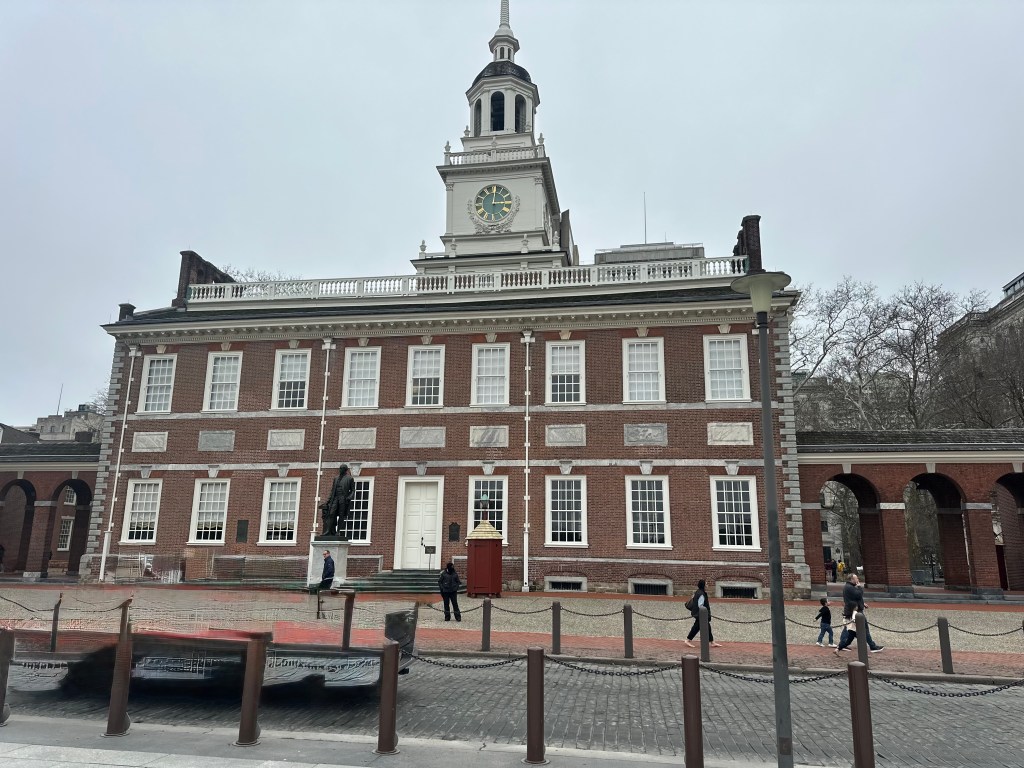
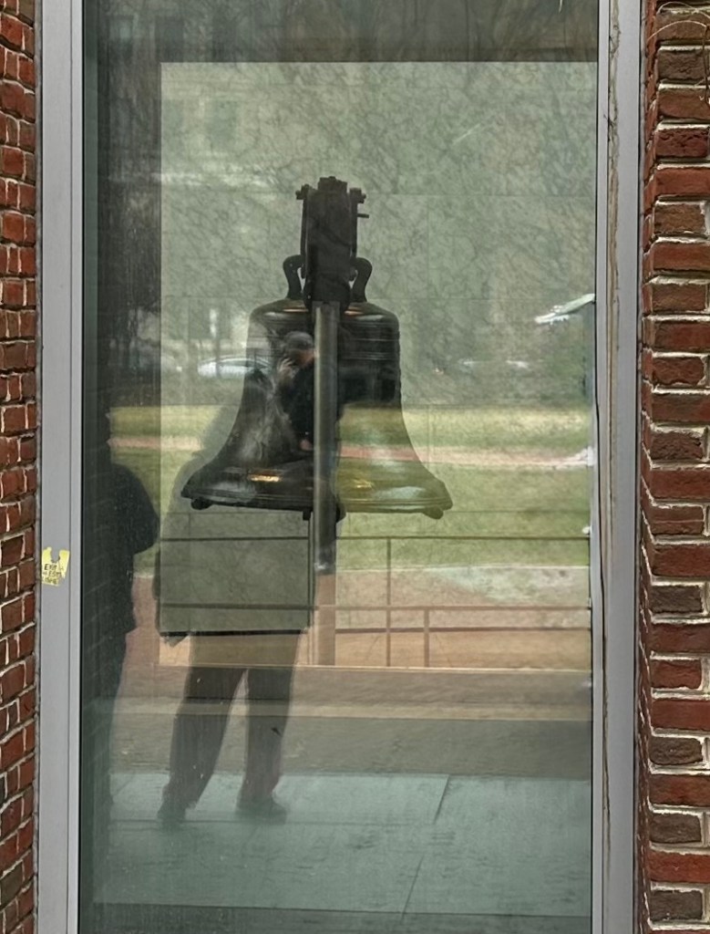
Back to tourist mode. On this dreary March day, Independence Hall was oddly peaceful in apprehension of the mobs to come in July, ranger Jack Collins had lots of pity anecdotes about security, commercialization, and what really happened back in 1776.
he convinced me to eschew the overhyped museums nearby, but I couldn’t resist glimpses of Nutty George in front of the famed edifice
and the Bell itself, thronged by sightseers even today, instead catching a peek through the bulletproof glass.
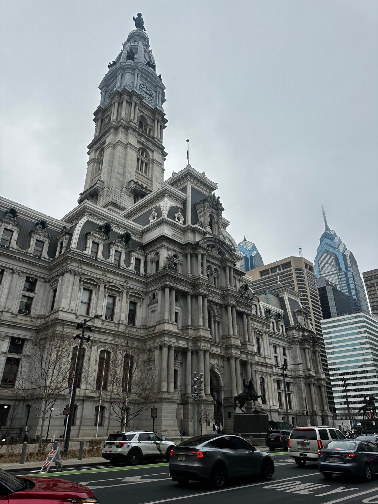
For almost 90 years, an unwritten gentlemen‘s agreement forbade any skyscraper from rising above Billy Penn’s hat atop City Hall,
Now surpassed by the Liberty Place towers in the background
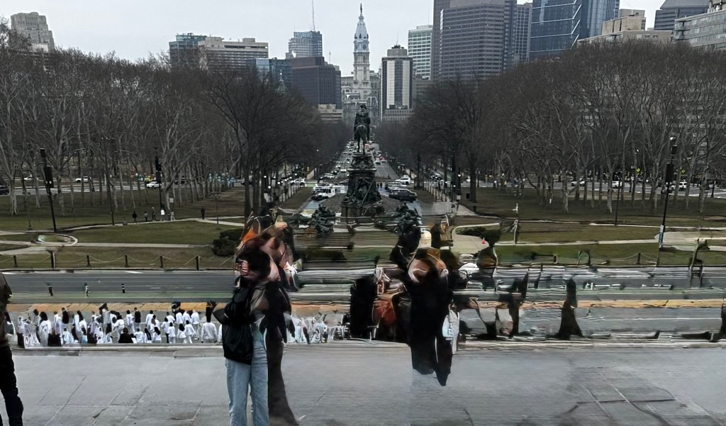
which stands at the end of Philadelphia’s Champs-Élysées, The Benjamin Franklin Parkway
I was only able to partially expunge the people in the foreground.
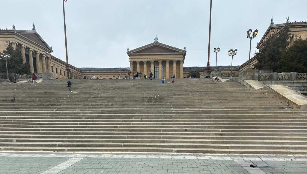
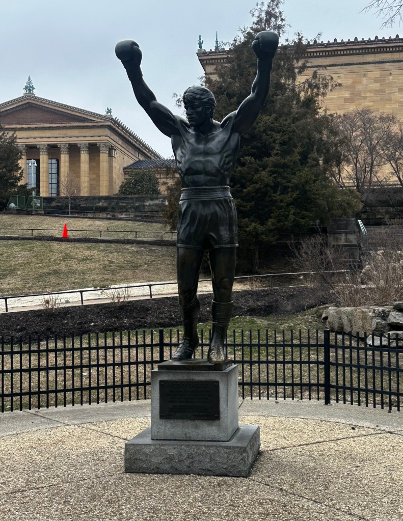
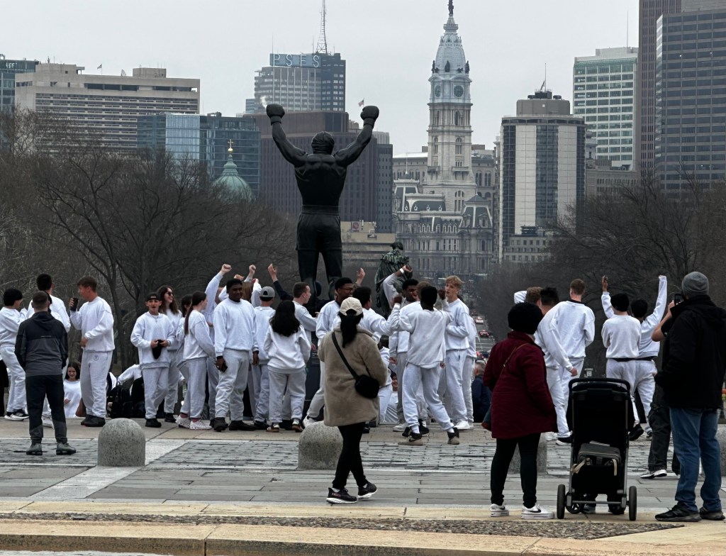
which passes the Franklin Institute and Barnes Foundation museums, en route to the neoclassical Philadelphia Museum of Art, designed in part by my brother-in-law Scott’s grandfather,
and sporting not one but two statues of Rocky, the second surrounded by a fan mob in white sweatsuits.
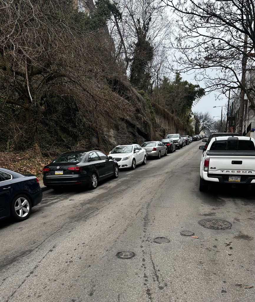
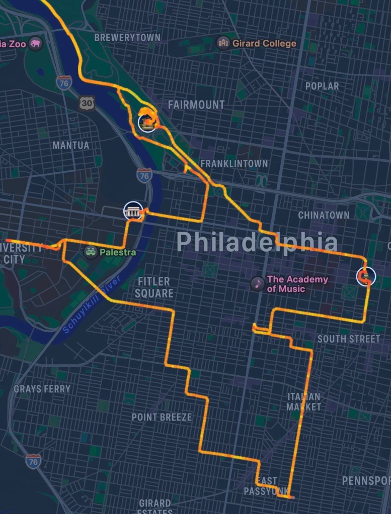
The trip home on the Schuykill River bike path took me by the “Manayunk Wall”, one of the steepest streets in America, with maximum grades of 17%, famous as a key feature in the Philadelphia International Cycling Championship. The view is foreshortened and doesn’t really capture how steep it is, but I didn’t want to try it, even on my e-bike.
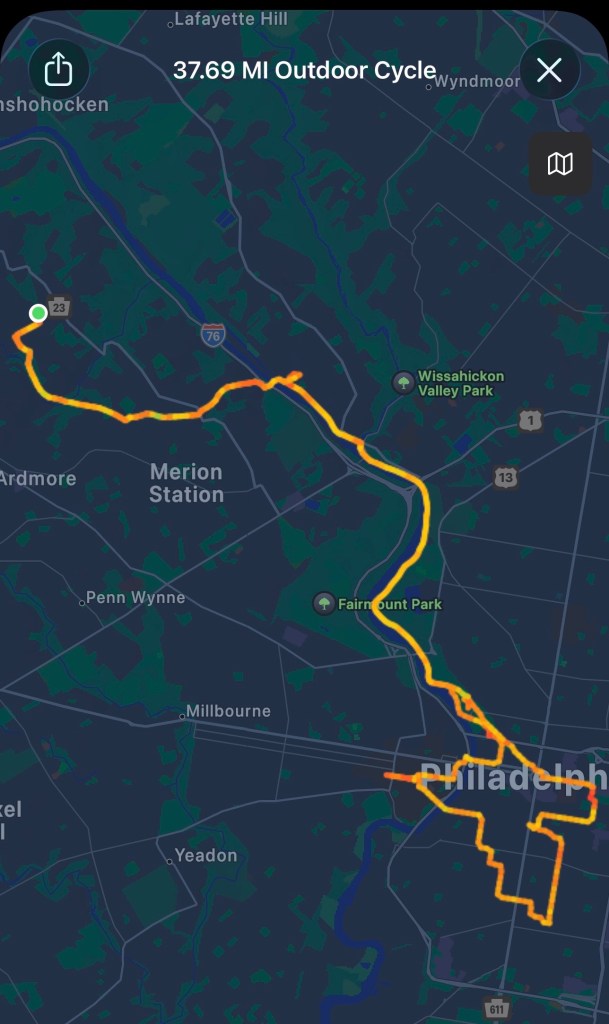
Here are screenshots of the ride, downtown detail,
ScreenshotScreenshot
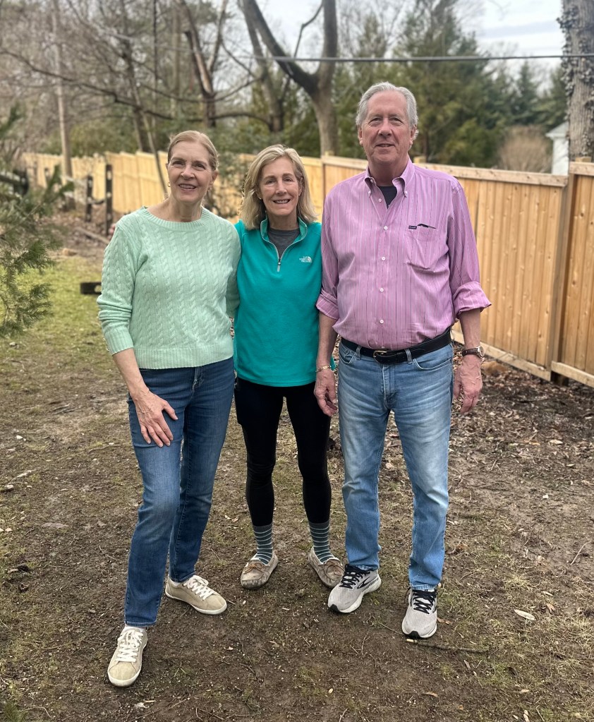
and a family photo of Jane, sister Carolyn, and husband Scott Smith.
I’ll only post the non-automotive miles here:
37.7 miles, 1,806 feetclimbed, time 7:15 with stops.
Reimagining the journey: Williston, Vermont to Philadelphia. Friday, March 6, 2026
It’s hard to let go, but let go I have. In my fairly recent post, Dénouement, I came to terms with the realization that completing the state highpoints from “sea to summit” under human power is no longer realistic, reasonable, or fair to my family. I’ve done over half of them (26) that way, and will content myself with completing them less rigidly. Like everybody else, I will rely on internal combustion to get me at least part of the way there.
At least I’m good company. Many of the great travel narratives, from the likes of Jack Kerouac, Bill Bryson, William Least Heat-Moon, John Updike involved automobiles, and perhaps most notably John Steinbeck, in his Travelswith Charley. Steinbeck outfitted himself with a new campervan for his journey, and responded to the skepticism and sarcasm of his friends by naming it Rocinante, the steed of the man of La Mancha, wingman for his impossible dream. I looked up the name on Wikipedia: “In many ways, Rocinante is not only Don Quixote’s horse, but also his double; like Don Quixote, he is awkward, past his prime, and engaged in a task beyond his capacities.”
Seemed about right. This highpoint quest has always seemed vainglorious, a grandiose expedition. In the two years since my last installment I’ve resisted, with limited success, emulating Bryson’s waddlesome sloth. The gym and a bunch of shorter journeys have only partially kept me away from the ravages of my beloved easy chair. It’s time to get moving again, to tilt at a few more windmills. Steinbeck had his Fair Elaine, and I have my Fair Jane to accompany me. We needed a new minivan anyway, so why not name it Rocinante?
You heard that right. Jane is accompanying me. I get to have my cake and eat it too. We’re lighting off for the horizon, in search of gardens, antique stores, and highpoints (the eight “easy” ones in the South and southern Great Plains.) We listened to the Steinbeck book on the first leg of the journey, to Jane’s sister’s house near Philadelphia. Seven hours of driving, migrating from snow-covered mountainsides to the dreary, not-yet-spring countryside of the middle Atlantic states. Our e-bikes are mounted on the back, constantly triggering the auto-stop brake when I put it in reverse, and doubtlessly getting coated with salty road spray. We tried covering them up, but that completely blocked my rear view.
Hi-Yo, Rocinante! Off to the Deep South with my Dulcinea! And that’s not just whistling Dixie.
Annual Boston to Provincetown bike rides, 1983-2025
50 years ago, New England was experiencing a heat wave similar to the present. In July 1975, the temperatures in Boston were often over 100. As a college junior of limited means who decided to stay in the (non-air conditioned) dorms over the summer, I was desperate to escape to Cape Cod over the weekend. I had no car, no friends to drive me, the buses were fully booked, and there was no place to stay there anyway.
Perhaps long on academics but short on common sense, I decided to ride my bike. Surely I’d find someplace to camp once I got there. It was way too hot to bike in the daytime, but just three months earlier I’d taken that all night ride following Paul Revere, why couldn’t I do it again? Still on a cheap 10-speed, still with no helmet, but at least I had a light of sorts. Do any of you remember Wonder Lights, those gizmos you strapped to your left knee? The anemic flashlight bulb within would bob up and down as you pedaled, hopefully attracting the attention of drivers.
You’ve got to be kidding me
How to get through the sketchy neighborhoods south of Boston? Simple: just sneak your bike onto the Red Line (illegal back then) and hope nobody caught you before you got to Braintree.
Improbably, it all went off without a hitch. Nobody caught me, and by 11 PM I was cycling down busy Route 3A from Braintree through the South Shore towns of Cohasset, Scituate, Marshfield, and Plymouth. No close calls, the traffic thinned out after 1AM, the sidewalk on the Sagamore Bridge wasn’t too bad, and cruising Route 6A on the Upper Cape in the wee hours was oddly peaceful. I only wished for a place to get a snack and a coffee.
The sun was just rising as I hit Coast Guard Beach in Eastham, and I collapsed gratefully on the sand. I wasn’t dozing for 10 minutes before I was nudged awake by a park ranger.
“You can’t sleep here.”
“ I can’t take a snooze on the beach?”
“You obviously biked a long way with your camping gear, and there’s no camping on the beach. You have to find a campground.”
I called every campground in the Yellow Pages, all were full. The ranger had no suggestions, and kept his eye on me. I saw I had no choice but to return to Boston.
As a college kid, I’d pulled my share of all-nighters, but never like this. I didn’t think you could fall asleep while riding a bicycle, but a couple of times I nodded off on 6A, the wobbling bike snapped me back awake. I tried to lay down in the grass next to the road, but invariably a concerned motorist would stop and ask if I was OK. I was now desperate for coffee, but the only establishments on 6A were real estate offices and antique stores. I somehow made it back to Plymouth at 11 PM, where a Good Samaritan saw me staring dolefully at my map, wondering how to get back through those sketchy neighborhoods after the subways had shut down, and offered to give me a lift to my dorm in his pickup truck. So despite my idiocy, I survived.
Claire Saltonstall wasn’t so lucky. Biking to the Cape by a different route in broad daylight the previous year, the 16-year-old had been killed by a motorist who veered into the breakdown lane. Her grandfather was renowned US Senator Leverett Saltonstall, her father was state senator William, who had advocated for safe bicycle routes for years. The driver was clearly at fault but refused to apologize, on his lawyer’s advice. The high profile trial set the precedent that apologies could no longer be construed as tantamount to an admission of guilt. Anyway, the family funded the creation of a safe route to Cape Cod called the Claire Saltonstall Bikeway. https://en.wikipedia.org/wiki/Claire_Saltonstall_Bikeway
Fast forward to 1983. Older and wiser, with a medical degree to boot, I no longer considered biking without a helmet. I had a fancy new bicycle. And best of all, I had a biking buddy who was game for anything.
A buddy and a mentor. Richard Nelson Bail was the finest doctor I’ve ever known, and I’ve known some great ones (see my On the Shoulders of Giants post a few blogs back.) In an incredible stroke of luck, he was assigned as my principal precptor in my Primary Care Internal Medicine residency, at the Harvard Community Health Plan. Dick had it all: academic rigor, intellectual curiosity, a bedside manner to put Marcus Welby to shame, and a teacher parexcellence. He was a role model to aspire to for the rest of my life, even as he set a target I could never hope to reach.
Dick Bail
A real Renaissance man, his bio is so long it would make this post unwieldy, I encourage you to read this tribute. https://www.communitieswithoutborders.org/the-passing-of-richard-nelson-bail/ Suffice it to say his altruism and community involvement matched his medical skills. To top it off, he was a great athlete, one of those 2% body fat guys. He biked to work year round, and ran during his lunch hour. No fancy bike for him, he had a beat up 1960s Raleigh Grand Prix, a milk crate bolted to an old child seat rack in back plastered with a bumper sticker for Moosehead Beer: The Moose is Loose! It didn’t matter—12 years younger, I couldn’t keep up with him.
That summer we hit upon the idea of trying to bike from Boston to the tip of Cape Cod in a single day. We would do it in June when the days are the longest, leave at the crack of dawn and hopefully get in before it got dark. The Saltonstall Bikeway was over 130 miles and Dick, who had grown up in southeastern Massachusetts, suggested enhancements (many involving beaches, scenic bike paths and detours to places like Plymouth Rock and Wellfleet Harbor, favorite swimming holes, and ice cream stands) which made the total closer to 150.
Once again, it went off without a hitch. Well OK, I was a little numb in the crotch for a couple of hours but overall, we were delighted. After spending the night in Provincetown, we took the ferry back to Boston, passing right over Stellwagen Bank, where all the whale watch ships go. Entering the city by sea is a moving experience.
We thought it would just be a one-off, a stunt, but the following year we realized we’d liked it so much we tried it again, and brought some other friends along. It turned into an annual tradition in spite of ourselves, and with further embellishments and refinements we dubbed it Beantown to Ptown with Claire. Sometimes, as many as 15 people would join us.
Other groups had similar ideas, organizing supported group rides, fundraisers for multiple sclerosis and AIDS research, and most notably the Pan Mass Challenge to support the Dana Farber Cancer Institute. An LGBTQ group, the Outriders, marks their route with distinctive green arrows on the pavement http://www.outriders.org/index.html.
I’ve followed some of these routes, but still like ours the best. It makes maximal use of bikepaths such as the Cape Cod Rail Trail, the National Seashore and Cape Cod Canal bikepaths, the Emerald Necklace paths in Boston, and the D.W. Field Parkway in Brockton. Almost all of the rest is on quiet back roads, with very few stretches on busy arterials, most of these are encountered in the early morning when there is minimal traffic. The only dicey section is a 3 mile stretch along Route 6A in Barnstable and Yarmouth, the shoulder is marginal but this is part of the official Bikeway, and the motorists are generally quite tolerant. Every year we’ve tweaked the route, keeping up with bike infrastructure enhancements and updating maps, cue sheets, and most recently navigation software. There are hundreds of turns, I’ve curated the directions to eliminate any ambiguity or confusion, and even thrown in some fun facts. Here is the latest route, field tested just last May: https://ridewithgps.com/routes/50798046
Irresistible. Sort of a greatest hits of the South Shore and Cape Cod. Mostly flat, with a few short hills. I can’t stop doing it. This year marks my 40th time (I skipped a few years when my children were born). Lately it’s just been me; older and fatter, I’ve slowed down and have had to take two days these last few years. 40 is a nice round number, I think from now on, I’ll do it on an E bike.
Alas, Dick is no longer with us. I mentioned his altruism and dedication to public service, in the early 90s he did a two year stint with the World Health Organization in Brazzaville, Congo, and contracted hepatitis C, which was endemic there. Nowadays the infection can be cured with a single sofosbuvir/velpatasvir tablet daily for 12 weeks, but back then all we had were injections of interferon and ribavirin. Dick gave these to himself weekly for years, they always made him feel punky so he skipped a dose when we took our annual bike rides. These delayed but did not halt the progression to cirrhosis, and he ultimately required a liver transplant. At that time, he was found to have a hepatocellular carcinoma (a known complication of cirrhosis) which responded to chemotherapy, but ultimately recurred, and he passed away on May 29, 2019.
So emblematic of his selfless dedication to help others, his noble efforts led directly to his untimely demise. A hero for the ages. I will continue these annual bike rides in his honor for as long as I’m able, with my thoughts full of how he enriched my life, and countless others. With due respect to Claire, I’d like to rename it the Dick Bail Memorial Bike Route. I encourage you to try it sometime. But watch out, it can be habit forming.
Random musings on Cape Cod. Saturday, July 26, 2025.
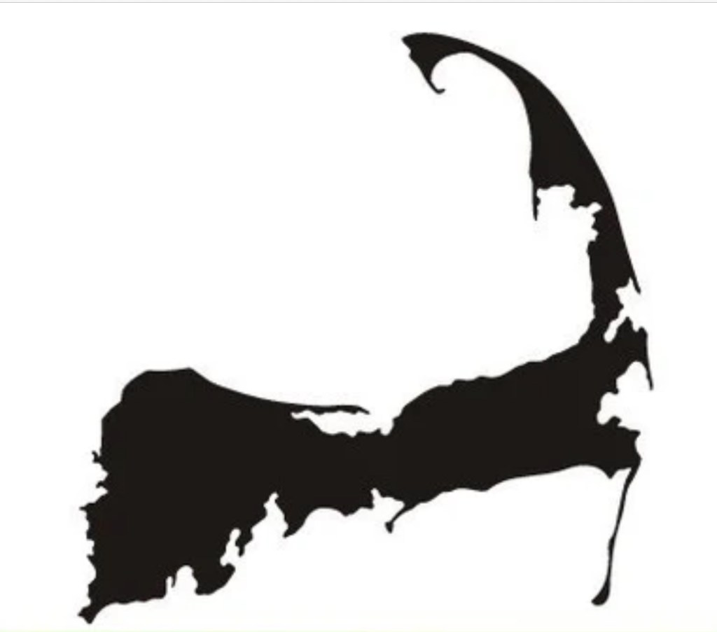
When most people in the US talk of the Cape, they mean Cape Cod. Certainly in the eastern US. It’s one of the most prominent features of the country’s outline, after Florida and the Great Lakes.
I guess you’d have to allow for Chesapeake and Delaware Bays, Long Island, and the Mississippi Delta
The distinctive silhouette is etched in the national consciousness, echoed in other iconic images
Rosie the RiveterHad to reverse the baking soda logo
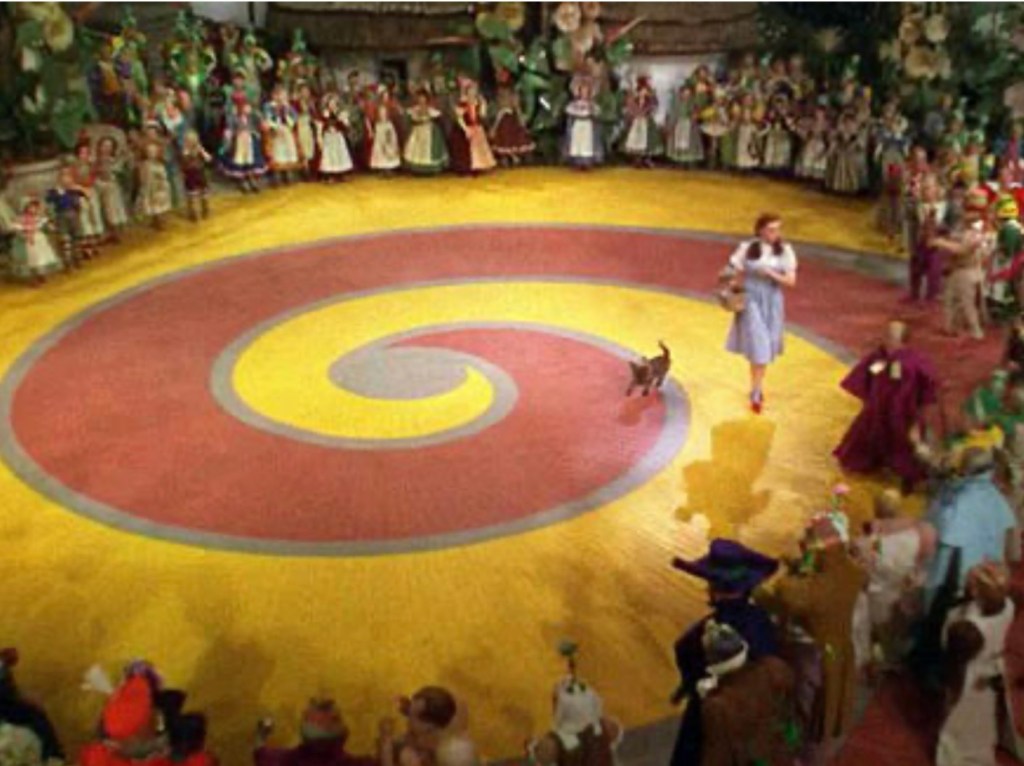
Most compelling of all is the smooth sweep of the Outer Cape, culminating in the fist, the spiral that is Provincetown.
a full one and a quarter turnsI don’t think we’re in Kansas anymore
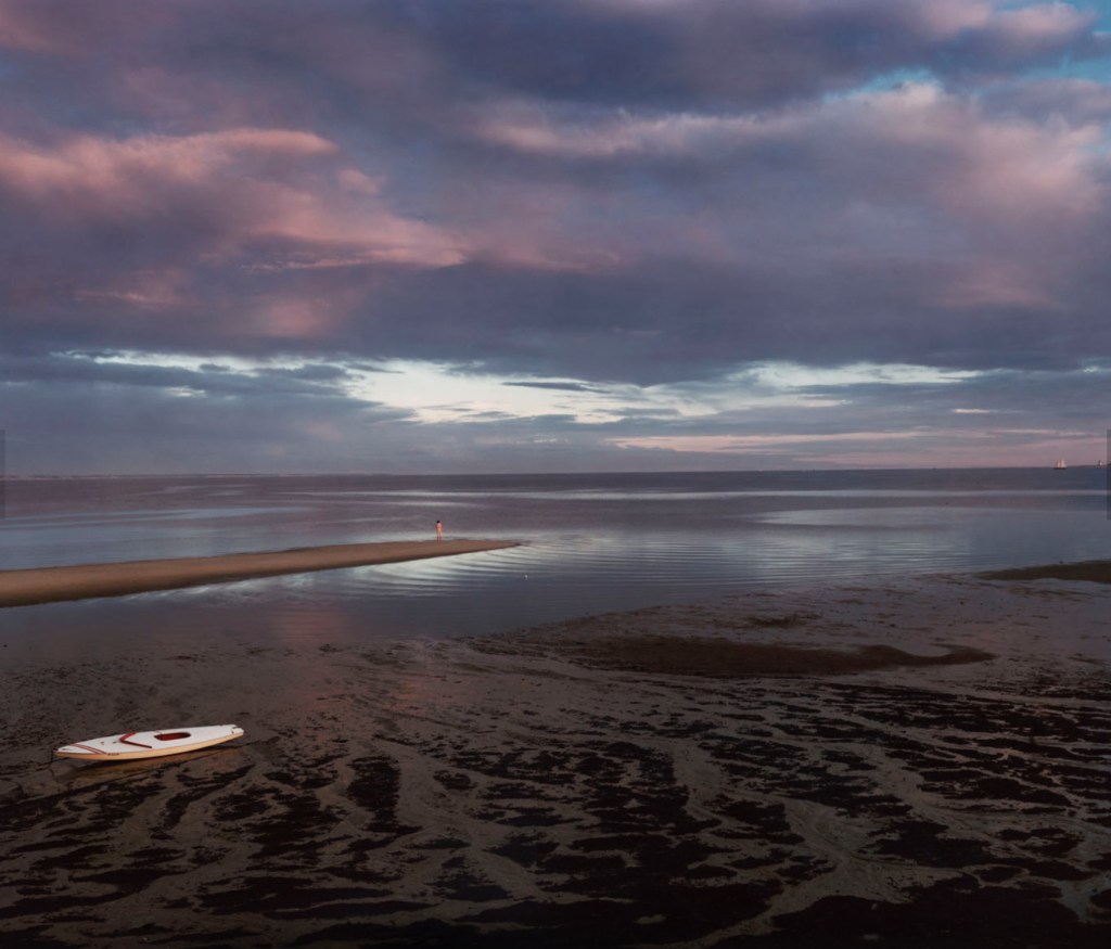
It was my great fortune to have lived and worked in Provincetown for three years in the 80s, in the early years of the AIDS epidemic, paying back my commitment to the Public Health Service, which put me through medical school. A magic time: the people, the beaches, the lobsters, the oysters, the art— all suffused with that special light that comes from being surrounded by water.
From the classic Joel Meyerowitz photo album “Cape Light“
A “cape” is also a distinctive house, available in a selection of sizes, with or without dormers
Full CapeHalf CapeThree-quarter Cape
I’m not a fan of EZ-listening music, used to call it “slush pump music”, but who can resist the smooth stylings of Patti Page’s classic Old Cape Cod? https://youtu.be/a34kIKVideI?si=Br5MCPbBqBrgXSnw
So yeah, the Cape has a grip on our national psyche. But how did this peculiar feature of geography come to be? While living there I hit the books (no internet back then), explored the National Seashore, talked with rangers, and hired a colorful local field botanist, Richard LeBlond, a middle-aged hippie who seemed to know more about the geology of the Cape than anybody, for many hours of walking tours.
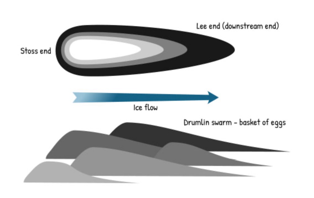
It all started with our friends the glaciers, who gave us the drumlins of the last post. In the last Ice Age, about 20,000 years ago, the Laurentide ice sheet extended down past southern New England. Sea level was many hundreds of feet lower than today, the water tied up in the polar ice caps, so that what are now Massachusetts and Cape Cod Bays were dry land. As the planet warmed and the glaciers retreated, they left piles of rubble at their terminal and lateral edges called moraines. The first terminal moraine became Nantucket, Martha’s Vineyard, Block and Long Islands; the second terminal and lateral moraines formed the outline of glacial Cape Cod, surrounded by the rising sea level.
Retreating glaciers, leaving moraines
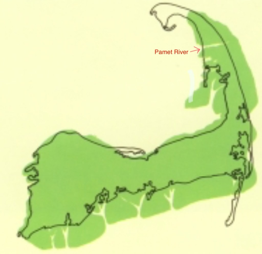
This blurry map shows the outline in green of glacial Cape Cod. You’ll note the outer Cape was much thicker, and did not extend to include Provincetown.
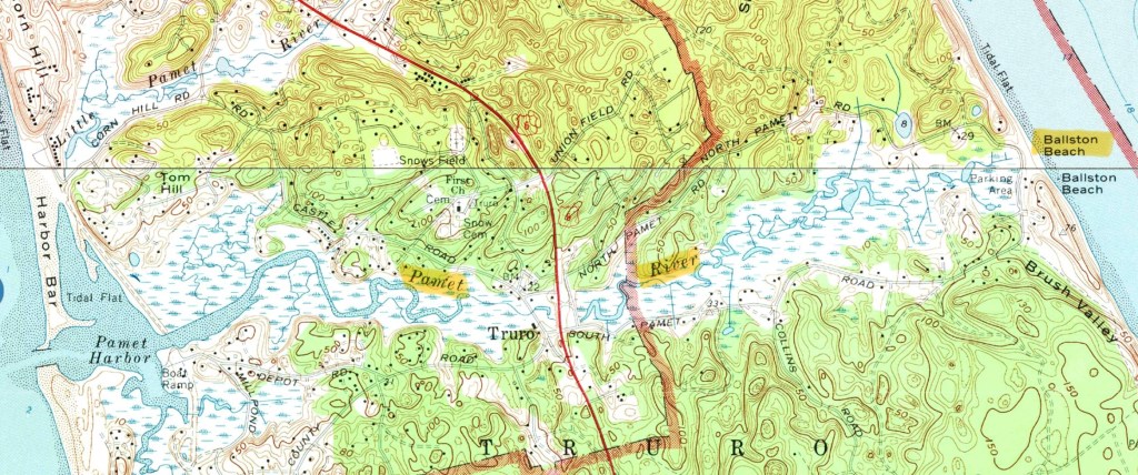
Wind and waves battered the Cape from the east, eroding the thick part and developing sand spits at the ends: Monomoy Island to the south, Provincetown to the north, which curled around. The erosion continues to this day, lighthouses and homes have had to be moved back, and the source of the Pamet River has washed away. Just like Mount Monadnock inspired the generic term monadnock for any isolated mountain not part of a range, the Pamet River gave rise to the term pamet for any river that has lost its source to erosion. This pamet has transected the entire Cape, which would have made the land north an island, had not the Army Corps of Engineers closed the gap at Ballston Beach.
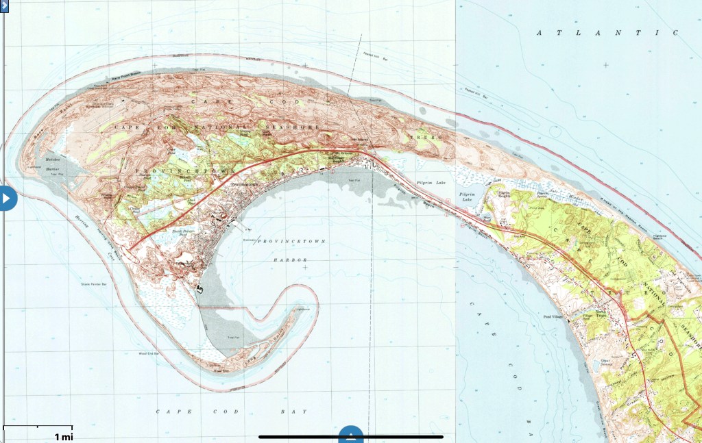
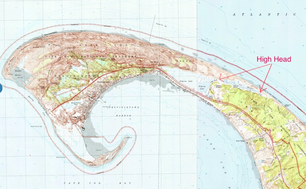
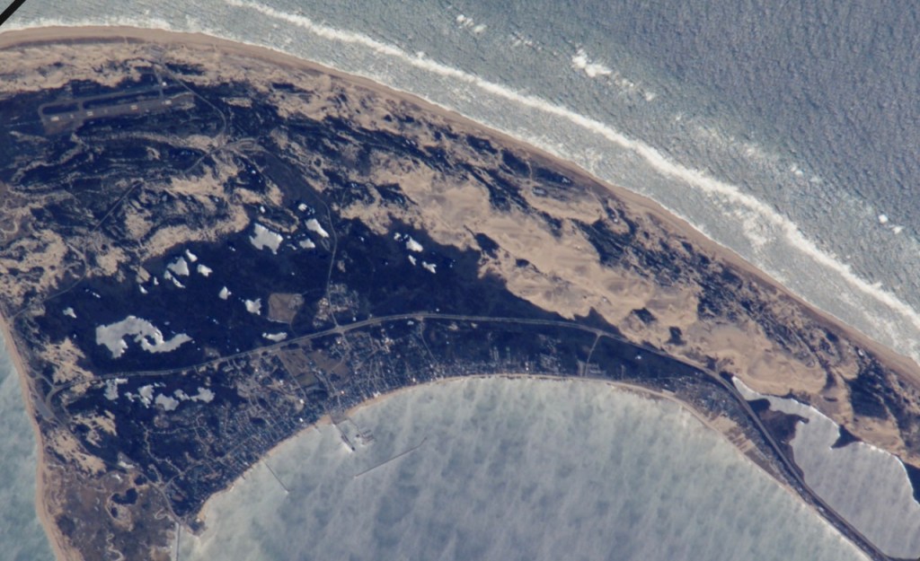
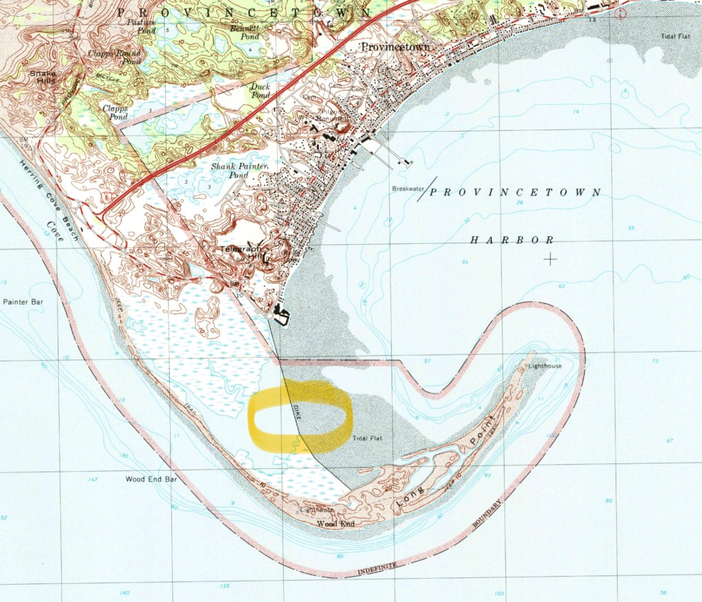
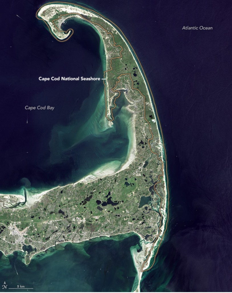
Let’s take a closer look at Provincetown. Glacial Cape Cod ended at High Head, everything beyond is sand spit
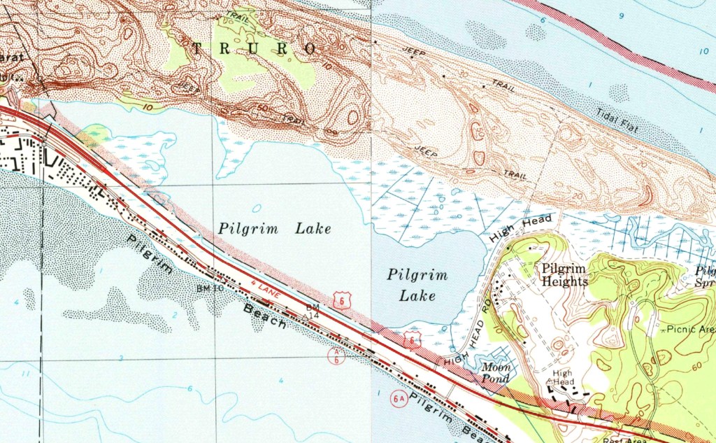
the first sand spit curled around and formed Pilgrim Lake
which was the first Provincetown Harbor. When that closed off, new sand spits grew, curled around and formed new Provincetown Harbors, closing off in turn and forming a chain of lakes.
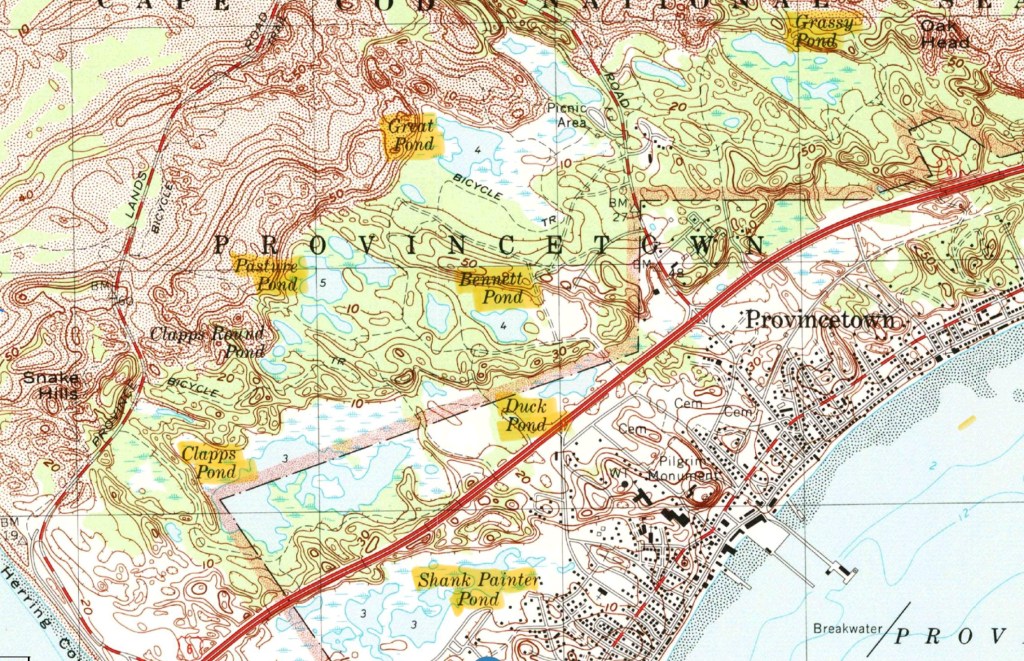
The lakes show up better in this photo, Pilgrim Lake is on the right
The current sand spit (Long Point) would curl around too and form another lake, were it not for ongoing efforts to stabilize it, including a dike.
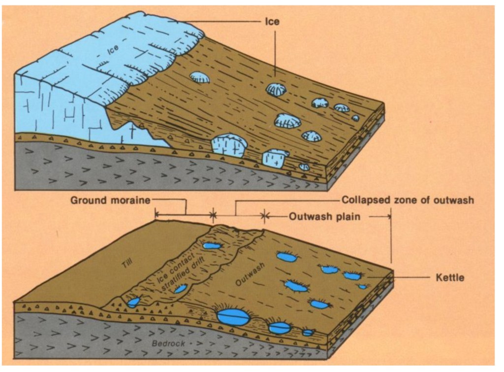
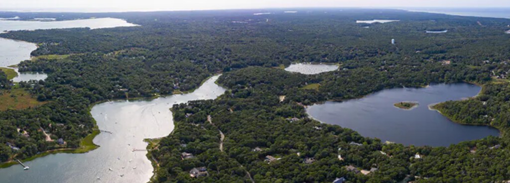
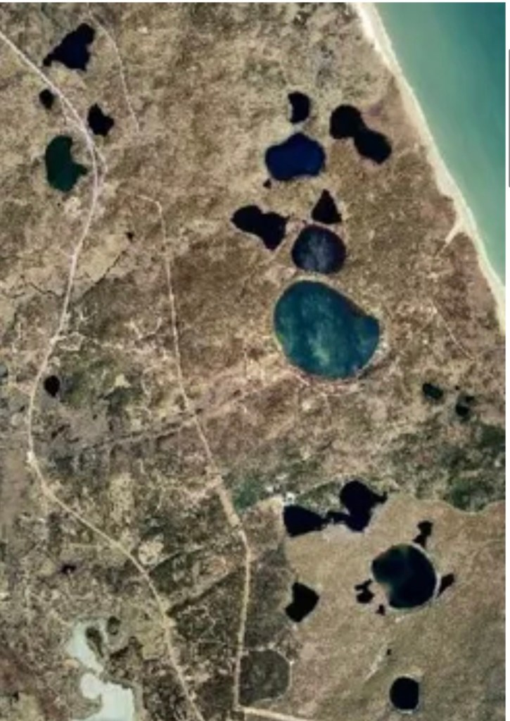
The lakes on glacial Cape Cod were formed differently. They are kettle ponds, caused by chunks of ice breaking off from the retreating ice sheet, leaving voids in the moraine and later filling with water.
The Cape is dotted with hundreds of these, and parts of it look like Swiss cheese.
Kettle ponds in Wellfleet
Moraines, pamets, sand spits, kettles–and one more Cape quirk: erratics, which sound quirky all by themselves. I discovered these while trying to make a New England clambake for friends, where you make a big pit in the sand, line it with rocks, build a fire to heat them up, put the fire out, layer corn, clams, lobsters, and seaweed and cover with a tarp until the hot rocks thoroughly cook everything. The first step was to get a bunch of rocks, but I came up short. There are no rocks on the glacial Cape, just gravel and pebbles from the moraines. Only occasionally was a rock deposited by the receding glaciers, these were so rare they were called erratics. A stunning example is Doane Rock, near the visitor center in Eastham, the largest erratic on the Cape.
Doane Rock
None of these quirks detract from the seminal feature of the Outer Cape, the Great Beach, over 40 miles of unbroken (except for a few breaches from storms) pristine strand facing the broad Atlantic. So different from the congestion and commercialization of the Inner Cape; we have JFK to thank for that. One of his last acts as senator was to sponsor the Cape Cod National Seashore, signed into law shortly after he became president. You can still find disgruntled old-timers who deplore his land grab, call him a communist, but most of us are very grateful.
Long ago the Great Beach was feared rather than revered, it represented a major navigation hazard. No rocks to threaten shipwrecks, the vessels simply got stuck in the shifting shoals and were stranded many yards from shore. If the crew braved the waves to reach dry land they often froze or starved to death on the desolate beach, with no facilities for many miles. Lifesaving stations were set up every five miles with regular patrols meeting each other to look for stranded ships, then launching rescues with Lyle guns to shoot ropes into the rigging and bringing the men to safety via breeches buoys. A few of these stations remain, they were the precursors of the Coast Guard. https://youtu.be/n-dEWCUJJrI?si=uVaiWwBqH-C6U4cw (skip ahead to 6:30 to see a Lyle gun rescue).
The opening of the Cape Cod Canal in 1916 allowed captains to bypass the Outer Cape, and render the lifesaving stations obsolete.
We moved away almost 4 decades ago, but that enigmatic spiral keeps calling us back, not a year goes by when we don’t visit. It’s been the destination of an annual bike ride, the subject of my next post.
The Battle of Bunker Hill. Tuesday, June 17, 2025.
It’s time I fessed up, I have a drumlin fetish. Having spent my wonder years in Boston, I became obsessed with these little glacial hills that dotted the landscape. You’ve heard of some of them: Beacon Hill, Bunker Hill, Winter Hill, Mission Hill, and most of the islands in Boston Harbor. They have a typical shape: about a mile long, oval, around 100 feet high, steeper on one side, typically pointing southeast, often occur in “swarms”.
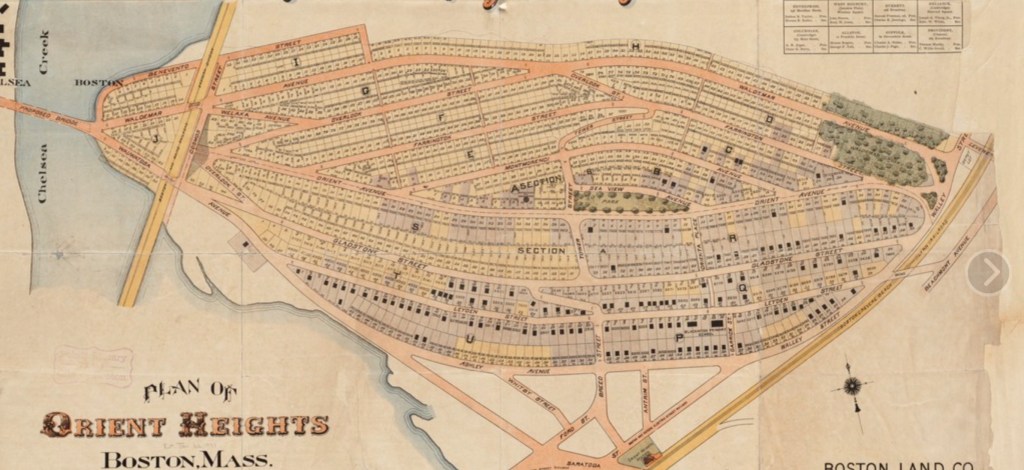
Most of the ones in Boston have been adulterated, carved up by development, the top 50 feet of Beacon Hill was dumped into the harbor for landfill. Orient Heights in East Boston, just north of the airport, is a textbook drumlin, but darned if I could find a picture of it on the web, just this map from 1894.
Great Brewster Island in the harbor is another classic drumlin.
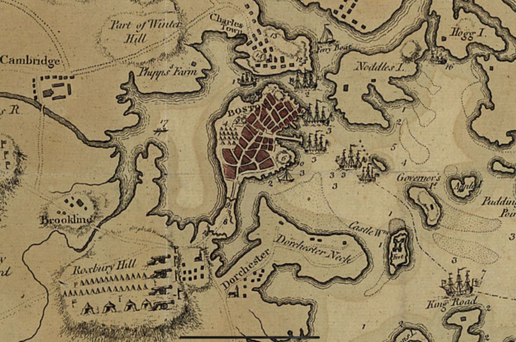
These little hills played an outsized role in the birth of our nation. Seizing the high ground, even ground as low as these, confers enormous strategic advantage. After the debacle of Lexington and Concord, British soldiers and loyalists were basically under siege, holed up in Boston, which then was almost an island, connected by a thin neck with a single road, surrounded by tens of thousands of hostile provincials. Their only lifeline was the sea, but that one was a doozy, the British Navy was unsurpassed in the world.
The British commanders realized that the closest hills, in Charlestown and on Dorchester Neck, represented a serious threat if occupied by the colonials. The night before the Redcoats planned to secure them, the provincials, tipped off by spies, worked all night to dig a crude earthwork on Breed’s Hill, #14 on the map. Sunrise on the morning of June 17, 1775 revealed to the outraged commanders that their plans had been co-opted, and the shelling started immediately. Most of the British guns couldn’t aim that high, and colonial fortifications continued. It took until 3 PM to land Redcoats in Charlestown, and march up the hill. It must’ve been a terrifying site to see. The rebels, low on ammunition, held their fire until they could see “the whites of their eyes”, but then unleashed devastating volleys. The British had to fall back, regroup, and try an additional two times before prevailing against the provincials who had completely run out of ammunition. The heroic Joseph Warren, whose spies had proved so crucial, was killed in that final assault. When the dust cleared on this first pitched battle of the Revolution, the British had “won:” they had seized Breed’s and Bunker hills, but at a cost of 1000 casualties, twice as many as the other side. General Howe, the new commander, deemed it “a prize too dearly won,” The rebels wished they “could sell them another hill at the same price.”
The other hill, obviously, was the one on Dorchester Neck, but Howe, perhaps chagrined by the earlier experience, dragged his feet about taking it. Meantime, the Second Continental Congress had appointed George Washington as commander of the newly formed continental army, and he arrived a month later to assume the ongoing siege. They decided a direct attack on Boston was too risky, but didn’t have artillery to secure the drumlin on the neck (now known as Telegraph Hill in South Boston.)
Enter three American heroes: Ethan Allen, leader of Vermont’s boozy Green Mountain boys, Benedict Arnold, a competent commander who had not yet turned traitor, and Henry Knox, a Boston bookseller. Allen and Arnold had captured Fort Ticonderoga, the “Gibraltar of the continent,” without firing a shot on May 10. Legend has it that Ethan woke the sleeping commander and demanded “surrender in the name of the Great Jehovah and the Continental Congress” but knowing Ethan, he likely said something more profane. Whatever, the stunning victory had netted the Americans some significant ordinance. Tasked with transporting the guns to Boston, Knox conducted the celebrated “noble train of artillery” over 300 miles unforgiving winter topography using oxen, sleds, boats, and sheer manpower.
By early March 1776, Washington had his ducks (or guns) in a row. In a hidden nighttime operation that rivaled what the provincials had done the year before on Breed’s hill, he fortified the Dorchester drumlin. Howe woke the morning of March 4 with déjà vu all over again, I love to picture him saying “D’oh!” Once again he launched an expedition to dislodge them, but a late winter storm kept him from landing, and each day, Washington strengthened his position. All of Boston Harbor was under his guns. Finally the British realized they had no choice but to leave. On St. Patrick’s Day, 1776, still celebrated in Boston as Evacuation Day, Washington entered the abandoned city, having won his first victory without firing a shot.
There are themes here: nighttime operations, sometimes bloodless battles, but to me, the liberation of Boston was all about the drumlins.
You know me, I couldn’t leave it at that. I “reenacted” the Battle of Bunker (really Breed’s) Hill by bike last month, not quite on the semiquincentennial. I knew better than to show up on the actual day. Every year, Charlestown celebrates Bunker Hill Day with a massive parade that circles the entire peninsula, traditionally attended by every politician in the state. One year I was trapped inside and couldn’t leave for hours. Today’s parade, I’m sure, will top them all.
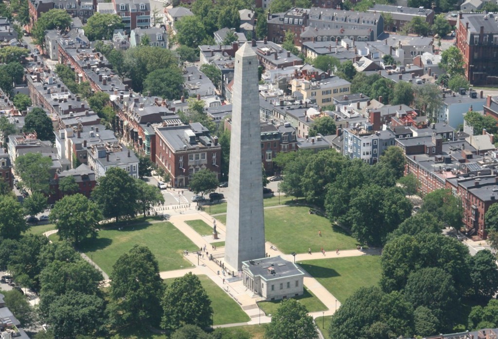
The ride was low-key by my grandiose standards, just from my sister‘s place in Newton to the battlefield and back, stopping by Copp’s Hill (another drumlin) where the Old North Church is, the USS Constitution, and noting that, even at 73 feet, Breed’s Hill is a steep little sucker.
Kind of comical, really, the monument is three times as tall as the hill is high. I’ve been there before, but the tower was always closed. This time it was open, a chance to climb 294 spiral steps, getting more claustrophobic as the tower narrowed towards the top, and peek out the tiny windows. At the base, there used to be a terrific multimedia exhibit The Whites of Their Eyes, but that was a bicentennial project that closed years ago.
Returned via my favorite Cambridge bike shop, then got to bed early for my annual Cape Cod bike ride. The subject of my next post.
Distance 27.4 miles, time six hours. Elevation gain 752 feet.
Boston to Concord, Massachusetts. April 18–19, 2025, revised June 14, 2025.
My terrific high school history teacher, Brooke Miner, took pleasure in deconstructing American heroes. George Washington never chopped down that cherry tree, Andrew Jackson was a ruthless Indian killer, Abe Lincoln suspended habeas corpus, Teddy Roosevelt didn’t ride up San Juan Hill, Woodrow Wilson (for whom our high school was named) was a misogynistic racist. She had particular disdain for the Midnight Ride of Paul Revere: he never made it to Concord, never shouted “the British are coming”, was only a small cog in the network of people spreading the alarm that night.
Yeah, but the legend endures, the focus of much of Boston’s Freedom Trail. Longfellow’s great poem, embellished though it was, was based on fact and captured the spirit of the moment, the birth of a nation. America’s image has taken quite a hit lately, but at bottom I still believe we are the last best hope of earth.
I felt that back in 1975, when I and my college dormmates decided it would be a hoot to re-create the ride on its exact bicentennial. Fortified by beer and coffee, we rode our cheap 10 speeds without helmets or lights from the Old North Church to the Concord Battlefield. We were rewarded with an all night concert featuring Arlo Guthrie, Pete Seeger, and Phil Ochs. It started to rain, and the six of us squeezed into a pup tent, surrounded by our bikes to keep from being trampled. At dawn we were shooed off the field to make way for the reenactment cannons and Gerald Ford’s speech.
Now, 50 years later, I felt compelled to repeat the ride. Another performative stunt, I suppose, but that seems to be my jam. Maybe it’s because I felt democracy is threatened, as it was 250 years ago, that it was time once again to spread the alarm. This time around, I have tried to research what really happened, compare it to the legend, and relive it in real time. I reached out to my dormmates, but suspect my emails went right to their spam folders. I had no better luck with my cycling buddies, who perhaps felt we were too old to be pulling all-nighters.
I looked for other mentions of the ride in popular culture, and found this song by Steve Martin and the Steep Canyon Rangers, told from the perspective of his horse, and much more factually accurate. https://youtu.be/ss038U9_8JA?si=RSPeXpJQKsAVgoUo
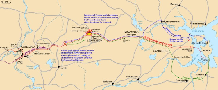
The National Park Service has a map that gives a good overview:
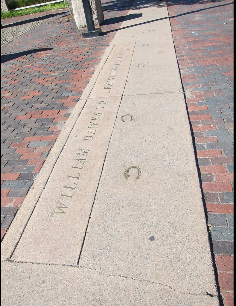
Right away, you can see that Revere wasn’t the only rider that night. William Dawes departed at the same time, taking the longer “land” route via Boston Neck. His unfair lack of recognition was lamented in an 1896 poem by Helen Moore.
At least Dawes got a little street cred, his hoof tracks through Harvard Square are preserved in bronze.
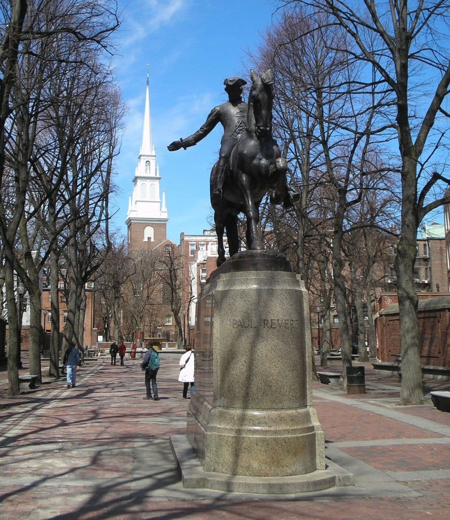
The mastermind behind these rides, this “alert,” was Joseph Warren*, a physician who was as active in the revolutionary cause as Samuel Adams and John Hancock. The latter two were visiting a cousin at the Hancock-Clarke house in Lexington, and Warren’s spies discovered the British commandant General Gage’s plan to arrest them and seize an ammunitions depot in Concord on the night of April 18, 1775. It was Warren who dispatched Revere and Dawes to warn Adams and Hancock and rouse the Minutemen, and who devised the “one if by land, two if by sea” signaling system at the Old North Church.
We should take a step back here to get the historical context. Why this “revolutionary cause?” Why the need to seize munitions? As I looked back from the present, I try to understand what was going on in the Massachusetts Bay area back then. The colonies had been content, the colonials proud to be Englishmen. What happened?
In the end, it was all about money. England was deep in debt from the Seven Years War, a.k.a. the French and Indian War. They had emerged victorious, conquered all of France’s holdings in North America, and reigned supreme as the greatest superpower on earth, but at a huge monetary cost. They took the national debt seriously back then. Since the war had been fought largely to protect the colonies from the French and the indigenous peoples, the king and Parliament thought they should share in the cost. The tax they levied was modest and reasonable, but was done without consulting the colonials first. This rankled the settlers, who felt their right to representation in governance dated back to the Magna Carta and the Mayflower Compact.
You probably know the progression—the Stamp Act, the boycotts, the Intolerable Acts, tarring and feathering of tax collectors, the Boston Massacre, the Tea tax, the Tea Party— a spiraling sequence of confrontations that resisted attempts at compromise and ultimately led to the declaration of martial law in Boston, the shutting down of local governments, and the occupation of the city by Redcoat regiments. The First Continental Congress in Philadelphia extended an Olive Branch Petition that was inexplicably ignored by the king. How could he have squandered a chance for a simple solution? There is evidence that he suffered from porphyria, a hematologic condition that can cloud the judgment cause frank psychosis, the “madness of King George.” Whatever, by that April night things were approaching the point of no return.
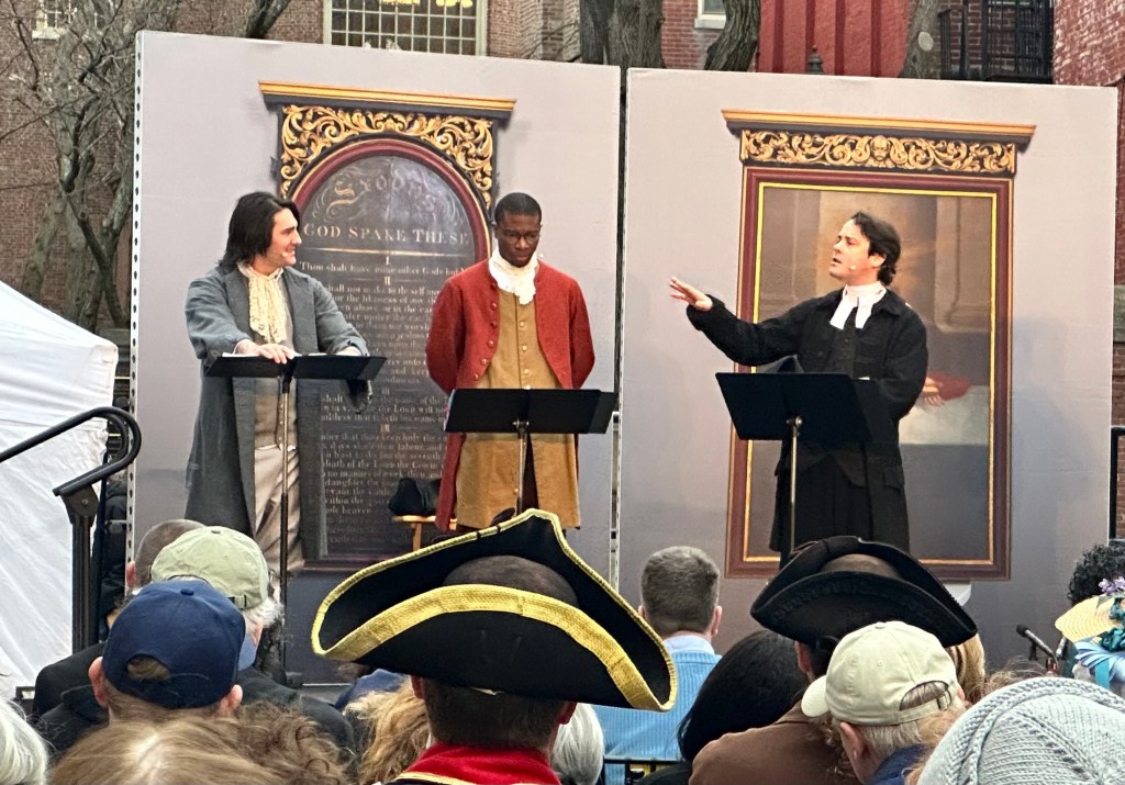
This April night I biked from my sister’s house in Newton to downtown Boston and followed the Freedom Trail to Paul Revere Mall and the Old North Church
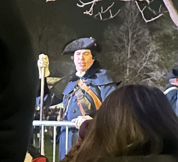
where the crowds were treated to a performance of Revolution’s Edge, a costumed play featuring a patriot, a loyalist, and a slave
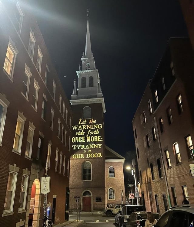
followed by remarks from the mayor and the governor. Afterwards, we were invited to create our own paper lantern and join the procession following Revere’s route to the harbor, attend a special service witnessing the iconic two-lantern signal lighting the steeple
Couldn’t catch the lanterns in this view
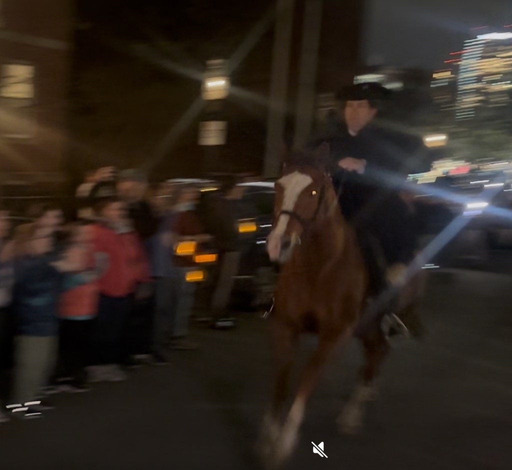
watch a dramatic reenactment of Revere’s crossing with music and a drone light show
And see Paul taking off down the streets of Charlestown
WordPress won’t let me embed videos, so this blurry picture is a screenshot of a single frame.
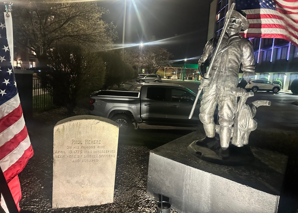
In Revere’s journal, he said he left around 11 PM, and after passing Charlestown Neck, turned left to head towards Cambridge and the main road to Lexington. But at a spot where “Mark hung in chains” (where a slave who had been executed 20 years before was still hanging, his decomposed corpse a grisly example) he encountered two Redcoat officers who gave chase; he had to backtrack and head for Medford instead, barely eluding capture. I found a monument marking the spot in front of a Holiday Inn.
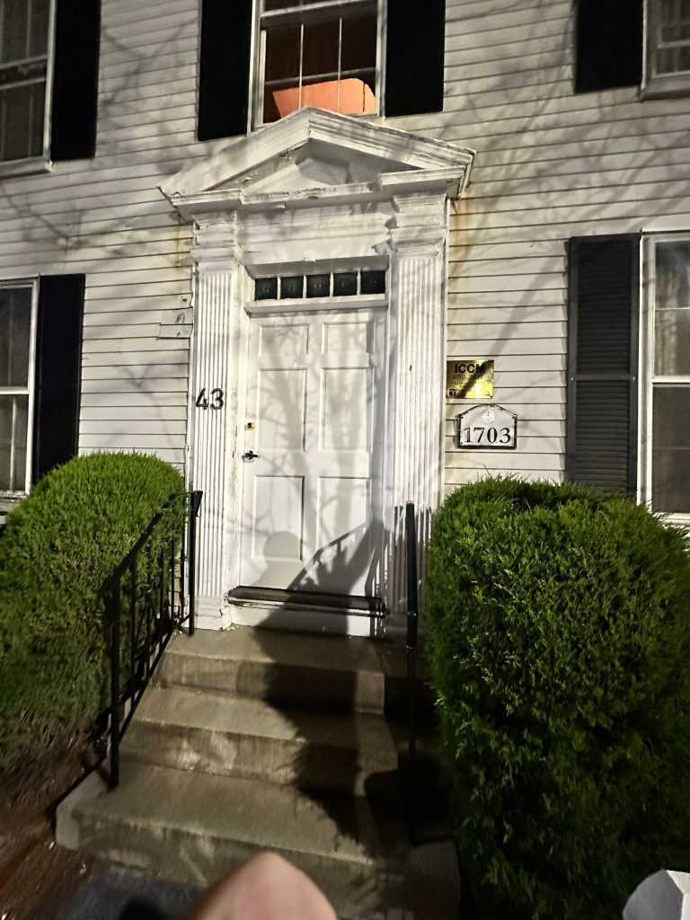
He never yelled “the British are coming” since everyone considered themselves British, and shouting would have attracted the attention of the patrolling sentries. Instead, he stopped at houses and warned the occupants quietly. I followed in his wake, dodging the late night traffic, and stopping at the home of Isaac Hall, captain of the Medford Middlemen, which is now an Islamic cultural center.
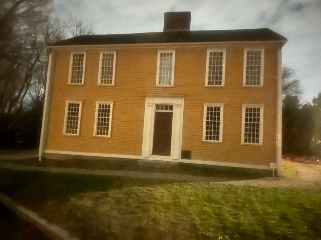
He reached the Clarke house in Lexington in the early morning, and warned John Hancock and Samuel Adams that soldiers were coming to arrest him.
The reenactors arrived at the Clarke house ahead of “schedule”, 10:30 PM. I got there at 12:30, closer to the actual time, the crowds were all gone.
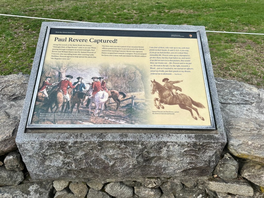
Revere and Dawes rode on towards Concord, but were intercepted by British soldiers a couple of miles down the road, Revere was captured, Dawes turned around, but a third rider, Dr. Samuel Prescott, who had joined the group after making a scandalous late night visit to his lady friend in Lexington, managed to elude the soldiers by jumping over a stone wall, and made it to Concord. So the famous Midnight Ride was completed by a Lothario.
I decided to stick around and watch the reenactment at Lexington, they have one every year, but this was supposed to be the most elaborate ever. It began at 5:15 AM, but they said to arrive a couple of hours early to have any chance of getting a spot where you could see. Sure enough, by 1 AM there were already a couple of hundred people clustered around the viewing area, many with sleeping bags or lawn chairs. I had nothing but a 1-foot square “butt pad” and settled down against a tree, just like Rip van Winkle did all those years ago. He caught a lot more than 40 winks, woke up to find he had missed the entire American Revolution; I was hoping to just get a couple of winks.
It was not to be. The crowd steadily filled in around me, kept tripping over my legs, and a very knowledgeable reenactor stopped by the barricade, and gave an excellent history lesson— with the result I got no sleep at all.
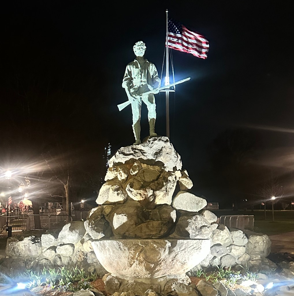
If the Revolutionary War, if “America” had a starting point, it was at Lexington. It’s not that simple of course, but John Parker’s words resonate: “Stand your ground. Don’t fire unless fired upon, but if they mean to have a war, let it begin here.” I passed his heroic statue at the apex of the green on the way to my “resting place.”
The statue often confused with the “Concord Minuteman” statue at the Old North Bridge (which I’ll be visiting later this morning) by Daniel Chester French, who also sculpted Lincoln at the Memorial, and John Harvard in the Yard.
Ralph Waldo Emerson’s Concord Hymn appears below it, with the famous line “the shot heard around the world.” But where was that shot? There was certainly gunfire hours earlier, in Lexington. Who fired it?
I read and researched extensively before my little ride, and was gratified to see the reenactment was as historically accurate as I could determine. Certainly worth waiting for. As I rose on my aching bones from under that tree, there were five packed rows ahead of me, and many thousands crowded around the green, with Jumbotrons erected for the people in back. My height counted for something, and I tried to take a video, but the woman in front of me kept hoisting her child on her shoulders. This clip from YouTube shows it much better anyway. https://youtu.be/Rgl49Wkkz4E?si=bREGcqOExD9s4j5E It’s quite long and worth watching in its entirety, but the main action begins at 7:30 when the mysterious first shot rings out, followed by panicked general fire on both sides, with the British officers desperately trying to control their men who were running amok. Equally compelling was 10:30, when the officers realized the countryside had been alerted, the mission had been compromised, and that they should go back to Boston. They were overruled by their commander, with devastating consequences.
When the smoke cleared, there were eight Colonials dead.
The battle was immortalized in the song “Mama Look Sharp” from the musical 1776. I can’t listen to it without misting up. The YouTube clip omits the preamble:
You seen any fighting?
Sure did. I seen my two best friends get shot dead on the very same day. And at Lexington it was, too. Right on the village green.
When they didn’t come home for supper, their mamas went down the hill looking for them. Mrs. Lowell, she found Timothy….right off.
But Mrs. Pickett, she looked near half the night for William. He went and crawled off the green…before he died.
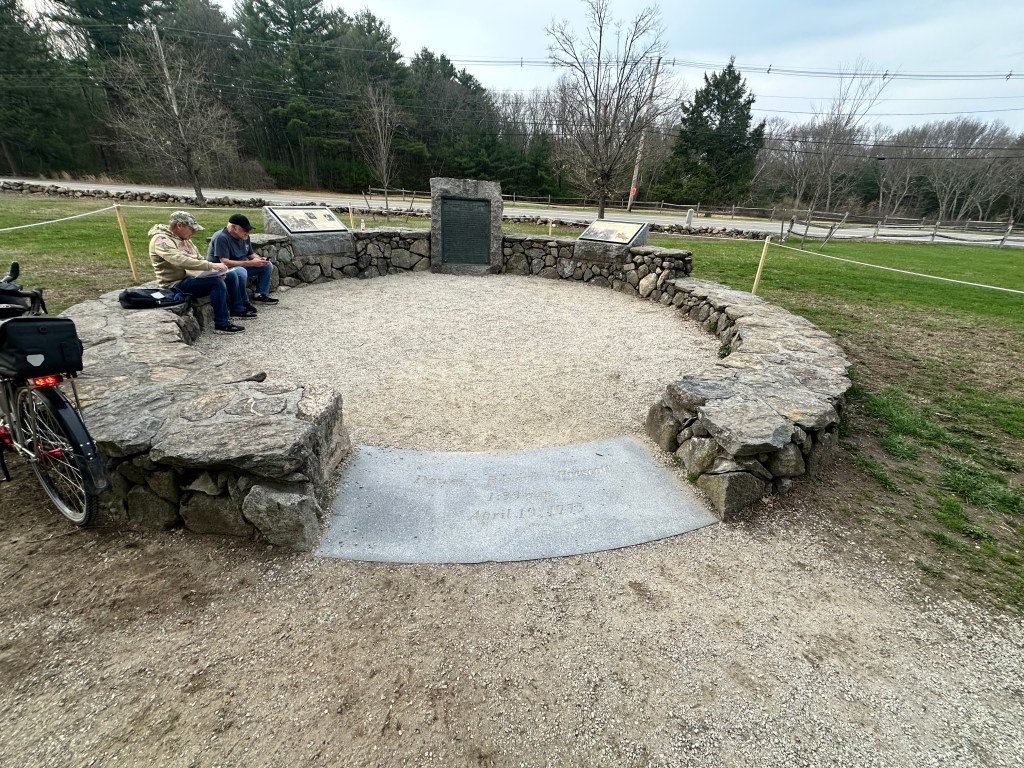
By now I was running on fumes, but pushed on to Concord, passing the Paul Revere capture site
the reenactment at the Old North Bridge, less well done than at Lexington
No rock concert this time, and no way was Trump going to show up in this deep blue state.
The battle at Concord was kind of a draw. The alerted villagers had moved their ammunition stockpile, the British could only find a few weapons and set those on fire, the militias in the hills beyond saw the smoke, thought the troops were burning their town, and advanced across the bridge. Losses were fairly light on both sides, but the British decided to withdraw.
That withdrawal, the least-known part of the battle, was where most of the casualties occurred. Retracing their steps along the “Battle Road” preserved as Minuteman National Historic Park, the Redcoats were continuously harassed by the enraged colonials, whose numbers had swelled to many thousands, firing from behind trees and stone walls, guerrilla warfare really. The British were equally furious, they had started their mission soaking wet after disembarking from their boats in a swamp, had marched 20 miles and having failed in their objective had to retreat 20 more under unrelenting fire, which they felt was cowardly, their opponents not coming out into the open. Their losses on a hill dubbed Parker’s Revenge were particularly devastating. Emblematic of their fury was there treatment of an 80-year-old resident of Menotomy (now Arlington).
When all was said and done, the British expedition, designed to discipline the upstart provincials and show them who was boss, had the opposite effect, and sent the country down the road to independence. The numbers tell the tale.
My expedition was a lot less traumatic.
* Joseph Warren was killed in the Battle of Bunker Hill, as you will see in my next post. His younger brother was a founder of Harvard Medical School, and his nephew helped to start Mass General Hospital, which has a building named in his honor.
One of them blue states. Wednesday, November 6, 2024
Flashback: February 28, 1984.
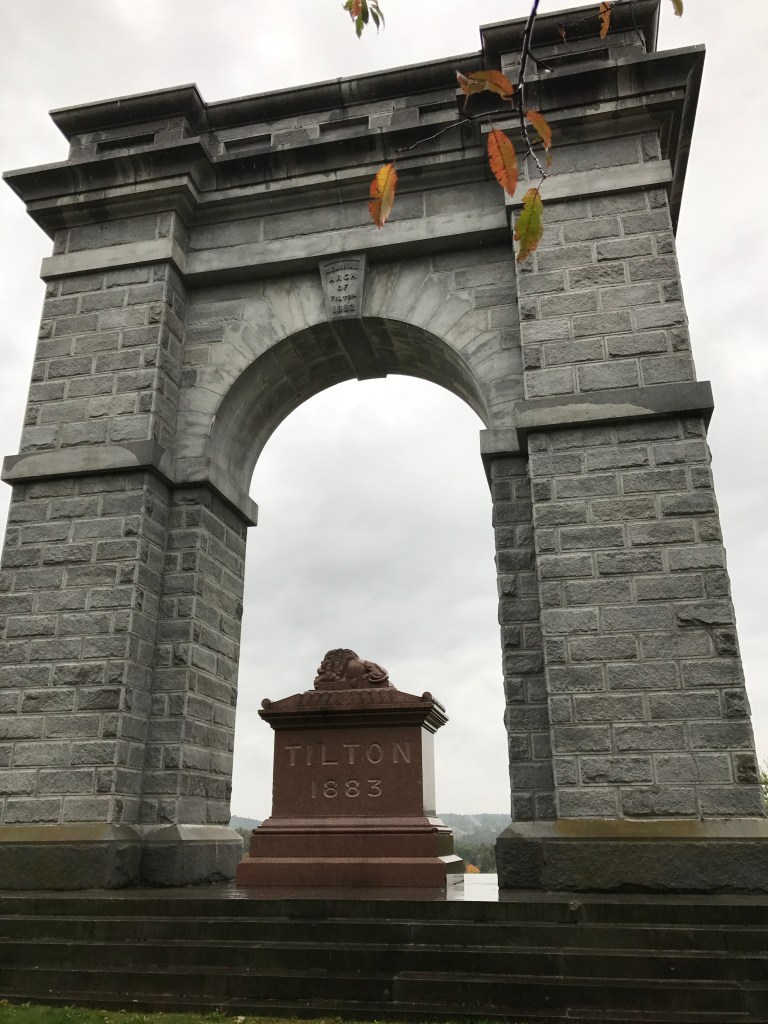
I’d been married for just a month. BFF Brian and I were scoping out offbeat New Hampshire roadside attractions, and stumbled upon the Tilton Arch,
the grandiose mausoleum of a delusional developer who thought he could found a great city in the backwoods of the Granite State. It was snowing, and from the hill we could see the main street of the eponymous town, with people going in and out of the municipal building. It was the New Hampshire primary, and later we heard that Gary Hart had upset Walter Mondale, and turned that election on its ear. It was a weird feeling, to think we were witnessing history.
It was with that in mind, to witness history, that I got up early yesterday to take a one-day bike tour on Guy Fawkes Day.
Not being a Brit, I’d never heard of Mr. Fawkes, and was mystified by the explosive ending of Lennon’s Remember, from the first (and some say the best) of his post-Beatles albums https://youtu.be/KIn6kDnmSLs?si=gHp1ob57s4xtL26k, so I looked it up. “Remember remember the 5th of November,” went the chant, referring to the day in 1605 when Guy was discovered guarding a pile of gunpowder stashed under the Houses of Parliament. He and his Catholic cronies were arrested and tortured, and confessed to planning to blow up the Protestant King James I and his government. They all suffered grisly executions, but the Gunpowder Plot achieved mythic status over the centuries as a symbol of resistance, and Guy Fawkes Day celebrations endure with fireworks, burnings in effigy, and children running around begging for “a penny for the Guy”. Guy Fawkes masks remain as emblems of social protest, popularized by the 2005 movie V for Vendetta.
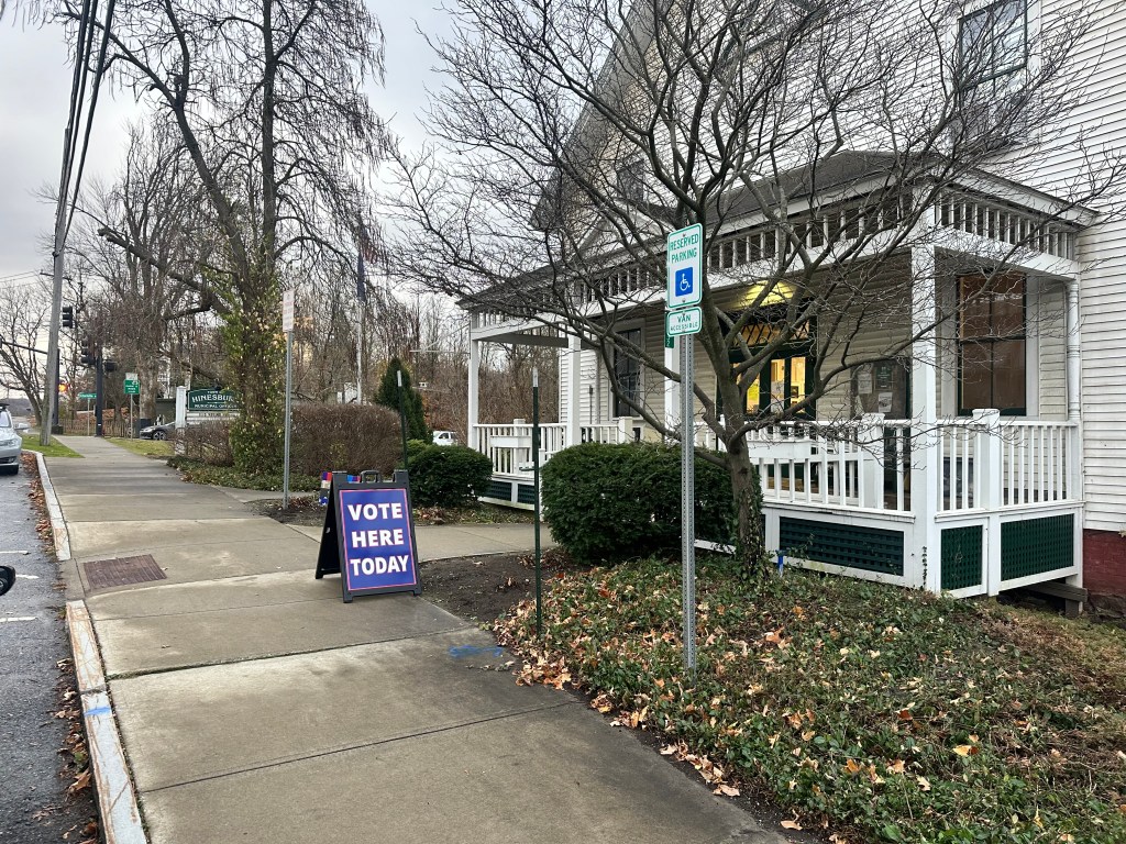
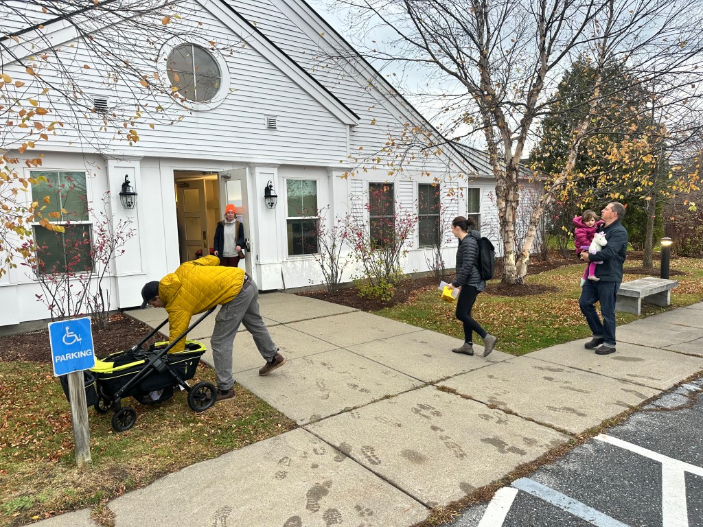
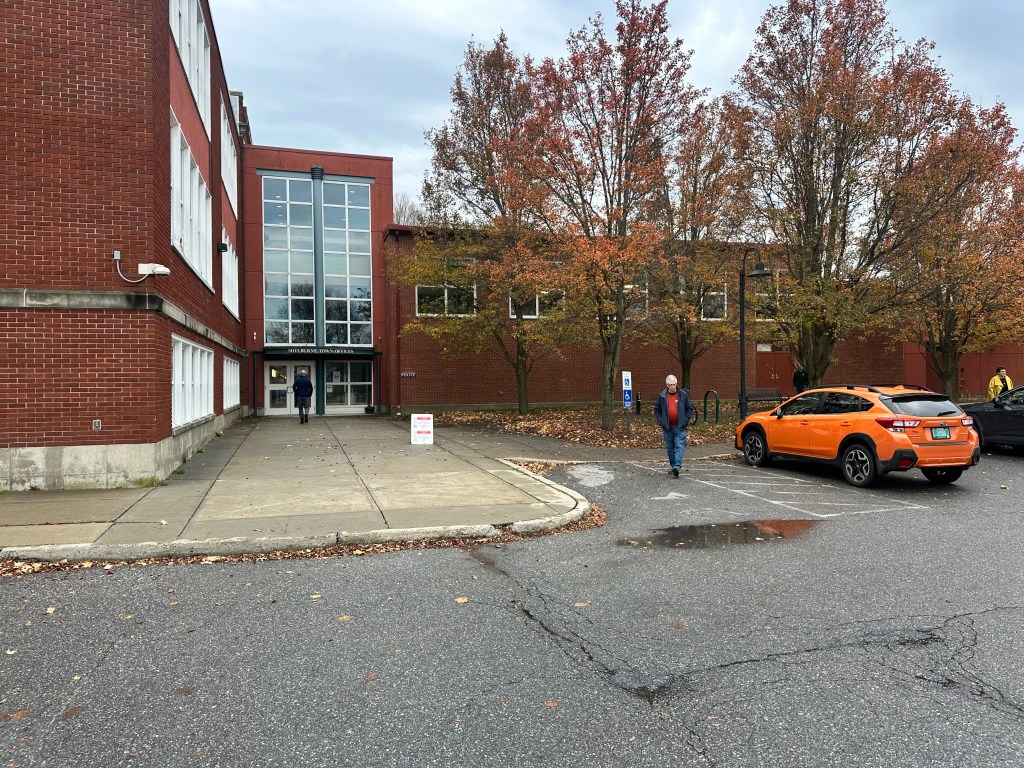
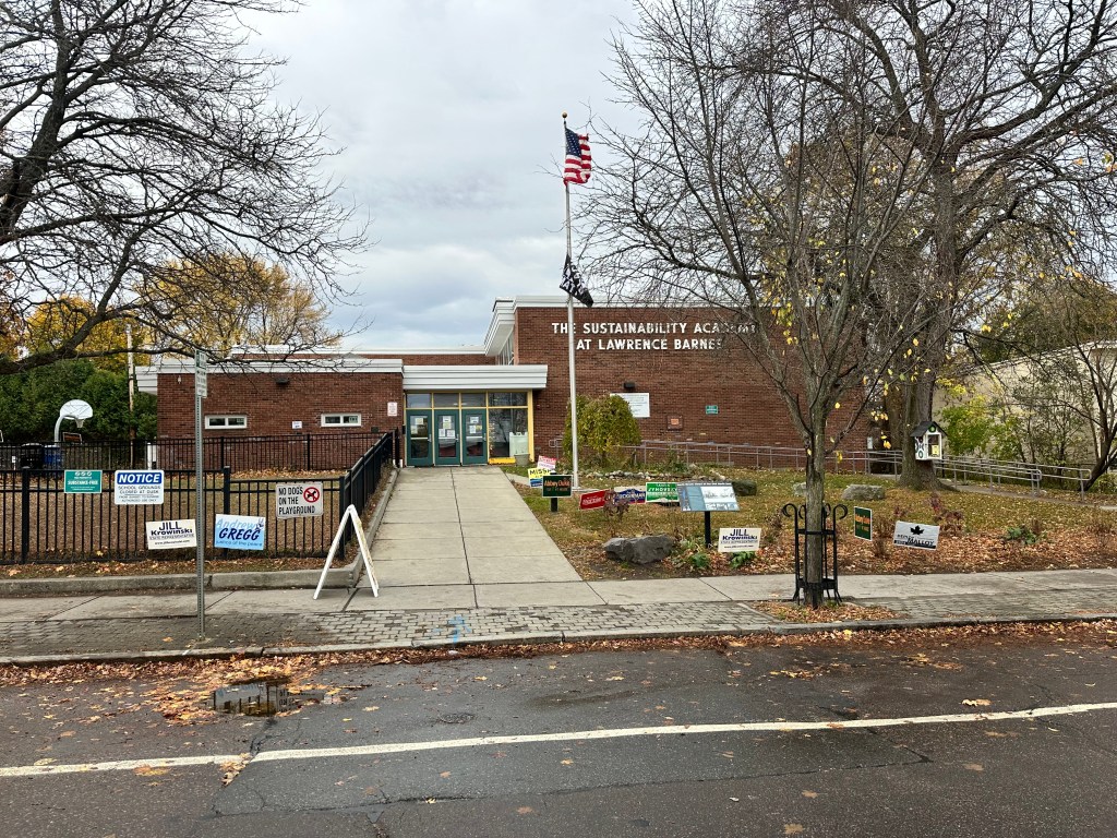
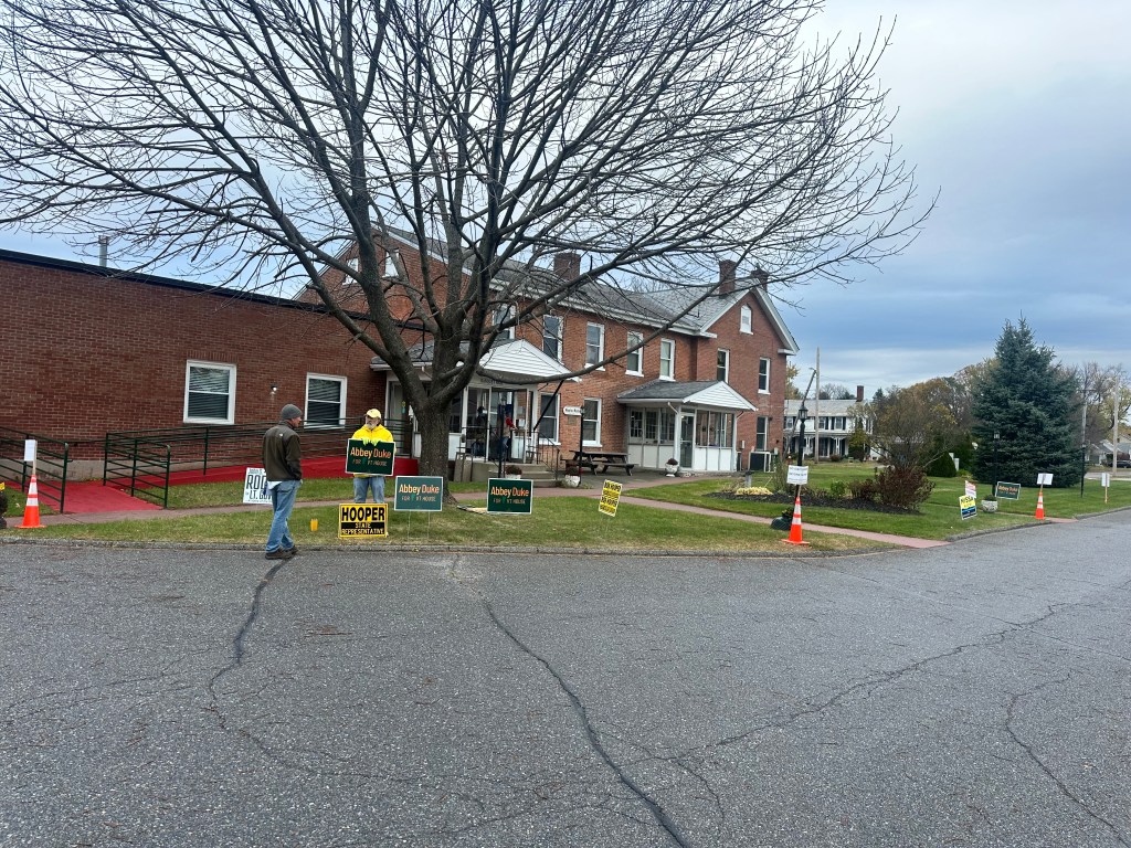
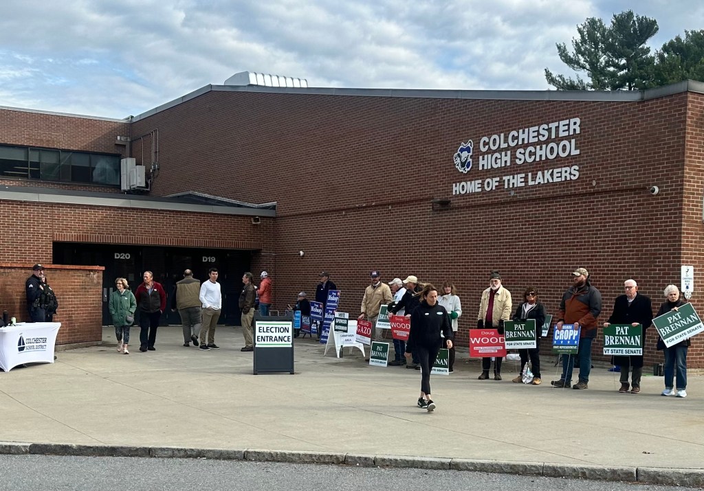
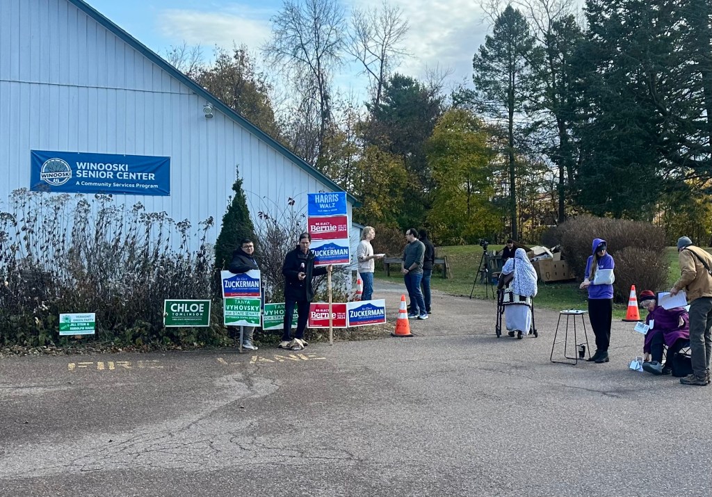
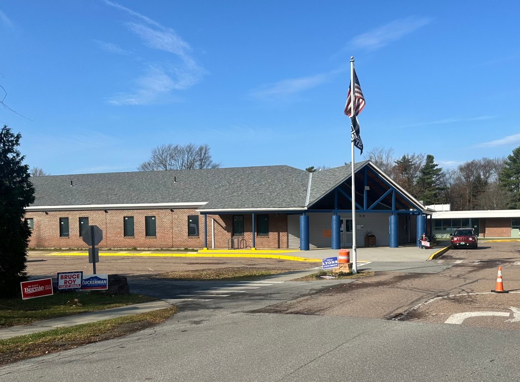
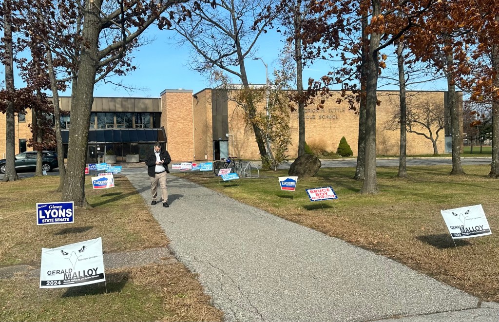
Anyway, it seemed portentious that this year’s elections fell on that day, a day that might have profound historical significance, a day that democracy might get blown up. I’d already voted, but decided I wanted to see as many polling places as possible. There are 28 such places in Chittenden County, and I could see 23 of them on an 88 mile e-bike ride. I started early, so I could catch the first one when the polls opened at 7 AM. Here’s my route
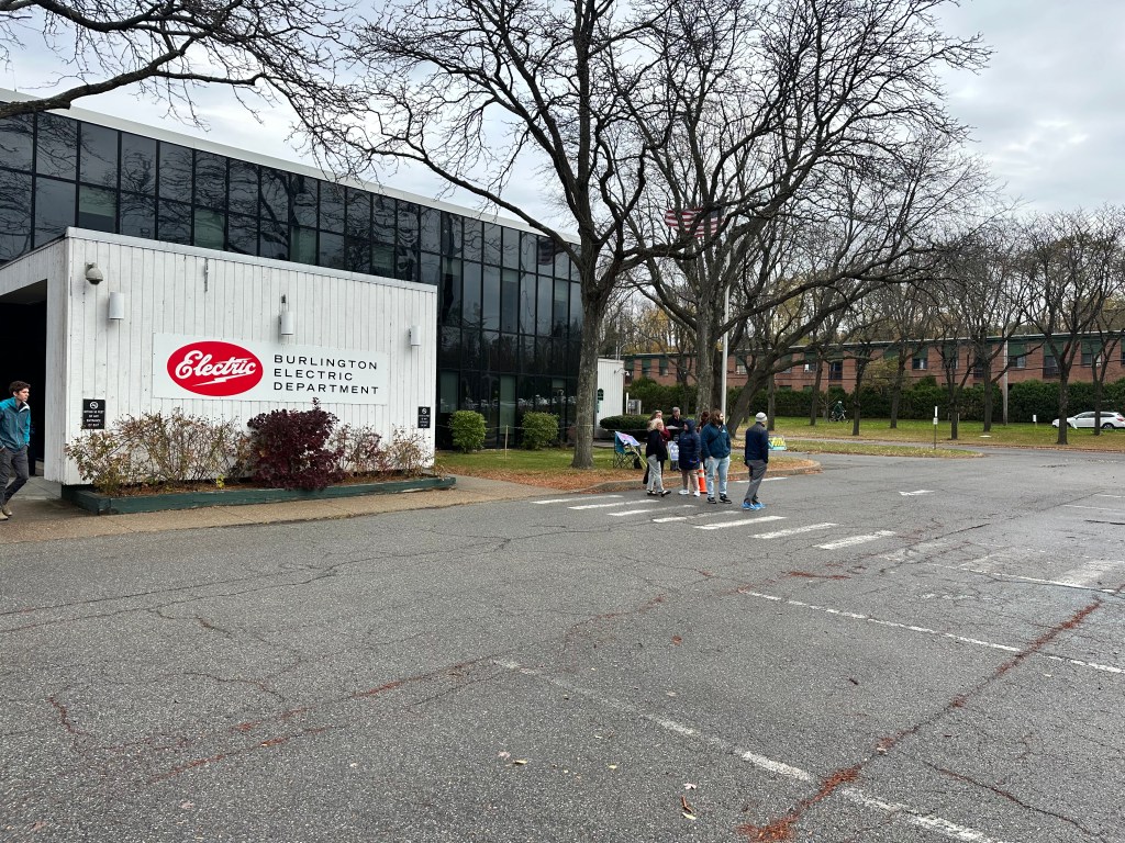
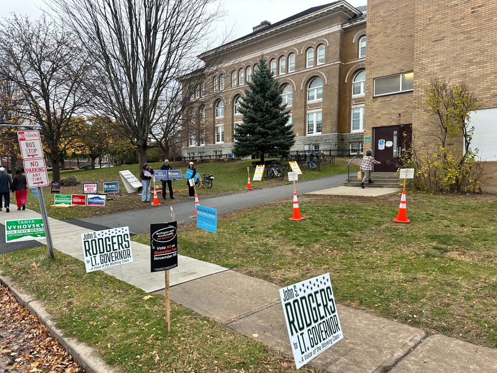
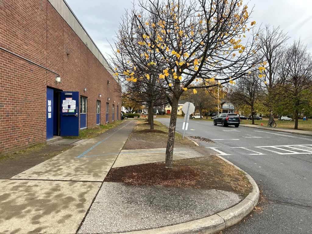
and photos of the 23.
St. George Hinesburg Charlotte Shelburne South Burlington 1Burlington 1Burlington 2Burlington 3Burlington 4Burlington 5Burlington 6Burlington 7Burlington 8Colchester WinooskiSouth Burlington 2South Burlington 3South Burlington 4Essex Junction Essex Town Jericho Richmond Williston
OK, OK for you sticklers out there, the Burlington and South Burlington wards were numbered differently. There were a couple of Easter eggs: A 10 second clip on a cable access channel,
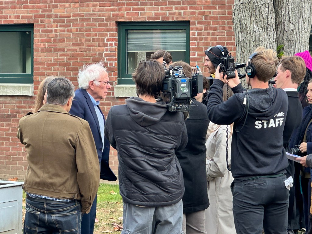
a chance encounter with Bernie Sanders as he came out from voting at Burlington’s Ward 7, surrounded by reporters,
We even had a “conversation”. I called out “Good luck Bernie” as he was walking away, and he waved back and said “Thank you”.
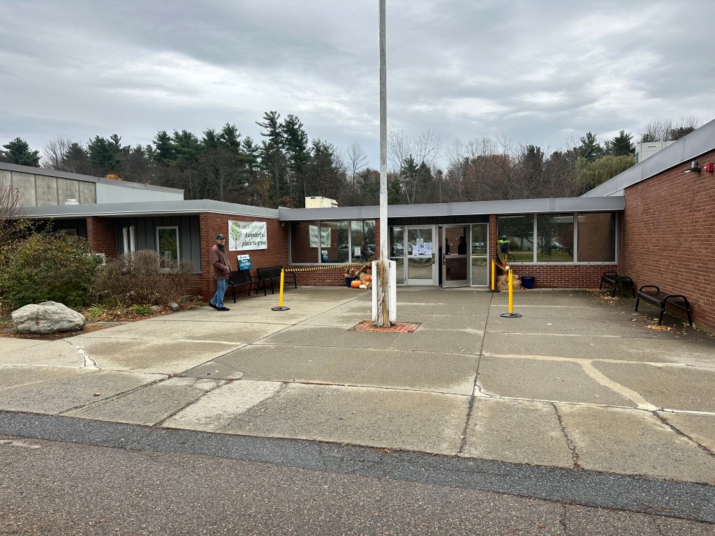
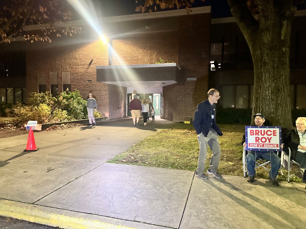
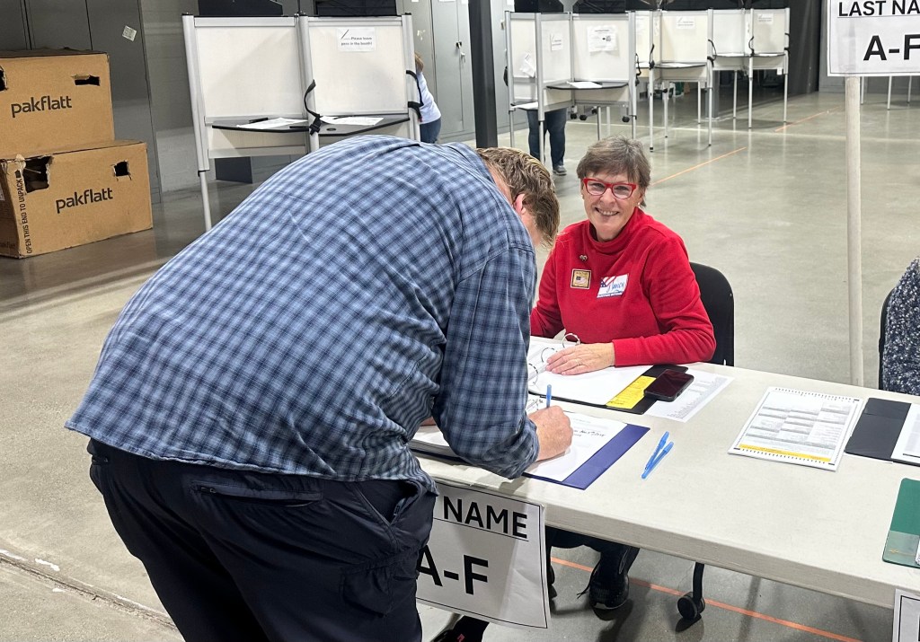
The last stop of course was my home polling place of Williston, where I’d already voted by mail. I chatted with my neighbor Nancy Milne, and realized belatedly that perhaps my time might’ve been better spent helping out at the polls.
Anyway, I got there just before the polls closed at 7 PM, then rushed home to watch the evenings’s grim events unfold on television. I don’t know what I was thinking. Perhaps by bearing witness, I could safeguard democracy? There was no doubt that Vermont was going for Harris, indeed it was the first state to do so. I’d spent the weekend knocking on doors in Greensboro, North Carolina; fat lot of good that did.
Some of the thousands 🙄 of you who follow this blog might remember my post from May 1, 2021, when I stopped by the statue of Grover Cleveland in Buffalo.
At the time, my comment was “Grover Cleveland …is (so far) is the only president to serve two non-consecutive terms, he was our 22nd and 24th president. Jury is still out whether his feat will be matched in 2024 by our most recent NY president.” Well now the jury is in, we have a 45th and 47th, and it feels appropriate to compare them. We all know who 45/47 is but let’s look at 22/24.
Except for that one numerical quirk, most of us know nothing about Grover. He was one of that great unremarkable blur of presidents between Lincoln and Teddy Roosevelt, the captains of Reconstruction and the Gilded Age. Most of them have sunk into the obscurity they so richly deserved, although Grant, Garfield, and McKinley got a little traction, mostly due to scandals and getting assassinated. Grover stood out as the only Democratic president between the Civil War and World War I, a span of 52 years. He won the popular vote in his first reelection, but lost the electoral vote and left graciously, his wife telling the White House staff, “don’t change anything, we’ll be back.” Four years later he was, having won both popular and electoral votes that time. His second term was notable for the Panic of 1893 mentioned prominently in my blog posts about the Aspen area, and for having a large tumor on his palate removed in secret, on a boat cruise. Wikipedia states “Cleveland is praised for honesty, integrity, adherence to his morals, defying party boundaries, and effective leadership, and is typically ranked in the middle to upper tier of U.S. presidents.”
Ol’ 45/47, not so much. But we can’t deny that he won, and won decisively. The reasons why are the subject of much hand-ringing and recrimination, to which I have a little to add. The man’s slew of negatives are self-evident, I won’t enumerate them here. Over the decades, with the election of Nixon, Reagan, the Bushes, and Trump the first time, I mused about leaving the country. This defeat is the most unsettling of all, since many of the constitutional guard rails have disappeared. I was born in Germany, wouldn’t be too hard to get a passport. Canada and New Zealand also beckon.
But no. If I learned nothing else in my fractured but complete trip across the country, it’s that the vast majority of people are reasonable, decent, and well-meaning, even in the deep red states. Everybody knew who Trump was, all of his baggage, and the majority decided that on balance, he was the better choice. It’s tempting to dismiss them as ignorant, xenophobic, misogynistic, and racist, but that’s not what I saw on that trip. From my comfortable, elitely-educated, cloistered perch, who am I to be so judgmental? Isn’t that what we were accusing Trump of doing, vilifying the opposition as “the other”?
Folks have been quoting Ben Franklin recently: “A Republic, if you can keep it.” To which I might add: a planet, if you can keep it.
One can only hope.
Distance 88 miles. Time 12 hours with stops. Elevation gain 4,650 feet
Greenwood Village, Colorado to Williston, Vermont. Sunday- Friday, July 21-26, 2024
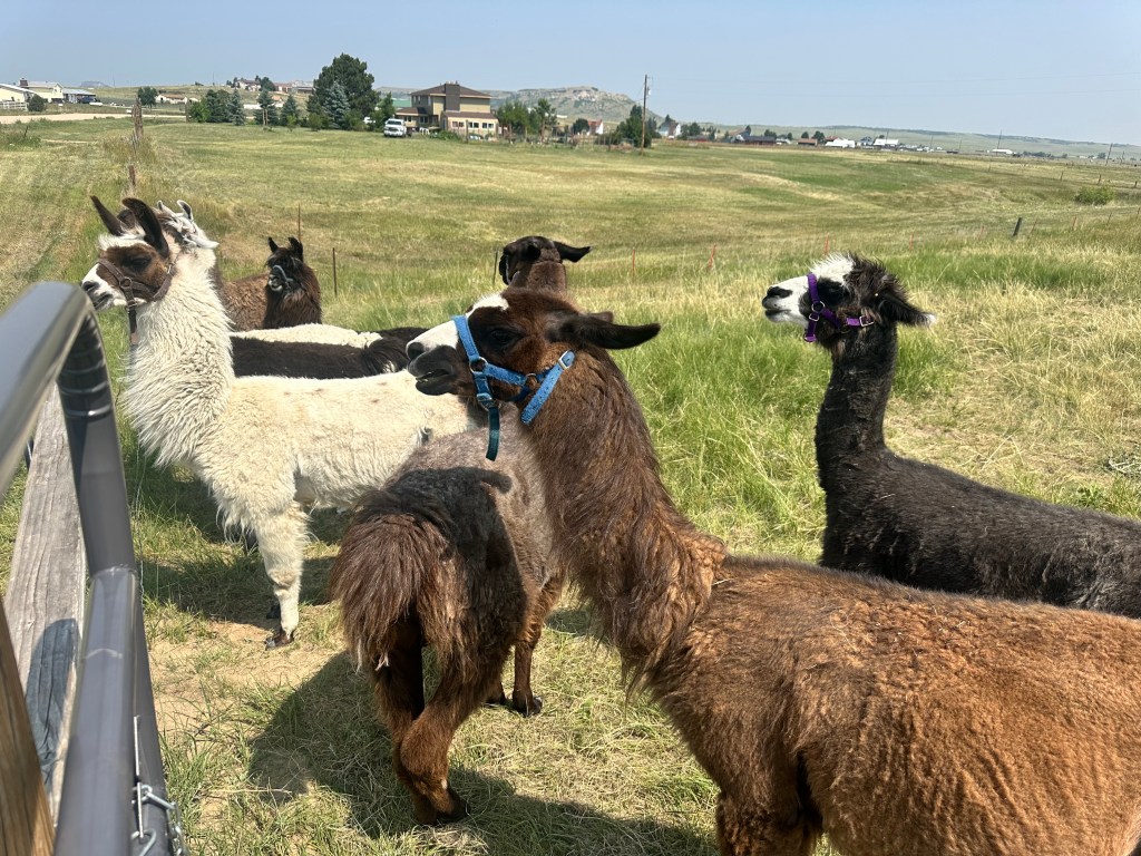
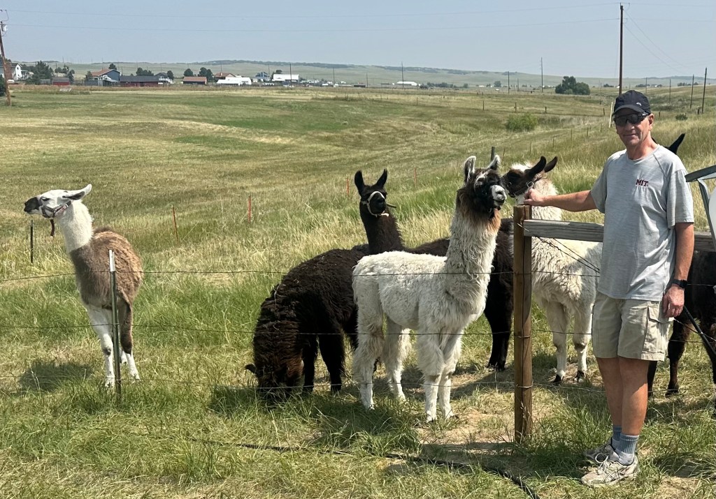
It was a quick ride to the third couple to host me in the Denver area, who would prefer I didn’t use their names. He is a retired neurologist and Colorado native, also an avid fly fisherman and llama wrangler, who has a herd of about 60 of these beautiful animals, he took me to his ranch in Larkspur.
I’ve known his wife for 57 years, we went to high school together and both were in college in Cambridge, both pursued careers in medicine. Although we live far apart, we have shared so many of life’s experiences and had so much to talk about. Visiting with them was the pièce de résistance of my journey, the cherry on top of the dessert that was Denver.
It was over all too soon. I got to finish with a flourish: the Cherry Creek Trail, which sets the standard for bike paths. Beautifully paved, it follows the creek on a gentle downhill from the leafy suburbs to the heart of downtown Denver with nary a street crossing, completely protected from all that traffic. I was at Union Station in a flash.
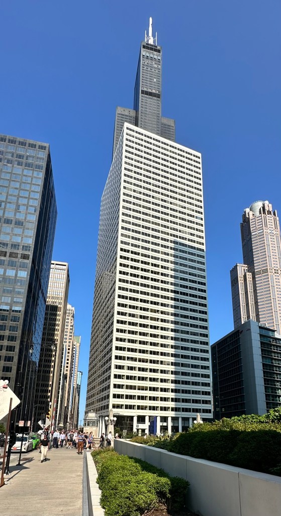
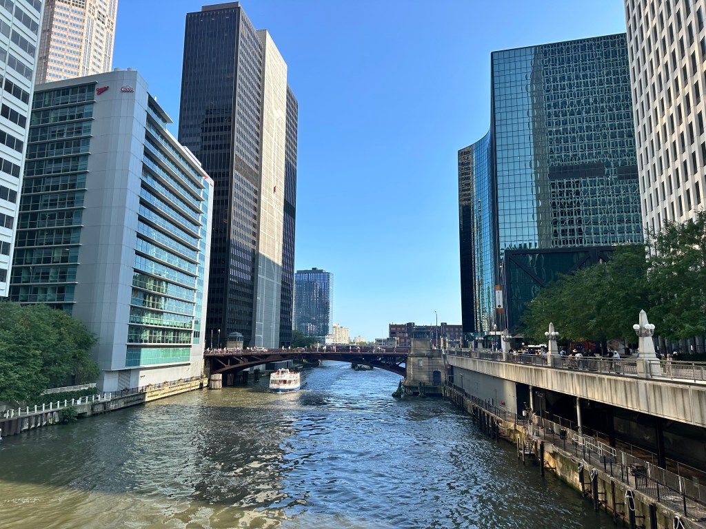
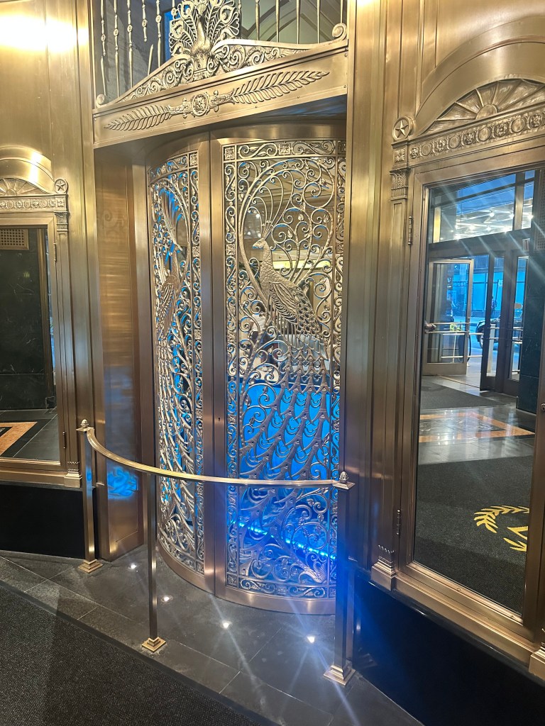
I chose the train rather than flying, much easier to take an unboxed bike, far less carbon impact, and the romance of riding the rails has always appealed to me, especially in a sleeper car. It takes longer, but I’ve got the time. A six hour layover in Chicago gave me another look at the Windy City, such a contrast to the months of the Wild West.
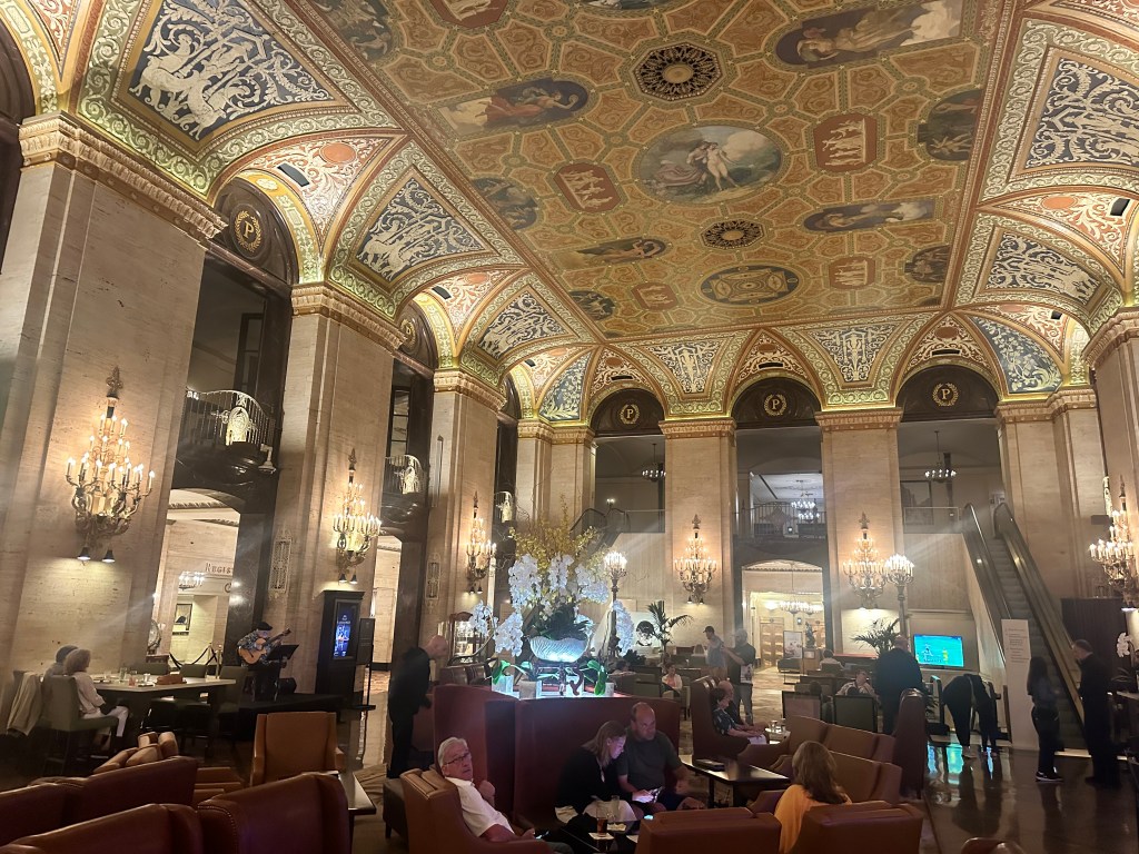
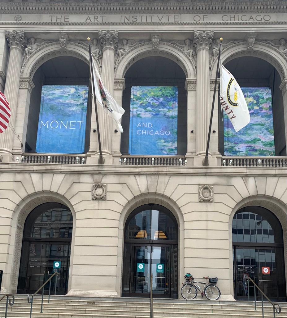
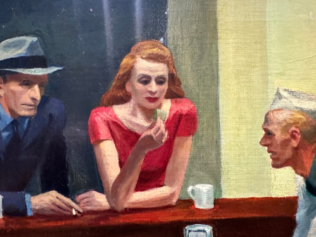
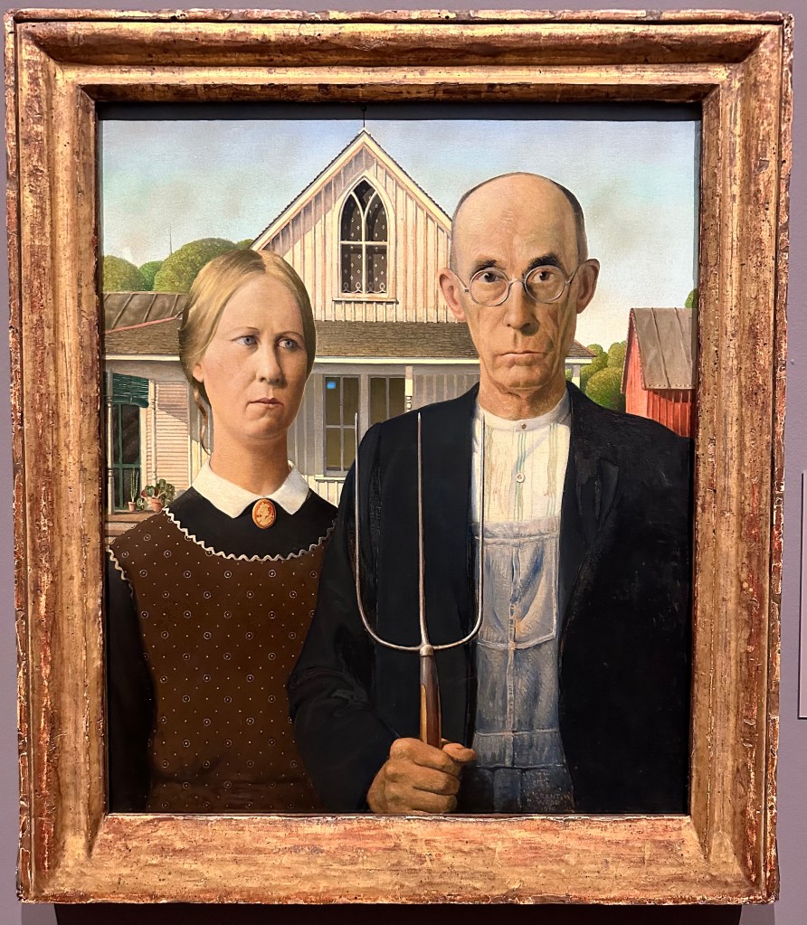
The Sears/Willis Tower, once the tallest building in the world. The Chicago River, connecting the Great Lakes with the Mississippi, home to dozens of cruise boats The Peacock Door… to the Palmer House in Chicago, mentioned in The Music ManMy real destinationI can see the Roman “U” on the historic entrance, but it looks pretentious on a modern signMy first Broadway play was Sondheim’s Sunday in the Park with George with Mandy Patinkin and Bernadette Peters, based on Seurat’s A Sunday on La Grande JatteHard to articulate why I’ve always found Edward Hopper’s Nighthawks so eerie and compellingThe models for the couple are Hopper himself and his wife Jo
My God, am I really that old? I first became aware of Grant Wood’s American Gothic in a 1963 ad for New Country Corn Flakes. https://youtu.be/OKSmj2g8shs
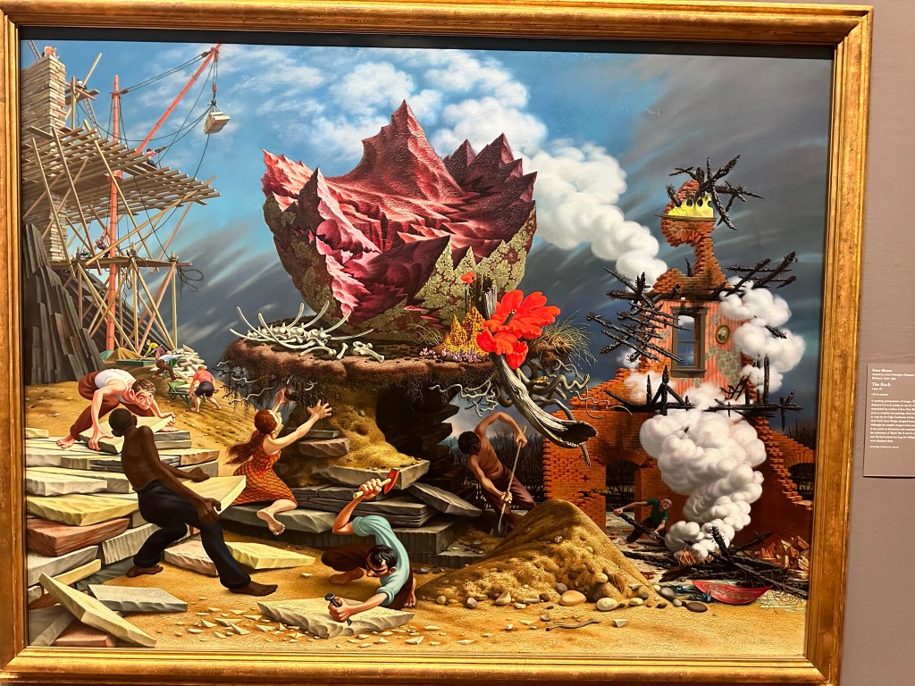
So that was the trifecta of classics I came to see at the Art Institute, but you always find hidden nuggets. I knew this disturbing work, The Rock, was by Peter Blume,
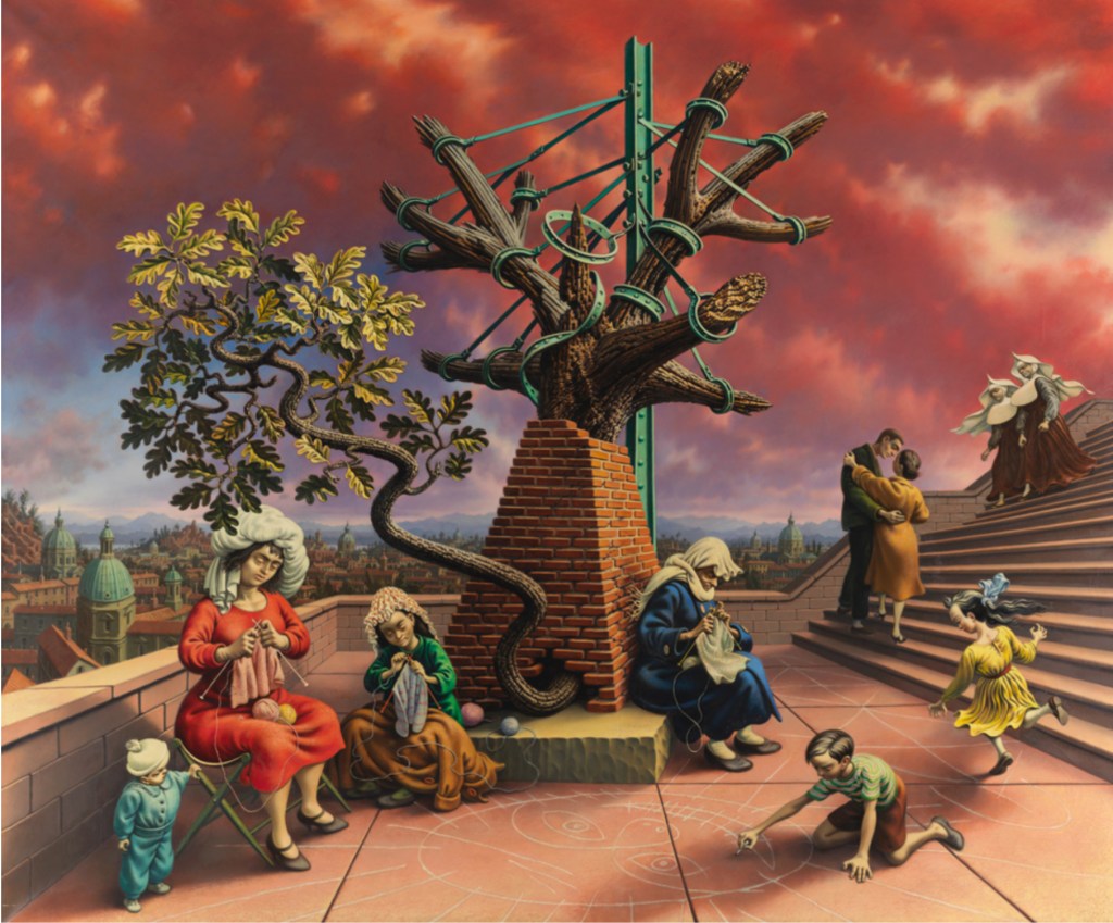
Since it resembled his creepy Tasso’s Oak
which affected me so deeply I sought out the Oak itself, on the Janiculum Hill in Rome on our trip to Italy in 2022.
under which the Renaissance poet Torquato Tasso spent the last year of his life waiting in vain for the pope to recognize him as poet laureate, and slowly going mad.
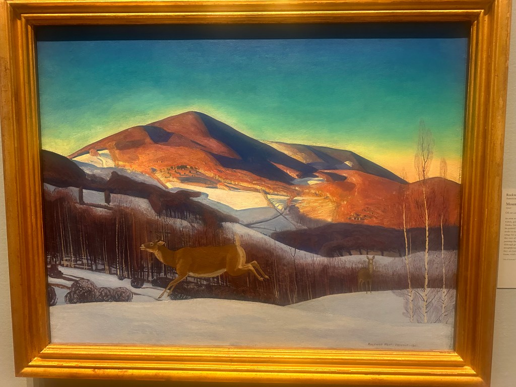
Other nuggets were evocative of BFF Brian’s local mountain, Mount Equinox
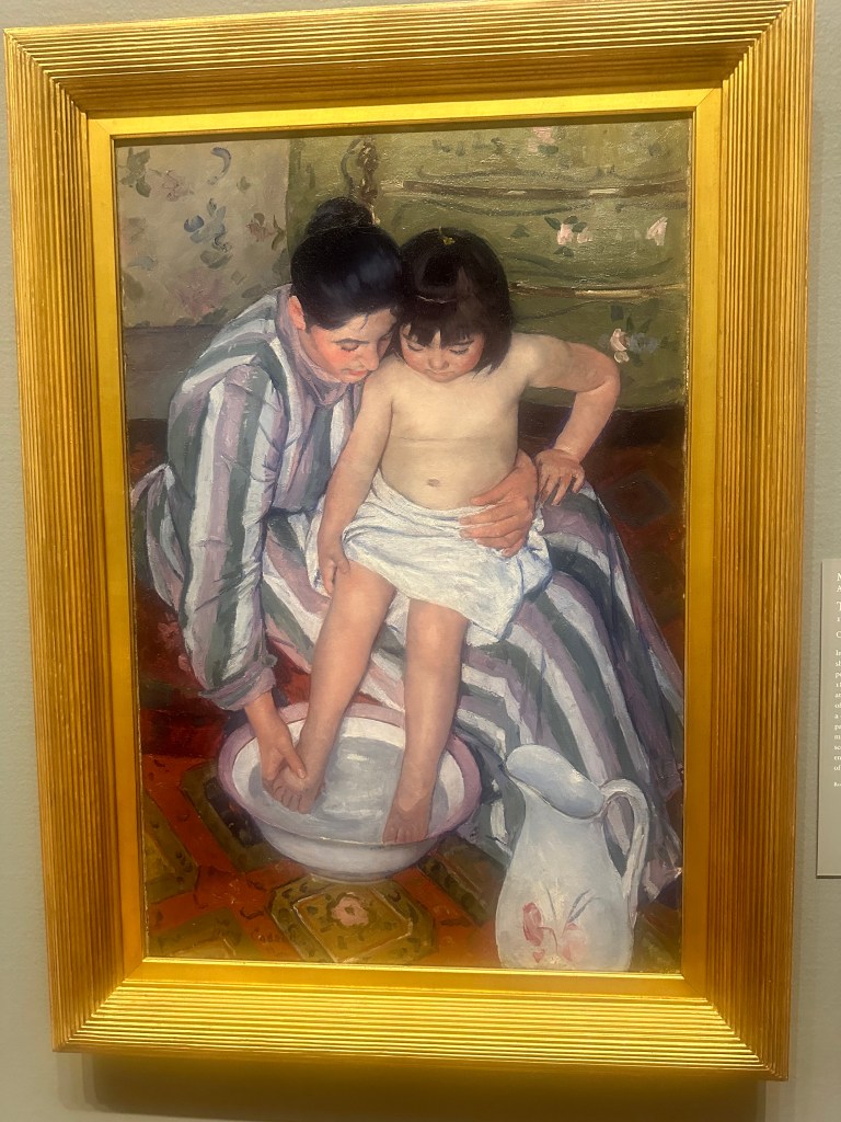
and one of his wife Mary’s favorite paintings by Mary Cassatt.
Back at the station, I saw that Steve Goodman/Arlo Guthrie weren’t just blowing smoke, there really is a train they call the City of New Orleans.
So much more to see, so little time. What a sublime, refined coda to my three months of the rugged outdoors, a closure of sorts. I feel I am really done. I have, in three stages, cycled across the country, from the Atlantic to the Pacific. I didn’t reach any new highpoints this time, but I’ve sea-to-summited 26* of them, out of 37 total. I’ll get the last 13, but no longer feel the need to do these solely under human power, from the sea. I hope to post an epilogue soon, reflecting on the full experience.
I’ve visited family and many friends, old and new. I’ve been blessed by trail angels and Easter eggs, almost beyond counting. I’ve watched the tapestry of our nation roll by in slow motion, gaining new perspectives on scenes of exquisite beauty. I’ve seen, almost without exception, that folks are basically decent and caring. So reassuring, in these times of strife and polarization. I’ve lost 35 pounds, and never felt healthier. To use Simon and Garfunkel’s overworked lyric, I’ve come to look for America. It’s there, and it’s doing OK.
And that will be enough.
Distance 50 miles, 3,156 total. Time 10 hours with stops. Elevation gain 1,503 feet
*I know, at Mt. Elbert I said the total was 24. But I realized I could cobble together a series of rides and hikes that put Mount Mitchell and Clingmans Dome, the highpoints of North Carolina and Tennessee, also in that category. So I’ve done half of the state highpoints from sea-to-summit.