Floyd Joy, and 2 Karens for the price of 1

Highlands Ranch, Colorado. Friday – Sunday, July 19–21, 2024

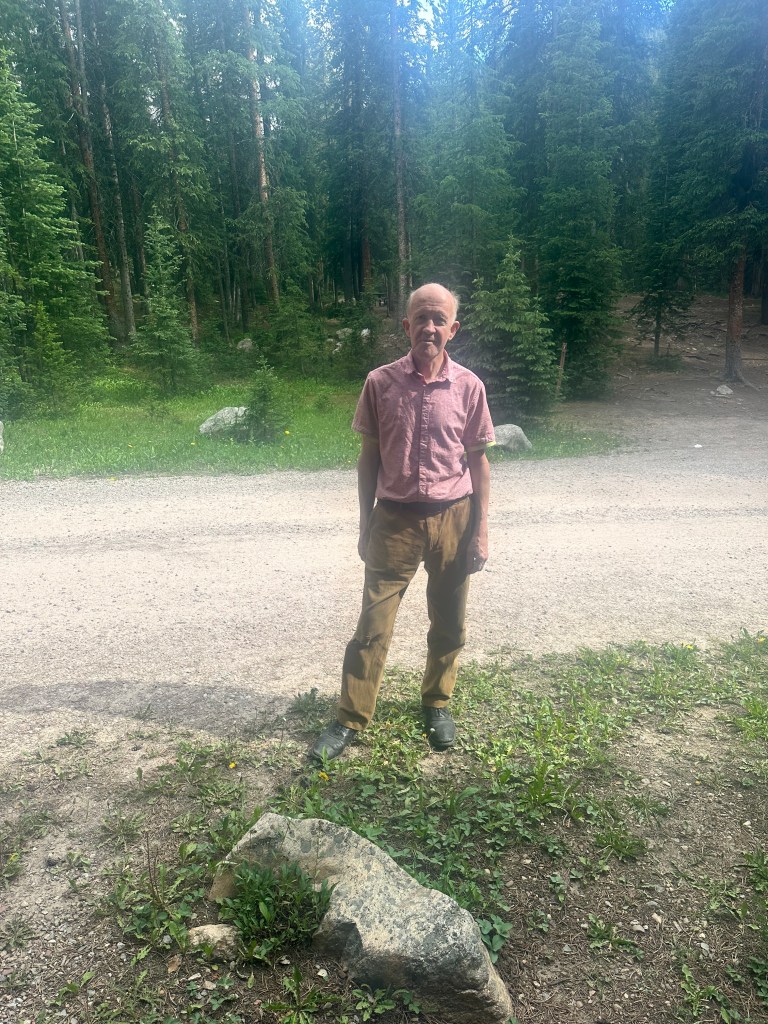
One of the more obscure Supremes songs, but one that sticks in my mind, is 1971’s Floy Joy. One of my favorite groups is Pink Floyd. It all fits, since my longtime buddy and med school classmate Floyd Russak is quite musical. He plays the guitar, and over the years we’ve had fun singing songs together.

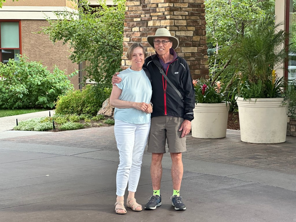
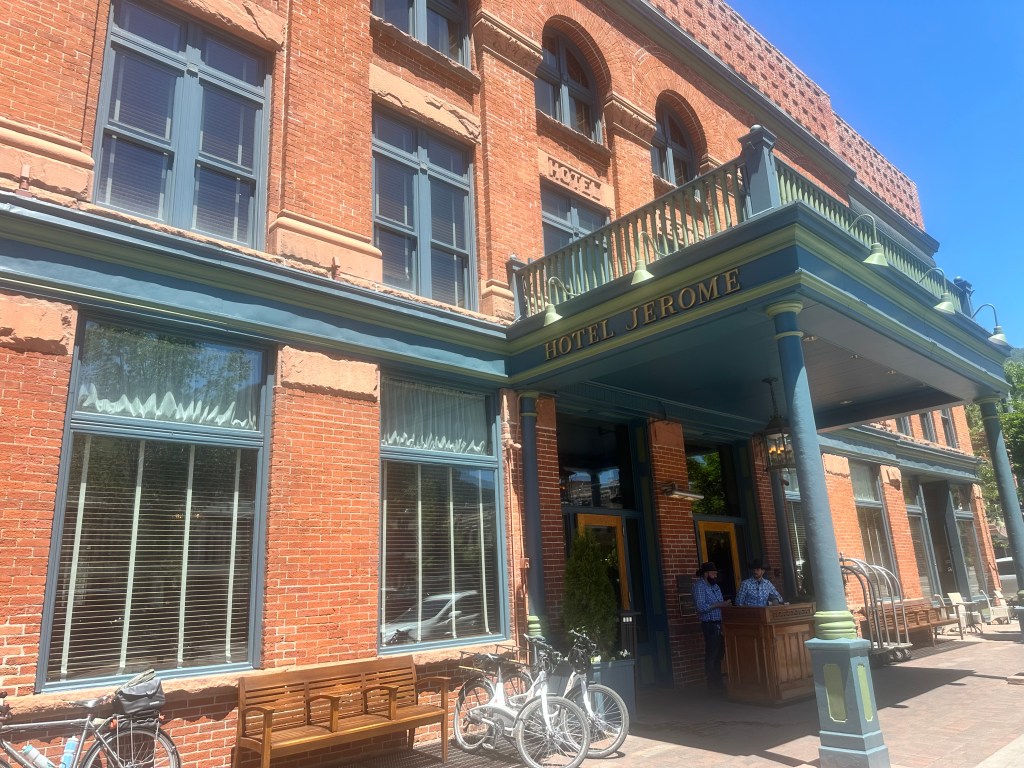
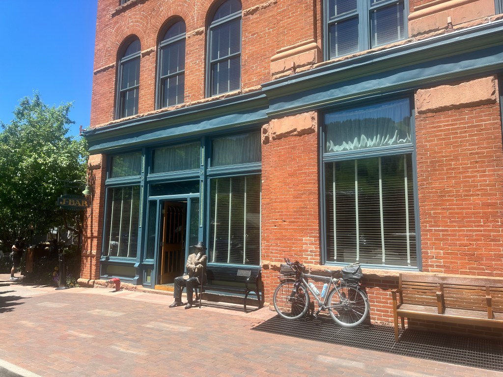
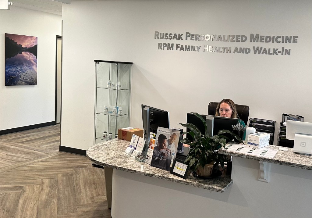
I mentioned him three years ago, when I was riding by Northwestern University in Illinois. where Floyd met Karen while they were undergraduates, they both came to DC to attend George Washington University, he in the medical and she in the business school. We were quite active in left-wing politics together back then, both in the public health service, we paid back our scholarships in Massachusetts, after doing internal medicine residencies in separate hospitals in Cambridge. Floyd is a native of Colorado, so he returned here and began a series of private practices. The first was a fusion of eastern and western medical philosophies, he worked in an ER in Aspen (and purchased a couple of hotel rooms there, he put me up in one of them), and now he has a concierge practice. Karen manages the business of both the practice and their beautiful home. By happy coincidence, that home is right across University Boulevard from the CCRC where Steven and Karen Moore live. Two of my favorite couples, right across the street from each other, having arrived from far away. How lucky is that?

The Vi complex from Floyd and Karen’s deck

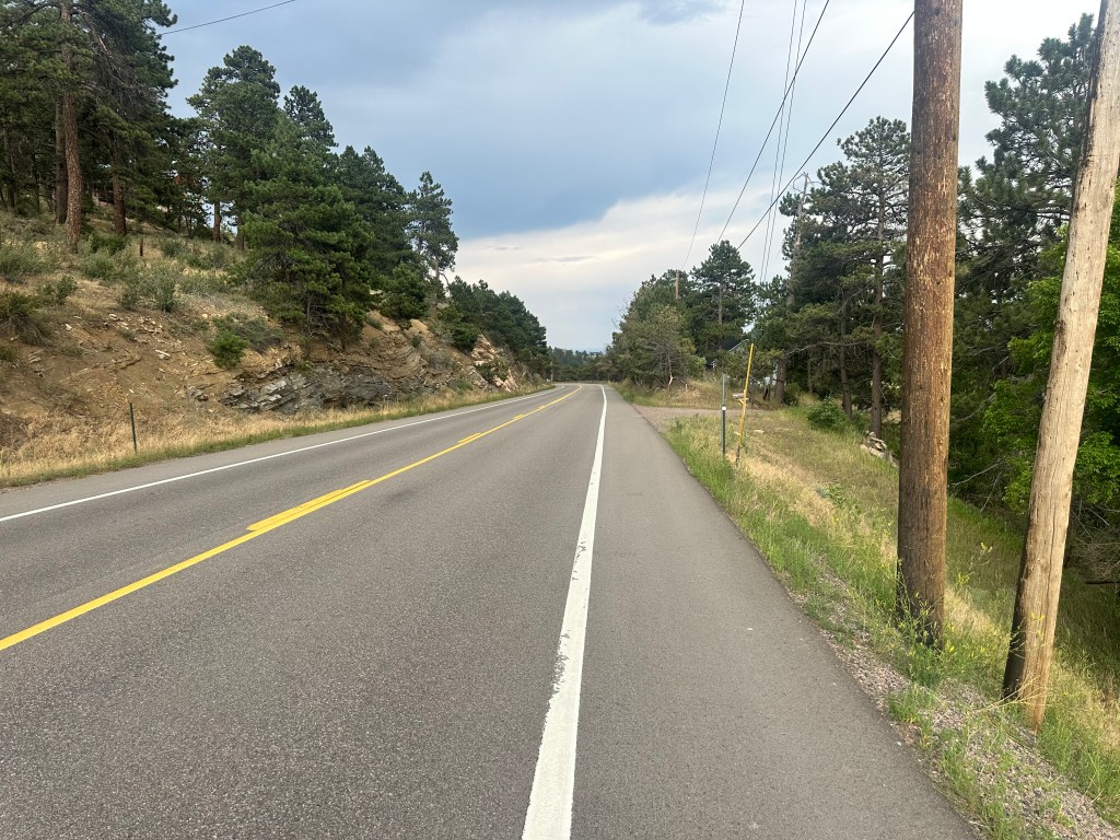
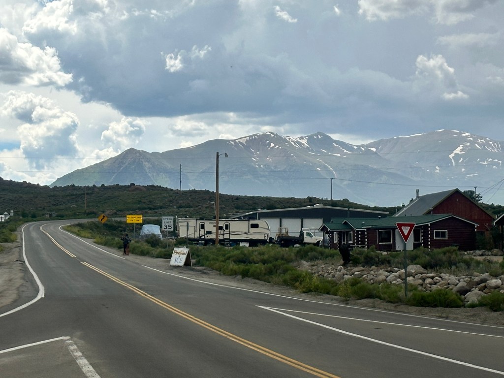
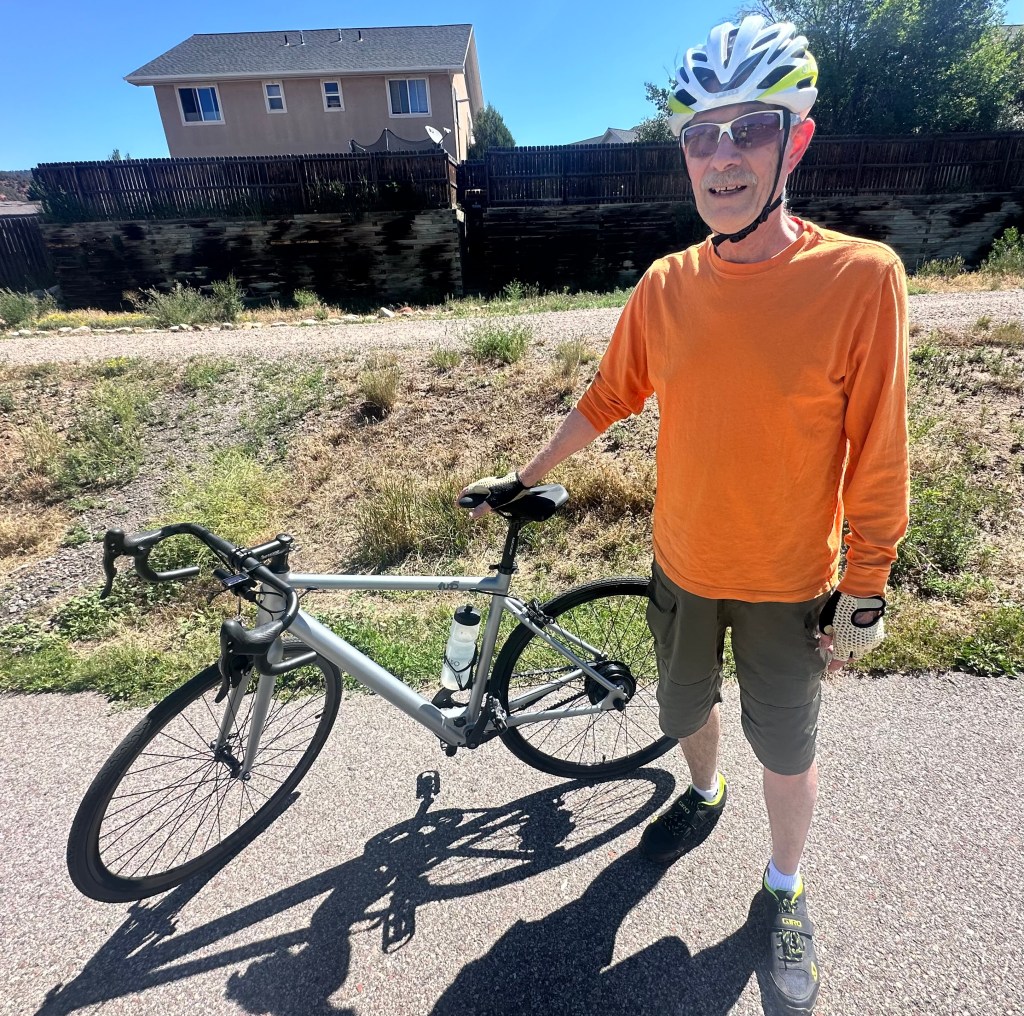
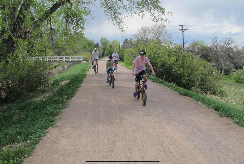
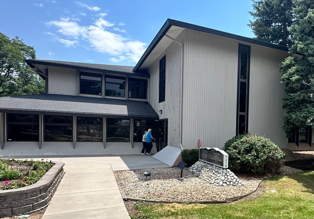
Floyd and Karen had to work Friday, so I took a leisurely ride on the meandering Highline Canal to check out his practice. The Highline Canal is a dream—flat, beautifully landscaped, reminiscent of my beloved C&O Canal, but in much better shape.

Not the most direct route
But what a delight to ride
That’s Kimberly, his clinical assistant

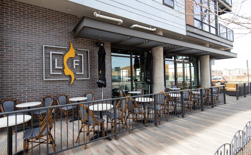
We had dinner that night in Le French, which was just as magnifique as it sounds.

Oh là là !

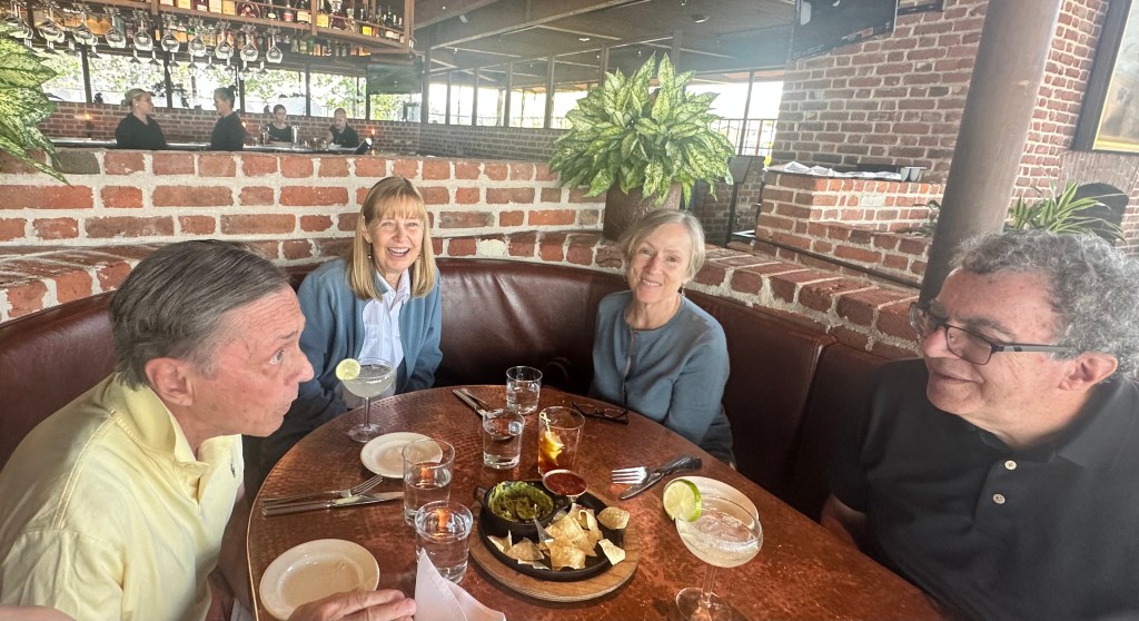
Saturday, at another posh restaurant, Sierra

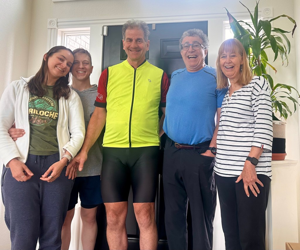
I finally got a chance to see these wonderful friends, who live so close but have never met, get together.

Steve, Karen, Karen, and Floyd.

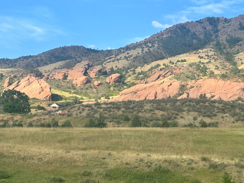
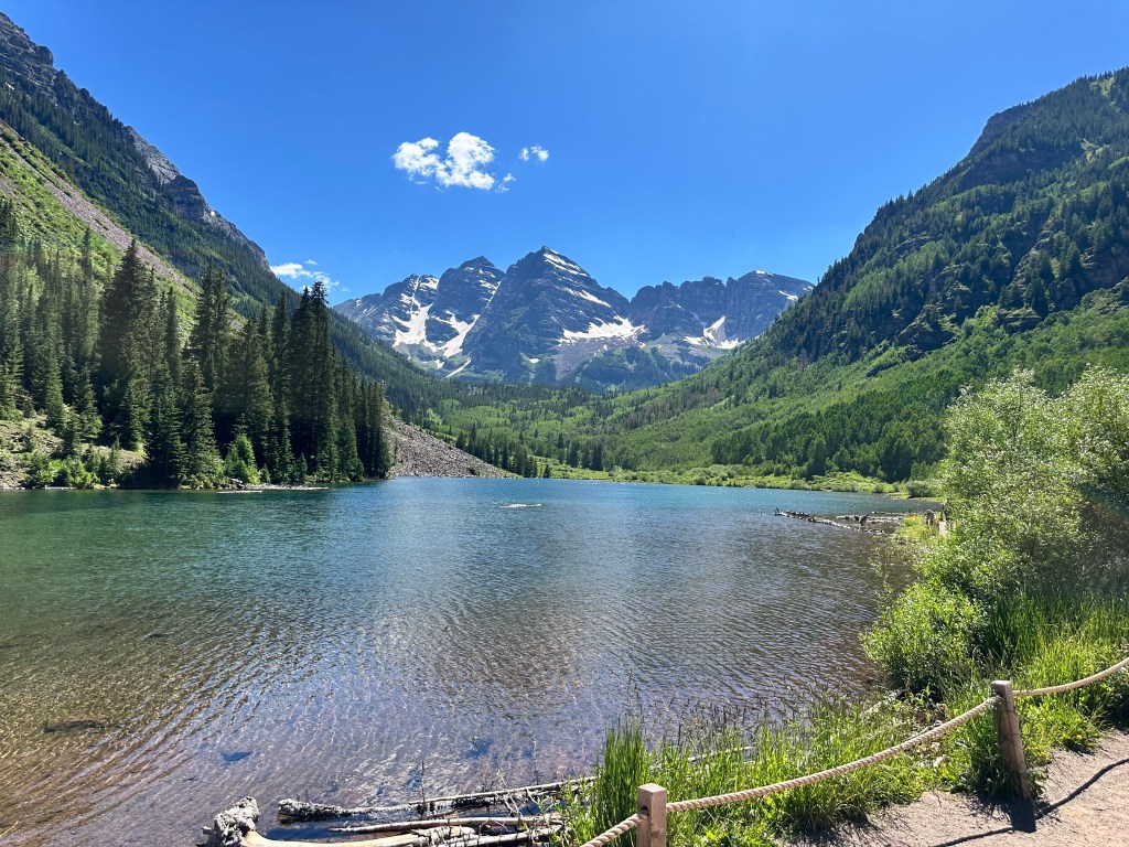
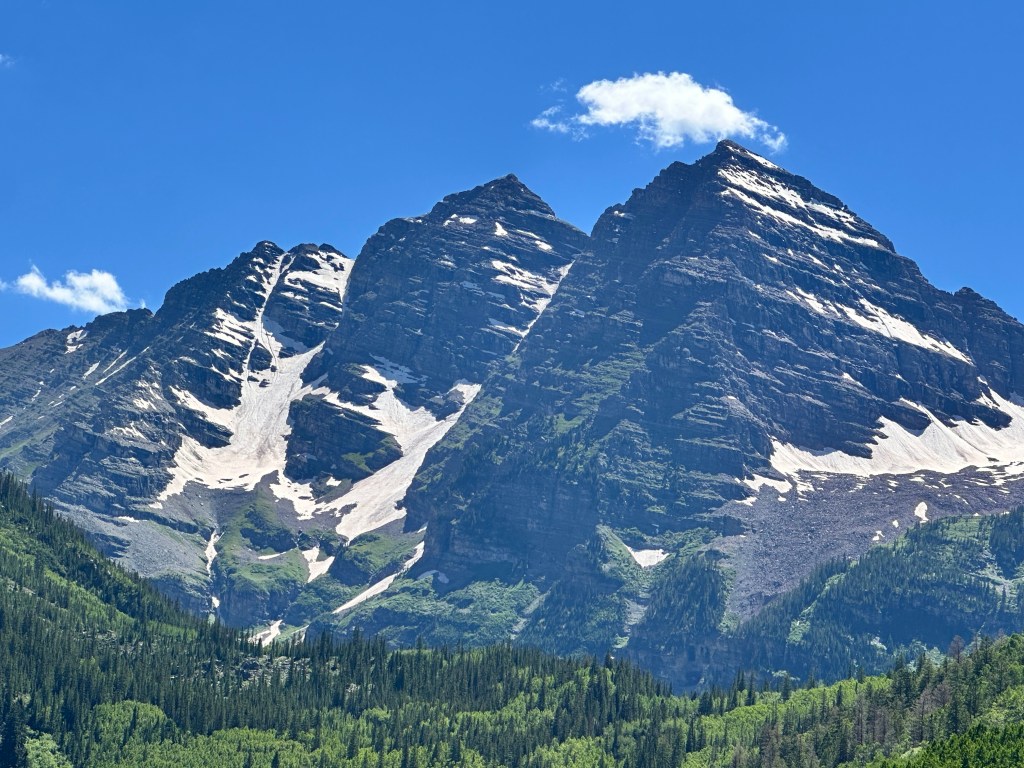
We moved on to Lookout Mountain, 2,000 feet above the city, for the Buffalo Bill Museum and grave.

“Bill” and Annie Oakley. Maybe you CAN get a man with a gun?

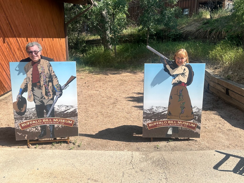
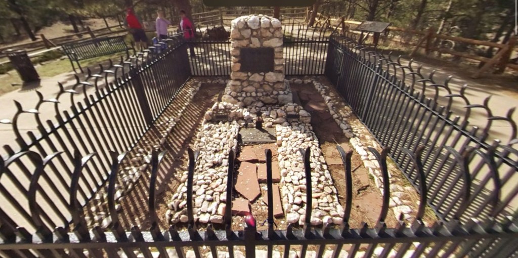
There’s some controversy about whether he is really buried here, or in the town he founded, Cody, Wyoming, that I visited a month ago. https://history.denverlibrary.org/news/western-history/buffalo-bill-cody-really-buried-lookout-mountain

Then it was off to another echo of previous places. Three years ago, I passed Chautauqua, New York, and ruminated about the central a role it played in my life, and how it spawned the Chautauqua movement. Three weeks ago I encountered a remnant of that movement, the Tank Center for the Sonic Arts, in Rangely Colorado. Now Floyd and Karen treated me to a terrific concert from the a cappella group Straight No Chaser

These guys have to be seen to be believed. Incredible.

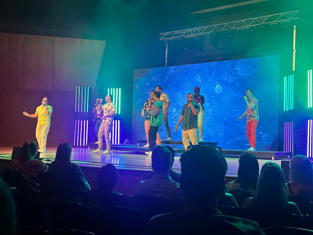
at the Colorado Chautauqua, the only other permanent Chautauqua in the country. https://www.chautauqua.com/2021/chautauqua-movement-history/ Just seeing the name, and the logo, brought back such warm memories. Such a night.

The next morning, we sang songs together, shared stories, and I said goodbye to the Russak family.

Daughter Emily, boyfriend Dave, Floyd, and Karen. Thanks guys!

No cycling or hiking these two days, just sightseeing and schmoozing. Heaven.

©️ 2024 Scott Luria

Switching gears

Golden to Highlands Ranch, Colorado. Monday-Thursday, July 15-18, 2024

After more than 3,000 miles, the trip is winding down. The feast is almost over, now comes dessert. Golden is at the doorstep of greater Denver, today is just 30 miles to the first of three sets of friends I’ll be staying with here.

One more bit of descending, past the famous Red Rocks Amphitheatre, often called the country’s greatest natural outdoor concert venue. Could only see this glimpse from the road

but I’ve been to a concert there, and wow what a place.

Photo from the web of a yoga session

The venue is best recognized by its two massive monoliths, named “Ship Rock” and “Creation Rock”, as well as the smaller “Stage Rock”, which together flank its 9,525 capacity seating area and naturally form the amphitheater. Many of the biggest bands have played here, most notably the Beatles in 1964.

That descent led me to the cute little town of Morrison, then onto the C-470 bike path.

C-470 (in red on the map above) is the southwestern segment of Denver’s incomplete beltway. Originally planned to be I-470, the full beltway was never completed for environmental concerns, but 3/4 of it was later finished by the state, the green portion is designated E-470. Most beltways are dreary-but-essential thorofares through suburban sprawl, but C-470 is a scenic wonder, skirting the foothills of the Front Range and offering dazzling views throughout. The associated bike path was a dream to ride.

At least until I hit another “trail closed” sign like yesterday, and was detoured onto the South Platte bike trail, gorgeous but not where I was going. I was left to negotiate the Greater Denver grid on my own, and was again gratified to see that even on streets not designed for bicycles, I felt accepted and safe.

My first two sets of friends live in a Denver suburb called Highlands Ranch, which as the name implies lies on a plateau above the city, so I had a mild climb at the end. Along the way, I discovered that my front brake no longer worked. This didn’t matter much now, since I was only going uphill, but thank heavens this hadn’t happened while I was making the recent 7,000 foot descent to the Denver plain. Since your weight shifts forward as you brake, the front brake provides most of your stopping power. I figured I could use my upcoming cycling hiatus to figure out the problem.

Steve and Karen, my trail angels from yesterday, were waiting to greet me at the entrance to their home, a CCRC (continuous care retirement community) called Vi at Highlands Ranch.

Steve was a residential and commercial architect who for many years was my main cycling buddy, Karen was a real estate broker and assessor, both are Vermont natives who had been our close friends for decades. When they retired, they lived for a while in a condo in Florida, but kept searching for a more suitable place to spend this phase in their lives. With their combined experience in real estate and business, they were well suited to understand the issues involved, and found an ideal community here.

Boy did they ever. I have seen a number of CCRCs over the years, but never one like this. Perched on the edge of the plateau, their sumptuous suite had a 270° view of the Rockies and the eastern Colorado plains. I couldn’t take my eyes off the scenery, which continuously changed from crystal views of the mountains, to swirling storms, to gorgeous sunsets. Their location had every amenity you could want to support an active lifestyle, but also on-site rehab and long term nursing care facilities to guarantee you would never have to leave, no matter what your future healthcare needs. Wow.

One of the amenities was a well-lighted and equipped bike repair station, I discovered that the brake problem was just mud from that highway construction jamming the mechanism, easily rectified. I was free to sightsee, and Steve and Karen led me off on adventure after adventure, focusing on the compelling geology of the Front Range, oversimplified here.

I learned that much of Colorado was originally underwater, covered by a shallow sea teaming with life, which created layers of sandstone and limestone full of fossils, later tracked by dinosaurs. An uplift called the Laramide Orogeny then spawned the Rockies, tilting the flat seabeds up at an angle and exposing amazing formations, such as those that formed the Red Rocks Amphitheatre. We took a 5 mile hike above that amphitheatre

Saw dinosaur footprints across a tilted slab

The sign says the track site is rated #1 in the nation by paleontologists

descended into the Cave of the Winds, carved out of that limestone and filled with formations

and had lunch in Colorado Springs, with a knockout view of Pikes Peak* and the Garden of the Gods.

We were joined by their friend Jodie, registrar of the Vermont College of Fine Arts, who was giving a symposium at Colorado College

The Garden of the Gods is something else again. The name sounds grandiose until you actually see it, with its sandstone formations, fins, gendarmes, and balanced rocks.

We spent our last day together watching rock climbers at El Dorado State Park, having a Nepalese lunch at the Sherpa House in Golden, and seeing more great rock formations at Roxborough Park. Alas, I didn’t get pictures, except for this one of a doe nursing her fawns.

All in all, these three days have been a vivid but low-key contrast to the daily push to move forward, to get more miles. Switching gears from the main course to the tasty dessert. Yummy.

Distance 35 miles (including 10 miles of hiking), 3,106 total. Time 10 hours with stops. Elevation gain 2,013 feet

©️ 2024 Scott Luria

*This is the second, more famous of the Pikes Peaks. I climbed the first one three years ago https://scottluria.org/2021/06/27/zebulon-lives/

I thought I was home free

Georgetown to Golden,Colorado, Sunday, July 14, 2024

The day started out so nicely. A 12 mile swoop downhill to meet Lynne Seaborg, Eric‘s older sister, for brunch in yet another outdoor café, this time in Idaho Springs. Lynne is a retired pediatric clinical psychologist who trained at Harvard and Purdue, and practiced for many years in western Colorado in southern Utah. Her late husband was an infectious disease specialist, the only one between Denver and Salt Lake City. Like her father and brother she is an active hiker, and we’ve shared many adventures together in the southwest, as well as our time in Cambridge and growing up in DC. So much to talk about, so many reminiscences.

We talked for hours and could have for many more, but we both had a long way to go today. I knew I had one more hump to get over, only 700 feet but steeper (13% grade) than anything I had yet done. At least it was going to be on a bike path.

But the bike path was closed. The Clear Creek canyon was very narrow here, so there was no alternative but I-70. Unlike in Montana and Wyoming, parts of the Colorado interstates are closed to bicyclists, and that was the case here. But there was no alternative, I rehearsed to myself in case I was stopped by a state trooper. The shoulder was narrow and full of debris, but a rumble strip protected me from the heavy traffic and things were OK for a while, until I hit construction. I tried to stick to the asphalt as I threaded my way through the barrels and Jersey barriers, but ultimately had to go down a steep bank and push my way up that 13% grade in the dirt. Construction vehicles were parked everywhere, but thankfully it was a Sunday, and nobody was there to stop me. As if on queue, a thunderstorm hit and turned the dirt to mud. It wasn’t fun, pushing along, filthy as never before, anxious there might be some impassible barrier ahead. I couldn’t imagine having to backtrack through all that.

Serves me right, I thought. You get cocky, you think you’re home free, and the Rockies have one more card up their sleeve, one more twist before they let you go. But just at the depths of my dismay, the phone rang.

Luckily, I had my noise-canceling AirPods in, or I never would’ve heard it through all that traffic. Steve and Karen Moore, the first of three friends I would be visiting in Denver in the next week, had been tracking my location on the Find My Friends app, and drove 40 miles to offer a port in the storm. They were surprised to see me pushing along on the other side of that Jersey barrier, but pulled off at the next exit and were waiting with food and a warm car.

Hard to imagine how grateful I felt. This kind of kindness is typical of Karen, who, for many years would meet us on our Boston to Cape Cod bike rides and provide snacks and comfort. These blog pages are full of trail angels and Easter eggs, but this one took the cake. To top it off, they had a cooler with root beer and Snickers bars. Steve and Karen are the epitome of healthy eaters, Steve often teases me about my dietary choices, but in this case they indulged me. I was touched beyond words. I had been looking forward to seeing them for so long, and here they were, a little taste of heaven ahead of time. Wow.

In the warmth of their car, we waited out the rain, my grubby body in their pristine vehicle. They knew enough not to insist on giving me a ride, knew I wouldn’t want to break the chain, the continuous bike ride from the Pacific. Thus fortified, and with only a couple of more humps to go over, I finally gazed upon the promised land. All of Denver spread out before me, 2,500 feet below.

Just 6/10 of a mile beyond the crest, I had to stop and take a couple of silly pictures.

This was the spot where I had turned around three years ago, the highwater mark of my Vermont to Denver trip, as chronicled in my Death by a Thousand Cuts post. https://scottluria.org/2021/08/21/death-by-a-thousand-cuts/ My Apple Watch had recorded my track then, so I knew the exact spot. If I didn’t go an inch further, I had now bicycled from the Atlantic to the Pacific, if not continuously (in 2020, I rode from my home to the Atlantic, those blog posts are still pending). I haven’t done any new highpoints, didn’t make it up Mt. Hood, didn’t even make it to every parking lot I wanted, but at least I’ve done this. Why that matters so much to me is another story, that I will address on the train ride home.

Now, suddenly, I was covering familiar ground. Once again, I was roaring down those twists on Highway 40, viewing them not through the bittersweet disappointment of three years ago, but the thrill of coming into Denver and seeing so many dear friends. My motel was right at the point where I agonized over my decision in 2021, and teed up the reservations, allowing me to turn around. How eerie, how Twilight Zone. How wonderful.

Distance 34 miles, 3,071 total. Time 9 hours with stops. Elevation gain 1,742 feet

©️ 2024 Scott Luria

Loveland Pass, way up on the Great Divide. Biking on down the other side

Dillon to Georgetown, Colorado, Saturday, July 13, 2024.

You boomers out there might remember the Truckers/CB radio craze of the 1970s, that added phrases like “Breaker one nine” and “10-4, good buddy” to the cultural lexicon. Much of it was inspired by the CW McCall hit Convoy, later made into a Sam Peckinpah movie, followed by The Burt Reynolds/Sally Field vehicle Smokey and the Bandit. The craze lionized long-distance truckers as modern-day cowboys, cackling to one another over their CB radios and harassed by overzealous state troopers they called Smokey Bears or Smokies.

Well before there was Convoy there was Wolf Creek Pass, CW McCall’s other hit, a hilarious story of a truck full of chickens crossing the continental divide and careening down the other side out of control. It’s worth a listen. https://youtu.be/KHb_0Lhegig?si=3MhruoAXTFgP38G9

So Loveland Pass was going to be my fifth and final crossing of the great divide. You may remember when I was being blown east on I-90, following the Yellowstone River in Montana, that I felt I was home free, through the Rockies, and could just head back to the east. But no, I had to turn back, cross the divide four more times, and visit those other highpoint parking lots. Now, finally, I’ll be free, through the Front Range of the Rockies, able to go home.

I’ve done this pass before, in 2009, while picking off fourteeners, and it didn’t seem so bad, but I was 15 years younger and both me and the bike were lighter. I was approaching the beginning of the climb in Keystone, when I was dismayed by a flashing highway sign: “Loveland Pass closed for event.”

What? This was the first I heard. I had even asked a policeman in Dillon if there was any problem with biking over the pass, and he said it should be fine. But the event guard said no, this sign has been flashing for days, he could let me by for now, but I would probably be stopped further up.

The event was the Triple Bypass https://www.triplebypass.org, a huge ride with 4,500 cyclists going over three major Colorado passes, for a total of 110 miles and 10,800 feet of climbing in a single day. One of the biggest events in the country, and, like Hood to Coast, one I’d never heard of. They’d all started at sunrise, and were coming in my direction, Loveland was their second pass. I pedaled on with dread, waiting for the police to pull me over, wondering what I do with my nonrefundable reservations and friends who were expecting me.

But nobody stopped me. It was wild, cranking or walking slowly up that huge hill, with an endless stream of ultra-fit cyclists whizzing down, many shouting words of encouragement to me like “You’re a beast!” or “Superhuman!” I waved gaily at them, but thought, yeah right. An old fat guy pushing his overloaded bike up the hill.

Unlike at Independence Pass, there was a food stop halfway up, a nice outdoor café at the foot of Arapahoe Basin, which has the highest in-bounds skiable terrain in North America.

A-Basin

I was seated in the hot sun, but a gentleman motioned me over to share his shaded table, and he turned out to be a fellow physician. Mark was a family practitioner in southern Colorado who was here for a conference at Keystone. I hadn’t spoken to another doctor in months. A wonderful break.

The last 4 miles to the top of the pass were the steepest, and I wound up walking most of it. I didn’t mind, it was fun to watch thousands of cyclists racing down the hill, the car traffic was limited to occasional boluses, led by a police car. I had to keep reminding myself to look behind me, to see the beautiful valley I was coming up.

I can’t count the number of times cars slowed down and asked if I needed any help. I did encounter a cyclist who had a serious breakdown, his derailleur hanger had broken off, and he had broken a couple of spokes. I have a lot of tools, but I couldn’t help him with that, he was waiting for a sag wagon.

Reaching the crest was a solemn moment for me. This was the shoulder of the last giant, the lip of the Front Range, the final crossing of our country’s spine. Denver, the Great Plains, and the Atlantic Ocean lay below.

It’s all downhill from here

CW McCall’s song rang through my ears as I flew down the other side, glad I wasn’t carrying any chickens. Weird to feel the potential energy I’d stored up in the seven days of climbing since Glenwood Springs released as kinetic energy, miles and miles of endless downhill. Denver was almost 7,000 feet below. I rejoined I-70 just as it was emerging from the Eisenhower Tunnel. 15 years ago I’d had to ride on its shoulder, but now there was a bike path and I could relax and really enjoy the dazzling scenery. I was now following the boiling rapids of Clear Creek, a tributary of the South Platte. Georgetown was a historic mining town, and a restored steam engine was offering rides.

I could only catch a glimpse of it through the trees, but its chugging and whistle echoed through the valley.

But I was happy with a smash burger at another outdoor café, and a snug motel room after a long day.

Distance 33 miles, 3,037 total. Time 10 hours with stops. Elevation gain 3,520 feet

©️ 2024 Scott Luria

Climaxing in Colorado

Leadville to Dillon, Colorado. Friday, July 12, 2024

We snickered as we drove through this tiny town in 1977, couldn’t believe they would really name a town that. Today, Climax, Colorado is technically a ghost town, although there is still an active mine there, the largest molybdenum mine in the world.

Molybdenum is one of those elements you may have struggled to pronounce in chemistry class, but never thought about again. Unless you were a bike geek like me. My first two fancy bikes, my Peter Mooney and my Greg LeMond, were made of very fancy steel, chrome molybdenum alloy, Cro-Mo for short. It was lighter, stronger, more rust resistant, and definitely a status symbol. That is, until carbon fiber and titanium bikes came along. Bike snobs are so fickle. La primadonna è mobile.

The Climax mine was on top of Fremont gap, the second of the 12,000 foot gaps I was going to have to cross, although actually this one was only 11,400 feet. Yeah, I was slumming it. And sure enough, it did seem quite a bit easier, but maybe that was because I was looking forward to the Climax. The downside was hardly anticlimactic (sorry), it had one of those bike trails so glorious you didn’t want it to end, brand new, smoothly paved, taking away all the traffic anxieties so you could enjoy the spectacular views, especially of the Mount of the Holy Cross, one of the Fourteeners. The Mount was dazzling when first photographed by William Henry Jackson in 1873, but the cross is very dependent on the snow cover, and more recent photographs, including mine, don’t show it as well.

The bike path swooped down to Copper Mountain, ski resort, and the town of Frisco where once again I joined the Transamerica Trail, that I had veered off in the Grand Tetons. I was hoping to meet some long-distance road tourists, but didn’t see a one. I did chat for quite a while with Jason, who is doing the Continental Divide Trail on his mountain bike, but when he gets down to New Mexico, he will be taking the ACA Southern Tier route all the way to Saint Augustine, Florida. A native Floridian, he was unfazed by the prospect of record heat, said he would just ride in the early morning and take siestas during the heat of day, possibly under the fly of his tent, or in the shade of a rock. Does that really work at 110°?

Jason

I made a curious discovery in a bike shop. I usually asked to use their floor pump, to top off my tires, especially since I have a big climb tomorrow. I was astonished to see that my tire pressure was over 100, when the goal is 85 psi. How could that be? I had filled them to 85 in Aspen.

Then it occurred to me: Aspen is just under 8,000 feet, Frisco is at 9,500. I wonder if at lower atmospheric pressures, internal tire pressures read higher (I had to drop physical chemistry/thermodynamics twice at MIT before I finally passed it). Anyway, I’m glad I didn’t pump them up any higher—instead, I bled them off.

The day wrapped up with a beautiful bike trail around the Dillon Reservoir, where I passed the 3,000 mile mark.

Then to bed early for the big climb up Loveland Pass tomorrow. Almost as high as Independence, but this time I’m going to try it in a single day. Hmm.

Distance 37 miles, 3,004 total. Time 7 hours with stops. Elevation gain 1,969 feet

©️ 2024 Scott Luria

Leadville: discrete blood doping for free

Leadville, Colorado, Thursday, July 11, 2024.

I don’t get why Lance Armstrong didn’t just move to Leadville. You may recall, his blood doping with EPO (erythropoietin) finally caught up to him, and his seven Tour de France victories were invalidated.

But erythropoietin is a natural hormone your kidneys make as a response to low blood oxygen, which you can get by simply moving to a higher altitude. Leadville is the highest incorporated city in North America, with an elevation of 10,200 feet. I just checked my oxygen saturation on my Apple Watch, it’s running about 7% lower than usual. Spend a few months here, your erythropoietin levels will rise naturally, which in turn will raise your serum hemoglobin, allow your blood to carry more oxygen, and enhance your athletic performance. All untraceable.

Leadville is another of those Colorado silver boomtowns, with a trajectory similar to Aspen, only at its peak it became the second biggest city in Colorado at 30,000 people, its population is now 2,633, making its money in recreation, but not alpine skiing. It’s cute, and many of the historic buildings remain, notably the Tabor Opera House, which at one time was the largest in the west, with over 1000 seats.

Clothes for renovations, the second photo is not mine.

The guy behind it, Horace Tabor, is one of the great rags to riches to rags stories, with a juicy scandal behind it. His silver grubstake made him fabulously wealthy, he spread his money all around Denver and Leadville, divorced his faithful wife for the dazzling beauty Baby Doe McCourt. Society didn’t approve and ostracized him, the silver market collapsed, and he and Baby Doe died in poverty and squalor. I found this PBS documentary about them compulsively watchable. https://youtu.be/M2quvBXAvmo?si=tp4nMIrtixibrvyr

Today was a “zero day”; I recovered from yesterday, caught up on my sleep, walked around the little downtown, got advice from the local bike shops, relaxed in the tiny house, and firmed up the next few days. Maybe got an iota of blood doping. Fremont Pass, not quite as formidable as Independence, is on tap for tomorrow. I’ll close with a few more pictures.

©️ 2024 Scott Luria

Elbert? What the heck is an Elbert?

Lost Man Campground to Leadville, Colorado. Wednesday, July 10, 2024.

It seems a lot of state highpoints are named after people we’ve otherwise never heard of: Rainier, Borah, Marcy, Wheeler, Harney, Whitney to name a few. But you’d think that the highest mountain in Colorado, the highest of all the Rockies (including the Canadian Rockies) would have a grand name. Samuel Hitt Elbert was territorial governor of Colorado for only a year, his chief accomplishment being negotiating a hollow treaty with the Utes, giving prospectors mineral rights to their vast lands, while allowing them to stay in Colorado. Just a few years later, the Meeker Incident led to the Utes’ complete expulsion. The prospectors were so grateful that they named the apex of Colorado after him. It’s an odd coincidence that this mountain is only 65 feet lower than the highest in the lower 48, Mount Whitney.

On August 16, 1977, I left my friend to shop and sightsee on the streets of Aspen, while I took her maroon Pacer over Independence Pass to the Elbert trailhead. The climb was challenging but straightforward, Class 1 actually, meaning you could do almost all of it with your hands in your pockets. They call Elbert the Gentle Giant. I remember the bands of vegetation almost followed the contour lines, aspens giving way to lodgepole pines, then scrub growth, then timberline at 11,000 feet. The last 3,000 feet were picking your way through manageable rocks. Near the top, I thought I was hallucinating, I could swear I saw an Amish couple up there. No hallucination, they really were a couple of Mennonites, the woman wearing that classic cotton bonnet. The view was nice, but an indecipherable jumble of other rocky peaks, I signed the register and went down. I have Kodachrome slides of all this that I hope to convert digitally and insert them later into this blog.

When I got back to the Pacer, the radio was full of eulogies and lamentations, it took a while to figure out that the King of Rock had been found face down on his bathroom floor. Another odd coincidence: I climbed Elbert on the day Elvis died.

Even though I’ve pretty much let go of my goal of sea-to-summiting all 50 state highpoints, I wanted to do this one, wanted it enough to deal with those three 12,000 foot passes. 1,500 feet of the first one remained, the grades weren’t any steeper than before, but the altitude was making me short of breath, and I wound up pushing half of it. I passed the ghost town of Independence near the top, the first mines in the Aspen area, but the gold found there ran out quickly and the prospectors found much more silver down in Ute City itself. I passed Kevin Costner’s driveway, but he didn’t come out to greet me. There were some intriguing side trails along the way, but I was too bushed to want to walk another step. I got a disheartening view of the road ahead, still way above me leading to the pass,

and what seemed an eternity later, from that road, looking back down to where I took the first picture.

Finally, finally, I reached the parking lot, and was greeted by cheers.

A nice lady agreed to take my picture

I hadn’t been this high since Gannett Peak in 2017, and never this high on a loaded bicycle. I surprised myself, how much I was huffing and puffing walking up that easy path you see in the background of the first picture, also noticed a slight headache and realized that these were the first signs of acute mountain sickness (AMS). I needed hydration and to get out of there, but not before a few more pictures of the view

and of the switchbacks I would shortly be taking heading down.

It seemed steeper heading down, I couldn’t imagine heading up this slope, couldn’t wipe the smile off my face while I belted out Springsteen’s The River at the top of my lungs. I was in the Arkansas River watershed. I soon reached the tiny settlement of Twin Lakes, where the path crossed the Continental Divide Trail, and I chatted with some backpackers.

I got an internet signal for the first time and saw there was a high chance of severe thunderstorms, indeed, those clouds looked threatening. The cabins here were all booked up, as the backpackers had discovered.

Only five more miles till the Elbert trailhead.

I had planned to camp here, and to go to Leadville the next day, but it started to rain, the temperature was forecasted to drop to 34°, and I had discovered last night a micro leak in my air mattress, difficult to fix out in the field. Leadville was only 20 miles away, I was able to extend my reservation a day in advance, and decided to make a run for it. The first 6 miles were easy and downhill,

I think that’s Elbert in the background. Doesn’t look like much, does it?

but there were still 14 miles to go, 1400 feet of climbing, and now I was on US 24, a much busier road with poor shoulders. Somebody actually honked at me, but I saw he had out-of-state plates. Soon the full force of the thunderstorm was upon me, with lightning striking nearby, pea-sized hail stinging my legs, and rain so heavy it soaked through my fancy Showers Pass jacket. Elbert wasn’t quite done with me yet. No shelter anywhere, there was nothing to do but just push on, fortunately like most thunderstorms it was short-lived.

My motel was a “tiny house”, I always wanted to stay in one of those.

Not quite the Parker House in Boston, but good enough. That’s a trailer hitch up front, I guess you can pull them around like a mobile home.

It was just as cute inside as out, just big enough. I was so soaked and chilled I didn’t go back out, just turned up the heat, ate the boil-in-a-bag meal I was going to fix in the campground, showered, and crashed.

Distance 48 miles, 2,967 total. Time 9 hours with stops. Elevation gain 4,019 feet

©️ 2024 Scott Luria

Partial independence

Aspen to Lost Man Campground, Colorado, Tuesday, July 9, 2024 

I babied myself today. I knew I was beginning the hardest part of this whole trip, and I didn’t want to take any chances. This statistics are underwhelming, just 5,000 feet of climbing and 42 miles to my next objective, the Mt. Elbert trailhead. If you look at previous posts, I’ve done more than that before, but never with a fully loaded bike. Water access was uncertain, so I carried 4 liters,  which along with extra food brought the bike’s weight to 140 pounds. I haven’t been to these altitudes before on this trip, all three of these passes are higher than the summit of Mt. Hood, I am fully aware of the manifestations of altitude sickness (see my Denali journal, on the menu above). I’m a 70-year-old man with medical problems, which I will detail in an upcoming post, traveling alone. My loved ones are constantly worried about me. I just wanted to be careful.

I saw that there was a campground with the appropriate name of Lost Man, 2/3 of the way up Independence Pass. It was primitive, with just outhouses, not even clear there was a water supply. You couldn’t reserve it, it was first come first serve.  Bear activity (black, not grizzlies) had been reported. The reviews warned about how cold it got up there. So dubious, but seemed like a reasonable way to break up the climb.

Things went pretty much as expected. Not wanting to add any miles, I stuck to the main road, Colorado Highway 82, right through Aspen. I saw that even after the rush-hour, cars were backed up for miles. I was glad to be able to ride in the protected bus lane. At the last convenience store for 70 miles, I fortified myself with chocolate milk and a fruit smoothie, and packed a Frappuccino, just in case.

5 miles out of town, the fun began. The shoulders and bike path disappeared, and the grade steepened to 8%. 5% is my comfortable limit.

I had no qualms about getting off and pushing, I’ve gotten used to it, found a posture where it feels like I’m pushing a rolling walker. Numerous ultra-fit bicyclists whizzed by, one of them could’ve been Lance, many offered encouraging words. After 5 miles of this, my right hip started to ache, so I tried pedaling again. I could manage if I weaved all over the road. Amazingly, the traffic was completely tolerant of this. A few even slowed to ask if I needed a lift. Another example of how bike-friendly Colorado is.

I got to the campground at 3 PM, and was delighted to see that there were spaces available, a water supply, and bear boxes. An older man named Peter stopped by to make sure I was OK, we chatted for quite a while, he is an Aspen native.

Peter

Only at the end did he reveal he was recruiting for Jehovah’s Witnesses. Maybe he thought I was a Lost Man.

I’m writing this at 3 AM in my tent, it’s 40° and I’m just barely warm enough with all my gear. Only 5 miles and 1500 more feet to climb to the top of the pass.

Distance 17 miles, 2,919 total. Time 6 hours with stops. Elevation gain 2,715 feet

©️ 2024 Scott Luria

Ute City

Aspen, Colorado Monday, July 8, 2024

Ute City* was the original name for Aspen, as the Ute Nation had a center there when the area was first approached by prospectors in the late 1800s. Shortly thereafter, the Utes were expelled from Colorado as a consequence of the previously mentioned Meeker Massacre (now referred to as the Meeker Incident, since the episode was provoked**), and the prospectors had the run of the place. Silver was discovered, and within 10 years Aspen was the third largest city in Colorado. Then came the Panic of 1893, the worst depression the country had seen up to that point; the bottom fell out of the silver market, and the town collapsed. Decades later, the ski industry, followed by a cultural renaissance and countercultural twist, made Aspen into what it is today.

I learned all of this on a fantastic walking tour led by Dean Weiler, I was lucky enough to be the only client and therefore got a private tour. Terrific. Dean pointed out the glitz of course, but more interestingly the infrastructure, the art, the historical architecture, the commitment to affordable housing, free public transportation, and a library that blew my socks off. Where I once dismissed Aspen as a playground for the rich, I walked away with an appreciation of a vibrant, progressive, and (somewhat) diverse community. Well done, Dean!

My tour guide Dean and the statue “El Conquistador“ by Lou Wille, made entirely of chrome automobile bumpers
The top rated Hotel Jerome
which contained the J Bar, where gonzo journalist Hunter Thompson used to hold court. He ran for sheriff, and almost won
The Gondola for Aspen Mountain (some of the locals call it Ajax) starts right in the center of town.
The library (anyone, even out-of-towners, can get a free library card) has sewing machines, board games to check out, and jigsaw puzzles
The library has 3-D printers for public use
How many libraries contain a recording studio?
You can even check out backpacks, with attached park permits

I forgot to photograph the bike share kiosks that you often see in cities, but here, use of the bikes, and even the e-bikes, was free.

I do have to interject a snarky memory I had of Aspen in the 1970s. This was where Claudine Longet shot her boyfriend, Olympic skier Spider Sabich, she claimed by accident. Although she was convicted of criminal negligence, she was sentenced to only one month of prison, served on successive weekends. What sticks in my mind is this skit from the first season of Saturday Night Live. https://www.veoh.com/watch/v142116943NdWYaGA

After a tasty gluten-free New York pizza, I was off to the scenic highlight of the area, the Maroon Bells, just a short shuttle bus ride away.

So-called because of their bell-like shape, their striations reveal they are composed of sandstone, which appears maroon when the light is right, reminding us that the Rockies were once a lake bed that spawned sedimentary rock, later uplifted into the soaring peaks you see today. These are two of Colorado’s famous Fourteeners, beautiful to look at but dangerous to climb.

A spectacular, relaxing day, but now it’s time to pay the piper. Independence Pass looms more than 4,000 feet above. They say Lance Armstrong rides it every day. It will make for quite the contrast: a yellow jersey streaking by, while another, in a yellow vest, is slowly pushing his bike uphill. I have tentative plans to camp halfway up, just 17 miles from here. I will likely have no signal, so the posts for the next couple of days may be delayed. Wish me luck.

Distance 10 miles, 2,902 total. Time 8 hours with stops. Elevation gain 340 feet

©️ 2024 Scott Luria

* I looked around, but was unable to find any of Joe Pesci’s “utes” from My Cousin Vinny. However, my friend and esteemed counsel Mary Welford found them: https://youtu.be/Hu8tX2BAD1k?si=aHJsPlWpu-J7uue6

** in the same way the Whitman Massacre is now known as the Tragedy at Waiilatpu. See my post of May 23rd

On the shoulders of giants

Glenwood Springs to Aspen, Colorado. Sunday, July 7, 2024

I love that expression. We used it in our medical training, to express appreciation for our mentors, superb clinicians who taught us so much, we felt like we were standing on the shoulders of giants.

Today, it felt like I was doing the same thing. I was approaching the giants, the roof of our nation, the densest collection of high peaks outside of Alaska. Over 50 of them are higher than 14,000 feet, the so-called “fourteeners”, and I have climbed eight of them, mostly the easy ones (OK, so maybe Longs Peak wasn’t so easy.) I’m not climbing them this trip, just getting to the trailhead of the highest one, Mt Elbert, but to get there requires threading through these giants, and going over three very high passes, the “shoulders”. A daunting prospect, this will be the highest I’ve gone so far, and involve the steepest grades and primitive camping.

I’m blessed that this sufferfest has a sumptuous beginning: Aspen, Colorado. And I’m doubly blessed that a good friend, Floyd, has offered to put me up in his mountain hotel, the Inn at Aspen. I’ll have a couple of days of pampering before the pain.

Aspen. Is there any ski resort in the country more synonymous with the jet set, with luxury, with glitz? A year-round community, also famous for its art, music, fashion, and culture. I fear I’ll feel a bit out of place in my grizzled grubbiness, but I’ll get over it.

As the doorstep to the land of the Giants, getting there still involved a big climb, 2,500 feet up from Glenwood Springs. But even that was luxurious: the Rio Grande Bike Trail, one of the nicest I’ve ever seen. The Rio Grande starts in Colorado, but is nowhere around here. However, the Rio Grande Railway used to provide access to Aspen, and has been converted into a rail trail. It’s steady, gentle grade over 40 miles made the climb reasonably painless. Later in the day, a tailwind helped.

I caught glimpses of the highway leading into Aspen, and was glad I wasn’t on it. Aspen is so expensive that most of the workers can’t afford to live there, so there is a daily rush-hour, similar to the one I saw feeding into Big Sky. The traffic is heavy all day. But all I saw was beautiful countryside, mountain scenery, and many other friendly cyclists. One of them, John, rode with me for quite a ways, and gave me lots of cycling advice. He had a belt-driven bike with only one speed, that I was surprised to hear was an e-bike, since it didn’t look like one. It was aluminum, quite light, and inexpensive.

Can you believe John is 75 years old?

Floyd had given me lots of recommendations for activities in Aspen, including paragliding and glider soaring, unfortunately, those two were all booked up. Very tempting was a shuttle to the beautiful Maroon Bells, I had reserved a slot on the last bus, but missed it by half an hour. So I just basked in the comfortable hotel room, and gave the bicycle a careful looking over, to make sure it was ready for the harsh conditions. In particular, I checked the brakes and tires, marveling that everything looked fine, after almost 3000 miles.

The hotel is right at the base of one of the four Aspen ski mountains, Buttermilk. Ironically, it’s the easiest mountain, even though Floyd is an expert skier. Even now, in mid July, there was still snow in the half pipe.

Tomorrow will be an easy day, sightseeing, shopping, and making it to those Maroon Bells. One more day of luxury.

Distance 43 miles, 2,892 total. Time 6 hours with stops. Elevation gain 2,585 feet

©️ 2024 Scott Luria