Rocket fuel, or the lack thereof

Ticonderoga to South Glens Falls, New York. Sunday, April 18, 2021

Ticonderoga and Whitehall are two very historic towns. Fort Ticonderoga has been called the Keystone to the Continent, a key part of the British invasion route in their attempt to divide the colonies and win the revolutionary war. Whitehall is considered the birthplace of the US Navy.

There are some big hills in between. I know them well, have done them five prior times. This time, however, it was different. I found myself slowing to a crawl, and on one occasion had to get off and walk the bike. It’s just wasn’t like me. Sure, it was the first big bike ride of the season, and that year of inactivity has left me in particularly couch worthy shape. But this was ridiculous. Have I really gotten that old?

Then it hit me. No caffeine. I resolved eight years ago to get off the stuff, it was giving me heartburn and Lord knows I am hyper enough. Stopped cold turkey, I had a hellish week of withdrawal, but I have been “sober” since. OK, who could resist the one-euro cafe con leches on the Camino, but otherwise, I was clean. I would only indulge on big bike rides.

I was trying to be good this trip, just a 3/4 decaf in the motel that morning, but as I almost fell asleep on a picnic table I realized, I need my rocket fuel. After a quick mocha frappechino in Whitehall, I was good to go.

The rest of the route followed the Champlain canal, and was much easier. Still a gentle tailwind, it was a bit warmer, things were looking up. Used the warmshowers.org website for the first time, and was treated to a delightful evening with Pam and Steve in South Glens Falls. What a generous thing to do for the bike touring community, I’ll look forward to paying it forward when I get back home.

Distance 53.5 miles, 111 total. Time 8 hours with stops. Elevation gain 2,557 feet

And we’re off

Williston, Vermont to Ticonderoga, New York. Saturday, April 17, 2021

Now the trip begins in earnest. Fully vaccinated, reasonably prepared, a rough plan in place, it’s time to hit the road.

Jane organized a great send off, brought together family, friends, and neighbors for a little ceremony in our driveway, complete with gold streamers, a bagel breakfast, and the perfect soundtrack: Bruce Springsteen‘s “Thunder Road”. She read me a personalized version of the Irish blessing, and it was hard to see as I clattered down the driveway, my glasses were fogged up.

The route in the beginning will be familiar, I have biked it so many times. It was notable for a nice tailwind, and some heartwarming stops along the way. My son Jason was working at Healthy Living, and I embarrassed him by coming in to say goodbye and giving him a hug. Longtime biking buddy Steve was right on the route in Charlotte, I visited with him and his sweet wife Karen for almost an hour, she gave me a great peptalk. I got a surprise as I approach the Champlain Bridge, my BFFs Brian & Mary had tracked me down on the find my friends app, and we shared a last farewell at a roadside cemetery.

It was cloudy and the wind was icy, but at least it was at my back. I could still see glimpses of the amazing Vermont scenery, and wondered why I was leaving this beautiful state that has been my home for the past 34 years. Crossing the bridge I entered New York, pretty in its own right but just not the same. Soon I was on the official Empire State Trail, a bikeway in name only since I was on a main road with a gnarly shoulder. I was too distracted to take pictures, my only one was at the funny little town of Street Road, at the top of a long hill. [hmm, what’s the deal with the cemeteries?]

A few miles later, I was at my destination, a Super 8 motel in Ticonderoga NY. Spartan, but perfectly pleasant.

So much to say, but let me post this now, and fill in the backstory when I get a chance.

Distance 57.5 miles. Time 7.5 hours with stops. Elevation gain 2,468 feet

Proud Mary

Day one, Friday July 24, 2020

For this “sea to summit” shakedown cruise, then, the first step is to get to the ocean.

No easy feat, since I live on the wrong side of the Appalachians. They form a wall which has stymied travelers since the beginning, typically an impediment to westward migration, or in my case to eastward. Easy ways through are rare, like the Cumberland Gap or the Erie Canal, or for me, the Winooski River.

Not widely known outside Vermont, this river (Abenaki for Onion River) predated the Appalachian uplift, and carved the Winooski Water Gap, and allowed me to slip between the 4000-foot peaks of Mt. Mansfield and Camels Hump at an elevation of 300 feet. I was giddy as I followed it into our cute little state capital of Montpelier,

and couldn’t help belting out the CCR tune made famous by Tina Turner

Cleaned a lot of plates in Memphis
Pumped a lot of ’tane down in New Orleans
But I never saw the good side of the city
‘Til I hitched a ride on a river boat queen

Big wheel keep on turnin’
Proud Mary keep on burnin’
Rollin’, rollin’, rollin’ on the river

I loved how she prefaced the song with “We don’t do nothin’…easy” which will become the motto for my expedition. If things work out, I won’t need to pump any ’tane (octane) at all.

It has been pretty easy so far. The rig is cumbersome but manageable, the gearing so low that I’m chugging up the hills with something approaching aplomb.

Here’s our cute capitol—how many other states have a forest adjacent to the dome? That’s Ceres up there, the goddess of agriculture.

The photo is also notable for demonstrating another goal of this trip—doing something about that gut. Notice those yellow letters? Vermont may be one of the whitest states in the union, but we’re also one of the bluest.

So if Montpellier is touristy and cutesy, Barre, just down the road, is real working class Vermont. Home to one of the largest granite quarries in the country, it attracted skilled stonecarvers from Italy, who outdid themselves at the Hope Cemetery. Off the beaten path, this hidden gem was first brought to my attention by a magazine article entitled “Death Be Not Minimalist”. I had to honk up a steep hill (with some worrisome popping in my gearbox) but was well rewarded. These are only two examples of the memorials there.

Mr. Corti was tragically shot as he tried to calm a fracas between socialists and anarchists in 1903.

Another heroic sculpture graces Barre’s main square.

I got my comeuppance shortly after, crossing the divide between the Winooski, which drains into Lake Champlain and the St. Lawrence, and the White River, which drains into the Connecticut. I only had to climb to 900 feet, but the hill was so steep I didn’t want to risk that popping again, and had to get off and push. From there, it was an easy glide to my first campsite, Limehurst Lake.

Distance 50.22 miles, elevation gain 1,786 feet

Shakedown city

OK campers, after months of radio silence I am finally getting my act together to start posting. As you can imagine, this big expedition was a no-go because of the COVID-19 situation, and also because of a lot of family and financial details I had to work out.

Now that work is largely done, and I have been itching to hit the road. Jane is off for a week with her sisters on Lake Winnepesaukee, so time to strike while the iron is hot.

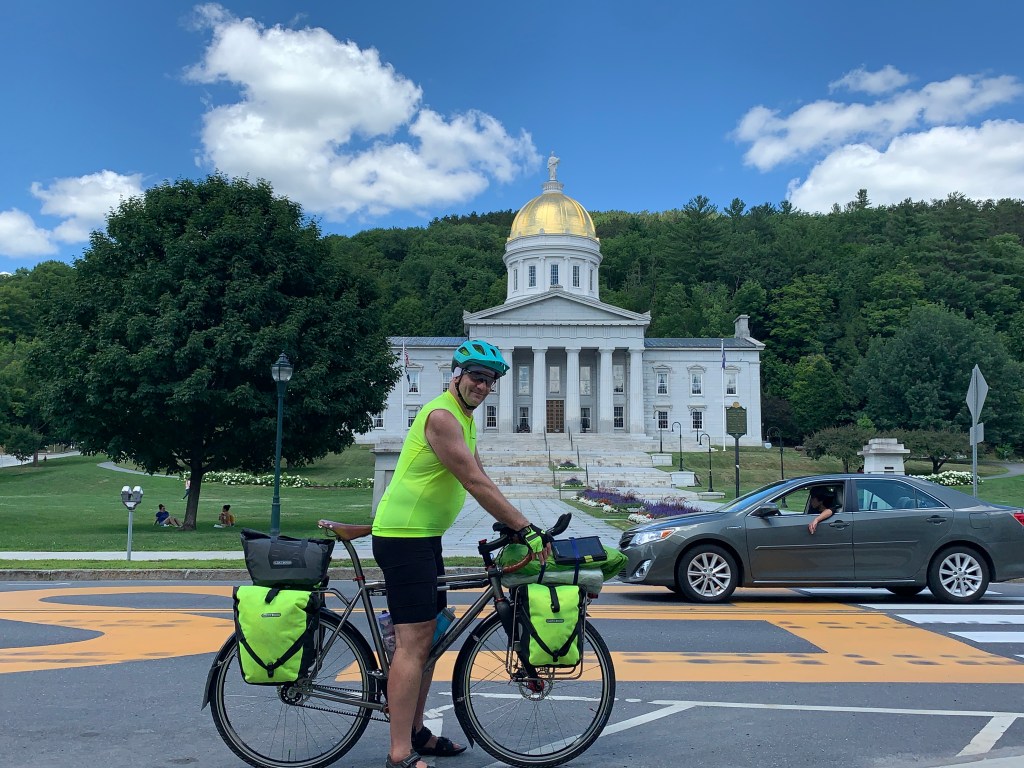
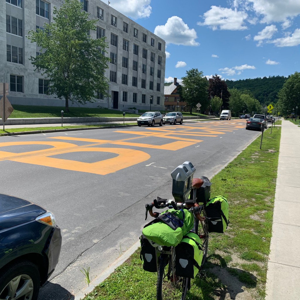
Some of you have seen my fancy new bicycle, which is finally fully assembled with all the bells and whistles, but untested. Since Vermont, New Hampshire, and Maine are relatively safe, this is the opportune time to take a shakedown cruise, deliberately load the bicycle up as heavily as possible, and see if anything rattles loose.

I could go on at length about the bike, but that will have to wait until later. Most of you probably don’t care anyway. I will give you fair warning if I do.

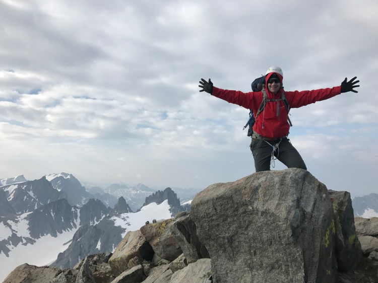
As the title of this blog grandiosely suggests, my principal objective for this expedition is to reach as many state high points as possible, completely under my own power. I am not alone in this curious compulsion, the Highpointers Club lists many hundreds who have done all 50 of them, but as far as they know, all got there by car, either to the summit itself or to the trailhead. It seems to me that if you were going to climb these suckers, you should do it from the bottom. I admit that the whole thing is foolish, but if you’re going to do it, you might as well really do it.

If you wade through the Denali chapter of this website, you will come fairly rapidly to a discussion of how this all got started, with my good friend Brian Sawyer, in 1973. Even then we felt a need to climb these from the bottom. Early on we did Mount Mitchell in North Carolina, the highest point east of the Mississippi, and rather than just drive to the top we searched around for a trail that started as low as possible. Over the years, this compulsion is only gotten worse, and now that I have retired I finally have the chance to take a long trip and try to achieve this goal. Jane is dubious about the whole enterprise, and really is not in favor of this, but has graciously accepted it, kind of. More about that later.

I’m sure many of you are scratching your heads and wondering what possessed me to get started down this cockamamie path in the first place, perhaps on the pages of this journal I will try to articulate this. For now, however, let’s just get started.

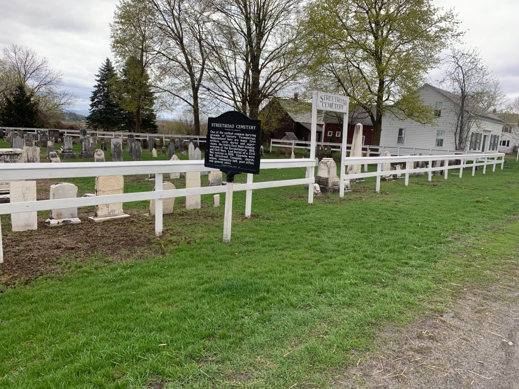
Right away, I will need to explain what I mean by climbing the high points “from the bottom.” The location of the lowest point of each of the states is often ambiguous or ill-defined, so for simplicity sake I am just going to try to start at sea level. I won’t try to do this between each state, but I do want to “zero out” at sea level at the outset.

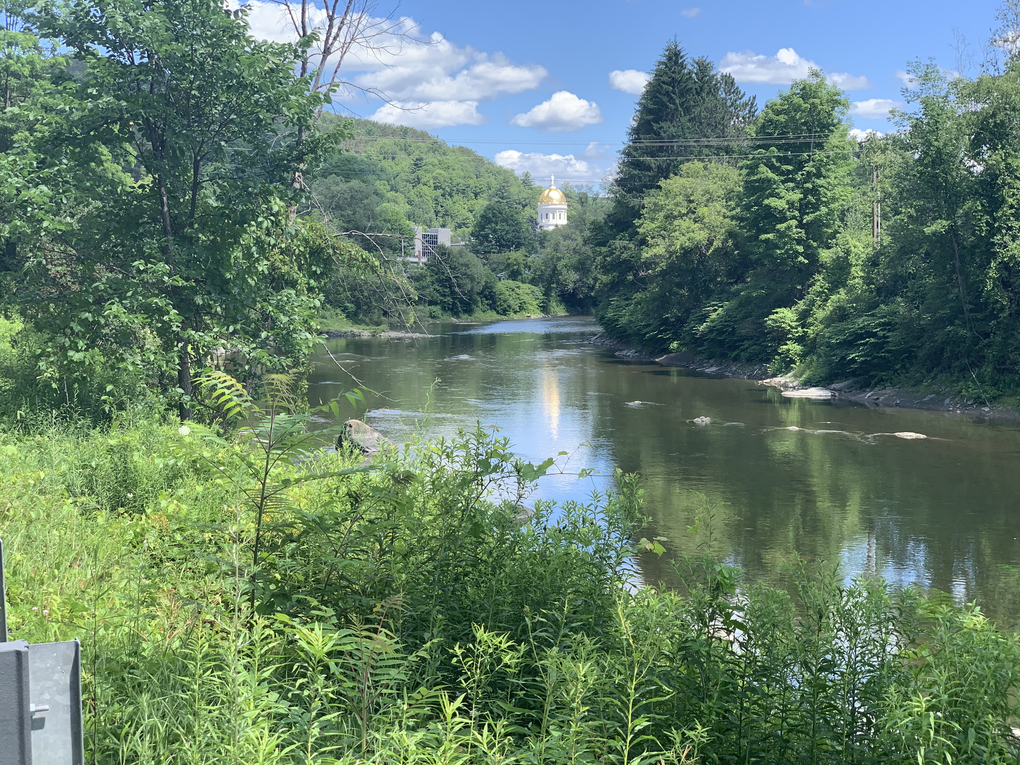
Limiting myself to Northern New England, the obvious choice is Mount Washington. This is the highest in the northeast, and a formidable peak, quite dangerous despite its relatively low elevation compared to the west. I believe more people have died on this mountain than any other in the US, including Denali, mostly From not taking it seriously. I have climbed it a bunch of times, but I always from a parking lot on one side of the mountain or another. For this trip, I plan to go to the ocean first, and then to the trailhead. The closest the ocean gets to Washington is in southern Maine, so I have selected Goose Rocks Beach in Kennebunkport, where Jane and I spent our first romantic getaway in 1981.

The bike is “loaded for bear“ like a pack mule, with a backpack, hiking poles, boots, enough gear to brave the harsh weather up there, despite it being in the 80s and 90s at the lower elevations, along with camping gear (both hammock and tent, since I prefer the former but often it’s not feasible at the campgrounds), cooking gear, bike tools, food, and electronics. I was horrified to see that bike and all the gear weighed 105 pounds. Ridiculous, I know, but again this is a shakedown cruise. I need to learn the hard way what I can do without, obvious as it may seem to all of you.

OK, time to hit the road. At 9:30 on Friday, July 24, 2020, the mule rattled down our driveway and headed east.