Rain man

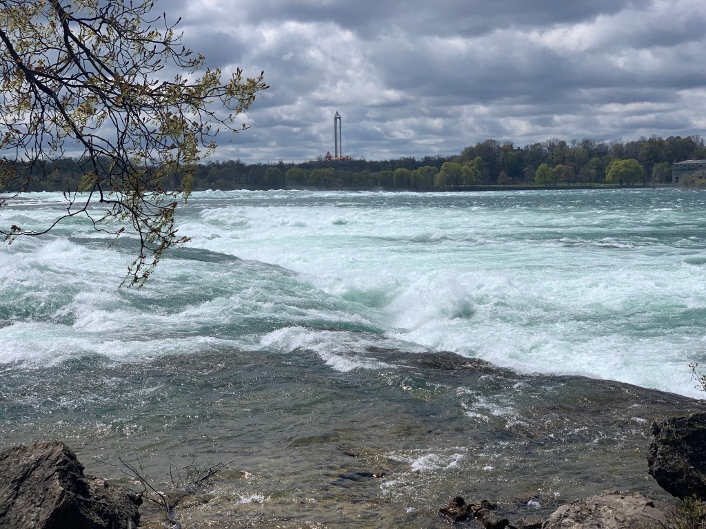
Bellefontaine to Greenville, Ohio. Sunday, May 9, 2021

Today I faced a dilemma (it’s my middle name). 30 miles to the northwest was Wapakoneta Ohio, birthplace of Neil Armstrong, one of my childhood heroes. We have all been recently reminded of his feat by the movies First Man and Armstrong, which commemorated the 50th anniversary of the moon landing. I remember watching it on TV like it was yesterday, I had built elaborate models of the spacecraft, and reenacted each maneuver for my family in real time, stuffing cotton into the rocket nozzles to indicate a burn. A first step on my path towards geekdom. I remember the jocular interviews with locals in Wapakoneta, America was fascinated that this tiny town was home to such a great man. I remember the context in that vivid summer of Stonewall, Woodstock, the Manson murders, and Chappaquiddick. I remember the controversy of spending so much for what was basically bragging rights. I remember Gil Scott-Heron’s satirical Whitey on the Moon. I remember it all. I wanted to pay tribute.

So what was the dilemma? It was in the wrong direction, would cost me a full day. It was pouring rain, so I would arrive at the cheesy museum soaking wet. I would wind up having to stay in the motel there, after only 30 miles. And besides, our corn-fed hero had eschewed MIT for Purdue, claiming he could get just as good an education there. The hell with him.

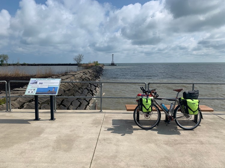
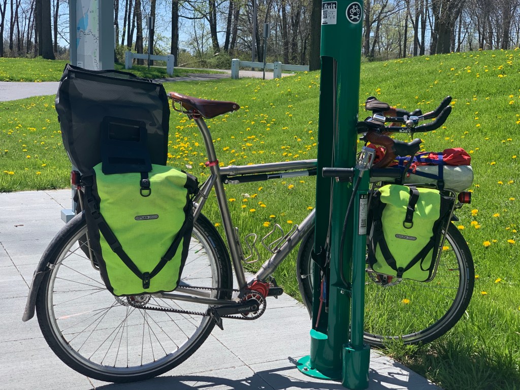
Who could smell the roses in this downpour anyway? No, the wind was blowing strongly southwest, in the direction of my next highpoint, which would make this freezing rain tolerable. My chance to put this fancy rain gear to the test. There was a cheap but well rated motel 60 miles down the road. Let’s go.

It went great at first. The gear was keeping me warm and reasonably dry, despite the two inches of predicted rain. The tailwind was a hoot, I was cruising at speeds up to 25 mph with only moderate effort. Try and catch me now, Fido. After 10 miles the odometer rolled over and I belted out The Proclaimers’ thumping song.

And. I. Would. Bike. Five. Hundred. Miles. And. I. Would. Bike. Five. Hundred. More. Just to be. The. Man. Who. Bikes. A. Thousand. Miles. To. Fall. Down. At. Your. Door.

The temperature never got above 40, and has been far lower than average this whole trip. I was concerned I would get really chilled when I stopped for lunch, but all of my clothing is synthetic and kept me warm enough in the quickstop, the bemused clerk Cathy was helpful with scads of paper towels as she watched me wring out my gloves. My mood would rise and fall with each bend in the road, a freezing crosswind or that blessed tailwind. I was really fine until close to the end. I saw that a fancier motel was just off to the side, and figured I’d go in to check to see if I could get a good price.

The cheerful receptionist gave me the best price she could, but it was still more than double. She didn’t mind if I sat my soaking body down on one of her couches as I tried Priceline, to no avail. My original motel was still 2 miles away. With great reluctance I went back out into the freezing rain, but I had gotten just enough off route that I needed Google Maps to show me the way.

After getting me started, my brave little cell phone finally gave up the ghost. Supposedly waterproof when I purchased it, I had had to repair a cracked screen and the serviceman said that they could no longer guarantee the water resistance. I had a special rain cover for the handlebar mount, which had worked well up to this point. However the repeated taking it on and off the bike and handling it with wet fingers ultimately to be proved too much. Suddenly I was in the middle of a smallish city, Greenville, shivering, exhausted, with no clue as to where to go. Not even the sun to tell me which was was North.

The nearest shelter was a pick-up pizza place. The counter guy was very busy as people came in and out, but he let me have a few paper towels and didn’t seem too annoyed as I stood in his lobby and attempted to resuscitate the cell phone. No luck. Finally I went out to the bike and got my iPad, which had been fully sheltered and was still working. It showed me the way, but I had to commit it to memory. I thought, all I need is a good old fashioned paper map, but good luck trying to find one of those. I’m sure the Luddites among you will get a kick out of my predicament.

Anyway, I made it without further drama, deeply disappointed that this was my first motel that did not have a washer and dryer. It was 63° in the room, and the little heater struggled all night to get it up to 72. I hung my soaking clothes around the room, the place looked like a tenement. However, a hot shower and a good sub from the delivery guy brightened my bedragglement, and at least was able to call Jane on the hotel phone. When’s the last time you used one of those?

The phone is partially working as of this morning, but none of the mapping software is. It keeps resetting itself. Uh oh. My route today has lots of tricky turns as I approach the Indiana highpoint, I’ll try to let my iPad navigate from my rear pannier, through my AirPods, while the phone continues to dry on my handlebars. We’ll see. What’s the next step, a bag of rice? I am reminded of that great scene from North by Northwest, where Cary Grant is standing at an isolated crossroads in Indiana, totally befuddled.

I guess Neil had the last laugh after all.

Distance 61.8 miles, 1,052 total. Time 7 hours with stops. Elevation gain 2,270 feet.

What’s the point?

Upper Sandusky to Bellefontaine, Ohio Saturday, May 8, 2021

Having reasonably recovered from yesterday‘s grind, I was looking forward to a more leisurely day today, only 48 miles to go and again, a northwest wind which would be just a little bit back of a crosswind. I was dawdling packing up, until I checked the website of the highpoint I was going to visit (my first for this trip), Campbell Hill. It is on the grounds of a vocational school, and they close at 3PM on Saturdays, not reopening until Monday. There were a number of posts of people who had come a long way to see it, only to be disappointed.

Oh shoot. Guess I’ll have to gut it out after all. I had allowed myself just enough time, with minimal stops, and no unanticipated curveballs, like the wind shifting again.

The wind held steady this time, and was a bit more of a help than a hindrance, but there was a new wrinkle—dogs.

I love dogs. I have had one for most of my life. Truly man’s best friend. But a potential problem on these trips. Dogs love to chase things, and bicycles are irresistible. Nine times out of ten they are just being friendly, but the other time, they can be dangerous. Trouble is, you never know. If they really are out to get you, you are quite vulnerable, especially on an unwieldy loaded bicycle with traffic speeding by. Serious injuries, even death have resulted.

One of the joys of bike touring in Vermont is that this never happens, for some reason. I guess it’s just a tacit understanding that bicycle tourism is so important to the economy, people just keep their dogs restrained if they tend to chase bicycles. Truly, I have toured tens of thousands of miles in Vermont and never had the slightest problem.

Things are very different as soon as you cross the state line, however. I have learned from experience to always be a bit on guard. If you see the dog coming, you have much more time to react and plan your strategy. Typically, this involves seeing whether you think you can outrun the dog, given the upcoming hills, wind, and your stamina at that instant. You don’t want to be wrong, and have the dog overtake you at a time when you are at your limit.

If there’s any doubt, the thing to do is to dismount, put the bike between you and the dog, and try to talk it down. This is successful in the vast majority of cases, although it can be quite time consuming, you have to walk away slowly until the dog (or the owner) decides to call it off and head home. For that very rare time that the dog is truly aggressive, you can squirt it with your water bottle, pretend to throw a rock at it, or use pepper spray. I do have pepper spray accessible, but I really, really, don’t want use it. I never have.

This strategy has worked for me for all these years. Still, the sense of hypervigilance take some of the fun out of the tour. Especially today, when I was in a hurry, and really couldn’t afford to take the time to dismount. I did get chased a couple of times, and made a run for it, although I think I was successful because the dog stopped at the property border, not because of my speed. Sometimes I crossed the street, dogs are generally trained not to do that although it does put you on the path of oncoming traffic. After each chase, I was exhausted from the adrenaline surge and the resultant tachycardia and hyperventilation. This is the one part of this big trip I am not looking forward to, unsure how things will be in different states.

Other than that, though, things went fine. Today’s “Easter egg” was passing through a bit of Amish country, with many horse-and-buggies, farming with no mechanized equipment, people in the classic period dress. I waved gaily to them all, but generally got no response. I imagine these good people are heartily sick of tourists. I didn’t dare take a picture.

I really didn’t know what to expect, approaching the highpoint. These minor highpoints intrigue me, I have done so few of them, but I hope they will be at least slightly prominent, stand out from the surrounding landscape, and be obviously a highpoint. The big ones are invariably impressive, I keep hoping the little ones will “step up”, so I don’t feel so foolish.

Alas, Campbell Hill did not “rise” to the challenge. As I approached it, I kept searching for something to see, but other than a cluster of antennas, nothing was visible until I was right there. The landscape had slowly changed from flat to undulating, and I was aware that each uphill was not fully matched by the next downhill; I did gain 1400 feet but it was all in that gradual way. I guess I was grateful, not to have a big climb at the end of this rush to make the deadline.

Anyway, I made it with five minutes to spare, good thing because the whole compound was protected by an imposing barbed wire fence. You go behind this vocational school and there was a small parking lot, with a bench, a flag, and a sign.

These benches are placed by the Highpointers Foundation, and are at many of the car- accessible highpoints.
The grand vista

The view, such as it was, was partially blocked by the surrounding antennas. As the sign indicates, this used to be a NORAD radar station, a relic of the cold war. My Dad’s line of work. Appropriate to scatter his ashes there.

This is technically illegal, scattering ashes on public land without a permit.

Another tourist, Sean, arrived in time to help me take my picture. He was from Florida, was mirthfully aware of its ridiculous highpoint, Britton Hill, the lowest of them all at 345 feet. Now that he had moved to Ohio, he wanted to bag one of the big boys.

We were shortly interrupted by the caretaker, who booted us off, she had to lock up. The hill is in the town of Bellefontaine, and it was an easy downhill for the 2 miles to my motel there. The motel clerk had never heard of it. I searched the horizon, and once again saw no eminence at all, nothing looming as I had hoped.

Nevertheless, I was thrilled. I had biked 22 days, come almost 1000 miles, and truly had “scaled” Campbell Hill from the bottom, from sea level at Troy, New York. That ugly picture of the boat ramp there was the true beginning of the climb. The summit was only 1549 feet, but adding up all of the elevation gains since Troy totals 13,800 feet. Eat your heart out, Sir Edmund Hillary.

Yeah. Uh huh. Whatever, dude. Surely some, if not most of you are wondering, what the hell is this clown doing? It’s the elephant in the room. One of a few, actually, along with my daddy issues, and my abandonment of Jane for a year while I pursue this, this, whatever it is.

It had been my intent, in my “gap year” between retirement and this trip, to explain myself. It never happened. Sure, there have been some attempts, in my very first post here, in the opening paragraphs of my long ago Denali journal, and in that Hamilton song, but they don’t really address the issue. Maybe it’s not possible. But I want to try, when I have down days in the near future. They will be “in between” posts, tentatively titled Elephant in the Room #1, #2, #3. Bear with me. If I ever turn this blog into a book, those will be the opening chapters.

Distance 48.8 miles, 990 total. Time 6 hours with stops. Elevation gain 1,453 feet.

Mama said there’ll be days like this

Huron to Upper Sandusky, Ohio. Friday, May 7, 2021

Serves me right. You get cocky, you deserve what’s coming to you.

I started the day a little more nervous than usual. Saying goodbye to Erie, and to the Adventure Cycling route, I was striking off on my own across Terra incognito. I have two versions of mapping software, the familiar Google Maps, and the bike-specific but less sophisticated Ride With GPS. The latter lets you edit the route, and I was using it to navigate the AC route. But the concern remains, from now on my route would be chosen by algorithm, rather than savvy locals.

I went out to the end of the pier for one last look at Lake Erie. The Cedar Point amusement park, the nation’s largest, was visible ten miles away (not in this picture).

One last look

The Google maps route to Campbell Hill, highpoint of Ohio, was more direct, it was only 102 miles away. It was sunny, in the 50s, and there would be a steady tailwind. I bet I could do a century, like the old days. Oh yeah. Oh yeah. We bad. We bad.

Bad is right. About 20 miles in, nimbocumulus clouds appeared ahead, the wind shifted around to a stiff headwind, and it shortly started to rain. Not a downpour, but a steady rain. I got my fancy rain gear on just in time, it did its job, but I was crawling at 6mph in a full tuck. Dress rehearsal for the Great Plains?

Century schmentury. I’d be lucky to make Upper Sandusky by dusk.

I was gutting it out, resigned to get my just deserts; after a while the rain and wind abated a bit, but by 6PM I was pretty bleared out and relieved I only had 5 miles to go. Road closed, the sign said. Aw, c’mon, a bike can sneak by, right?

Uh, no.

I guess the bridge is out

I stood there, flummoxed, for way longer than I should. I seriously considered trying to ford the creek over those stones on the left side, but then imagined myself dragging my hundred pound rig up that muddy bank on the other side, and came to my senses.

My gym teacher told us adversity builds character. Gee, thanks. This character had to backtrack two miles and take a detour that added five, but I got to the motel by 7:30. I’d rather take my lessons from the Shirelles.

Mama said they’ll be days like this, they’ll be days like this my mama said.

Distance 61.8 miles, 942 total. Time 9 hours with stops. Elevation gain 1,066 feet.

One Last Time

Cleveland to Huron, Ohio. Thursday, May 6, 2021

This blog post is named in recognition of the song from the musical Hamilton, where Washington announces his decision to step down, not seek another term as president. This was probably the single greatest act of Washington’s career, at a time when he was at the height of his popularity, could have retained power in perpetuity, and effectively become a king. In the song, he is asking Alexander Hamilton to help him write his farewell address.

For me, “one last time” refers to today being the last time I will be associated with Erie. For the last 17 days, I have either been following the Erie Canal or Lake Erie. After today, I will be turning inland to head for the first real objective of my trip, the highpoint of Ohio, Campbell Hill. Erie has been a comfortable and reassuring presence, guiding the way, and keeping the terrain basically flat. It feels like turning away from an old friend.

We finished with a bang. After getting a late start from the hotel (broken spoke) I said goodbye to Cleveland from a spectacular vantage point, the Superior Street Bridge, arching high above the now–smokeless Cuyahoga River. Then it was a straight shot, almost completely flat along the shore of the lake, passing a string of small towns, and a varied set of lakefront properties, from modest homes to grand estates to new high-rises. Sometimes there were bike paths, sometimes challenging old pavement, but often smooth new asphalt where you could glide from miles, aided mercifully by a real tailwind this time. What a gift! I was averaging 10 mph including stops! (Wipe that smirk off your face, you hotshot bikers out there).

I was prepared to go farther, but it was starting to rain and I decided to call it quits at Huron, my very last point along Lake Erie, one last time.

Since we’re talking about Hamilton, I thought I would insert here the theme song to this bike ride, set to the tune of the opening number/rap. For those of you who haven’t already seen it. Sorry about the line spacing, I’m too much of a WordPress newbie to fix it.

How does a paunchy, old guy

Son of a teacher and a Cold spy

(No lie) racked with arthritis and an old spine

Extolled by a grim determination 

Seek to ride his bike across the nation?

A lifelong fixation 

But a big frustration 

Couldn’t get enough vacation 

To attain his destination 

Had to wait until he retired 

For the time that he required 

But by then events transpired 

COVID quarantines conspired 

Not to mention his “spare tire”

Made him just feel old and tired

So with all those obstacles, and all that pain

Our man saw his chances drip-drippin’ down the drain

Put his pencil to his temple, connected it to his brain 

Or put another way, he put his stylus to his cranium

And built a new bicycle out of carbon and titanium 

That could ease the inflammation in his knee and hip and thigh joints

And achieve his aspiration to reach all of the state highpoints 

Under human power only, without benefit of fossil fuel 

And be the first to do it, show the world that it was possible 

And the people gonna know his name

What’s your name, man?

Scott de Lima Luria 

My name is Scott de Lima Luria

And I sure don’t wanna worry ya

I’ll be fine

Just you wait!

————————————————————————————————-

…So how does it feel to leave the canal/lake after all this time? Forgive me.

Eerie.

Distance 50.6 miles, 880 total. Time 5 hours with stops. Elevation gain 628 feet.

Cleveland, city of light, city of magic

Ashtabula to Cleveland, Ohio Wednesday, May 5, 2021

This is from a satirical song Burn On by Randy Newman about the Cuyahoga River fire.

Cleveland is the Rodney Dangerfield of cities, it don’t get no respect. At least it didn’t. In the 60s it was epitome of urban unrest and decay, punctuated by that fire, when an oil slick/floating bunch of trash caught fire in 1969, helping to spawn the environmental movement. But since then, it has been slowly building back its reputation.

In the 1800s it was very cutting edge, a major steel town, and also a birthplace of the petroleum industry, since it was close to the first oil discovered in North America, in northwestern Pennsylvania. The richest man in our history, John D Rockefeller, got his start as a lowly clerk in Cleveland, but was shrewd enough to buy out some of the early oil ventures that failed, and was able to craft a monopoly. He and other captains of industry built Cleveland into a major cultural center, with a symphony, museums, and many grand old buildings that last to this day. Cleveland’s more recent renaissance has produced three major stadiums, the Rock ‘n’ Roll Hall of Fame, and a revitalized waterfront. It is also the home of the world-renowned Cleveland Clinic, famous for pioneering cardiac surgery and procedures.

I almost took a job there. A partner at UVM, David Bronson, was recruited to be director of primary care at the Cleveland Clinic; he invited me to give grand rounds in 1992, and also offered me a job there. I had only been in Vermont for a few years, having already decided to eschew big-city medicine for the bucolic serenity of the Green Mountain State, so I was not ready to make that change. I often wonder, however, what might have happened if I had. Certainly, it would’ve been a good career move.

I had hoped to see David, but he is currently vacationing in the south. Instead I spent this Cinco de Mayo trying to get to Cleveland in time to see that Hall of Fame. It was still cold, damp, and windy, but thankfully it was more of a crosswind this time. I stopped only once for coffee at the picturesque town of Painesville, with a beautiful town square.

Passing by a number of dying steel mills brought to mind Springsteen’s haunting anthem Youngstown (https://youtu.be/4GaFUOQWi9A), and its most compelling line:

Them smokestacks reaching like the arms of God into a beautiful sky of soot and clay

It also mentions the Mesabi Iron Range, which I’ll be crossing in Minnesota. Bob Dylan was raised there.

I arrived at the Hall of Fame just after 3 o’clock, but by then had been advised by my buddies not to bother paying the hefty admission fee for just a quick visit. Instead, I took pictures of the striking building designed by I.M. Pei, and the playful displays in the lobby.

Wandering around the grounds yielded some cool views, but they wouldn’t let me close to the First Energy stadium, where the Cleveland Browns play. It was still cordoned off for activities relating to the NFL draft.

Another part of the Hall of Fame building
The Cleveland skyline
I had to wait for a moment when there weren’t tourists draped all over this sign
The closest I could get to the stadium

Later, though, I got a pretty good view of the stadium from my 18th floor hotel window, with the sunset over Lake Erie.

Distance 56.9 miles, 829 total. Time 6 hours with stops. Elevation gain 832 feet.

Four Dead in Ohio

Erie, Pennsylvania to Ashtabula, Ohio. Tuesday, May 4, 2021

Another pretty uneventful day, skirting beautiful Lake Erie with views that were both stunning and fairly featureless, certainly nothing that would make a striking picture. In the late morning I passed into Ohio, which was jarring in a number of ways.

The cold shoulder

First of all, you can see how the shoulder abruptly disappears. So it would be for the rest of the day, with storm grates to avoid, and traffic a little bit less tolerant of bicycles. No big issue, however.

Secondly, Ohio feels pretty foreign to me, I think I have only spent two nights there in my life. It is the place my mother went to college, first at the Western College for Women (now part of Miami University of Ohio) in Oxford, later at the University of Ohio in Athens. I was recruited in 1992 to join the Cleveland Clinic, I’ll be talking about that later. It is my first Midwestern State, definitely not part of the eastern seaboard, and a perennial swing state. It is the home of aviation pioneers Orville and Wilbur Wright, and Neil Armstrong.

But the most jarring thing about it was an amazing coincidence. I’m sure you’ve noticed the musical theme to many of my entries and blog titles. Sure enough, the rhythm of Neil Young’s “Ohio” was thumping through my head as I crossed the line.

Tin soldiers and Nixon’s coming
We’re finally on our own
This summer I hear the drumming
Four dead in Ohio

It got me thinking back to when Kent State actually happened, I was in 10th grade. The students there were protesting the expansion of the Vietnam war into Cambodia, and after the shooting our high school student body decided to go on strike, both in solidarity with the Kent State students and for our own protest about the war. When we returned the next day, our stellar history teacher, Edna Jackson, expressed support of those who went downtown to protest, but excoriated those of us who just chose to take the day off, and treat it like a lark. Her words have stayed with me to this day.

Our high school, Woodrow Wilson, has recently been renamed. Although growing up I thought Wilson was heroic, with his leadership during World War I, the 14 Points, the League of Nations etc., it’s becoming increasingly hard to deny his overt racism and misogyny. Not perhaps the best role model for developing adolescents, and so the search for a new name was on. Many favored Edna Jackson, who was the first black teacher to join the faculty, and had bravely endured many political challenges, especially in the beginning of her tenure.

They ultimately decided to name it for August Wilson, undoubtedly a great playwright, but someone who had nothing to do with Washington DC, or the school. I guess they decided they didn’t want to change all the signs and logos. We can all still sing “Sons of Wilson”.

So why this lengthy digression? What was the jarring coincidence? I remembered the shootings happened in early May, so I looked it up: sure enough it was May 4, 1970, fifty-one years ago today! What are the chances?

The first town, Conneaut, had a railroad museum, so I went to take a look, as a long time fan of the romance of railroads. Unfortunately, it was closed.

A pretty pleasant day, low 60s with only an occasional shower. Although the 15 mph headwind was constant, it is bothering me less and less. I am getting more comfortable tucking down into my dropped handlebars or aero bars, it is not making my arms numb like before, and my gut is slowly shrinking, not getting in the way so much. That will be important in the great plains, when there won’t be any trees to block the headwinds.

The final town was Ashtabula, a historical marker mentioned it was once a port greater than Cleveland, and considered one of the roughest ports in the world, on a par with Shanghai and Calcutta.

For me, that unusual name, Ashtabula, had a personal connection. My very first “10 speed” bicycle, a Schwinn Continental, had Ashtabula cranks. That unique one-piece design has fallen from favor, but to me at the time, they were the coolest cranks in the world.

Ashtabula cranks

I loved that old Schwinn. On it I took my first big bike tour, my first century, and commuted to college on it every day until it was stolen in my sophomore year. I still remember that dark day, the loss of freedom. I was bike-less for eight months, my longest hiatus since I learned how to ride.

Quite a day of wistful memories.

Distance 52.5 miles, 772 total. Time 7 1/2 hours with stops. Elevation gain 1,062 feet.

Chautauqua dreams

Dunkirk New York to Erie Pennsylvania. Monday, May 3, 2021

Now this is a weird title for today’s entry. I didn’t even go to Chautauqua, but I was dreaming about it for much of an otherwise uneventful day.

Perhaps you have heard of this little town on the shores of Chautauqua Lake in extreme southwestern New York. Back in 1874, a nondenominational religious and art/culture colony was established, that spawned a movement that was very popular at the beginning of the last century. Traveling “Chautauquas” would commonly tour to remote sites across the country, bringing lectures, speeches, music, theater, and other genteel entertainment to places that would otherwise have no access. The movement gradually died out with the advent of radio and television, but the “mother Chautauqua” continues to thrive.

For me, it was a magical place. My mother’s family, the Readings—you have already met Lindsay Reading—have a couple of homes there, and we would often visit in the summers. Chautauqua was where I learned to swim, sail, do arts and crafts, and be dazzled by all of the art and culture. The Chautauqua Institution is an exclusive enclave, with a hefty gate fee, but once you were inside, all the performances and activities were free. it was kind of like a highbrow Disney World.

I came within 12 miles of it today, and on my 2007 trip we ended there, capped by an idyllic week. My father gave a lecture in the amphitheater. But this time it is too early, the enclave is closed until mid June. I was tempted to detour there anyway, to see the place of my childhood dreams, but it is over a 1000 foot climb.

The geography is one of the intriguing things about it. Chautauqua Lake looks like a Finger Lake, long and thin, pinched in the middle (its name comes from the native Erie tongue, meaning “bag tied in the middle”), but it is pointed perpendicular to the other Finger Lakes, like an opposable thumb, and drains south into the Allegheny River system, rather than north into Lake Ontario. That thousand foot climb represents crossing the Eastern Divide, between waters that drain into the Mississippi watershed and the Gulf of Mexico versus the Great Lakes watershed into the Saint Lawrence, ending near Newfoundland. How odd that Chautauqua Lake is only 8 miles from Lake Erie, but drains in an entirely different direction.

I ate my lunch at a little quickstop in Barcelona, my closest approach to Chautauqua, and was regretful about missing it. I was also sad because I wouldn’t get a chance to see Scary Lucy.

The iconic actress and comedienne Lucille Ball was born on the shore of Chautauqua Lake, near the gritty city of Jamestown. In 2009 a statue was erected in her honor, that became a viral sensation. The sculptor had attempted to re-create the famous scene of her getting drunk on Vitameatavegamin while shooting a commercial, but the result looked more like Steve Buscemi than Lucy, and sparked outrage among her fans. It was eventually replaced with Lovely Lucy, and now both statues can be seen on the shores of the lake.

Scary Lucy
Lovely Lucy

The only actual highlight of the day was finally leaving the Empire State after 17 days, and entering the Quaker State.

The little corner of Pennsylvania that touches Lake Erie is only 46 miles wide for me, I should be able to get across in just over a day. By now it was raining, so I cruised nonstop to my motel in Erie, Pennsylvania’s fourth largest city. I was feeling fine, since my rain gear is doing its job, but have perfected the “pitiful drowned rat” look which convinced the motel clerk to give me the nicest room she could for my cheapo Priceline rate. I was delighted to see it came with a Jacuzzi!

Talk about Easter Eggs!

The highlight here is the battleship Niagara, used by Commodore Perry to defeat the British Navy in the war of 1812, the famous line was “We have met the enemy and they are ours”. But after that whirlpool bath, no way was I going out in the rain again. I had wings and a salad delivered, did another interview with Steve Shepard (if you have the Apple podcast app, you can hear them on his National Curiosity Project podcast https://podcasts.apple.com/us/podcast/the-natural-curiosity-project/id1443160082?i=1000519653928 ) and tucked into bed, snug as a bug in a rug.

Distance 48.6 miles, 720 total. Time 5 1/2 hours with stops. Elevation gain 1,256 feet.

AirPod Kerfuffle

Buffalo to Dunkirk, New York May 2, 2021

My hotel room was so sumptuous, I wound up sleeping a total of 10 hours. There was also an elaborate breakfast, so I really felt like I was luxuriating. The result was I didn’t leave till almost noon, then as I was packing up, I realized that my AirPods were missing.

Oh rats. They were the expensive, noise-cancelling kind, very helpful when navigating, as well as talking on the phone and listening to podcasts. I’m usually quite careful with them, where could they be? I searched the room, went back down to the breakfast area and searched around there, asked the cleaning staff and the front desk, nobody had turned them in. The “Find My” app on my iPhone is supposed to help you track them down, and have them play a tone. I did that near the trash can in the breakfast area, and even asked the hotel manager to take me to the dumpster, so I could use the app to play a tone there. Nothing. They must’ve fallen out of my pocket somewhere, and somebody picked them up. I resigned myself to having to buy a new pair, but the nearest Apple store was 10 miles in the wrong direction. I guess I will have to go pod-less until Erie, or Cleveland. Maybe serve me right. We get too dependent on new technology.

All of this kept me from leaving until well after noon. Rain was forecast, but it was just sprinkling a tiny bit. I was left to navigate the dystopian industrial suburb of Lackawanna using the speaker from my cell phone mounted on the handlebars, often drowned out by the noise. As a result, I got off-route a couple of times, and found myself negotiating busy arterials with trucks lumbering by, debris littering the meager shoulders.

Not to worry. Over the years I’ve gotten quite a bit of experience navigating hostile streets in cities such as DC, Manhattan, and Boston, and even London and Paris. I had my super-bright flasher, and an innate sense of urban cycling technique, born of the definitive text on the subject, Effective Cycling by traffic engineer John Forester, published by the MIT Press. I highly recommend that book. I have taken his lessons to heart, and in almost 200,000 miles of riding (including 34 Vermont winters) never had a bike accident or even a close call.

Lackawanna. Sounds like a libido problem. The streets eventually got tamer, I got back on route, the rain stopped, the sun came out, the headwind abated, and I was soon joined by a familiar friend, the amazing Adventure Cycling route system.

The Adventure Cycling Association is the AAA of bicycle touring. Founded in 1976 as BikeCentennial, they laid out a coast to coast bicycle route from Oregon to Virginia called the Transamerica Trail, and from that built up a network long distance bicycle routes that looks like the US interstate highway system.

You purchase the route in sections, that are similar to the AAA TripTiks of yore, a series of strip maps on waterproof paper that lay out the details of each route in segments.

Bike-friendly amenities such as campgrounds, bike shops, convenience stores, post offices, libraries etc. are marked. Each route has been curated by local bike clubs, so you can be confident you’re on the safest and most optimal route through a given area. It’s a great comfort, I use these maps whenever I can, and have been a charter member of the ACA since 1976.

Now that I am finished with the Erie Canal, I can follow these routes almost exclusively as I track my way across the country. I will have to diverge to the various state highpoints and other points of interest/friends/family I hope to see, but the ACA will be my traveling companion whenever possible. The network also increases your chances of meeting up with other long distance bike tourists.

The route soon followed the shoreline of Lake Erie, and passed a series of jaw-droppingly beautiful lakeside estates. The most prominent was Graycliff, designed by Frank Loyd Wright. I balked at paying the admission fee, but snapped a quick picture and talked at some length with Alicia Meyers, a docent who had found a new chapter in her life, and great fulfillment showing people this beautiful residence.

Now off the canal, there are mild hills but nothing daunting, and the smooth pavement made the miles speed by. I ended at Dunkirk, New York, where there is a cute fishing pier and a very quirky restaurant, Spike Dailey’s, where I finally had my Beef on Weck.

Just in time, this is my last day in New York. At the bar there, I chatted with Gene, an Uber driver from Erie PA, and Matt and Carrie, who were directing a documentary about a local punk rock phenomenon, formerly called the Descendants, now called ALL. Matt’s first film about them is called Filmage, and I watched it on Amazon prime. Compelling.

At the motel, as I was getting out my charger cords, I had to laugh. There were my AirPods. I had mistaken them for one of the Apple chargers. Folded up, they do look kind of similar, but I felt like such an idiot. There’s an hour of my life I’ll never get back.

Distance 47 miles, 671.2 total. Time 6 hours with stops. Elevation gain 955 feet.

From Albany to Buffalo

Niagara Falls to Buffalo NY. Saturday May 1, 2021

Tra la, it’s May! The lusty song from Camelot rang in my ears as I headed out today. It was in the 30s, but sunny and with that blessed gentle tailwind. Better weather has got to come, right?

Despite my ebullient mood, I felt chagrined today. Today my lovely wife Jane turns 65, and here I am gallivanting around while she enters senior-citizenhood alone. I sent a gift, and that crazy errand at the mall last Sunday was to find a birthday card, but still. I’m rarely without thoughts of how selfish this trip is, how caddish to abandon her for a year. I plan to reflect on this at length in an upcoming blog. For now, though, I was heartened to hear of celebrations from friends, and an outpouring of love from family.

Here’s the route for today, and once again it begs the question: WTF?

Why this crazy track? If I “hypotenused” (a great term courtesy of Brian) from start to finish today’s trip would be 20 miles instead of 61. And there’s supposed to be a southwest wind springing up later today. Get a grip, guy.

Alas, like Popeye, I yam what I yam. See my entry from Wednesday. I had left the Canal at Lockport to see the Falls, no way was I going to bypass the last 30 miles of it. Much of that last stretch has been upgraded since I was last here in 2007, and it was pretty great then. It’s only miles, right? It’s not like I’m burning up any fossil fuel.

It all went smoothly, the wind wasn’t too bad, the renovated path truly spectacular, I regret I didn’t stop for a picture. I did get these from a rest stop:

Bike aid station

Every 10 miles or so along the canal the state has placed these beautiful aid stations, with a cluster of bike tools dangling from cables, and a floor-style bicycle pump, much more efficient than the frame pump you see clipped under my top tube. Tire-inflation valves can be fragile, so I had a resisted using these pumps up until now, but today I gave it a try. It worked beautifully. I was gratified to see that after more than two weeks and 600 miles, I had only lost 7 pounds of pressure in my rear tire, and 5 in my front.

Also there was an overview map of the Empire State Trail System, on which I have been from day one.

Again, you can see that if I’d hypoteneused across the Adirondacks, bypassed Troy, and eschewed the Canal, I could have made Buffalo in 370 miles, rather than 624. But that’s not how I roll.

Looking back to today’s map, you may ask, what’s that little ditzel labeled McKinley? Well now we come to another motivator for the trip, checking out America’s dark places. I already wasted time looking for the Love Canal. Now I was seeking the place where our 25th president was assassinated.

A few years back I chanced upon a frothy little book by Sarah Vowell titled Assassination Vacation. Best known for her role as Violet Parr/Invisigirl in The Incredibles, Sarah is also a humorist, and she took a fascinating trip around the country seeking out the details of presidential assassinations. I too plan to visit Dealy Plaza, Ford’s Theatre, and for good measure throw in the final-act sites of James Dean, Bonnie and Clyde, Marilyn Monroe, Martin Luther King, and Meriwether Lewis. Not to mention the field where The Day the Music Died happened. I can’t explain this. I’m hardly morbid or Goth. I’m just drawn to these places like a moth to a flame. My daughter Hope can’t get enough of podcasts about serial killers. I guess we’re a family of rubberneckers.

Anyway, old Bill was gladhanding at the Temple of Music, an elaborate structure built for the Pan-American Exposition, when the anarchist Leon Czolgosz shot him at close range with a pistol hidden under a handkerchief on September 6, 1901. McKinley seemed to recover initially, and VP Theodore Roosevelt felt it was safe to begin an expedition to climb NY state highpoint Mt. Marcy, but on day 8 gangrene set in and McKinley succumbed. The story has it that poor Teddy was within a mile of the summit, a huge deal to reach in those days, when the Secret Service caught up to him and said, trip’s over.

The Temple, and the entire Exposition, were torn down the next year, and a two mile detour took me to a quiet suburban neighborhood, where a forlorn American flag marked a small boulder in the median strip.

I suspect the neighbors must be heartily sick of the gawkers.

It was just a few miles to the official end of the Erie Canal, a weird lighthouse in Buffalo, with a view of Lake Erie itself, which will be my companion over the next few days.

The song goes From Albany to Buffalo, but the canal really begins at Troy. The first 10 miles from Albany are just along the Hudson River, which is navigable up to that first lock in Troy. Back in 2007, when I was doing this ride with Eric, I insisted that we detour to circle the state house in Albany. He wondered why we had to ride 20 miles in the rain “just to tag a post”. I consider it a big step for me, that I didn’t go to Albany this time. Trouble is, From Troy to Buffalo doesn’t scan as well in the song.

Buffalo is the second-largest city in New York, and rather grand in places. Its 32 story Art Deco City Hall was built the same year as the Empire State Building, and is one of the highest municipal buildings in the country. The observatory on top is free, but closed on weekends.

At the base are two other US presidents associated with New York, more obscure than the Roosevelts. Millard Fillmore was only in office for two years, Queen Victoria called him the handsomest man she had ever met, and many think he is the spitting image of Alec Baldwin. What do you think?

With that schnoz no one could accuse Grover Cleveland of winning the handsome sweepstakes, but he (so far) is the only president to serve two non-consecutive terms, he was our 22nd and 24th president. Jury is still out whether his feat will be matched in 2024 by our most recent NY president.

I have failed in my quest to sample all of the signature New York dishes, missing the Garbage Plate and the Tomato Pie. At least I got Buffalo Wings and Big Ass Pork. Today I googled Beef on Weck, was lucky to get a seat by the window on this Saturday evening at the Pearl Street Grillhouse, but the menu was Weck-less. “We only carry those specialty items on occasion” the waiter said. Oh well.

The Hampton Inn had a beautiful pool and hot tub open until 10PM, but I figured I’d better shower first. It was so relaxing I just laid down for a quick rest, and woke up 5 hours later. In the words of Homer Simpson: D’oh!

So today was not only May Day, Jane’s birthday, and end-of-canal day, but it was also president’s day. Next four days are forecast for rain, 50s, with a SW headwind. Oh well, that’s what they say about New York. If you can make it there…

Distance 61.2 miles, 624.2 total. Time 8 1/4 hours with stops. Elevation gain 787 feet.

Ain’t that America

Niagara Falls, New York. Friday, April 30, 2021

Breakfast at the Anchor Bar again, the service was spotty but well-intentioned. I asked if the maple syrup was real, and the waitress said sure, it’s real maple-flavored syrup. Oh well. The pancakes, eggs, sausage, bacon, blueberries, and home fries were hearty and filling, would be good for the rest of the day. Her name was Lindsay, like my cousin, and I almost asked if she spelled it with an “a” or the less-classy “e”. When the check came, her name was printed out: Lynnsi.

I gave her a big tip anyway.

Winter refuses to vacate the premises. Mid 40s, with wind gusts in the 40s also. Maybe a better day to walk than ride. I dug out my trail shoes and fanny pack for the first time, and set out on a mission: seeing the falls without spending a penny. No easy task.

Niagara Falls, dazzling though it is, is one of the nation’s biggest tourist traps. And not just our nation. It straddles the border with Canada, and for once, Canada got the better of the deal. A bend in the river turns the falls facing away from the US and towards Canada. An island, Goats Island, splits the falls into the stupendous Horseshoe Falls on the Canadian side, and the much less impressive American Falls, which get a tenth of the water, falling onto a visible pile of boulders. Whenever we’ve gone in the past, we always go to the Canadian side, and the tourist facilities are much more developed there. Casinos, three observation towers, a huge Ferris wheel, and a strip packed with schlocky traps: Hard Rock Cafe, Ripley’s Believe It Or Not, wax museums, laser mazes, gloppy food as far as the eye can see—in other words, America. By contrast, the American side has older hotels and a much more subdued feel. It’s like the roles of the two countries were reversed.

Figuring the border was still closed during the pandemic, I decided to walk as many of the trails here as I could. Lindsay likes the American side better. Sure enough, Goats Island is in the US, and was landscaped by the great Frederick Law Olmsted. Here is the route I took.

The southern tip of the route took you to the Three Sisters Islands, with the pre-fall rapids swirling all around. You felt like you were in a small boat about to be swept over.

Next is Terrapin Point, the American edge of Horseshoe Falls, the main event, the most powerful waterfall in North America. It’s only 167 feet, but that’s four of the five Great Lakes going over the edge.

It brought back my physics lectures about power (watts) being a product of pressure (voltage, or in this case the height of the falls) and current (amperes, the volume of water going over). Thus Angel Falls, 2000 feet high but with much less water, might have as much power as Niagara. Or a static electricity spark (20,000 volts but minimal current) might equal a car battery, 12 volts but enough amps to crank a cold engine. Or a time exposure with a narrow aperture letting in the same light as a fast shuttter speed with a wide open lens.

All very interesting, but better just to stand silently and feel the energy thrumming in front of you, and marvel that the mist below makes its own rainbows.

Speaking of power, it was Nikola Tesla who first harnessed the power of Niagara into electricity. A vivid statue commemorates the achievement.

If only Elon Musk could be so humble.

On to the other side of Goat Island, where American Falls is actually split by Luna Island into Bridal Veil Falls, plunging down to the tourist trap Cave of the Winds, where you take a elevator down to be buffeted by the spray, protected by these dry-cleaning-bag ponchos they give you.

On the other side of Luna Island is American Falls proper, poor cousin to Horseshoe but no slouch, you can see how the US side only gets a sidelong view, although that weird observation tower looked promising. Or maybe the Rainbow Bridge to Canada behind it.

Sockdologizing old man-trap, get it?

I tried to get up there but no, the cantilevered platform is closed, and the bridge is only for customers going to the elevator down to the Maid of the Mist boats, still running in this frigid weather.

Only a few hardy souls, it’s packed during the summer months.

OK, maybe the Rainbow Bridge, could I sneak across the border? Um no.

Check out the concertina wire, these guys aren’t messing around

I hiked another mile or so downstream, looking for a better vantage point, but this was the best I could do. You can see the cluster of development in Canada, with their superior view.

Back to the Rainbow Bridge, could I get through legitimately?

So close, and yet so far

What have I got to lose? The pedestrian gate was not exactly welcoming.

I tested those subway gates, and to my surprise they turned. They would let me through, but not back. Nobody at the window, but I pushed the buzzer and the customs lady said they couldn’t stop me from going through, but I’d have to go through customs to get back in. Thank heavens I got that enhanced driver’s license a few years back.

I went halfway across the bridge, where flags ands a sign marked the actual border. I sneaked just a toe across to Canada—it occurred to me that on this whole huge trip this was as close as I planned to get to another country—and finally got the picture I was looking for.

One toe over the line…

By now I’d been at it for almost four hours; The Hawk (our childhood name for an icy wind) was unrelenting. Time to end my Niagara-on-the-cheap tour. Went to the 7-11 for groceries for dinner and breakfast, I’ve got a big day tomorrow.

Lindsay was right, the American side is pretty cool. Sure glad I didn’t try to bike today.

Distance 6.6 miles, (walking only, not added to total) Time 3 3/4 hours with stops. Elevation gain 833 feet.