Dammit, Gannett

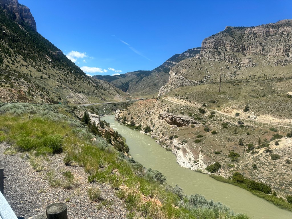
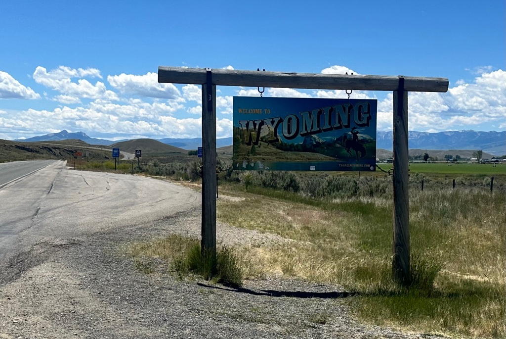
Pinedale, Wyoming. Tuesday, June 25, 2024

[This blog post title will only make sense to fans of the bizarro movie The Rocky Horror Picture Show]

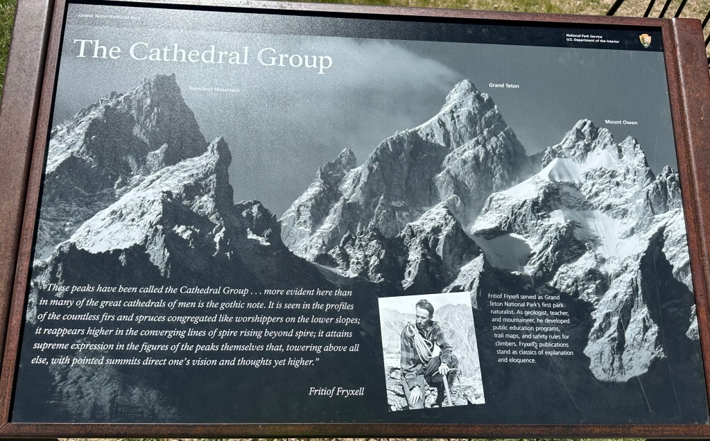
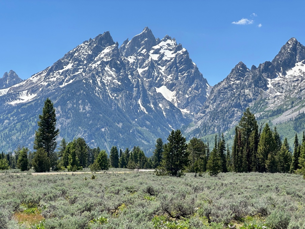
34 feet. 34 measly feet. That’s how much higher Gannett Peak was than the Grand Teton. But it meant I had to climb it. It’s a five day hike and requires some pretty intense ice climbing.

It took me four tries, although the first two weren’t even really tries. In 1989 we went hiking in the Wind River Range, I was only 35 then and figured we could do it without any experience. I did buy a rope and some crampons, and we got close to where the actual climbing began, but my friends weren’t into it and nothing came of it. We did Fremont Peak instead, the third highest in Wyoming.

We had proposed to do it along with Granite Peak in 2004, but after the tribulations on Granite, we decided not to take an even riskier hike. So we never even started.

At the Highpointers Convention in 2016, where a bunch of us succeeded on Granite Peak, there was another guided climb up Gannett the week afterwards. Everybody but me made it. My rented crampon fell off on a steep ice slope; I was immobilized with fear, balancing on one crampon while the guide came down and reattached the other. I was slower than the rest of the group anyway, but that episode delayed me enough that the guide turned me around on the summit ridge, with worrisome clouds approaching, about a mile short of the top.

Already disappointed, I was further demoralized when the successful summiteers passed me on the way down. I didn’t get back to camp myself until midnight, having to negotiate a treacherous scree slope, with one guide patiently helping me, in the dark. Hiking back out took two additional days; I tried not to act too glum around the other celebrants, even at the “victory dinner” back in Pinedale.

Demoralized, but not daunted. After all, I had been successful on Granite Peak the week before. I decided the best thing to do in the future was to hire a private guide, so that my slowness did not affect the rest of the climbers. The patient guide on the scree slope was Eddie Schoen, he was so kind and competent that I hired him privately the next year, 2017. Gannett was the last of the really hard highpoints (Hood notwithstanding) and I figured I’d better get it done sooner rather than later.

Eddie proposed a different approach. Most of the climbs leave from Pinedale, but that route entails going over an icy scree slope, Bonney Pass, 1200 feet up-and-down on Summit Day, which is difficult enough without that hurdle. It was the reason I didn’t get back until after midnight.

Bonney Pass can be bypassed by an eastern approach, from the town of Crowheart, but that is on the Shoshone reservation, and requires a permit fee, and a 20 mile ATV ride to the trailhead, by a member of the Nation. The hike is still quite challenging, you have to go over Scenic Pass, a hurdle in its own right, but you do that on the first day, not summit day. The entire climb still takes five days.

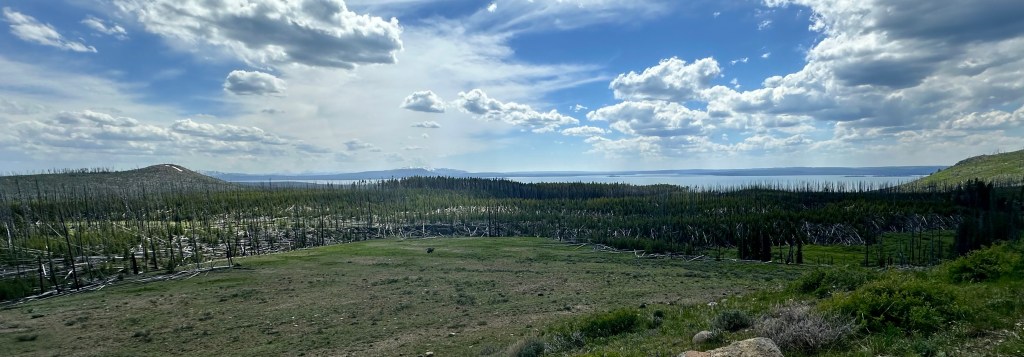
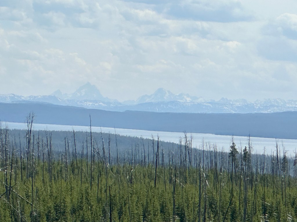
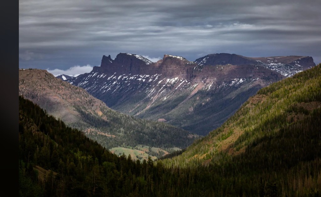
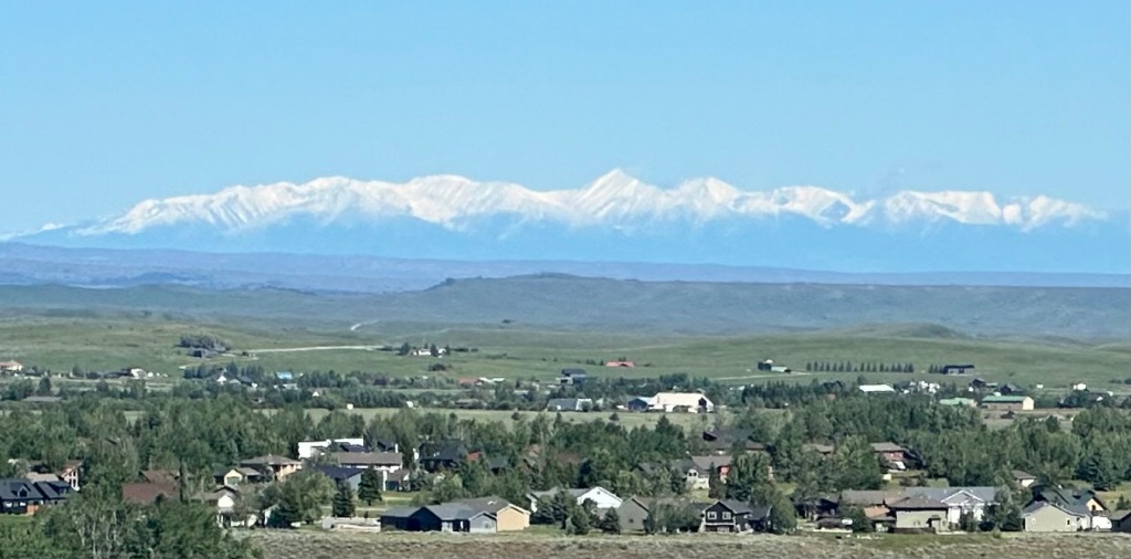
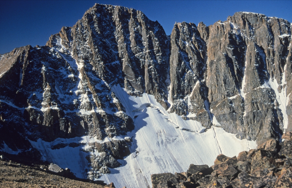
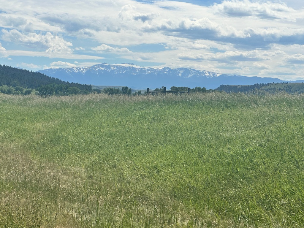
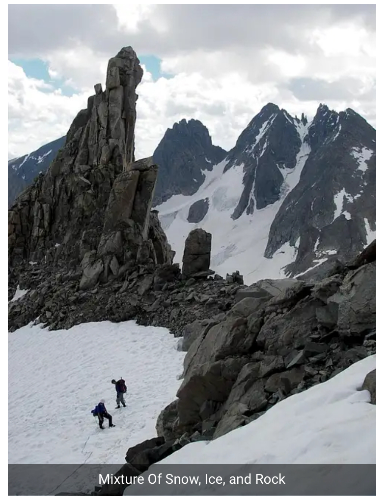
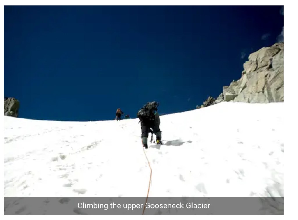
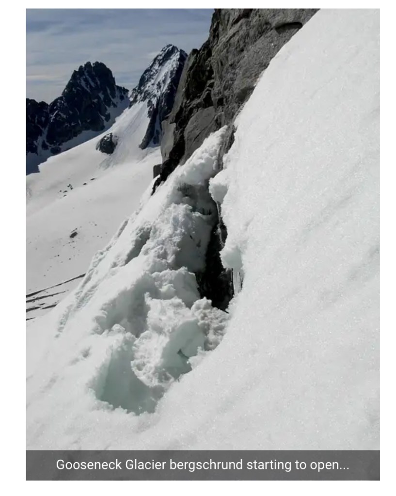
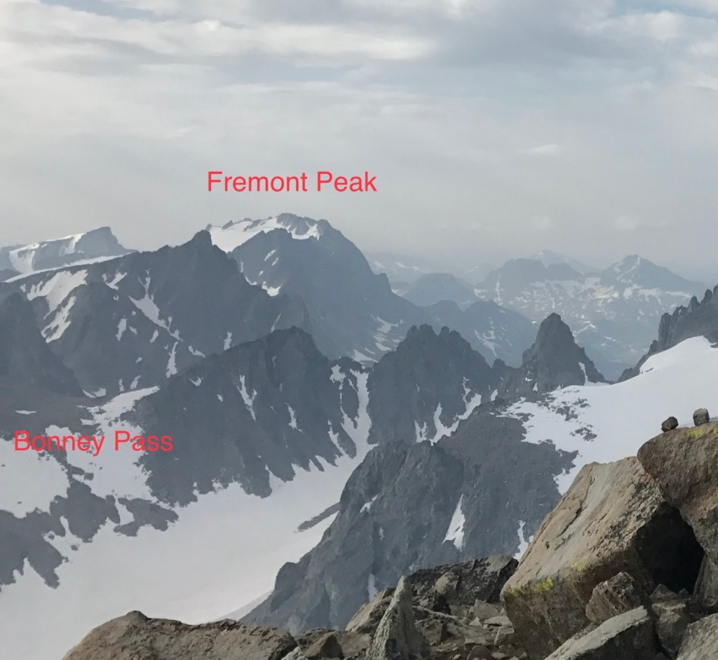
I dug up a couple of photos of that climb. It does have the advantage of giving you a view of Gannett Peak, not visible on the other approach until you are right there.

Aha! So there you are.
A blurry photo, but you can see: it may be higher, but the Grand Teton sure looks more impressive
Our final camp before the summit push
The Wind River Range does have a stark beauty, I guess. You could also say it’s pretty bleak.

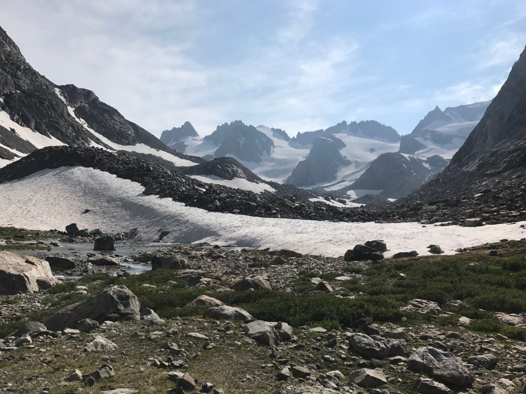
I didn’t take many photos, I got these off the web. That tower is called Gooseneck, and the bergschrund was the most challenging part of the climb.

A-l-m-o-s-t there
Ta Da!

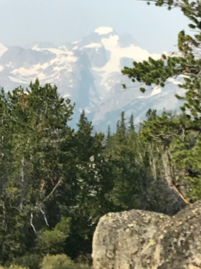
I zoomed in on the left background, and identified the aforementioned Fremont Peak, the third highest in Wyoming, and Bonney Pass, the hurdle on the approach from Pinedale.

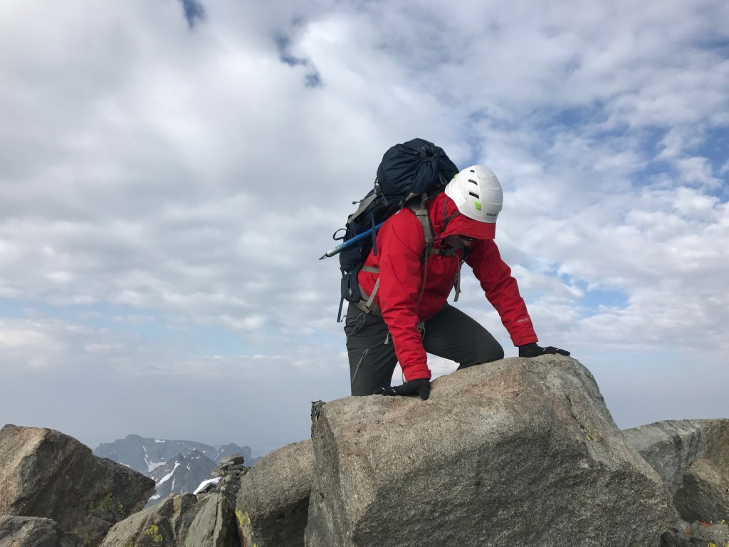
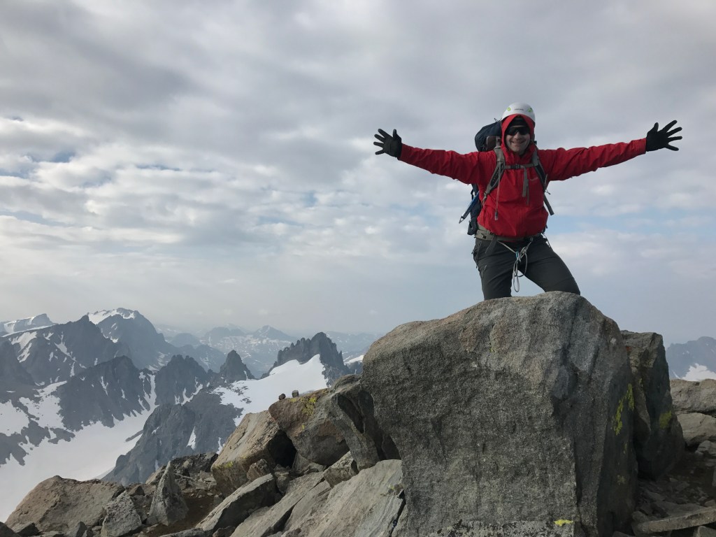
OK, so I climbed it. But I climbed it from the east side, through Crowheart, and I can’t exactly cross Native lands and bike that super rough ATV track to the trailhead. How can I say I climbed this one from the sea?

Well the track of the two climbs converge on Summit day, after the Pinedale route gets over Bonney Pass. I did get to the summit ridge on that earlier attempt. So if I go to the Pinedale trailhead, I can plausibly claim to have sea-to-summited in three stages. Circuitous, sure; roundabout, absolutely; but it’s simply an extension of the “parking lots” two-step I’ve been doing all along. OK?

Well, nobody really cares except for me, and I’m happy.

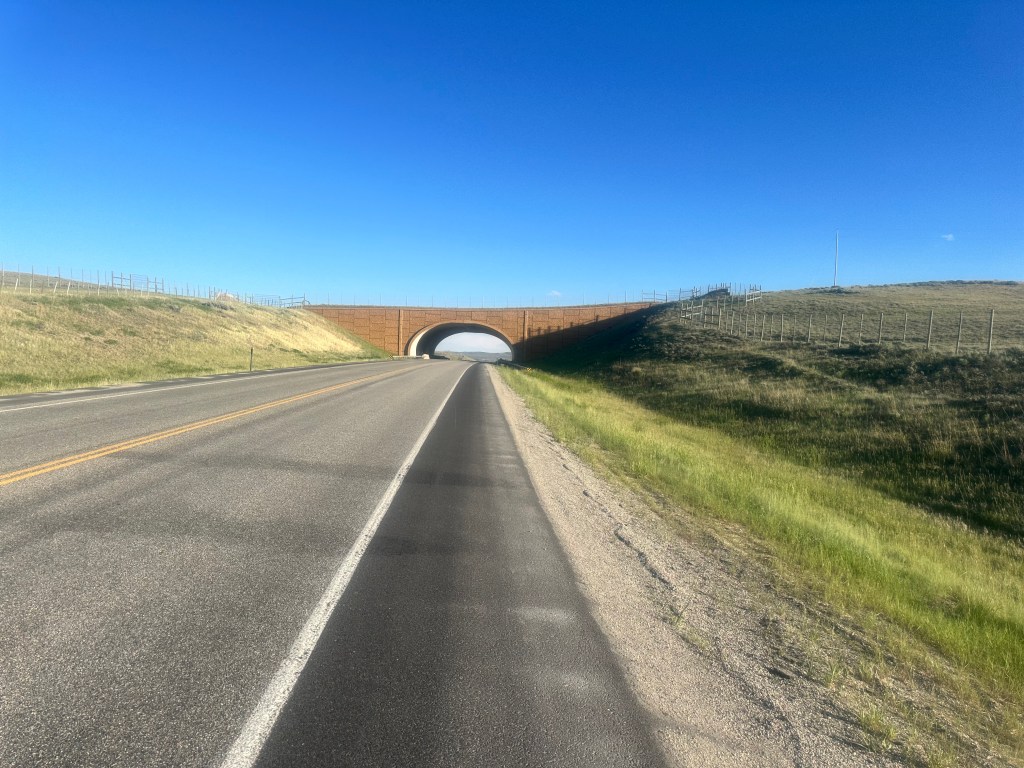
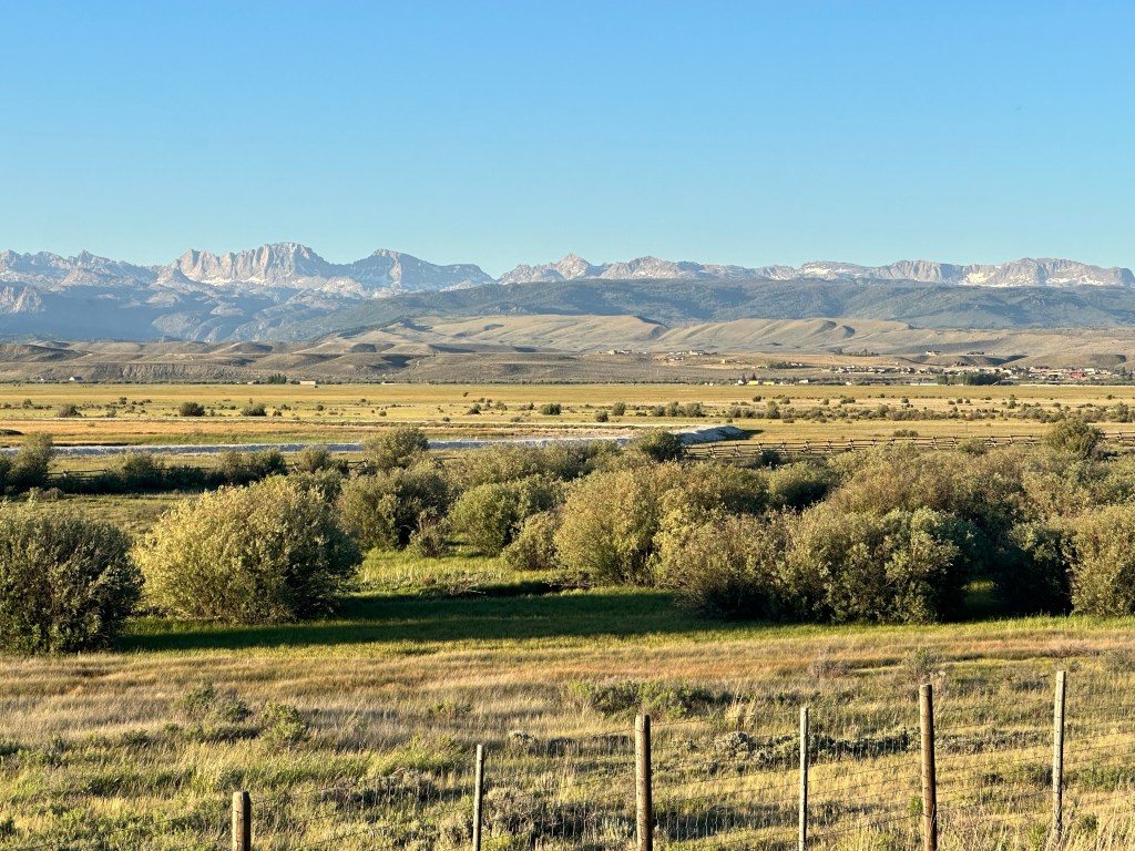
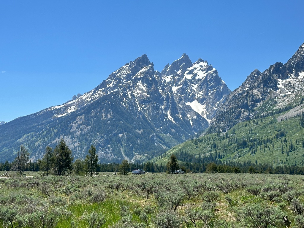
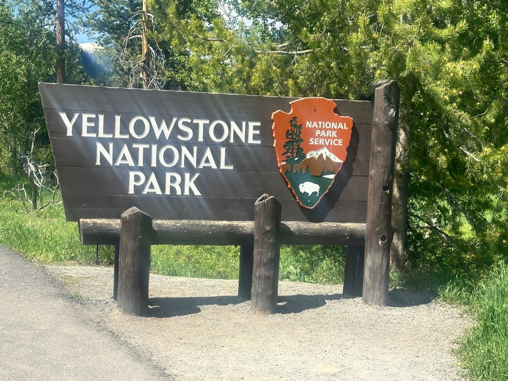
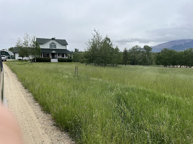
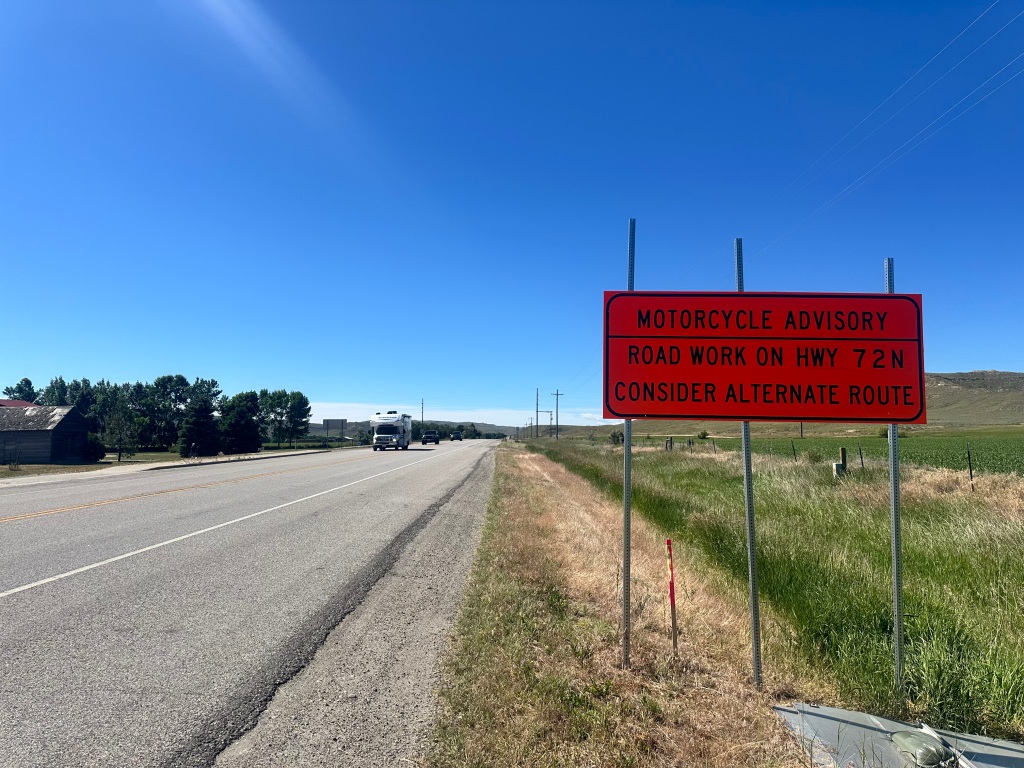
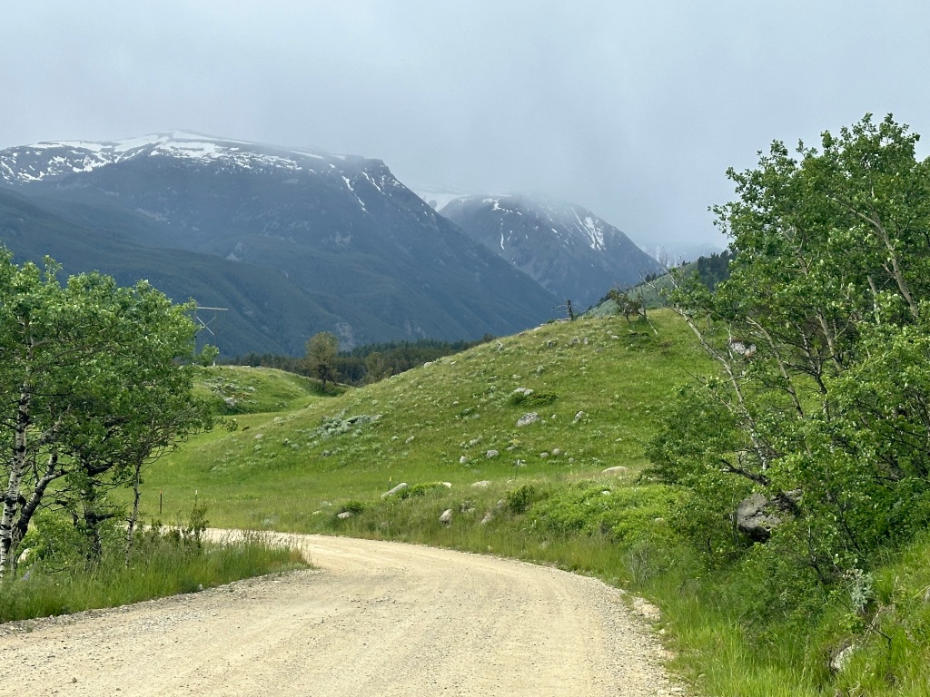
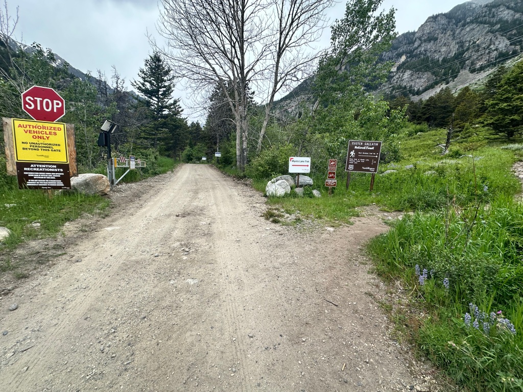
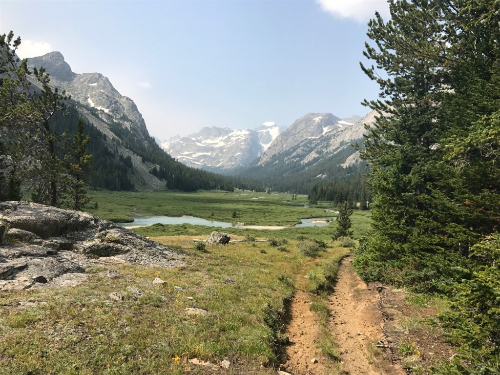
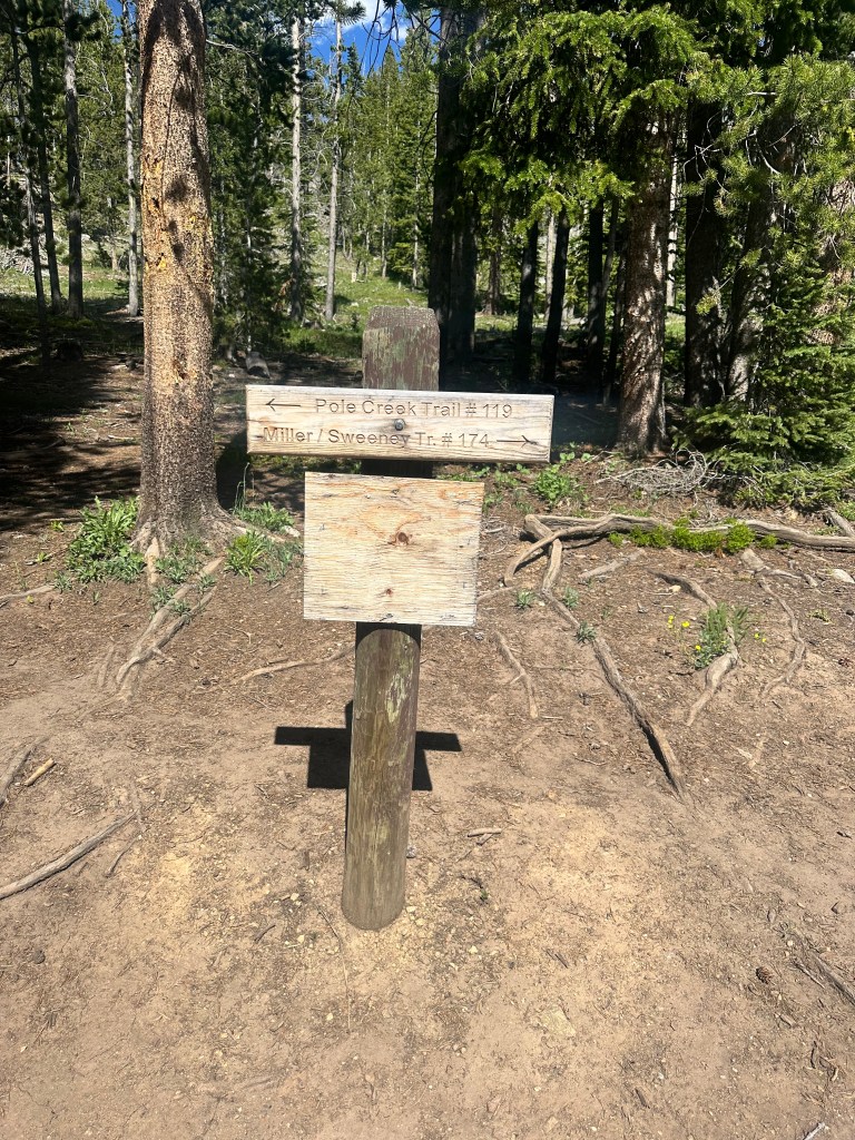
OK, so all that remains is for me to bike up to the Pinedale trailhead today. Should be easy, just a 2,400 foot ascent, 16 miles each way. I left my bags with my Warmshowers hosts, and it wasn’t too hard. But Gannett wasn’t done messing with me. My navigation software assured me it was paved all the way, but the last 4 miles was “under construction” and turned out to be the roughest dirt road, with nonstop washboarding, I have encountered so far. I had to walk about half of it, and drink every drop of water I was carrying. I thought I remembered a water tap at the trailhead, but no such luck. Just a sign, that doesn’t even acknowledge that the Pole Creek Trail is the first part of the Gannett climb.

Not much to look at, but this establishes Gannet Peak as my 23rd highpoint from sea level, out of 37 total

Then, as a final gift from Gannett, I discovered my fancy Oakley photochromatic sunglasses, which I hang securely from my handlebars on sweaty uphill climbs, had rattled off from the washboarding. I found them 4 miles back. They had been run over and were in pieces, but salvageable. Scratched up, but usable. I’ll have to order another pair to be shipped ahead to Denver, but these will suffice in the interim.

The road was long but I ran it, Gannett. I am so done with you.

Distance 33 miles, 2,378 total. Time 6 hours with stops. Elevation gain 2,400 feet

©️ 2024Scott Luria

Pushing through to Pinedale

Jackson to Pinedale, Wyoming. Monday, June 24, 2024

This will be a short entry for my longest day so far, in terms of distance. Pinedale, the base for my climb up the Wyoming highpoint Gannett Peak, was 78 miles south of here. Because of today yesterday’s blistering headwind, I thought it would be a big struggle. But it turned out the wind was shifting to the west, and would actually push me a lot of the way. Good thing, because the ride included a scary, twisting canyon and a steep climb up to a plateau.

It was smooth sailing once I got up there, but I feared it would be rude to get in too late. My Warmshowers hosts, Kristi and Clayton, assured me they stayed up late every night, so I felt I had time to slow down a bit and take a couple of pictures.

I hadn’t seen a highway overpass since I left I 90 in Montana. Curious to see this one, in the middle of rangeland without another road in sight.

Turns out it’s a wildlife overpass https://beingwildjh.com/wildlife-champions/wildlife-advocates/success-stories/wildlife-overpasses/ Cool.

As I approached Pinedale, I was looking forward to a killer view of Gannett Peak. I mean, if it’s higher than the Grand Teton, it will be even more spectacular, right?

Wrong.

It’s in there somewhere

The Wind River Range is beautiful once you get inside it, but not much to look at from far away. The highpoint, I now recall, isn’t visible at all until you get quite close to it; there are lots of intervening ridges. If you’re the king, I guess, you can afford to be coy.

Along the way, I met Tim, who has hiked the Continental Divide Trail and teaches long distance shooting; Arnie, who opened up the convenience store at the top of my plateau climb so I could grab a much-needed snack; and of course my gracious hosts, who share their large home with scores of bikers passing through. I’m told I will meet a couple more tomorrow night.

Distance 78 miles, 2,345 total. Time 11 hours with stops. Elevation gain 3,197 feet

©️ 2024 Scott Luria

Sliding on out the back door

Jackson Lake Lodge to Jackson, Wyoming. Sunday, June 23, 2024

Today I thought would be easy, just slide on out the back door of Yellowstone and the Tetons, downhill most of the way into Jackson. Brought to mind a favorite blues number by Lane Tietgen, continuing the religious theme on this Sunday, with a little Heisinger and Schrödinger thrown in. https://youtu.be/1ml3Xf64APQ?si=Nuk87D2rYToZEAYs

But the wind had other ideas. Focused by the contours of Jackson Hole, it compelled me to get into a full tuck and pedal hard just to go downhill. At least it was cooling on this hot day, and the scenery was so dazzling I didn’t mind much. Hard to take my eyes off of the Cathedral Group as I slowly slid past.

I blew right by the Chapel of the Transfiguration, a favorite tourist photo op with its view from the altar, so I had to cage these images off the web.

My buddy Eric used to say, when we came upon a great view during a Sunday hike, “we didn’t go to church today, but you can’t have a better sermon than this.”

I was following the Snake River, the major tributary of the Columbia, which starts right above Jackson Lake and is impounded by this dam.

and continues its journey through Idaho Falls and Lewiston, where I’d seen it before. A roadside stand warned us that bears were still a problem this far from Yellowstone.

It was fun to pass the trailhead of my 1977 climb of the Grand Teton, so now I can claim to have done that peak from the sea as well. I know, it’s only the second highest in Wyoming.

Jackson was a little schlockier than I remembered, with its wooden sidewalks, stagecoach rides, and the town square framed in elk antlers. Even the cheapest motels were crazy expensive, and no tent camping was allowed. Ah well, it will be my last Gateway town for a while.

Distance 39 miles, 2,267 total. Time 7 hours with stops. Elevation gain 612 feet

©️ 2024 Scott Luria

Gobsmacked

Lake Yellowstone Hotel to Jackson Lake Lodge, Wyoming. Saturday, June 22, 2024.

I was wrong before. This was actually my eighth trip to Yellowstone (I’m Yellowstone the Eighth I am). Even more reason to be blasé about it. Breakfast at the hotel was very nice, as was the view of the lake.

Rounding the corner of the lake at West Thumb, I figured I might as well see one thermal feature, even if there weren’t any geysers.

Black Pool

Took a pass on Old Faithful, but at least I drank the root beer.

Crossed back to the western side of the divide, this time there was a sign to acknowledge it

and then a 1200 foot swoop down to the Tetons.

Yellowstone and the Tetons go together like peas and carrots, it’s rare to see one without the other, so this was also my eighth trip to the Tetons. I thought I could be blasé about them too, but not a chance. Rounding the bend and getting that first view of them leaping out of Jackson Lake, I was gobsmacked all over again.

And this isn’t even the full frontal view

In a previous post I described that Road to Damascus epiphany I felt when viewing them for the first time in 1970. Yeah, like that.

When I climbed the Grand in 1977, I wanted to have a celebratory dinner at the posh Jackson Lake Lodge, in the Mural Room with its massive windows.

A starving student between college and medical school, I certainly couldn’t afford it, but I think I even tipped the maître d’ for a mountain view. I should’ve been more specific. The mountain we got a view of was Signal Mountain, a low green hill behind the lodge.

47 years later I can afford it, now that there’s no chance of me hauling my butt up that peak again. They sent me behind the right window this time, and I lingered as long as I could over dinner, just staring.

The sun was setting, and every minute the lighting was different. I wished I had a proper camera. Claude Monet painted the same façade of the Rouen Cathedral 30 times, to catch it as the light changed. This central cluster of peaks, Teewinot, Grand Teton, and Mount Owens (in front of the Grand, hard to see as a distinct peak from this angle), is often referred to as the Cathedral group.

Mount Moran, almost as impressive

I wasn’t the only one taking pictures. I lingered until after sunset.

and scrambled to be first in line for a breakfast window as well.

Lake elevation 6,772 feet, summit 13,770 feet. Just 2 feet shy of 7000 feet higher.
Mount Moran again, with its Skillet Glacier and the darker diabase dike, angling up towards the summit.

The most expensive hotel so far, and the rooms were weren’t even in the main lodge, but in cottage outbuildings. Oh well, as the expression goes, location, location, and location.

Distance 66 miles, 2,228 total. Time 10 hours with stops. Elevation gain 2,345 feet

©️ 2024 Scott Luria

The other Yellowstone

Pahaska Tepee Resort to Lake Yellowstone Hotel Friday, June 21, 2024

Yellowstone National Park has an outsized reputation as the nation’s (if not the world’s) first national park, one of the largest, and one of the most legendary. Everybody has heard of it, it’s a UNESCO world heritage site. I have been there six times already, and seen all the major draws: Old Faithful and most of the other thermal features, the Grand Canyon of the Yellowstone, Lower Falls, Mammoth Hot Springs; and climbed Sepulcre Mountain, Specimen Ridge, and Mount Washburn. I’ve seen grizzlies, black bears, bison, wolves, elk, marmots, coyotes, etc. I’ve done Yellowstone.

This time, I was just passing through, on my way to the next highpoint. The first day of summer, today is early in the season, and the crowds weren’t too bad. On my last trip, in August, the traffic was oppressive. It seemed every parking lot had a 2 mile back up, no car could enter until a car left. On my bicycle, I was able to bypass those lines, but it still soured the experience.

Less than a year ago, Jane and I had seen one of the worlds other major thermal areas, on the north island of New Zealand. Impressive, but none can hold a candle to the features in Yellowstone. Even so, I didn’t feel the need to see Old Faithful et al again.

Nope, I was just passing through. But I still got a thrill when I passed the iconic sign.

The place is just special, even when you’re not really trying to see it. It feels like hallowed ground. My 70-hour audiobook, The Dying Grass, was just getting to the part where Chief Joseph and the Nez Perce were chased through Yellowstone by the army. I passed a stereotypical scene, a collection of cars and camera tripods, apparently a grizzly and her cub had just left before their equipment had gotten a chance to capture them.

The only “feature” I was really going to see was Yellowstone Lake, the highest large freshwater lake on the continent, and the source of the eponymous river. So big, it’s hard to capture in a single shot.

but if you zoom in, you can see a bison grazing

and the Tetons rising over the lake, 60 miles distant

I had hoped to have the quintessential Yellowstone camping experience at Grant Village, 55 miles away; but another late start, a headwind, my ongoing struggles with caffeine withdrawal, and the highest pass to date, Sylvan Pass at 8,524 feet, really kicked my butt. At 30 miles I passed the posh Lake Yellowstone Hotel

always booked months in advance, and found that they had a cancellation. So I wimped out. Evening was coming, I felt a little vulnerable on my bicycle when the wildlife would be more active, I had my bear spray at the ready, but still. Cut me some slack, I’m an old man.

The restaurant was sumptuous, I had cassoulet, a combination of Coq au Vin, Jackalope sausage, and white beans. My waitperson, Juneau, was planning a moonlight ice climb of Avalanche Peak with friends overnight, before returning to work tomorrow morning. Ah, to be young again.

Distance 30 miles, 2,162 total. Time 6 hours with stops. Elevation gain 2,600 feet

©️ 2024 Scott Luria

Up the Shoshone

Cody to Pahaska Tepee Resort, Wyoming. Thursday, June 20, 2024

Almost exactly 3 years ago, I did a post from Wisconsin titled “Uh, Doc, West would be THAT way”. I was heading due east, precisely the wrong direction, to kill time while I waited for the Illinois highpoint, Charles Mound, to open up.

I could have a similar title for today’s ride, heading due west when my ultimate destination is the East Coast. This time it’s because my next highpoint is Wyoming’s Gannett Peak, and the trailhead is west of the divide. I will need to go through Yellowstone and Grand Teton parks to get there, and as I mentioned yesterday, this is the safest way in.

I have only entered Yellowstone from the east once before, 47 years ago in 1977. My girlfriend and I had just driven cross-country in 48 hours, in a maroon AMC Pacer

Like this, only maroon

from Boston to the Black Hills. The next day I climbed Harney Peak (now called Black Elk Peak, see my post https://scottluria.org/2021/08/06/black-elk-peaks/https://scottluria.org/2021/08/06/black-elk-peaks/ ) and that same day we saw Devils Tower and drove across northern Wyoming, so sleep-deprived we were searching for a place to snooze in the car. The Buffalo Bill Museum in Cody did not allow overnight parking, so we drove to a parking area on the reservoir. The upshot is that we never saw how beautiful this entrance road is.

I was very late leaving Cody, had to find a place to buy bear spray, frustrating because it’s possible to rent rather than buy, but not from anywhere on the east side of Yellowstone. I wound up having lunch and an ice cream in Cody also, so I really didn’t get rolling till 1 PM. 4 miles out of town, I passed the venue for the rodeo I’d blown off yesterday.

If you zoom in, you see that Cody claims to be the rodeo capital of the world

The east entrance road to Yellowstone follows the Shoshone River, which has carved itself quite a canyon.

Shortly the road pierced the canyon in a series of tunnels, made less scary because you could activate a flashing light to alert the motorists.

Between two of the tunnels was the area where we practiced for the Granite climb in 2016. These were harder pitches than we did.

Next was the Buffalo Bill Dam, which when it opened in 1910 was the tallest dam in the world. These pictures don’t really do it justice, too close to get a perspective. Seems like a smaller version of the Hoover Dam.

The reservoir went on for 7 miles, and delayed my climb towards Sylvan Pass, the lower version of the Beartooth Pass I passed on yesterday. It was pretty late now, and I’m sorry to say I didn’t take any more pictures of this spectacular canyon. Here are some that I got from the web.

At one point, there was a beautiful bison right by the road, but it was at the bottom of a hill and I didn’t want to stop my forward progress. Almost felt like cheating, I’d been warned of the headwinds on this road, but for me it was a gentle tailwind, and made the 2,800 foot climb seem almost easy. I got into the Pahaska Tepee Lodge (the original hunting Lodge of our friend Mr. Cody) at 7 PM, happy to have a place to sleep inside. It was going down to 35 tonight and bears were active in the area. I don’t ever want to have to use that bear spray.

Distance 51 miles, 2,232 total. Time 7 hours with stops. Elevation gain 2,795 feet

©️ 2024 Scott Luria

Still not my first rodeo

Red Lodge, Montana to Cody, Wyoming. Wednesday, June 19, 2024

I wanted today to be my first rodeo, but I got in too late. Cody, Wyoming is famous for its Fourth of July rodeo, but it has one every night. It’s about 4 miles out of town, so I didn’t make the detour. I’ve gone to a couple of small-time events in Vermont, but never to a real rodeo. When I saw I wouldn’t make it, cognitive dissonance kicked in, and I decided I didn’t want to anyway, since rodeos abuse animals. Or so I’ve heard, I have no idea if it’s true.

After another night in the sumptuous home of the George’s, Mary made me a double breakfast of eggs, bacon, and delicious gluten-free granola with oat milk. I got out before nine, but not before snapping a photo of Mary and her two dogs, Callie and Two Dots.

I was sorry I didn’t get a photo of Bill himself, who was off on his fishing trip. Also sorry I never snapped a picture of their lovely home; fortunately, Nile did yesterday when he came to pick me up.


Back in the town of Red Lodge, I had to make a decision. The most direct route had me going up over the Beartooth Highway, an “All-American Road,” called “the most beautiful drive in America,” by late CBS News correspondent Charles Kuralt. I had driven it a couple of times and was awestruck. However, it was very twisty, topped out at 10,947 feet, had no shoulders at all, and there was lots of RV traffic, concerning because those drivers are often much less experienced with handling big rigs than truck drivers. The alternative was to go into Wyoming and enter Yellowstone through Cody, quite a bit longer, but less steep hills and better shoulders.

As it turned out, the decision was made for me. The rain we had yesterday was snow up in the mountains, and the pass was closed. As I climbed out of Red Lodge, I could look back across the Beartooth mountains and confirm that for myself.

Finally, you can see Granite Peak, the highest one

Crazy, in Vermont, quite a bit further north than here, they reached a record high of 95°.

It was a beautiful sunny day here, highs in the 70s. 10–15 mph headwind, but with my shrinking gut, I’m finding it easier to get into a deep tuck and use my aero bars. This disconcerting sign

was not as ominous as I feared, it was just a couple of miles of firm gravel. I worried I was passing through another services desert when I passed a dusty roadside stop that turned out to be a paradise, the Edelweiss Riverhouse. Wendy served me up a delicious grilled chicken salad, and many ice cold glasses of Pepsi and root beer.

I got an email from Eric correcting my recollection of our ill-fated Granite Peak climb in 2004. I have since edited my blog from yesterday. It seems my slowness on the hike in was the principal reason for our lack of success.

Anyway, the sunshine, though beautiful, was so unrelenting that it was a challenge reading anything on my phone. There was no shade anywhere. Entering Wyoming was fun, but it was also useful to provide that shade, and allow me to read that email.

Wyoming was fun also because it had consistent smooth wide shoulders, which can make all the difference. What a relief not to have to look in my rearview mirror constantly, I got to listen to more of the Chief Joseph story. One more steep hill, I was happy to see that even with the headwind I could tackle a 7.9% grade without walking. Could it be that the dropper post is making me pedal differently, and start to recruit my long-dormant gastrocnemius muscles?

Finally a downhill swoop into Cody, and even though I was too late for the rodeo, I did score a steak dinner at Irma’s, founded by Buffalo Bill himself, and named for his daughter. Touristy, I guess, but reasonable and not half bad.

William F. Cody was a larger than life figure, and dominates the lore of this town. He has a huge museum which I seen before, I was unimpressed with its treatment of Native Americans. Indeed, Sitting Bull had appeared in some of Cody’s Wild West shows, but Bull was unable to adopt to American culture, and wound up giving most his earnings to street beggars.

He went back to his home in North Dakota and shortly was murdered while the Army was attempting to bring him in.

As I was leaving my motel, I chatted with Joe from Lafayette, Indiana, long distance motorcyclist. At one point, he cycled all 48 states in 10 days. His mascot is Goofy, on the back of his bike.

Cody is also the eastern Gateway town to Yellowstone Park, my next destination. The Internet coverage for the next two days will be spotty. I will post when I can.

Distance 69 miles, 2,081 total. Time 10 hours with stops. Elevation gain 3,547 feet

©️ 2024 Scott Luria

Not taking it for Granite

Absarokee to Red Lodge, Montana. Monday-Tuesday, June 17-18, 2024.

Granite Peak is considered by many to be the toughest highpoint after Denali. It’s the only one that requires rock climbing skills. The other tough ones are all ice climbs.

The year we all turned 50, that is 20 years ago, my friends Brian, Eric, and I thought we could do it on our own. Websites said that if you stuck to a certain route, it was really quite doable. They were full of photographs about which ridge and crease to follow. There was no blazing on the mountain, so we printed those photographs and took them with us. This was in 2004, before smartphones. I asked colleague of mine, Geoff Tabin, ophthalmologist and world renowned mountaineer (he climbed the Seven Summits) if he thought it looked feasible, and he responded by climbing 15 feet up the brick wall of our clinic in street clothes. Sure, he said, no problem.

We started off bravely, encountering buff young adults who had done the whole thing in a single day, and who also said, no problem. That was before 26 switchbacks up to the disconcertingly-named Froze to Death Plateau, and we realized maybe we weren’t as buff as we thought we were. Or I should say, I wasn’t buff enough. I was slowing down the group. We hadn’t brought enough food for a multi day trip, so Brian and Eric went back down to purchase more, while I moved the camp as close to the actual Peak as possible. I hunkered down on Tempest Peak, right before a thunderstorm raged and had me cowering in the tent, praying I wouldn’t get hit by lightning. When Brian and Eric returned, we moved to a safer location.

While waiting to start the climb early the next morning, we were amused and l somewhat discomforted by the hordes of mountain goats on the plateau.

They were never aggressive but frequently came close, we had the guard our food, learned to pee some distance from my camp, as the goats loved to lick the salt. Eew.

We got up at the crack of dawn to start climbing the peak itself, but were greeted by a snow and hailstorm. When it cleared, and the day was sunny, we got our first good look at the climb ahead.

Are you kidding me?

Eric was still game to give it a try, but I felt was no way we were going to climb this mountain on our own. We went back down, feeling disgruntled. This might have been the first time we turned back on a mountain.

12 years later, in 2016, the Highpointers Club held their annual convention in nearby Red Lodge, Montana. They offered the opportunity for a guided climb, so a bunch of us signed up with Jackson Hole Mountain Guides. They recommended we hire a porter to haul our heavy gear up to the plateau. I was reluctant to do that, felt like cheating, but then I realized I’d hauled my own gear up that time before, and I wanted to maximize my chances.

You remember on my Borah Peak post the description of climbing classes. Class 1 was a walk up, Class 2 a scramble, Class 3 hairy but doable without a rope, Class 4 you need to rope up. Class 5 you also need to provide “protection”, anchors and carabiners along your way to catch you if you fall. Class 5 climbs are also broken down by difficulty, so 5.1 is the easiest, and it goes up to El Capitan crazy. We had a rock climbing clinic the day before the hike, and they took us up some 5.4 stretches, which they said would be as difficult as it would get.

Of all the guided climbs I’ve taken, only one has been unpleasant, our guide today. He was a martinet, barking orders and pushing us to keep moving. We rapidly realized we were in much tougher terrain than anything we had practiced on, going up dicey arrêttes and chimneys—on one occasion I got stuck, someone had to push me from below and pull from above. We suspected he had gotten off route. When we got to the top, I was so frazzled, I’m not even sure I took a picture, I can’t find one in my files. I remember seeing smoke in the direction of Yellowstone. It would’ve been much easier if we could have rappelled going down, but that took extra effort on the part of our guide and he didn’t want to set that up, so we had to downclimb, even scarier than going up.

It wasn’t fun, but we made it.

I knew today wouldn’t be fun either, getting to the trailhead, lots of vertical and steep gravel. Like on Borah, I dropped my bags at the road junction, but this time the out-and-back was 34 miles. I let some air out of my tires for better traction and flotation, but it didn’t help much with the soft spots and washboarding.

Rain was coming in, that’s Froze to Death Plateau up there somewhere.

2 miles before the trailhead I passed the campsite where Brian and Eric and I had stayed the night before the hike, I thought maybe we had walked from there and I could turn around now, but I didn’t want to take it for Granite. No, I pushed on until the signs would not let me go further, and documented that I was at the trailhead.

Wow. That’s 23 highpoints I’ve now done from sea level, out of 37 total. Also, my odometer had just rolled over to 2,000 miles. There were a couple of young women there with the forest service, I wanted to take a celebratory photo with them, but they told me they were not allowed to appear on social media. (This is social media?)

Just as well. It was freezing up there, and starting to rain, the washboard was bone-rattling on the way down, but I let it rip, hoping I wouldn’t get a blowout. Reuniting with my bags, I realized I had 26 miles to go, with the steepest hills yet to come. I reached for the rocket fuel I hadn’t touched in days, a Frappuccino, and discovered to my horror that my suntan lotion tube had burst open with the altitude, and coated everything in my rear pack with that sticky zinc oxide goo.

I had started at six that morning, but was behind schedule and was racing for a deadline. Bill George is a Family Practitioner, the brother of a friend of mine, she had connected us and he had offered me a place to stay in Red Lodge. We both had Massachusetts roots, and the final game of the NBA championship was on, we were hoping to catch it in a bar. The Frappuccino wore off pretty quickly, and I had to push my bike up five hills. I hated to keep my friend waiting. He met me in his pick-up about a mile from his house, moosing my 125 pound bike into the truck might’ve taken more effort than just pedaling it. But we caught the last half of the game, the Celtics winning their 18th championship, and all was good in the world.

Bill and Mary have a lovely home and two beautiful dogs; it was raining the next day, so they offered to host me for a rest day as well. That gave me a chance to have breakfast with one of my favorite former patients, Nile Schneider and his wife Linda, who are RVing across the country after spending many years cruising the Bahamas. They have been following me on the blog and altered their plans so we could meet up. What a treat.

I also got to catch up on sleep, make future plans, complete the blogging, and have one more incredible meal, at Prerogative Kitchen. It seemed unfair, one small town having three terrific restaurants.

A day of pampering after a day of pain. And now, finally, I can take it for Granite.

Distance 71 miles, 2,012 total. Time 13 hours with stops. Elevation gain 5,820 feet

©️ 2024 Scott Luria

Pater Familias

Big Timber to Absarokee , Montana, Sunday, June 16, 2024.

I hadn’t thought of it before, but with my parents gone and being the oldest child, I guess I’m the pater familias. Anyway, today I got the most wonderful Father’s Day gift. Hour-long conversations with my children, one while I was being blown down the Yellowstone River, 15 mph with almost no effort, allowing me to talk in normal tones. All three are doing well and happy, and it warmed my heart.

At Columbus, I got one last sweeping view of the Yellowstone

before turning the corner, into the wind and uphill, back towards the Rockies. Specifically the Beartooth Range, home of Granite Peak, the highest in Montana. It’s hard to pick out the peak in this picture, but it’s quite formidable when you get close to it.

Long day tomorrow, 70 miles, hilly, lots of gravel, as I try to make it to the trailhead. Getting to bed early to leave at the crack of dawn. Hope to rendezvous with a couple of friends, the first familiar faces in over a month.

Distance 56 miles, 1,941 total. Time 7 hours with stops. Elevation gain 1,361 feet

©️ 2024 Scott Luria

Ride with the wind

Bozeman to Big Timber, Montana. Saturday, June 15, 2024

I read more about Bozeman, it’s the fastest growing metropolitan area in the US. Once a quiet college town (Montana State University), it has attracted the attention of the gentry, who have moved here in droves and jacked up the real estate prices. The motel proprietor in Arco, Idaho had been driven out by this. Bozeman was her hometown, but she could no longer afford to live there, even with her and her husband working two jobs.

The weather has been crazy. The morning news was full of record highs across the country, but there was a winter storm watch for Big Sky, I got out just in time.

A strong wind was blowing out of the west, suggesting maybe I should do the same. Once again, I asked at a local bike shop for the best routes, they were lukewarm about me taking I-90, but it was the most direct and least hilly option. It looked a bit foreboding as I approached Bozeman Pass

but the shoulder held, it was not too steep, and I was up and over in two hours. Once again, I was touched by the historical context.

After that, it was all downhill with a stiff tailwind. What could be more ideal?

I took frontage roads whenever I could, but a lot of the time I was on the interstate, and never felt unsafe. The scenery was stunning as I swooped down into Livingston

and crossed the Yellowstone River, which I will follow downstream for the next 80 miles. Lots of media context, this valley is the site of the hit TV series Yellowstone, also the movie The Horse Whisperer, among many others.

I was purchasing a “nutritious” snack of Coke and a Snickers ice cream bar, when a woman insisted on paying for me. She had been intrigued by my story, and invited me into her RV, where she and her husband made me a truly nutritious lunch of tuna salad, avocado, and mineral water. Allyson and Rick Dennis were from Hanford, Washington, she was in human resources and he had been testing ports of entry around the world for radiation contamination of imports, before they retired. Their RV was meticulously organized, and they seem to be truly enjoying the Van life. Just fascinating to talk to, and I was so appreciative of these trail angels. I hope we can connect in the future.

Allyson and Rick

I know I sound like a broken record, but I just can’t get over the kindness of strangers.

As I continued to blow down the Yellowstone, I realized I was no longer among mountains, but gently rolling hills. I had crossed the Rockies, crossed the divide; I could just cruise on back to the East Coast. But no, you poor schmuck. There are four more highpoint “parking lots” to hit, many more crossings of the divide in service of my OCD. The passes looming ahead are much higher than the ones I’ve done so far.

What’s that expression? Whatever floats your boat.

Distance 62 miles, 1,886 total. Time 8 hours with stops. Elevation gain 1,688 feet

©️ 2024 Scott Luria