Shoulder strategies

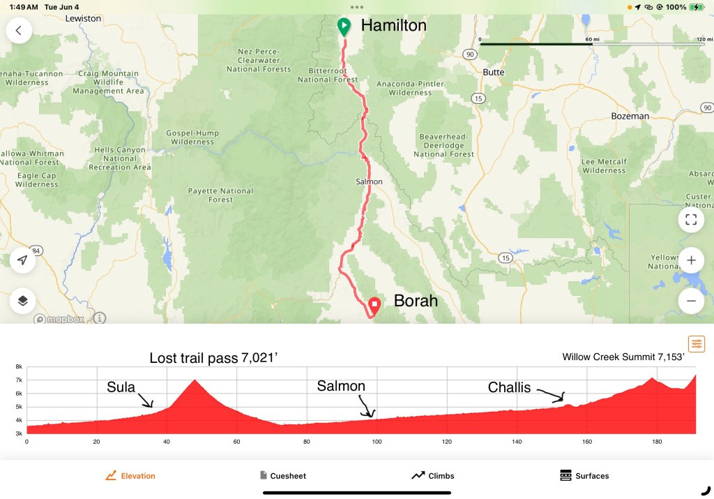
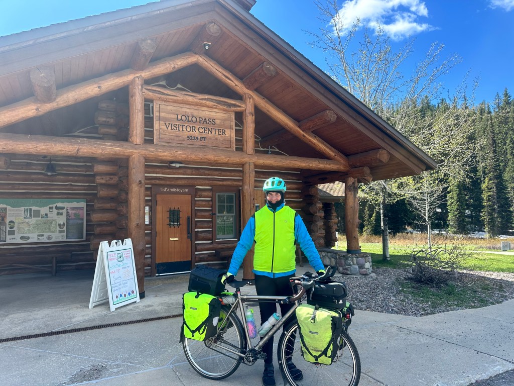
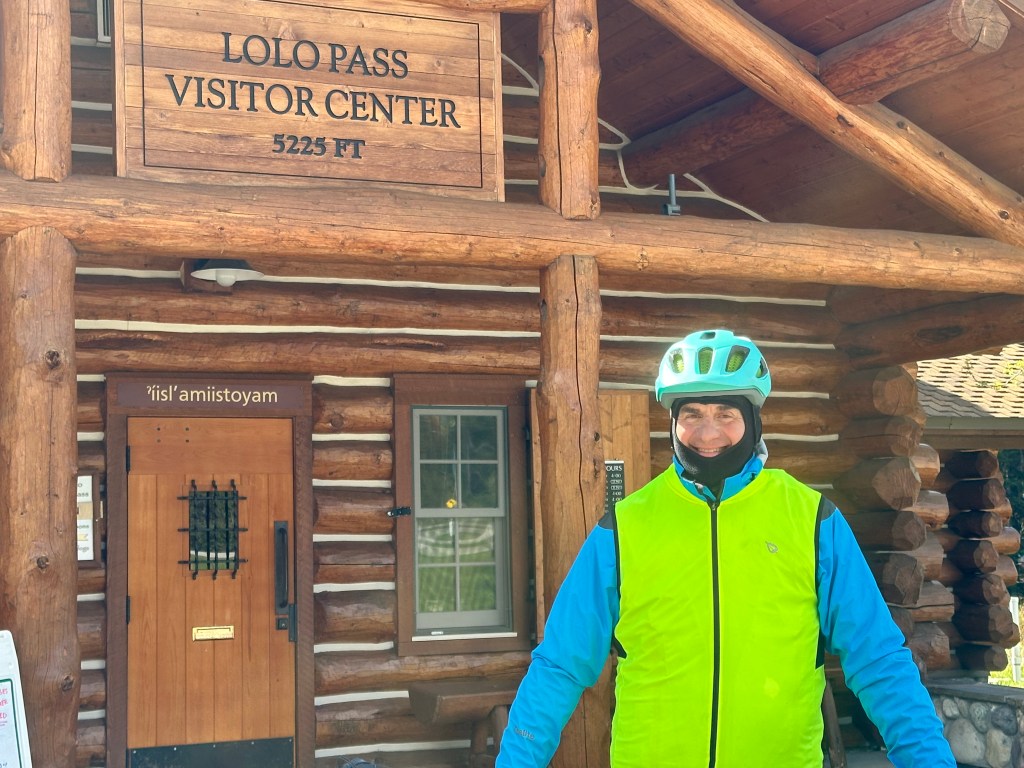
Hamilton to Sula, Montana Tuesday, June 4, 2024.

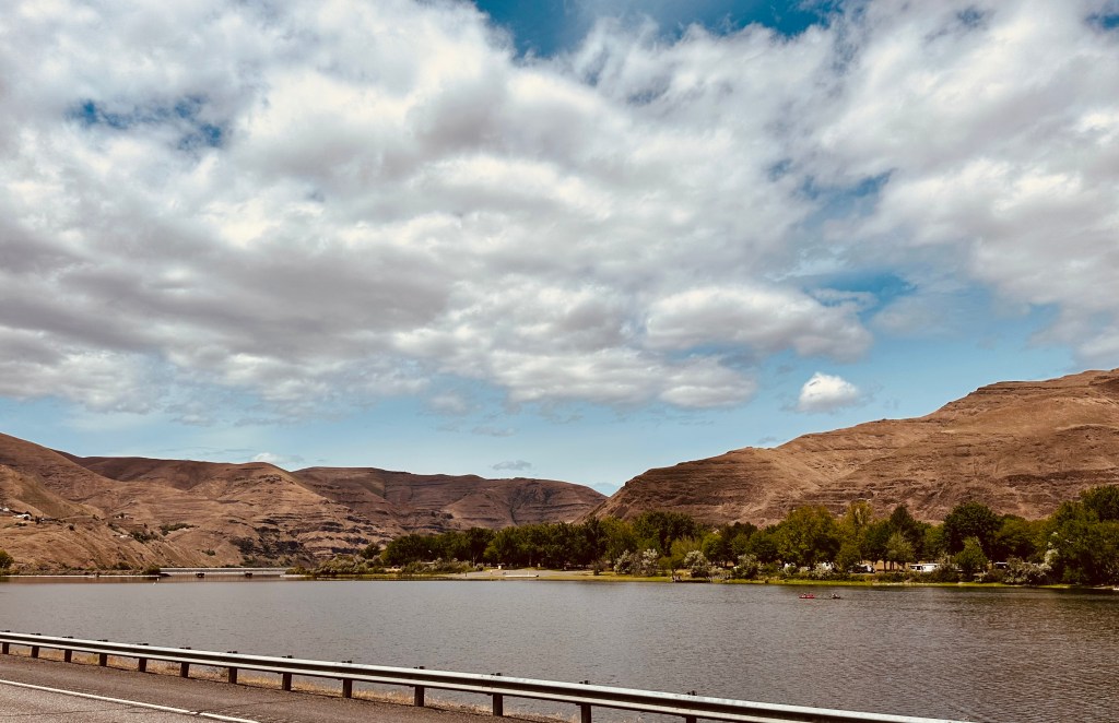
Today would be the easiest of the next four days, no major climbs, just 36 miles; would’ve liked to go further, but that’s how the lodging worked out. There was a big challenge today, however, 7 miles of a scary twisty road, busier US 93 this time, with no shoulder.

At least I’d been forewarned. Montana has an excellent resource, a highway map tailored to bicyclists, indicating the width of shoulders, presence of rumble strips, and traffic density, along with big climbs.

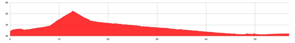
In the map detail, you can see today’s route with Hamilton towards the top and Sula, most of the way to the bottom. If you look at the legend, you can see that most of the route has rumble strips and wide shoulders, but the neon green arrow points to a 7 mile stretch where there is no shoulder at all, and that gets 1404 vehicles and 105 trucks a day.

It helped to know that other people had done this, and that in fact it was part of the Transamerica Trail, so soon it will be the site of thousands of bicyclists. But I am ahead of the crowd and did not see another cyclist all day.

Most people would not even dream of tackling a road like this. Of all the potential ways you could get hit by a car, people seem to most fear being run down from behind. In fact, this is a tiny fraction of car/bicycle accidents, most of the collisions come from cars that are in front of you*.

One of the greatest lessons I got from MIT had nothing to do with biology. A traffic engineer, John Forester, had studied car/bicycle accidents for 40 years, and compiled his findings in a seminal book called Effective Cycling (MIT Press). It’s still in print.

I have no financial relationship with Dr. Forester or the MIT Press

Bicycling has been my primary mode of transportation my entire life. Between commuting and touring I have ridden over 200,000 miles, through many Vermont winters, and many cities—such as DC, Boston, New York, London, and Paris—and never had an accident, or even a close call. I credit this book with keeping me alive. Forester took his data and compiled many pages of strategies for dealing with just about every challenging traffic situation: storm drains, parked cars, exit ramps, left-hand turns, poor shoulders etc. They have become my mantra, second nature to me. They have kept me safe.

Forester’s central premise is that bicycles are vehicles, subject to the rules of the road, and entitled to their protections. Like any slow moving vehicle, they should stay to the right as much as they safely can, and faster cars should pass them in the adjacent lane.

The key phrase is “as much as they safely can”. For bicycle, that means about 2 feet out from the edge of the pavement or obstructions such as potholes or storm drains, or a car door’s length out from parked cars. I’m always looking ahead for these obstructions, and take that safety margin ahead of time, so that I don’t have to swerve suddenly into traffic.

Most states require vehicles to pass bicycles with 3–4 feet of clearance. It’s all about visibility. With my dynamo generator my headlight and taillight are on 24/7, my panniers and clothing are high-visibility, and I use that crazy bright flasher in dicey situations like today’s poor shoulders. Nevertheless, I assume that cars ahead of me don’t see me unless I establish eye contact, and behave accordingly.

All of this often means that I am “taking the lane” more than the typical bicyclist does, but because I behave predictably and always follow the rules of the road, I almost never get attitude from drivers. I can count on one hand the number of times per year I get honked or yelled at.

Whenever a friend or patient has an accident, or whenever there is a bicycle fatality in Vermont, I try to get all the details. With the exception of drunk or distracted drivers, I feel my strategies would have avoided that accident.

For today’s scary shoulderless 7 miles, I turned off my audiobook, changed my AirPods from “noise canceling” to “transparency” (actually amplifies, like a hearing aid) and had my eye on the rearview mirror almost constantly. When blind curves approached, I tried to position myself so that cars behind me could see me as far away as possible, then pulled over to my safety margin as they approached. I tried to think like a driver. I made it with no incident, no honking.

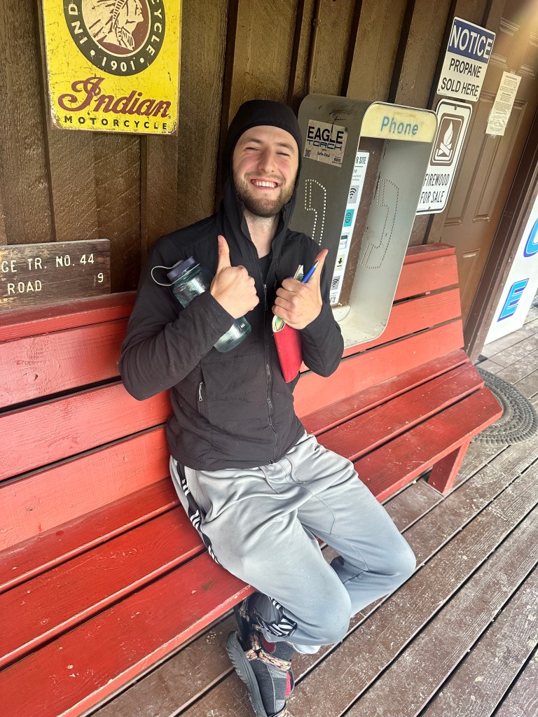
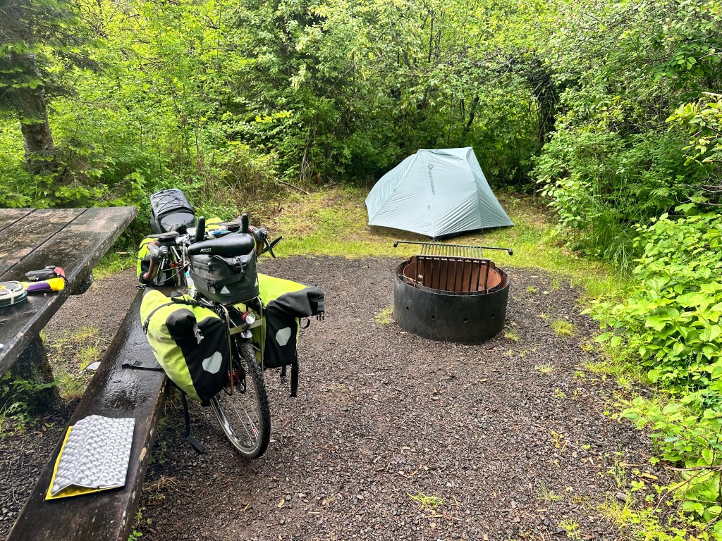
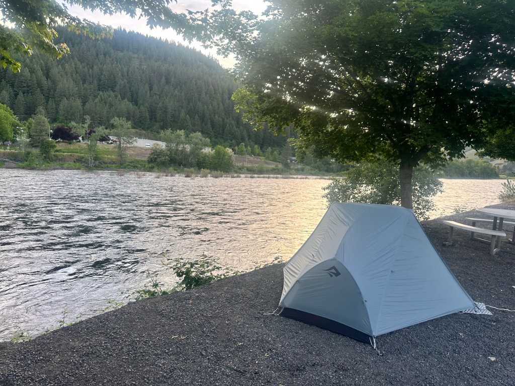
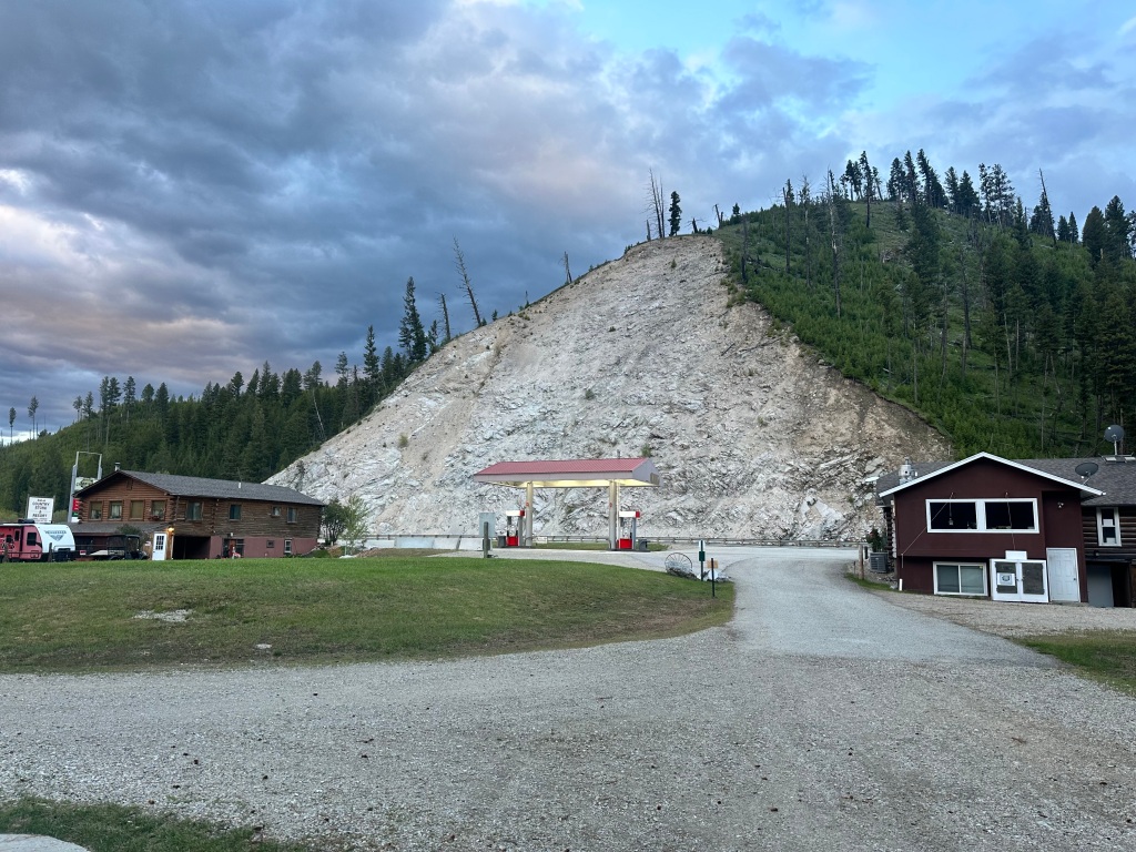
The only accommodation on the stretch was Camp Sula, campground and cabins. The general store was closed.

Looks like that far bank could collapse any moment

My campsite looked inviting, and had an electrical hook up

but I didn’t like the look of those clouds,

and I opted for a cozy cabin, heated and with linens, for only $30 more.

Moses, site owner, and former Navy seal. 

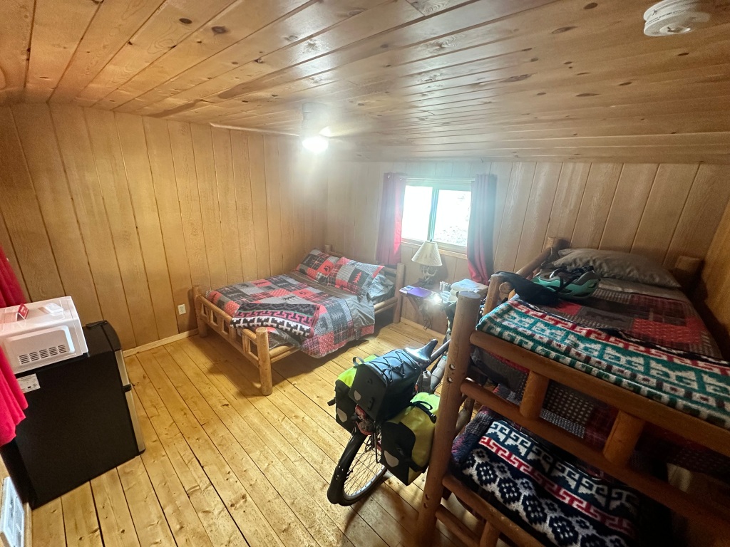
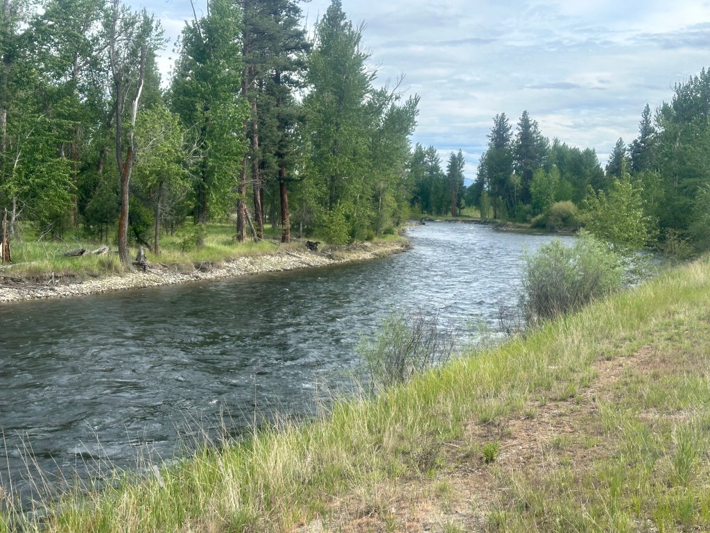
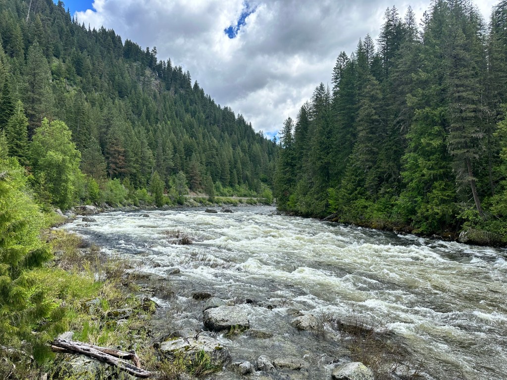
I need to get an early start tomorrow. The Bitterroot River, babbling just outside my window, lulled me to sleep. Yup, a river runs through it.

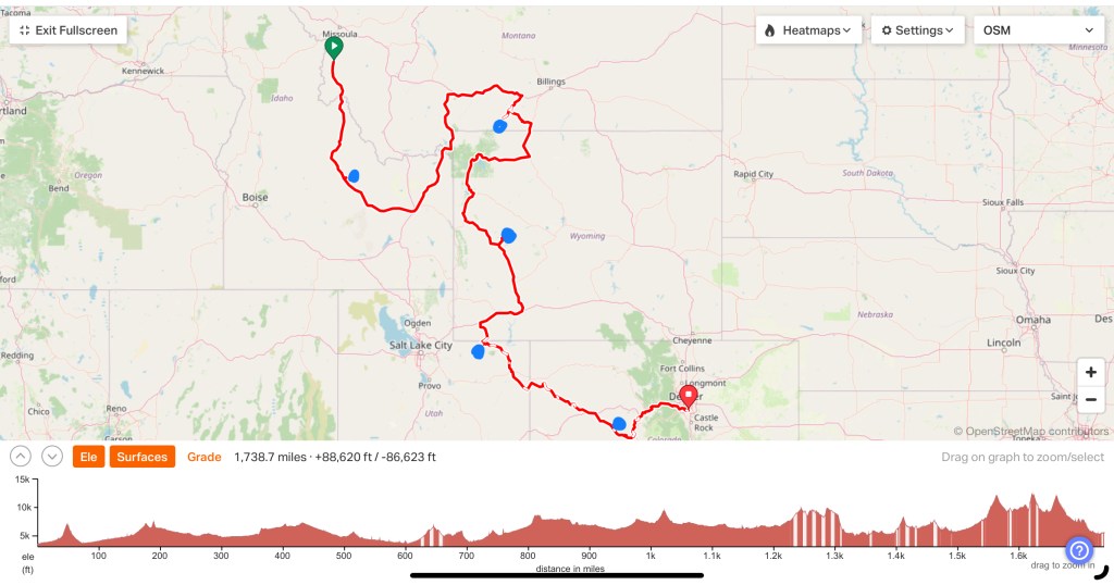
Distance 36 miles, 1,342 total. Time 6 hours with stops. Elevation gain 1,438 feet

©️ 2024 Scott Luria

* the most common accidents are the left cross, where an oncoming vehicle turns left into you, the right hook, where passing vehicle makes a right hand turn right in front of you, and the T-bone, where a vehicle on the side street doesn’t see you.

Future plans

Hamilton, Montana. Monday, June 3, 2024

Heavy rain and a wind advisory once again compelled me to take a down day, just as well since I really need to firm up my plans over the next few weeks.

Jane and I refer to this plan dismissively as the “parking lots tour”—biking to the trailheads of the major Rocky Mountain peaks I’ve climbed, thereby closing the loop between the sea and the summits. Trouble is, they don’t line up very well, not on a flat map and certainly not considering all the intervening topography. After struggling with this Gordian knot, I finally came up with this as the most straightforward plan.

The blue dots represent the highpoints of Idaho, Montana, Wyoming, Utah, and Colorado

Hardly straightforward— over 1,700 miles and 88,000 feet of climbing, just to get to Denver. It will need further tweaking and revising, but at least it gives me a template.

The first step is to get to Borah Peak trailhead in Idaho, almost due south of here, all on US 93. I know, it seemed crazy to me also to swing into Montana just to go back to Idaho, but that’s how the mountain ridges work. I was happy this afforded me the chance to see Missoula.

So with stops at Sula, Salmon, and Challis, and three more steep climbs, I should get there in about four days. I checked in at a local bike shop, one of the guys has ridden 93 the whole way, and says it’s doable, although the shoulders are sub optimal.

Let’s see if this flies.

©️ Scott Luria

A river runs through it

Missoula to Hamilton, Montana. June 2, 2024.

Sister Anne, once she heard I was in Montana, sent a link to a Henry John Deutschendorf Jr. (AKA John Denver) song Wild Montana Skies that I’d never heard before https://youtu.be/wztUGHnSmAM?si=IJUFJiuU1QE-3wJ5. Never been a big Deutschendorf fan, but I had to admit the song was compelling. The first line was “He was born in the Bitterroot Valley” and I realized, that was the valley I would be biking up today.

There was nothing bitter about this route. The Bitterroot River was a placid stream compared to the continuous rapids of the Clearwater and the Lochsa.

I was going upriver, sure, but only rising 1200 feet in 50 miles, so the slope was so shallow as to be inpreceptable. I was following US 93 now, much busier and wider than US 12, but there was a bike path the whole way. This was a typical scene, hardly the spectacular landscape and nonstop flapping eagles of the video.

I didn’t take many pictures, but was inspired nonetheless. The Missoula area was the setting for the novella and movie A River Runs Through It. Norman MacLean’s sensitive story, Robert Redford’s direction, and Brad Pitt’s film debut made quite a sensation decades ago, but the real star was the beauty and grace of fly fishing. This video captures the spirit. https://youtu.be/dzyzAXVBioY?si=UbT0xWUiTThLZZvk

I’ve been fortunate to go on two llama-and-fly-fishing treks with my good buddy John, and can personally attest to the magnificence and serenity the sport evokes, even to a total newbie. Not to mention the great eating.

Distance 50 miles, 1,306 total. Time 6 hours with stops. Elevation gain 1,151 feet

©️ 2024 Scott Luria

The Divine Mount M

Missoula, Montana. Saturday, June 1, 2024.

Missoula was just too cool a town to leave after one day, and I decided after yesterday’s big push I deserved a down day. I lined up a Warmshowers host, finished my belated blogging, and went out to explore.

The first thing you notice is a big white M looming over the town.

I figured it stood for Missoula, but it’s actually Montana, after the university. I went to the center of their quad, the oval, and there it was, hovering above University Hall.

If you zoom in, you can see switchbacks leading up to it.

Turns out the mountain has a name, Sentinel

and I very much wanted to go up there. But time was short. Missoula is a foodie paradise, it was Saturday night, and the University was hosting 3 high school graduations today. The lines would be long at the restaurants if I didn’t head right over.

I did climb high enough to get a view of Grizzly Stadium

Don’t think that’s Joe Montana

and got downtown in time to score a great meal at Zoo Thai. Last night it was El Camino (no, they wouldn’t give me a discount for having walked it) and both times the line was out the door as I left.

Bette Midler’s platinum debut album was The Divine Miss M. I often call Mt. Mansfield, Vermont’s highpoint, only 18 miles from my home, The Divine Mount M for its many beautiful trails and views, it’s also the site of Stowe ski area and the Trapp Family Lodge, of Sound of Music fame. But I think Missoula has its own Divine Mount M. I was sorry to miss the birds eye view of the city, but in the end my stomach won out.

There was a consolation prize. The town’s river, Clark Fork, had a rapid with a standing wave. Three guys with wetsuits and surfboards put on quite a show. I wish I could embed videos here.

My Warmshowers host, Erin Dozhier, is at the University to study for a career in social services, and we shared many stories about health care and helping the unfortunate. Overall a lovely evening, a lovely day, a lovely city.

Erin and his green-cheeked conure Alfie
Alfie entertained us with his antics and intelligence, he’s 11 years old and will probably live to be 30.

Distance 12 miles, 1,256 total. Time 4 hours with stops. Elevation gain 300 feet

©️ 2024 Scott Luria

Urge for Going

Lochsa Lodge, Idaho to Missoula, Montana. Friday, May 31, 2024.

🎶 I woke up today and found frost perched on the ground 🎶

My favorite Joni Mitchell song (actually, I like the Tom Rush version better), but not such a fun memory this morning. I worked out the time and realized I had to leave here before 6 AM. The temperature was 31°. WTF!? It’s May 31 for God’s sake! Not only that, but I discovered the warm gloves and the special waterproof gloves I’d exchanged at Showers Pass in Portland, were nowhere to be found. Must be sitting in some motel somewhere, overlooked in my rush to pack. All I had were my lightweight cycling gloves, good to about 45°. My Urge for Going was getting weaker by the minute.

But it had to be done. I had an 1800 foot climb to Lolo Pass, not as formable as the climbs to Paradise and Timberline Lodge, but I’d done those on a bare bicycle. The first 8 miles were a continuation of the gradual uphill I’ve been doing for the past few days, but the last 5 miles were 8% grade, typically more than I can handle on a loaded bicycle.

Elevation profile

“I think I can, I think I can” was my mantra as I cranked slowly uphill. My granny gear is as low as you can go, but at those speeds it’s really hard to keep from weaving all over the road. At least the traffic was minimal this hour in the morning. I had to stop to rest three times, and in the last half mile I full-on bonked and had to walk. As I rounded the final bend to the visitor center at the summit, I got back on my bike so as not to appear too pathetic. I limped in at 8:47 AM, and a ranger took my photos.

But it was really 9:47 AM, this was the Montana border and Mountain Daylight Time. I was so focused on the time because I wanted to make the Adventure Cycling Association (ACA) headquarters by 3 PM, to have an hour with them before they closed for the weekend. I still had 44 miles to go, but it was mostly downhill. Freezing at the beginning, but improving as the altitude diminished and the day got warmer.

Montana! I was in Montana! The state has always had a mystical allure from me, home to Glacier and Yellowstone National Parks, the headwaters of the Missouri, Little Bighorn, and the Unabomber. The only state highpoint, Granite Peak, that required rockclimbing skills. And, most importantly for me, the ACA headquarters.

For an atheist, I seem to make a lot of pilgrimages. I talked about the REI flagship store in my Seattle post. I did the mother of all pilgrimages, the Camino de Santiago, in 2019 (an incomplete blog is in the menu above). I had driven through Missoula before, but avoided stopping by the ACA headquarters, felt the only way to arrive there was by bike.

And there it was, just as I hoped it would be.

Almost looks like a church, doesn’t it?

The doorhandles were wrapped drop handlebars, how cool is that?

Inside were a cyclist’s lounge, with ice cream and cold drinks, lots of ACA memorabilia from the Bikecentennial glory days, a photo wall of all the cyclists who’d passed through, and Sam and Geoff, who knew more about cycling in these parts than anyone.

Behind them are all the ACA “TripTiks” that have been my bible these many years

I monopolized their time for an hour past closing. They gave me state cycling maps with info about shoulder quality and traffic densities, critiqued and made suggestions for my proposed circuitous route to connect the highpoint “parking lots”, gushed over my bike, weighed it on their special scale (126 pounds with no water!), and got a professional photographer to shoot me for the back cover of Adventure Cyclist magazine. I was reminded of that inane song by Dr. Hook and the Medicine Show:

(Rolling Stone) Wanna see my picture on the cover
(Of the Stone) Wanna buy five copies for my mother (Yeah!)
(Stone) Wanna see my smilin’ face
On the cover of the Rolling Stone!

Yeah, exactly like that. We’ll see if I actually make it into the mag.

Distance 60 miles, 1,244 total. Time 7 hours with stops. Elevation gain 2,627 feet

©️ 2024 Scott Luria

Marginal communicado

Wilderness Gateway Campground to Lochsa Lodge, Idaho. Thursday, May 3, 2024.

I was delighted to see how the tent kept me dry in the steady rain all night, not so delighted with the situation when I woke up. The rain had stopped but the rain fly was soaked. Despite a clever apex ventilation system, the inside of the fly had condensation on it, so if it touched the inner tent, that would get wet also. Some of it dripped down on my top quilts.

Normally in this situation I would wait until the sun dried everything out, but it was mostly cloudy, and that probably would’ve taken hours. I didn’t have that time to spare. I folded the wet panels in on themselves, and tried to put everything away without making it wetter, but it was no use. My sleeping gear was pretty damp all over.

I had a visitor while I was packing, Dustin Gould, a full-blooded Nez Perce who, like the traditions of his people, had been migrating up and down with Clearwater and Lochsa valleys the past few months. He gave me some insights into the audiobook I was listening to about the Nez Perce, and demonstrated how they got their name. They did not pierce their noses—the gestures they showed Lewis & Clark when asked for directions made it appear that’s what they were doing.

Dustin Gould

Otherwise, the ride was the same as yesterday, seemingly level, but following nonstop churning rapids, which indicated I must be going uphill. Periodically trails would take off across the river via dramatic suspension bridges, which offered better views of the rapids.

At one of these I met Ed, a motorcyclist heading in the opposite direction, doing an 800 mile loop from British Columbia in three days. It was interesting to compare our experiences.

As Billy from the B&B had informed me, Lochsa Lodge was the only accommodation in this stretch, and the only place that had Wi-Fi. It was the weakest Wi-Fi I’ve ever seen, taking many minutes to load a single webpage, but I was finally able to reach Jane. There was also a pay phone at the general store (how long has it been since you’ve used one of those?) where you could talk as long as you liked for four quarters (I kept waiting for the operator to say “40 cents more for the next three minutes”).

At the store, I met Chris, a forestry inventory specialist from Mount Kisco, New York who trained at Binghamton University and traveled to various gorgeous locations to assess the health of the local flora. We chuckled that he was following his dream while many of his classmates were selling insurance.

Chris

Also fun to talk to was Tony, another northern New York native who’d moved to California but loved to visit gorgeous places like this. He’d played hockey for the UVM  Catamounts in the sixties. Small world.

Tony

I dried out all my camping gear and got to bed early. I went to make it over Lolo Pass and into Missoula while the Adventure Cycling headquarters is still open. This is where Lewis & Clark crossed the Rockies. A major challenge for them, sure, but at least they didn’t have to deal with truck traffic, or with losing an hour crossing into Mountain time.

Distance 40 miles, 1,184 total. Time 6 hours with stops. Elevation gain 1,493 feet

©️ 2024 Scott Luria

Incommunicado zone

Kooskia to Wilderness Gateway Campground, Idaho.    Wednesday, May 29, 2024 

[note: the next three posts are coming all at once, since I was off the grid for three days. They are a little bit less tightly edited than the others, my apologies in advance.]

Bonie & Billy sent me this photo of our lovely evening last night

Heading off today felt more formidable than my last accommodations desert, at least then I had a cell signal. I somehow thought that being on the Transamerica Trail would bestow this route with biker friendly services, but I was mistaken. I didn’t see another bicyclist all day. What I did see was lots of rafters, the Clearwater had turned into an unbroken rapid. It was exhilarating to cycle along it, and even more so to watch the kayakers and rafters negotiate the churning water. We waved and hooted encouragement to each other. Gratified that my bicycle and body were behaving themselves in the steady uphill grind, I was vexed by the intermittent rain.

I’d been lulled in into a sense of insouciance by the semi arid climate I’d enjoyed since the Columbia Gorge, no rain except for that one stormy day in Umatilla; I was in the rain shadow of the Cascades. But now I was approaching the Rockies, the Bitterroot and Sawteeth ranges were creating their own rain shadow, and I was on the wet side. My Showers Pass gear rose to the occasion – I was never uncomfortable – but I had to camp tonight and I hate setting up camp in the rain.

Billy and Bonie at the B&B had been invaluable in giving me the lay of the land. 40 miles in was a campsite, with running but no hot water, 40 miles after that was Lochsa Lodge, the only creature comforts before historic Lolo Pass (where Lewis & Clark crossed their highest pass in the Rockies). The next stop would be Missoula, college town of the University of Montana and headquarters of Adventure Cycling.

The steep forested sides of the canyon the Clearwater had carved for itself were unrelentingly beautiful, but impossible to capture in a photo. I wished I had taken my GoPro, to record a continuous video, and perhaps relay the sense of awe I felt coming around each bend. But that awe was undercut by constant vigilance, I could rarely take my eye off my rearview mirror. One huge truck whooshed by frighteningly close. You’d think a road this popular with cyclists would have decent shoulders. Apparently they’re coming, in fact the construction I’ve been warned about is to widen the shoulders. Too late for me.

Jane is constantly worried about me , and now has no way of tracking my progress or getting updates about my safety. Highway signs announced old-fashioned call boxes at intervals, I stopped at one and considered using it to reassure Jane I was all right. But the sign said it would connect me directly to Idaho State Police dispatch, and it seemed an egregious misuse of emergency services. I wandered around the campground hoping to find someone with a satellite uplink or Wi-Fi or something, but no luck. It’s bad enough, abandoning Jane for all these months, but especially harsh to be incommunicado like this. I remembered I felt this way on Denali, knowing two people had died on the mountain, and being unable to reassure Jane.

The rain paused just long enough for me to be able to set up my tent without getting the insides wet. Apparently there’s a way to set up the rain fly first, but I didn’t want to learn how to do it under these rushed circumstances. I used my camp stove for the first time to prepare Mountain House chicken pad Thai, it wasn’t half bad; Bonie had joked I was eating MREs, or K-rations. I hope to find kindred spirits in the campground, but the only people I encountered were drunken revelers from a wedding. Nothing to do but take a baby-wipes “shower”, go to bed early, and be thankful that this new tent is keeping me bone dry in the rain, and that my top quilts are keeping me warm at 40°. Nighty night.

Could be worse …

Distance 44 miles, 1,144 total. Time 6 hours with stops. Elevation gain 1,524 feet

©️ 2024 Scott Luria

Transamerica Trail

Orfino to Kooskia, Idaho. Tuesday, May 28, 2024

Today, finally, I will be joining the legendary Transamerica Trail, the original coast to coast bicycle route that was begun by a group called Bikecentennial in 1976 as an offbeat way to celebrate the nations bicentennial. A grassroots effort spread by word-of-mouth, it attracted over 4000 cyclists. They were mostly in their 20s, rarely wore helmets, and typically rode discount store bicycles. I had just graduated college and was considering joining them, but just couldn’t swing three months without generating income at that point. These photos capture the esprit of the group, and of the times.

The route endures today as the centerpiece of the Adventure Cycling Association (ACA), whose maps and advocacy I have often touted in these pages.

The ACA route map, Transamerica Trail is in orange

In my mind, it is as iconic as the Appalachian Trail and I have often dreamed of following it. I envisioned scores of cyclists also going that way, eagerly anticipated the sense of community. And here was my chance to join it.

I awoke to the soothing sounds of the Clearwater River right outside my tent, and followed that river upstream all day. I was getting used to the shoulderless Route 12, and happy to see that on a very gradual uphill, with no wind to aid me, I was averaging 10 mph. I’ve been warned of construction along this route, and the traffic guard at the first stoppage, Symphony (I kid you not, that was her name) warned me that the contractors at upcoming work zones were more surly. At Kooskia, I joined the Transamerica Trail, but didn’t see any cyclists today. A sign warned that there were no services for the next 93 miles, so I stocked up on groceries. Thunderstorms and a half inch of rain were predicted overnight, so I stayed at a B&B 7 miles out of town. I was greeted by this sign

and the evening went uphill from there. My hosts Bonie and Billy served me wine and a lovely charcuterie, and we talked for hours. Bonnie is a retired nurse, and Billy a search and rescue specialist who has assisted at many hot spots around the world. He gave me lots of advice about the upcoming road, and how to cope with the challenging conditions.

Bonnie, Billy, and their adorable border collie Piper

Tomorrow will have no cell service and only primitive campgrounds, it will be a couple of days before I can post again. Wish me luck.

Distance 38 miles, 1,100 total. Time 6 hours with stops. Elevation gain 761 feet

©️ 2024 Scott Luria

Oh 12, 12, why hast thou forsaken me?

Lewiston to Orofino, Idaho. Monday, May 27, 2024.

Astute readers of this blog will recall I’ve used this line before, for Highway 41 in “The ultimate hypotenuse” post in Michigan on 5/30/21.

The US highway system is the forgotten stepchild of American road building, largely subsumed into the interstate system, only a few remain intact in our imagination, like Route 1 down the East Coast. The legendary Route 66, Steinbeck’s Mother Road, is mostly gone. Route 20, from Boston to Newport Oregon, is the longest road in the United States.

Route 12 is still with us, stretching from Aberdeen, Washington to Detroit,

Screenshot

it has been my companion since Wallula Gap. It has generally behaved itself, with wide, reasonably smooth shoulders, but 10 miles east of Lewiston those vanished. I’d been forewarned, and thankfully today was Memorial Day, so truck traffic was minimal, but constant attention to the rearview mirror kept me from photographing the beautiful scenery I was riding through, along the Clearwater River, which had carved a minor canyon for itself.

I did get a shot of a stereotypical Expedition statuary, with Clark, Sacagawea, and Lewis planning their route,

and a photo of my campsite along the Clearwater at the end,

but that’s it, folks. Sorry.

The saddle saga continues. My makeshift rail splice remained intact, but the tension bolt broke, I only have a couple of replacements. What we’ll do for a comfortable place to park your keister.

At least the weather was nice.

Distance 44 miles, 1,072 total. Time 7 hours with stops. Elevation gain 1,216 feet

©️ 2024 Scott Luria

Pride goeth before a fall

Pomeroy, Washington to Lewiston, Idaho. Sunday, May 26, 2024.

This script almost wrote itself. I should’ve known better. If I wax poetic about my dream bike, if I gush with pride, something is sure to happen.

The seat had been squeaking more than usual, so I got down below it to apply some lube. I was immediately taken aback.

D’oh!

Oh no! The right seat rail had broken, just as in the seat before, but this time I couldn’t blame the seat post clamp, it was brand new and much more supportive than the previous. I noticed this early Sunday morning of Memorial Day weekend, and for a moment, I was at loss about what to do. I called Jane, who talked me off the ledge.

I was in this tiny town, Pioneer, with the only establishment being a small grocery store. No handy garage with a welder, no service station at all. I looked for bike shops, only one showed up on Google maps, 32 miles away in Lewiston, Idaho, where I’d already reserved a room for tonight. It was open from noon till four today, then not again until Tuesday. Other than that, there were no bike shops at all until you hit Missoula, Montana!

Take an Uber to and from the bike shop, Jane suggested. I was skeptical Uber would even come here, in the middle of nowhere, but apparently I could do it, for $170 round-trip. Or I could see if I could squeeze the bike into the Uber and save one leg. But that would of course “break the chain” of a coast-to-coast bike ride, and my sea to summit mountain climbs.

I could see if the motel proprietress, Rhonda, knew a welder in town. I’d survived the shower, so she’d morphed in my mind from Norman’s Mother to Help Me Rhonda.

These were sensible suggestions, but none sounded too appealing. I futzed around a bit and was able to slide the seat backwards, so that the clamp acted as a splint across the break.

Hmm…

Maybe, if I was very ginger on the bike seat, I could ride the bike to Lewiston on my own. Jane was rightly skeptical. What if this MacGyver job failed, and I was really in the middle of nowhere, out of cell range, with no chance of making it to the bike shop before it closed? I’d be up the proverbial creek. Get the Uber, she said.

What do you call a man with half a brain? Gifted. The old joke echoed in my head as I torqued the clamp bolts to 10 Newton meters and cringingly headed down the highway, trying not to put too much weight on the seat. There was a thousand foot climb to Alpowa Summit, then an exhilarating 10 mile descent to the Snake River, averaging 32 mph. I tried to stand on the pedals, did not want the seat to fail here. When I reached the river, it took a minute to unclench my teeth, and pry my fingers from the handlebars.

The seat seemed intact. I dared a look.

Could it be? It looked like the gap was smaller! Could I have taken the half brained option and gotten away with it?

Anyway, I could relax a little and notice the Snake and the scenery.

The Snake River, the major tributary of the Columbia. I would follow it for only ten miles before it veered off to its eponymous Canyon, site of the infamous Evel Kenevel Skycycle jump so long ago. I’d been so anxious I failed to notice my odometer rolling over to 1,000, and missed the chance to belt out, as I had in the rain in 2021, the thumping Proclaimers song.

And. I. Would. Bike. Five. Hundred. Miles. And. I. Would. Bike. Five. Hundred. More. Just to be. The. Man. Who. Bikes. A. Thousand. Miles. To. Fall. Down. At. Your. Door.

It was just ten more miles to Clarkston, my last town in Washington, which seemed little more than a commercial strip, then across the Snake to Lewiston, Idaho, much cuter and leafier. The town name reminded me of BFF Brian and Frank’s college town in Maine. Bates was the classic New England small college, so beautiful, such a contrast to the sterile halls of MIT; I would escape there whenever I could. Funny it was surrounded by the gritty town of Lewiston Maine, site of Muhammad Ali’s “phantom punch” defeat of Sonny Liston in 1964

and much later, the largest mass shooting in Maine’s history.

But I digress. I failed to notice that Lewiston and Clarkston were named for my old buddies Meriwether and William, and belatedly purchased the Audiobook Undaunted Courage, Stephen Ambrose’s classic biography. And I’ve been on the Lewis and Clark trail for three weeks. D’oh!

The bike shop, Follett’s Mountain Sports, was still open, and Scott was very helpful.

He is a collector of Lionel model trains, and showed me a photo of his awesome home set up. He mentioned he had met Evel Knievel at a convention, he seemed a rather withered old man. He warned me of a hazard in these parts, goathead thorns, cause of many flat tires. And he sold me a classic Avocet touring bike seat for only $15.

I remember these from the 1980s, the first of the anatomically padded bike seats. Avocet was more famous for their adorable little cyclometer, so simple and light, came in many colors, all of the Tour de France riders sported them back in the day.

Since the MacGyver job seems to be holding I think I’ll keep the Brooks Saddle until it fails, having the Avocet on hand. I texted Simon Firth, the Brooks guru in Philadelphia, for his ideas on why the rails keep breaking. Scott at the bike shop has never seen that happen. Meantime, Jane will mail my other Brooks Saddle, the one Simon repaired, once I figure out a good pickup spot, and I’ll send this one to Simon. And so the triangle trade continues. Maybe, as I lose further weight, this dance can stop. Not ready to give up on Brooks yet.

The hotel was full of baseball players, from Indiana University Southeast campus, I had fun chatting with Ben, their coach. Lewiston is the site of the NAIA World Series. I wish them luck.

Idaho. One of my least visited western states, although incongruously I have climbed the highpoint, Borah Peak, twice (don’t ask). Famous for potatoes, Sun Valley, Hemingway’s suicide, and the Ruby Ridge debacle. For me, notable for the Idaho Stop (Idaho was the first state to allow bicycles to use stop signs as yield signs) and for an inane childhood riddle.

If Mrs. Ippy leant Miss Ouri her New Jersey, what would Della Wear?

Idaho. Alaska.

Distance 34 miles, 1,028 total. Time 6 hours with stops. Elevation gain 1,243 feet

©️ 2024 Scott Luria