Wittenberg to Merrill, Wisconsin. Sunday, May 23, 2021
So even though I wound up bailing to the highways yesterday, I was determined to try the back roads again. This time I lasted about 3 miles. I got dumped back on that unimproved railroad, this time a bit firmer, but still was only doing 7 mph. Today, it was State Highway 29 that beckoned. Seemed fairly quiet at first, shoulders were not as good as US 45 but not bad, but gradually the highway got busier and wider and pretty soon I realized I was on a four-lane limited-access superhighway.
The thing was, it was great. I didn’t want to get off. The shoulder was now fully wide and in good shape, the rumble strip protected me from the speeding traffic, which never got close, and a tailwind had me going 15mph average, even with the hills. I kept looking for that “pedestrians and bicycles prohibited” sign you see at freeway on-ramps, but I wasn’t on an on-ramp, having “grandfathered in”. I wondered if a cop would pull me over, but none did. I made the 33 miles to Wausau in just over 2 hours.
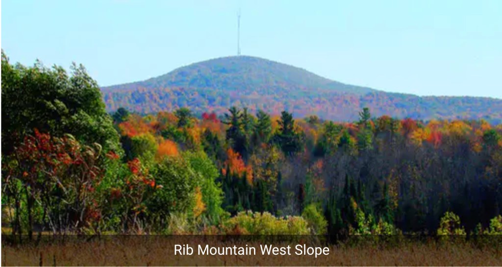
About 10 miles out, I saw something I hadn’t seen in over a month—a mountain. I had to blink to be sure, it wasn’t that high but it was a genuine mountain! I wanted to take a picture but didn’t dare stop and give Smokey a chance to bust me.
I knew what it was: Rib Mountain. Long thought to be Wisconsin’s highpoint, it was eventually found to be 9 feet lower than Timm’s Hill, but much more prominent, in how it rose over the surrounding landscape. It loomed 741 feet above Wausau, and had one of the nation’s first ski areas, built by the CCC in 1937. When I got off the highway, it was obscured by clouds, so I’ll have to scrape the web for a picture.
I pulled into Mickey D’s just ahead of a downpour, had to linger for an hour. Next was a stop at the local bike shop (I hate to pass these by, they’re so few and far between) to top off the tires, repair my handlebar tape, and buy a beanie to protect my scalp from the sun. Zach was very helpful. There is a road up Rib Mountain, but the rain shower burned up the time I had. She was not to be denied, however. I was back to the RideWithGPS-selected back roads, and the road I was following seemed to climb a wall ahead, a “rib” of Rib Mountain. As I approached,I thought surely the navigator would route me around, bu no, we were going straight up it. It was only a quarter mile long, but one of the steepest grades I have ever encountered. In WisCONsin! I had to get off and push, and stop to rest 4 times in that quarter mile. Legend has it that those are Paul Bunyan’s ribs, buried on that mountain.
Am I the only one for whom the name Wausau tickles the mystic chords of memory? This logo, which I haven’t seen in 50 years, is as fresh in my mind as yesterday.
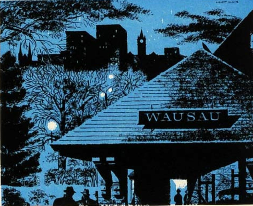
I had to look it up to find out why. Wausau Insurance was one of the earliest advertisers for 60 Minutes, which we watched constantly when it began. That logo would flash on the screen each week. There’s something about that image—comforting and scary at the same time. Homey but exotic, the name evoking the wild north. “USA” is buried in the name. The dark shape of the depot evocative of the Auschwitz death gate. Brrr, creepy.
I already knew the depot had long since been torn down, so no sense going into town to look for it. Chippewa Falls, which every Titanic fangirl knows is the hometown of Jack Dawson, is nearby; I didn’t go there either. Instead after that ridiculous climb I zigzagged north and west, going over many smaller hills, the flat days are definitely over. Again, I hoped to get close to Timm’s Hill, but by 4PM I still had 36 miles and the wind was cold, the air heavy with threatened rain; I wimped out after 54 miles. Merrill offered a choice of a cheap motel or a campground, and I wimped out a second time. I hate packing a wet tent. The town at least had a cool courthouse.

Distance 54 miles, 1,688 total. Time 7 hours with stops. Elevation gain 1,796 feet
