Apple River to Galena, Illinois. Saturday July 3, 2021
This is one of the candidates for the overall title of my blog. My father, Carlos Luria, died last year under dramatic circumstances, which I will be expanding on in a future post, one of the “elephant in the room” posts that I keep talking about, but have not yet had the time to do. At the risk of stating the obvious, Carlos is the Spanish version of Charles, and the title is a riff on Steinbeck’s Travels with Charlie, his renowned narrative of a nationwide trip he took in 1960 with his poodle Charlie in his truck Rocinante. I am scattering Dad’s ashes at the highpoints and other significant spots along the way, taking a cue from another compelling story, The Way, starring Martin Sheen. Sheen is scattering his son’s ashes along the Camino de Santiago, completing the pilgrimage his son was killed attempting. A partial record of my family’s Camino trip 2 years ago is available in the menu above.
I mention it today because I was finally able to do Charles Mound, highpoint of Illinois, a full month after my last highpoint, delayed by the aforementioned restrictions of the landowner. It’s only 1,235 feet high, but the surrounding hills of the Driftless Region meant I climbed 1,852 feet overall. I’ll paste some info from the SummitPost page:
At 1,235 feet above sea level, Charles Mound is the high point for the state of Illinois, which ranks as the 45th state in order of elevation. Charles Mound is located in the northwest corner of the state, near the town of Galena, and is less than 1/2 mile from the Illinois/Wisconsin border. Unlike the rest of the state, Northwestern Illinois was spared by the glacial activity that flattened most of the Midwest. The area actually has some rolling hills, limestone bluffs and some very nice scenery.
Interesting fact: The Sears Tower in Chicago rises 1,450 feet above ground with a ground elevation of 583 feet. That puts the top of the Sears Tower at an elevation of 2,033 feet above sea level, nearly 800 feet higher than Charles Mound. However, it is obviously not considered to be the state highpoint since it is man made. [end of paste]
The roads leading there were hilly and quietly majestic, reminiscent of Terrence Malick’s Days of Heaven. They were deserted, until I came upon this odd little cluster of parked cars in the middle of nowhere.

There was little to identify this obscure dirt road leading off,
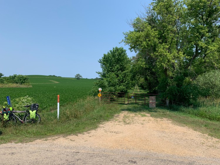
but a closer look at that sign did give a clue, as did the gap in the gate, completely locked except for the first weekend of each summer month.

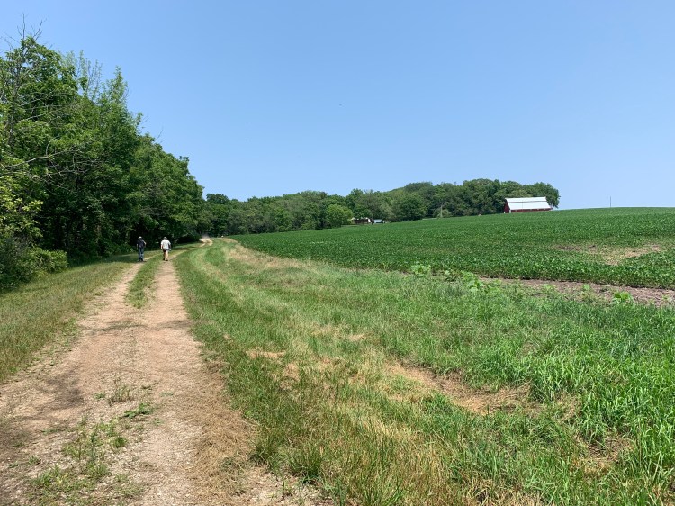
The path was a mile long, I was tempted to bike up it, but I elected not to provoke the restrictive landowner. I switched to hiking boots and locked the bike to a post. The track was level at first but gradually steepened and lead past his barn. The net climb from the road was 255 feet.

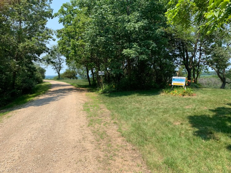
You come upon this colorful sign in a copse of trees, and although the road ahead looks a little bit higher the small white sign says no trespassing. A nearby USGS marker does identify the first sign as the summit.
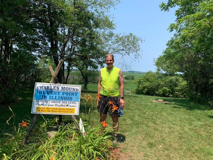
The religious theme of the sign was echoed by a couple of fellow hikers, Michael and Ann. Michael is a pastor, had brought up a Bible and recorded a brief podcast at the top, also gave me a personalized prayer that I found quite touching, despite my atheism.

Today was my sister Anne’s 64th birthday, and I tried to call her a couple times from up top, but there were so many visitors that it seemed rude to be talking. With a month’s worth of highpointers crammed into a single weekend, I think I encountered close to 50 other people. Many had seen my bike and had questions, you all know I’m unable to resist talking about myself. I spent over two hours up there.
Highpoint #35, 15 from sea level.
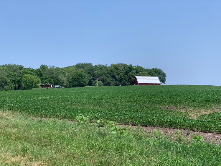
This was the best picture I could get of the highpoint from afar, it certainly doesn’t look like much.
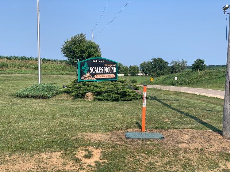
At least the nearby town of Scales Mound acknowledges its existence.
The yakking at the top and the continued corrugated landscape meant that I didn’t get into the cute town of Galena until 6 PM, and I didn’t stop. There was one more huge hill to the campground, which was first come first serve. Galena is the hometown of Ulysses Grant, I of course was unable to read the Ron Cherow biography in advance. I had thought to go back into town for dinner and to catch the fireworks, but it turned out they aren’t until tomorrow and I didn’t relish climbing that hill twice. So I settled for the local fast food joint Culver’s, which at least has pleasant picnic tables and a strong WiFi, where I’m doing this post. I was hampered by two young women having an hours-long animated conversation of escalating volume. I couldn’t really ask them to keep it down in this public place, and my annoyed looks were ignored. I wound up using my Camino earplugs for the first time on this trip.
Distance 28 miles, 3,403 total. Time 8 hours with stops. Elevation gain 1,852 feet.
©️ 2021 Scott Luria
