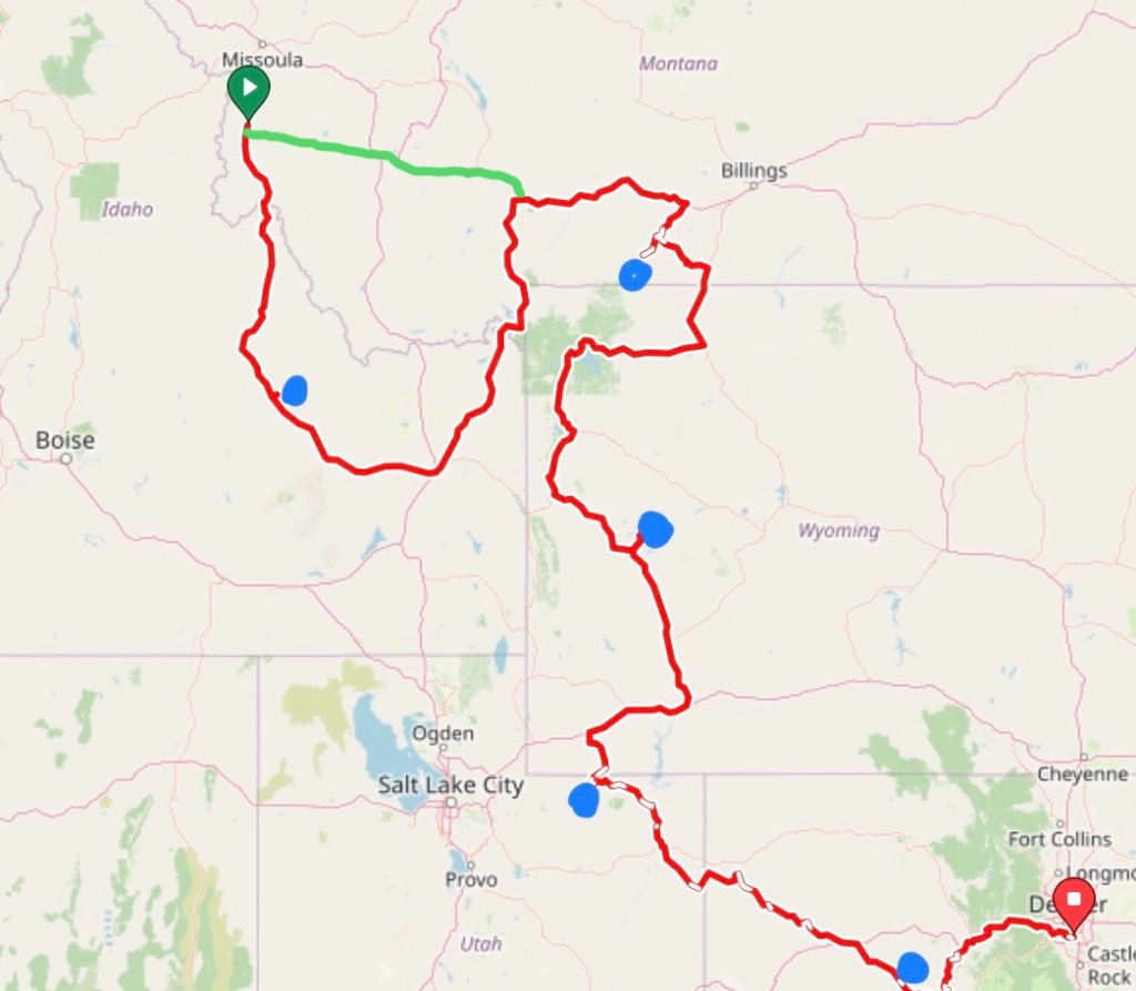
Challis to MacKay, Idaho. Saturday, June 8, 2024
This was to be the biggest day in quite a while. Climbing over another high mountain pass, and then heading up to the trailhead of Borah Peak, highpoint of Idaho.

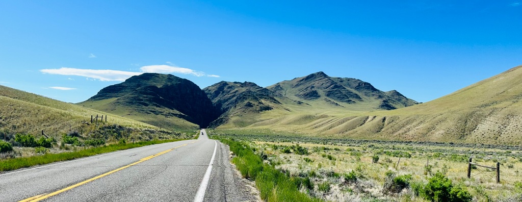
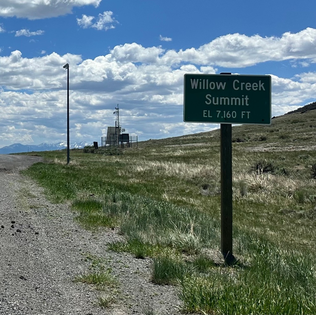
The climb up to Willow Creek Summit was not as steep as some have been, but unrelenting for 25 miles. As you can see, the shoulders were minimal (mostly gravel), and at one point it went through a narrow and dark slot canyon with limited sight distances. More of a hazard when you’re crawling uphill, and struggling to keep from weaving back-and-forth.
After four hours, I reached the first summit
and swooped down to the beginning of the second climb, a steeper 3 mile side road to the trailhead. Here, I faced a dilemma. My mapping software had indicated this would be paved, but it was gnarly gravel. Also, I had miscalculated the amount of water I would need, on that first climb I consumed more than I had intended. I only had a liter left, for a big climb and 27 more miles to my destination. If I skipped this detour, it would only be 21 miles, mostly downhill. Tempting.
But skip the detour? Getting to the trailhead was the main reason for this 250 mile loop southward, otherwise I could have taken a huge shortcut.
It had taken me a full week to get from Missoula to this point. I was not going to quit now, with just 3 miles to go. I am not throwing away my shot.
Near the intersection was a cluster of motorhomes and trailers, perhaps I could get water there. It turned out to be a construction site, not active during the weekend, and the trailers were all deserted.

The one on the left had a large red cistern, sort of a rain barrel.


I called out and knocked on the door, no answer. The cistern was about 1/4 full, I could just barely immerse my empty water bottles and fill them. The water looked clear, tasted of plastic, but it was better than nothing. And I did have that water filter Jane gave me for my birthday, never used.
I didn’t want to drink it until I had to. I found a place to remove my panniers and hide them out of sight, and proceeded up the gnarly road 100 pounds lighter. Dehydrated and bonking (the food I had needed water to wash it down), I had to stop multiple times.
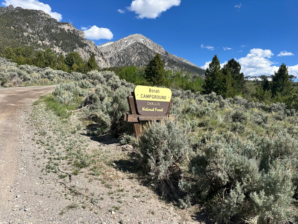
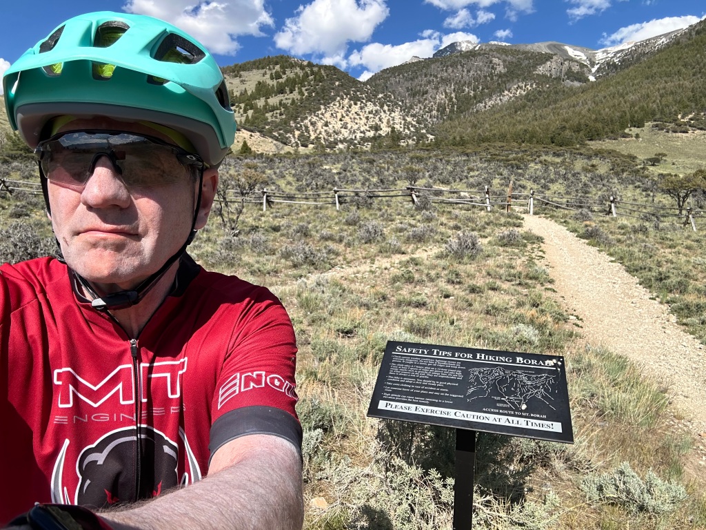
The campground at the trailhead was deserted and swarming with mosquitoes; no water, just outhouses. But I recognized my departure point; another highpoint climbed from the ocean! 37 highpoints total, 21 climbed from the sea.
Here is where I digress, to talk about my original hike. It was on the same trip in 1994 when I climbed Rainier, I was scheduled for a conference in Coeur d’Alene, Idaho. I flew into Spokane and drove nonstop to the trailhead, doing in eight hours what took me two weeks on a bicycle. I had just turned 40, which seemed old at the time, but I was comparatively young and strong.
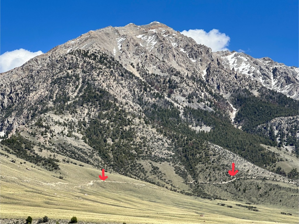
Borah is a class 3 hike. Class 1 is a hike that might be long and steep, but you can do it with your hands in your pockets. Class 2 requires scrambling, using your hands as well as your feet. Class 4 is rock climbing, requiring rope and equipment. Class 3 is somewhere in between—you don’t need a climbing rope, but you might wish you had one. The best example is the chimney section of the Knife Edge on Katahdin in Maine.

As the sign explains, the trail is unremittingly steep, climbing 5,100 feet in less than 3.5 miles. The class 3 section is Chicken Out Ridge, many people balk here. At one point you have to put your foot down to a ledge you can’t see, it takes a leap of faith. After that, however, it’s just a steep uphill slog. And for me, coming down a steep trail is worse than going up.
I did it alone on 8/8/94, and then with friends Eric and Brian on 8/8/04, when I was 50. I certainly see no need to do it a third time.
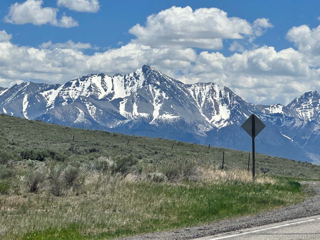
The other interesting thing about Borah Peak is the earthquake that happened there 41 years ago. Only two people were killed, by falling masonry in Challis. 6.9 on the Richter scale. You can still see the scar the fault line left along the base of the mountain.


OK, back to now. I got out Jane‘s filter for that cistern water, and was horrified to see that it didn’t work. But no, you had to saturate the filter of water first, then by squeezing hard, you could get a trickle of filtered water. It didn’t taste great, but it let me eat my power bars and get some strength back. Heading down, I came across a beautiful stream I hadn’t noticed before, and filtered two more liters of water right on the spot, drinking it all right there, throwing out the plastic water. Cool, clear, and delicious.

It was all downhill from there, that’s the thing about highpoints. Still, it was 20 more miles and I didn’t arrive till almost 9, just getting into a restaurant before it closed.
The father of the proprietor was there, a nice gentleman named Gordon, and it turned out he owned the ranch right at the corner where I was having my water dilemma. He said he would’ve been happy to give me all the water I needed. He spotted me then, and was very interested in my story and my blog. I don’t remember seeing a ranch at that corner; I had passed a number of them, but they were all down long driveways. I never dreamed of imposing on one of them. Silly. I forgotten how nice people are in Idaho, and honestly everywhere along my trip.
Distance 62 miles, 1,526 total. Time 12 hours with stops. Elevation gain 3,997 feet
©️ 2024 Scott Luria

Thank you for letting us know you are alright! May The Force be with you today!
Love,
Anne
LikeLike
Thank you for letting us know you are alright! May The Force be with you today!
Love,
Anne
LikeLike