Meeker to Rifle, Colorado, Friday, July 5, 2024
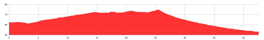
Rifle. Now that’s a peculiar name for a town. It’s named for Rifle Creek, which in turn was named because a rifle was found on its banks long ago. The creek is a tributary of the Colorado River, and I would follow the creek to the river today. As the elevation profile shows, today’s route is a gradual climb to a summit, then a 2800 foot plunge down to the Colorado.
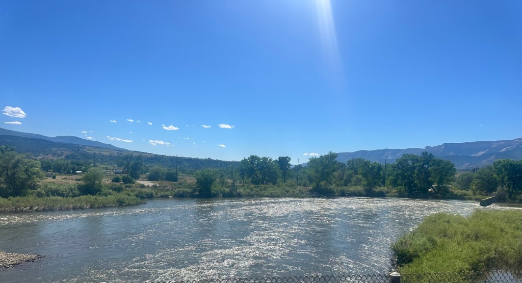
The descent was dreamy at first, with a wide shoulder and smooth pavement, but halfway down the shoulder vanished, and the pavement got rough. Not a lot of traffic, but enough to be unnerving, since I needed to take the full lane. Felt like shooting down a rifle barrel. Some spectacular scenery, but I didn’t dare stop. Again, this is Colorado, so the traffic was fully considerate, even the big trucks as they pulled entirely into the other lane to pass. Finally hit the Colorado, still fairly close to its source, but already quite big, it would go on to carve the Grand Canyon and fill Lakes Powell and Mead, before being almost completely diverted for municipal water supplies. At its mouth, it’s almost nonexistent.
Much has been written about the diversion of this great river, my favorite book is Cadillac Dreams. A significant part of its flow is diverted right at the start, in Rocky Mountain National Park, via the Alva B Adams tunnel, drilling right through the continental divide, and supplying the Ogallala aquifer under the Great Plains. In some ways, its water is more precious than gold.
I could only get a glimpse of it today from a highway bridge, but I will be following it upstream tomorrow.
Rifle is also the home of Congresswoman Lauren Boebert. Just saying.
Distance 44 miles, 2,817 total. Time 6 hours with stops. Elevation gain 1,960 feet
©️ 2024 Scott Luria
