Merrill to Hill, Indiana Monday, May 24, 2021
Poured all night, boy was I glad it I wasn’t camping. There would be a four-hour lull between the morning rain and afternoon thunderstorms, where I hoped to squeeze in today’s ride.
I had taken me too long to get here, but at least today was going to be easy. Just 45 miles to Timm’s Hill, the highpoint of Wisconsin. Once again, I had a choice of highways versus back roads; the back roads “hypotenused” across the square corners of the highways, and saved me about 5 miles. A no-brainer.
No camping and only one lodging choice in the area, a group of cabins called High Point Village. I called them, and got the impression that they were technically closed on Mondays, but Cathy, the owner, said that a cabin should be free. I gave her my usual story about the unpredictability of bike touring, I didn’t want to reserve, but I would call her once I knew I was going to make it. Her restaurant, Hill of Beans (love it) was definitely closed, she said she might be able to cook something for me but I said, no, I don’t want to infringe on your only day off, I’ll just load up on the motel swag—fruit, cellophane-wrapped muffins and Danishes, granola bars.
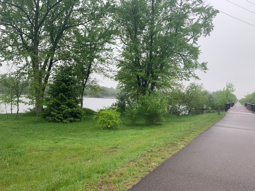
Things went bravely at first. Little Merrill turned out to be quite nice for me—a good motel, a no-fee ATM, a decent Mexican restaurant, easy laundry, nice hot tub, that pretty courthouse—and this morning, a sweet bike path called River’s Bend to guide me out of town, following the Wisconsin River.
Those first 15 miles sped by, and I was feeling great. Then all hell broke loose.
The road turned to dirt. I don’t mind dirt roads so much, I was bound to encounter them and have the right tires, but after all that rain they were pretty soft and dropped my speed from 13 to 8 mph. Not the biggest deal, but I was trying to get in before the thunderstorms. I briefly considered backtracking to the highways, but thought, no, RideWithGPS knows what it’s doing, I’ll just press on, the dirt can’t last too long, right?
Wrong. The roads kept deteriorating, my speed dropped to 4 mph, and by the time I realized my mistake I was in for a penny, in for a pound. The app allows me to download the route so I’m not dependent on a cell signal for guidance. Trouble is, the route is all it has. Sure enough, I had no cell signal at all to give me a bailout route, just the blue route line in a blank sea on the screen. All I could do was press forward.
It begs the question, why didn’t I have a paper map for times like these? In Wausau I checked at the bike store and a Barnes and Noble—nothing. Nobody uses paper maps anymore. I could hear Burt Reynolds, laughing at me.
The crummy road I was on veered right, but the app said to go straight. Huh? There was no straight. Wait a minute, a faint track through the brush did lead to a wire gate. and a sign, Private Property. You’ve got to be kidding. The road will go around, no? Without a signal, there was no telling. No choice but to duck awkwardly under that cable, and trespass. I hoped Farmer John wasn’t waiting ahead with a shotgun.
No Farmer John, but a couple of large birds—turkeys? herons? geese?—blocked the weedy track I could only walk through, and didn’t want to back down. They kept honking at me, agitated. Was I invading their roost? They were at least four feet tall, with sharp beaks. Stupid to be afraid of a couple of birds, but I was exhausted, a little scared, swarmed with mosquitoes, and trespassing. I was way behind schedule, the thunderstorms were coming and would turn this mess of back roads into a real quagmire. Well, I guess I could camp here if I have to, but there was no dry ground in sight, and that’s before the storms.
OK, one bar of cell service. Enough to get a set of coordinates, to pass on to Jane if I needed a rescue. I tried to call her, but the one bar gave out. So I pressed on warily, the birds made a fuss but eventually flew away. Wow, they were spectacular (I heard later they were sandhill cranes). In better times I would have tried to get a picture and identify them, but now I was bent on survival.
In half a mile, I ducked under another wire gate, at least I wasn’t trespassing any more. Back on the “roads”, but here’s a picture of what they were like.
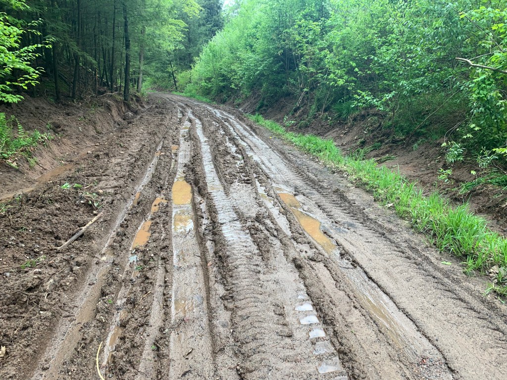
All I could do was awkwardly drag my bike through the ruts and puddles. I was hungry and dehydrated, I knew my three water bottles weren’t enough for overnight, but the only water around was in those puddles.
Eventually passed another closed gate, and gathered that everything I had been doing for the past few miles was closed. There was a maintenance building for the Town of Corning, locked and empty, but at least a sign of civilization.
There was also, thank God, a water pump out front. If the deluge hit, I could at least huddle under an eave. The water tasted funny, but I downed 2 liters and hoped there was no giardia. I crouched on a stump, wolfed down some of my motel swag, and found a chocolate bar that Steve Youker from my first warmshowers in Glens Falls, 5 weeks ago, had given me.
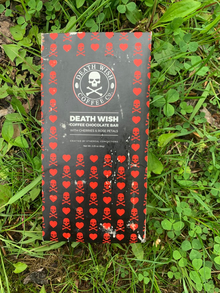
Death Wish. Yeah, that’s about right. But it tasted great, and the caffeine restored my moxie. If you’re still following the blog, thanks Steve! You might have saved my life.
After another mile of muddy ruts, I came upon a real dirt road. Still soft from the rain, but at least I could ride again. No signal, still no map to guide me, but a sign said Spirit Falls, 12 miles. I remembered that was a town on the highway I would have taken if I hadn’t hypoteneused.
Words can’t describe the relief I felt. See you later, RideWithGPS. In 12 miles I was back on the highway, no signal but there was a paper map (YES) on a bulletin board that showed it was about 12 more miles to Timm’s Hill. By now it was pouring, and already almost 4PM, but no thunder and the caffeine had definitely kicked in. The highway was so smooth, good shoulder, easy hills, almost no traffic—why on earth hadn’t I chosen that option from the beginning?
My odometer again stopped working in the rain but I had that map in my mind. As I always do when I approach these minor high points, I looked for an impressive view of it from afar. Nothing but forested hills, and after about an hour I saw a tiny sign, Hill of Beans Restaurant, pointing off to the left. No other indication I was close to my destination.
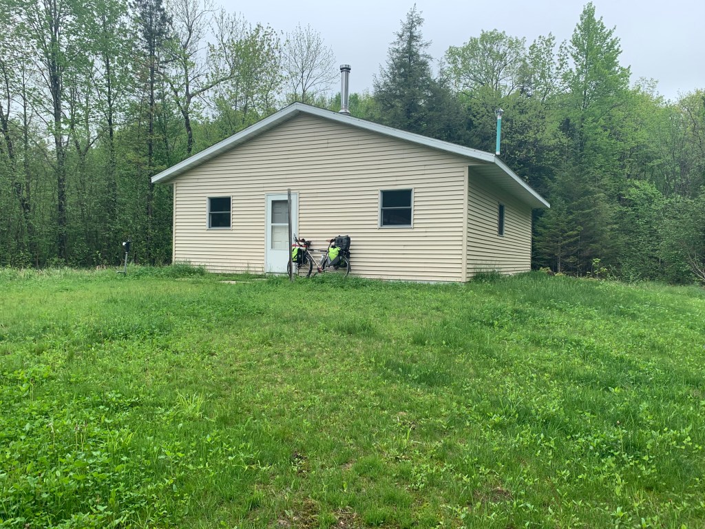
In two more miles I was at Highpoint Village. It was now 5:30 PM.
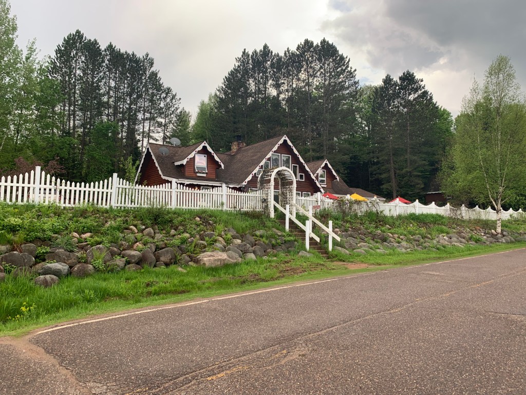
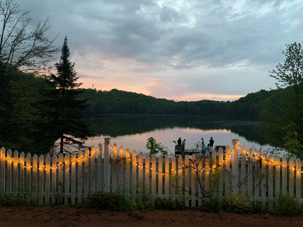
Adorable, with a view of Timm’s Hill across Bass Lake, but signs saying Closed. I’d tried to call repeatedly from the road, but no signal. Great. Well, I could run up the highpoint and go another 6 miles to the next town, where supposedly there was a motel. No way to call and make sure.
Hope against hope I found a back door open, and called out “hello?” To my immense relief, Cathy, the owner appeared. A “trail angel” if ever there was one. She’d wondered about me, her son had spotted a bedraggled biker on the highway. Sure, I could stay there. And sure, she could make me a meatball sandwich, a salad, and she had some root beer. I protested weakly, no this is your one day off, but how could I turn her down? I’ve rarely had a meal that tasted so good.
She loaded my blog (she had WiFi) and checked out my podcasts as I wolfed down my meal. She had many stories to tell, much more impressive than mine, of highpointers that had come through. One was a guy who had met someone in a bar who needed a kidney transplant. Right away he became a kidney donor, and was biking across the country as he recovered from the surgery. Wow.
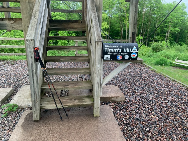
Now fully revived, I still had time for the highpoint. A two mile loop circled the lake, and went up the 145 foot climb to the towers. I had the whole park to myself.
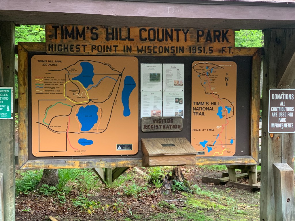
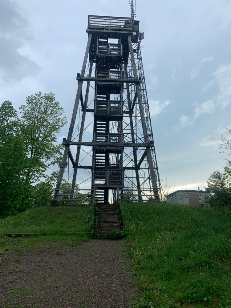
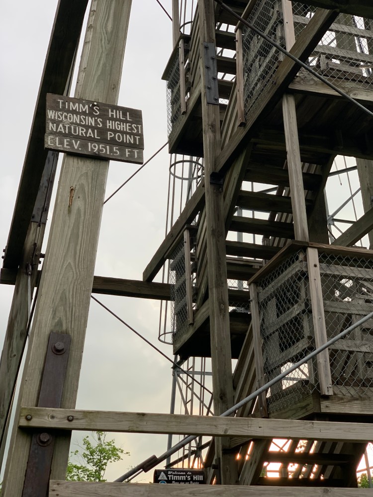
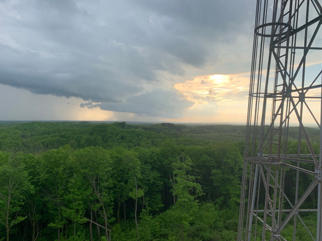
Timm’s Hill resonates with me, Tim the Beaver is my college mascot, the school name spelled backwards. The original fire tower is higher, but has a scary steel ladder, and not the best choice with thunderstorms around. Let’s face it, I shouldn’t be on a mountain at all. But the lower wooden tower had fine views anyway, my first vistas from any highpoint this trip.
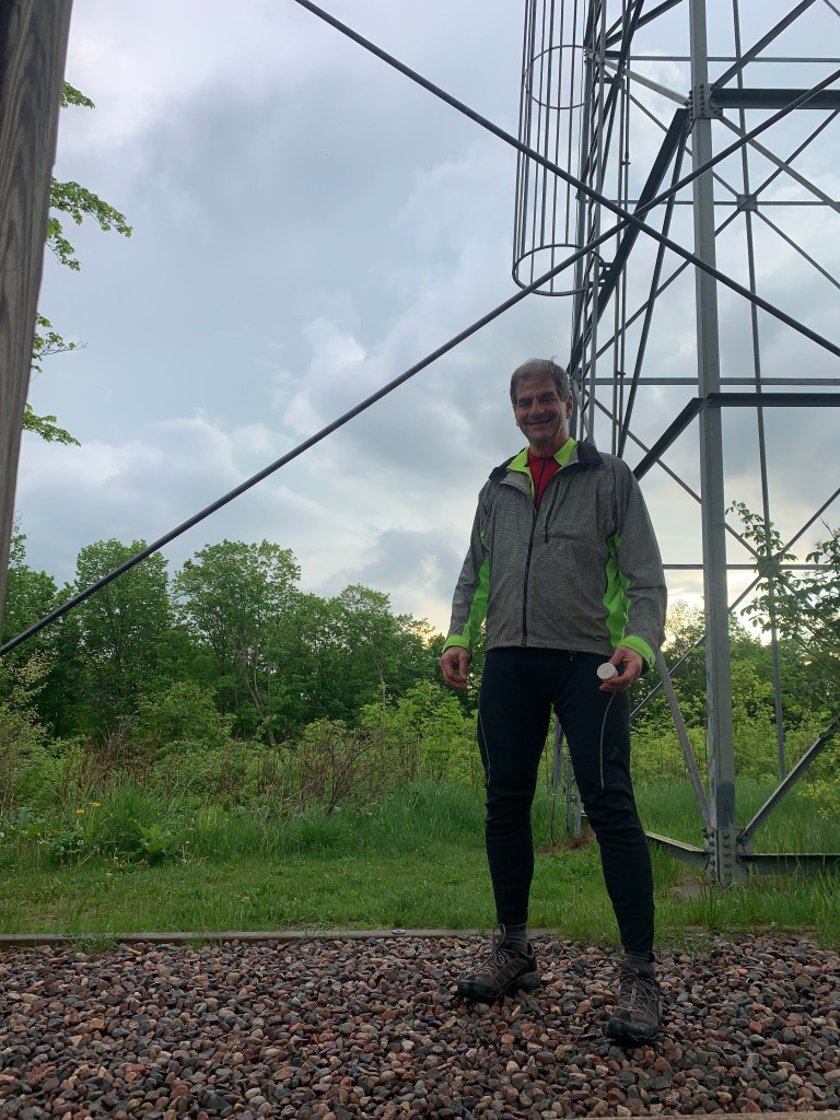
I did the obligatory ash-scattering, and signed the log in the mailbox, while dodging intermittent cloudbursts. Highpoint # 32 for me, my 10th from sea level. Back at the lodge, at sunset, I marveled at how pretty this place is.
Still, this was supposed to be one of the easy ones. Jane is right, I catastrophize everything. Campbell Hill had the “Momma said there’ll be days like this” drama, Hoosier Hill had the Rain Man debacle, and now this. The next two highpoints are known for being trickier. I wonder what adventures lie ahead. One thing for sure, no more dirt roads, if I can help it.
Distance 51 miles, 1,739 total. Time 9 hours with stops. Elevation gain 1,992 feet

OY Scott! Oy!! Here is hoping you have firm (and open!) roads ahead! Hang in there! Just remember these hard days become part of the greater adventure and make the great days that much sweeter. At least they weren’t any dogs to trouble you – or shotguns!
Also, you are looking mighty fine in the photo! I think you’ve lost more weight. Good for you!
Love,
Anne
LikeLike
Loving reading these blogs everyday. Keep them comin cuz… that mud looked crazy. You look great. Can’t wait to see tomorrow post, or is it today? Either way your doing awesome. Do you have a map of what is your ideal way of traveling everywhere or are you relying on GPS to tell you daily? Will you go thru Oregon? Will u go thru Klamath Falls? If so I know some people that could give you a place to stay and food on your belly. Love you.
Estela
LikeLike
Got to say you are a caution! Old Downeast term. Look forward to you posts each day!
LikeLike
Now, isn’t there at least one four-leaf clover behind that coffee chocolate bar?
Everything turned out all right, so I am sure that there was. You were just forgetting to smell the muddy roses!
LikeLike