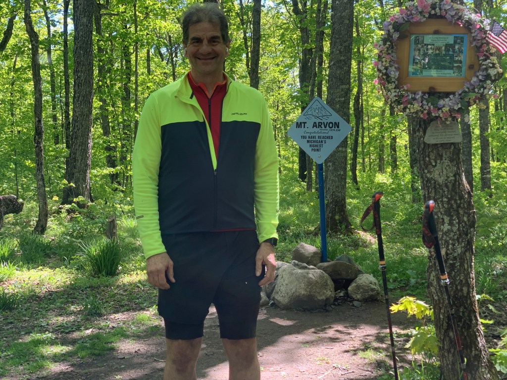
Ascent of Mount Arvon, Michigan Saturday, May 29, 2021
I can’t seem to find this photograph, but it remains indelible in my mind. On May 29, 1981 I am standing, sweating in my acetate shirt (why was that ever a thing?) and my cap, gown, and green hood, next to my beaming mother and my relieved father; clutching a piece of paper, just awarded by George Washington University.
I didn’t really know what I was getting into at the time, but 40 years later, I have to say, it was a great ride (technically, I stopped being a doctor on March 31, 2020 when I retired, although I am still fully licensed and board-certified, and have done a little perdiem work since then). And what better way to celebrate then to pick off another highpoint?
Mount Arvon is one of the silly ones, like all of the ones so far this trip. It’s fully wooded, the only view on top is courtesy of a chainsaw. It’s only been the highpoint since 1982, before that Mount Curwood was listed in the maps, but Arvon was found to be 11 inches higher. The motel clerks and restaurant personnel I mentioned my plans to, who’d grown up around here, had never even heard of it. Still, I was excited to do it, and celebrate this arvonersary (ouch).
Google Maps says it’s just 17 miles away, and 1100 feet of climbing. But as I mentioned, all of the trip reports said don’t rely on your navigator, you’ll just get lost in a tangle of lumber roads. The route to follow is the one I had downloaded from the visitor center yesterday. More roundabout, but it gets you there, and is marked by signs.
Yeah, but it’s twice as long and more than twice as much climbing. No matter, it was a beautiful day and my spirits were fortified by the double breakfast I’d had at the Hilltop Restaurant. Check out their legendary sticky buns.
Maybe fortified wasn’t quite the right word. I felt those buns sloshing around in my gut as I slowly cranked up the dirt roads, but I was still happy. The bike was newly light and nimble, stripped of all but the gear I’d need today. The roads, which I had heard could be problematic, were recently graded and in great shape, and I was hopeful of being able to bike all the way to the top.
It was not to be. I have super-low gearing for the steepest stretches, but that means I’m going so slowly that I weave around from side to side. There was a fair amount of ATB traffic on the road, and though they courteously gave me as much room as they could, it still meant that I had to stop on the steep parts, then walk to a flatter section so I could get started again. I gave up with about 2 miles to go, and switched to my hiking boots and poles, locking the bike to a tree.
Actually, it felt good to be hiking. As I walked along, though, I remembered that this was also a somber anniversary. Two years ago my great friend and mentor, Dick Bail, died of metastatic hepatocellular carcinoma, caused by chronic hepatitis C that he had contracted while doing humanitarian work in Africa.
I had the summit to myself. Well, me and the bugs, just barely held at bay by the repellent.
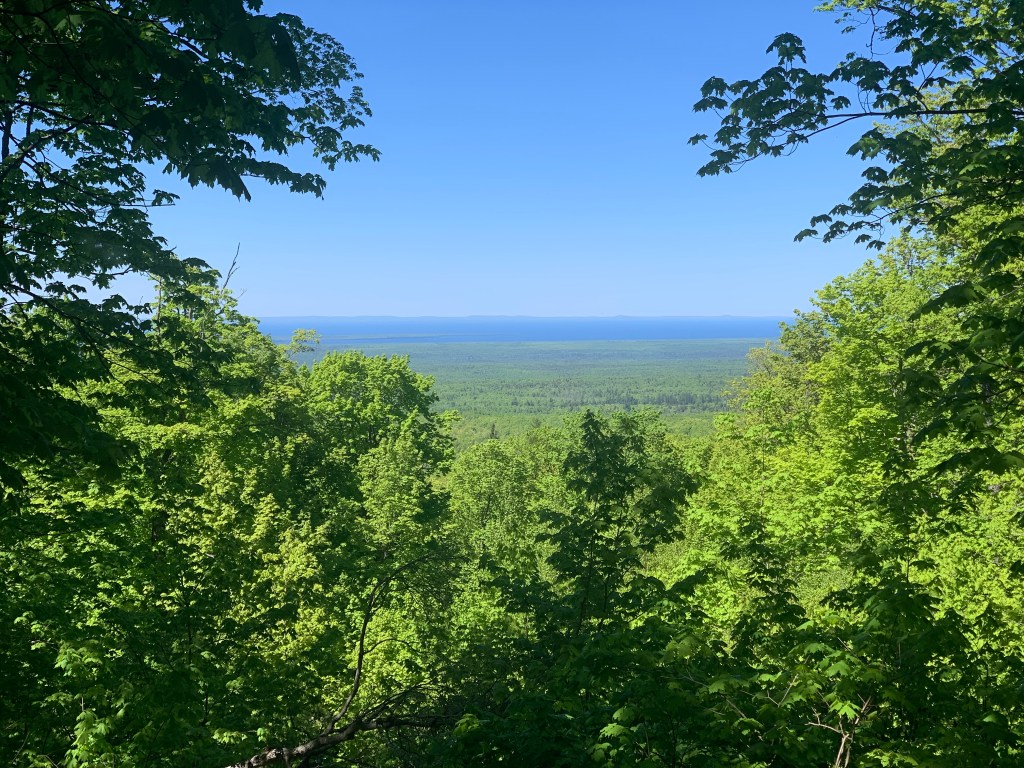
Here is the chainsaw view of Lake Superior, if you zoom in you can see that the distant shore is the Keweenaw Peninsula, I will be traversing those hills tomorrow. Ugh, that’ll be 82 miles.
Distance 58 miles, 1,974 total. Time 9 hours with stops. Elevation gain 2,923 feet

Almost didn’t recognize that handsome, svelte guy. You look great Scott.
LikeLike