Grand Marais to Tofte, Minnesota Thursday, June 3, 2021
So I was searching for an appropriately goofball title for today’s ascent of Eagle Mountain, not easy to find, an eagle is not usually a goofball icon. Then I remembered Eddie the Eagle, the sentimental favorite of the 1988 Calgary Olympics, a ski jumper from England, he came in last place but was everybody’s darling. I guess there was a movie made about him a few years ago, I didn’t see it.
Anyway, this map shows my dilemma.
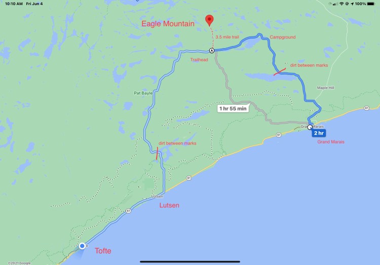
The simplest thing to do would have been to leave my bags at the hotel and just go up and down. However, the whole town was fully booked (more about that later) and nobody wanted to hold my bags unless I was staying there. So I was going to have to drag all my equipment up 1100 of the 1700 foot elevation gain.
My old bike app, RideWithGPS, recommended the route in grey, but I’ve been burned before (see Timm’s Hill, 5/25) and I wanted to check with the visitor center to see what they thought, they didn’t open until 10. Sure enough, they recommended the route in blue, said most of the climbing would be on a paved road, it was only 3 miles longer. Couldn’t find any campgrounds online, and most of the motels were full, but I did find an AmericInn in Tofte who said they had rooms, that I wouldn’t need to reserve, and I could arrive late. Good enough.
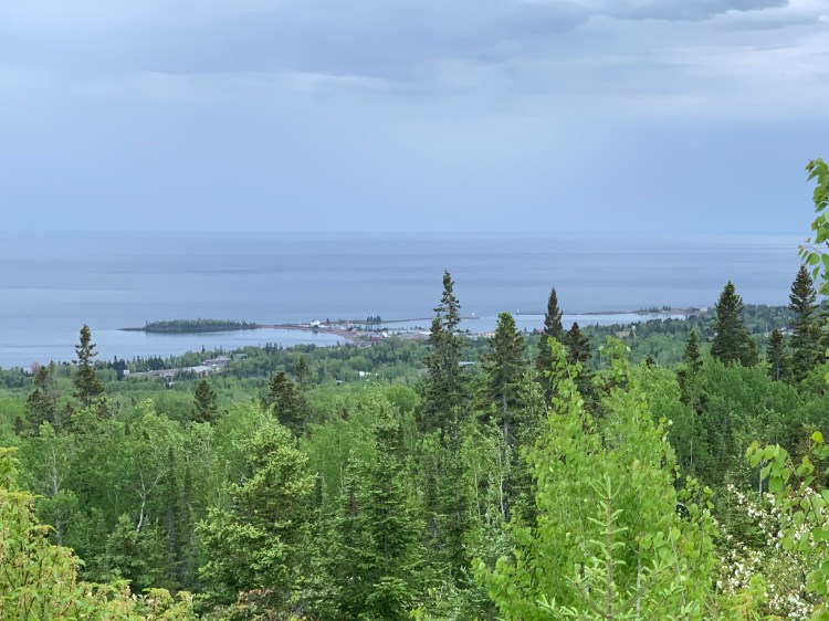
The paved part of the climbing was on Gunflint Road, sounded ominous, and indeed it was. It was quite steep, and shortly there was no shoulder at all, just soft gravel, with dozens of trucks rumbling by. I wound up having to walk about 2 miles, although I did reach an overlook of the Harbor.
Finally off that busy road, but just before the pavement gave out I found that my drive belt (instead of a chain, I’ll elaborate on the details of this bike later) had derailed. In the 8000 miles I’ve ridden this bicycle, that had never happened before. Easy enough to fix, I but I was reminded of an important maxim in medicine. Congestive heart failure is a syndrome, not a diagnosis, you always need to find out why, such as valvular heart disease, coronary artery disease, hyperthyroidism, cardiomyopathy, etc. So too with the bicycle, I had to find out why.
Flipped the bike by a road sign, glad I had already put on bug repellent. The answer became clear soon enough, a small pebble from that gravel road had lodged in the teeth and popped it off. Simple to fix, but important to tension the belt properly so it wouldn’t happen again. This is accomplished with an app on the iPhone similar to how you tune a guitar. You pluck the belt and aim for between 35 and 50 hertz. Not so easy when the cars and trucks were rumbling by, making too much background noise. The whole operation took about an hour.
Already sweating quite a bit, I was concerned perhaps I hadn’t packed enough water. I came upon a lovely National Forest Service campsite, with lakeside sites for just $10, it was tempting to leave my bags there. But the trailhead was still 6 miles distant, and I didn’t want to backtrack. Instead I just drank lots of their water and filled up all my bottles.
The trail head had seven cars (some had left by the time I took this photo) and a kiosk where you had to apply for a free backcountry permit.


There was also, thankfully, a picnic table which meant changing from “biking mode” to “hiking mode” was lots easier. I locked the bike deep in the woods and got started.
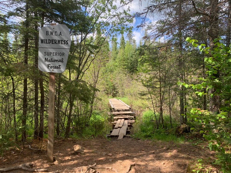
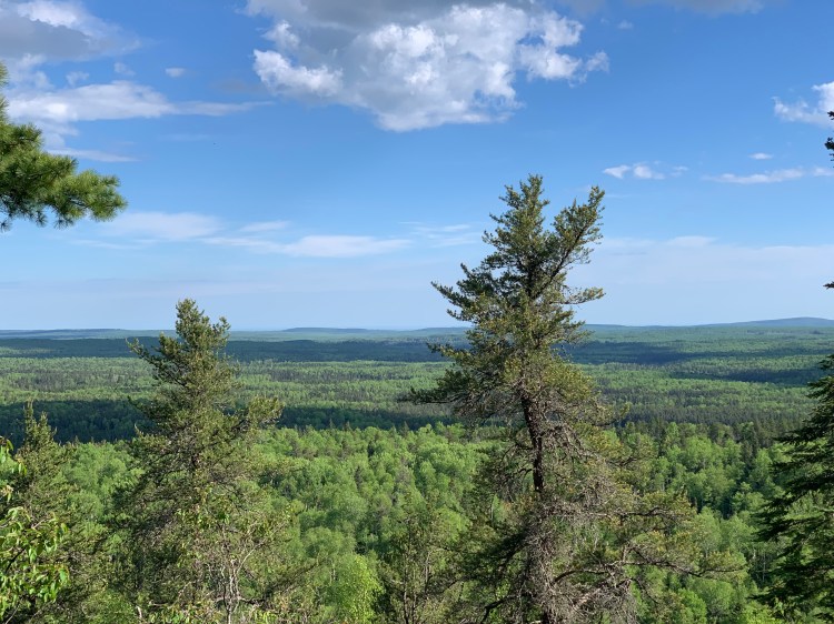
Right off I encountered a family, all wearing headnets, and looking completely wiped out. I was glad I had applied another layer of DEET. The trail was rocky but reasonably flat for the first 3 miles, passing a wilderness boundary, lots of puncheon, and coming out onto a beautiful lake.
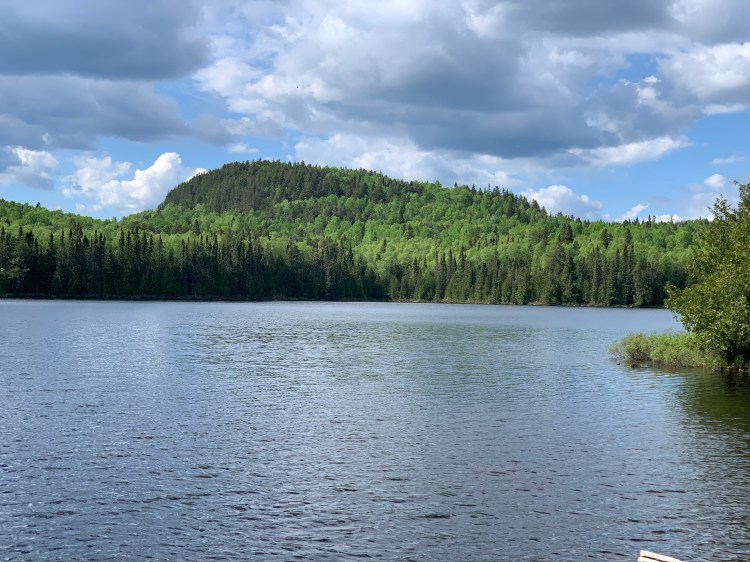
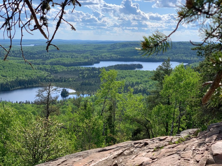
I chatted with other hikers, including a couple who were very glad to borrow my insect repellent, and gave me tips about the somewhat confusing path to the actual highpoint. The trail does have a slightly rocky climb at the end, but it’s only 600 feet. You pass a couple of gorgeous viewpoints along the way, but the summit itself is completely wooded.
Sharp-eyed readers will notice that my “Highpoint from sea level” count jumped from 11 to 14. More about that later.
By now it was 6 PM, and the sun was setting at nine. I knew I had a long way to go, but had adapted a cavalier attitude today, I would just find a place by the side of the road, there are lots of establishments that don’t advertise on Google Maps. I had all this camping gear I had not yet used, in a pinch I could set up a “cowboy camp” on a flat space. I considered going back 6 miles to that good campsite, but just couldn’t get my head around backtracking like that, with all that weight.
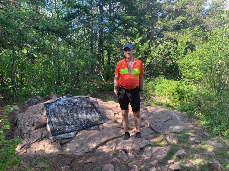
I even got cocky, sending texts and emails, calling home, chatting at length with the hiker Mike (who took my picture) and his beautiful husky. After a few antalgic miles, I was delighted to be hiking fast. Even so, I didn’t get back to the trailhead and back into biker mode until 8:45. There were 21 miles to go down to the lake, 17 of which were still on dirt roads. Mike thought I’d find campsites along the way, as I had on the way up.
It got completely dark after a few miles. I was happy to see my generator headlight, always on, did a fine job of lighting the dirt roads, even going down fast. The taillight gave the few cars who passed plenty of warning. I noticed the stars were absolutely spectacular, but I had other priorities. I passed a number of signs, had to stop and hoist the front of the bike so the headlight trained on them, saw that none were campgrounds. Finally I hit the paved road, got pretty chilled streaking down. My water was totally gone, the only fluid I had was that can of whup-ass (the “nuclear option” Starbucks Double-Shot Energy), but didn’t want to use it, I wanted to have a chance of sleeping at least a little bit tonight. I finally got a signal, and texted Jane I was safely on pavement.
It was midnight when I hit the resort town of Lutsen, nothing was open or had vacancy. The general store at least had a bench where I could put on warm clothes. Hope against hope, I called that AmericInn in Tofte. Yes! They still had rooms, and the only place that had a front desk person there all night. Ten more miles, but along that great costal highway with good shoulders. No wind, 53 degrees.
Just then two huge busses pulled up to the store, asked if I had any water. They had just transported a load of seniors to the resorts at Grand Marais, had to get back to southern Minnesota, but were overheating and needed water. I told them I didn’t work there, and needed water too. We found a spigot behind a real estate office next door. Tasted funny, but must have downed two liters, and was able to choke down some of my trail snacks.
I knocked on a few motel doors enroute to Tofte, to no avail. Got into the AmericInn at 1:30, but life wasn’t quite done jerking me around. The only rooms they had were on the second floor, no elevator. Taking the bags off is an ordeal, so I just moosed the 100 pound bike up the stairs. The desk clerk apologized, offered to help me, said she used to work in maintenance and was quite strong, but I was too much of a chauvinist to let her. My back didn’t protest too much. Had a nutritious dinner of fruit and root beer, then slipped and fell in the shower like an old man. Shoot, my shoulder hurt, I’d had rotator cuff surgery in 2003. I checked the Empty-Can, Hawkin’s and Neer’s signs, seemed OK, took the rest of the shower while sitting in the tub. Scottie the Geezer.
Distance 63 miles including 7 miles of hiking, 2,172 total (decided to include those 6 miles in Niagara Falls as well). Time 15 hours with stops. Elevation gain 2,500 feet.
©️ 2021 Scott Luria

You are a brave man. No geezer in you.
LikeLike
Former patient here. I am thoroughly enjoying your stories (though I occasionally have to pause and look up things like “Empty Can,Hawkin’s and Neer’s signs”).
LikeLike