Bellingham to Marysville, Washington. Saturday, April 27, 2024
Or maybe I should say water zero. Part of this little conceit I have about the highpoints is that I want to start from sea level. So whenever I begin a new leg, I have to “zero out” at an ocean or some place contiguous with one. For instance, before climbing Mount Washington in 2020, I dipped a toe in the water at Goose Rocks Beach, one of the prettiest in Maine.

The blog post for 4/19/21 shows me zeroing out at the Hudson River at Troy, which is still tidal at that point and therefore also at sea level, before I did the 10 highpoints on that trip.
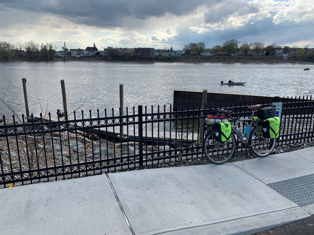
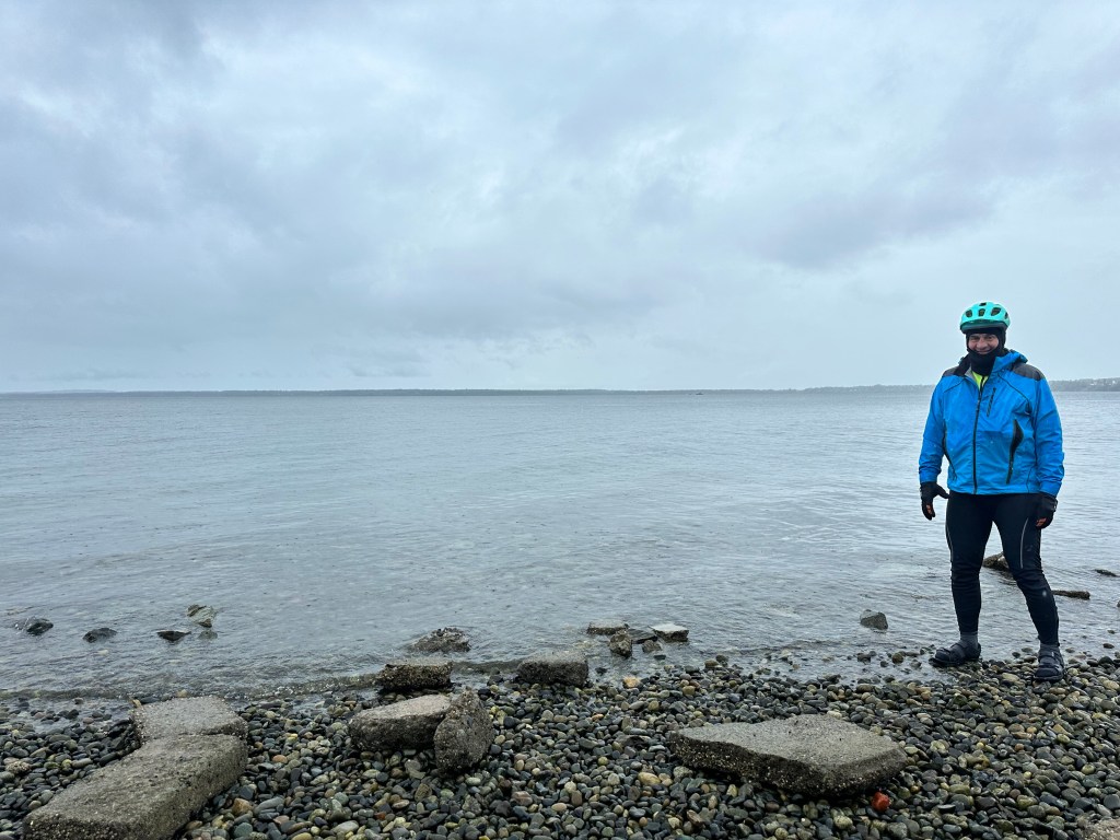
For this trip, I had to zero out at the Pacific. I’m not sure when I’ll get another chance, I’ll be near the ocean quite a bit but often on a high bluff where accessing the beach is problematic, especially in cycling shoes. As I left Bellingham today, Andy suggested a spot in the harbor, and a couple of women were very kind to take my picture there. This is Bellingham Harbor, above Puget Sound, and therefore part of the Pacific.
And while we’re on this sea to summit thing, I might as well show you a helpful visual. When I retired in 2020, my resident firm (nine residents who I had precepted for three years) gave me a lovely gift, a map of the state highpoints, with little pins to stick in when I completed them—gold, silver, and bronze. This is a smallish picture, but high definition, you can zoom in if you like.
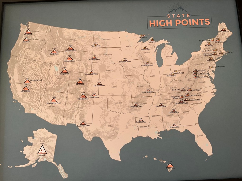
The gold pins show the highpoints I have done from sea level, 19 in all. The bronze pins (which I thought looked prettier than the silver, which look almost black) mark the big boys: major peaks like Denali, Rainier, Whitney, and others in the Rockies or Appalachians, each was a major undertaking, four of them required professional guides, but in each case I left from a trailhead or parking lot that I had driven to (or in the case of Denali, flown to an a ski plane). Therefore, I did not do these 13 from sea level. The silver/black pins mark the hall of shame, the five peaks I simply drove up.
My overarching goal then, is to turn all of the pins gold, including the 13 I have not done. Alas I am too old to climb those western big boys again, so in the twisted rules of this game (which matter only to me) I hope to bike to the starting points from before, thereby claiming I climbed them from sea level in two stages. Lame? Convoluted? You betcha. The first such gambit I hope to do is to bike to the Paradise Inn, where I started my Rainier climb 30 years ago.
Moving from the ridiculous to the sublime, today’s ride involved two gorgeous byways, Chuckanut Drive and the Centennial Trail, hilly but dazzling. There’s nothing like a glassy smooth-rail trail to lift your spirits. The elevation profile showed that the two were linked by a nice flat stretch.

The flat stretch turned out to be the hardest part of the trip. Crossing an open plain with no trees for shelter, I was exposed to a steady 50° rain and a 20 mph headwind, that slowed me down to under 7 mph. It was manageable if I got into a full tuck, but this early in the ride, I could only maintain that for a few minutes, my thighs were kneading my gut like bread dough.
Which of course brings up the other objective of the trip, it’s a fat camp. I lost 40 pounds in 2021, despite eating all manner of indulgent foods. Now that I have celiac disease, I’m eating more carefully, so hopefully the lard will come off even faster.
Distance 60 miles, total 120. Time 8 hours with stops. Elevation gain 1,914 feet
©️ 2024 Scott Luria

So grateful you are back on course and once again being helped by the kindness of strangers!
Love and strength,
Anne
LikeLike
Remember the scene from “the birdcage“ where Nathan Lane‘s character says, “I know how ridiculous I am”. I love your humor and self-awareness as you navigate your way to the ends of the Earth, the Scott de Lima Luria way!
Love,
Anne
LikeLike