Cody to Pahaska Tepee Resort, Wyoming. Thursday, June 20, 2024
Almost exactly 3 years ago, I did a post from Wisconsin titled “Uh, Doc, West would be THAT way”. I was heading due east, precisely the wrong direction, to kill time while I waited for the Illinois highpoint, Charles Mound, to open up.
I could have a similar title for today’s ride, heading due west when my ultimate destination is the East Coast. This time it’s because my next highpoint is Wyoming’s Gannett Peak, and the trailhead is west of the divide. I will need to go through Yellowstone and Grand Teton parks to get there, and as I mentioned yesterday, this is the safest way in.
I have only entered Yellowstone from the east once before, 47 years ago in 1977. My girlfriend and I had just driven cross-country in 48 hours, in a maroon AMC Pacer
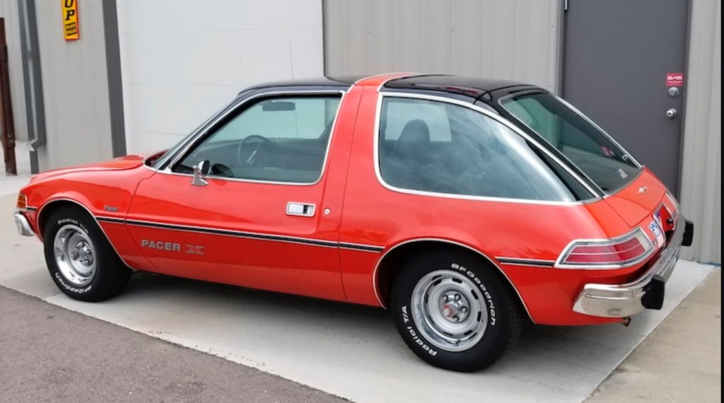
from Boston to the Black Hills. The next day I climbed Harney Peak (now called Black Elk Peak, see my post https://scottluria.org/2021/08/06/black-elk-peaks/https://scottluria.org/2021/08/06/black-elk-peaks/ ) and that same day we saw Devils Tower and drove across northern Wyoming, so sleep-deprived we were searching for a place to snooze in the car. The Buffalo Bill Museum in Cody did not allow overnight parking, so we drove to a parking area on the reservoir. The upshot is that we never saw how beautiful this entrance road is.
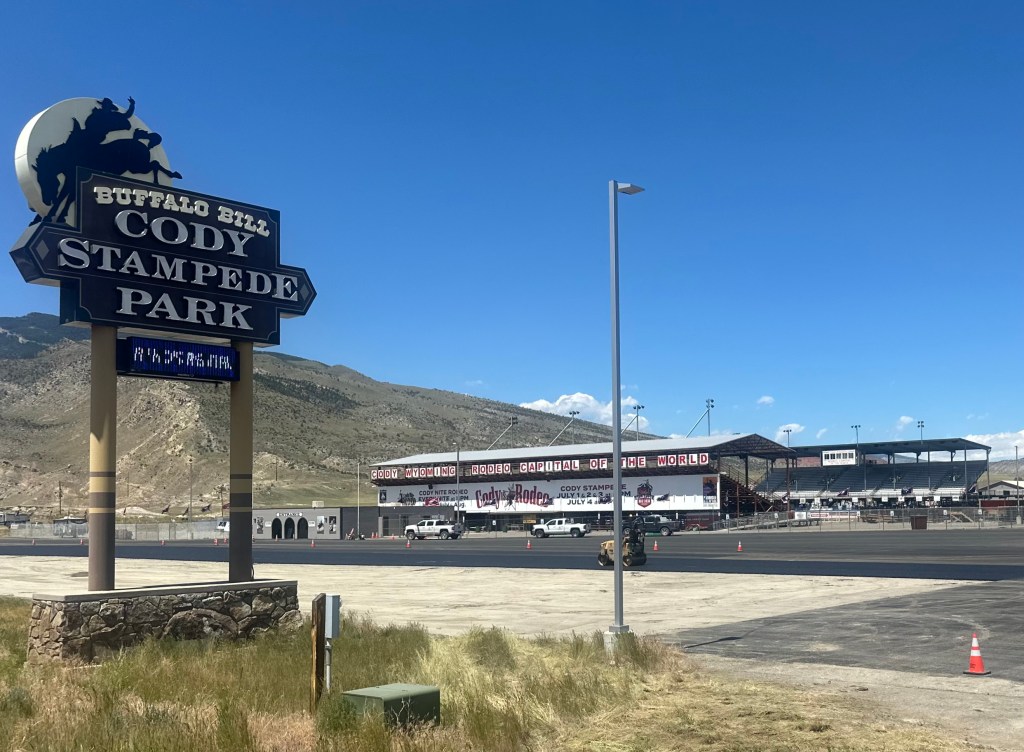
I was very late leaving Cody, had to find a place to buy bear spray, frustrating because it’s possible to rent rather than buy, but not from anywhere on the east side of Yellowstone. I wound up having lunch and an ice cream in Cody also, so I really didn’t get rolling till 1 PM. 4 miles out of town, I passed the venue for the rodeo I’d blown off yesterday.
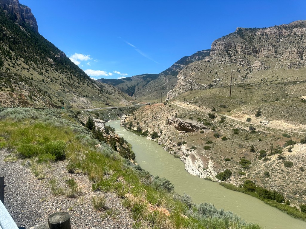
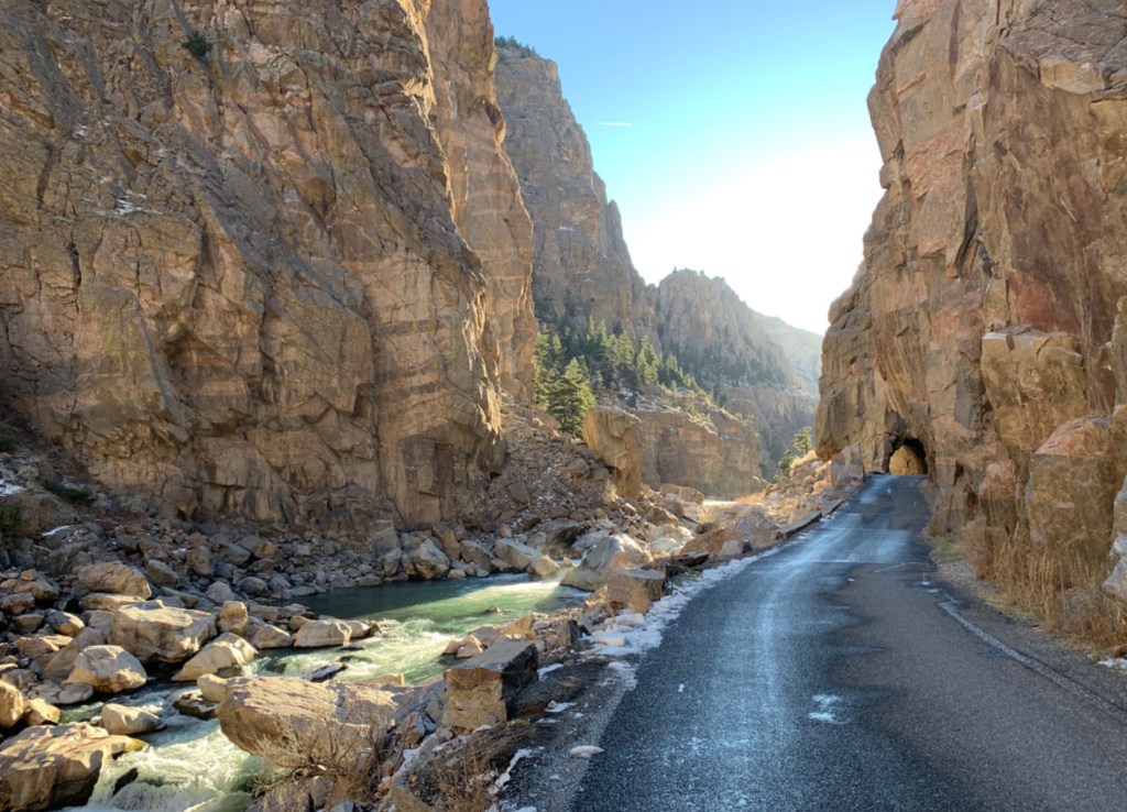
The east entrance road to Yellowstone follows the Shoshone River, which has carved itself quite a canyon.
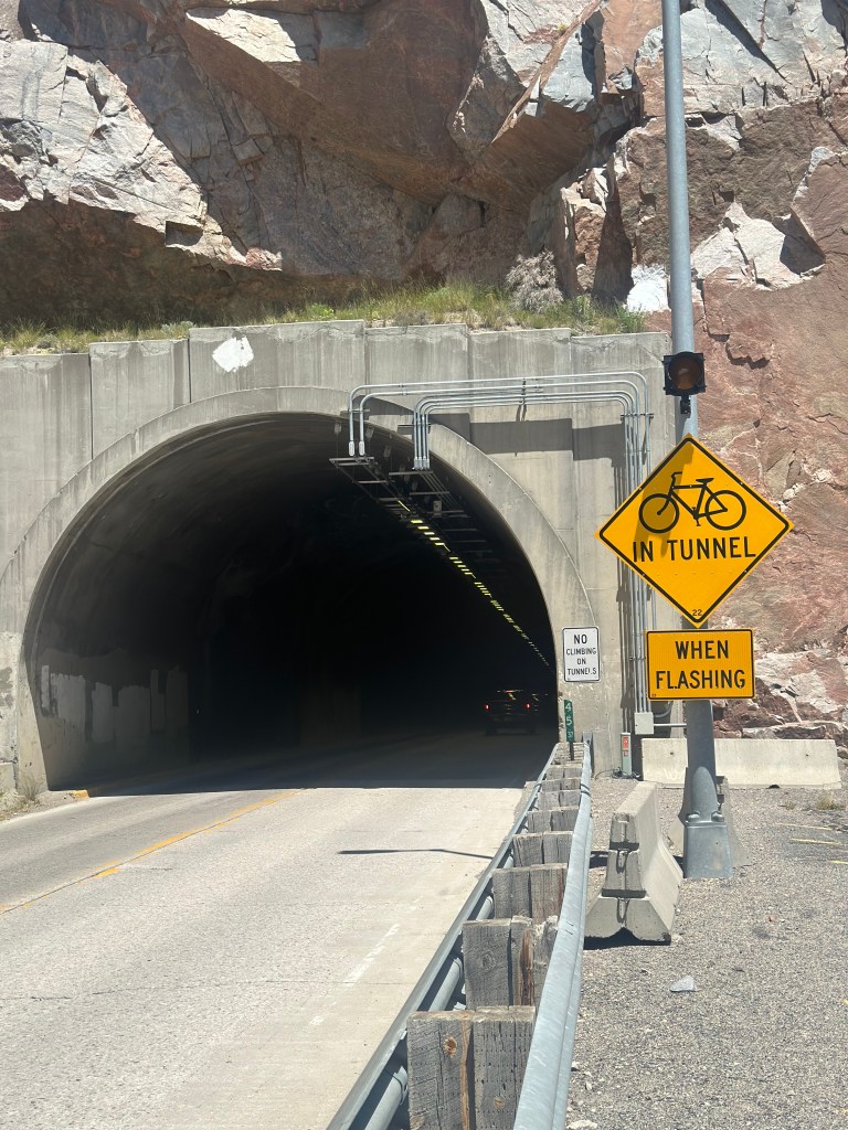
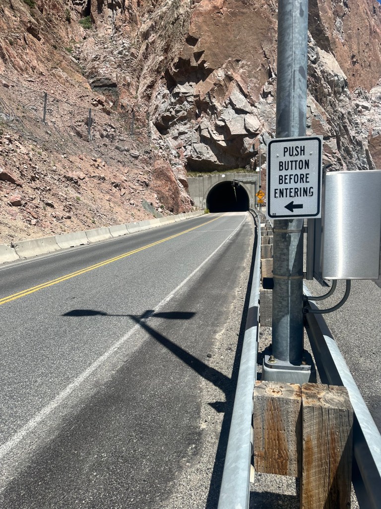
Shortly the road pierced the canyon in a series of tunnels, made less scary because you could activate a flashing light to alert the motorists.
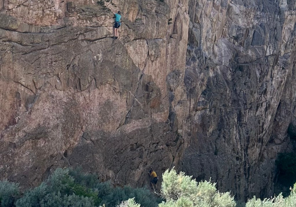
Between two of the tunnels was the area where we practiced for the Granite climb in 2016. These were harder pitches than we did.
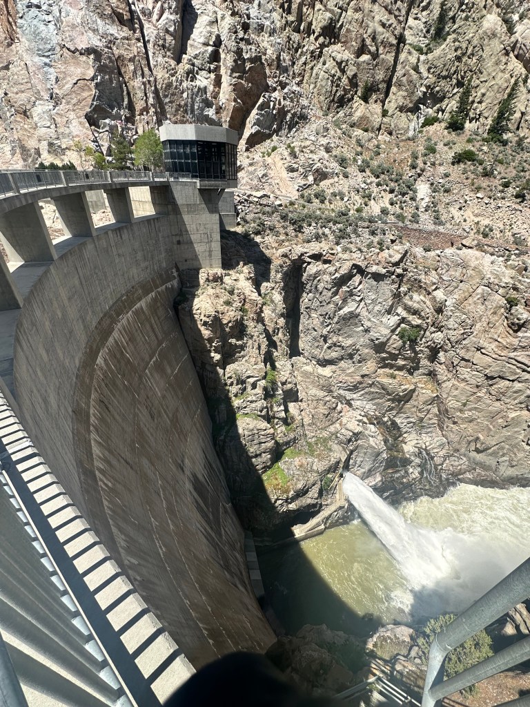
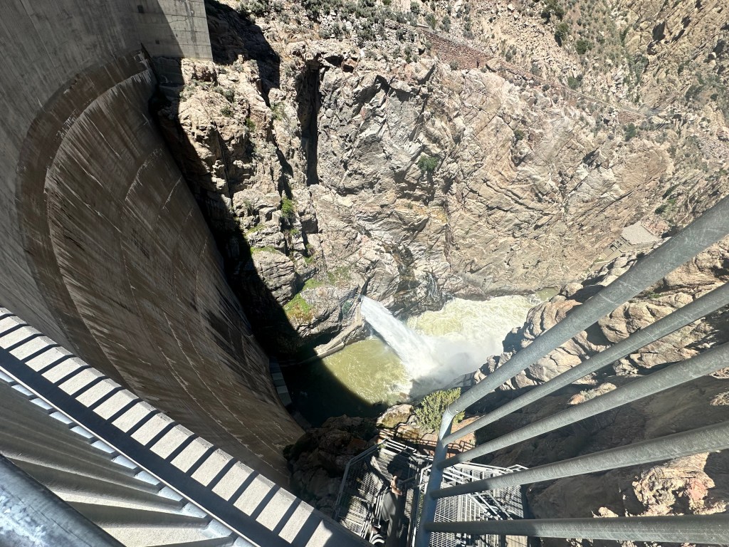
Next was the Buffalo Bill Dam, which when it opened in 1910 was the tallest dam in the world. These pictures don’t really do it justice, too close to get a perspective. Seems like a smaller version of the Hoover Dam.
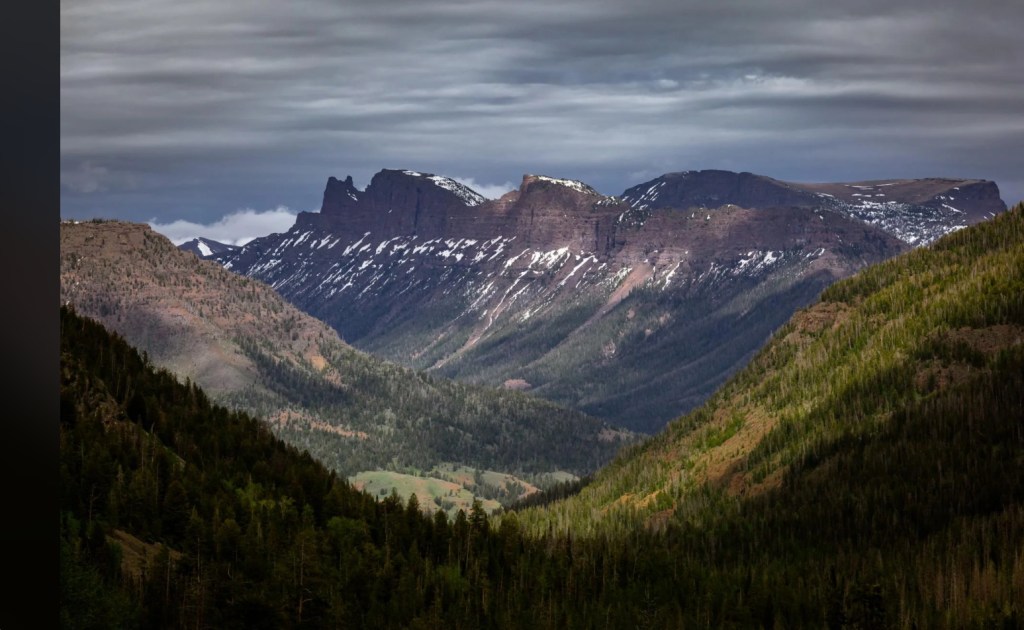
The reservoir went on for 7 miles, and delayed my climb towards Sylvan Pass, the lower version of the Beartooth Pass I passed on yesterday. It was pretty late now, and I’m sorry to say I didn’t take any more pictures of this spectacular canyon. Here are some that I got from the web.
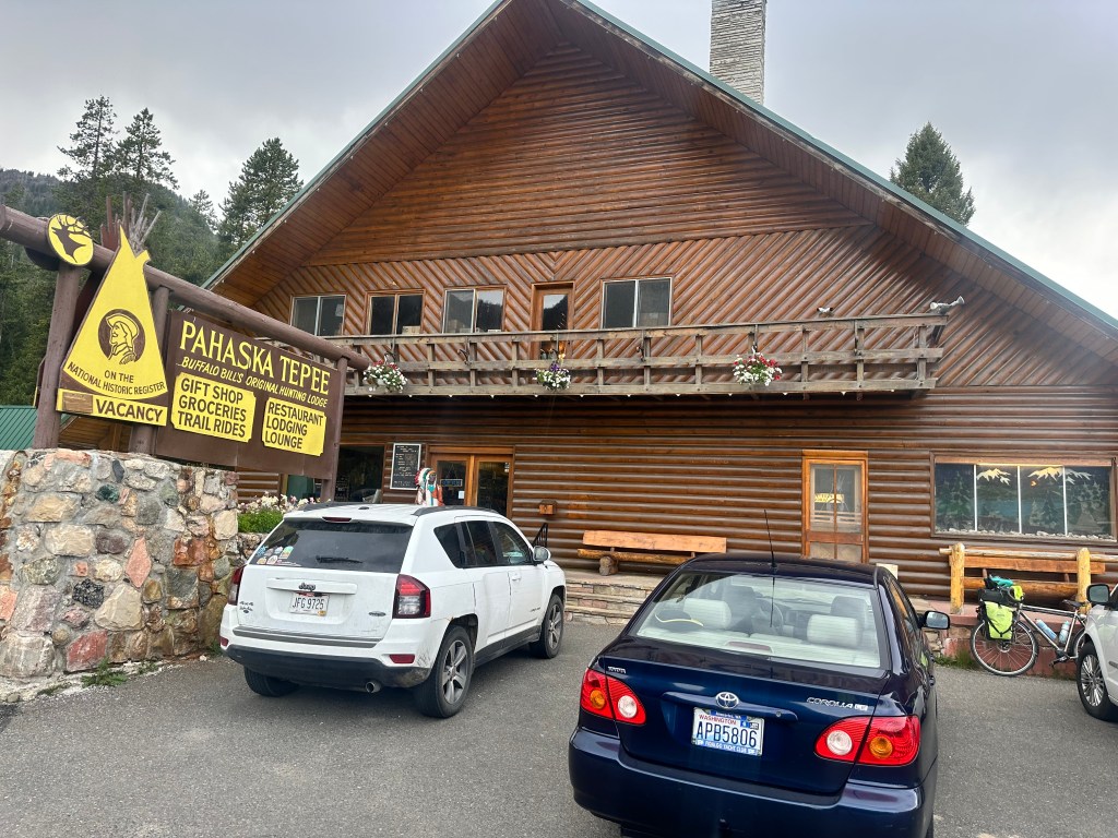
At one point, there was a beautiful bison right by the road, but it was at the bottom of a hill and I didn’t want to stop my forward progress. Almost felt like cheating, I’d been warned of the headwinds on this road, but for me it was a gentle tailwind, and made the 2,800 foot climb seem almost easy. I got into the Pahaska Tepee Lodge (the original hunting Lodge of our friend Mr. Cody) at 7 PM, happy to have a place to sleep inside. It was going down to 35 tonight and bears were active in the area. I don’t ever want to have to use that bear spray.
Distance 51 miles, 2,232 total. Time 7 hours with stops. Elevation gain 2,795 feet
©️ 2024 Scott Luria

Good job, Scott. Keep on pedaling. Here in Bryce Canyon area we see many bikes, but almost all are e-bikes.
LikeLike