Buffalo to Belle Fourche, South Dakota Monday, August 2, 2021
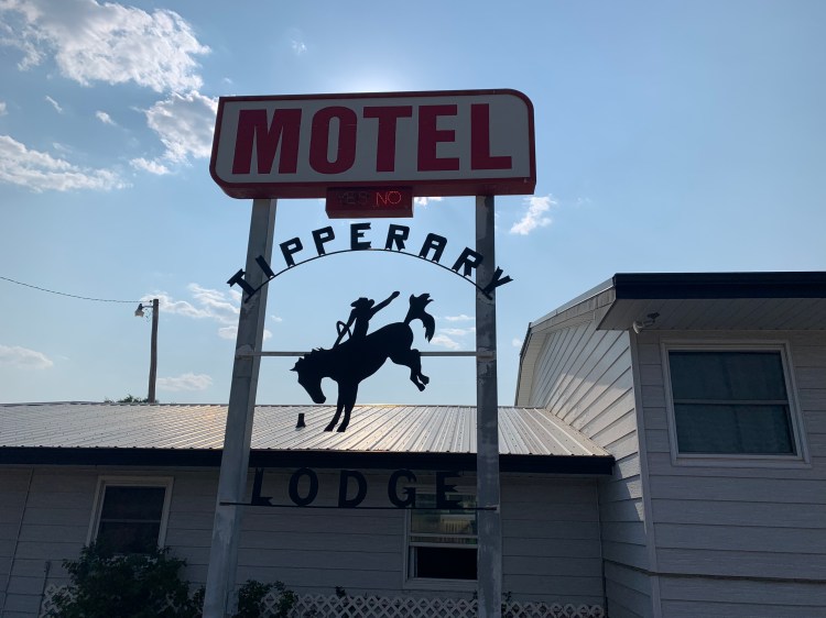
I stayed at the Tipperary Motel last night and was on the road before 6 AM.
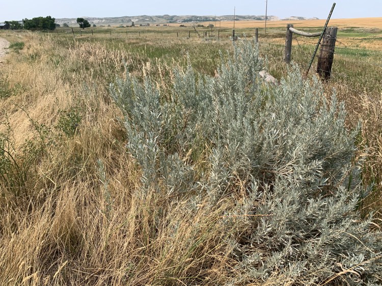
At White Butte I had noticed my first sagebrush, a real sign I was in the West. I picked off a leaf and crushed it, just love that smell.
Sagebrush!
This morning, as the sun rose on my left, my shadow was projected into the fields on my right, it was cool to see it dancing along. An old rider of the purple sage.
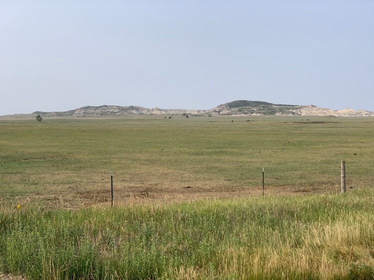
I continued to listen to the Crazy Horse book and got a thrill when I saw these mountains rise up over the horizon, could these his sacred Black Hills?
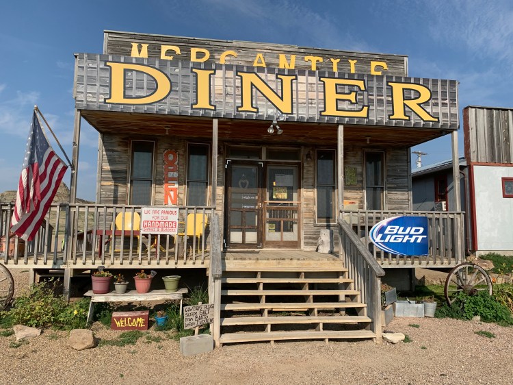
They also marked the only food stop in 72 miles, the charming Mercantile Diner, run by Becca, who served up a mean biscuits and gravy. Originally from Indiana, she and her husband Scott had visited this place and fell in love with it, buying it and fixing it up, she had many stories about long-distance walkers and bikers, and about her own struggles with ovarian cancer.
Zoom in on the sign by the stairs
Becca
I spent way too long there, 90 minutes, chatting with her and customers, I still had 50 miles to go. Fortunately, the shoulder was in good shape the whole way, and the heat and wind not too oppressive. The hardest part was listening to the sad, sad end of the Crazy Horse story, when the great leader turned himself in to the Fort Robinson agency to save his people from annihilation, only to die in a scuffle as they tried to put him into a jail cell. His cousin, Little Big Man, pinned his arms as he was bayoneted by a soldier. Dustin Hoffman he wasn’t. I was glad no one could see my tears.
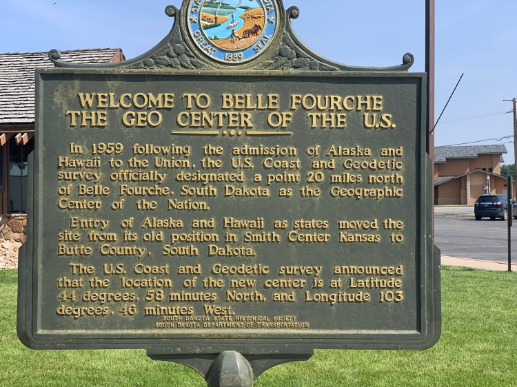
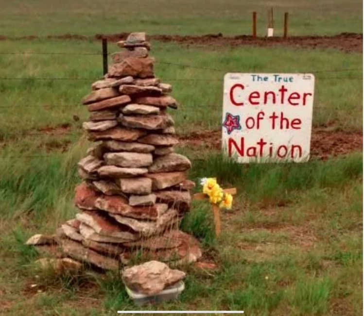
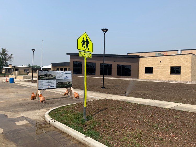
15 miles out of Belle Fourche (pronounced Foosh) I saw this curious sign.
Huh. I thought that was in Kansas
Once I got into town, I found a little park that commemorated it
So Kansas was where the center of the Lower 48 was, recently commemorated in a controversial Super Bowl commercial, featuring Bruce Springsteen https://youtu.be/L2LJpicgA2E
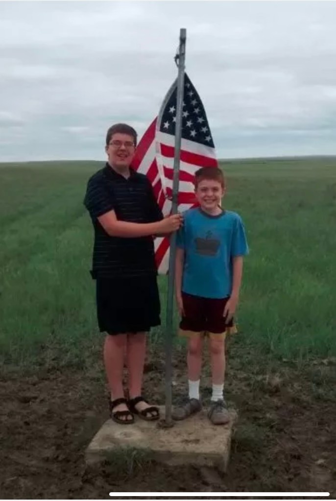
The sign said the actual spot was where that first sign was pointing. I found it on the web, glad I hadn’t added 15 miles of dirt roads to see it in person.
Cairn by the road
The actual spot
Benchmark
The Sturgis motorcycle rally starts in four days, the closest I will get to it is tomorrow morning at Spearfish, 22 miles away. There were only six Harleys in the motel lot today.
Distance 72 miles, 4,794 total. Time 10 hours with stops. Elevation gain 1,958 feet
Bowman, North Dakota to Buffalo, South Dakota Sunday, August 1, 2021
This entry is going to be short, I need to get to bed early, tomorrow is a huge day. Today was just 47 miles due south, recrossing back into South Dakota, en route to the Black Hills. I was just as happy to say goodbye to the “Legendary“ North Dakota after eight days, but regretted my flippancy as soon as I saw what happened to the shoulders on two-lane US 85. I guess South Dakota spends less on highway maintenance. The nice broad shoulders I had been enjoying vanished into crap, and I was forced to ride on the main roadway, on a fairly busy route, also known as the CanAm Highway. I guess I was lucky it wasn’t five years ago, when the oil-fracking fields of Williston, North Dakota (not to be confused with my Vermont hometown) were really humming. Then, I was told, the trucks were nonstop. Now, they were just intermittently frequent, at a rest stop I saw dozens of identical flatbed trucks hauling the same piece of huge, complicated equipment, fracking-related, I assumed. The drivers were generally courteous, passing me in the other lane, but one truck beeped me since there was oncoming traffic and I had to ditch into that crappy shoulder. Harrowing, but I didn’t fall, was able to keep my balance. I have to do 72 miles of this same highway (there’s no alternative) tomorrow, so I’ll try to start well before dawn.
When things were quieter I was able to listen to more of the audiobook The Journey of Crazy Horse, and imagined him riding on the same sweet grass South Dakota prairie I was. As it happened, Eric had sent me a link to a Jesse Colin Young song, Before You Came, just two days ago. Talk about capturing the mood.
While I’m busy pasting, another germane song is the Eagles The Last Resort, all about Manifest Destiny https://youtu.be/4ETN21RZwwI
Everything is drawing me towards Wounded Knee. I hope it’s feasible.
Distance 47 miles, 4,722 total. Time 6 hours with stops. Elevation gain 1,301 feet
Amidon to Bowman, North Dakota Saturday, July 31, 2021
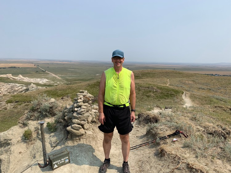
OK, today I climbed the highpoint of North Dakota, my eighth highpoint on this trip, exactly 12 weeks after the first one, Campbell Hill in Ohio. On that day, I promised to explain why I was so fixated on highpoints. As today’s is the last new one I’ll be doing for quite a while, I suppose I should finally get around to trying to explain.
I have tried, partially, in earlier posts and my Denali chapter. I guess it started with my love of my maps. I was an early subscriber to National Geographic, but the maps I loved best were in the Rand McNally road atlas. I would stare at states I didn’t know, places I had never been, and would wonder about all the points of interest. Every state had a little black triangle marking its highest point, and I would find myself searching for it on each page. In the summer of my freshman year of college, Brian and I were touring back roads West Virginia, and noticed that we were quite close to that little black triangle.
Sure, why not? Funny how the locals, people who had lived their whole lives within 5 miles, had never heard of it. That should’ve tipped us off. But eventually we found someone who could give us directions, and drove up to Spruce Knob, elevation 4,862.
The view wasn’t that good, maybe it was hazy that day. There was a little observation tower, and I remember how the trees were so windswept that they only had branches growing out of one side. Brian, who had already climbed Mts. Washington and Katahdin, mused that it might be cool to try and do them all. What I should’ve said was you’ve got to be kidding me. What I said was sure, why not.
That was 48 years ago, August 1973. For the life of me, I can’t recall what possessed me to take the bait, to put this monkey on my back. Highpointing was not a thing back then, less than five had completed them all; one of them, Frank Ashley, had written the aforementioned pamphlet, Highpoints of the States, and he had only done the lower 48. It was until 13 years later that Jack Longacre of Missouri sent a letter to Outside Magazine that led to the formation of the Highpointers Club. https://www.insidehook.com/feature/action/the-highpointers-club-turns-30
Mutual friend Eric scoffed at the ridiculousness of this project, then turned around and did 49 of them, all but Denali. His wife Ellen has done 39. That’s the thing, it kind of sneaks up on you. I warn you, it’s habit forming.
Brian I think is stopping at 45 (the last five require guides, unless you are a very experienced mountaineer). I only have 37 with today’s highpoint, but my ace in the hole is Denali, and I’ve done all but one of those “last five”—the easiest one, Mt. Hood. I do have a reasonable chance of doing all 50.
Over 300 people are “50-completers” by now (far fewer than those who have climbed Everest), and I believe the fastest time is 22 days https://www.colinobrady.com/50hp. I was wondering what kind of record I could set, possibly the slowest time? Climbing the big ones is undoubtedly a thrill, but over half of them are easy, often just a quick walk from the car. To me, doing those seemed kind of silly, just trying to complete a list. But what if you got there under your own power?
In 1981 I celebrated a life transition by biking from Washington (med school) to Boston (residency). Along the way, I tagged the Elbright Azimuth in Delaware, the second lowest of them all at 448 feet, but this time, not so silly. You see, I’d just ridden the bike past Delaware Bay, sea level, so I could rightly say I had “climbed” the state. Now that was something. Sea to Summit, just like the name of that outdoor company. I checked with the Highpointers Club and searched the web, it didn’t look like anyone else had done this, or even though of it. Maybe I could be the first “human-powered highpointer”.
Over the years, as my travels took me close to some of the highpoints, I would avoid going over there, wanting to “save them” for when I could do them by bicycle. The idea took shape to do them all in a single mega-trip, starting at the Atlantic.
The start of this blog chronicles the beginning of the journey last year, just after retirement, when I biked from my home in Vermont to the ocean in Maine, then to Pinkham Notch to hike up Mt. Washington. I was only able to post the first day, I’ll fill the rest in later. One day after Mt. Washington I had an equipment breakdown and Jane had to come get me, thereby “breaking the thread”. I would have to “zero out” at sea level again before doing the others, fortunately I found that spot in Troy whether Hudson was still tidal, so I could do that without having to go back to the ocean. Over a total of 30 days last year, I did all of the New England highpoints (except Maine, which I’d sea-to-summited in 2002) and Mt. Marcy in New York. Like I said, I’ll have to blog days 2 to 30 later. Covid kept me from doing the rest until this year. The blog is intact for these last 106 days.
So I’m not sure if this lengthy preamble adequately explains my goals and rationale, but I will have to break it off to get down to the business of documenting what happened today.
Coming into Amidon yesterday I noticed a police car in a speed trap, and was surprised to see the same car there early this Saturday morning. Closer inspection revealed there was just a dummy in the car, Ralph at the bar last night explained that the town couldn’t afford to hire a policeman.
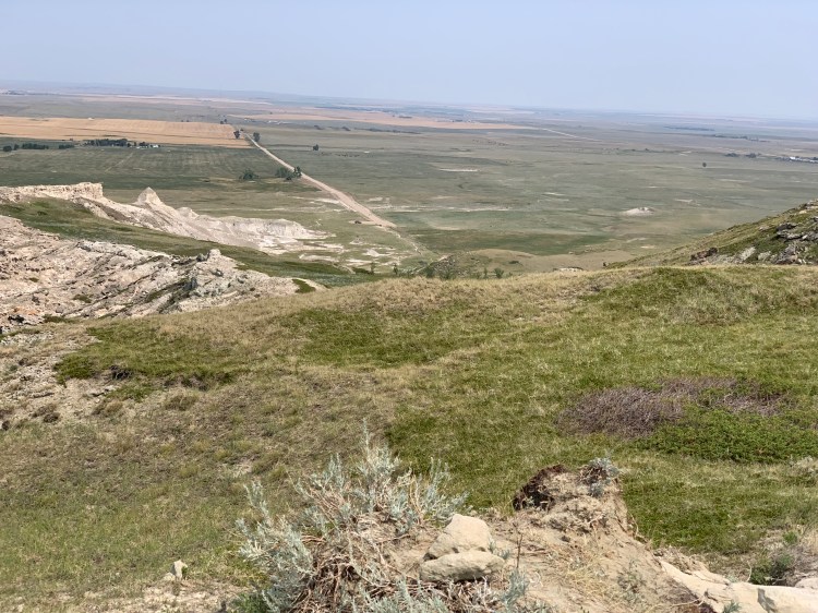
Getting to White Butte involved 18 miles of dirt roads, but they were of good quality. I encountered four other hikers, a gentleman visiting from Nîmes, France; a father and daughter traveling across the country, and a local hunter, John, who is getting in shape for deer season. He had a pistol on his belt.
White Butte from afarJohn, approaching the summit
None of the others had heard of highpointing, they were just out for a Saturday stroll. I signed the register, John took my summit photo, and I looked out over the bleak expanse of western North Dakota.
If you zoom in, you can just make it out John’s car, my bike, and the father and daughter at the end of the road Highpoint #37, 17 from sea level
Under each of my highpoint photos, the caption reads the total number I’ve done, and the number in the sea-to-summit mode. What about the other 20? I plan to revisit the ones I drove up on this trip, but not the big ones out west—Rainier, Whitney, five of the Rockies—I’m too old to do those again. For those, the plan is simply to bike to the trailhead parking lot where I had started before, thereby sea-to-summiting in two stages.
White Butte was more of a hike than the others, but it still wasn’t much. The whole process, changing my shoes, packing my fanny pack, chatting with the others, scattering Dad’s ashes, took three hours. The rest of the trip was fairly easy, not too hot, favorable wind, and I got into Bowman by 3 o’clock. Every grocery store in town was closed. The next couple of days will be challenging, there is a “food desert” until I reach the Black Hills.
Distance 35 miles, 4,675 total. Time 7 hours with stops. Elevation gain 1,364 feet
Dickinson to Amidon, North Dakota Friday, July 30,2021
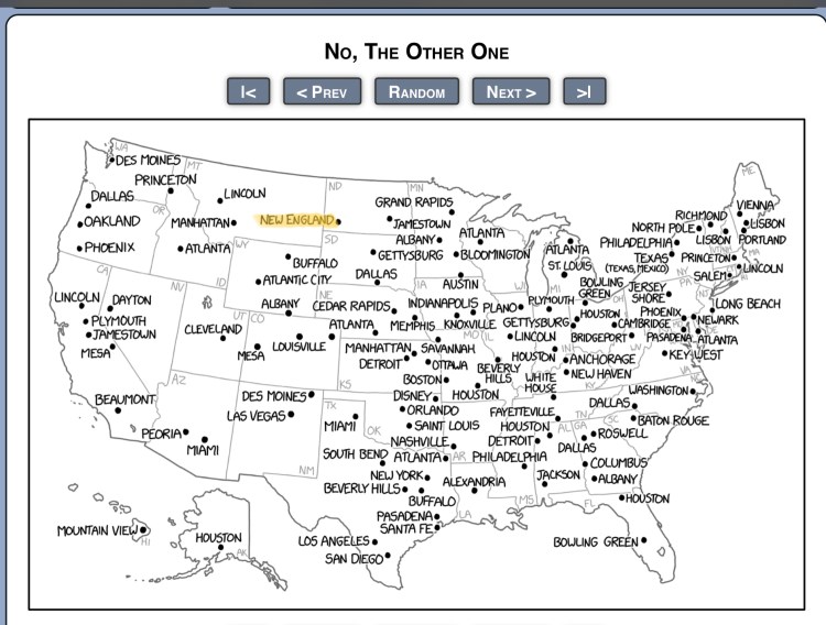
My good buddy Frank sent a link to a great webcomic called xkcd (worth checking out if you’ve never seen it) when he saw where I was headed next. It’s a map of the many US towns named after more famous places.
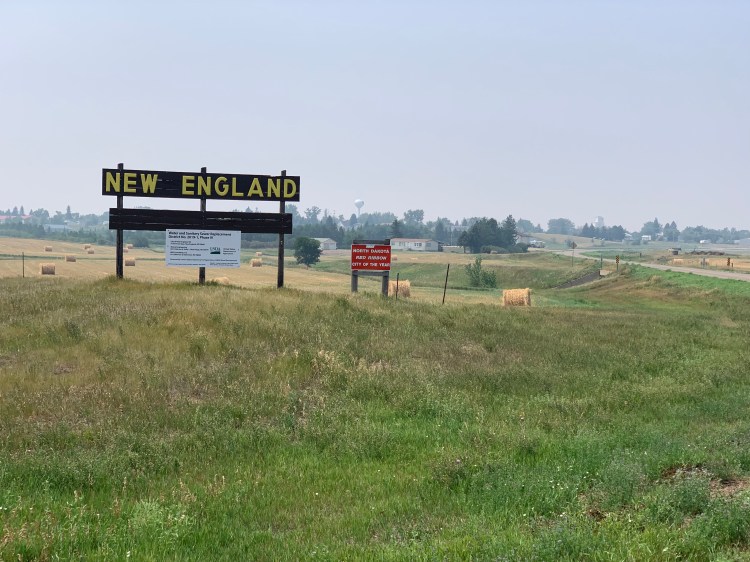
Yup, it’s true, today’s ride took me through New England, North Dakota. Brian, who you remember got me started on this highpoint thing and has also been through here, had scoffed at it thusly: “We drove by a town called “New England” that had a sign proclaiming it Class Whatever State Football Champions in some long ago year. There were half a dozen houses, a couple of closed businesses, and there, at the end of the one main street, was the high school – looked about big enough for four rooms on each of two floors.”
So I was prepared to laugh at this incongruously-named little town I reached after battling 26 miles of uphill headwind with poor shoulders and moderate traffic, but was surprised by feeling a burst of homesickness.
All I could think of was the line “sweet New England” from the Paul Simon tune, Duncanhttps://youtu.be/u3_UddjEGMA
The town was a little less bleak than Brian said, and the high school was being renovated
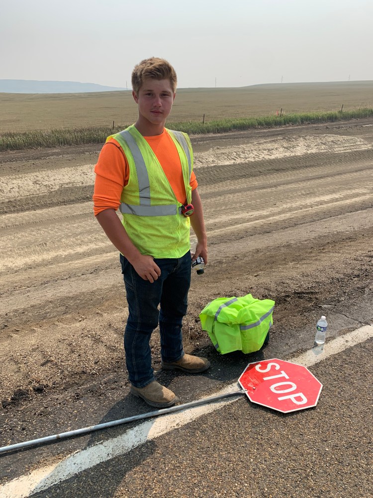
There was a great quickstop, with a meal that really revived me, and the clerk let me have two root beers for the price of one, and got me a big cup of ice. The road out of town had a lot of construction, but one of the flagmen, Caleb, saw my predicament and gave me a Powerade and a cold bottle of water. A true Trail Angel!
Thanks, Caleb!
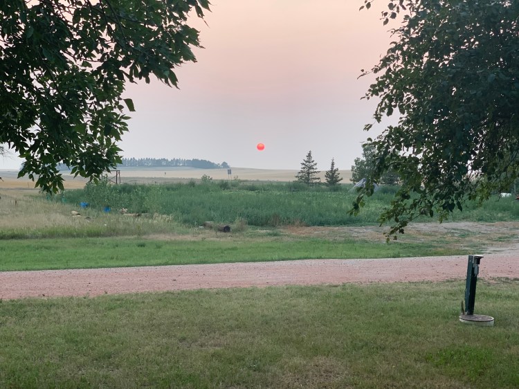
The tiny town of Amidon, closest to the highpoint tomorrow, it looked like it had nothing but there was a campsite with an underground bar, Mo’s Bunker, where I had fun talking to the bartender Jodi, and two bikers, Ralph and Maynard, who told me what to expect at the upcoming Sturgis rally. All they had was fried food, not so healthy but so satisfying. I pitched my tent under the sunset, the smoke from wildfires in Canada made it once again a red rubber ball.
Sweet New England, indeed.
Distance 53 miles, 4,640 total. Time 8 hours with stops. Elevation gain 1,541 feet
Glen Ullin to Dickinson, North Dakota Thursday, July 29, 2021
This will be my final day on the Adventure Cycling Lewis and Clark Trail, and it gave me a sweet sendoff. Bittersweet, I guess, since I will not be following their routes again for some time. I woke up early, saw I had a favorable wind and temperature, and indulged myself by getting a couple of more hours of sleep. Made myself a sumptuous breakfast at this charming inn, chatted with the elderly couple (the husband is celebrating his 92nd birthday today) and set off into a lovely day. The landscape was muted but grand in that “big sky” kind of way. Like all of the great plains states, North Dakota tilts almost imperceptibly upward as you go west, so today I climbed a fair amount but never felt any significant hills.
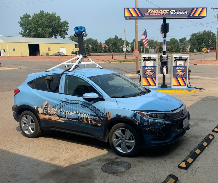
My first rest stop was in the tiny town of Hebron, and I was initially concerned that everything was closed, but tucked around the corner was a repair shop/general store that had everything I wanted. It even had a little bonus, the Google Street View car was parked there, I had never seen one before. The checkout person was happy, apparently Hebron had not had a Google update since 2011.
I just checked Google Maps and the Street View has not updated yet, I wonder if he captured my bicycle parked outside the repair shop.
I had to download my free audiobook before the end of the month, so I chose The Journey of Crazy Horse, which turned out to be just the thing for this landscape. Narrated by the author Joseph Marshall, a Lakota native, his soothing tones told the story of this great man honestly, flaws and all, I could almost picture him riding through these amber waves of grain.
My lunch stop was in Richardton, and again I despaired of finding anything open, but a passerby directed me to Suzy’s Stash, which looked like a sewing shop. Sure enough, stashed in the back was a great little lunch counter. Their TaterTots stew was a welcome change from the usual convenience store fare.
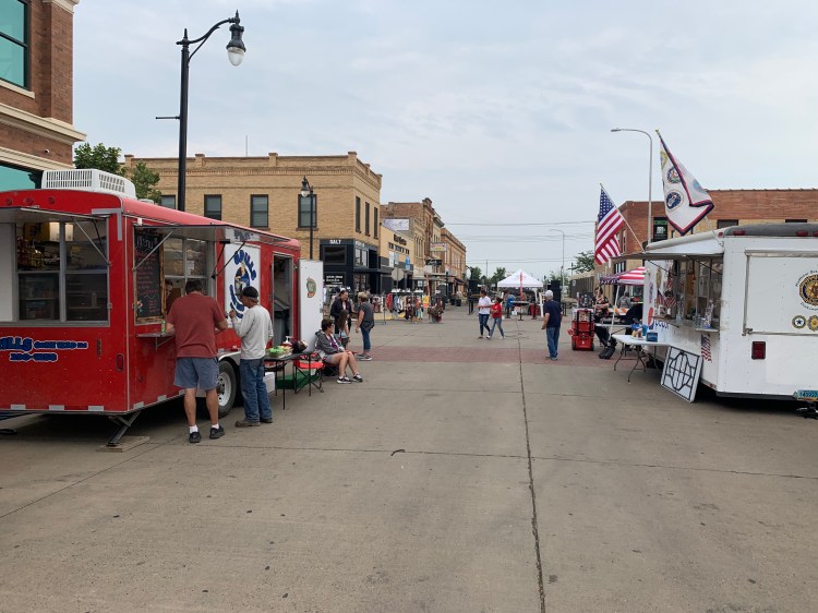
My final stop at Dickinson did not look good at first, I had to deal with 2 miles of very rough construction, pulling off the road every five minutes to let the backlog of cars go by, and the town seemed to offer nothing but the usual dreary fast food joints. I heard some music playing, however, and followed it to a little street fair they have there every Thursday, with lots of food trucks.
They call it “First on First,” at the intersection of First Street and First Avenue
I made the happy choice of Dog Gone Good, run by a lovely family from Clovis, California, who had moved here in hopes of finding better job prospects, associated with the oil boom. That boom had busted, but the daughter is trained in human services and is quite optimistic about finding another job. Her husband could make a great burger and fries, still not the healthiest meal but much fresher and tastier than I could’ve gotten at the usual joints. The music and conversation were a real bonus.
Sunny, Kristina, and Cameron Brown—thanks for a great meal!
Altogether, a joyous day, but I look at the next few days with some trepidation. I’ll be heading due south from the North Dakota highpoint to the Black Hills, on uncertain roads and some unavoidable dirt; because of the Sturgis motorcycle rally I have reserved a whole week of lodging in advance, having been warned that rooms are almost impossible to find that week. The forecast is for seasonable temperatures in the 80s to low 90s, but I see that the prevailing winds this time of year are out of the south, and I have no room for error, these reservations are nonrefundable. There will be one 75 mile day, there was nothing in between. Fingers crossed.
Distance 53 miles, 4,587 total. Time 9 hours with stops. Elevation gain 1,192 feet
Bismarck to Glen Ullin, North Dakota Wednesday, July 28, 2021
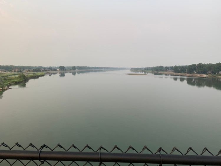
OK, let’s see if we can get this party restarted. I’ve licked my wounds long enough. Got out by 6:30, threaded the streets of Bismarck, and crossed the Missouri for the last time; now I am really entering the West.
Goodbye, Big Muddy. That’s the real Missouri, undammed at this pointSunrise over Bismarck, and its weird State Capitol
Blessedly, things were easier today. It was still 58 miles, still almost 2000 feet of climbing, but the temperature just barely reached 90°, and the wind, though strong, was a crosswind, which served to keep me cooler, rather than slow me down. There were also facilities along the way, so I didn’t need to worry so much about food and water. Phone calls from friends, as always, were an elixir.
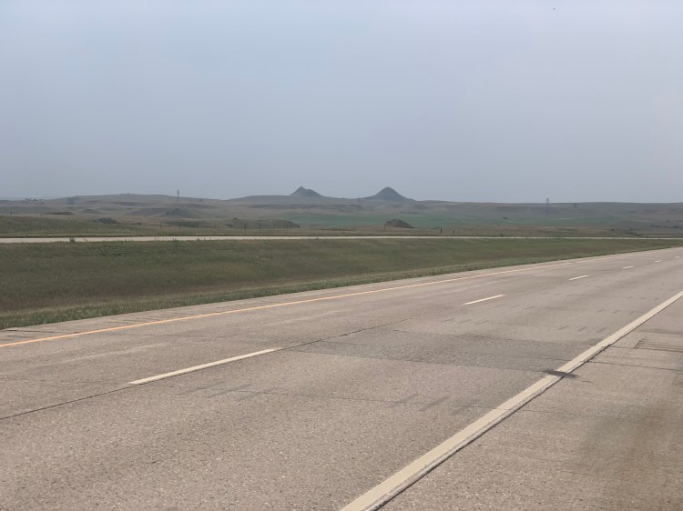
The Adventure Cycling route offered a shortcut, which saved 60 miles but required 13 miles along Interstate 94. The narrative promised “broad shoulders” but these have since been marred by a particularly noxious type of intermittent rumble strip that ate up all but 18 inches on each side. This is partially evident at far right in the photo, what you don’t see is the thin strip of rideable pavement on the other side, away from the traffic, that itself was often half covered with weeds.
I took the photo to demonstrate the occasional buttes that you would see along the way.
Irksome, but not insurmountable. I arrived at my stop for the night in the mid afternoon, had a great omelette/burrito at the Wet Spot, and was surprised that a couple I’d been chatting with had left the bartender seven dollars towards the cost of my meal. By the time I found out, they had left, and I had no way of thanking them. What a kind gesture.
Equally sweet was the bed and breakfast, the Rock Roof Inn, run by kindly elderly couple. Although they were both quite infirm, the Inn had all of the necessary amenities, and I had full run of their kitchen to serve myself a grand breakfast. It was also full of homey touches that were so appreciated after scores of sterile motel rooms. One example: a cuckoo clock!
Things are looking better already.
Distance 58 miles, 4,534 total. Time 9 hours with stops. Elevation gain 1,976 feet
Bismarck, North Dakota Monday-Tuesday, July 26-27, 2021
Yesterday marked exactly 100 days on this ride. Presidents are often evaluated on how they did in their first hundred days, and I did some evaluating too.
4461 miles, so averaging 44.6 miles per day, even including all of the zero days and other diversions. Some challenging moments, but nothing catastrophic. I still feel perfectly healthy, I’ve lost over 30 pounds, and my BP was so low when last checked, 100/68, that I cut my BP med (olmesartan) in half. After some early problems with broken spokes and saddle tension bolts, the bike has performed flawlessly. I’ve broken a couple of mirrors, and had to replace my tires, that’s it. Other riders I have encountered have had far worse problems with their bikes, I’m really quite delighted with mine, and hope to be able to describe it in detail in a future post.
But this hot weather has really knocked the stuffing out of me. The climate scientists are calling it a “heat dome” and it’s particularly bad in the Pacific Northwest. Ironic, because by eschewing fossil fuel I’m trying to do my infinitesimal bit to mitigate the very problem that may defeat me.
Well I had these two days to nurse my (psychological) wounds and run some errands. The guy who replaced my screen protector at Verizon cheered me up with his self-deprecating humor. He had returned to his native North Dakota after being away for a while. When I asked him if he was glad to be back, his sheepish smile said it all. He was amused to be reminded of the state slogan, Be Legendary.
I visited the two bike stores in town, and they always lift my spirits. They didn’t have all the supplies I needed, but they were a great source of encouragement and local knowledge. At one of them was an amazing coincidence, I met another retired doctor from Vermont, Paul Jarris, who was biking cross country in the other direction! I mean, what are the chances? It’s like two arrows hitting each other in mid-flight. We chatted so animatedly we decided to get together for dinner. Even though it was hard to hear each other in that noisy brewery, sharing our experiences, both on the road and in Vermont, was an elixir for me.
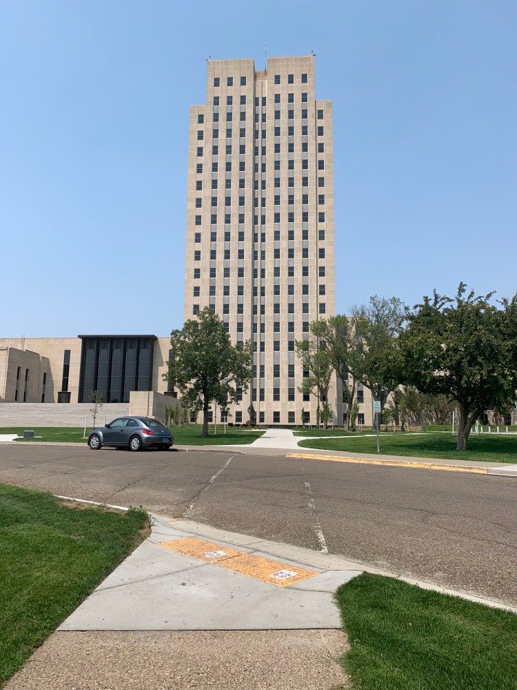
Bismarck is my fourth state capital, and I’ve made a fetish of visiting the capitol building. This one was charming in its goofily incongruous way. I mean, where’s the dome?
I guess it’s the tallest office building in the state, which reminded me that North Dakota has the second tallest structure in the world, a TV mast outside of Fargo. It has to be so tall because the land there is so flat, there’s no hill to put it on.
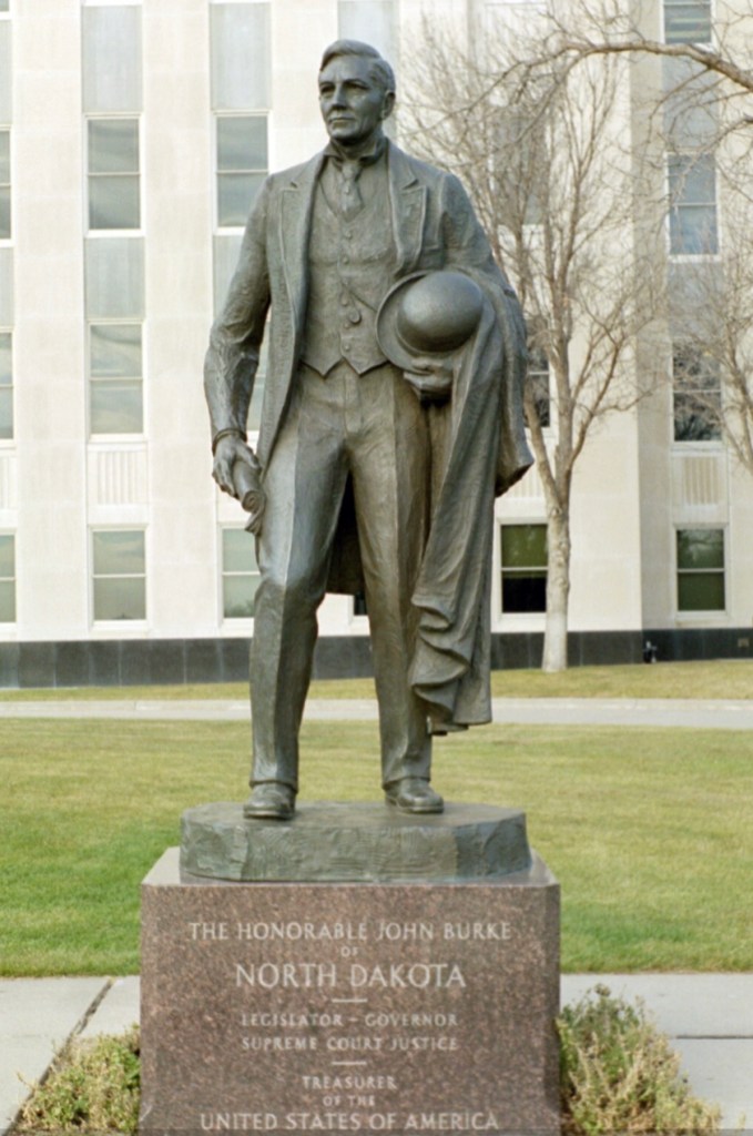
There is a statue at the base of the capitol and I thought, does North Dakota have somebody famous outside of Lawrence Welk? Well, kinda
Well OK. He was in the state, not the US Supreme Court, but still.
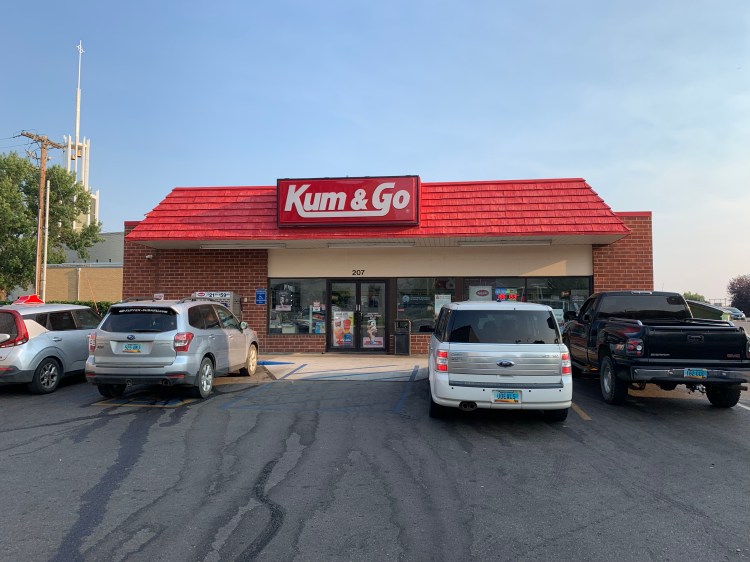
And how can the name of the local convenience store chain not make you chuckle?
Seriously?
All of this, along with calls and messages from family and my weekly therapist call, succeeded in piercing the funk I was in. Not to mention chillin’ (literally) in the air-conditioned Radisson. I plotted and reserved lodging for the next few days, which calls for snagging the highpoint, White Butte, west of here and then dropping south throughout the Black Hills to Denver. That nutso motorcycle rally in Sturgis will be a challenge to avoid. Bikers of a different sort.
Hey, Lewis and Clark had to contend with much worse, and they proceeded on. So can I.
Distance 15 miles, 4,476 total. Time 3 hours with stops. Elevation gain 315 feet
Stateline Resort to Bismarck, North Dakota Sunday, July 25, 2021
I have a little sleep monitor on my Apple Watch, which measures my hours of total and deep sleep. Curiously, I had my deepest sleep last night, in a hot tent with a cooling breeze. Something about air-conditioned rooms interferes with restful sleeping for me.
I was determined to get going before sunrise, so I got up at three and packed hurriedly. By now it was 55°, but slated to reach 99 that afternoon. That’s a difficult range to deal with. Leaving the campground in the dark, I hit a soft spot that eluded my headlights, made me fall over and break my rearview mirror, the second time this has happened. Luckily, I had bought a spare.
The worst hills were in the early morning, and it was cool to see the sun rising like a red rubber ball, just like in the Cyrkle song. In 21 miles I had reached my original intended campground, and up a short steep hill was a little convenience store that was just opening, although it didn’t have much. Still 52 miles to go, and now the hot sun was out.
The hills were still numerous, though not quite as steep, but the worst thing was the total lack of any shade. I had lots of spare water, but it heated up in my panniers and it wasn’t very palatable. I finally found a small RV park where I could have lunch, but all they had was a picnic table in the broad sunlight. Leaving there, I had my post-prandial loginess to add to the heat and exhaustion, and I was starting to despair. Fortunately, I was able to reach my good friend Sharon on the phone, and she really bucked me up as I pedaled slowly up the hills.
With 17 miles still to go, I found a small patch of shade under a single large tree, and carefully lay my bike and myself down for a final rest. A couple of cars stopped to ask if I was OK. I was, just barely.
Readers of this blog know I have had challenges before, but this was possibly the worst. There’s just no escaping the heat. It’s weird because Vermont gets relatively little sunshine, and we are always grateful when it comes. Here, it is just a brutal unrelenting glare, and you pray for it to stop. Even if you’re an atheist.
The next two days are predicted to be over 100, there is a heat advisory, so I will be taking two rest days. I need to rethink whether continuing this trip will be possible at all. Bismarck has the last sizable airport for many hundreds of miles.
Kinda bummed tonight.
Distance 76 miles, 4,461 total. Time 10 hours with stops. Elevation gain 2,999 feet
Mobridge, South Dakota to Stateline Resort, North Dakota. Saturday, July 24, 2021
Again, the residual of the storms meant that I didn’t get going until after eight. That’s too late when there’s this much heat and sun. The hilliest part was in the beginning when it was relatively cool, but by the time I hit the only town, Pollock, the sun was blazing and I was in desperate need of shade and a cool drink.
Pollock initially seemed to have nothing, but on close inspection there was a bar that served food, Grumpy’s, and a visitor center. Grumpy made me one mean steak and cheese and a big chocolate cookie, along with plenty of ice water and root beer.
While dining there I meant Vina LaFave, who grew up near here and runs the visitor center next door. That center has displays about how this town was largely flooded by the formation of Lake Oahe, some of the buildings were moved to higher ground and make up the new Pollock, such as it is.
VinaHer visitor center
Vina warned me to watch out for rattlesnakes. They will try to avoid you, but be careful when walking through brush. She mentioned that her dog Rex used to kill rattlesnakes all the time, but when he got older his reflexes were not so good and he got badly bit. He wandered off, and the family had assumed that he had died. Four days later, looking bedraggled and very hungry, he showed up. He had gone to the riverbank and lain in the mud, which drew out the venom. Amazing that dogs have the instinct to do that.
By the time lunch was finished the wind had fully shifted into a strong hot headwind, and it was a replay of that awful day in Iowa where I only went 20 miles. This time I had 34 miles to go, and large hills lay ahead.
There was a little dazzle to this bleak situation, however, crossing for the first time into a new state by bicycle. North Dakota is one of only four states where I have never been, and it was a thrill to enter it this way, just as it was thrilling to first enter Spain by foot on the Camino.
If you zoom in on the sign you’ll see the state motto “Be Legendary”. Later when I would ask natives about it, they would just roll their eyes.
What’s more remarkable in that photo is the plume of black smoke rising just above the highway. Cars were whizzing by and seemingly paying it no mind. But I looked at it with trepidation, knowing that the fire risk was high in this drought and heat, and that a grass or brushfire whipped up by the wind can travel quite quickly. And the wind was blowing right at me. I stood there for about 10 minutes, eyeing it warily, before I decided that calling 911 would be foolish, and that it did not appear to be too serious. I proceeded on, as Meriwether and William would say.
After five more miles of battling the headwind, I despaired of reaching my campsite before dark. I happened to see a sign for the Stateline Resort, which had not appeared on any of my Google campsite searches, and I called the number. Yes, they had tent camping, yes, they had hot showers, the owner would be right over. There were still 21 miles to go to my intended campground, but I thought it best to stop here and deal with those miles before sunrise tomorrow. It would be a tailwind by then.
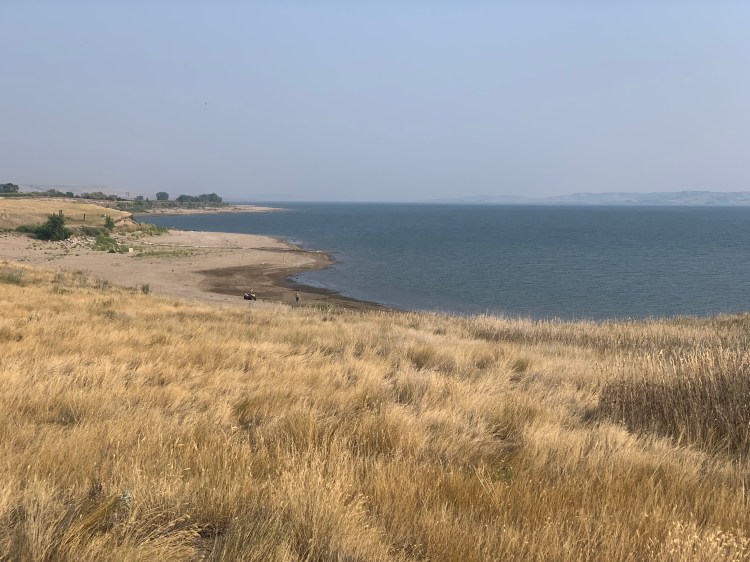
The owner was on his way to a wedding, so I was touched that he came over to help me. I asked him about that smoke, he thought some farmer was cleaning out his diesel tanks or something, did not seem too concerned. This would be my first night camping in the heat, there were a few trees but I had to pick my tent site carefully to make sure it would stay in the shade as the sun moved through the sky. There were a bunch of RVs, but I was the only tent there. The resort was on the lake, but the shoreline didn’t look too appetizing, and there was no one swimming.
The trouble with reservoirs, as opposed to natural lakes, is that they’re often unpleasant for swimming
Well, it wasn’t too bad. I prepared the only food item I had required cooking, a hot apple cobbler I have been carrying with me since the beginning of the trip. I had to ration my food to last me for breakfast and 75 more miles. My tent has an option to be as breezy as possible, it didn’t cool down to under 90 until the sun went down, but by then you could lay in the tent and not be too uncomfortable.
So North Dakota. I’ve only been in the state for five miles, don’t have a feel for it yet. So far, more rolling grassland, I do spot some dry buttes in the distance. The couple of people I’ve met have been very friendly, and the traffic seems courteous passing. I’ve always been fascinated by the state, which seemed to me to be about the bleakest and emptiest place in the country. The birthplace of Lawrence Welk, was all I knew. One of my residents had gone to medical school there, felt that having to go there was a kind of penance. Legendary? We’ll see.
Distance 50 miles, 4,385 total. Time 8 hours with stops. Elevation gain 1,922 feet
Gettysburg to Mobridge, South Dakota Friday, July 23, 2021
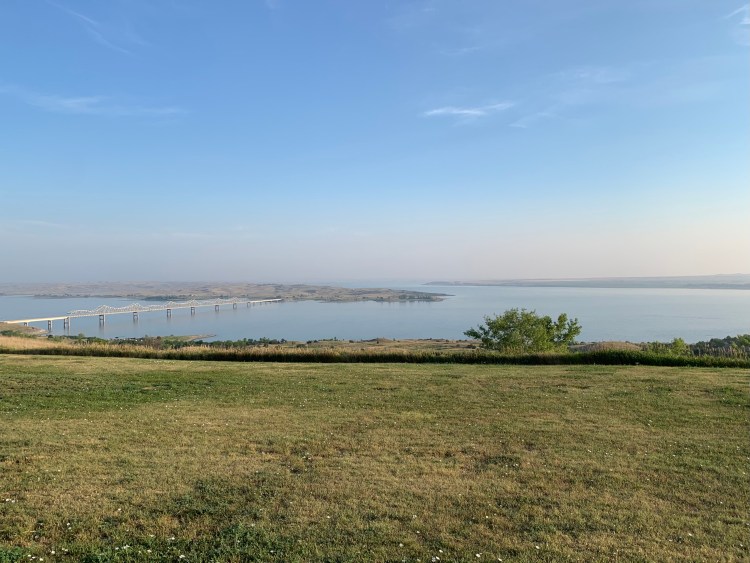
I had wanted to leave before sunrise this morning, but it was raining so I didn’t actually leave until 7:30. The rain had stopped and cleared the haze somewhat, and I got a better picture of Lake Oahe.
Despite the heat and the challenges I’ve mentioned, I have been leading a charmed life these last few days, with fairly constant southeast winds pushing me along, unusual because the prevailing winds are from the west. Today was supposed to be my comeuppance, but for most of the day, the wind was still out of the southeast and still behind me. That was appreciated, because it was quite hot at 98°, although again, not as bad as predicted . As Garrison Keillor often says, it could be worse.
There was not much more to say about today, away from the lake the landscape was monotonous, rolling fields of corn and hay, nothing worthy of a picture. As I’ve mentioned before, there is a certain majesty to the sweep of the plains, of this heartland of America, where Lewis and Clark went before me more than 200 years ago, and where so much strife with the First Nations occurred. The town of Mobridge, my destination for tonight, is reputed to be one of the possible sites where Sitting Bull was buried. How odd, how sad that they don’t know for sure.
There were violent thunderstorms overnight, quite dramatic, I was glad not to be camping. But now the front has come through, and the wind has shifted. In a few days the temperatures will be in the high 100s.
I write this early on Saturday morning, quite perplexed. The next town, actually the biggest city since Madison, is Bismarck ND, 124 miles and 6,000 vertical feet of climbing away. Essentially no facilities in between, just primitive campsites without water, with one exception: at the 72 mile mark, there is a somewhat improved campground “there’s a shower, it’s not clean but it works” and a small restaurant with a convenience store just up the hill. Temperatures today will peak out in the low 90s, but it will stay that hot well into the evening, not very conducive to camping. However, the nearest motel is 22 miles away, involving a 44 mile detour in total. Tomorrow will be hotter, but I will have a tailwind again.
I’m considering staying here another day, leaving at midnight and trying to do the whole 124 miles to Bismarck in a single day. Probably better to just deal with the headwind and hills today, have one uncomfortable night camping, and go to Bismarck tomorrow.
I know, I know, stop writing and start pedaling. I have packed quite a bit of food, and 5.5 liters of water. Reportedly little to no cell signal at the campground, so will be incommunicado. Wish me luck.
Distance 68 miles, 4,335 total. Time 8 hours with stops. Elevation gain 1,326 feet