Tangled up in blue

Chisholm to Swan Lake, Minnesota Wednesday, June 9, 2021

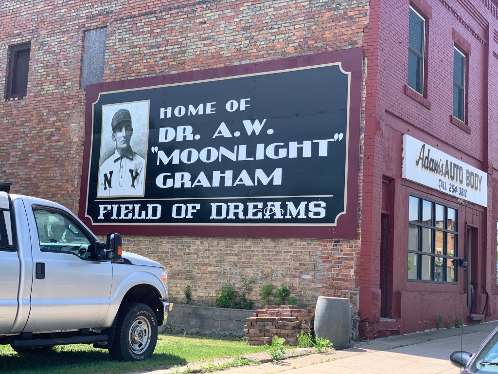
Turns out, Moonlight wasn’t hard to find, there is a mural right in the center of town, at the Mesabi Trailhead. He caught WP Kinsella’s imagination as he wrote Field of Dreams, as a right fielder who only played one inning in 1903, and never got to bat, but went on to become the beloved town doctor for Chisholm, and lived another 62 years. In the movie, he was played by Burt Lancaster in his last role. I’ll be stopping by the Field itself in a few weeks.

First name was Archibald

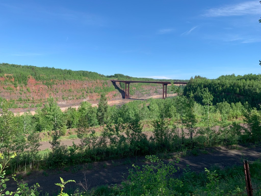
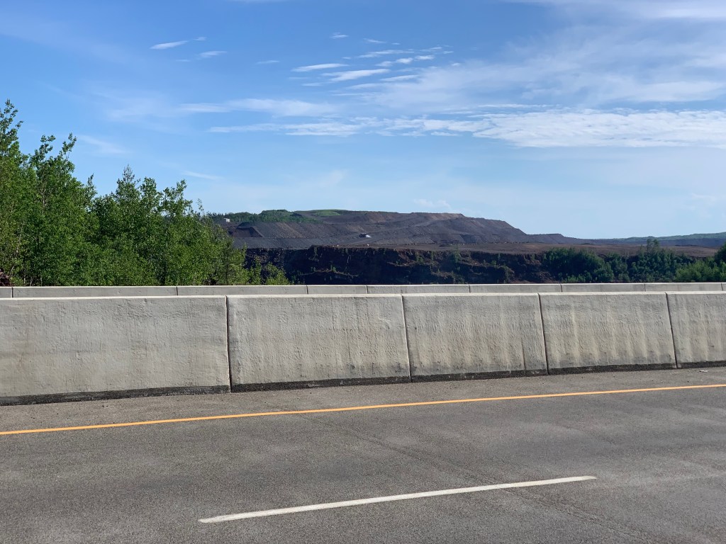
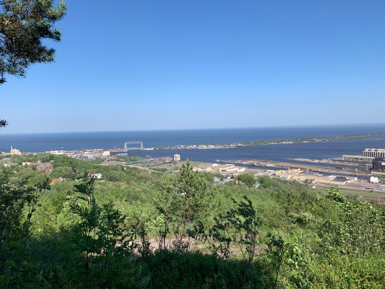
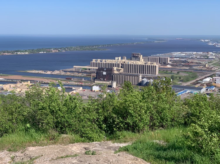
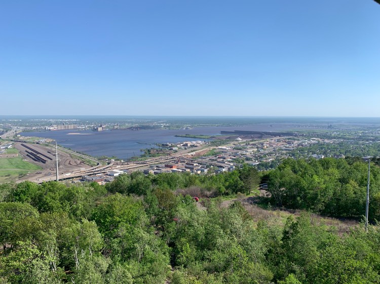
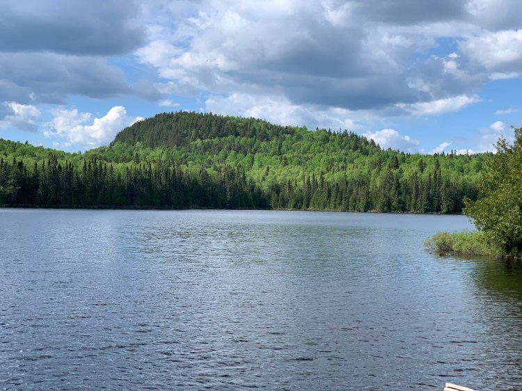
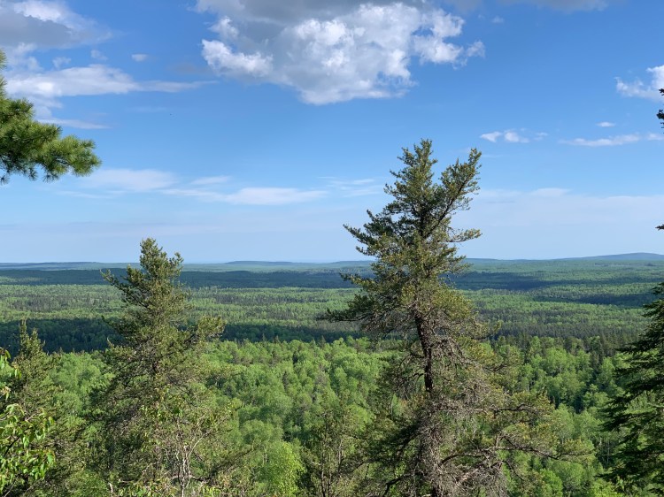
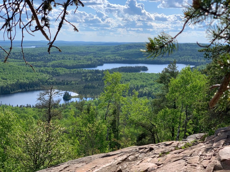
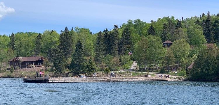
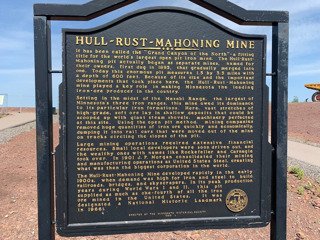
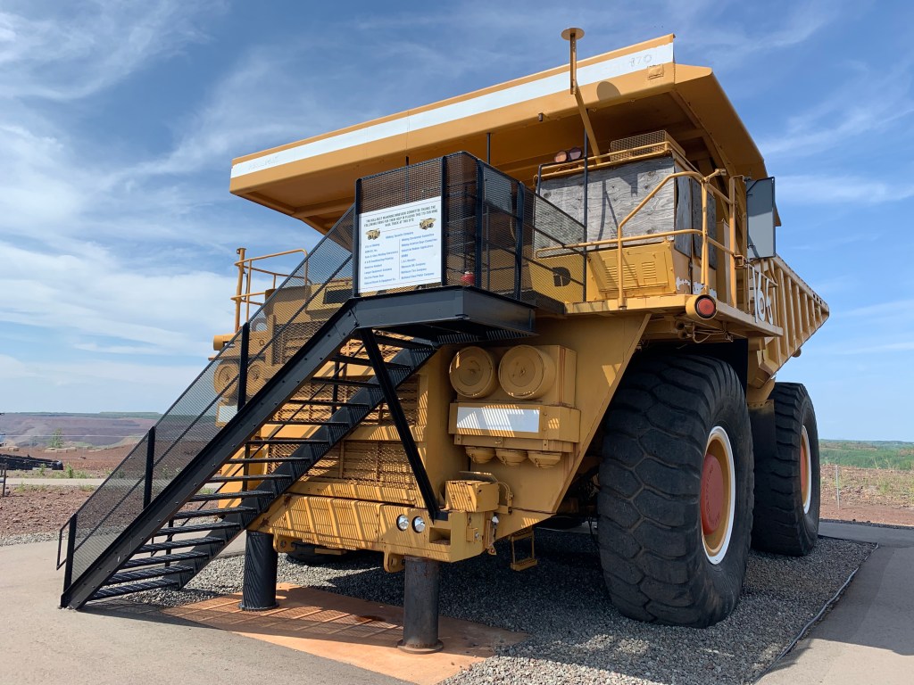
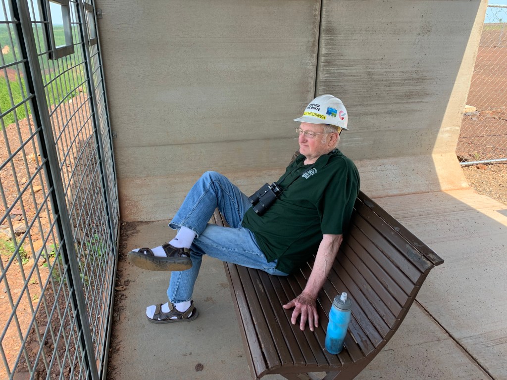
Another 7 miles took me to Hibbing, the reason I came up here in the first place. There was a steep gravel road (I had to stash the bike and walk) to the largest iron mine in the world. I’ll let the pictures tell the story.

So this is where JP Morgan started US Steel
Pictures of course cannot convey the scale of this place., it indeed looked like the Grand Canyon. Those are massive trucks down there.
One of those trucks was on display, the tires are twice as tall as I am
“Wally,” a retired mine worker, now serves as ambassador, and gave me the word
The mine was perched over the town of Hibbing

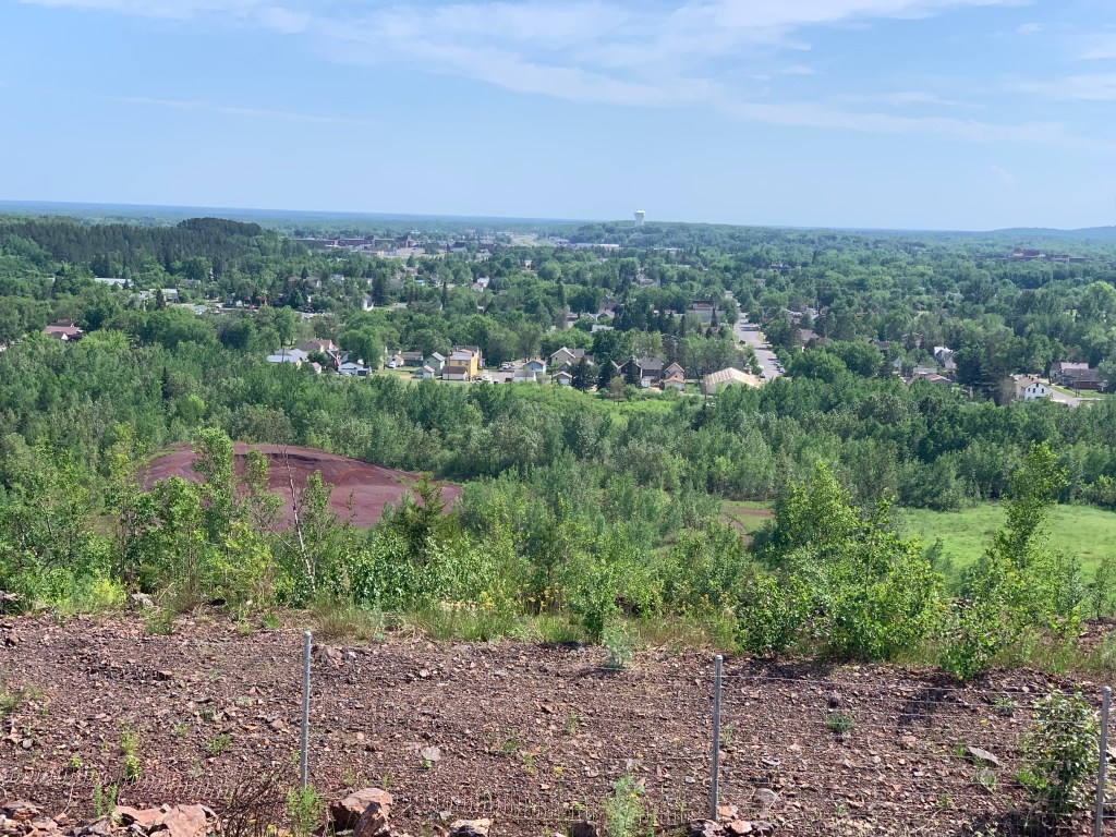
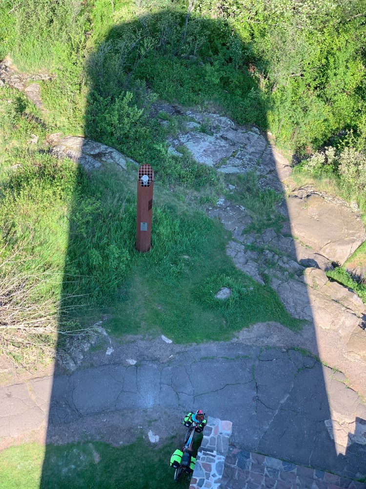
So I got a bird’s eye view of the town before I descended, home of Roger Maris, Celtics great Kevin McHale, and of course, the Jester himself from American Pie, Bob Dylan, née Zimmerman.

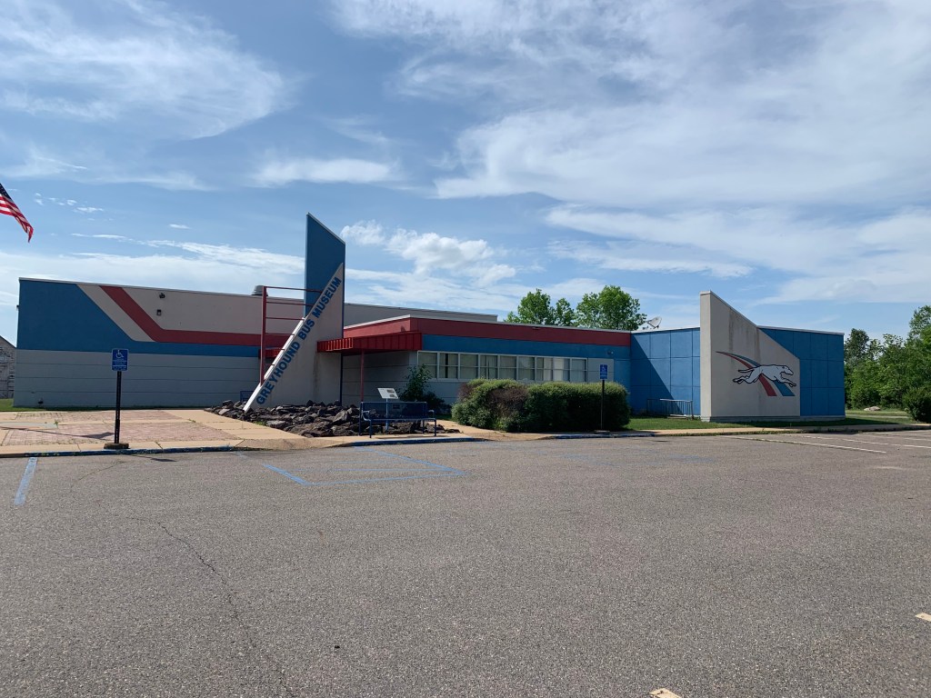
Before I got to his house, I came upon the Greyhound Bus Museum, which was just closing. I didn’t realize that the famous company began as a local bus service in Hibbing.

It took me four days to hitchhike from Saginaw

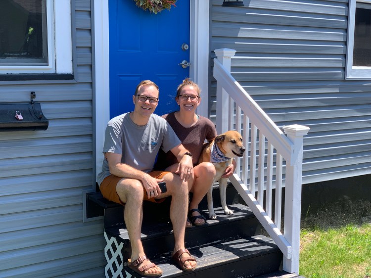
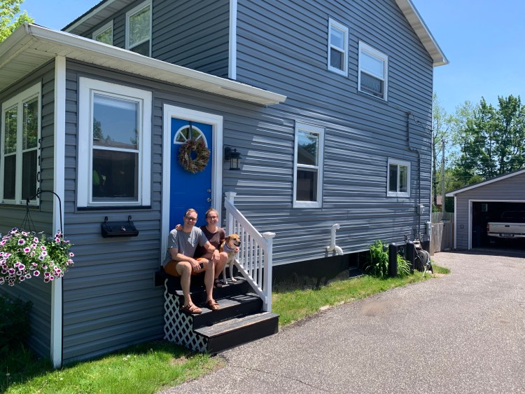
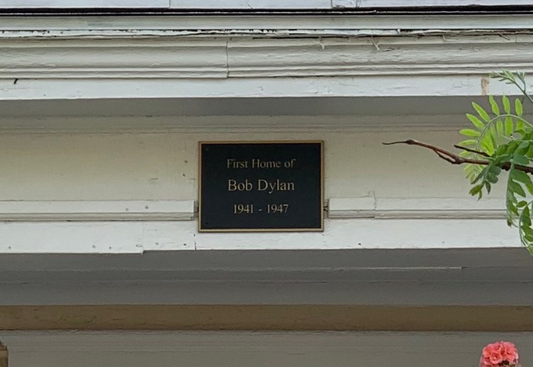
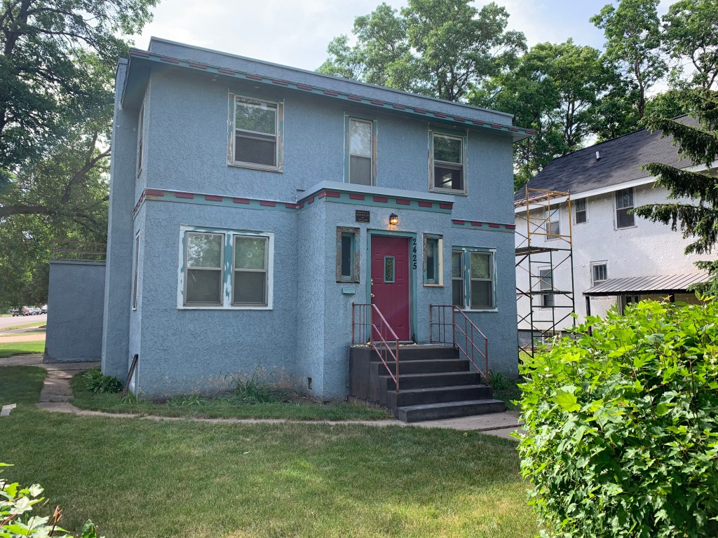
In three miles, I came to an iconic blue house on the corner. You can just see the other side was tangled up in scaffolding, and I could hear hammers pounding.

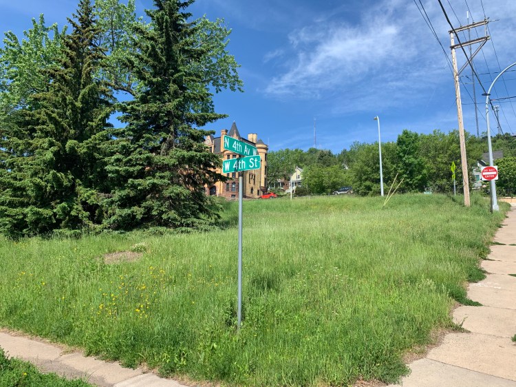
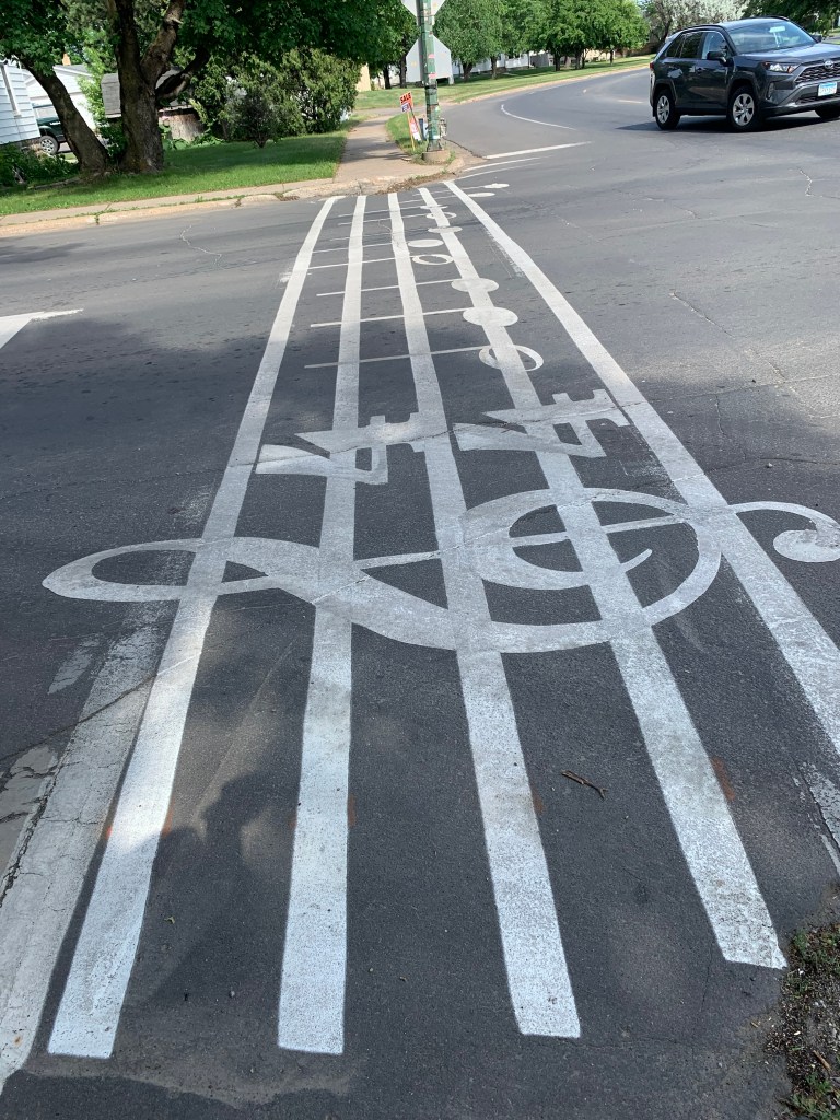
These few blocks of 7th Avenue were renamed Bob Dylan Drive, and as I was gawking and taking photos a character, who had perhaps smoked one joint too many, accosted me with a diatribe about how he lived on the avenue, and tried to get his driver’s license to reflect Bob Dylan Drive in the address, but nobody in the goddamn DMV would listen to him etc. etc.—when an older man came out and rescued me, sent the other guy on his way.

Now THAT’S a crosswalk, the opening notes to Blowin’ in the Wind
My savior—kind of a mellow Doc Brown from Back to the Future? Great Scott!

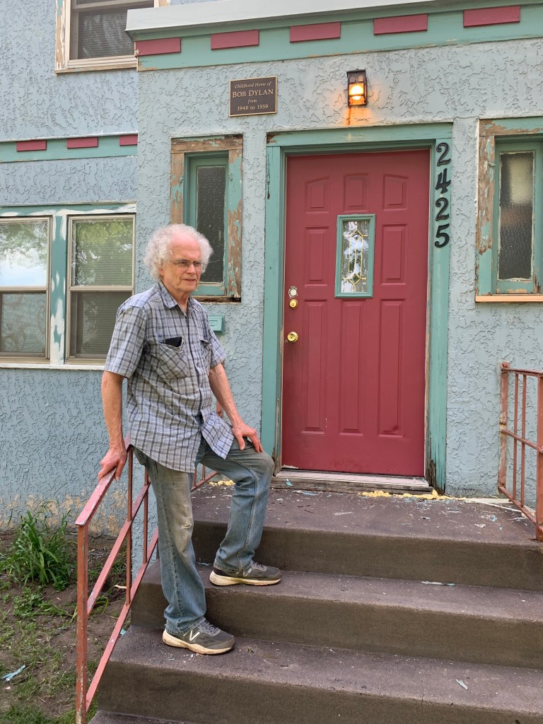
My savior turned out to be Bill Pagel, and he gave me his card

Recognize that picture?

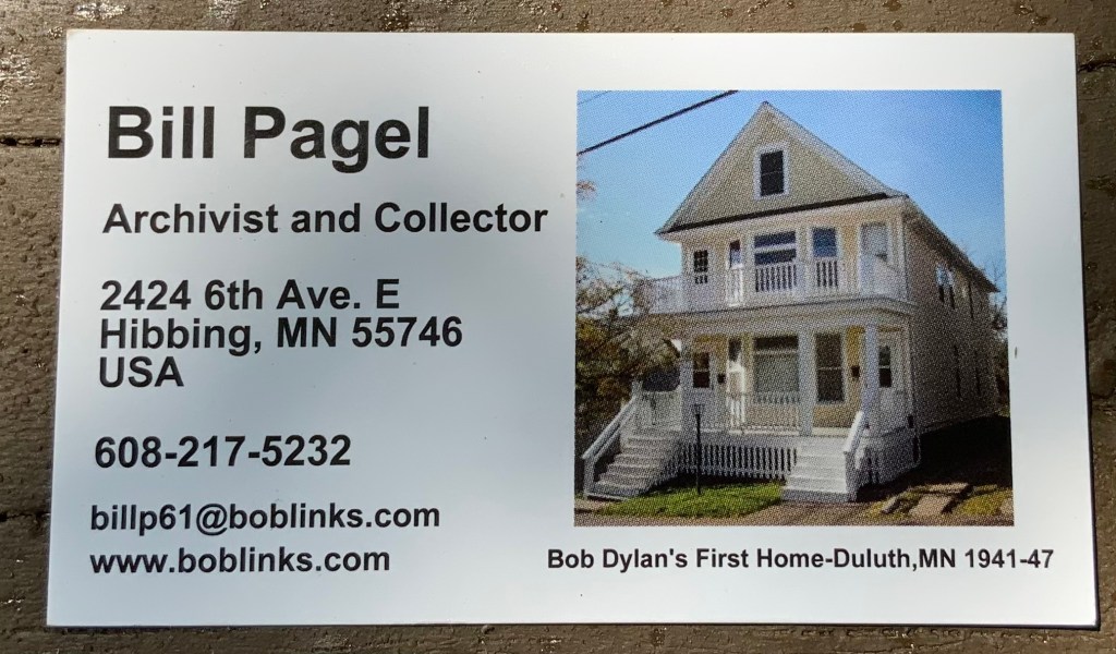
Bill is a retired pharmacist who bought both of Bob’s childhood homes, the one in Duluth and this one, which he was restoring to its 1950s appearance. He came out because he was intrigued by my bicycle, I didn’t seem like the usual tourist, and also to rescue me from that guy. Would I like a tour of the house? Um, yeah. (!!!!!!!)

One happy camper

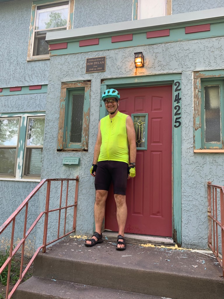
This Easter egg just trumped the Chicago penthouse! I couldn’t believe I was going to see where the Jester grew up! He asked me not to take any pictures inside, as he hoped to open it as a museum someday. He showed me his small bedroom, the knotty pine rec room where he wrote songs instead of studying, the one car garage where he and his buds practiced over the complaints of the neighbors, the linoleum floor in the kitchen that was identical to the floor in my house in DC (!) and, crème de la crème, the many places where he had carved his initials B.Z. I had to keep pinching myself. Talk about getting some cred with your son, the Dylan disciple!

Actually, I have mixed feelings about Dylan. No question he was a genius, and wrote some of the best rock ‘n’ roll and folk songs ever written. But he was a prickly personality, I thought it was incredibly arrogant not to go to Sweden to accept his Nobel prize, and Jason and I attended a very pricey concert a few years ago that was just awful, only a few songs, he barely acknowledged the audience. Jason in particular was furious that his idol had feet of clay.

Anyway, the tour and visit lasted over an hour. I was so fascinated that this mediocre student developed into this outsized figure, right here in this modest house. Neither of his parents were particularly musical. Bill had me sign the guest book, and had many questions about my trip. I left walking on air, realized I hadn’t eaten all day, and bolted for the nearest Subway.

While wolfing down my steak and cheese, I saw ominous thunderheads on the horizon. Other patrons suggested I get a motel room right here, but every room was booked, on a Wednesday. The pipeline workers were in town (hadn’t I just heard the Keystone Pipeline plans had been abandoned by the owners?), and all accommodations had been gobbled up. It was 6PM, as usual, and I had to go 25 more miles to a campground. Roger and Kevin (Maris and McHale) would have to wait.

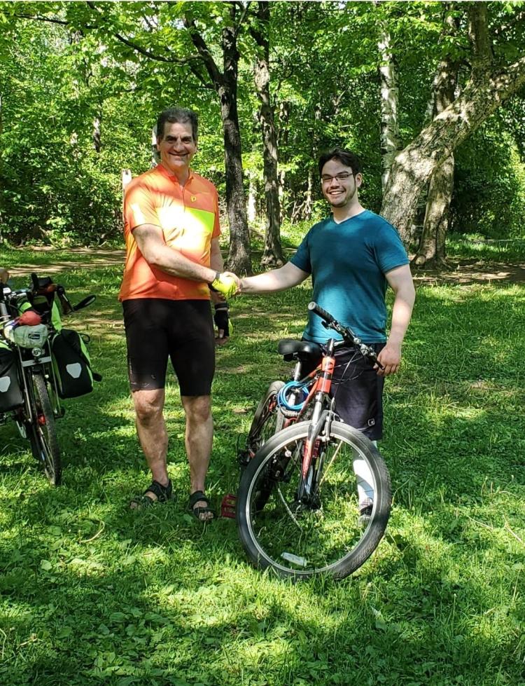
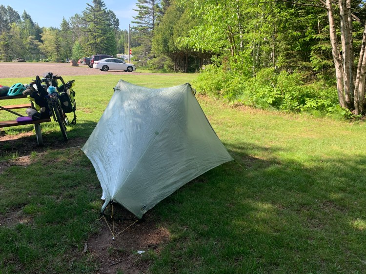
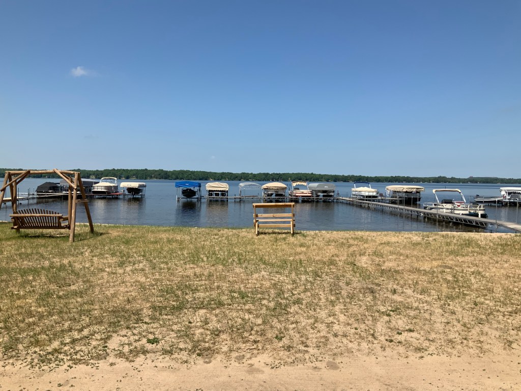
Thankfully, the thunderheads passed without incident, and the Mesabi Trail was glorious for those miles. I was so high from that Dylan thing I don’t think anything would have thrown me. The Swan Lake campground was beautiful, and there were some other bike tourists, Tom and Karen from Alexandria MN.

Tom and Karen

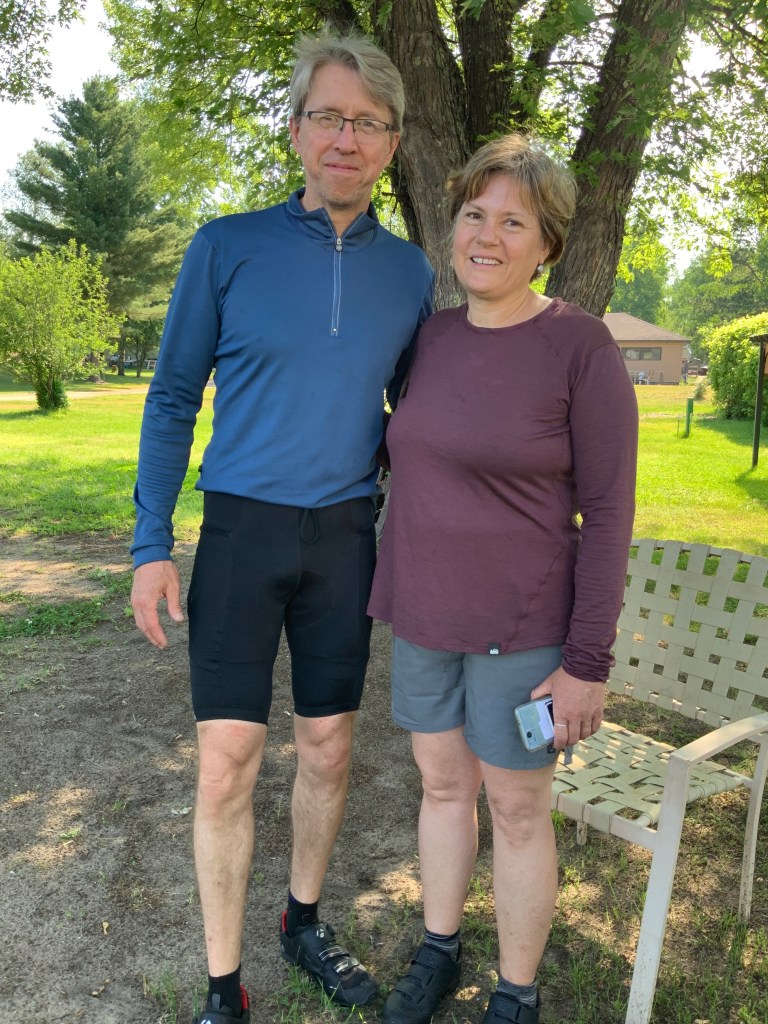
Tom is a family practitioner who, though 10 years younger, is “old school,” doing 12 hour shifts in the ER, intubating patients and managing them in the ICU, doing minor surgery; and Karen is a preschool teacher. Between bikes, teaching, and medicine we could have talked for hours, but I had arrived at 9:15, it was getting dark, the bugs were coming out. Another thoughtful camper warned me about thunderstorms overnight, and pointed out that campgrounds here have storm/tornado shelters. Yikes. I pitched my tent extra carefully, and ditched the Tyvek footprint. By morning, I discovered it was all teapot and no tempest.

Swan Lake in the morning

Distance 37 miles, 2,404 total. Time 8 hours with stops. Elevation gain 946 feet.

©️ 2021 Scott Luria

Highways vs. bike paths

Eveleth to Chisholm, Minnesota. Tuesday, June 8, 2021

It was actually 3:30 before I left the campground, I decided to do my therapist call sitting down for once. The campground manager kept swinging by in his golf cart, looking at me questioningly. He thought it was too late to leave, that everything would be closed by the time I got to my destination.

I left anyway, adopting that cavalier attitude that served me so well on Eagle Mountain last week. The Mesabi Trail immediately announced that it was going to be very hilly, even though the road right next to it seemed quite flat. I was tempted to just go to the road, but no, I had paid my trail fee, I was going to give the Mesabi Trail a chance.

Bike trails are rarely as well graded as streets, and have far less “infrastructure” beneath them, so they are very prone to being cut up by frost heaves and tree roots. If the path is more than a few years old, it can really get quite bumpy. This particular trail was halfway between smooth and a little bumpy. Its main problem was that when going through towns, the route got quite circuitous, and was poorly marked, I got lost more than once.

But in between towns, wow, it was glorious. It followed an old rail line used in the iron mines. I loved how it cut through rust-stained iron embankments. Abruptly it gave out onto the tallest bridge in Minnesota.

You can see the iron in the hills
An entire mountainside that is being strip mined. Ugly, but compelling

It’s funny, when I think of Minnesota I think of Norwegian bachelor farmers, hilarious accents, the Mayo Clinic, and the Land of 10,000 Lakes. I don’t really think of mining, but then 3M stands for Minnesota Mining and Manufacturing.

I hadn’t had much to eat all day, so I stopped in the town of Virginia, Minnesota, for a bite and wound up having a full Mexican meal including a margarita. I asked for the “small” but they gave me a “large”; in my defense I only drank 3/4 of it. Any of you could tell me this was a dumb idea, I still had 25 miles to go and I was not a happy cowboy.

The trail paralleled the highway again, and again I was tempted to cross the ditch and avoid these crazy ups and downs, but I could see those infernal seams I didn’t want to go kerCHUNK again. The first available campground turned out to have no facilities other than a couple of outhouses, and was swarming with bugs, the sun was just going down at 9 PM. I went another 7 miles to an RV park, but arrived in the pitch black. Just as I arrived, my drive belt came off again, thank heavens that didn’t happen while I was on the road, it’s an hour repair.

Like the Mesabi trail, you registered for this campsite online. I picked the cheapest spot that had electricity, and when I got there I found the abutting RV had stashed his spare vehicle in my site. Too late to change my registration. They were asleep, I didn’t want to wake them up, so I wedged my tent in and slept like a baby. I imagine they were surprised in the morning; when I woke up the vehicle was gone. I never met them. RV parks can be weird.

Chisholm was the hometown of Moonlight Graham, for you Field of Dreams fans. Wonder if I can find any trace of him here. A fellow PCP. Go the distance.

I could have used a little moonlight when I arrived last night, but it didn’t rise until 5AM.

Distance 35 miles, 2,367 total. Time 6 hours with stops. Elevation gain 1,320 feet.

©️ 2021 Scott Luria

The long goodbye

Duluth to Eveleth, Minnesota. Monday, June 7, 2021

Didn’t I say goodbye to Lake Superior on Saturday and Sunday? I’m like the guest who wouldn’t leave.

I felt fine this AM, yesterday’s drama was clearly a combination of heat exhaustion and separation anxiety. It’s funny, this fancy hotel has no breakfast or even coffee, so I had to go over to Starbucks, felt like a real urban commuter.

The route to Hibbing took me right back over that steep hill I had just come down, the hill that Harrison was trying to help me avoid when he gave me directions from his house yesterday. It was so crazy steep I had to walk half of it, it took me half an hour to do one mile. But I was happy to do it, it was still in the mid 70s, and I figured it would give the old pump one last test before I left the security of a nearby medical facility. It was all good. The old-timers among you will remember that Timex ad by John Cameron Swayze: takes a licking, keeps on ticking.

One last view, from the hill I just climbed

After the climb, it was fairly flat. My navigator kept trying to put me on dirt roads, so I finally went over to US 53. The first 15 miles of that seemed to have a good shoulder, but there was a seam every 20 feet, and going ker-CHUNK, ker-CHUNK every ten seconds got old real fast, was giving me a headache, and I despaired something would rattle loose.

It turned to blessed smooth pavement after that, and life was sweet. Ruler straight, nothing but featureless forest, fairly minimal traffic on the highway. A perfect time for phone calls, but no one was answering. A mild tailwind made it sweeter, but when it’s in the high 80s you want little wind. I pulled into Eveleth (not quite the Levon Helm lyrics), not feeling ’bout half past dead. Lovely campsite over a lake, with a power hookup. Massive thunderstorm at 3AM, was gratified that my tent kept me dry.

Well, almost dry. The floor was wet when I awoke, and had to hang around while my stuff dried out. The tent is super high-tech, made of ultra-high-molecular-weight polyethylene (UHMWPE, “Dyneema”, formerly called Cuben fiber), weighs less than a pound, although your use your hiking sticks for poles. It says you don’t need a “footprint” but I’ve been using a sheet of Tyvek under it; this is what funneled the water under the tent. Maybe time to go commando. UHMWPE is supposed to be indestructible.

Another Easter egg: Eveleth is a starting point for the Mesabi Trail, a 65 mile rail trail that will take me to Hibbing and all the way to Grand Rapids. Weird feature: you’re supposed to pay a trail fee, which I did online, though I suspect nobody checks.

Not getting going until 3PM today. I’m worse than Yogi Bear (he only slept till noon).

Distance 65 miles, 2,332 total. Time 8 hours with stops. Elevation gain 1,498 feet.

©️ 2021 Scott Luria

Look Back in Enger

Duluth, Minnesota Sunday, June 6, 2021

I woke up this morning with a start, I had slept till 9:30. I never do that. The Olk’s bed was so comfortable, and they were so quiet getting up, that I slept in. How luxurious. When I opened the door, there was a wonderful aroma is coming from downstairs. Mari was cooking Shakshuka. There was Duluth coffee, almond milk, OJ, and a great bowl of fruit. What is it with kids today, eating so healthy? It’s downright un-American!

I had another of my recurrent minor repairs to do, a broken tension bolt for my Brooks saddle. This broke last in Muncie, Indiana, so seems to be happening every thousand miles or so. This is the Achilles’ heel of the otherwise perfect English saddle, I will need to order more bolts from Simon Firth in Philadelphia, the sole North American distributor. In addition to the tools I’ve packed it requires a couple of large screwdrivers to repair, thankfully Harrison had these on hand.

So fun talking medicine, hiking and biking, music, and life changes with Harrison and Mari. I didn’t leave until 1:30, monopolizing another day of these trail angels. They live in a supercool house, with many features we are incorporating into our home renovation. Again, what’s wrong with kids today, to own such a nice place at the age of 31?

Harrison, Mari, and Penny

So where was I headed? My next stop is Hibbing, Minnesota, of the Mesabi Iron Range, but first I had to make a stop recommended by Brian, my PHIZ tour director in absentia. Enger Tower perches over Duluth on a 600 foot headland and offers a view to die for.

I almost did. Not really, but I felt funny grinding up the long hill in the 88° heat. As it happened, Harrison and Mari passed me on their way to a hardware store, and texted that I looked great. But I didn’t feel that way.

I’m 67, have hypertension (well-controlled on an angiotensin receptor blocker), borderline prediabetes, until recently was obese, and have lipids that put my 10-year risk of coronary artery disease in the mid-teens percentage. Never never actually had a heart problem, and had a negative stress echocardiogram a few years ago, but I’m concerned. Today’s feeling wasn’t really cardiac, I had no chest symptoms at all, kept checking my pulse and even my EKG on my Apple Watch and all seemed OK, but just felt disproportionately “whupped” even given the circumstances.

They say doctors make the worst patients. True to form, I stopped for an ice coffee, an ice cream bar, a cookie, and then later for a root beer float and a Coke. To all my former patients, please, do as I say, not as I do.

Anyway, I thought it was best to hang back a bit when I reached the Enger Tower. Certainly was easy to spend time there, the views are spectacular, really gave you a feel for Duluth’s unique geography and commercial prominence.

Enger Tower
An aerial view of my bike in the shadow of the tower

Situated at the head of Lake Superior, Duluth is the world’s farthest inland port accessible to oceangoing ships, and by far the largest and busiest port on the Great Lakes. It’s 2,300 miles via those lakes and the St. Lawrence Seaway to the ocean.

The lift bridge that allows the largest ocean going vessels to pass through the sand bar that protects Duluth, and is a lovely beach
The huge grain elevators, last night we drove by the largest of Great Lake ships that was tied up there.
Those dark shapes below are where the iron ore from the Mesabi Range is loaded

With the three Great Lakes I have seen on this trip, Niagara Falls, and other bike trips to Montreal, Quebec City, and the mouth of the Saint Lawrence at the Gaspe Peninsula, I feel quite connected to this massive system. Maybe all this medical concern was just me reluctant to leave it behind. You may recall, I had trouble leaving Lake Erie.

While I was downing my root beer float I talked with a remarkable young man, Sam Henry, who had survived pneumococcal sepsis at age 7 that left him with partial amputation of his digits and the need for leg braces, but who had rallied to become a multi-talented musician. Such incredible people, responding to such adversity. He pointed the way to some isolated and unique spots in Enger Park, so I could look back at the Great Lakes one last time.

Sam Henry, I will try to listen to his music on Spotify

After cooling my heels in this remarkable place, I felt better, but by now it was almost 6. I had planned to cycle another 26 miles to a campground on the way to Hibbing, but it was still in the high 80s, there was a small craft advisory for high crosswinds, and I still felt it was prudent to remain in the vicinity of a major medical center until I was sure I was fine.

I knew Harrison and Mari would be happy to put me up another night, but they were 9 miles away and had to work in the morning. I was able to Priceline a fairly cheap room in the Radisson, the most prominent building in the city, with the revolving restaurant on top. It was only a mile and a half away. Descending the dramatically steep streets was harrowing in this heavy rig, heaven forbid I should snap a brake cable.

Was that 4th street I was on? Positively. Oh yeah, I had one more stop to make.

This is where he spent the first 6 years of his life

Could I sweet-talk the manager at the Radisson into upgrading my room?

Not this time. The revolving restaurant was fully booked also. I did get a view of the courthouse, one of many buildings with classical architecture in this cool town. Had great sushi for dinner that night.

And that’s Duluth, Ruth.

Distance 14 miles, 2,267 total. Time 5 hours with stops. Elevation gain 999 feet.

©️ 2021 Scott Luria

Such a night

Two Harbors to Duluth, Minnesota. Saturday, June 5, 2021

Wow. 50 days. I’ve been away so long, and yet the trip has hardly begun.

This was a joyous and bittersweet day. Joyous because of the wonderful time shown me by Harrison and Mari Olk, one of the couples I had met on the boat from Isle Royale, who offered to put me up tonight and take me to a bluegrass concert where Harrison was playing the banjo. It was a perfect evening, both weather-wise and in the venue, a tent in Superior, Wisconsin where over a hundred people gathered for their first concert in months, and celebrated with good music, beer, dancing, and conversation. I met Mari’s parents, a civil engineer and a speech therapist, and a number of their friends, everyone was having such a good time. Their enthusiasm washed over me like a warm wave. Such a night, as Dr. John would say.

Harrison picking a mean banjo, with his mate Danny Frank
Mari and her parents

On the way back to their house, Harrison and Mari treated me to a tour of Duluth with many of the historic landmarks, their colleges and hospitals, and a trip to the sandbar at the end of Lake Superior, with a great view of the city.

Harrison and Mari and the town they love

Bittersweet because this was my last day on Lake Superior, after nine days in the presence of this singular body of water. I only had 24 miles to go today, but was dragging my feet. As I stopped by a beach, I noticed for the first time that I could see the shore on the opposite side, indicating that the lake was finally tapering down to a point, that it was about to end.

Brighton Beach, with the Wisconsin shore in the background

I made multiple stops on this short trip, one spot had homemade ice cream that could rival Ben & Jerry’s, and just 5 miles later I had to stop for a Coke. Who could resist a roadside stand in an Airstream trailer?

That “61” emblem reminded me that this great North Shore highway, Minnesota 61, was about to become the famous US 61, immortalized by Bob Dylan and known as the “Blues Highway,” heading all the way down to New Orleans. Duluth is Bob Dylan’s birthplace.

To top it off, I had two great phone calls. My son Jason, who loves music and has hundreds of vinyl albums, called me right during the concert, so I felt he was a part of the celebration. He is thinking about taking a “walkabout” of his own, which I strongly encouraged. So good to hear from him, despite making me homesick.

The second was from my best buddies Brian, Eric, Frank, and Matt, who were on their own road trip. For decades, Brian has organized a semiannual junket of short hikes and roadside attractions for us he calls PHSIDARUTT, for Pre Hiking Season Improvisational Drive Around, Run Up, and Talk Trash. We all live in different corners of the country, but this reunion is sacrosanct, making sure we get together at least twice a year. I was sorry to be missing it for the first time ever, but was following along vicariously, tracking them on the Find My app. Brian has made many suggestions for my trip, which was inspired by his; if I substitute a B (bike) for the D (drive) I could call it PHSIBARUTT. Anyway, it was good to talk trash with those guys.

So 50 days. Averaging 45 miles per day, despite the down days. Still feeling great, but as always, uncertain about what the future holds. I don’t even know exactly where I’m going tomorrow. So weird for me, after a life of being so regimentally organized, to have things so open-ended like this. Exhilarating, but frightening. Homesick to the extreme, but also having the time of my life. Wow.


Distance 24 miles, 2,253 total. Time 4 hours with stops. Elevation gain 680 feet.

©️ 2021 Scott Luria

Be true to your school

Tofte to Two Harbors, Minnesota. Friday June 5, 2021

My legs were cramping almost constantly overnight, but it seems I’ve learned to deal with this while still sleeping, or at least only half awakening, so I felt somewhat rested in the morning. Today was straightforward, just 56 miles up Lake Superior towards Duluth, ending in the town of Two Harbors. I was racing against the clock, since I was trying to attend a virtual event.

This is my 45th college reunion year. I typically don’t go to these, but because of the pandemic this one is virtual, so we can attend online. One of the signature events is “Tech Night at the Pops” at Boston Symphony Hall, very expensive but, I’ve heard, a lot of fun. This time it was free, but it started at 7 PM. I was racing to try to get to the campground in time to tune in, but kind of ran out of gas about halfway, I guess the fatigue from last night caught up to me.

Not to worry. I had a strong enough signal that I could tune in right from my cell phone on my handlebars. What an amazing situation, listening to beautiful music while cycling along Lake Superior, ever dazzling, even going through a couple of tunnels. I was worried about these on a bicycle, but they had broad shoulders and were well lighted. Remarkably, I didn’t even lose the signal inside.

Didn’t dare stop to get a picture for myself, for fear of losing my connection to the concert, so I got this off the web.

The concert wrapped up with a tribute to the class of 1971, the 50th reunion year, and the music that was popular at that time, Carole King’s Tapestry and the number one song, Three Dog Night’s Joy to the World, punctuated by a balloon drop of red and grey, the MIT colors. Wow.


This was just as I was pulling into Two Harbors, where had my first actual “meal” in two days at the Dairy Queen, and settled into my first campground on this, the 49th day of my trip. I had camped once before in Wisconsin, but they upgraded me to a cabin. This time I actually had to break out the tent.

Quite a bit of hubbub, the high school had graduated today and were celebrating at the beach. Sprinkled a bit overnight, but slept like a rock, and even made breakfast of coffee and instant oatmeal in the morning.

Distance 57 miles, 2,229 total. Time 7 hours with stops. Elevation gain 1,468 feet.

©️ 2021 Scott Luria

Scottie the Eagle

Grand Marais to Tofte, Minnesota Thursday, June 3, 2021

So I was searching for an appropriately goofball title for today’s ascent of Eagle Mountain, not easy to find, an eagle is not usually a goofball icon. Then I remembered Eddie the Eagle, the sentimental favorite of the 1988 Calgary Olympics, a ski jumper from England, he came in last place but was everybody’s darling. I guess there was a movie made about him a few years ago, I didn’t see it.

Anyway, this map shows my dilemma.

The simplest thing to do would have been to leave my bags at the hotel and just go up and down. However, the whole town was fully booked (more about that later) and nobody wanted to hold my bags unless I was staying there. So I was going to have to drag all my equipment up 1100 of the 1700 foot elevation gain.

My old bike app, RideWithGPS, recommended the route in grey, but I’ve been burned before (see Timm’s Hill, 5/25) and I wanted to check with the visitor center to see what they thought, they didn’t open until 10. Sure enough, they recommended the route in blue, said most of the climbing would be on a paved road, it was only 3 miles longer. Couldn’t find any campgrounds online, and most of the motels were full, but I did find an AmericInn in Tofte who said they had rooms, that I wouldn’t need to reserve, and I could arrive late. Good enough.

The paved part of the climbing was on Gunflint Road, sounded ominous, and indeed it was. It was quite steep, and shortly there was no shoulder at all, just soft gravel, with dozens of trucks rumbling by. I wound up having to walk about 2 miles, although I did reach an overlook of the Harbor.

Grand Marais from above

Finally off that busy road, but just before the pavement gave out I found that my drive belt (instead of a chain, I’ll elaborate on the details of this bike later) had derailed. In the 8000 miles I’ve ridden this bicycle, that had never happened before. Easy enough to fix, I but I was reminded of an important maxim in medicine. Congestive heart failure is a syndrome, not a diagnosis, you always need to find out why, such as valvular heart disease, coronary artery disease, hyperthyroidism, cardiomyopathy, etc. So too with the bicycle, I had to find out why.

Flipped the bike by a road sign, glad I had already put on bug repellent. The answer became clear soon enough, a small pebble from that gravel road had lodged in the teeth and popped it off. Simple to fix, but important to tension the belt properly so it wouldn’t happen again. This is accomplished with an app on the iPhone similar to how you tune a guitar. You pluck the belt and aim for between 35 and 50 hertz. Not so easy when the cars and trucks were rumbling by, making too much background noise. The whole operation took about an hour.

Already sweating quite a bit, I was concerned perhaps I hadn’t packed enough water. I came upon a lovely National Forest Service campsite, with lakeside sites for just $10, it was tempting to leave my bags there. But the trailhead was still 6 miles distant, and I didn’t want to backtrack. Instead I just drank lots of their water and filled up all my bottles.

The trail head had seven cars (some had left by the time I took this photo) and a kiosk where you had to apply for a free backcountry permit.

There was also, thankfully, a picnic table which meant changing from “biking mode” to “hiking mode” was lots easier. I locked the bike deep in the woods and got started.

Right off I encountered a family, all wearing headnets, and looking completely wiped out. I was glad I had applied another layer of DEET. The trail was rocky but reasonably flat for the first 3 miles, passing a wilderness boundary, lots of puncheon, and coming out onto a beautiful lake.

Eagle Mountain itself is hidden behind this closer peak

I chatted with other hikers, including a couple who were very glad to borrow my insect repellent, and gave me tips about the somewhat confusing path to the actual highpoint. The trail does have a slightly rocky climb at the end, but it’s only 600 feet. You pass a couple of gorgeous viewpoints along the way, but the summit itself is completely wooded.

Lake Superior is visible on the horizon, but does not show in this picture
Hmm. Still paunchy
Highpoint # 34, 14 from sea level

Sharp-eyed readers will notice that my “Highpoint from sea level” count jumped from 11 to 14. More about that later.

By now it was 6 PM, and the sun was setting at nine. I knew I had a long way to go, but had adapted a cavalier attitude today, I would just find a place by the side of the road, there are lots of establishments that don’t advertise on Google Maps. I had all this camping gear I had not yet used, in a pinch I could set up a “cowboy camp” on a flat space. I considered going back 6 miles to that good campsite, but just couldn’t get my head around backtracking like that, with all that weight.

I even got cocky, sending texts and emails, calling home, chatting at length with the hiker Mike (who took my picture) and his beautiful husky. After a few antalgic miles, I was delighted to be hiking fast. Even so, I didn’t get back to the trailhead and back into biker mode until 8:45. There were 21 miles to go down to the lake, 17 of which were still on dirt roads. Mike thought I’d find campsites along the way, as I had on the way up.

It got completely dark after a few miles. I was happy to see my generator headlight, always on, did a fine job of lighting the dirt roads, even going down fast. The taillight gave the few cars who passed plenty of warning. I noticed the stars were absolutely spectacular, but I had other priorities. I passed a number of signs, had to stop and hoist the front of the bike so the headlight trained on them, saw that none were campgrounds. Finally I hit the paved road, got pretty chilled streaking down. My water was totally gone, the only fluid I had was that can of whup-ass (the “nuclear option” Starbucks Double-Shot Energy), but didn’t want to use it, I wanted to have a chance of sleeping at least a little bit tonight. I finally got a signal, and texted Jane I was safely on pavement.

It was midnight when I hit the resort town of Lutsen, nothing was open or had vacancy. The general store at least had a bench where I could put on warm clothes. Hope against hope, I called that AmericInn in Tofte. Yes! They still had rooms, and the only place that had a front desk person there all night. Ten more miles, but along that great costal highway with good shoulders. No wind, 53 degrees.

Just then two huge busses pulled up to the store, asked if I had any water. They had just transported a load of seniors to the resorts at Grand Marais, had to get back to southern Minnesota, but were overheating and needed water. I told them I didn’t work there, and needed water too. We found a spigot behind a real estate office next door. Tasted funny, but must have downed two liters, and was able to choke down some of my trail snacks.

I knocked on a few motel doors enroute to Tofte, to no avail. Got into the AmericInn at 1:30, but life wasn’t quite done jerking me around. The only rooms they had were on the second floor, no elevator. Taking the bags off is an ordeal, so I just moosed the 100 pound bike up the stairs. The desk clerk apologized, offered to help me, said she used to work in maintenance and was quite strong, but I was too much of a chauvinist to let her. My back didn’t protest too much. Had a nutritious dinner of fruit and root beer, then slipped and fell in the shower like an old man. Shoot, my shoulder hurt, I’d had rotator cuff surgery in 2003. I checked the Empty-Can, Hawkin’s and Neer’s signs, seemed OK, took the rest of the shower while sitting in the tub. Scottie the Geezer.

Distance 63 miles including 7 miles of hiking, 2,172 total (decided to include those 6 miles in Niagara Falls as well). Time 15 hours with stops. Elevation gain 2,500 feet.

©️ 2021 Scott Luria

Grand and Grander

Grand Portage to Grand Marais, Minnesota Wednesday, June 2, 2021

My father’s mother was a de Lima, from the Sephardic Jewish side of the family, her father was a bank president and considered one of the “grandees” of New York City in the early 1900s. Me, I’m just grandiose.

I got a cheap hotel room last night, with a view of an airshaft, but tonight decided I would splurge on a view of Superior. I was very self-indulgent today, sleeping late, lingering over breakfast, emailing with friends, and not hitting the road until almost noon. There was no rush, I knew it would be too much to bike 50 miles to Eagle Mountain and climb it on the same day, it was a 7 mile hike, with another 20 miles beyond to lodging or a campsite. So instead, I just biked 35 miles to the next town, Grand Marais, the closest to the mountain.

Some construction at the beginning, but then nothing but a gorgeous road paralleling this incredible lake, which I couldn’t take my eyes off of. Again, my few pictures just can’t capture the sprawling majesty of a freshwater ocean, with subtle lighting that reminded me of Cape Cod.

I stopped at pebbly beach and dipped in my toes, the water was surprisingly warm in the shallow area.

The water is so clear
Cape Light

Grand Marais reminded me of Wellfleet without the salt. Sadly, much of it had road construction, but I could still see the charm. The motel recommended a local fish place, the Angry Trout, and I did have a great meal there and watched the scenery once again.

The Angry Trout
I dined inside, where it was warmer
The public beach at sunset

Then back to the motel to do my laundry while soaking in the hot tub.

When it’s running, that bar in the back creates a waterfall

Sunrise from the motel the next morning.

Eagle Mountain looms 1700 feet above the lake, but you wouldn’t know it in the view from the town.

The lofty peek in the background

Alas, the motel is fully booked tonight, so I can’t just keep my bags here while I bike to the trailhead, I will need to take them with me. The silver lining is that I can take a different way down, and make some progress towards the next destination.

Distance 35 miles, 2,103 total. Time 4 hours with stops. Elevation gain 944 feet.

©️ 2021 Scott Luria

A man should never gamble

Isle Royale Michigan to Grand Portage, Minnesota. Tuesday, June 1, 2021

The ferry for the trip to Minnesota was not as luxurious as the Island Queen. The Voyager II was older and extremely noisy inside, so I spent the entire 6 1/2 hour ride on the back deck.

Luckily, I had great company, two couples from Duluth, who had just finished a seven day backpack along the length of the island.

Sarah, Kyle, Mari, Harrison

All 4 are clinicians, Sarah and Harrison are speech language pathologists, Kyle is a chiropractor, and Mari a physicians assistant who primarily does vascular surgery. We had lots to talk about on the voyage, both about medicine and about our outdoor adventures. I was envious that they had gotten to see so much of the island, when I had seen so little, but our ferry route did give us a view of quite a bit of it, as these maps show.

The eastern half of the island
The western half. The Voyager II makes numerous stops along the southern side before returning to Grand Portage

Again, I took a few photos, but they can’t capture the majesty of the place, the silence, the isolation. Truly a Royal Island.

Rock Harbor lighthouse
Windigo, the only other place on the island with some development. My friends started their backpacking trip here.

We were amused by some major cargo that was unloaded at Windigo, many cases of soda, or “pop” as they call it here

Precious cargo

The island was beautiful, but I was looking forward to returning to civilization, and an Internet connection. I was surprised to see that despite the name, Grand Portage was an isolated outpost. There was nothing at the ferry dock except a gravel driveway, a bathroom, and a lot of bugs. Still no cell signal. When the passengers departed, I was all alone, and not sure of where to go, since I was still dependent on digital maps. I groped my way blindly for a few miles until I came to a casino, which offered lodging. I had planned on going further, but the highway was under construction, there was a headwind, and the next accommodations were 30 miles away.

Geez, this was my lowest-activity day since being marooned in Amsterdam NY. The casino was pretty low-key, the rooms were nice, the Wi-Fi signal strong, and they had a fire going by the lake shore, although I was too chilled to indulge.

The room came with a $15 voucher for the slot machines, which I succeeded in blowing in seven minutes.

Easy come, easy go

It called to mind one of my favorite mournful ballads from David Bromberg, Diamond Lil https://youtu.be/cDzISoDQL98

Distance 4 miles, 2,068 total. Time 1 hour. Elevation gain 172 feet. Sheesh.

Isle Royale with Cheese

Copper Harbor to Isle Royale, Michigan Monday, May 31, 2021

This title will only make sense to die hard Pulp Fiction fans. John Travolta is having male-bonding talk with Samual L. Jackson before they carry out a vicious hit. He muses about France, how he loves the little differences. Because of the metric system, they don’t call it a Quarter Pounder with Cheese. It’s Le Royale with Cheese.

I love cheese, so I brought plenty with me to the island. If you look at a map, Lake Superior looks like a profile of the head of a monster.

The monster

The Keweenaw Peninsula is the mouth, and Isle Royale is the eye. I always wanted to go, but you can only get there by boat or seaplane. Now, I had my chance. If I wanted to be grandiose (who, me?) I could say I was Paul Bunyan, using the island as a stepping stone to Minnesota.

Bikes aren’t technically allowed, they don’t want mountain bikes on the trails, but you can bring them if you don’t ride them. Needless to say, not many do, so I made quite a stir with the backpackers and kayakers waiting to board the ferry, the Island Queen IV.

Always happy to talk about myself, I was in almost constant conversation on the 3 1/2 hour passage, and for as couple of hours more after we landed. I wish I could remember their names and stories, they were at least as compelling as mine.

That and logistical snafus kept me from getting into my cabin until almost 3PM. Just enough time for a short hike, the ranger had recommended a 5 mile loop to Point Scoville.

Lake Superior fascinates me. I’ve only seen it once, from the Trans-Canadian train enroute to Vancouver on June 13, 1987. It’s the largest freshwater lake by area in the world (Lake Baikal in Siberia is deeper and has more volume, and the Caspian Sea is technically a lake, but is salty) and the most pristine of the Great Lakes. The lake they call Gitche Gummi is featured in Longfellow’s Hiawatha and Gordon Lightfoot’s The Wreck of the Edmund Fitzgerald, https://youtu.be/9vST6hVRj2A, which was the last thing I listened to before I lost my signal on the mainland.

Here is a map of the island. The main facility is at Rock Harbor, near the northern tip. My hike went to the tip of that prong Rock Harbor is on. So you can see, I just did the tiniest fraction of the island.

Rock Harbor, the most developed facility on the entire island
The only restaurant, still closed in the preseason

These photos utterly fail to capture the magnificence and scale of the place. You just have to be there.

Here is where I could get a weak cell signal
Point Scoville

The water is so clear you are fooled that it’s much deeper than it appears. On one cliff over the water, when the wind blew just right, I got a single bar of service and was able to reach Jane. Funny, I could hear her clear as a bell, but she could barely hear me.

The trail led past one of the old copper mines that used to dot the island, before the national park was established.

Old copper mine

When I got back to Rock Harbor, the place was deserted. All the bustle of passengers when I arrived was gone, they had backpacked or taken their canoes elsewhere. I went back to my cabin, ate the food I had brought from the mainland, watched a sunset through the windows, and fell asleep to the call of loons.

Distance 1 mile biking, 5 miles hiking 2,064 total. Time 3 hours with stops. Elevation gain 390 feet