C&O no-go

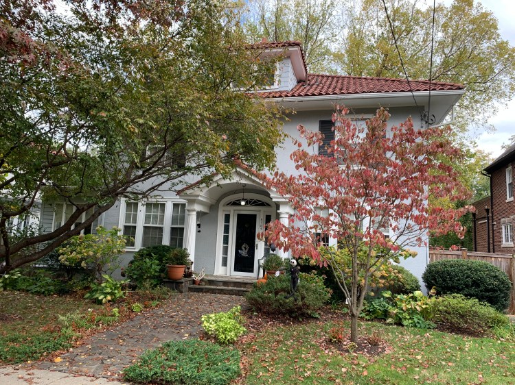
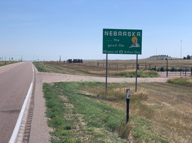
Glen Echo to Gaithersburg, Maryland Sunday, Halloween 2021

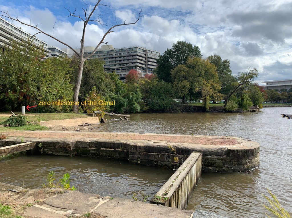
It’s hard to overstate the importance of the C&O Canal in our nation’s, and in my history. It dates back to George Washington, who saw the Potomac as a path to the nation’s interior, and envisioned a series of bypass canals to detour around the waterfalls and rapids. His idea morphed into the Chesapeake and Ohio Canal, an Erie Canal wannabe, hoping to cash in on the westward expansion gravy train, linking the Chesapeake Bay with the Ohio River, and the Mississippi basin.

The idea was doomed from the start. On the same day John Quincy Adams turned the first shovelful of dirt on July 4th, 1828, the B&O railroad kicked off from Baltimore. Unlike the Erie, which traversed mainly flat terrain, the C&O cut through rugged mountains and paralleled an unruly river. At one point, Paw Paw, a tunnel had to be built, the first canal tunnel in the world. Construction was dogged by labor disputes, poor treatment of immigrant workers, and cholera outbreaks. By the time it reached Cumberland MD in 1850, a little over halfway to Pittsburgh with the Great Eastern Divide (over 2000 feet high) yet to cross, the B&O had been there 8 years, and the canal was obsolete.

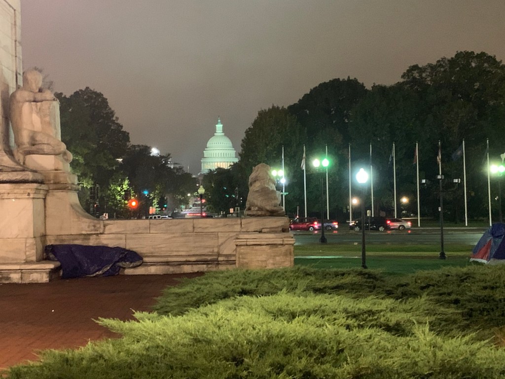
The unfinished canal enjoyed some success, it could haul coal cheaply and was competitive if speed of delivery was not a factor. The Potomac flooded frequently, however, necessitating expensive repairs, and after a bad one in 1924 the canal was abandoned, and soon became a derelict ditch. It was saved from being paved over by a highly-publicized hike in March 1954 by Supreme Court Justice William O. Douglas, was partially restored (most of it still a ditch with a towpath) and in 1971 became a national historical park. The river didn’t get the memo, though, and still floods frequently, with frequent closures.

The Douglas hike was two weeks before I was born, and the canal has always been magical for me. At age 14 my buddy Eric and I did our first “bike hike” to Great Falls, an audacious 30 mile trip that began my love affair with bike tours. So appealing: flat, beautiful, a conduit through history and mountain scenery without climbing, and with “hiker-biker overnighter” campsites every 5 miles. We did many trips in our Raleigh 3-speeds with wire baskets carrying our trash-bag protected gear. Many of you have heard my “famous outhouse” story, where we were caught in a freezing March rain with only a Sears drop cloth for shelter, and four of us had to cram in to a smelly old outhouse for hours, before bolting 10 mountainous miles in the sleet to be picked up at Harpers Ferry. A sympathetic friend dubbed it “the greatest wussy story ever told”.

It didn’t matter. I was hooked. I have biked the 184 mile length of it three times, and it never gets old. In a twist of irony, one of the rail lines that spelled the defeat of the canal went bankrupt itself, and was converted into a rail trail, the Great Allegheny Passage, that completed the route to the Ohio. The GAP is newer, better graded and surfaced, and goes through restored, lighted tunnels and over impressive viaducts. In 2012 I bribed Jane and Hope into doing the whole enchilada, 335 miles from DC to Pittsburgh, by staying in posh B&Bs. I was in heaven, but as quoted in my 5/19/21 post, Jane dismissed it as “a boring green tunnel”. Well.

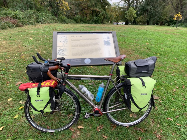
So it’s been nine years since I pounded the towpath, and it was the hook that got me going on this resurrection of the highpoint junket. Irresistible, a slingshot shooting me deep into the mountains with minimal hills, depositing me 10 miles from Mt. Davis, the Pennsylvania summit. Eagerly anticipating, I downloaded a complete towpath guide, full of the rich historical minutia that really floats my boat.

Ah, romanticism vs. reality. The connecting path from Glen Echo was comically rough, down a steep railroad tie-studded slope I knew I could never get back up again, then around some washed out spots from the recent rain that were almost impassable. I was relieved to hit the relative safety of the towpath. It started out great

The classic canal scene, the Potomac on the left

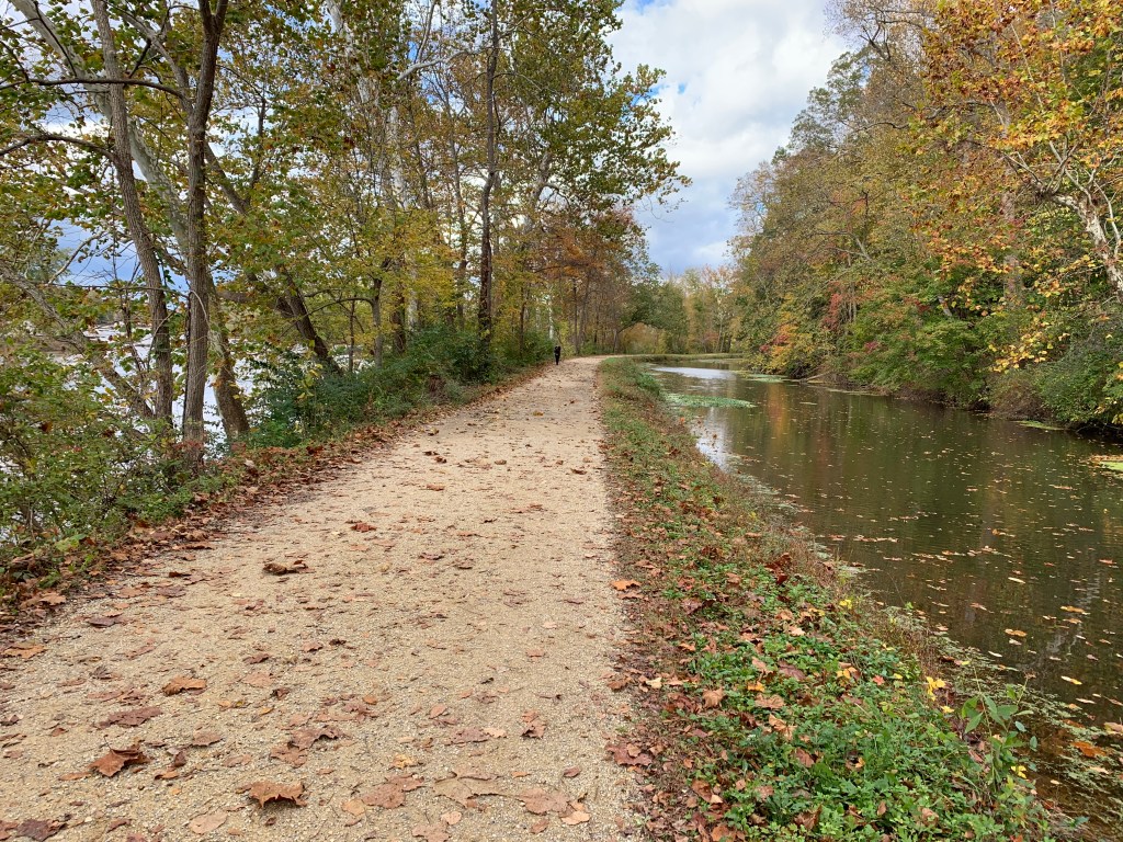
but soon devolved into ruts, roots, rocks and some near-washout spots. I knew this was the best-maintained part of the canal, and that crappy weather was coming soon. I’d ambitiously secured a warmshowers host 60 miles up the canal at Harpers Ferry, involving many metal steps to cross the bridge over the Potomac, and a warning from the host of a steep climb to his house. The thing about cycling in the late fall is, it gets dark early. I’d gotten one of my trademark jackrabbit starts (9:30). There were only primitive campgrounds (back in the day, I didn’t care that the hiker-biker sites had only a water pump) for accommodations before Harpers Ferry.

I knew all this in advance, of course. I knew some critical points, like the Paw Paw Tunnel, were closed, and that the detours were irksome. If I’d thought it through, I might have guessed that rattling down a bumpy path for hundreds of miles with my arthritic bones and a 110 pound bike might not be a cakewalk. But hey, I’m a guy. As Jane loves to say, guys have the dumb-stick.

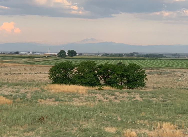
In 10 miles, I hit Great Falls, more impressive than usual with the recent rain.

It’s not Niagara, but the river falls 75 feet here

I was transported back to age 14, where it all began, but now the trip seemed even more audacious. Just like at the base of the Rockies, the wind was out of my sails. I talked with Jane for an hour, and decided to duck out to a motel. It was 12 miles off the canal, but I was pretty sure I had to deep-six the canal idea.

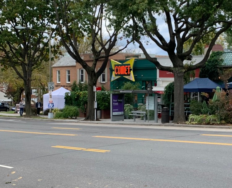
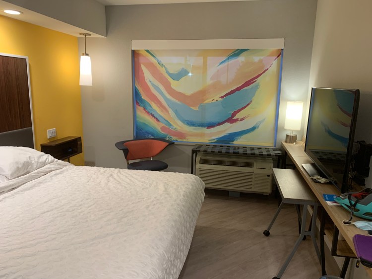
Even on this downer of a day, there were Easter Eggs. It was Sunday, scads of people were out, and my tricked-out bike got lots of those oohs and ahhs that I seem to crave. When booking the motel, I discovered I had something called Hilton Honors points that allowed me to score a nice room for $4.29. At a Subway, I helped a woman having trouble calling an Uber, she was just back from hiking in the Pennsylvania mountains I was headed for. We chatted awhile she waited for her ride, and it turns out she is the sister of Jerome Powell, chairman of the Federal Reserve.

Libby Powell

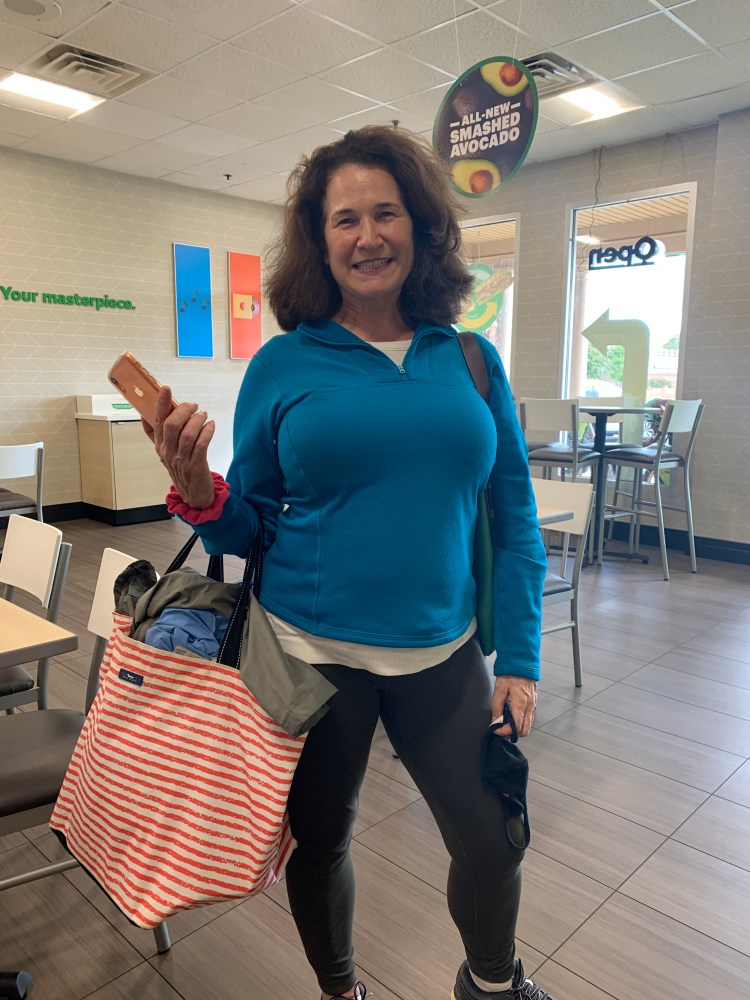
I know. A typical DC moment, random brushes with greatness. Shameless name-dropping. But she was delightful, and the encounter brightened my day considerably.

Distance 22 miles, 4,490 total. Time 6 hours with stops. Elevation gain 728 feet

Stomping grounds

Washington DC to Glen Echo, Maryland Saturday October 30, 2021

Been away for 40 years, but DC is still my hometown. Today was short on milage, but chock full of visiting friends, family, and old haunts. From that first Mr. Smith Goes to Washington view of the Capitol as I left Union Station last night, my mind was awash in nostalgia and reminiscing.

Hadn’t noticed the homeless person when I snapped the photo in the drizzle

My hotel, the “Yotel,” was ultra trendy with muted, colorful lighting and a front desk called Mission Control, but when you flattened the motorized bed/recliner you had minimal room to walk by. Like the Hilton Tru in Cheyenne, it was all about cramming in more rooms.

Had breakfast with Harvey Washington (see my post of 5/17/21) and we talked of our high school days and our medical careers, he’s still working long hours. We could have gone on for hours, made plans to get together more in the future.

Harvey

Then off to Lafayette Square, passing the White House

for coffee with My Uncle David and Lynne. Again, not enough time, but it was lovely to see them.

Passed my med school, remembered how we used to refer to the odd building as “the box the Lincoln Memorial came in.”

To restart the highpoints, I needed to touch sea level again, what better place than at Tidelock on the C&O Canal, also known as the water gate, the gate between the canal and the tidal Potomac. The infamous Watergate office complex rises just behind.

I posted on 7/31/21 that my highpoint obsession began on Spruce Knob in 1973, but I wonder if it was locked in long before. The highpoint of DC, Point Reno, was between my junior and senior high schools. Not officially marked back then, I’d walked within yards of it daily for years. Today was a chance to scale it from sea to summit, reminiscing along the way.

I passed the Shoreham, where Mom and Day spent their one-night honeymoon before Dad had to report to Frankfurt, Germany. Mom followed a few months later, and two years after that, she had me.

Nearby were the two group houses I lived in in med school, both near the zoo

On up Connecticut Avenue to my childhood neighborhood, just two blocks away from Comet Pizza, site of the infamous Pizzagate Incident in 2017

Thence to my three grade schools, site of my Wonder Years

I guess Georgian architecture was a thing back in the 1930s, all three schools were WPA projects.

Between Deal and Wilson was Point Reno, now marked with a sign and a benchmark.

Just a short hop to the house I grew up in, now all tricked out for Halloween

The last 4 miles of this trip down memory lane took me to an old med school classmate, Mark Head. He was staying with his friend Anna in the leafy Maryland suburb of Glen Echo, and they treated me to a lovely dinner with another friend Josephine, and a soft bed. So great to reconnect and catch up.

Distance 14 miles, 4,468 total. Time 6 hours with stops. Elevation gain 835 feet

Back from the dead

Train to Washington DC Friday, October 29, 2021

I thought I was done. Maybe I am done. But I’ve decided to give it another go.

It was good to be back. Despite all my trepidations, it was clearly the right thing to do. Thanks to all of you for the supportive comments, calls, and letters. I got one more day in the mile-high city with my terrific hostess, we saw the Molly Brown mansion and a couple of awesome art galleries, before we scored a great sushi dinner; she drove me to the airport the next day. Shipping the bike and gear home was crazy expensive but easy. By Sunday night, I was back in lovely Vermont, just in time for a primo September and that famous foliage. We took a bunch of hikes, saw a bunch of friends, and I did my wigged-out Boston to Provincetown ride for the 36th (and I think last) time.

But what happens to a dream deferred? I’m not too fond of raisins and God knows Vermont doesn’t get much sun. I didn’t explode, but I felt adrift. Without the press of having to go another 40-50 miles every day, it was too easy to just veg. As the Thane of Cawdor said, I had no spur to prick the sides of my intent. OK, enough with the hackneyed literary tie-ins.

The grim truth was, I had no other plans for my retirement. All last year was spent planning the ride, preening my steed, and waiting out the pandemic. Back home, I didn’t feel safe resuming until I could get a stress test (equivocal, but without worrisome signs) and my booster. I was first in line when Moderna #3 got approved last Friday; piggybacked with the high-dose flu shot we seniors are supposed to get, it was a few days before I felt up to snuff. Now I’m ready to bolt.

Between the short hikes and rides I was doing, I spent too much time in the Barcalounger (the “death chair”, my family calls it). My poor eating habits continued, so you can imagine the results. Of course the smart move is to take my diet by the horns, and work on a sustainable retirement plan. Of course.

Hope made me a lovely poster for my sendoff last April. It’s still taped to the garage entry door. Great to see it then, now not so much.

I only wound up doing a third, 5,449 miles in four months

So there’s this big hole in the next few months where my trip was supposed to be. Never in favor of it, Jane was resigned to have me gone until next spring. She has her own trips planned with family and friends, and the bathroom/kitchen renovations loom, with their attendant disruption. Now’s my chance. One of the lessons of my golden years is to be flexible. Maybe I can salvage much of it.

As Hope’s rough map shows, the plan was to cross the northern states in the summer, drop down the west coast in the fall, and return across the southern states in the winter. Now winter is hard upon us, and as we speak I’m on a train from Vermont to my hometown of Washington DC. You can bring your bike, unboxed, for $20. I can “zero out” again at the sea-level Potomac, follow the towpath of the C&O Canal Historical Park, where I cut my teeth on bike touring, to the highpoints of the Alleghenies/Blue Ridge. I drove up these 50 years ago, but in my twisted logic, that “doesn’t count.” Breaking for the holidays, I’ll aim to follow the Appalachians south to Florida, then head west.

We’ll see if the weather cooperates. It’s raining heavily now, the towpath could be a muddy mess for a few days. A little snow is predicted in the Alleghenies. The days are getting shorter. With my winter gear, the bike is heavier than ever. This could be a fiasco. But hey, I’ve got to try.

Distance 4.9 miles, 5,454 total (I guess it’s OK to keep adding to the total) Elevation gain 212 feet

Death by a thousand cuts

Denver, Colorado Friday, August 20, 2021

This will come as a shock to many of you. I’ve decided to stop.

Please don’t worry. I’m fine. There was no catastrophe, no trauma, no single thing that brought on this decision. It was just a lot of little things.

I just spent four days of unmitigated bliss and joy. It was so great to see my friends again, and their hospitality overwhelmed me. They were so kind to me, but the love they showed me had a curious reverse effect. It made it almost impossible to leave. Having tasted domestic bliss for the first time in four months, the prospect of going back to the daily challenges of the road was daunting.

There was one aspect of domestic bliss I did not get to taste. My wife had to cancel at the last minute because of a medical problem, not too serious, but prohibitive of travel. She’s already improving, was able to get a refund on her tickets, but it would be months and months before I could see her again. I had never been separated from her for this long, and now it was going to be longer.


The audacity of this whole enterprise was hung on the tender pegs of the state highpoints. I knew I was too old to do the big ones again, but had resolved to bike to their starting points, to climb them from sea level in two stages. My time off finally afforded me the chance to plot out the route, day by day, and look at what climbing the multiple high passes really entailed. A number of them were crazy steep, would necessitate prolonged stretches of walking my bike. I couldn’t get around it, it was just not practical. It was too late in the season. I could still make it to the Pacific, but instead would need to take Adventure Cycling’s signature Transamerica Trail. An exciting thought, it’s their most popular trail, and I would finally be able to meet other long-distance cycle tourists. Still, having to give up on the “prime mission” of this trip felt like kicking the legs out from under the whole enchilada. I put “prime mission” in quotation marks because I realized early on that the people I met were the real highpoints of the trip. So true, but still.

I was both thrilled and a little creeped out by the Front Range of the Rockies. I’d been looking forward to seeing them for so long, but when I finally got a good look it hit me like a ton of bricks. There was 7000 feet of sheer climb between Denver and the passes I would have to traverse. I had done this before, 9000 feet actually if you count the ascent of Longs Peak, but that was 15 years ago. I’m 67, hypertensive, prediabetic, recently obese, and traveling alone.

One the founding members of Adventure Cycling, very buff, about my age, who had led multiple long-distance tours, had been notified by his Apple Watch that there was an irregular heartbeat, and that he ought to get it checked out. He went to an urgent care center, and died before they could transfer him to the hospital.

Ever since I lifted my heavy bike into the pickup of that kindly sheriff’s deputy in Nebraska, I’ve had a nagging pain under my right shoulder blade. It became more evident when I was doing easy cycling, running errands during my sojourn, radiating up to my neck and around my entire thorax, possibly more evident with exertion but then that’s when I was twisting my shoulder more. It’s my business, my profession to tease out cardiac from noncardiac chest pain. This really felt non-cardiac. I was 95% sure…

All this was swirling through my head as I reluctantly rode away from my wonderful host. She lives on a plateau above Denver, so to approach the big climb of the Rockies I swooped downhill for 15 miles, giving me an even more eye-popping view. Today was one of those bluebird days, cool, crystal clear, with a soft tailwind and fantastic views. Just as I was rounding the corner to begin to climb, I got so distracted staring at my nav system that my wheel got hung up in a rut, and I tumbled over. It was onto a grassy bank, kind of like falling into a pile of cushions. No injuries, but I was still clipped in, and it was awkward disentangling myself. I was reminded of the father of a friend, who had one of those clipped-in falls that wound up having a significant impact on his life. There but for the grace of God. It just kind of knocked the wind out of my sails. I needed to have a root beer and a long talk with Jane, just to steady my nerves.

OK, I thought. Pull yourself together. You’re fine, it’s a perfect day. I cranked slowly uphill, past the awesome Red Rocks Amphitheater, my mind going back-and-forth. At the next rest stop, I studied the options, how much would it cost to go home; if I backtracked, could I get a reservation at a hotel in Denver? I kept going, the bike is so ideal that even bad hills are doable, but it was so slow. I had wasted time looking for a missing piece of equipment at the outset, and these additional delays had me way behind schedule. I knew I wouldn’t reach my original hotel in Georgetown until well after dark. I checked, there were no other campgrounds or hotels available. Those last 15 miles would have to be on the shoulder of I-70.

My NPR podcasts were full of bad news about the raging Delta variant, and the wildfires in the west. The worst of the wildfire season was yet to come. Parts of the Transamerica Trail had to be closed temporarily, and even now were under restricted use. The “bluebird-ness” of this day also had a curious reverse effect. This was the best the conditions could ever be, what happens when they revert to their usual heat or tempestuousness? No wildfire smoke today, but they were saying the smoke increases your susceptibility to Covid. It was now late summer, every day was getting noticeably shorter. One of my favorite songs, April, come she will, has this to say about August: the autumn winds blow chilly and cold. In my jumbled mind, I was fretful about heat and cold at the same time.

Do you ever experience the “false summit” conundrum? You’re climbing this big mountain, the trail is endless, you’re sure that when you round to the next bend you’ll be on top, only to see that there is more climb. So it was with me. I had teed up the Denver reservation on my cell phone, all I had to do was push the button. Take the irrevocable step (literally irrevocable. I am not going to put Jane through this again). I resisted at every “false summit” bend. Until one time, at 4:30 and 7,500 feet, I pushed it.

It felt like a huge weight off my chest. Roaring down the mountain, I hadn’t realized how steep the hill was that I was climbing. The views into Denver and of the surrounding mountains were beyond spectacular. I threaded around a tangle of police cars, there had been a bad accident on the road I had just passed, the ambulances had left but the wreckage was ghoulish. Another eerie omen.

Now I’m at that hotel in Denver, funny how rooms are so hard to get on the road on weekends, but are easy in the big cities. There is a big parcel of hassle coming up, figuring out how to ship my bicycle and all my stuff home, I am about to go to the UPS store. I fly out tomorrow morning.

Do I have regrets? Sure, it’s hard to have this epic, that has dominated my life for much more than these four months, come to an end. I am very sad not to be able to visit the friends and family that were on the agenda, but there will be other chances. I am particularly regretful to those who have been kind enough to say they’re living vicariously through this adventure. I feel like I have let them down, although I know they will protest to the contrary. I am so grateful to the followers of this blog, those who have commented and those who haven’t. It has been a tremendous comfort.

Even though I had a fitful night, I know this is the right thing. Kind of like Forrest Gump, when he just stopped running. The journey has been wonderful beyond words, the trip of a lifetime. The people I’ve met, the things I have seen, the nonstop kindnesses and goodwill I have been blessed with, the great realization of how special this country is, will stay with me forever. But it’s time to stop. Future adventures, this time with friends and family, await. My very best to you all.

Distance 64 miles, 5,449 total. Time 11 hours with stops. Elevation gain 3,057 feet

©️ 2021 Scott Luria

The mile-high biker’s paradise

Greeley to Denver, Colorado Sunday, August 15, 2021

I could barely sleep, I was so excited. Today I would see a city I love, Denver, see dear friends, and soon rendezvous with my wife. A long day, 80 miles, but 50 of these were on bike paths, following the South Platte River, Cherry Creek, and the Highline Canal. All were beautifully designed and surfaced. The smoke dissipated and I could get a real view of the Rockies, specifically Longs Peak and Mt. Meeker.

At the confluence of the two rivers was an REI flagship store, always a magical place for me. Saw my sixth State Capitol, and a friendly tourist snapped a photo of the iconic inscription and marker on the steps, confirming I had arrived at the mile high city.

A short post for a very full day. The next few days will be visiting friends, shopping, planning, reuniting, and generally blissing out. I’ll start posting again when I’m back on the road. Enjoy a break from having to read them, hope you all can celebrate the waning days of summer, too.

Distance 80 miles, 5,385 total. Time 11 hours with stops. Elevation gain 1,180 feet

©️ 2021 Scott Luria

The Centennial State

Cheyenne, Wyoming to Greeley, Colorado Saturday, August 14, 2021

Before we get started, I have to lay down some snark on my quirky hotel. It was cute, trendy, and innovative, but it appeared that at bottom, it was about cutting costs. Hilton figured out that almost nobody uses the dressers in hotel rooms anymore, which were there in part to give enough room for the big color TVs of yore. Now it’s all flat screen TVs, so they got the idea that if you remove the desk and dresser, have a roll-out table instead, and have the chair do double duty, you can make the rooms narrower. A little claustrophobic, but it worked. Shelves were everywhere, even a webbing one on top of the air conditioner.

A walk-in shower is trendy, and takes up less room than a tub.

The soap, shampoo and conditioner were mounted on the wall, with cute slogans and logos. Unfortunately, the soap dispenser was empty, so I had to use shampoo for everything.

There was one triumph: the TP dispenser. For decades the debate has ranged, does the roll dispense from the top or the bottom? Poor Ann Landers, when she was still alive, got endless letters about this. But the Hilton Tru has solved the problem. True bipartisanship, in this age of polarization.

Turns out, you CAN have it both ways

Speaking of snark, my good friend Mary Jo (MJ), with whom I’ll be staying in Denver, rightly called me out for my snarky remarks about Wyoming yesterday, with a germane passage from Marcel Proust encouraging me to look at the landscape with new eyes, new attitudes, that only then could I expand my horizons. Inspiring words, and after reading them I noticed my speed had increased considerably, 5 mph faster than yesterday, with no help from the wind. Could my stamina have increased overnight? Was this a Proust boost?

Nah, it just turned out my elevation profile was the mirror image of yesterday’s. It seemed flat, but I was gradually descending 1500 feet from the high plains of Wyoming to the, um, regular plains of eastern Colorado.

Ah, Colorado! So excited to be here, been waiting so long.

You can see the flowers (daisies? sunflowers?) starting here and lining the highway for miles

The only state healthier than Vermont. Soaring peaks, lush valleys, legendary rivers, aspen, wildflowers, meadows, heaven. The Centennial State, since it was admitted in 1876. Centennial was my first book by James Michener, about a fictionalized version of the very town where I’m staying tonight, Greeley. Some people hate on Michener, say he produces watered-down or “pop” history, but I find his technique, to follow a corner of the earth from prehistory to the present, to be brilliant and compelling. I read the book almost 50 years ago, but looking at the synopsis now I’m startled by how much I remember.

All day I was running parallel to the Front Range of the Rockies. I have long fantasized about first spotting the Rockies rising from the plains, as the pioneers did, seeing those purple mountain majesties above the amber waves of grain. Alas, the smoke from the wildfires interfered, I could maybe just make out the faintest skyline. Maybe tomorrow, as I enter Denver.

Distance 55 miles, 5,305 total. Time 6 hours with stops. Elevation gain 716 feet

©️ 2021 Scott Luria

Reflections on a gerund state

Pine Bluffs to Cheyenne, Wyoming Friday, August 13, 2021

There’s no getting around it, Wyoming is a weird state. The only state ending in “ing”, which makes it a gerund, I guess, sounds like a verb; the ending is unusual for place names in general (although Lansing, Flushing, Reading, and Corning come to mind). One of only two states that’s a perfect rectangle. The 10th largest state in area, but the smallest state in population, the only one behind Vermont. Home to spectacular scenery and barren wasteland. Named after the Wyoming Valley in Pennsylvania, where Scranton and Wilkes-Barre are, one of that valley’s original land owners was Vermont’s own Ethan Allen. As it happens, I’ve climbed its three highest peaks (Gannett, the Grand Teton, Fremont). Its most populous city, and its capital, is in the extreme southeastern corner of the state. Usually a capital would be more centrally located. There was a time when the Nebraska Panhandle was considering succeeding and joining Wyoming, since Cheyenne was more in tune with its geography and needs than Lincoln. Site of famous Yellowstone and Devils Tower, the Hole in the Wall, and the Teapot Dome scandal.

Other than Pennsylvania, this will be my shortest state sojourn, less than two days, although I’ll probably cross it again. Today’s ride was weird as well, following I-80 the whole way, itself roughly following the Oregon Trail. Seemed flat, but I was going slower than I usually do with a tailwind, the election profile explained why, I was gradually climbing all day.

Friday the 13th, but nothing bad happened, other than hearing a beloved patient had died, I called the family. The state capitol was a little weird, I thought a gold dome meant the state had given us a president, I guess Wyoming and Colorado didn’t get the memo.

At these capitols I usually look around for a statue, to see the state’s most famous son. Here’s all I found:

The plaque says Elling William “Bill” Gollings, A True Cowboy Artist. Two more gerunds.

What, Dick Cheney didn’t make the cut? Now Liz, I could see.

I capped this weird day with a quirky hotel, the “Tru” from Hilton, known for its bright colors, lack of dressers, and “clever” bathrooms. Too clever by half, perhaps, but pleasant enough.

Distance 45 miles, 5,250 total. Time 7 hours with stops. Elevation gain 1,537 feet

©️ 2021 Scott Luria

I just couldn’t not do it

Kimball, Nebraska to Pine Bluffs, Wyoming Thursday, August 12, 2021.

I ended my last post with a Homer Simpsonesque “D’oh!” Here I had just talked myself into resignation, skipping the Nebraska highpoint because I couldn’t get an escort through the buffalo range. I spun it as a life growth event, learning to gracefully accept reality and bending on my rigid goals. Anne posted a lovely comment lauding my choice. Then, just as I was closing the entry, Brandon the deputy offers to escort me after all. I graciously decline, my mind is made up. He says I can call tomorrow if I change my mind.

I slept fitfully that night. The smart thing to do was nothing, just go ahead with what I had decided, and head for Denver. But whatever sickness it is that compels me to do these highpoints in the first place kept gnawing at me. I had to give up on Wounded Knee because it just wasn’t possible. In this case, Brandon had made it possible, and if I bypassed it, it would be because I didn’t want to. It would be my choice, not circumstances beyond my control. And I just couldn’t say no.

At the cross roads, I called the landowner, Jean Klawonn. She was so nice about it, said it was the insurance company that told her to forbid pedestrians and cyclists at the highpoint. She mentioned that the buffalo were in rutting season, and that it would definitely be dangerous to be around them. However in the heat, they commonly lie down and are usually less of a problem. She was quite happy with the idea of my having a deputy escort. Even enthusiastic, since she welcomed anything that would bring law-enforcement out to her property, being so out of the way, they don’t get out there much.

I checked again with Brandon, and he confirmed that he was happy to help me out. He suggested I approach from Wyoming, which would keep me on pavement for as long as possible. Crossing the border was funny. I got a chance to look back and capture that ironic Nebraska welcome sign

Well at least there are a couple of trees in this photo

But Wyoming made no such fanfare. This rundown shack was the only sign I could find that I had even entered the state.

Fanfare or no, I was in Wyoming! Yes!! This is truly the west. As if on cue, a tumbleweed rolled by, I wasn’t quick enough to get a picture. Instead, I grabbed a quick lunch, dropped my heavy bags at the motel, and was off to meet Brandon.

It was a 16 mile detour, with 6 of those miles on dicey dirt roads. The sign at the entrance to the Klawonn property confirmed that bicyclists and pedestrians were not welcome.

No envelopes provided, so I just stuffed my three dollars into the box left.

Brandon arrived in due course and drove slowly behind me as I crossed the cattle guard and bounced down the rough track for the final mile and a half to the highpoint. There were no bison in sight, after all that.

Highpoint total is still 37, but now I’ve done 19 from sea level.

I thought I had gotten a photo of Brandon and his big pickup, but I can’t find it. He offered me a ride back to the hotel, and even though some could argue that wasn’t kosher, I took him up on it, it would’ve been a headwind all the way. Plus, I wanted to get a chance to talk to him. He told me of the expanded duties of the sheriffs office in rural Nebraska, and that he plans to run for sheriff next year, with an excellent chance of winning. He also has a cattle and crop farm that has been in the family for 100 years, and I was amazed to hear how much work that is. I heard about the details of those irrigation booms, how they work, how much they cost, and that this part of Nebraska has only seen a half an inch of rain in the last three months, when they usually have 5 times that. With the two jobs, 110-hour work weeks are common. It just made me realize how thoughtful he was to come out and help me. He wouldn’t let me buy him a beer or dinner, it was just in the line of work. This kind of generosity is the norm here in the great plains, but it amazes me every time.

So for better or worse, I maintained my “streak”, but the whole thing held me up enough that I will have to bust my hump to make it to Denver in time. Hopefully the wind will cooperate.

Distance 42 miles, 5,205 total. Time 6 hours with stops. Elevation gain 1,224 feet

©️ 2021 Scott Luria

Reality 101

Scottsbluff to Kimball, Nebraska Wednesday, August 11, 2021

Today was a day of compromises and missed opportunities. For quite a while now, I have been uncertain of being able to visit the Nebraska highpoint. I’ve already been there by car, with Brian and Eric in 2004, but I hoped to get there under my own power. Trouble is, it’s on private land with an active bison range, and a large sign requesting that pedestrians and bicyclists stay away, it upsets the buffalo and could be dangerous. They ask that you visit only in a vehicle.

The buffalo aren’t always there, sometimes they’re in other pastures. My plan was to contact the landowners, to see if that might be the case tomorrow, when I hoped to do it. Their number isn’t listed; websites said they could be contacted through the chamber of commerce of the nearest town, Kimball. Google maps said the chamber closed at noon.

The chamber was up a 2000-foot hill, 45 miles away. I got up sleep deprived, super early to try to make it. The good thing was that I was able to catch the morning balloon launch, and get a better picture of Scotts Bluff. Too bad I didn’t have time to climb it.

Up, up and away. There were many more that I was too late to photograph.

Imposing edifices like Scotts Bluff should be the highpoint, but the real one is one of those slight rises in a flat field, like Indiana and Iowa. The whole state of Nebraska tilts upward as you go west, and the highpoint is just a few yards from the Colorado and Wyoming borders. Here’s a picture I got off the web, a stone monument placed by the chamber of commerce years ago, surrounded by an absurdly stout pipe fence, and an adjacent ancient steel desk where the register is. The landowners ask that you make a three dollar donation.

I pushed as hard as I could to get to the chamber by noon, but the heat, wind, my age, and sleep deprivation got the better of me, and I didn’t get there until 12:30. I needn’t have bothered.

What Google maps identified as the Kimball Chamber of Commerce

Great. Now what do I do? I went into the municipal building, and a very helpful Wendy Baker called a woman she knew, Jessica, at the information center on the interstate. It was up another 300 foot hill, but what the heck.

The first rest stop in Nebraska for eastbound travelers.
Jessica, a real Trail Angel

Despite being busy with other tourists, Jessica spent nearly an hour with me, contacting the landowner, who was noncommittal about where the buffalo would be, giving me a special map, and brainstorming about perhaps finding someone who could meet me at the gate. The plan would be for me to walk or bike behind their vehicle, and if a buffalo came around, I would duck inside.

She offered to meet me there herself, but I saw how busy she was, what an imposition it would be. She mentioned that there was a deputy who lived fairly close to the highpoint, perhaps he could help. She texted his wife, who contacted him. By the end of the day, I hadn’t heard back.

I had to make a decision. Jane was flying to Denver to meet me in five days. Even in the best of circumstances, going to the highpoint, down 35 miles of dirt roads, would make the schedule very tight, at a time when the wind and heat remain significant factors. Add to that the uncertainty of when I got there, if there were buffalo around, and I was not able to arrange an escort, I would have to turn around empty-handed.

I’d already caved on the Wounded Knee destination, so I decided to let this one go as well. This may turn into a pattern. I had hoped to bike to the trailheads of all the big Rocky Mountain highpoints I have climbed, but I now see that time pressure and the approaching winter will make that impractical. If I am unable to do those, there will be a little point in trying to do Nebraska, to maintain my “streak” of doing them all under human power, in one or two stages.

Ah well. My therapist and family say this is good for me, making compromises, easing back on my rigidity, acknowledging the perfect is the enemy of the good. Another bitter pill to swallow. There was a point today, when I was pushing as hard as I could to reach that non-existent chamber of commerce in time, that I was ready to throw in the towel. Instead, I was sustained by the love of family and friends, and the kindness of strangers. The real theme of this trip.

Just as I’d cemented my plans, and wrapped things up to try to catch up on my sleep, Brandon the deputy called at 9:30, apologetic for not getting back to me sooner, he’d been flat out since 3AM. Sure, he’d be happy to meet me at the highpoint and provide an escort. D’oh!

Distance 46 miles, 5,163 total. Time 8 hours with stops. Elevation gain 2,008 feet

©️ 2021 Scott Luria

Calling my Bluff

Alliance to Scottsbluff, Nebraska Tuesday, August 10, 2021

Another fairly featureless day, but at least this one had an intriguing destination. Scotts Bluff, a butte which rises dramatically 800 feet above the prairie, was a landmark for earlier travelers on the Oregon Trail. It also rises above the eponymous town, which pushes the two words together. Both were named for Hiram Scott, a 23-year-old fur trader who was found dead at its base in 1828.

You could see it from far out, although today the wildfire smoke kept it hidden until I was fairly close. I was only able to get one shot, in shadow as it rose above the North Platte River. It’s a national monument, and there is both a hiking trail and road to the top, but it was almost 100° today, and I held off.

I imagine many of you, when flying across the country, have noticed those intriguing green circles made by irrigation booms with a center pivot. I was able to see one of those up close, although it was so huge it took a while to grasp that I was looking at the edge of a giant curved field.

Today was also remarkable for long talks with Anne, Howard, Ellen, and my therapist, and of a random act of kindness. Looking for a place with some shade, I found a desolate general store with a sign saying “opening soon”. Linda, an older woman with a paintbrush, said I could go inside to talk, and there I found a fully functioning soda fountain machine, complete with ice and root beer. What heaven, this was the only establishment I passed the entire day. Linda and her husband Kevin were hoping to open it within a couple of weeks. She wouldn’t let me pay for the huge quantities of root beer I consumed. They told me of a balloon festival in Scottsbluff, and where to find groceries and food, and a good bike shop. That little shop was surprisingly well stocked, I got new cycling gloves and some elbow pads for my aero bars, that I have been looking for for months. Bike shops in the big cities didn’t have them. More Easter eggs amongst the desolation.

Distance 61 miles, 5,117 total. Time 7 hours with stops. Elevation gain 953 feet

©️ 2021 Scott Luria