Chadron to Alliance, Nebraska Monday, August 9, 2021
OK, this is the first time this has happened in the 115 days of this trip. I really have nothing to report. 54 miles across the featureless Nebraska Panhandle prairie, there was 1000 foot climb out of the White River Valley, and then just gently rolling, with good shoulders and a favorable wind. That’s it. Reminiscent of the Meseta on the Camino, which was interesting at first but then got kind of old. It was hot, and there was no shade, but I’ve gotten used to waiting until I cross a stream, which at least gives me a guard rail to lean on while I eat lunch in the hot sun. This particular stream was dry. I’m glad I had the whole 6 litres of water with me, and a couple of oranges I copped from the motel breakfast spread.
I was determined to find beauty in scenes like this, but this time it was a challenge. It’s hard to imagine what it must be like to live here. The irrigation booms were active, which I guess was something. There were still a few stray bikers from the Sturgis rally, trailing their multiple American flags.
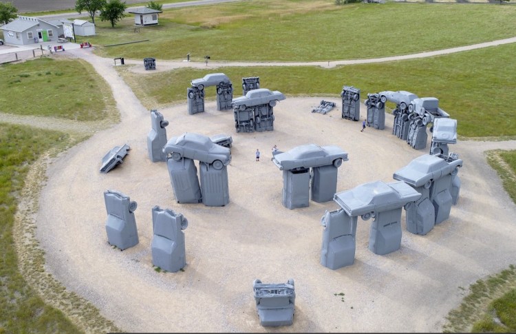
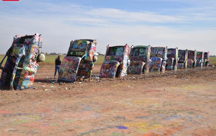
I could’ve made it slightly interesting by detouring to Carhenge, but it was 6 miles out of the way in this hot sun, and I couldn’t see the appeal of a shrine to fossil fuel. Still, it seemed kind of cool. The family did get a kick out of the Cadillac Ranch, in the Texas Panhandle in 2005. I should lighten up. This trip is about embracing America.
Give me Manhattanhenge or MIThenge any dayAt least with the Cadillac Ranch, you can spray paint to your heart’s content
Th-th-that’s all, folks! Only 5 more days of prairie to Denver. Don’t give up on me, I’ll try to find something.
Distance 54 miles, 5,056 total. Time 6 hours with stops. Elevation gain 1,956 feet
Hot Springs, South Dakota to Chadron, Nebraska Sunday, August 8, 2021
Decision made, it was time to get going. Another scorcher today. I left as early as I could, left the last trace of the Black Hills behind and re-entered the rolling prairie. I passed a sign that symbolized my difficult choice.
Rolling prairie. Now I see where the term “prairie schooner” came from, it felt like I was crossing oceans of grass. The monotony was mitigated by a long phone call with Sarah, during which I crossed into Nebraska. I didn’t want to risk dropping the call to take a photo of the welcome sign, but it mentioned that Nebraska was the home of Arbor Day. This without a tree in sight. You can’t make this stuff up.
It was 99° when I rolled into Chadron, just before three. Chadron has the only Warmshowers host in the Nebraska panhandle, but you can’t camp in heat like this, so I opted for a nice motel. They had a fitness center with the first scale I’ve seen in weeks, and my sorrow was bucked up by seeing I had lost 40 pounds. Of course this was before eating anything or fully rehydrating, so I guess it was the opposite of a thumb on the scale.
I went over to see the Warmshowers hosts anyway, since Steve and Cheryl had cycled around the world. Their lovely home was naturally cool without air conditioning
Steve and Cheryl
…a real oasis as they gave me food and drink, local route advice, and we shared stories of our love of the open road. They met while cycling through Salzburg, Austria, which brought to mind a favorite movie Before Sunrise. We could’ve talked for hours, but it was Cheryl‘s birthday, so I left them to celebrate.
The 3 mile detour to visit them gave me another little bonus: my odometer rolled over to 5000 miles, or five large as Tony Soprano would say. What a long strange trip it’s been.
Distance 57 miles, 5,002 total. Time 7 hours with stops. Elevation gain 1,587 feet
Custer to Hot Springs, South Dakota Saturday, August 7, 2021
Today couldn’t have been easier, 34 miles down the Mickelson rail trail and good roads, almost all downhill, and with a tailwind. So why didn’t I feel better?
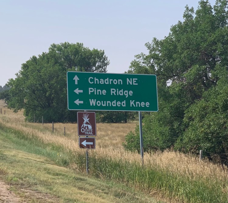
For weeks I have been talking about, and apprehensive about, visiting the site of the Wounded Knee massacre, the heartbreaking coda of our military action against the Lakota People, on December 29, 1890. Apart from slavery and the Jim Crow era, this is possibly the most shameful episode in our history. I just can’t stop thinking about it, of course have read Bury My Heart at Wounded Knee, seen the PBS and other videos, and after finishing my Crazy Horse audiobook, have just completed American Carnage. No, not that American Carnage, the earlier book, the most detailed and definitive recounting of the massacre, and the grievous trail of deception, coercion, humiliation, and treachery that led up to it. That Sitting Bull had been killed just 14 days before, that all three tragedies—Crazy Horse, Sitting Bull, and the massacre—were precipitated by bungled attempts to bring the Lakota into custody; and that the inciting event was the poignant and heartrending Ghost Dance, a plaintive call for a messiah to restore to the First Nations what was taken from them; it was all just too much. The dance was beautiful and harmless, but it unnerved the soldiers and settlers, and became the spark that ignited the powder keg.
Beyond the highpoints, a theme of this trip is to visit the worst as well as the best of America, that only by acknowledging, by paying tribute, by owning the harm we have done, can we begin the healing. The Germans have done this, to some extent, with the Holocaust, and are much farther down this road than we are. Maybe it’s all part of my grandiose self-delusion, that by eschewing fossil fuel on this trip I can combat global warming, that by visiting these sites I can help kickstart the healing. Silly perhaps, OK silly definitely, but it’s been an engine of motivation keeping me going.
So why the apprehension? This one has me creeped out. It will take me three days out of my way—I’ve blown days before taking zeros and zigzagging all over creation waiting for Charles Mound to open up—but now I’m feeling the pressure of the approaching winter, of getting through the Rockies and Cascades before then. The facilities are extremely sparse along the way, after reserving that B&B I discovered it has no running water, and the idea of doing these sweaty days without my nightly shower is daunting. Indeed, the heat and winds look unfavorable, as does the road quality exiting into Nebraska. I seem to be developing my own wounded knee, the DJD that dogged me on the Camino has been mercifully quiet until that 11 mile hike up Black Elk Peak on Thursday. Finally, and I’m embarrassed to admit it, the common practice of dogs roaming free on the reservations has me anxious.
My whining seems ludicrous compared to the real dangers and suffering of 1890, but tonight I’ve made the agonizing decision to skip Wounded Knee. Better part of valor and all that. Just getting through the semi-arid desolation of Nebraska and northeast Colorado will be challenging enough. Wounded pride (this is the first major stop I have had to give up) aside, I don’t want to jeopardize the whole trip to tag this post.
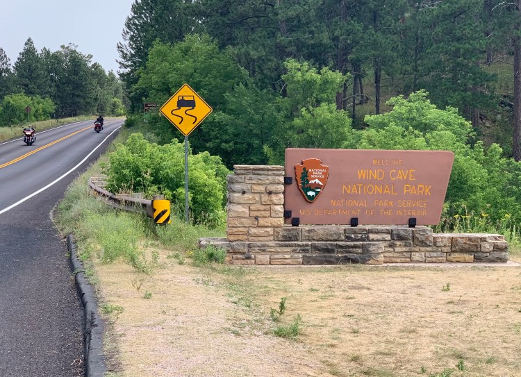
There was a bright side to this Debbie Downer day. My route took me through Wind Cave National Park
Sturgis is 70 miles away, but there were still scads of bikers
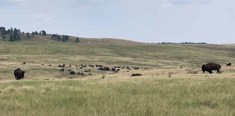
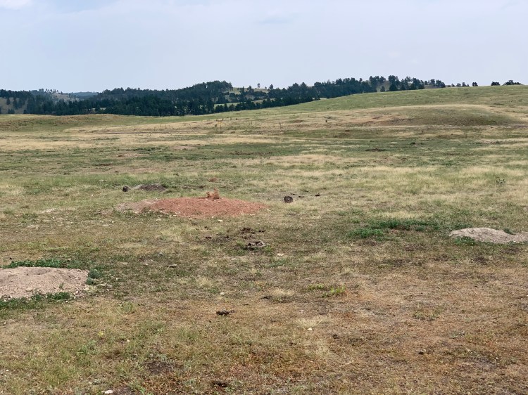
Only my second national park, Isle Royale was my first. I didn’t go to the caves themselves, we had been there in 2005 and they were cool, but there are more impressive caverns elsewhere. Just passing through, however, I was able to see bison, prairie dogs, and untouched prairie.
This is as close as I want to getTwo prairie dogs in the center on their mound, a long way from Prairie du Chien in Wisconsin.
Randy had suggested I ride through the heart of Custer State Park, where there are large herds of bison, but included a link to his own adventures there.http://theentertainernewspaper.com/writers/brich/feb06.html Impressive story, but poor salesmanship, in terms of getting me to go there. I’ll have trouble enough with the bison at the Nebraska highpoint.
Distance 34 miles, 4,945 total. Time 5 hours with stops. Elevation gain 650 feet
Sylvan Lake Lodge to Custer, South Dakota Friday, August 6, 2021
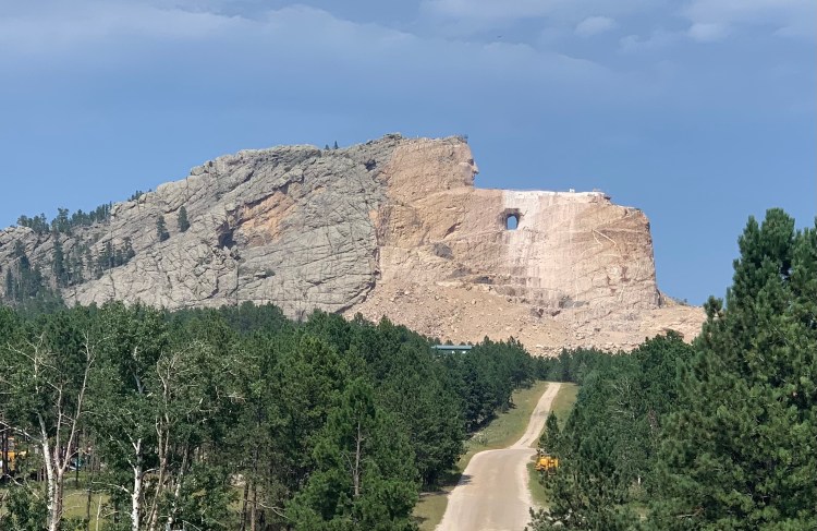
The backside of Mount Rushmore, seen yesterday from the top of Black Elk Peak, was all I cared to see of that monument. I’ve seen it twice before, there are always huge crowds, and as much as I admire those four men, one could argue that two slaveholders, a wealthy adventurer, and the man who was responsible for the largest mass execution in our history, 38 Native Americans in 1862, were out of place here. There was one face in stone I did want to see, TȟašúŋkeWitkó, AKA Crazy Horse. I’d listened to his full story over the past few days in the audiobook The Journey of Crazy Horse, and I wanted to pay tribute to this man who cherished the Black Hills above all else, and who gave his life defending them for his people.
Today would be an easy day, swooping downhill from Sylvan Lake, then just 6 miles up the Mickelson Rail Trail to the monument, where I hoped to camp. Between them was the town of Custer, and I spent some time in the library using their good Wi-Fi and researching lodging for the next few days, the librarian helped me find a B&B just 11 miles from Wounded Knee.
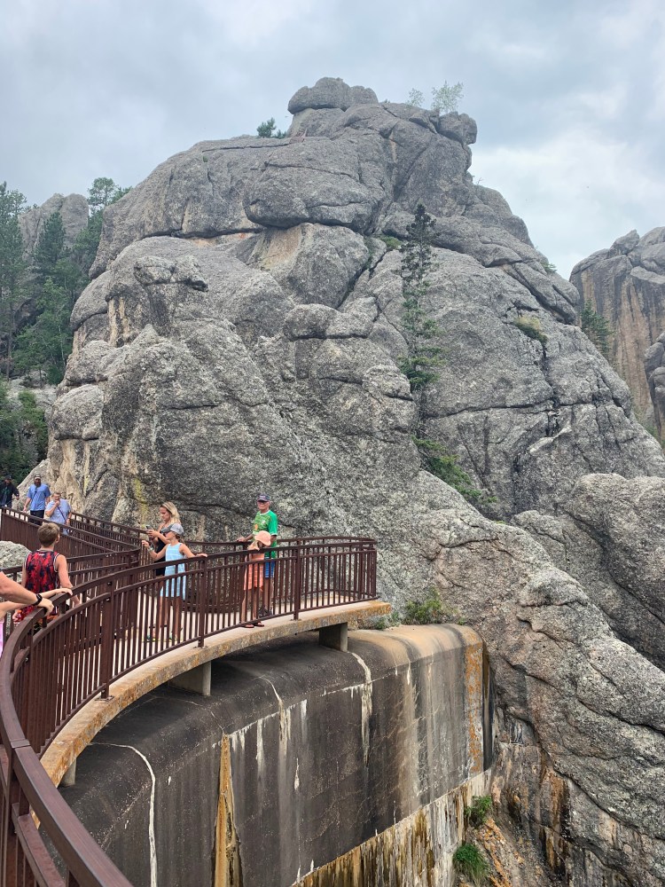
There was no rain in the forecast, but I guess the Black Hills make their own weather. As I went up the trail, I saw storm clouds ahead and suddenly they were forecasting an 80% chance of thunderstorms. Great, the crushed stone rail trail does not do well in rain. I considered turning around, but decided to scoot up and at least make it to the visitor center before it poured. It was arresting to round the bend, and suddenly see him up there.
Buses to take you closer were cancelled because of the weather
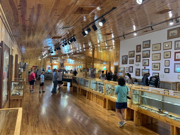
The Polish-American sculptor Korczak Ziolkowski began working on this in 1948, at the request of Henry Standing Bear to serve as a counterpoint, and to dwarf, Mount Rushmore. He knew it would not be finished in his lifetime, and indeed he died in 1984, the work being carried on by his family. They have refused all government aid. If completed, it will be the second largest statue in the world. This is as far as they have gotten in 73 years, not much further than when I saw it with the family in 2005. The visitor center has grown considerably, however, and was swarming with tourists (given the news of the delta variant, I’m wearing a mask indoors again). This was the best picture I could get of the completed model, with the monument in the background.
This was as sparse as the crowds got, maybe I’ll Photoshop the people out later. Only a small corner was devoted to Crazy Horse himself
This was the most touristy thing I did in the Black Hills, but I was happy to pay the admission fee, eat in their mediocre, overpriced restaurant, and make my way through the gift shop. I consoled myself that at least it was for a good cause, then I saw this New Yorker article https://www.newyorker.com/magazine/2019/09/23/who-speaks-for-crazy-horse
He is being carved into Thunderhead Mountain, and sure enough, the storms returned with a vengeance. I had hoped to watch the laser light show at 9:30, but it’s no fun setting up camp in the rain. During a lull I headed back down the hill to Custer and a motel. There’s some resonance there, Crazy Horse defeated Custer at Little Bighorn in 1876.
Distance 22 miles, 4,911 total. Time 6 hours with stops. Elevation gain 983 feet
Sylvan Lake Lodge, South Dakota. Thursday August 5, 2021
The plural is intentional, a play on Black Elk Speaks, the definitive work on the Oglala medicine man. Until 2016, South Dakota’s highpoint was named Harney Peak, which I climbed in 1977. The name was a great insult to the Lakota people, General William Harney was known to them as “Woman Killer” for his habit of attacking defenseless women and children, so galling to have his name on the apex of their sacred Black Hills.
So I’ve climbed Harney Peak, but not Black Elk Peak. A silly distinction, perhaps, but it brings up the issue of what to do with all the big highpoints I’ve already climbed, but from a parking lot I drove to. As stated before, I’m too old to redo the really tough ones, have already decided to just bike to my prior parking space and call it good. Sea-to-summitting in two stages, acceptable to these “rules” that matter only to me.
Black Elk is in the gray zone, pretty hard but doable even in my decrepitude. I have reclimbed the northeast peaks, even the semi-tough ones like Washington, Marcy, and Katahdin. This one would be the highest so far. I was on the fence right up until I checked in to the Sylvan Lake Lodge last night. When the clerk said I could keep the room for two nights, that clinched it.
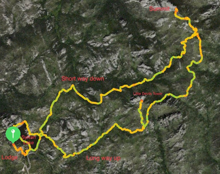
On July 22, 1977 my girlfriend and I drove nonstop from Boston to the Black Hills, on the 25th I bagged Harney with enough time to see Devils Tower and make it all the way to Yellowstone. Ah, to be young and strong, the whole shebang took three days. This time it took me 110 days to get here, and I knew the seven mile, 1200 foot vertical climb hike would burn up most of the day. Furthermore, an acquaintance I’d made outside of Pierre, Randy Brich, who has been giving me great advice about all things Black Hills, suggested I take a longer trail up and the short one down. What the hell, I’ve got all day.
Randy was right, the longer trail was much more interesting than I recall the short trail being.
Overall route
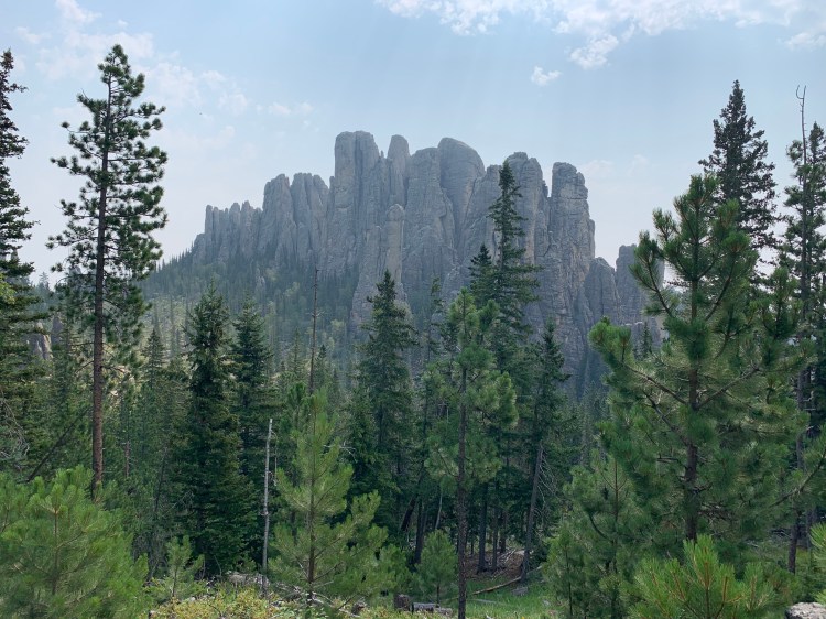
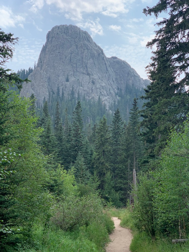
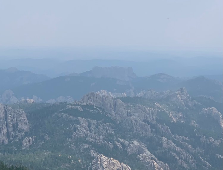
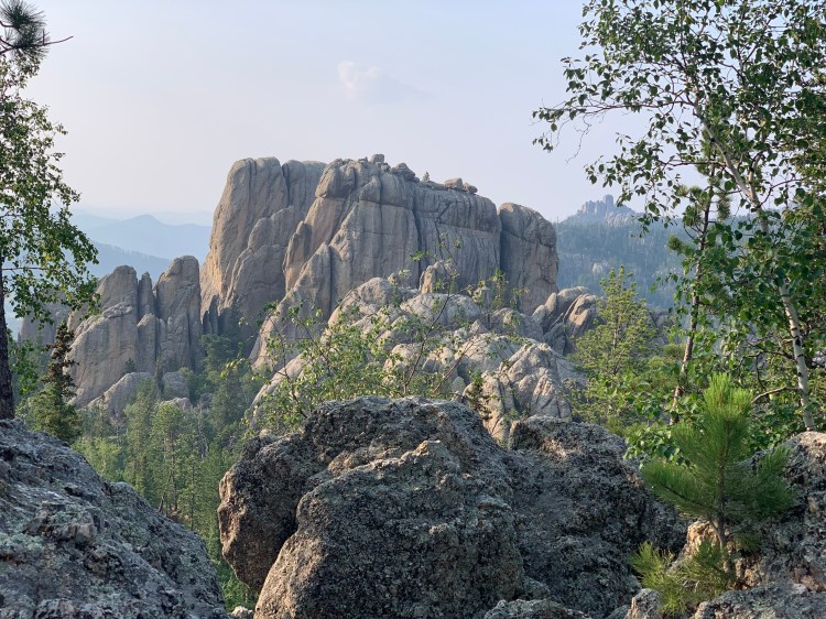
The views were nonstop, many difficult to capture in a photo. It took me by a number of spectacular features, including Cathedral Spires and Little Devils Tower.
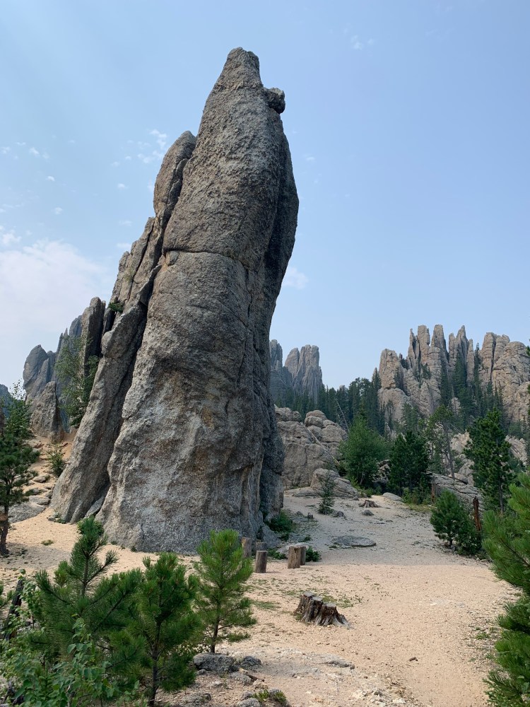
Cathedral SpiresLittle Devils TowerOne of the Needles
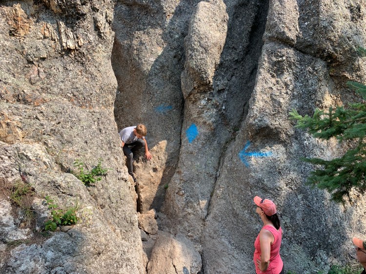
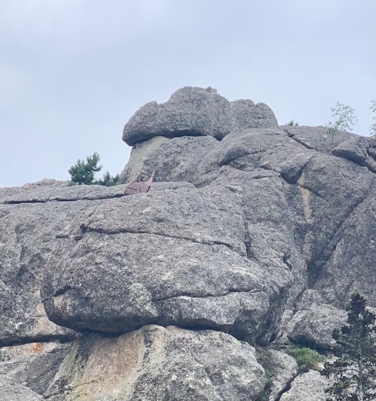
I didn’t have time for the side trails that lead to these, but on one occasion when blindingly following a family ahead of me, I came upon this crevice, and realized that I had gotten about halfway up Little Devils Tower.
Oops
I was tempted to proceed to the top, but no, this hike will be long enough as it is. The mistake had already added another mile.
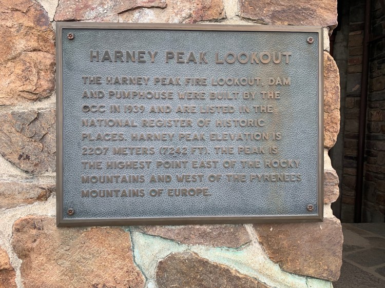
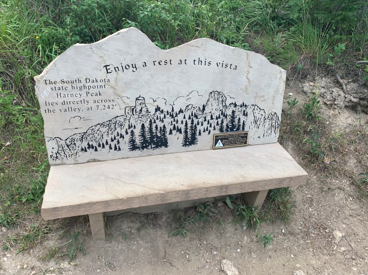
The actual summit of South Dakota is covered by an old observation tower, and they have not changed the plaque on the wall, or on a Highpointers Club bench on the way up
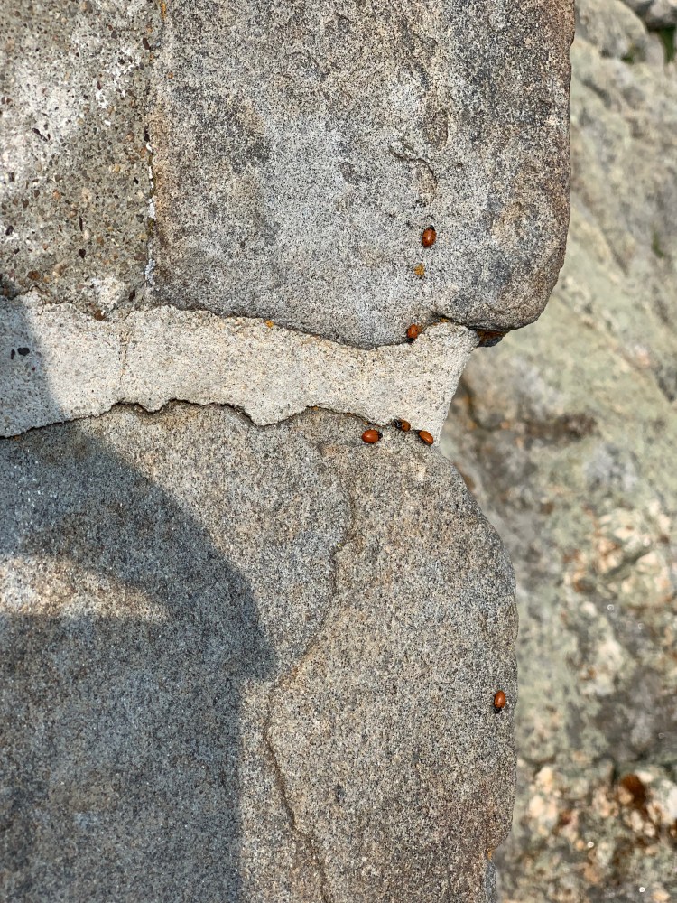
I remember from 1977 that there were scads of ladybugs at the top, and there still were quite a few. Ironic, because Harney, you recall, was a lady killer.
Fly away homeA face made for radio
This does not increase my highpoint count, I am still at 37, but now there are 18 that I have done from sea level.
In the hazy distance you could see the backside of Mount Rushmore, and can get an idea of what the mountain must’ve looked like before they carved it up.
Mount Rushmore is the flat topped mountain in the middle distance
You can also see how bogus that classic Hitchcock movie, North by Northwest, was. I’ve already mentioned it for the Indiana crop duster scene. In the climax, Cary Grant and Eva Marie Saint are being chased through the woods and happen upon the top of Mount Rushmore. You can see here that they would’ve had to have made a major rock climb to get to the top of the heads from the back.
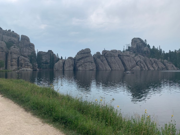
The “short way down” still seemed interminable at the end of this day. However when I got back to the lake I had enough energy to walk around the perimeter, adding another mile. It was generally pretty easy except for a cluster of rocks at the dam on one end.
Randy had told me that a famous rock climber, John Gill, had pioneered the climb up the boulders there, and to look for paint marks indicating the route. The paint was gone, but there was a little chair at the top of the cliff, for anyone who cared to climb up there.
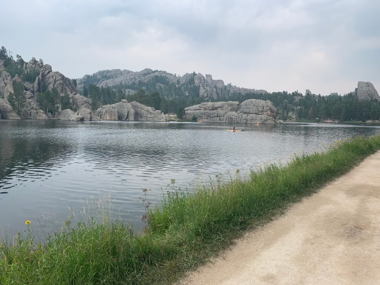
The John Gill cliff above the dam, you can just make out a brownish smudge below the summitHave a seat, if you canThe idyllic lake. On a family trip in 2005, Jane and I walked around it, while the boys rented paddleboards
The biggest hike of the trip so far, and quite a bit longer that the hike in 1977, but totally worth it.
Distance 11 miles, 4,889 total. Time 8 hours with stops. Elevation gain 2,042 feet
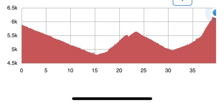
Carstens Cottages to Sylvan Lake Lodge, South Dakota Wednesday, August 4, 2021
So today I started at almost 6000 feet, and finished at 6300. Why did I have to climb over 2000 feet? The elevation profile tells the tale.
On two occasions I dropped about 1000 feet only to have to climb it again. I wished I had a zip-line, so I could just go from peak to peak.
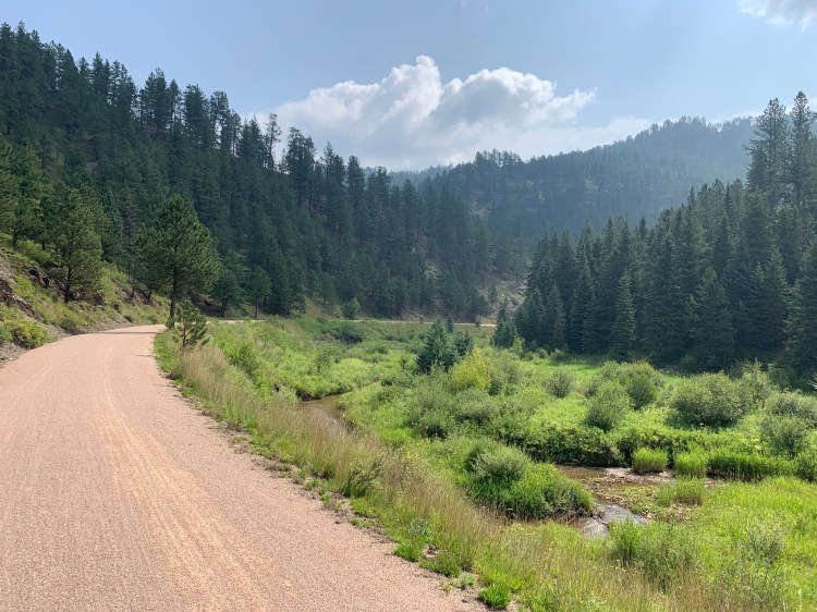
Well if you have to do all this up-and-down nonsense, it helps to have a great rail trail, the Mickelson, which I followed for 32 of these 41 miles. It was amazing how it cut through the landscape, beautifully graded with bridges and tunnels, avoiding all the ups and downs of the adjacent road. It used to be the Burlington Northern railroad, built many years ago, but what a tour de force of civil engineering.
It’s crushed limestone, generally very smooth, but because it had rained so hard last night, there were some ruts and soft spots in places. For the most part, though, I was able to cruise down the first slope averaging 18 miles an hour, grinning ear to ear, trying not to think about the paying-the-piper climbs ahead.
That last climb was on paved roads, no shoulders, as steep as I have encountered on this trip. In my lowest gear, I was weaving from side to side and having to take up the whole lane. Long lines of cars and motorcycles would pile up behind me, but not one person beeped or shouted, mostly just called out words of encouragement. At the top were the twisted granite cliffs and spires the Black Hills are famous for, you could see how one of them could’ve been transformed into Mount Rushmore.
In the right background, just touched by the leaves of the tree, is tomorrow’s objective, Black Elk Peak
Distance 41 miles, 4,878 total. Time 7 hours with stops. Elevation gain 2,109 feet
Belle Fourche to Carstens Cottages, South Dakota. Tuesday, August 3, 2021
How great that Lin-Manuel Miranda’s first musical is coming to the silver screen. I found myself in my own heights today, the Black Hills.
My hoped-for distant view of them rising from the plains never materialized, it was too hazy or smoky. Their hulk manifested itself in a different way, in my pathetic speed. I kept checking to see if my tires were low, or something was rubbing—I never go THIS slowly.
No, the bike was fine, and I personally felt fine. It was the constant uphill grade, so shallow as to be imperceptible, but steep and unrelenting enough to knock my speed into serious wussy territory. It might have been an optical illusion. I was approaching the Black Hills from the backside, thereby spared the grievous string of tourist traps leading into them from Rapid City. I remember one of them was about defying gravity. SEE WATER FLOW UPHILL the sign shrieked. Well in fact I was going gradually uphill, I thought it seemed I was going flat or even slightly downhill. It was uncanny.
Suddenly I was in Spearfish Canyon. Wow, what scenery.
Such a welcome change from weeks of prairie. A couple of other positive notes: it was getting cooler as I climbed, and the food stops were frequent. I could probably stop carrying my 6 liters (12 pounds) of water, but old habits die hard. A thunderstorm came by, but I was able to duck into a bar and avoid having to break out my rain gear, which for all its high tech fabrics still gets sweaty inside. The motorcycles were frequent but respectful, this scenic highway has a 35 mph limit. One stretch had no shoulders, but I fired up my crazy-bright rear flasher, and no worries.
The road finally steepened to the point where it was noticeable, I even had to walk my bike for a mile. I topped out at 6,300 feet, higher than Mt. Washington, so the acme of this trip so far. Then down to the Mickelson Rail Trail, 109 miles of crushed-stone heaven, as long as it doesn’t rain. Wound up at Carsten Cottages, the only lodging for miles, I’d called ahead and had the proprietor pick up groceries, and barbecued a sirloin steak.
Distance 43 miles, 4,837 total. Time 10 hours with stops. Elevation gain 3,485 feet
Buffalo to Belle Fourche, South Dakota Monday, August 2, 2021
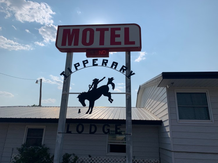
I stayed at the Tipperary Motel last night and was on the road before 6 AM.
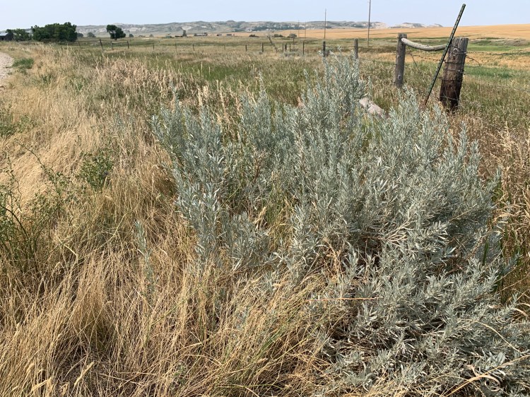
At White Butte I had noticed my first sagebrush, a real sign I was in the West. I picked off a leaf and crushed it, just love that smell.
Sagebrush!
This morning, as the sun rose on my left, my shadow was projected into the fields on my right, it was cool to see it dancing along. An old rider of the purple sage.
I continued to listen to the Crazy Horse book and got a thrill when I saw these mountains rise up over the horizon, could these his sacred Black Hills?
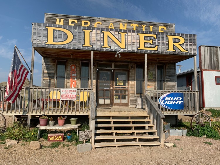
They also marked the only food stop in 72 miles, the charming Mercantile Diner, run by Becca, who served up a mean biscuits and gravy. Originally from Indiana, she and her husband Scott had visited this place and fell in love with it, buying it and fixing it up, she had many stories about long-distance walkers and bikers, and about her own struggles with ovarian cancer.
Zoom in on the sign by the stairs
Becca
I spent way too long there, 90 minutes, chatting with her and customers, I still had 50 miles to go. Fortunately, the shoulder was in good shape the whole way, and the heat and wind not too oppressive. The hardest part was listening to the sad, sad end of the Crazy Horse story, when the great leader turned himself in to the Fort Robinson agency to save his people from annihilation, only to die in a scuffle as they tried to put him into a jail cell. His cousin, Little Big Man, pinned his arms as he was bayoneted by a soldier. Dustin Hoffman he wasn’t. I was glad no one could see my tears.
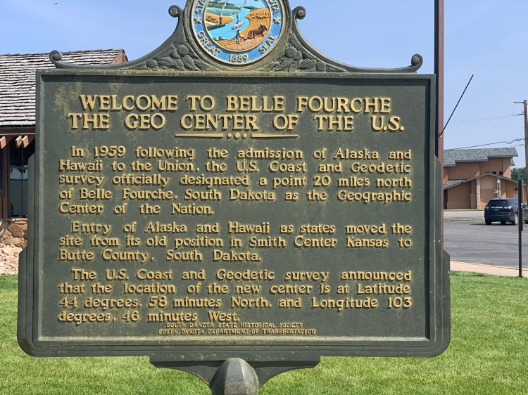
15 miles out of Belle Fourche (pronounced Foosh) I saw this curious sign.
Huh. I thought that was in Kansas
Once I got into town, I found a little park that commemorated it
So Kansas was where the center of the Lower 48 was, recently commemorated in a controversial Super Bowl commercial, featuring Bruce Springsteen https://youtu.be/L2LJpicgA2E
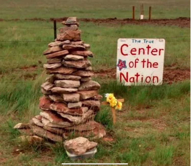
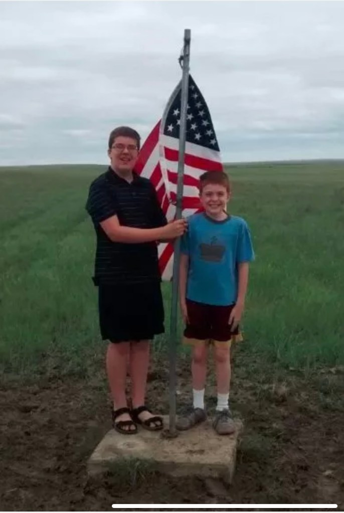
The sign said the actual spot was where that first sign was pointing. I found it on the web, glad I hadn’t added 15 miles of dirt roads to see it in person.
Cairn by the road
The actual spot
Benchmark
The Sturgis motorcycle rally starts in four days, the closest I will get to it is tomorrow morning at Spearfish, 22 miles away. There were only six Harleys in the motel lot today.
Distance 72 miles, 4,794 total. Time 10 hours with stops. Elevation gain 1,958 feet
Bowman, North Dakota to Buffalo, South Dakota Sunday, August 1, 2021
This entry is going to be short, I need to get to bed early, tomorrow is a huge day. Today was just 47 miles due south, recrossing back into South Dakota, en route to the Black Hills. I was just as happy to say goodbye to the “Legendary“ North Dakota after eight days, but regretted my flippancy as soon as I saw what happened to the shoulders on two-lane US 85. I guess South Dakota spends less on highway maintenance. The nice broad shoulders I had been enjoying vanished into crap, and I was forced to ride on the main roadway, on a fairly busy route, also known as the CanAm Highway. I guess I was lucky it wasn’t five years ago, when the oil-fracking fields of Williston, North Dakota (not to be confused with my Vermont hometown) were really humming. Then, I was told, the trucks were nonstop. Now, they were just intermittently frequent, at a rest stop I saw dozens of identical flatbed trucks hauling the same piece of huge, complicated equipment, fracking-related, I assumed. The drivers were generally courteous, passing me in the other lane, but one truck beeped me since there was oncoming traffic and I had to ditch into that crappy shoulder. Harrowing, but I didn’t fall, was able to keep my balance. I have to do 72 miles of this same highway (there’s no alternative) tomorrow, so I’ll try to start well before dawn.
When things were quieter I was able to listen to more of the audiobook The Journey of Crazy Horse, and imagined him riding on the same sweet grass South Dakota prairie I was. As it happened, Eric had sent me a link to a Jesse Colin Young song, Before You Came, just two days ago. Talk about capturing the mood.
While I’m busy pasting, another germane song is the Eagles The Last Resort, all about Manifest Destiny https://youtu.be/4ETN21RZwwI
Everything is drawing me towards Wounded Knee. I hope it’s feasible.
Distance 47 miles, 4,722 total. Time 6 hours with stops. Elevation gain 1,301 feet
Amidon to Bowman, North Dakota Saturday, July 31, 2021
OK, today I climbed the highpoint of North Dakota, my eighth highpoint on this trip, exactly 12 weeks after the first one, Campbell Hill in Ohio. On that day, I promised to explain why I was so fixated on highpoints. As today’s is the last new one I’ll be doing for quite a while, I suppose I should finally get around to trying to explain.
I have tried, partially, in earlier posts and my Denali chapter. I guess it started with my love of my maps. I was an early subscriber to National Geographic, but the maps I loved best were in the Rand McNally road atlas. I would stare at states I didn’t know, places I had never been, and would wonder about all the points of interest. Every state had a little black triangle marking its highest point, and I would find myself searching for it on each page. In the summer of my freshman year of college, Brian and I were touring back roads West Virginia, and noticed that we were quite close to that little black triangle.
Sure, why not? Funny how the locals, people who had lived their whole lives within 5 miles, had never heard of it. That should’ve tipped us off. But eventually we found someone who could give us directions, and drove up to Spruce Knob, elevation 4,862.
The view wasn’t that good, maybe it was hazy that day. There was a little observation tower, and I remember how the trees were so windswept that they only had branches growing out of one side. Brian, who had already climbed Mts. Washington and Katahdin, mused that it might be cool to try and do them all. What I should’ve said was you’ve got to be kidding me. What I said was sure, why not.
That was 48 years ago, August 1973. For the life of me, I can’t recall what possessed me to take the bait, to put this monkey on my back. Highpointing was not a thing back then, less than five had completed them all; one of them, Frank Ashley, had written the aforementioned pamphlet, Highpoints of the States, and he had only done the lower 48. It was until 13 years later that Jack Longacre of Missouri sent a letter to Outside Magazine that led to the formation of the Highpointers Club. https://www.insidehook.com/feature/action/the-highpointers-club-turns-30
Mutual friend Eric scoffed at the ridiculousness of this project, then turned around and did 49 of them, all but Denali. His wife Ellen has done 39. That’s the thing, it kind of sneaks up on you. I warn you, it’s habit forming.
Brian I think is stopping at 45 (the last five require guides, unless you are a very experienced mountaineer). I only have 37 with today’s highpoint, but my ace in the hole is Denali, and I’ve done all but one of those “last five”—the easiest one, Mt. Hood. I do have a reasonable chance of doing all 50.
Over 300 people are “50-completers” by now (far fewer than those who have climbed Everest), and I believe the fastest time is 22 days https://www.colinobrady.com/50hp. I was wondering what kind of record I could set, possibly the slowest time? Climbing the big ones is undoubtedly a thrill, but over half of them are easy, often just a quick walk from the car. To me, doing those seemed kind of silly, just trying to complete a list. But what if you got there under your own power?
In 1981 I celebrated a life transition by biking from Washington (med school) to Boston (residency). Along the way, I tagged the Elbright Azimuth in Delaware, the second lowest of them all at 448 feet, but this time, not so silly. You see, I’d just ridden the bike past Delaware Bay, sea level, so I could rightly say I had “climbed” the state. Now that was something. Sea to Summit, just like the name of that outdoor company. I checked with the Highpointers Club and searched the web, it didn’t look like anyone else had done this, or even though of it. Maybe I could be the first “human-powered highpointer”.
Over the years, as my travels took me close to some of the highpoints, I would avoid going over there, wanting to “save them” for when I could do them by bicycle. The idea took shape to do them all in a single mega-trip, starting at the Atlantic.
The start of this blog chronicles the beginning of the journey last year, just after retirement, when I biked from my home in Vermont to the ocean in Maine, then to Pinkham Notch to hike up Mt. Washington. I was only able to post the first day, I’ll fill the rest in later. One day after Mt. Washington I had an equipment breakdown and Jane had to come get me, thereby “breaking the thread”. I would have to “zero out” at sea level again before doing the others, fortunately I found that spot in Troy whether Hudson was still tidal, so I could do that without having to go back to the ocean. Over a total of 30 days last year, I did all of the New England highpoints (except Maine, which I’d sea-to-summited in 2002) and Mt. Marcy in New York. Like I said, I’ll have to blog days 2 to 30 later. Covid kept me from doing the rest until this year. The blog is intact for these last 106 days.
So I’m not sure if this lengthy preamble adequately explains my goals and rationale, but I will have to break it off to get down to the business of documenting what happened today.
Coming into Amidon yesterday I noticed a police car in a speed trap, and was surprised to see the same car there early this Saturday morning. Closer inspection revealed there was just a dummy in the car, Ralph at the bar last night explained that the town couldn’t afford to hire a policeman.
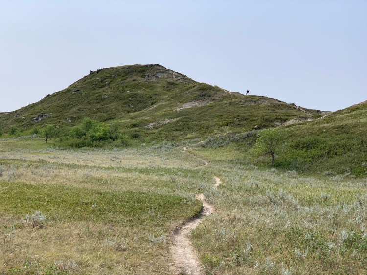
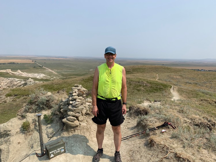
Getting to White Butte involved 18 miles of dirt roads, but they were of good quality. I encountered four other hikers, a gentleman visiting from Nîmes, France; a father and daughter traveling across the country, and a local hunter, John, who is getting in shape for deer season. He had a pistol on his belt.
White Butte from afarJohn, approaching the summit
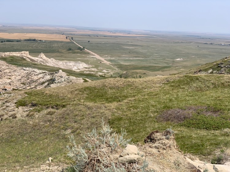
None of the others had heard of highpointing, they were just out for a Saturday stroll. I signed the register, John took my summit photo, and I looked out over the bleak expanse of western North Dakota.
If you zoom in, you can just make it out John’s car, my bike, and the father and daughter at the end of the road Highpoint #37, 17 from sea level
Under each of my highpoint photos, the caption reads the total number I’ve done, and the number in the sea-to-summit mode. What about the other 20? I plan to revisit the ones I drove up on this trip, but not the big ones out west—Rainier, Whitney, five of the Rockies—I’m too old to do those again. For those, the plan is simply to bike to the trailhead parking lot where I had started before, thereby sea-to-summiting in two stages.
White Butte was more of a hike than the others, but it still wasn’t much. The whole process, changing my shoes, packing my fanny pack, chatting with the others, scattering Dad’s ashes, took three hours. The rest of the trip was fairly easy, not too hot, favorable wind, and I got into Bowman by 3 o’clock. Every grocery store in town was closed. The next couple of days will be challenging, there is a “food desert” until I reach the Black Hills.
Distance 35 miles, 4,675 total. Time 7 hours with stops. Elevation gain 1,364 feet