Zen and the art of talking to motorcyclists

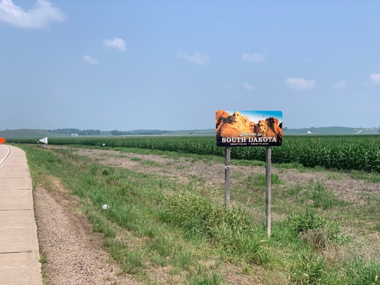
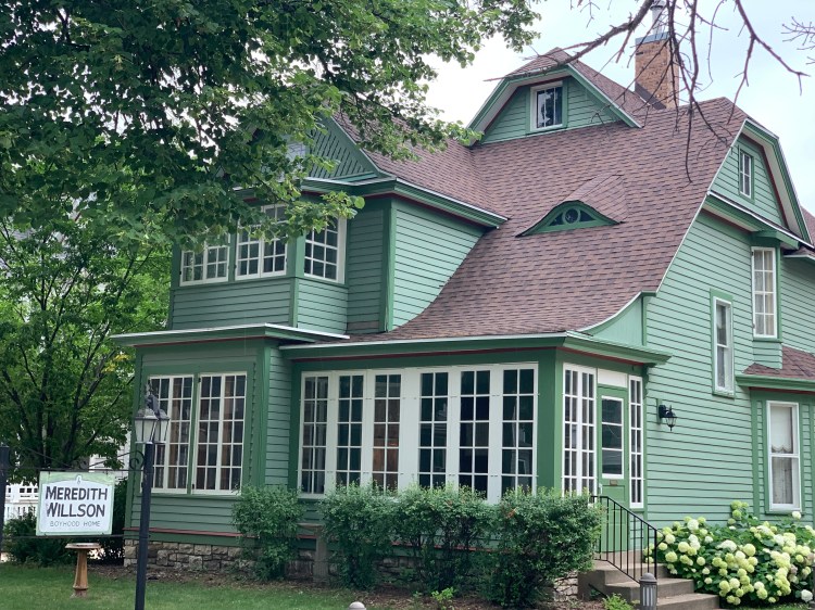
Lucas to Chamberlain, South Dakota Sunday, July 18, 2021

D’oh. It didn’t rain at all last night, despite the 100% chance of severe thunderstorms, so I felt kind of foolish in this crazy hunting lodge, when I could’ve easily camped by the Missouri. Still, I didn’t think it was worth the risk, in tornado country.

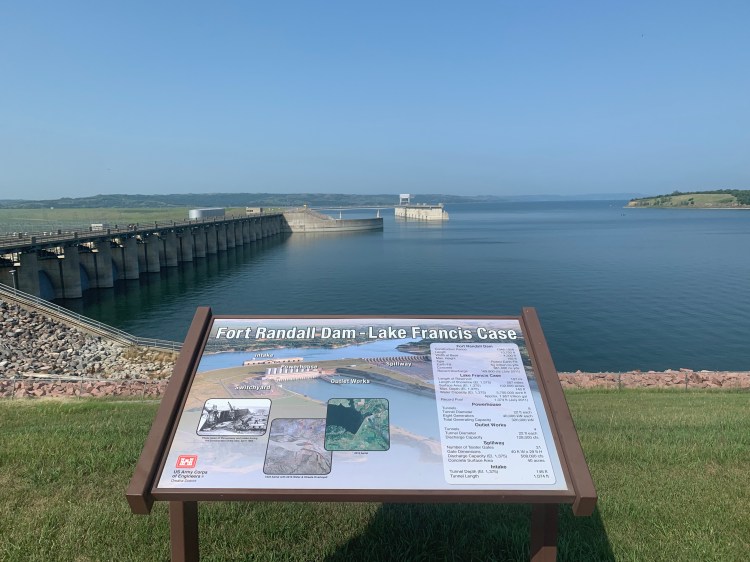
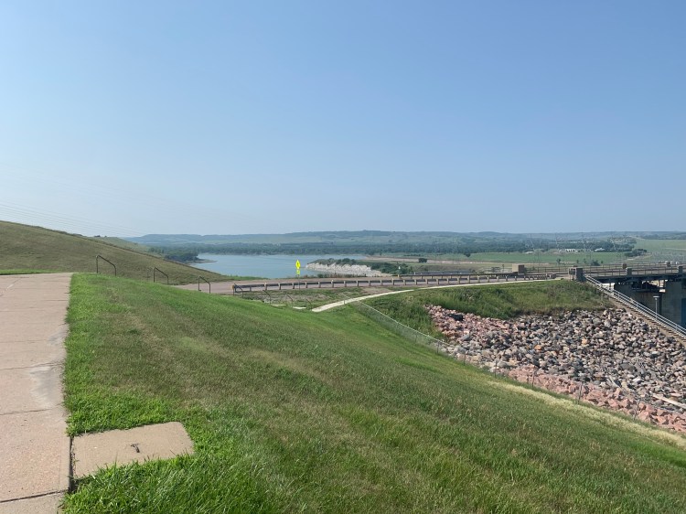
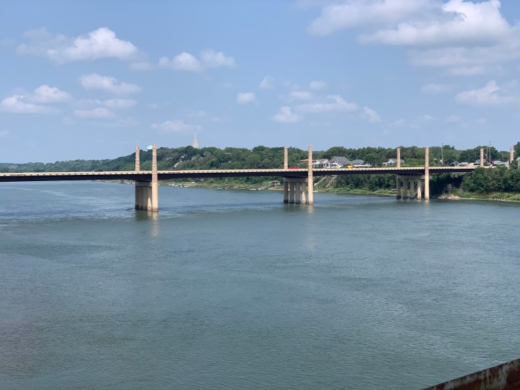
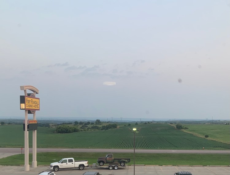
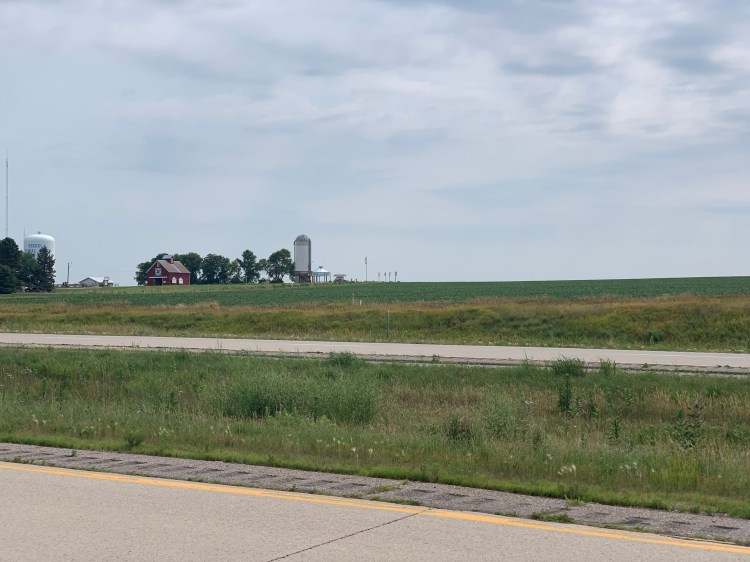
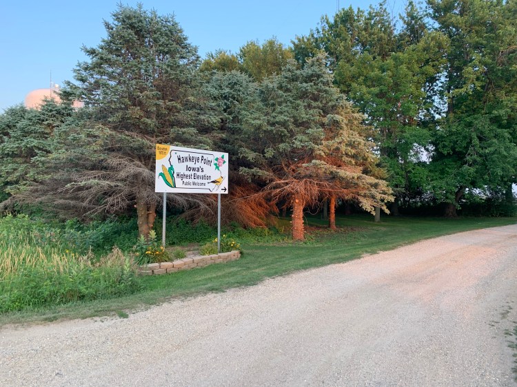
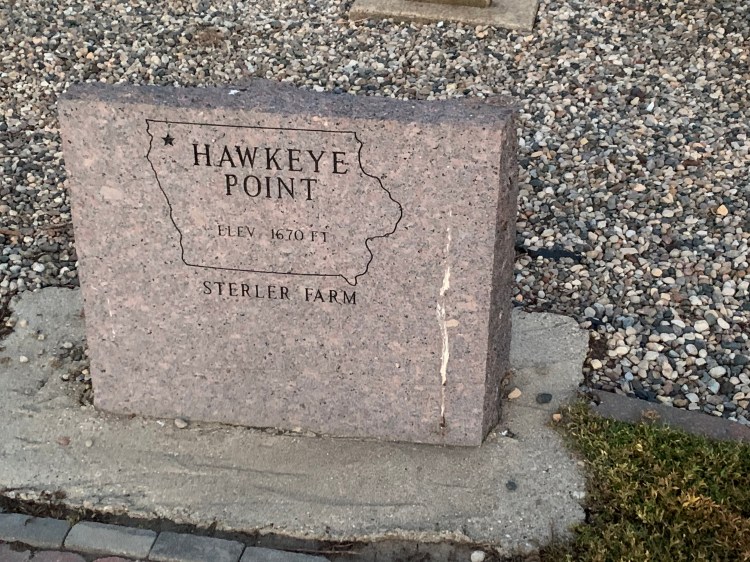
It was a pretty uneventful day. Plunged quite steeply down to the Missouri again, actually the same Lake Francis Case that was damned up at Pickstown, steep enough that I worried about my brakes holding, but they were fine. The campground I would’ve stayed at is in the Snake Creek Recreation Area, but there is also a nice restaurant, and even though I wasn’t that hungry, I had a sizable meal because there were no services at all for the next 45 miles. I had copped a couple of frozen water bottles from the hunting lodge, and combined with some non-perishable groceries from the restaurant, I figured I would be OK. I was.

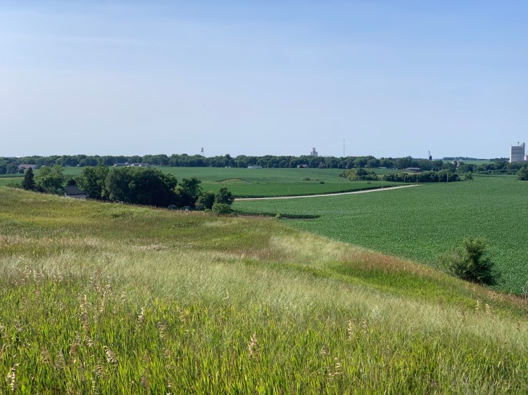
The climb back up the other side of the bluffs wasn’t as bad as the descent, otherwise it was just gentle rolling, with a hot tailwind. It got into the upper 80s, which is about as hot as I feel comfortable riding with a tailwind. A headwind, irksome though it is, is at least somewhat cooling. Tomorrow it’s going up to 94, so I will try to start early and get into a motel by the early afternoon. Yeah. We’ll see if that happens.

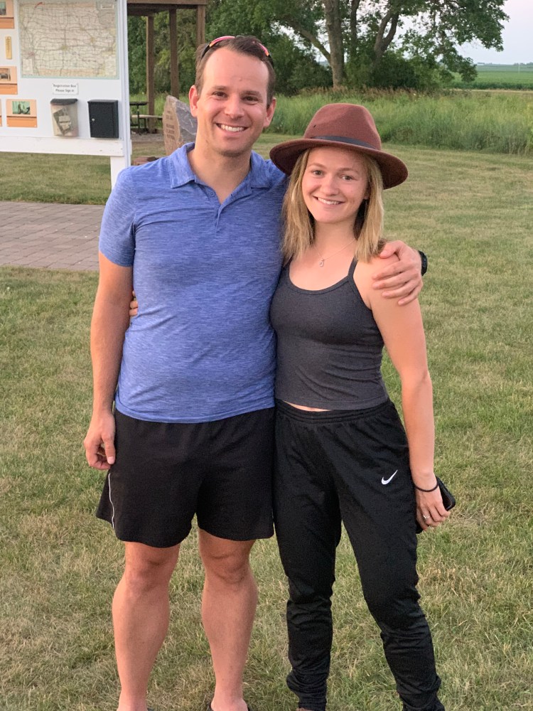
At least tonight, I found a lovely campground on the Missouri, at American Creek in Chamberlain. It’s so easy to meet cool people in a campground. I met Douglas, an English teacher who is taking a motorcycle trip from Oregon to the Pittsburgh area, to give support to his ailing grandparents. He is traveling alone, camping in a hammock, and in many ways we have been having similar experiences. We talked for hours about the people we’ve met, political issues, health issues, and life goals. A favorite book of his is Zen and the Art of Motorcycle Maintenance, and he followed the exact track of the author for part of his journey. Also met Jenna and Jo, physical therapy students from Cincinnati who left this morning are trying to see the western national parks on the way to Seattle. They wisely made reservations at the campgrounds, but are still concerned about traffic, the heat, wildfires, and the drought. They had somehow wedged the lid of their expensive water bottle on too tight to loosen, and sought our help. This triggered an episode of Male Impotent Prowess Syndrome that would have made Click and Clack the Tappet Brothers cackle with delight. We failed, of course, but not before stifled grunts and groans, trying cooking oil, chilling with cold water, and waiting too long to give up. The ladies and the guys were gracious all around, but I wondered if we had been set up, to take us down a notch. Lord knows I needed it.

Distance 61 miles, 4,107 total. Time 8 hours with stops. Elevation gain 1,188 feet

©️ 2021 Scott Luria

Four square

Pickstown to Lucas, South Dakota Saturday, July 17, 2021

Today was a day of symmetry. I left precisely three months ago, so the trip is exactly one forth over. I also happened to pass 4,000 miles on my odometer today. If I can maintain this pace, even with the days I “took a zero” or had meager mileage, I should be able to complete 16,000 miles when the trip is over. I estimated I would need 15,000, so this gives me some margin for error.

Although I felt OK when I woke up this morning, I guess yesterday’s huge mileage, and the moderate heat, took its toll. Even with a tailwind today, my rolling average was only 9.3 mph, when yesterday’s was 10.8.

The day started auspiciously enough. I got to swoop down 3 miles to the Missouri River, right at the Fort Randall Dam, which impounded the 105 mile-long Lake Francis Case.

Spillway on the left, intake for the power generators on the right
Below the dam, the Missouri runs pristine for hundreds of miles. That’s what I saw when I crossed the pedestrian walkway yesterday.

Trouble is, what goes down must come up, and crawling up the other side of the Missouri River bluffs was enervating, it was hot even in the mid-morning, and I was so bleary I didn’t even witness the odometer rolling over. I was also disappointed to be following US 18 almost the whole way, even on the official Adventure Cycling route, and I did not see a single other long distance bike tourist. All of this was mildly irksome, but nothing too daunting.

100% chance of severe thunderstorms tonight, but it was Saturday, so hard to find a free motel room. Ultimately stumbled upon the Sully Flats Hunt Club, in the middle of nowhere, the proprietor thought there would be a room available, even at the last minute, so I didn’t have to commit until I was 10 miles away and knew that I would make it. He took my credit card info and said he would leave the door open.

I needn’t have worried. This is the hunting club, there was nobody else around for miles. I just hoped Stephen King wasn’t hiding out in one of the back rooms.

Not exactly a going concern

From their website https://sullyflatshunts.com, it looks like they make their living running pheasant hunts, and skeet shooting, this was the skeet launching device trailer in the back. Guess it was too hot for that this weekend.

Looks a little medieval

It actually looked nicer on the inside, and I was comfortable, with the whole place to myself. They had a full kitchen, beers in the refrigerator, and a pretty impressive man cave in the back.

Maybe should’ve copped one of them hats

Distance 62 miles, 4,046 total. Time 10 hours with stops. Elevation gain 1,499 feet

©️ 2021 Scott Luria

D’oh!

Vermillion to Pickstown, South Dakota Friday, July 16, 2021

For those of you that don’t know, “D’oh!” is the exclamation Homer Simpson makes when he realizes he has just done something stupid. I had two D’oh! moments this morning. My right pedal had been squeaking, and this morning I saw that the bearings were loose. Sean, who is also a bike shop mechanic, confirmed this, and that special tools are needed to repair it. I said “D’oh!” because I had arrived in Vermilion at 3 PM yesterday, and the only bike shop there is open from 1 to 5 PM. But Sean said it was unlikely that they could’ve helped me anyway. Instead, I ordered new pedals to arrive in Pierre, and be held for me at the post office.

The other D’oh! moment was when I looked more carefully at the Adventure Cycling maps, which I had glanced at yesterday. Always worried about getting reservations for weekend nights, yesterday I confidently reserved a hotel 70 miles away. Looking at the maps more carefully this morning, I realized I had skipped a panel, and at the hotel was actually 112 miles away. I’ve had some long days recently, but nothing that long. The reservation was nonrefundable, so the only alternative was to take highways, which would save me 18 miles, some dirt roads, and some of the hills. Ironic, because I had made a big detour just to be able to take the Adventure Cycling route. Now I was going to have to take the highways anyway. D’oh!

A great breakfast from Sean got me going, and I did have a steady tailwind. Maybe better this way. A southeast wind was really a blessing, and rare this time of year. I had been making meager mileage recently, so it was good to really make tracks. It was grueling to be in the hot sun for 11 hours, but doable, and reassuring that I could put in this kind of mileage if I had to.

25 miles in was Yankton, the old territorial capital of the Dakotas. They had a historic downtown, and an old highway bridge across the Missouri that had been converted to a pedestrian/bicycle walkway. I had seen this only once before, in Poughkeepsie NY, the Walkway over the Hudson, the longest elevated pedestrian walkway in the world. This one was almost as spectacular, gave me a chance to see the Mighty Mo for the first time, and to scoot over and tag Nebraska. I plan to be passing through it later, to do the highpoint, but you never know what might come up. For the appropriate soundtrack, I played Melissa Etheridge’s Nowhere To Go https://youtu.be/Hzr9YdRBqFA, and Pete Seeger’s The Big Muddy. https://youtu.be/24VOo7-ctKU

The Big Muddy, and the highway bridge that replaced the old one
The old bridge, one level for each direction of traffic, now there are walkways in both directions
Most people take the lower level
It’s really quite beautiful, I passed dozens of people, though none show in this photo
Hedging my bets and tagging the Cornhusker State
Downtown Yankton

Anybody who has driven across South Dakota knows the ubiquitous billboards for Wall Drug, you pass dozens on the interstate. I saw only one today, and had to photograph it.

Just my luck, my hotel was at the top the highest hill in the region, I arrived sweaty and exhausted at 8:30 PM. It was a casino run by the Yankton Sioux nation, and did have a nice view.

Distance 94 miles, 3,984 total. Time 11 hours with stops. Elevation gain 1,713 feet

©️ 2021 Scott Luria

Finding the groove?

Orange City, Iowa to Vermilion, South Dakota. Thursday, July 15, 2021

I can’t explain it. Maybe taking that zero day and getting some things sorted out was just what I needed. Whatever, I was able to leave before 8, and cover 64 miles by 3. This is more like it. A nice tailwind didn’t hurt. It’s like Iowa was trying to say goodbye on a good note.

For all of its reputation for flatness, Iowa was surprisingly hilly, as my daily elevation figures will attest. Nothing too steep, but the gentle undulations added up. This was especially true today, when I passed through the Loess Hills, another odd remnant of the last ice age. The glaciers ground the rock into a fine dust, which later became soil that was blown by the westerly winds into dunes, made of dirt, not sand. This rich rolling farmland defines the Iowa-South Dakota border in this area, before giving out into the flatness of the Great Plains.

Crossing into my 11th state, I was amused by the way South Dakota chose as its defining feature. You could say Mount Rushmore was an amazing creation, honoring our greatest presidents. You could also say it was a desecration of the Black Hills, sacred to the Lakota.

The South Dakota border, with the last of the Loess Hills in the background.

I had plotted my route using the South Dakota bike website, which was fairly minimalist, and was surprised that it deposited me on Interstate 29. Fortuitously, a state trooper was monitoring construction at the on-ramp, so I could ask him if it was legal. He said it was, as long as I stayed on the shoulder, which was more than adequate. Not pleasant, with trucks whizzing by at 85 mph, but safe enough. Apparently, this is not uncommon in the west, where often the interstate is the only road available.

I had targeted Vermillion as the place to re-join the Adventure Cycling route, but it turned out to be the college town for the University of South Dakota.

Like Penn State, central administration building is called the Old Main
The quad
Their mascot, the coyote
Their big sports complex, the Dakota Dome
The campus has a bike share program, though I didn’t see it used much

My warm showers host tonight was Sean, a real kindred spirit. At 33, his job in digital marketing and his apartment in San Francisco were disrupted by Covid, so he spent last summer biking across the nation, from Oregon to Brooklyn. He passed through Vermilion, where he had friends, and decided to settle here for a while. His small house was sparsely furnished but quite comfortable, and he cooked me a fantastic meal, including cookies made from cricket flour. Tasty! Our conversation about long distance bike touring, life transitions, and the spirituality of our quests lasted well into the evening. How fun to make a connection with a total stranger!

Distance 64 miles, 3,890 total. Time 7 hours with stops. Elevation gain 2,244 feet.

©️ 2021 Scott Luria

Blowing this popsicle stand

Hawkeye Point to Orange City, Iowa Tuesday-Wednesday , July 13-14, 2021

OK, I’ve done my last touchstone in Iowa. Time to blow. My next destination is White Butte, highpoint of North Dakota, northwest of here. Rather than strike out on my own through the Dakota plains, I’ve elected to follow the Adventure Cycling Association Lewis and Clark Route up the Missouri.

Going that way will be almost 300 miles longer, and it’s a reasonable question, why on earth take such a detour? Especially after the delays waiting for the opening of Charles Mound, and my slow progress through Iowa. It really could imperil my ability to cross the Rockies before the early autumn snow starts setting in.

But I’m learning that this trip is more about the journey than the destination:

  1. I’m tired of having to pick my own route, having to pore over state highway maps and find roads that have a good shoulders, pavement, and not too much traffic; and then transfer these routes to my mapping software. Too many times, when left to their own devices, RideWithGPS and Google Maps put me onto dirt roads. Then I have to stop, pull out the map, and figure out an alternate route, often while standing in the middle of an intersection with nothing to lean my bike against.
  2. Iowa at least has a good state bicycle map, but North and South Dakota do not.
  3. I’m lonely to meet other bicycle tourists, much more likely on an ACA route
  4. I have a soft spot for old Meriwether and William. We have crossed their path numerous times on previous outings, including a cross country family trip at the 2005 bicentennial of the Corps of Discovery. I love how they got away with hilarious misspellings in their journal. Sacagawea is a particularly compelling figure. Continuing my theme of historical rubbernecking, I plan to visit the site of Meriwether’s suicide, on the Natchez Trace, when he was being summoned to Washington to account for discrepancies in the books while governor of Louisiana.
  5. 15 years ago, when the route was being researched, I made a contribution, and am therefore one of the sponsors.
  6. I can’t think of Lewis and Clark without recalling one of my favorite Far Side cartoons:

Just as I was leaving the campsite I was visited by Kelly from Bangor Maine, who was on a multi-year tour to visit all 48 states, on an e-bike rig that weighed 300 pounds. It was quite a sight, a huge cargo bike, festooned with multiple panniers, including a couple of pet shelter-type boxes (no pets that I could see.) “No pictures, please” he said. He’d been camping behind the bushes at the highpoint last night, heard me talking with Travis and Brandi but didn’t come out, thought we were just kids.

My nearest access point for the L&C route was Vermillion, South Dakota, to the southwest, and rather than zig and zag through the graph-paper grid of back roads I just took Iowa Route 60, a limited-access road that allowed bicycles but often had marginal shoulders. Always safe, with good separation from the traffic but the rumble strip often ate up most of the shoulder leaving only two feet to the gravel margin. I’ve gotten semi-comfortable riding these narrow strips, but it means constantly having a firm grip on the handlebars, never looking away for even a second. Exhausting over the long run, but saving many miles, and with far less hills. I know, didn’t I just say it’s about the journey, not the destination?

After 43 miles of this into a headwind, and with thunderstorms approaching, I ducked out to a motel in Orange City. 80% chance of severe thunderstorms on Thursday, so I took a zero and got caught up, somewhat. I did bike a mile to a restaurant…

Of course, the storms weren’t as bad as predicted, so I felt a little foolish. When younger, I was a lot braver about potentially bad weather. But something about storms in the open plains creeps me out, there’s no easy way to seek shelter, and this is tornado country.

Distance 44 miles, 3,826 total. Time 6 hours with stops. Elevation gain 426 feet.

©️ 2021 Scott Luria

The once and future highpoint

Ingham Lake to Hawkeye point, Iowa Monday, July 12, 2021

Back in 1973, when Brian and I first started highpointing, there was only one guidebook available, just a pamphlet really: Highpoints of the States, by Frank Ashley. I still have my copy. He identified Rib Mountain as the highpoint of Wisconsin, Mount Curwood for Michigan, and Ocheyedan Mound for Iowa. All three turned out to be inaccurate, after more detailed survey information became available. As I mentioned in previous posts, Rib Mountain is certainly more impressive-looking than Timm’s Hill, but 24 feet lower. Mount Curwood is just 11 inches shorter than Mount Arvon. And Ocheyedan Mound is 15 feet lower than an imperceptible rise in a cornfield, later named Hawkeye Point.

My ride today took me right past Ocheyedan Mound, and I kept a lookout for it. I’ve been bemoaning the fact that most of these Midwestern highpoints are unrecognizable as such as you approach them. It’s too bad, the Mound at least looked like a hill from afar.

,

I had to go check it out.

I was the only one there
It’s a 130 foot climb from the road

I am a glacier geek, into moraines, kettle ponds, and drumlins, but I have never heard of a kame before. If you zoom in on this picture, you can see the details. Interesting.

Zoom in if you like

The view from the top was expansive in all directions, but difficult to capture on camera. The view to the northwest shows the town of Ocheyedan, and somewhere behind it, 11 miles away, is Hawkeye Point, although you’d never know it. This was the first 360° view from a natural point on the entire trip. (I did get one from the fire tower on Timm’s Hill.)

To the southeast were hundreds and hundreds of wind turbines, but they didn’t show up well in the picture, I won’t even bother posting it. It was quite a sight after dusk, all those air warning lights.

Definitely worth the slight detour, but it did set me even further behind (I typically get late starts talking with charming warmshowers hosts), so I only had an hour of daylight left when I arrived at Hawkeye Point itself.

Hawkeye Point from the highway, the flag pole to the right of the silo marks the actual spot

I spent half of that setting up camp in the campground that was right there. Then I hurried over to the highpoint, which, for all my scoffing, has been nicely improved. Until recently, it was just a feed trough on the Sterler farm, but the family passed the land on to the state, and it made an interesting park there. When life gives you lemons…

Pretty mosaic on the actual highpoint
Highpoint number 36, 16 from sea level

There was one other couple there, Travis and Brandi,

who had done Illinois (on a no-access date, but nobody stopped them) earlier that day and were heading to the Badlands. They were from Portland, Maine, she had just gotten her PA degree and was starting in the neurosurgery department at Maine Medical Center in a month, they were trying to see as many highpoints and national parks as they could. Brandi’s mother has done all 50, and will be joining her on Granite Peak next month. Brandi is also trying to run a marathon in every state, and has already done many, as has Travis. They were an impressive couple, and we talked until after the sun went down, I’m afraid I held them up on their journey.

I lingered until it got really dark, finishing my Subway dinner and taking as many pictures as I could in the meager light.

They built an observation platform by the original silo
Should’ve thought to have Travis and Brandi insert their faces in the holes to complete the American Gothic picture
They made the hex barn into a museum of farming techniques and equipment

Tonight was the Mars-Venus conjunction, but there was enough ground haze that I could only see Venus and the moon. It didn’t show up well in photos. Didn’t get to sleep until after midnight.

Distance 74 miles, 3,782 total. Time 10 hours with stops. Elevation gain 1,348 feet.

©️ 2021 Scott Luria

Longest day yet

Clear Lake to Ingham Lake, Iowa Sunday , July 11, 2021

Hallelujah! The stars seemed to align on this Sunday morning, and indeed Mars and Venus were in conjunction above. I slept well, my caffeine withdrawal is largely done, and it was perfect weather today, with a fair wind and moderate temperatures. I was able to leave early and make it to the somber memorial in the cornfield before 9 o’clock.

It’s marked not by a sign but by an icon, Holly’s trademark Wayfarer glasses, recreated in steel and anchored to concrete posts. The stark effect is diluted somewhat by scores of glasses left as tribute.

Maybe I shouldn’t be smiling here

The land is privately owned, and the farmer has been generous to allow tourists to cross the quarter-mile to the spot where the plane was found. I walked it with a family who had driven up that morning from St. Louis, en route to a Twins game in Minneapolis. Like my buddy Brian, they are trying to catch a ball game in every stadium in the country.

This is the shrine itself, really quite modest when taken in toto, although the individual elements are poignant.

For each of them, their record label and their biggest hit
They honored the pilot as well, although separate from the others
Not sure what the spinning Bundt pans signify
My wife and daughter will be horrified by this outfit, but it’s all I’ve got

I checked in with Jane, Eric, and Ellen as I walked out. I recall many discussions with Eric back in 1971, as we tried to decipher the lyrics of American Pie. I was there for a total of 45 minutes. One last footnote, the local newspaper article framed on the wall of the motel.

I talked for an hour and a half with sister Sarah, the English literature professor, and we explored my morbid fascination with the sites of these tragedies, both of our writing projects (my blog, her sabbatical), and how we felt about Dad’s recent passing. When we finally hung up, I saw I had covered 25 miles while we were talking. This trip has been enhanced by long conversations with both of my sisters, Anne in particular has a knack for reaching me at ideal times, like Lake Itasca and Music Man Square.

I mentioned to Sarah that I found the endless, mildly rolling cornfields around me, peppered by hundreds of wind turbines, to be not boring but somehow moving. She suggested I take pictures, but they just don’t capture it.

There was only one blot on this perfect day. Another bridge out, this one would necessitate a 9 mile detour (added to an 85 mile day), and I didn’t want to keep my warm showers hosts waiting that long.

I decided to just bull through it, crossing that muddy stream and moosing the bike up the steep rubble; I got filthy, I could have hurt myself, and it took half an hour anyway. Maybe not the wisest choice.

I got to Curt and Cindy’s lovely home on Ingham Lake at 7, and over dinner I learned how they had both retired from school teaching in Texas in their 50s, and returned to their native Iowa. They have a podcast encouraging people to make the most of their retirement, with big, active projects, and I hope to contribute to it when my trip is over.

Distance 85 miles, 3,708 total. Time 11 hours with stops. Elevation gain 1,845 feet.

©️ 2021 Scott Luria

The day the Music Man died

Mason City to Clear Lake, Iowa Saturday, July 10, 2021

Today turned out to be one of my wimpiest days ever, but at least I didn’t take another zero. Continued rain all day, with my head still cloudy from caffeine withdrawal, there was going to be a tailwind so I decided to go for it. I couldn’t leave Mason City without stopping by the Music Man’s grave, in Elmwood cemetery.

Geez, I wish I’d seen this sign yesterday, I could’ve saved typing out his biography.

The rain hadn’t quite started as I was blown down the Trolley Bike Trail to Clear Lake, but it was pouring by the time I made the Surf Ballroom.

As with the Field of Dreams and The Music Man, it’s hard to explain my fascination with “the day the music died.” It’s not like I was a particular fan of Buddy Holly, Richie Valens, or the Big Bopper. I was only 4 when it happened. But American Pie hit the charts when I was 17, and my infatuation with rock n’ roll was just beginning. The lyrics were so complicated and cryptic, therefore sure to pique my curiosity. Although the Day itself was never in doubt, rock scholars have argued long and hard about the meaning of the dozens of other references, and Don McLean wasn’t talking. “It means I don’t ever have to work again if I don’t want to,” he quipped. The rest of us puzzled if it was Lenin or Lennon who read that book on Marx, or if Jack was JFK or Jumpin’ Jack Flash. Dylan in particular bridled at the assumption he was the Jester. “A jester? Sure, the jester writes songs like ‘Masters of War‘, ‘A Hard Rain’s a-Gonna Fall‘, ‘It’s Alright, Ma‘ – some jester. I have to think he’s talking about somebody else.”

Whatever, it was fun to memorize, argue about, and hear the various covers and parodies. And the titular tragedy was compelling. Weird to think that Holly was only 22, and Valens 17. Richardson was the old man at 29. Also poignant to see that the whole mess was because of a nutso concert tour, the Winter Dance Party, where 3 bands crammed into condemned school busses and ricocheted all over the frozen north with no breaks, minimal sleep, no heat in the busses (one of them got frostbite) and nobody to load their gear. It truly was a voyage of the damned.

The crazy, zigzag tour of the Winter Dance Party—come to think of it, it looks like my recent track

The Surf Ballroom was their 11th gig in as many days, and Holly was frantic with fatigue and dirty laundry, and Richardson had the flu. Rather than take another hellish 365-mile bus ride to Moorhead, MN in the early morning hours of February 3rd, 1959, Holly chartered a plane that could take three of them (and all the laundry). They argued and flipped a coin about who got to go. Waylon Jennings magnanimously offered his seat to the ill Richardson, and when Holly said in jest: “Well, I hope your ol’ bus freezes up,” Jennings responded: “Well, I hope your ol’ plane crashes.” He was forever haunted by his quip.

The 21-year-old pilot, Roger Peterson, was quite experienced but did not have a full instrument rating, was not familiar with a new gyroscope in the plane, and was not fully informed of impending blizzards. The plane was not in the air for five minutes before it went down in a cornfield, cartwheeling and ejecting the bodies. There was no evidence of plane malfunction, it was surmised that Peterson simply lost the horizon. Eerily similar to what made JFK Jr’s plane go down near Martha’s Vineyard, 40 years later.

Listening to their songs now, I’m impressed by their pioneering roles in pop music, especially Holly, but I do think it’s a stretch to refer to it as the day the music died. Still, I had to go. It’s who I am.

The Surf Ballroom is still active, and was in fact hosting a wedding soon, so we only got a few minutes in the lobby. Not enough time to fully absorb all of the rock ‘n’ roll memorabilia.

The crash site was 7 miles away, but now there was an 80% chance of thunderstorms, and my local motel options were evaporating in front of my eyes. I guess it was that wedding. I was just able to snag an overpriced room at America’s Best Value Inn, a chain I had avoided because of a creepy/hilarious voicemail I got last fall after staying in one in Putnam, CT. Many of you have already heard the X-rated diatribe. I can text it to those who are interested. Let’s just say, I’ll be careful to lock the door tomorrow, when I leave early to see the site.

Distance 15 miles, 3,623 total. Time 3 hours with stops. Elevation gain 223 feet.

©️ 2021 Scott Luria

Trouble in River City

Waverly to Mason City, Iowa. Thursday and Friday, July 8-9, 2021

Yup, I’m one of those Music Man freaks. Hard to explain, my ongoing fascination with a musical released 59 years ago, based on a Broadway play five years earlier, corny, dated, chauvinistic, glorifying a sleazeball con man. Every July my family would gather around the TV to watch it, and we loved to sing along. My mother particularly liked Marian the Librarian. Later, in a show of terminal nerdliness, I memorized the entire lyrics to Ya Got Trouble. Also the opening number, Rock Island, on the train, often cited as one of the first rap songs.

Meredith Willson wrote it as a valentine to Mason City, which he left at 17 to attend Juilliard, under difficult circumstances. He never returned, but always had a soft spot for his hometown. The movie’s premiere there was a gala event that rivaled the premiere of Gone With the Wind, and attracted marching bands from all over the country. It was on my way, and I had to see it, this inspiration for River City.

After averaging 30 miles for the last three days, I finally had good weather, and it was time to make tracks. I hadn’t had a 70 mile day for weeks, and found myself repeatedly stopping for coffee, as the previous cup wore off. Hmm. This is addictive behavior. I’ll need to detox myself in River City. Thunderstorms were predicted all day Friday, so it made sense to go all the way Thursday and find a cheap motel right by Music Man Square. Without the burdens of heat and wind, it was easy to be captivated by the gentle undulations of the Iowa corn fields, and be awed by dozens of huge wind turbines, not spinning today.

Didn’t get in until 10, and the caffeine kept me up until 2:30. The EconoLodge was pretty seedy, but quiet, and the bed was good. I was charmed by the ancient company logo in the shower,

the super cool license plate map on the wall,

the snarky sign on the counter, and the $25 ice bucket!

The “river” of River City, supposedly the Mississippi in the movie, was actually Willow Creek.

The museum didn’t open until 1 PM, and started with a tour of Willson’s house.

His family (the unusual spelling of Willson is Welsh) had money from the California gold rush, and his father was an attorney, so they built one of the nicer houses in town, with five bedrooms, and with indoor plumbing, unusual in 1895. Meredith was the youngest child, and at 14 1/2 pounds was the largest baby ever born in Iowa at that time. The father paid no attention to his son, and later abandoned the family to marry another woman, so his childhood was not happy. However, he was an obvious prodigy, and was sent to Juilliard at the age of 17. He was a renowned flute and piccolo player, composed many radio and movie scores, took 8 years to complete The Music Man, also wrote the Unsinkable Molly Brown and It’s Beginning to Look a Lot Like Christmas. JFK asked him to compose the theme for his President’s Council for Physical Fitness, so he gave us Go, You Chicken Fat, Go.

The town reveres his memory, and built Music Man Square behind the house,

Note the lyrics across the top

with a recreation of the streetscape for the movie (which of course was filmed in Hollywood).

The street is paved with varnished oak blocks, apparently not uncommon in that period (1912)
The infamous pool hall, source of the Trouble
I had a hot fudge sundae in the candy kitchen
The “high school” is used for banquets, the stage where Professor Hill sang 76 Trombones is in the back

It was all very tastefully done, there was also a nice museum with a “making of” video narrated by Shirley Jones, who was secretly pregnant during the filming (the fetus, the future Patrick Cassidy, gave Robert Preston a good swift kick when they were embracing on the footbridge; this was how Preston found out).

I was enchanted, spent hours there, and watched the rest of the movie on my iPad. It brought back so many happy family memories.

It was pouring all day, I was glad to have an otherwise “down day” at this motel. Also helpful because I was battling caffeine withdrawal, with headache and hypersomnia. Hopefully, I will be “dried out” enough to hit the road tomorrow.

Distance 70 miles, 3,608 total. Time 10 hours with stops. Elevation gain 1,062 feet.

©️ 2021 Scott Luria

Mom and the rain

Oelwein to Waverly, Iowa Wednesday, July 7, 2021

Today was a sad day. My mother died 35 years ago today, of metastatic breast cancer, at the age of 58. Too young, and too soon to lose your mother. Funny to think that she was alive for less than half of my life. Martha Jane Reading was funny, brilliant, beautiful, and a real catch for my father. She accepted the life of a CIA wife, and all of the foreign travel that involved. Sarah and I were delivered at army hospitals in Germany. She started out in early education, having attended Western College for Women and the University of Ohio, and later became an aide to senators Mondale and Sarbanes. She raised three happy, successful children, and I remember her most as a comforting, nurturing presence, ever a safe harbor. I remember her spending hours sewing elaborate Halloween costumes for us, that would always take top prize at the school competition. She was a diehard fan of Jeopardy, back when it was hosted by Art Fleming, and I often think that competing against her on the couch (she would always win) is what sparked my intellectual curiosity.

Even though it meant separation from her many friends, she was game to try the life of living aboard a sailboat, fulfilling Dad’s lifelong dream. She took to it like a duck to water, delighting in the “happy hours” of yachts rafting together in Bahamas anchorages, and able to cook great meals in the galley, no matter how much the boat was tossing and turning. We called her “iron gut”, she never got seasick.

She suffered from bipolar disorder, and had two major psychotic breaks before being stabilized on lithium. The first was triggered by worry over Dad’s clandestine work in Berlin, after she was discharged from the hospital Dad was brought home, it was felt her instability could compromise the mission. Even at the end, dying of mets to the brain, she told me cancer was a piece of cake compared to mental illness.

Thunderstorms were predicted all day, and I dragged my feet leaving the motel, even considered “taking a zero”. When the forecast improved to just a steady drizzle, I decided to go for it, my progress through Iowa has been slow enough. Though it was warmer, I did not reprise my 60 mile “Rain Man” dash through Ohio, this time there was a mild headwind. I finally figured out how to complement my mapping software with the excellent Iowa Bike Map I’d picked up at Pikes Peak, and find a route with good shoulders and great bike paths. This left me free to play 60s ballads and think about my sweet Mom. Even the destination reminded me of her. She always loved the witty and sophisticated Mr. Waverly in The Man From U.N.C.L.E.

Distance 34 miles, 3,538 total. Time 4 hours with stops. Elevation gain 490 feet.

©️ 2021 Scott Luria