Rough start, great finish

Syracuse to Lyons NY. Monday April 26, 2021

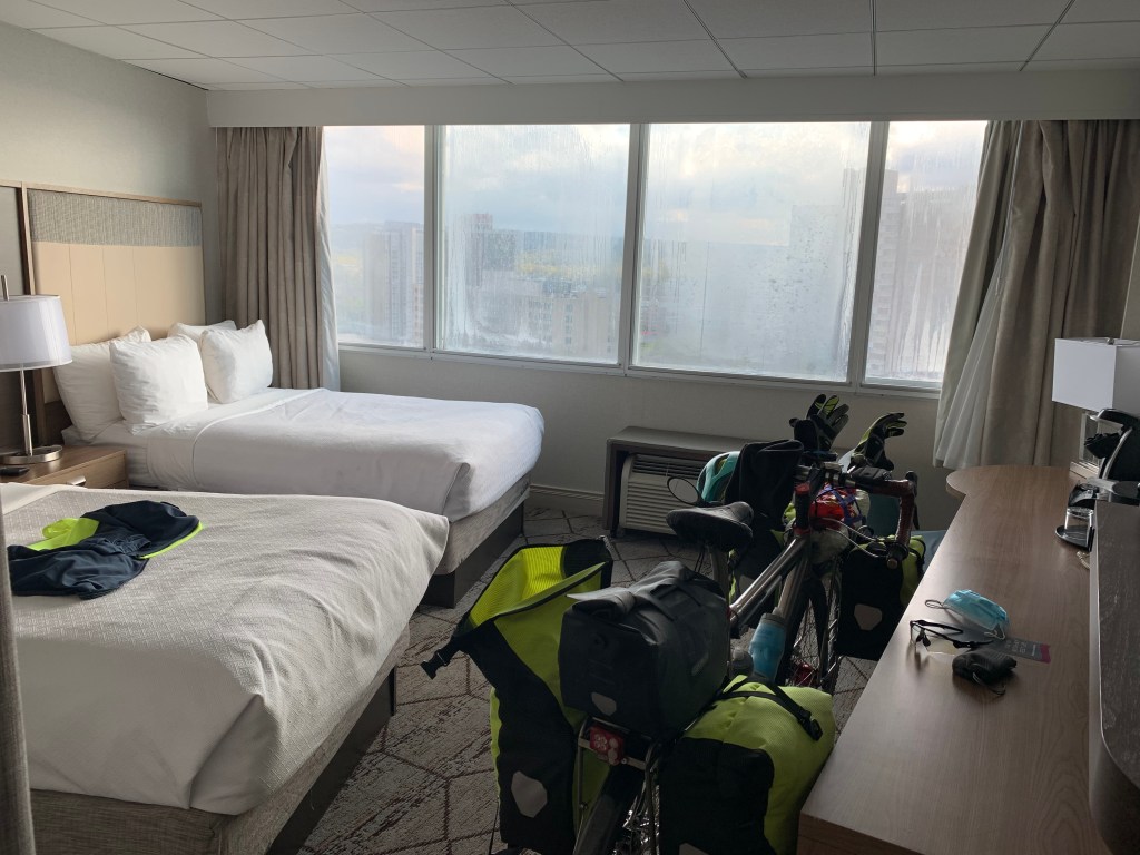
I knew I would have to pay the piper. Cutting yesterday short meant having to cycle 56 miles into a bitter headwind today to make up for lost time. I left my sinfully sumptuous hotel by 8 AM, and was a bit startled to find myself in big city Monday morning rush hour traffic, it’d been awhile since I’d dealt with that. Luckily, I have a crazy bright rear flasher to use in such situations.

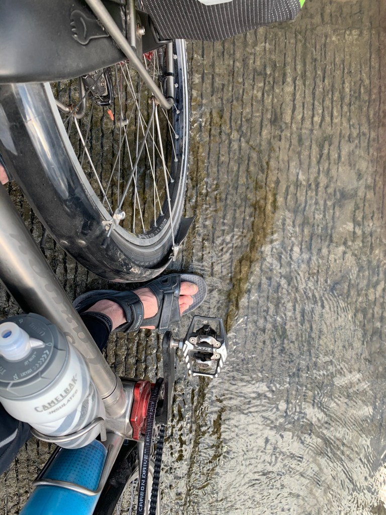
This time I followed the Erie Canalway route out of town, or tried to. I was happy to thread my way through a series of bike paths, protected lanes, even a beautiful stretch along the rapids of Onondaga Creek, tucked into the cityscape, until the marker signs abruptly stopped and I hit a dead end. Had I missed a turn? I backtracked half a mile to the last Canalway sign and confirmed that nope, the signs just stopped. Maybe they’d been vandalized. Having to search around in that traffic, in 25 degree windchill, wearing so many layers of gloves it was hard to peel them off and mess with the cell phone—well, chalk it up to paying the piper. I eventually found the signs again, excited that the route was going to take me by the city’s restored Onondaga lakefront when I got shut down again by a Trail Closed sign. Rats! I could see a spanking-new bikeway arching ahead over a graceful bridge, but I knew better than to skirt around the sign. Probably lead to another dead end.

So here I was, marooned in the same tangle of industrial highways I followed yesterday to the Destiny USA center, complete with the sewage treatment fumes. Muttering, I peeled off my sweaty/icy gloves and got Google Maps to show me the way out of there. It took me on a wide loop through miles of shoulderless, broken glass-strewn congested thoroughfares. I could glimpse the lake between warehouses, and took comfort that if I’d been able to get to the lakeshore, the headwinds would have been brutal. The Canalway is promising, but not quite ready for prime time.

After an hour of this I was thankfully back on the stone dust towpath, with trees mitigating the wind, and things slowly started looking up. At 25 miles I passed the Weedsport motel, if I’d pushed on last night I would have gotten there at 9 PM. Despite my morning ordeal, I was glad I’d opted for the Crown Plaza.

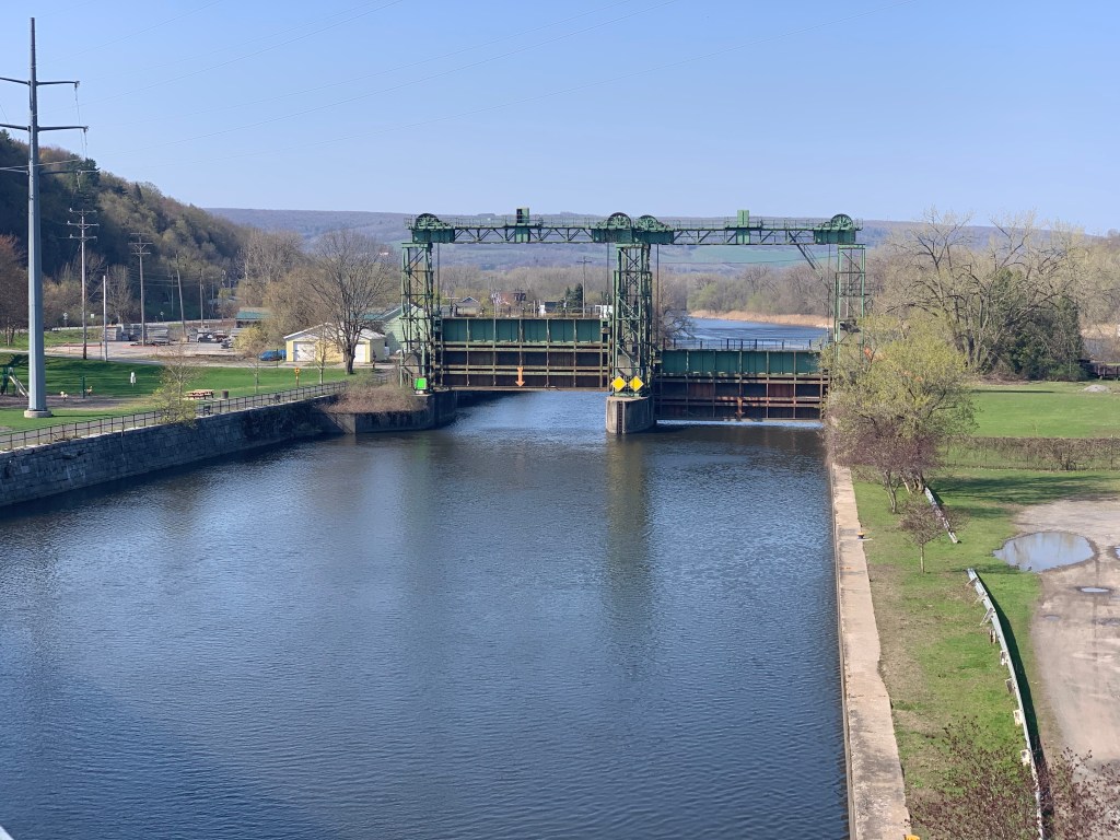
The watered canal and towpath went on for 25 miles, really quite beautiful. I only passed occasional walkers/bikers on this chilly Monday. The sweaty/icy gloves thing prevented me from getting any pictures, but they wouldn’t really have captured the bucolic serenity of the scene. Next came the longest stretch of road miles on the Canalway, 15 moderately hilly miles with expansive views of farmland, then back on the canal for the home stretch.

Anne and Carl have opened up their lovely home to Warmshowers, and what a gift it is. Retired engineers from the EPA in DC, they have restored an 1840s farmhouse to tasteful elegance, a working farm with cattle, chickens, pigs, geese, and sustainable agriculture. Anne estimates they grow/raise 80% of what they consume. They have a solar array that overflows into the grid and gives them free power year round. I was so impressed: after years of talking the talk in DC, they are walking the walk. They served me a farm-to-table feast, and our conversation lasted well past sunset. They are active cyclists and have 3 tandems.

I write this snuggled down in a four poster bed. What a finish!

Distance 57.7 miles, 407.8 total. Time 9 hours with stops. Elevation gain 964 feet.

Follow the yellow brick road

Canastota to Syracuse, New York Sunday, April 25, 2021

It was raining in the morning, and I had to Loctite all 44 screws on my Ortlieb panniers, so I didn’t get out of the motel until noon.

A number of friends have told me I shouldn’t focus on the goal so much, just enjoy the journey, and be sure to smell the roses. Seven miles into today’s trip, I saw I was only a couple of miles north of L. Frank Baum’s birthplace in Chittenango and decided that rose was worth sniffing. I have fond memories from the 60s of the family gathering around the TV when “The Wizard of Oz“ was aired every year. My daughter Hope feels a particular connection to the musical “Wicked”, her first Broadway show, centered around the wicked witch of the west, given the name Elphaba, derived from Baum’s name. But most poignantly, it evokes my father’s final message to us, saying “we’re off to see the wizard.” More about that later.

The little museum was closed on this Sunday, but it was fun to look in the windows and see that all the sidewalks in the town center were paved with yellow bricks.

The stone dust was in great shape, and I passed many Sunday walkers and bikers along the placid canal. Rather abruptly I saw some skyscrapers in the distance, I was approaching Syracuse. The route shifted to a clever bike path in the median strip of an arterial road, I have only seen this technique once before, on Pennsylvania Avenue in my hometown of Washington DC. It got me safely into the center of town, it was weird to be in a city. Hope’s best friend went to Syracuse University, and mentioned that the must-see was, wait for it, Dinosaur Barbecue. This was the original, the flagship, how could I resist?

Even at 3 PM on a Sunday it was a half hour wait to get in, I sat at the bar and told them I was on a research project, to see how their Big Ass Pork compared to the one in Troy. Syracuse won by a nose.

I needed a specialty shop you could only find in a big city, and Google maps directed me to the Destiny USA Center, reached through a maze of industrial highways clustered around a sewage treatment plant. The center turned out to be a massive shopping mall, I have not been in one of those for decades. Like most malls, it had partially gone to seed, a lot of the storefronts were vacant. It was almost comical, took me forever to find the shop I was looking for, most of the touchscreen directory kiosks were broken, and nobody seemed to know where my store was. It was just as bewildering finding my way back out again. I felt like such a hick.

By then it was 5:30, and I still had 25 miles to go to my next Thruway-side motel in Weedsport. Just for fun I checked Priceline to see what was available in Syracuse, and found that the swanky Crowne Plaza Hotel was actually cheaper than the Weedsport motel. Time to sniff the roses once again. I sweet-talked my way at the front desk into a room on the 19th floor, and even though the windows were partially fogged up it was a spectacular way to end the day, the sunset was amazing. I watched it as I talked with my good buddy Steve Shepard, who is devoting one his Natural Curiosity Project podcasts to this trip.

Even better, I found a Warmshowers for tomorrow, the roses are saving me some serious scratch. It will be 54 miles into a chilly headwind, but worth it.

Distance 30.1 miles, 350.1 total. Time 6 hours with stops. Elevation gain 162 feet.

Get up mule, here comes a lock / We’ll make Rome ’bout six o’clock

Little Falls to Canastota, New York Saturday, April 24, 2021

This is from the Springsteen version of the old Erie Canal song.

And today, Spring had finally arrived! Sunny, highs in the upper 60s, and only a 13 mph headwind! Like Bruce, I felt sprung from cages. The Mohawk had broken free from the gorge it was in, the land opened up, and I no longer had to climb a wall if I wanted to deviate from the route.

Time to make tracks. Rain was forecast for tomorrow, so it made sense to put in some serious miles today. When I say serious, I mean 65 miles. Pretty lame, compared to what I used to be able to do, but this journey is all about adjusting expectations, aging gracefully, making a passage. Hopefully, I’ll get stronger as I go.

A word on the topography. The last few days were all about the Mohawk dropping down to the Hudson, going over serious rapids at Cohoes and Little Falls, carving that gorge. The most dramatic defile was at the Noses, right before Canajoharie, where the River cut through a prominent ridge of the Adirondacks, and passed between the headlands Big Nose and Little Nose. Eagles were said to soar there, but I was too tucked down into that headwind to see or get a picture. I’ve brought along a GoPro, my birthday present, but haven’t had the time to figure out how to use it. Or maybe I don’t want to look dorkier than I already do, with a camera mounted on my helmet.

Little Falls has one of the highest-lift locks in the world, with unique “Guillotine gates”. Yikes.

But now I was up at the Rome Level, a long stretch of relative flatness with few locks, centered on the town of Rome NY. Here’s where the work on the Canal started back in 1817. They dug in both directions over this easy terrain, trying to make fast progress to satisfy their investors.

Rome itself is a cool town, not just for the Springsteen shout-out or the controversial Woodstock 99 concert, but for a little known chapter of the Revolutionary War. Fort Stanwix and the nearby Oriskany Battlefield were where heroic Nicolas Herkimer held off British general Barry St Leger’s attempt to unite with Johnny Burgoyne and cut the colonies in two. In what was considered to be the bloodiest battle of the Revolution, Herkimer was mortally wounded but continued to direct the battle as he sat dying under a tree. St Leger didn’t get through, Burgoyne was later defeated at Saratoga, the French were convinced that these ragtag Colonials had a chance and joined the cause, and we got ourselves a country.


I’d say Fort Stanwix was worth a picture. Good thing, too, ’cause it made me look down and see another “for want of a nail” screw had shaken loose on the stone dust trail, and my pannier was hanging by a thread. Steve from my first warmshowers home had commented on the blog I should get some Loctite compound to secure these screws, and like magic there was an Ace Hardware adjacent to the Fort, and a very helpful clerk who directed me to the Loctite and a proper Torx driver to tighten them all properly. Like Blanche DuBois, I have always depended on the kindness of strangers.

Making the repair burned up an hour, so the sun was setting as I pulled into the motel at Canastota. At least the wind had died down, so I was making good time. I met the first long distance bike tourists of the trip, they were heading east from Buffalo to Albany. That was the smart choice, they had the wind at their backs. One of them had done the southern tier route across the country in February, which is part of my plan as well, and we talked about the effect of the wind on that.

Did I mention that it’s all about the wind? 🌬

Distance 65.3 miles, 319.1 total. Time 9 1/2 hours with stops. Elevation gain 694 feet.

It’s always something

Amsterdam to Little Falls, New York Friday, April 23, 2021

Well I needn’t have worried. It was cold but the sun was shining, and my gear was adequate to keep me fairly warm. I was delighted to make 10 mph, which doesn’t sound like much on a flat surface, but the headwind was significant, mitigated only somewhat by the trees. Stopped for breakfast at the Berean Bean in Canajoharie, it was lovely to talk to the owner Carol and her friends Matt and Teresa. Matt is a pastor in the local church, and they both are recovering from Covid, although only Teresa got sick. Fortunately, she did not need to be hospitalized.

When I tried to pay up, they said it was by donation only, and they only took cash. I tried to go out to the bike to fetch it, but they would have none of it, insisted on treating me, despite my protests. Just another demonstration that while bike touring, it’s the people who are the highpoints.

I had to get to the motel by 1:30 for a zoom call, but was on pace and feeling pretty great. 8 miles away, however, the path changed from paved to stone dust. This is commonly used on bike paths, and is usually easy to negotiate, but in this case it was treacherous. Maybe because it rained yesterday, or that it had not yet been packed down by regular usage, but it was like cycling through sand. My speed dropped to 4 mph, and I had to struggle to keep from wiping out in the loose ruts. My bike has big tires, 700 x 40 C, which can usually handle off-road surfaces just fine. I suppose I could’ve let air out of the tires for better flotation, but it’s awkward to pump them back up again.

After 2 miles of this, despairing of reaching the motel on time, I bailed out and got on the adjacent highway. It wasn’t too traffic-y, the shoulders were adequate, and the hills not too bad. However the trees were wide open, so the effect of the headwind was dramatic.

I did make it to the motel just in time, but with more of a struggle that I had hoped for. One of my favorite comediennes was Gilda Radner, of the early Saturday Night Live. She had a great routine as Roseanne Rosannadanna, where she would launch in tirades invariably ending with an exasperated “it’s always something”.

Gilda died too young of ovarian cancer, but not before she wrote a memoir entitled “It’s Always Something”😔

Distance 43.5 miles, 253.8 total. Time 4 1/2 hours with stops. Elevation gain 682 feet.

Taking a zero (or two)

Amsterdam, New York. Wednesday and Thursday, April 21-22, 2021


The weather only worsened after yesterday’s chilly encounter with a headwind. The WNW winds increased to 20-30 mph with gusts up to 50, a couple of inches of snow were predicted, with temperatures in the low 30s and wind chills in the low 20s. This wouldn’t have stopped me on my bicycle commutes, but I did not plan for weather this cold.

Appalachian Trail hikers refer to “taking a zero”, when they go into town and spend a day recuperating, not putting in any trail miles at all. My motel is nothing special, but it’s cheap and clean and a decent place to hunker down.

I got a tear in my bike shorts, and nobody wants to see that. I didn’t bring a sewing kit, which wouldn’t have worked on Lycra anyway, so I decided to ask the “experts” at Joann’s Fabrics across town. Just three miles away, but it meant dropping down the 200 feet back to the Canal, and back up 600 feet on the other side. Not exactly going rim to rim on the Grand Canyon, but still daunting in the wind and rain.

There was an “easter egg” at the canal I hadn’t noticed yesterday. Amsterdam is one of those once–glorious towns that has gone to seed, its riverfront almost lost in a tangle of highway off ramps, but they recently added a pedestrian bridge with interpretive signs and sculptures that were really kind of touching.

Cranking up the other side I passed from the sublime to the ridiculous. Joann’s was in one of those strips with endless big box stores and pedestrian-unfriendly highways, I couldn’t wait to get out of there. The ladies helped me with tips about back-to-back iron on patches, though. I was hoping to build up a head of momentum dropping back into the gorge that would get me up the other side, but got diverted to a maze of construction detours. Meanwhile the rain had turned to snow and the crosswinds intensified, I was glad to have stayed put.

The motel clerk David was very helpful with an ironing board and iron, and I chatted with him as I made the repair (sandwiched between pillowcase sheets) in the lobby and did my laundry. Also there was a cross-country truck driver, Michael, who was marooned here, just like me, waiting for a part for his 18-wheeler. I have always been fascinated by long haul truckers, who seem to me to be the cowboys of the modern age. He was remarkably erudite and well informed, and it emerged he had lost custody of his son, and resolved to end his “poor choices” and educate himself about a career in hydroponics. The three of us talked for almost an hour. Human connections like these are one of the highlights of the trip.

While remounting my panniers back in the room, I made a horrifying discovery. A critical screw had come loose and couldn’t be found after scouring the whole room. These Ortlieb waterproof panniers from Germany are fantastic, but their hardware is specialized and has to be ordered. The “for want of a nail…the kingdom was lost” proverb echoed in my head as I searched around. Jane says I tend to catastrophize things. I calmed down, cannibalized a screw from a less-critical spot on the pannier, and tightened it and all the other screws in the set with my Swiss Army knife. Good thing, many of them had started to loosen.


I ordered replacement screws to come to my cousin Lindsay in Rochester, where I had originally planned to be in two days. Not bloody likely, it’s still 200 miles away. As I informed her of the delay, I couldn’t resist paraphrasing Dylan.

Oh, Lindsay, could this really be the end / To be stuck inside of Amsterdam with those Rochester blues again?

Distance 9.6 miles, 210.4 total. Time 1 1/2 hours with stops. Elevation gain 805 feet.

Addendum: the second day was just as bad, with winds that actually did hit 50 mph. I took a second “zero” day, and didn’t even leave the motel. I caught up on my sleep, worked on the blog, and read the newspapers. It was great to have a truly “down” day, ironic that it happened to be Earth Day.

I write this contemporaneously, early on the morning of 4/23/21, it’s still windy but the temperature is moderating. I am going to try to make a break for it. The next motel is 43 miles away and I’ve been warned it’s “pretty shabby”. Hopefully I won’t get turned around by the wind, and have to take a third zero here.

Low bridge, everybody down

Troy to Amsterdam, New York. Tuesday, April 20, 2021

Up till now, I have been heading south, to get to Ground Zero. Now it’s time to head west, hopefully all the way to the Pacific. And what better way to start that on the legendary Erie Canal?

It’s hard to overstate the importance of the canal. Although seen as a backwater in this day and age, when it was built it represented the epitome of human innovation. The farsighted New York governor, Dewitt Clinton, saw this was an opportunity to make his state gain national prominence.

He took advantage of a happy accident of geography. As I mentioned earlier, the Appalachian mountains, though low compared to the Rockies, formed a natural barrier against westward migration. Traversing them was hazardous, the roads were poor if even existent, the indigenous people not always friendly, and there was no easy way to haul any cargo.

Clinton saw that the Hudson River, and its tributary the Mohawk, carved a natural valley through these mountains, with only a few rapids (none below Troy). Where the Mohawk petered out, it was fairly flat all the way to Lake Erie, with only the Niagara escarpment to contend with. He had the audacious idea to dig a canal, with locks around the rapids and up the escarpment, 360 miles from Albany to Buffalo. The project, derided by skeptics as “Clinton’s Ditch,” was completed in 1825, and almost immediately became an international sensation.

It changed everything. Now it was fairly easy and cheap to break through to the Great Lakes and the Mississippi riverine system. New York City became the gateway to the west, and the state became the Empire State. Towns like Buffalo, Rochester, Syracuse, Utica, Schenectady sprung up along the canal, and soon became a major cities. The route became the innovative equivalent of the Silicon Valley of the 1800s, attracting companies like General Electric, and later Kodak and Xerox. Rockefeller’s family got its start near the canal. The flood of innovation attracted people from all over the world, and many religions were started there, it was often referred to as the “burned over district.” Some of these were prominent, like the Oneida community, but most died out, with the exception of the Mormon church, which started with Joseph Smith’s vision on Hill Cumorah in Palmyra, outside of Rochester.

I could go on and on, but time has not been kind to the Erie Canal. The original ditch has been revised four times, the thoroughfare is now the New York State Barge Canal system, and only parts of it follow the original route. Canal shipping has fallen off over the years, of course. The rush of innovation has moved elsewhere, and many of the cities have fallen on comparatively hard times, and are mere shadows of their former glory. There has been something of a comeback in recent years, however, fueled in part by historical tourism. Much of the original Canal it has been restored, at least in the form of the Canalway Trail, which is almost complete, anticipating the Ditch’s bicentennial in 2025.

For me, the canal was as attractive as it must’ve been to the early settlers. What’s not to like? An almost-flat pathway to the west, scenically and historically significant, with a fair number of tourists support facilities along the way. I couldn’t wait to get started.

It did start out great. There was a sharp climb at the beginning corresponding to the Cohoes Falls of the Mohawk River, but after that it was quite flat and beautiful. In most cases, the pavement was in good shape, there were occasional sections with stone dust and scattered areas undergoing construction. I was in bliss, just like yesterday. The route took me through the historic and beautiful stockade district in Schenectady.

The picture doesn’t do it justice, the flowery trees were just budding

Alas, reality intervened. The wind shifted to the west, right in my face. I had to tuck down deep into my drops, or my aero bars. That’s fine for a few minutes. After a while the need to crane your neck got oppressive, and in my case tweaked some cervical nerves, leading do a heavy feeling in my left arm I had to repeatedly shake out (don’t worry, this was not cardiac).

The temperature was 51 and still somewhat sunny, but the relentless wind was chilling and I had to zip up my parka, which led to sweating and even more chilling. I had hoped to go 50 miles that day, but I realized I was lucky to make 40. I had an important phone call at 3 PM, so I took it at the table of an outdoor café that was somewhat out of the wind. Afterwards, a very nice man had spied my bike and had lots of questions, and I am always happy to talk about myself. However, the whole process had me sitting for an hour in damp clothes, and I was thoroughly chilled.

The thing about the Canalway Trail is, as long as you stay on the canal you are fine. However the walls of the valley are close by. My motel was up by the Thruway, and a 200 foot climb. Typically, not much but in my chilled state it was quite arduous. I collapsed in my room and striped my clothes, desperate to take a long hot shower. I was grateful for a good Chinese restaurant nearby that delivered.

So overall, a good day, but not quite the blue ribbon day I had before. I am going to have to figure out a way to deal with headwinds, fully aware that the predominant winds will be out of the west.

Distance 41.5 miles, 200.9 total. Time 5 1/2 hours with stops. Elevation gain 1,124 feet.

One of those blue ribbon days

South Glens Falls to Troy, New York Monday, April 19, 2021

You ever have a day like this? One that couldn’t be finer?

Waking up in a trail angel’s comfortable home, fortified with a turkey sausage omelette beyond expectations, more great conversation with the angel, then out into a bluebird day with the happy knowledge it would be downhill all the way. My destination was Troy NY, home of Uncle Sam, the Rensselaer Polytechnic Institute, and most importantly, Dinosaur Barbecue, iconic chowhouse where I was due to meet friends for dinner.

The route soon joined the Hudson, and often followed the towpath of the Champlain Canal. It was dotted with little parks, where you could spot a bald eagle (too far away for a good picture, but unmistakable), bask in the sun, and just bliss out. My daydreaming was interrupted by a group of young adults with Down Syndrome, out for a stroll with their caretakers, one of the guys proudly showed me his “police badge”. I passed a setting for the musical Hamilton, but couldn’t find Angelica, Eliza, or Peggy.

The canal towpath was flat, quiet, and pastoral, but the stone dust surface was slower than the paved streets. The tangle of islands at the junction of the Hudson and the Mohawk were challenging to negotiate, but scenic.

Once at Troy, there was some business to attend to. As I mentioned earlier, I want to climb the state highpoints from sea level. On a previous trip I did go to the Atlantic Ocean, but then had to call Jane to get me when I had an equipment breakdown. This “broke the chain” of biking continuously from sea level, so I had to “zero out” again. The closest place to do this is at the head of natural navigation of the Hudson River, at Troy. The Hudson is still tidal right up to the first lock of the Erie Canal, and therefore is at sea level.

The actual spot was at the Ingalls Avenue boat launch, just below that first lock. Not active this time of year, I had the place to myself, with only a Canada goose for company.

Dipping my wheel and toe into the Hudson
It’s all uphill from here

An ugly picture of the ramp leading up from the water’s edge, but symbolic since this is essentially the beginning of my climb of the highpoints. What is that joke about the Hudson River? “They did a study of the health of the fish in the Hudson, and he’s fine.” That’s not really fair, they have cleaned the Hudson up quite a bit, people even swim in it occasionally.

A wider angle of view of the whole scene
Looking upstream to the dam associated with the first lock of the Erie Canal
The ramp from across the river, the next day

Yeah, I know, a lot of pictures of a fairly mundane location, but important to me, as this is Ground Zero.

Nothing left to do except a quick shower at the hotel, then meet my friends for dinner. Brian and Mary had to leave before Frank could come, so I did this in two shifts, nibbling slowly on a Big Ass Pork platter all the while. Luxurious for me, had lots of time to talk, reminisce, and say au revoir to these dear friends. Familiar contact will be sparser from now on.

There was a funny note. Our table was on a balcony overlooking the Hudson, and directly across was a luxury housing development on an island, with the words “Starbuck Island” in huge lighted letters on the embankment. I thought OMG, the ubiquitous Starbucks has gone too far. But when I looked it up, I saw I was wrong. The island had had this name for over a century, and was named after the hero of Moby Dick (the first mate, who tried to stand up to Ahab), and who was also the inspiration for the name of the coffee company.

Distance 48.4 miles, 158.4 total. Time 7 1/2 hours with stops. Elevation gain 644 feet.

Rocket fuel, or the lack thereof

Ticonderoga to South Glens Falls, New York. Sunday, April 18, 2021

Ticonderoga and Whitehall are two very historic towns. Fort Ticonderoga has been called the Keystone to the Continent, a key part of the British invasion route in their attempt to divide the colonies and win the revolutionary war. Whitehall is considered the birthplace of the US Navy.

There are some big hills in between. I know them well, have done them five prior times. This time, however, it was different. I found myself slowing to a crawl, and on one occasion had to get off and walk the bike. It’s just wasn’t like me. Sure, it was the first big bike ride of the season, and that year of inactivity has left me in particularly couch worthy shape. But this was ridiculous. Have I really gotten that old?

Then it hit me. No caffeine. I resolved eight years ago to get off the stuff, it was giving me heartburn and Lord knows I am hyper enough. Stopped cold turkey, I had a hellish week of withdrawal, but I have been “sober” since. OK, who could resist the one-euro cafe con leches on the Camino, but otherwise, I was clean. I would only indulge on big bike rides.

I was trying to be good this trip, just a 3/4 decaf in the motel that morning, but as I almost fell asleep on a picnic table I realized, I need my rocket fuel. After a quick mocha frappechino in Whitehall, I was good to go.

The rest of the route followed the Champlain canal, and was much easier. Still a gentle tailwind, it was a bit warmer, things were looking up. Used the warmshowers.org website for the first time, and was treated to a delightful evening with Pam and Steve in South Glens Falls. What a generous thing to do for the bike touring community, I’ll look forward to paying it forward when I get back home.

Distance 53.5 miles, 111 total. Time 8 hours with stops. Elevation gain 2,557 feet

And we’re off

Williston, Vermont to Ticonderoga, New York. Saturday, April 17, 2021

Now the trip begins in earnest. Fully vaccinated, reasonably prepared, a rough plan in place, it’s time to hit the road.

Jane organized a great send off, brought together family, friends, and neighbors for a little ceremony in our driveway, complete with gold streamers, a bagel breakfast, and the perfect soundtrack: Bruce Springsteen‘s “Thunder Road”. She read me a personalized version of the Irish blessing, and it was hard to see as I clattered down the driveway, my glasses were fogged up.

The route in the beginning will be familiar, I have biked it so many times. It was notable for a nice tailwind, and some heartwarming stops along the way. My son Jason was working at Healthy Living, and I embarrassed him by coming in to say goodbye and giving him a hug. Longtime biking buddy Steve was right on the route in Charlotte, I visited with him and his sweet wife Karen for almost an hour, she gave me a great peptalk. I got a surprise as I approach the Champlain Bridge, my BFFs Brian & Mary had tracked me down on the find my friends app, and we shared a last farewell at a roadside cemetery.

It was cloudy and the wind was icy, but at least it was at my back. I could still see glimpses of the amazing Vermont scenery, and wondered why I was leaving this beautiful state that has been my home for the past 34 years. Crossing the bridge I entered New York, pretty in its own right but just not the same. Soon I was on the official Empire State Trail, a bikeway in name only since I was on a main road with a gnarly shoulder. I was too distracted to take pictures, my only one was at the funny little town of Street Road, at the top of a long hill. [hmm, what’s the deal with the cemeteries?]

A few miles later, I was at my destination, a Super 8 motel in Ticonderoga NY. Spartan, but perfectly pleasant.

So much to say, but let me post this now, and fill in the backstory when I get a chance.

Distance 57.5 miles. Time 7.5 hours with stops. Elevation gain 2,468 feet

Proud Mary

Day one, Friday July 24, 2020

For this “sea to summit” shakedown cruise, then, the first step is to get to the ocean.

No easy feat, since I live on the wrong side of the Appalachians. They form a wall which has stymied travelers since the beginning, typically an impediment to westward migration, or in my case to eastward. Easy ways through are rare, like the Cumberland Gap or the Erie Canal, or for me, the Winooski River.

Not widely known outside Vermont, this river (Abenaki for Onion River) predated the Appalachian uplift, and carved the Winooski Water Gap, and allowed me to slip between the 4000-foot peaks of Mt. Mansfield and Camels Hump at an elevation of 300 feet. I was giddy as I followed it into our cute little state capital of Montpelier,

and couldn’t help belting out the CCR tune made famous by Tina Turner

Cleaned a lot of plates in Memphis
Pumped a lot of ’tane down in New Orleans
But I never saw the good side of the city
‘Til I hitched a ride on a river boat queen

Big wheel keep on turnin’
Proud Mary keep on burnin’
Rollin’, rollin’, rollin’ on the river

I loved how she prefaced the song with “We don’t do nothin’…easy” which will become the motto for my expedition. If things work out, I won’t need to pump any ’tane (octane) at all.

It has been pretty easy so far. The rig is cumbersome but manageable, the gearing so low that I’m chugging up the hills with something approaching aplomb.

Here’s our cute capitol—how many other states have a forest adjacent to the dome? That’s Ceres up there, the goddess of agriculture.

The photo is also notable for demonstrating another goal of this trip—doing something about that gut. Notice those yellow letters? Vermont may be one of the whitest states in the union, but we’re also one of the bluest.

So if Montpellier is touristy and cutesy, Barre, just down the road, is real working class Vermont. Home to one of the largest granite quarries in the country, it attracted skilled stonecarvers from Italy, who outdid themselves at the Hope Cemetery. Off the beaten path, this hidden gem was first brought to my attention by a magazine article entitled “Death Be Not Minimalist”. I had to honk up a steep hill (with some worrisome popping in my gearbox) but was well rewarded. These are only two examples of the memorials there.

Mr. Corti was tragically shot as he tried to calm a fracas between socialists and anarchists in 1903.

Another heroic sculpture graces Barre’s main square.

I got my comeuppance shortly after, crossing the divide between the Winooski, which drains into Lake Champlain and the St. Lawrence, and the White River, which drains into the Connecticut. I only had to climb to 900 feet, but the hill was so steep I didn’t want to risk that popping again, and had to get off and push. From there, it was an easy glide to my first campsite, Limehurst Lake.

Distance 50.22 miles, elevation gain 1,786 feet