Umatilla, Oregon to Walla Walla, Washington Thursday, May 23, 2025.
The day off turned out to be a godsend. A storm was raging outside, I got lots of loose ends taken care of, and had great talks with family and friends.
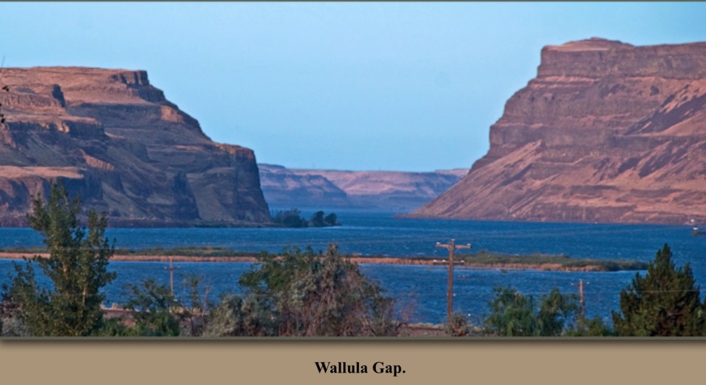
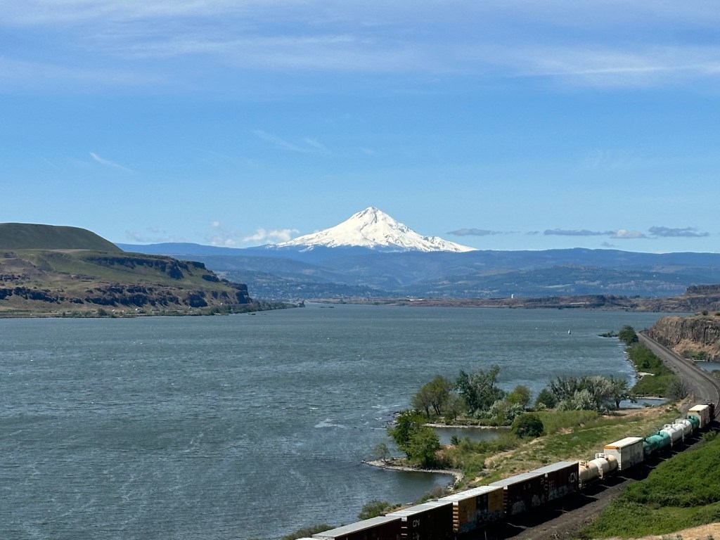
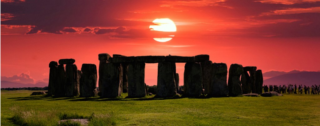
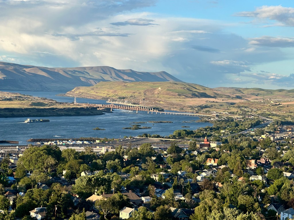
Today’s ride took me through Wallula Gap, an upstream version of the Columbia River Gorge. Dramatic, but the shoulder was narrow, trucks were roaring by, and I didn’t dare take a picture for myself, had to get this one off the web.
This is where the Columbia river turns north, and ceases to become the southern boundary of Washington state. I left Oregon for the last time. Encountered my first three long-distance bicyclists. The first two were an older couple riding from Astoria, Oregon to Plymouth, New Hampshire. They had reserved a string of B&B‘s for the entire trip. They were going faster than me, like everybody does, but it turns out they had e-bikes. I didn’t think that would be practical on a trip like this, they would have to be recharged too often.
The third was David Rapoport, a McGill-educated computer engineer who changed careers and was working at the Alta ski resort in Utah. He was biking from Spokane to the coast, against the wind, but then was heading south to San Francisco. I know from prior experience he’ll have a beautiful tailwind for that stretch.
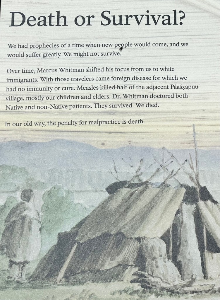
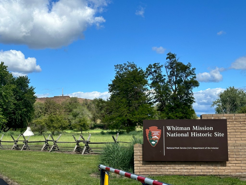
Next up was the Whitman Massacre site, now known as the Tragedy at Waiilatpu. I’d never heard of it, this was one of the first episodes of violence in our westward expansion, and led to the creation of the Oregon Territory. The story was so poignant, the Whitmans were missionaries who were part of the Second Awakening in the early 1800s, driven to convert the Cayuse Nation to Christianity. He was also a doctor. His intentions were good, and relationships with the natives thrived initially, but then things turned sour. The press of further white migration, rumors of atrocities in the east, disputes over land rights set the stage, but what triggered the incident was measles. An outbreak devastated the Cayuse, and they believed the doctor was trying to poison them. In fact he was trying to help them, but their background immunity was weaker, having no prior contact with Caucasian diseases, so their death rate was higher than the whites, and they became resentful.
Yikes. Put a whole new spin on malpractice insurance..
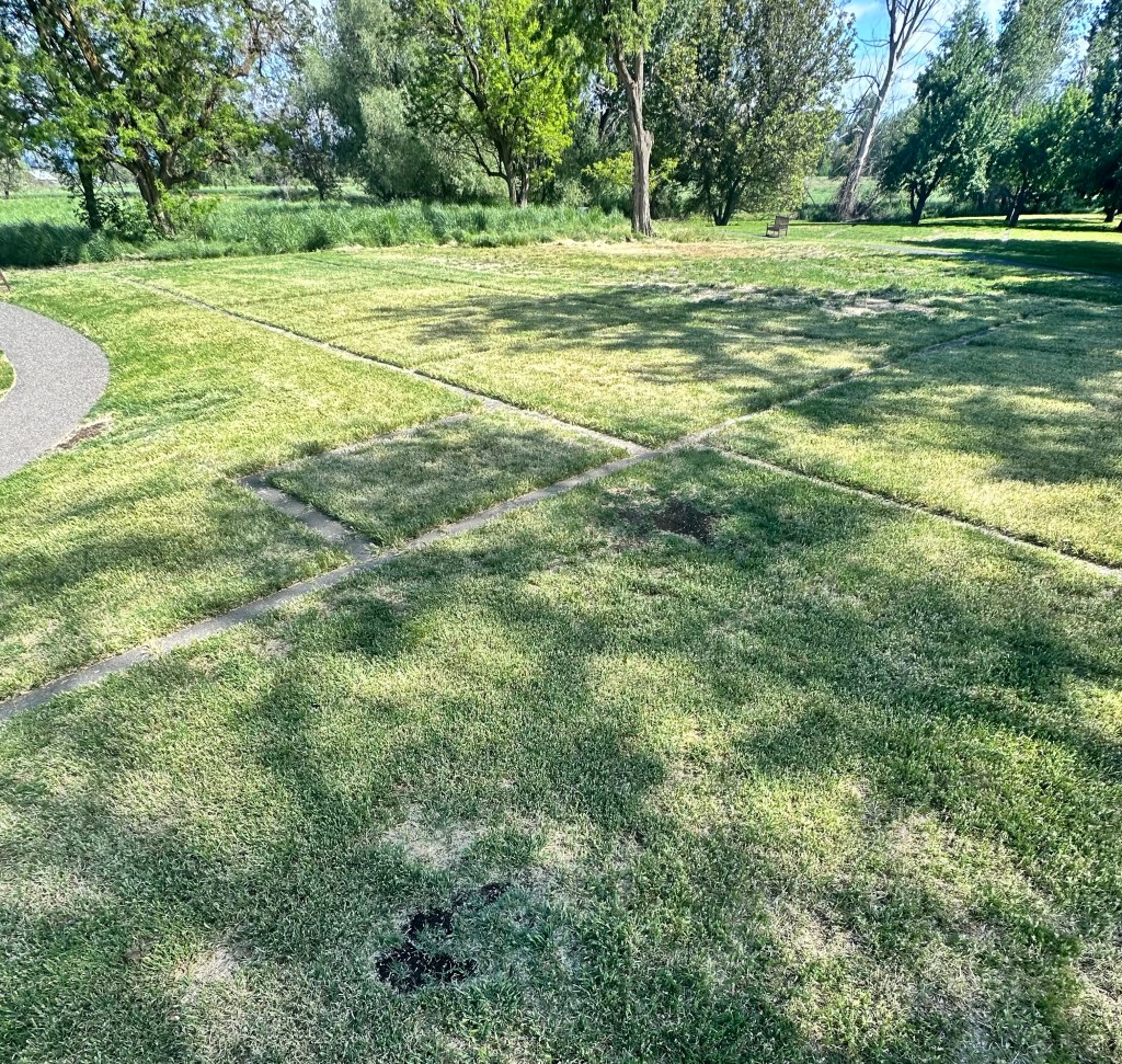
Dr. Whitman was warned of this, but he chose to stay. On November 28, 1847, he along with his wife and 12 others, were brutally murdered. All that remains of his Mission is the outline of the foundation.
If you zoom in, you will see an obelisk on a hill. Nothing happened there, it was erected years later, in the same wave of monument-building that also gave us the confederate statues that triggered the beginning of the Jim Crow era. The perpetrators were hanged. The whole episode was so sad, born of a misunderstanding, but the beginning of a wave of Manifest Destiny atrocities that ended so sadly at Wounded Knee. The Park Service video is quite compelling, and explains that the story was more complicated than that.
A reminder of how devastating measles can be, a disease that should be eradicated by now, but is rearing its ugly head again because of the anti-vaxxers.
Also a reminder of the haunting lyrics from the Eagles’, Paradise, The Last Resort
You can leave it all behind… Just like the missionaries did So many years ago
They even brought a neon sign “Jesus is coming” Brought the white man’s burden down Brought the white man’s reign
Who will provide the grand design? What is yours and what is mine? ‘Cause there is no more new frontier We have got to make it here
We satisfy our endless needs And justify our bloody deeds In the name of Destiny And in the name of God
And you can see them there On Sunday morning Stand up and sing about What it’s like up there
They call it Paradise I don’t know why You call someplace paradise Kiss it goodbye
Yeah.
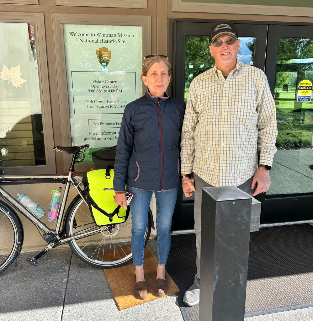
Had fun chatting with Fred and Madeline, who sent a picture of me riding off.
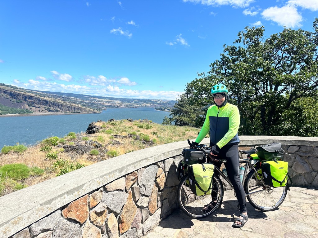
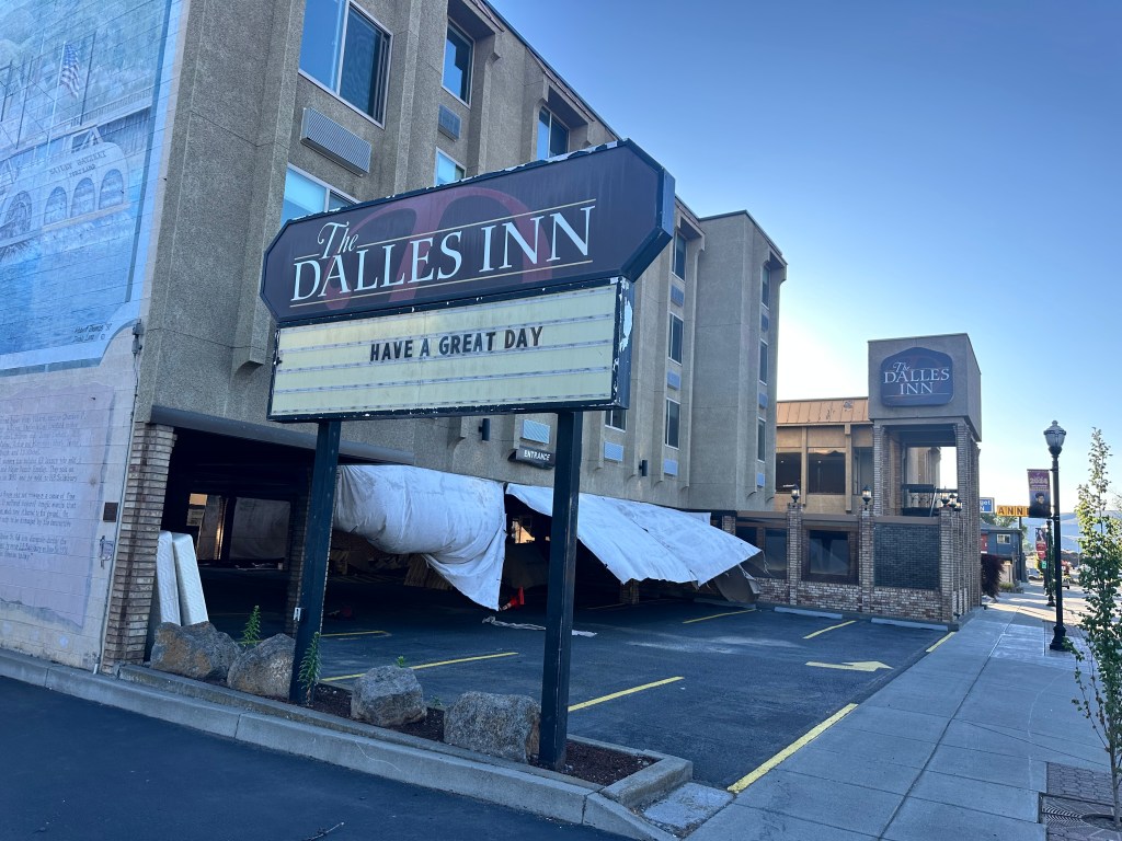
Walla Walla, Washington. The king of alliterative place names. My stepsister and her husband, Jen and Thom Bolduc, practiced pediatrics there a decade ago, and Thom gave me tips of places to see. Spent a delightful evening with my Warmshowers hosts Laura and David Brannan, their son Samuel, and two adorable pugs. Laura is a general contractor, David a pilot for Alaska Airlines, they remembered that they took their kids to the Bolducs. Small world.
Distance 59 miles, 924 total. Time 9 hours with stops. Elevation gain 1,296 feet
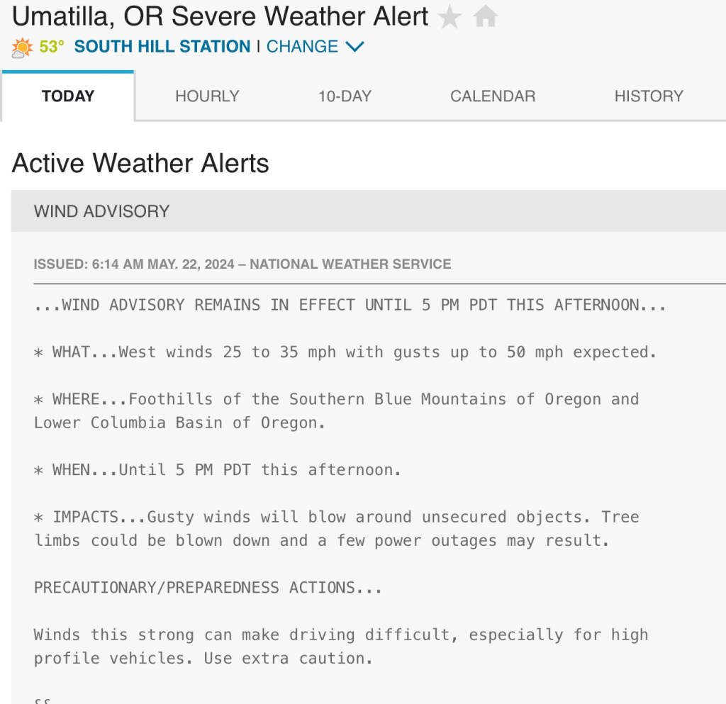
I was all set: laundry done, route planned, Warmshowers host arranged in the next town, Walla Walla; even got a reasonable amount of sleep. My knees seem to be a little better. Got up early, ready to bolt, but then I checked the morning forecast.
On the one hand, it was a tailwind, promising to blow me to Walla Walla in no time. On the other hand, I am the quintessential high-profile vehicle, especially with those large bags over the front wheel, which can get blown around like a sail. Even in yesterday’s moderate tailwind, I would sometimes struggle to maintain control of the bike as I descended at nearly 40 mph, buffeted by gusts. Thunderstorms were also predicted, 50% chance. I couldn’t get that scene from Wizard of Oz out of my head. https://images.app.goo.gl/yGVo2wgHm8faGzUZ7
But right at the point of decision, the sky looked clear. I asked the receptionist if I could possibly stay another day, and before I could stop him, he had booked me. So the decision is made.
It was a classic example of cognitive dissonance. After the fact, I decided it was for the best. My knee is better, but not perfect. I haven’t had a “day off” since I started a month ago, if you don’t count that transition day when I was licking my wounds.
So once again I’m quoting Bob Dylan (perhaps I’m entitled, having gotten a private tour of his boyhood home, see post of 6/9/21). Stuck inside of Umatilla with those Walla Walla blues again. Maybe there’s something interesting about the town, but the Wikipedia page was less than encouraging:
“The population in 2010 was 6,906, but the city’s population includes approximately 2,000 inmates incarcerated at Two Rivers Correctional Institution. Umatilla has the highest poverty rate (24%) and lowest Median Household Income ($38,796), of all communities in the area.”
Besides, it’s 2 1/2 miles away, right into the teeth of that headwind. Ain’t gonna happen. Down that steep hill I came up yesterday is the McNary Dam, which appears to have some kind of a fish ladder exhibit. The Oregon Fish View Room it’s called, and reviews say that sometimes you see fish, often not. Hmm.
There’s a decent greasy spoon just down the street, I had their chili-and-cornbread special last night and they’re famous for their Awesome Burgers. Maybe without the bun. There’s a pool outside, but it’s 52°. I can see the thunderheads building on the horizon.
Or maybe just hole up here in my ironically-named Quality Inn. My Apple Watch tells me I’ve only averaged five hours of sleep per night, I could try to catch up. Maybe try to plan the route more than one day in advance, line up some Warmshowers hosts without last-minute notice. Call the family (had an hour long conversation with number one son Andrew yesterday, while the wind was blowing me along). Maybe do one or two of those background posts I’ve been meaning to get to for weeks. Maybe try one of those NYT crosswords (gasp). Or maybe just do a whole lot of nothing.
The trains keep rolling by, on both sides of the river, blowing their mournful whistles. Yeah, I’m stuck in Two Rivers Prison, but better off than the Man in Black.
When I was just a baby, my mama told me, “Son Always be a good boy, don’t ever play with guns” But I shot a man in Reno just to watch him die When I hear that whistle blowin’, I hang my head and cry
No statistics for today, unless you call count walking back and forth to the greasy spoon.
Roosevelt, Washington to Umatilla, Oregon Tuesday, May 21, 2024
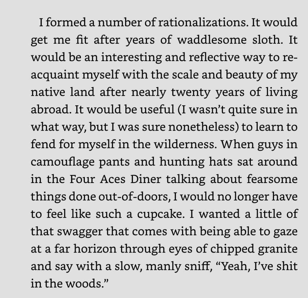
Today was the end of the century, the century I thought I could do yesterday, until reality told me otherwise. I was comfortable enough in that new tent, but there were trains going by all night on both sides of the river, mitigated somewhat by the custom-fitted earplugs I got for the Camino. I braved the 48° temperature to take a shower in that sketchy bathroom, went back to that same general store (the only one in 100 miles) for breakfast, an immediately had a flashback to a favorite passage from Bill Bryson’s A Walk in the Woods, where he explains his sudden impulse to hike the Appalachian Trail:
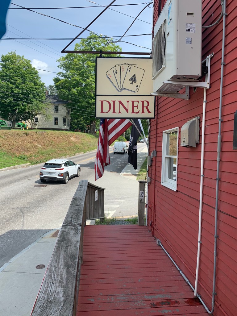
Four years ago, on my bike ride to the ocean to start my climb of Mt. Washington, I passed this sign in Lebanon, New Hampshire
and thought OMG, that’s the Four Aces Diner! Alas, there were no such characters inside then, but there were there this morning, right out of central casting, sitting around drinking coffee and mercilessly teasing the weird guy in Lycra with the titanium bike. I wish I’d taped the banter, it was priceless. The line I remember was, you’ll have wind up your ass all the way to Idaho.
I presumed he meant tailwinds, magic words to any cyclist. And sure enough, I had a good stiff breeze pushing me the 53 miles to Umatilla. The hills had moderated, the pavement was smooth and sparsely trafficked, my bravado came back and I thought, yeah, I could have done this last night. I’ve got a good headlight. I could’ve done that century.
It never fails. You get cocky, reality kicks in. The mouse in my left knee started squeaking.
A joint mouse (corpus liberum) is a loose piece of cartilage or bone tissue that floats freely through the joint, most commonly the knee.
I’ve had one for years, normally giving me no trouble. But every once in a while, it will float into the articular surfaces of the knee, like a burr in the gears, and produce sharp pain. Then, after a few more steps, it floats out of the way and everything is fine.
Lately it’s been serving as a wakeup call, a warning when I’m overdoing it. Last fall, on our campervan tour of New Zealand, we were racing to catch a ferry on one of the world’s premier trails, the Milford Track, and the knee started acting up. I (and Jane) could hear a pop with every step. We made the ferry but the pain persisted, this time for months. The Mouse That Roared. An orthopedist said yeah, you’ve got osteoarthritis, like everyone else your age. Our good friend and crack physical therapist Lesli Bell gave me exercises but the pain abruptly stopped and I never did them. Doctors make the worst patients.
The last mile to my motel was comically steep, it had started raining, and I was limping. My body was telling me, Dude, there’s no way you could have fined that siècle.
You think I’ll listen?
Distance 53 miles, 865 total. Time 5 hours with stops. Elevation gain 1,341 feet
The Dalles, Oregon to Roosevelt, Washington. Monday, May 20, 2024
Figuring I might have to do a century today, I tried to get an early start, but early starts are not my strong suit. As always, crossing the Columbia was both scenic and harrowing, made more so by a strong crosswind. I passed right in front of The Dalles dam, but barely got a chance to look at it; it appeared to have a pretty dramatic spillway.
Once I rounded the bend I had a full-on tailwind, and life was sweet. My average speed increased from my usual 8 to 13 mph, despite over 3,000 feet of hills. It was almost like I was riding an e-bike. I looked over my shoulder to catch one last taunting sneer from Mt. Hood.
I’ll see YOU later, sucka
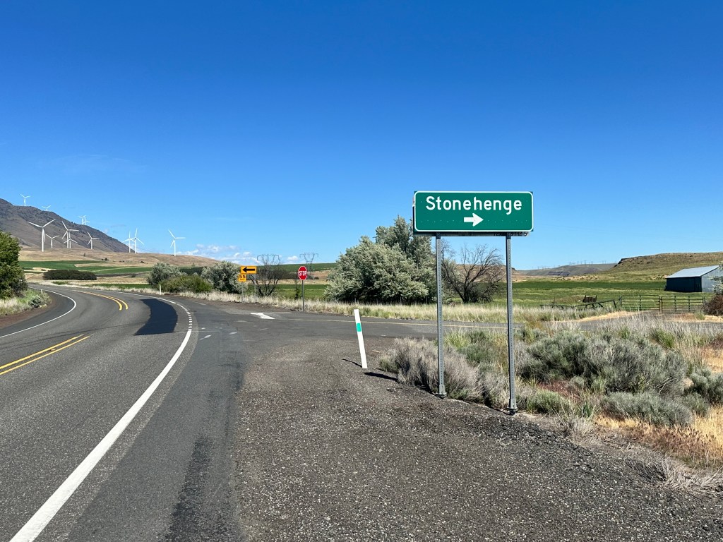
A few miles later, I was brought up short by an unexpected sign.
Huh?
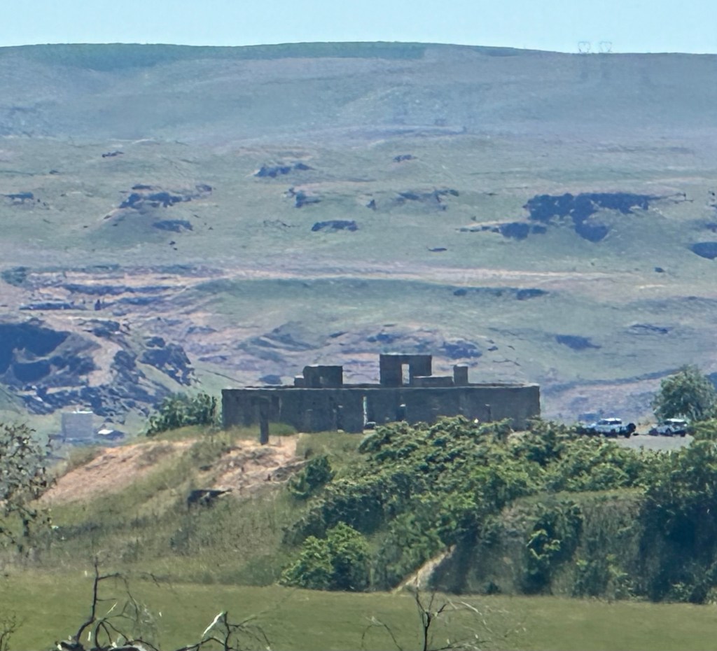
It was a replica, of course, constructed as a World War I memorial. Visiting it would’ve meant a 4 mile detour, so I had to settle for a telephoto shot.
but it triggered a whirl of reflection and rumination. I’ve never seen the original in Salisbury, England, hear it’s overrun with tourists and so fragile that you can’t get close to it. But what a thing. Constructed over 3000 years ago by Druids that left no written language, it appears to have been a sophisticated astronomical observatory. Most famous is the Heelstone, that marks the summer solstice sunrise, but accessory features apparently also could predict solar eclipses. Amazing. Here’s one of the better web photos I could find.
What’s also fascinating is how the concept of solar alignment has fostered many tributes. Perhaps you’ve heard of Manhattanhenge, where the sun lines up perfectly with the cross streets of Manhattan.
I had to glom this photo from Stutterstock
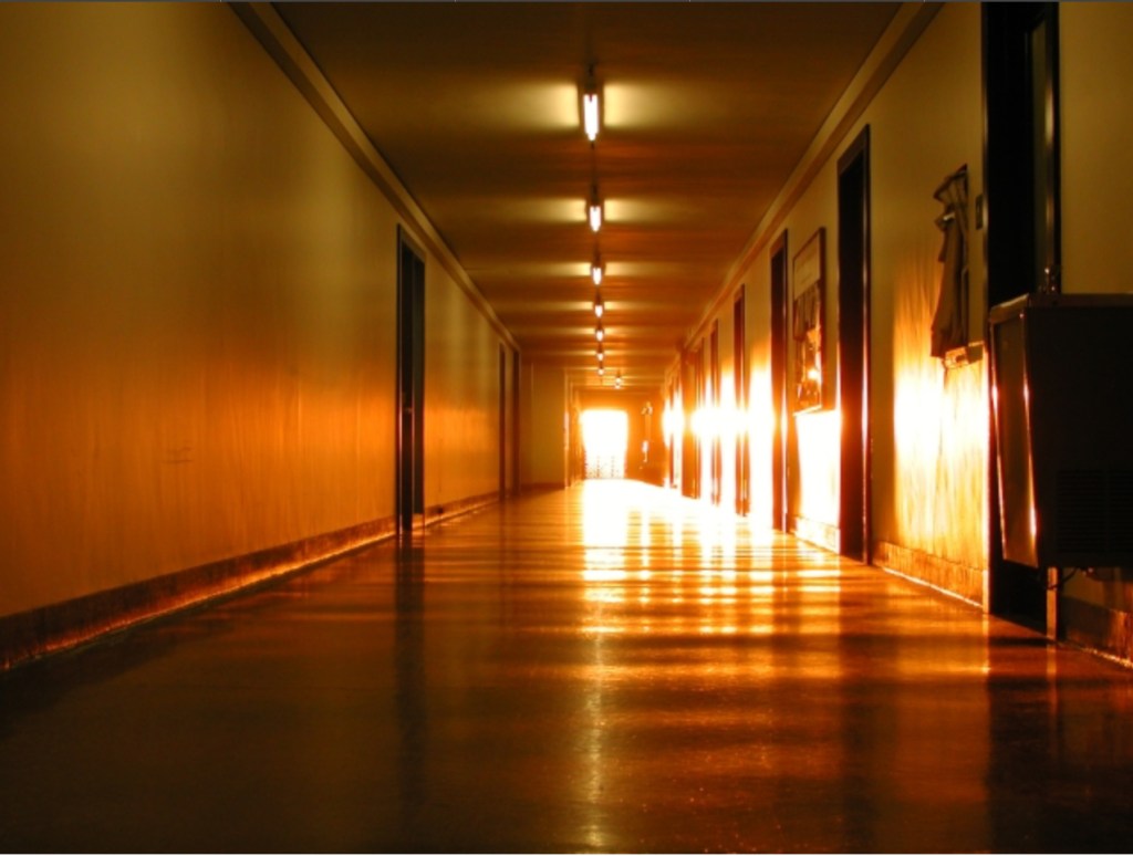
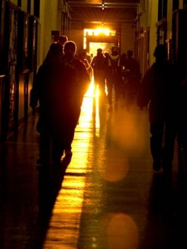
From college I remember MIThenge, where twice a year the sun illuminates the iconic Infinite Corridor, central axis of the university, three football fields long.
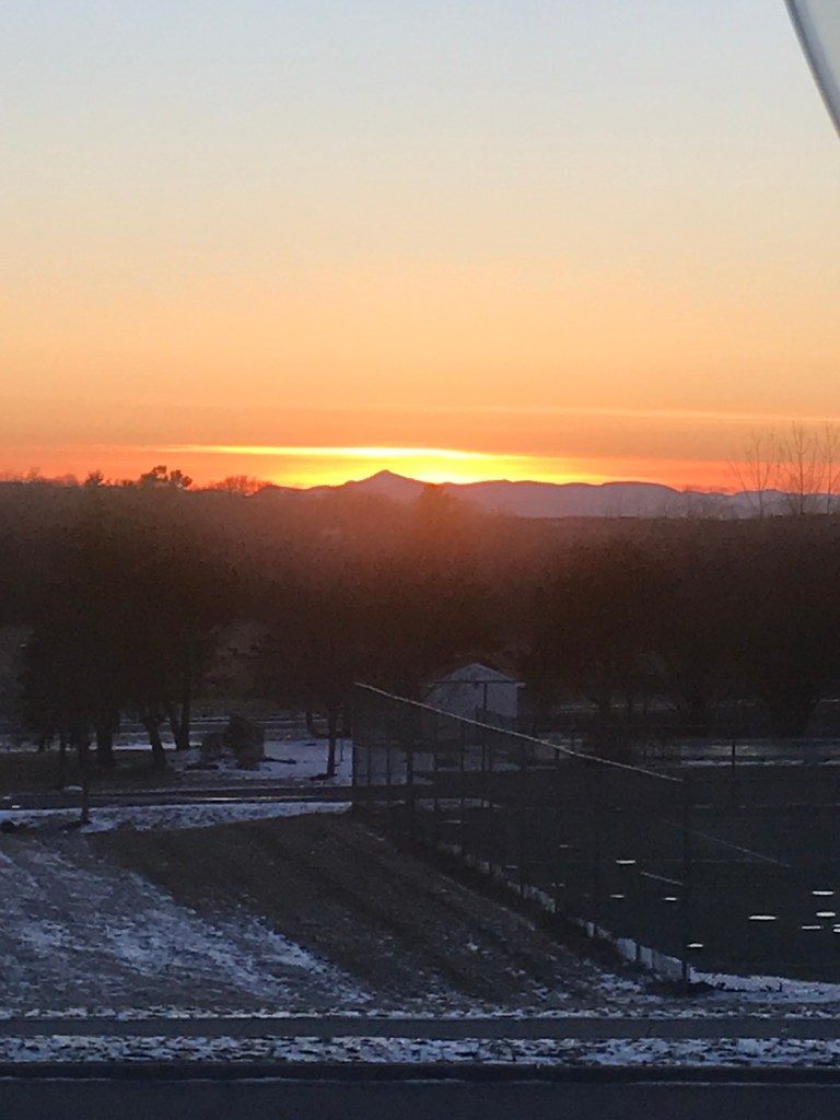
And in true solipsistic fashion I have Luriahenge, where on March 5 the sun sets precisely over Mt. Whiteface (site of the 1932 and 1980 Lake Placid Olympics) as seen from our bedroom window.
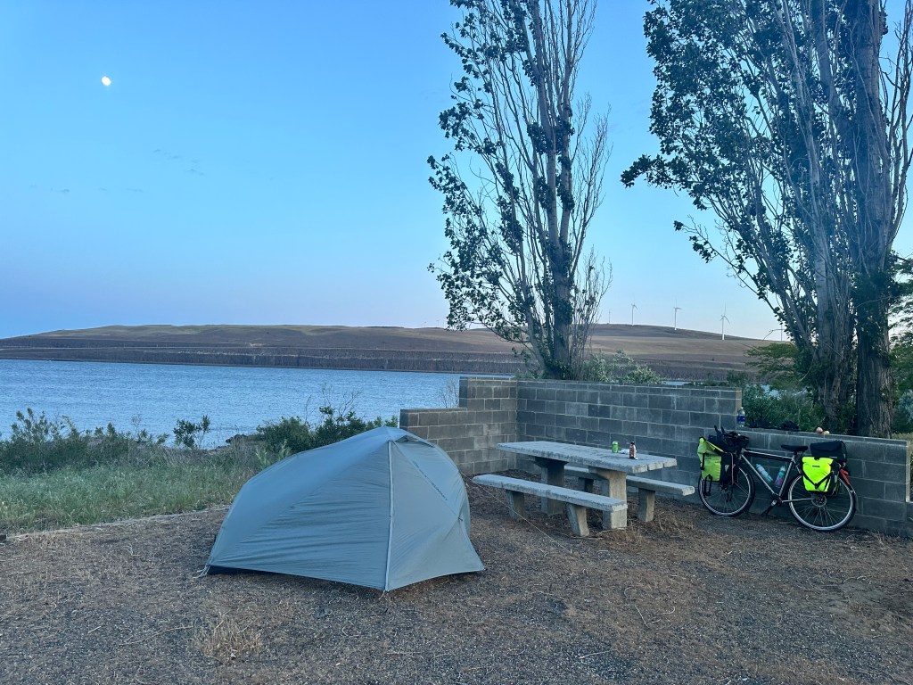
I would like to say I rode a century today, but at the town of Roosevelt, 60 miles in, I realized I was running out of daylight. There was a general store, the only one in 100 miles, whose proprietor told me that there was a campground down the road that didn’t appear on any of my maps. It was deserted and a little creepy, but had a semi-functioning bathroom, and the price was right. I was gratified to be able to set up my brand new two-person tent in the relentless wind. If you ignored the abandoned cars and trailers nearby, it was actually pretty scenic, right on the Columbia with a nice moonrise.
Distance 61 miles, 812 total. Time 9 hours with stops. Elevation gain 3,079 feet
Hood River to The Dalles, Oregon. Sunday, May 19, 2024
I’ve always wondered about this town, with the odd name. It’s unusual to have the article “the” in a town name, I can only think of The Hague and The Bronx. Countries like the Ukraine and the Bahamas have dropped the article, once they became independent states. Anyway, it’s the largest settlement on the Columbia east of Portland.
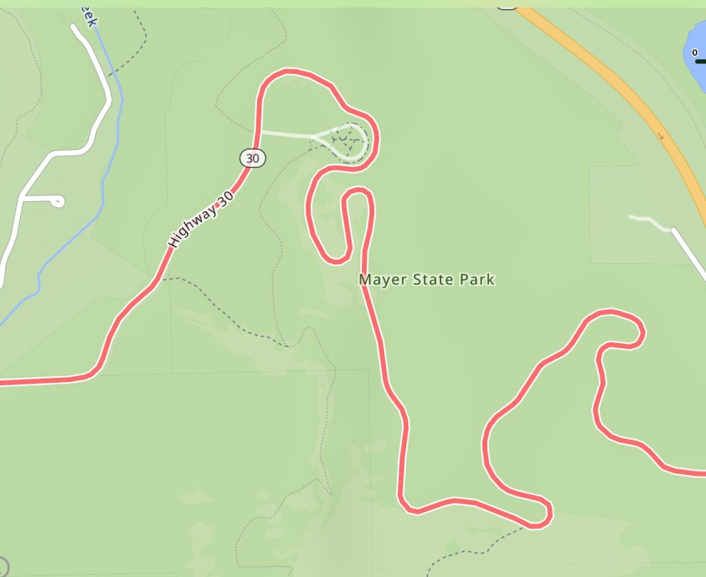
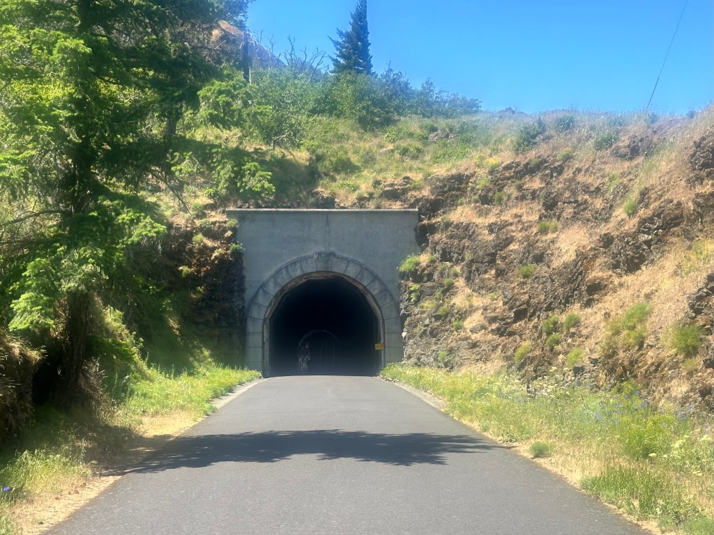
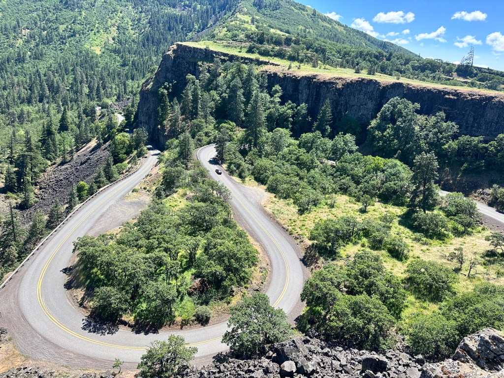
It also marks the end of the Columbia River Gorge, and boy what a finish. The serpentine Historic Columbia Highway bike path outdid itself, as the screenshots of my route will testify.
Each of these twists and turns represented switchbacks up or down, but they were always well graded and never too steep, one bend even went through a dramatic tunnel.
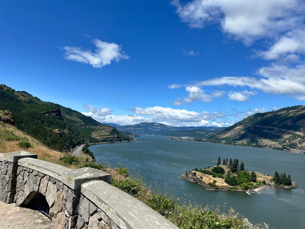
And of course, they led me to spectacular views.
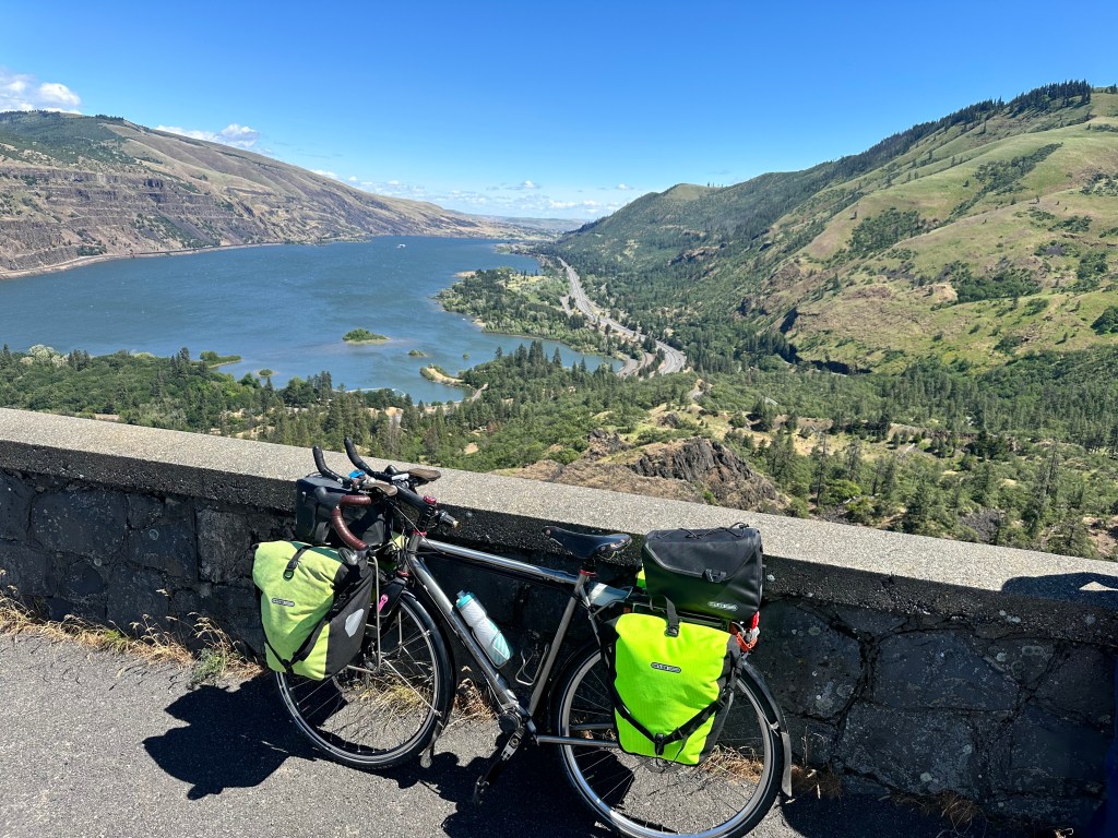
Check out those twists and turns
If you look closely at this last picture, you will see that one of my water bottles is missing. Sure enough, I accidentally knocked it over a 200 foot cliff. Reminiscent of that scene in Wild, where Cheryl Strayed/Reese Witherspoon hurls her too-small boots over a cliff in frustration (I stifled the primal scream).
It dawned on me that I was a litterbug. And here, in one of the greenest states in the nation. Looking up trivia about the movie, I found the producers were accused of littering also. Later, a hiker found those boots and they’re now enshrined in a bar in Seattle, autographed by Reese herself.
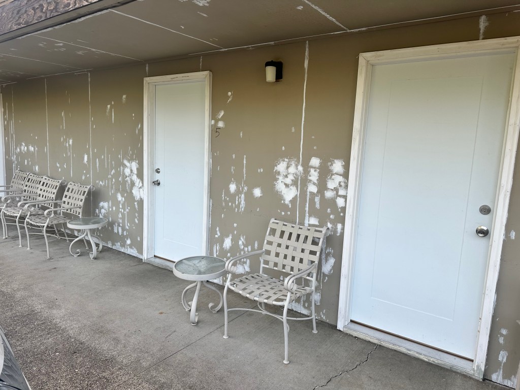
My trepidations about booking that fleabag hotel were not helped by my first view of it
My God, what have I done?
But that was just the backside, they were also undergoing renovations. The front side was better and the room was actually fine, and 1/4 the price of that Holiday Inn Express.
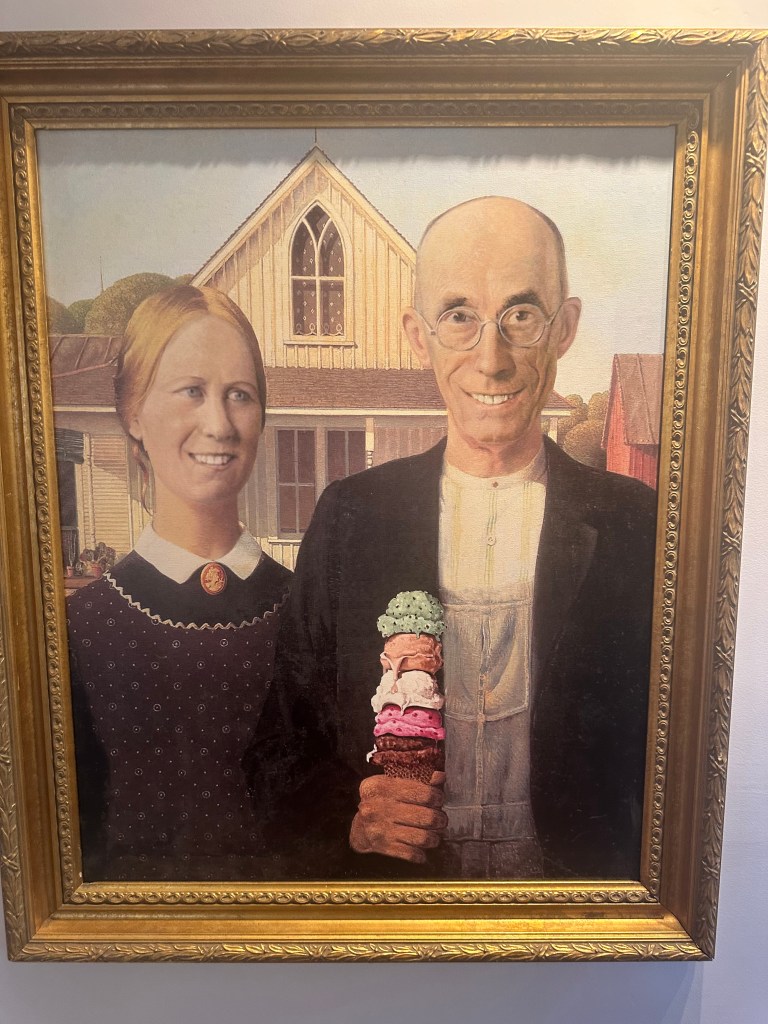
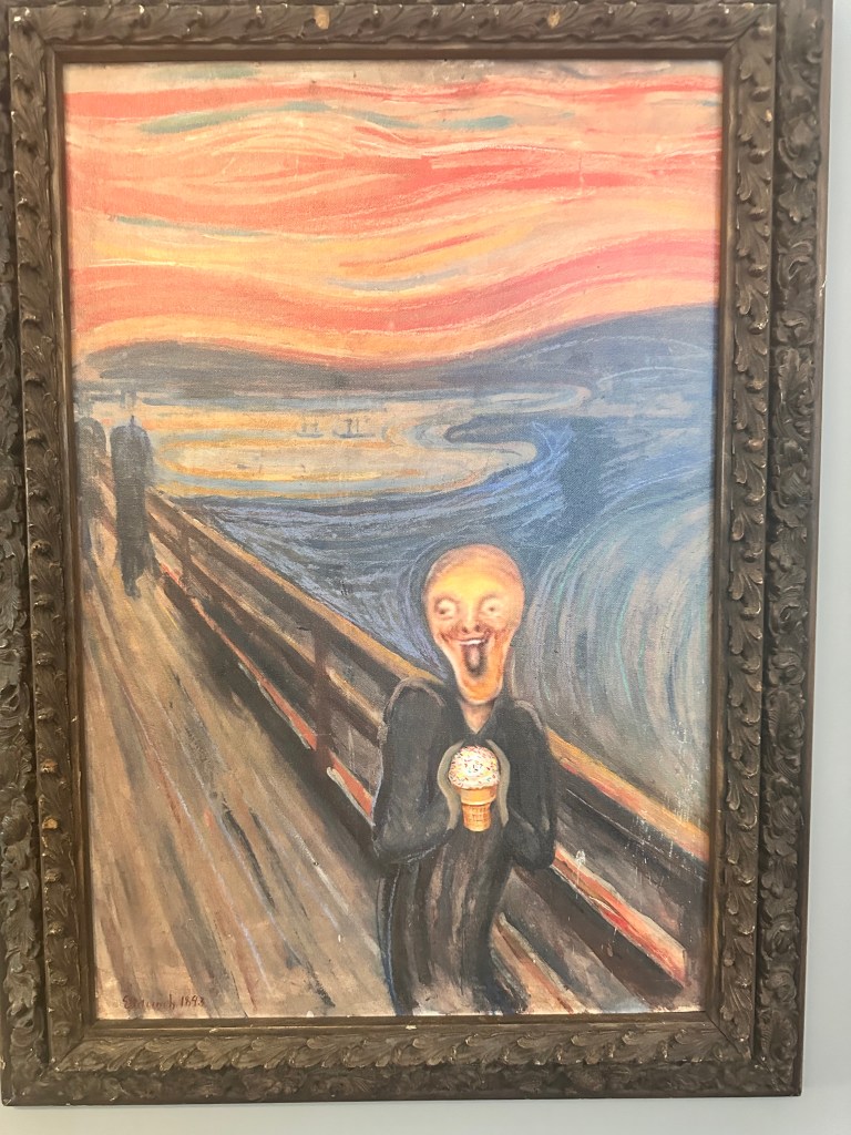
Patti Elliot, the Warmshowers host who offered me her home a few minutes after I’d booked that fleabag met me for dinner anyway, at a nice Indian restaurant, and we shared our biking and family experiences. We got homemade ice cream at Shannon’s, and smiled at the whimsical paintings on the wall.
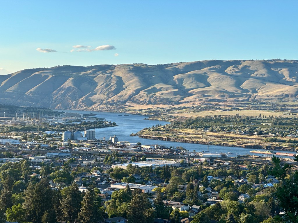
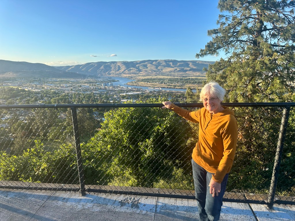
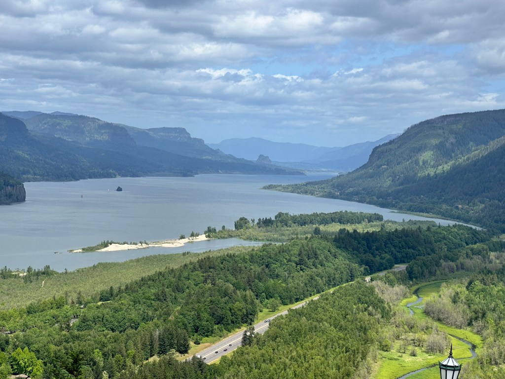
Patti capped off the evening by driving me up to a viewpoint above the city, for perspective of where the Columbia Gorge gives out into the Klickitat hills.
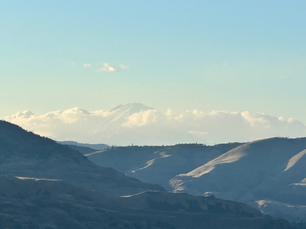
Many of those buildings on the waterfront are operated by Google The bridge I’ll be crossing tomorrow, back into Washington, and one of the Columbia River barges That’s Mount Adams, second highest of the Cascades, peeking through the clouds Patti, my delightful dinner companion
Followers of this blog will think I’m a broken record, talking incessantly of the kindness of strangers. Patti gave me lots of route advice, and warned me that the next stretch of this bike route was an “accommodations desert” with no Warmshowers hosts, motels, or even campgrounds for over 100 miles. Well, I’ve been pretty self-indulgent these last few days, still licking my wounds, reveling in the spectacular scenery, but only doing meager mileage. Now it’s time to step up. At least there should be a tailwind. Time to stop blogging and get to sleep.
Distance 29 miles, 751 total. Time 4 hours with stops. Elevation gain 1,672 feet
Cascade Locks to Hood River Oregon Saturday, May 18, 2024
You’d think after all my touring, I’d be an old pro at booking accommodations. Today’s experience showed how much I still have to learn.
Last night’s stay was in an unprepossessing place with reasonable rates. I was taken aback by the outside decor, they said they were undergoing renovations.
Ah yes, the toilet in the shower. Always a classy touch.
But you know what? It was fine. Comfortable, quiet, inexpensive, personable staff, no bedbugs.
I knew today’s destination, Hood River, was popular with tourists and that it was Saturday night. I sent requests to five Warmshowers hosts the day before, but none answered. Still going down to the low 40s at night, I’m still balking at camping. So I had to find a motel last minute, and was a victim of surge pricing. A nice Holiday Inn Express, but more than three times the cost of the night before.
My good friend and earlier host Annie Krumboltz always likes staying at Holiday Inn Express, and we joked about an old ad they ran claiming that staying there makes you smarter. I didn’t feel so smart this time. https://youtu.be/eHCTaUFXpP8?si=MKPLrz8GAwrjBBWj
Another smart move. Today’s ride was beautiful, but I only got this one picture, after two of that marginal motel room.
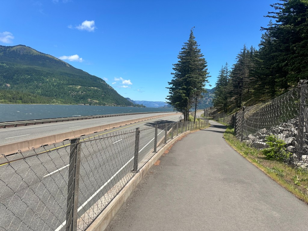
You can see that the interstate-adjacent bike path this time was well graded, not so abruptly hilly; I failed to capture the beautiful balustrades it had as it soared gracefully above the Columbia. You can kind of see ahead how the mountainous walls come very close to the river, forming a venturi, a natural carburetor that focuses the wind. In fact, just around the bend is Hood River, with a reputation for being the windiest place on earth. Fortunately for me, it was a tailwind.
There were a couple of blips. The bike path abruptly ended, and there was no choice but to ride on the interstate itself, which is allowed when there are no alternatives. It had a wide shoulder, protected by rumble strips, but still unnerving to have cars and trucks roar by so close.
The other blip was a sharp hill towards the beginning, with a 12% grade. I had to walk parts of it, but definitely found the dropper post made it easier to get back on the bike and continue when the grade lessened. A couple of lean cyclists were taking their racing bikes up and down this hill, I guess it’s comparable to one in the Tour de France, and they were training. Even they had to walk sometimes, and were impressed that in my lowest gear, I was going slower than their walking.
Jane, who had been there before with the family during my first failed attempt on Mt. Hood, told me the waterfront at Hood River was beautiful, full of windsurfers and kiteboarders plying the venturi winds. I figured it was worth 4 extra miles and another big hill to go see, but when I got there there was only one kiteboarder, too far away for a picture.
Determined not to be a victim of surge pricing again, I sent a last-minute Warmshowers request for tomorrow (generally frowned upon), and after not getting an answer in a couple of hours, went ahead and booked a fleabaggy room. Five minutes later, the host answered, saying I was welcome to stay there. D’oh!
Distance 24 miles, 722 total. Time 3 hours with stops. Elevation gain 1,779 feet
Sandy to Cascade Locks, Oregon Friday, May 17, 2024
It’s funny, I’ve been to the Pacific Northwest a bunch of times, but I’ve never seen the Columbia Gorge. Time to rectify that situation.
I was a little wobbly, mounting my titanium steed for the first time in a week, and the dropper post took some getting used to, but I soon got the knack of it, and I was in hog heaven. Swooping down from Sandy to the river also boosted my spirits. But what really snapped me out of my funk was the dazzling view from Vista House, my first look at the legendary Gorge.
Lots of other bikers passed by, it was great to chat with them The Columbia beckons
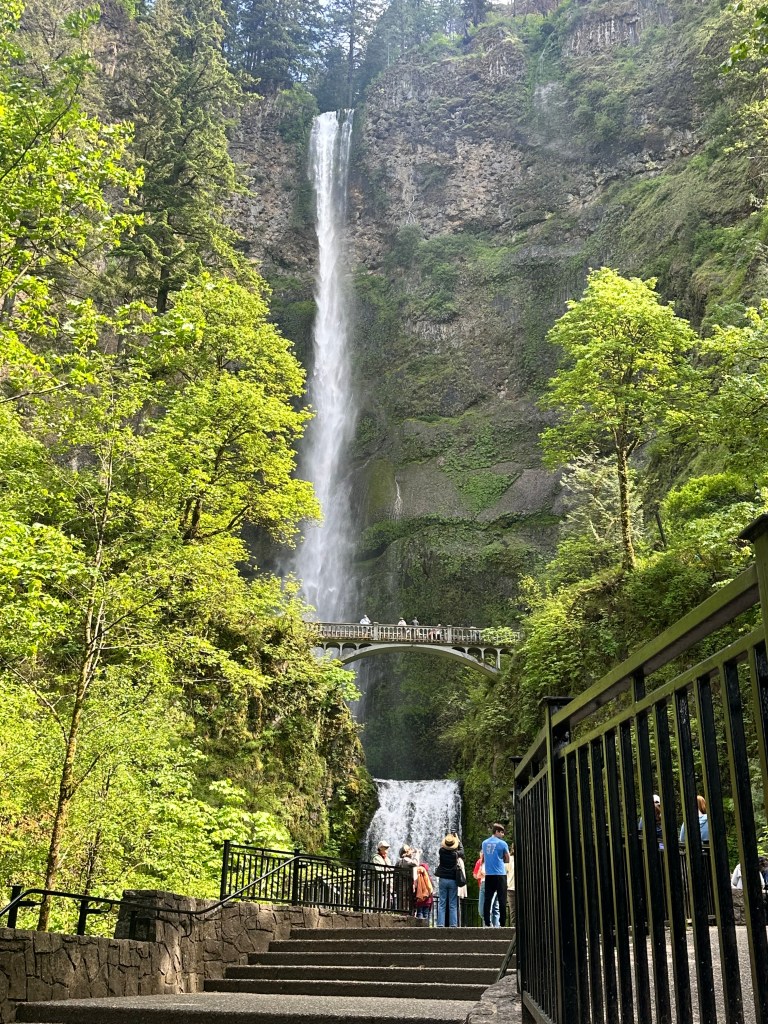
Another downhill swoop into that valley and past one spectacular waterfall after another, I was running late, so only had time to photograph one of them.
Multnomah Falls
There was a campground just beyond, and I considered it, but it’s going down to 40° tonight, and I thought it best not to push it, this early on in the tour. The road I was on, the Historic Old Columbia Highway, was narrow and twisty, but the cars were on it for the scenery (I-84 went right next to it) and were tolerant of bikers. It gave out into a bike trail, which seemed dreamy at first, but it turned out to be one of those trails constructed at the same time as the interstate, that loops back-and-forth under the highway, with lots of sharp ups and downs. After one steep climb, I was hopeful for a nice glide downhill, but was dismayed by a 90 step concrete staircase it took a white-knuckle half hour to ease my heavy rig down. I was so frazzled I forgot to notice I had passed the Bonneville Dam, at the time the largest in the country.
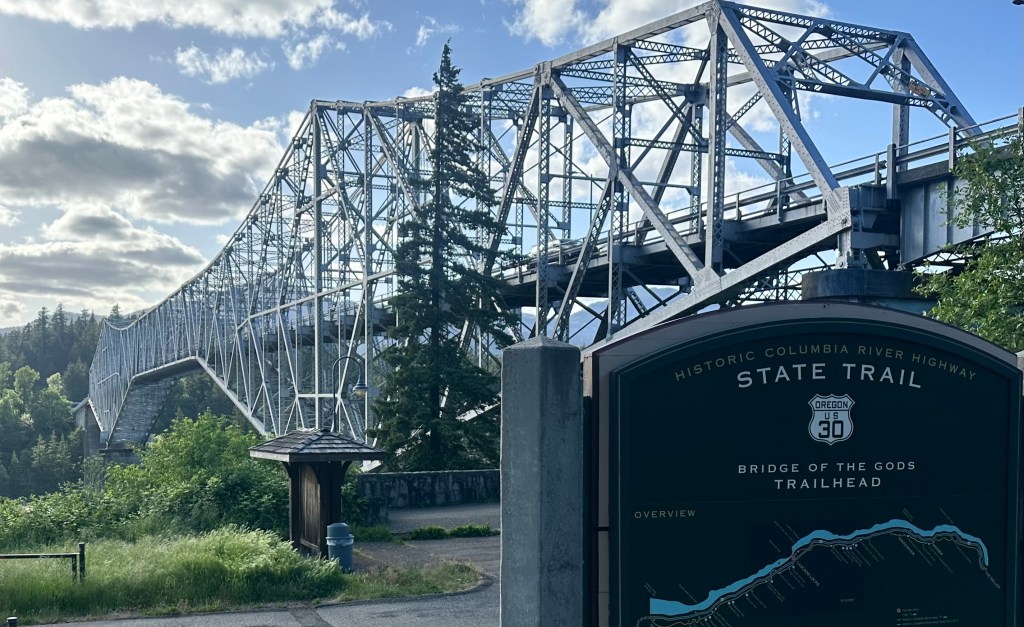
My destination was the Bridge of the Gods, so named for a natural crossing that was felt by the First Nations to be a gift from the Great Spirit.
To me it loomed large as Cheryl Strayed’s destination in Wild, made into an equally compelling movie starring Reese Witherspoon. I had to rent it tonight. The movie is pure gold from start to finish, but this scene always tears my heart apart. https://youtu.be/Wj1Mu3yM-uc?si=JQ6UlWrREMssCG82
Distance 44 miles, 698 total. Time 7 hours with stops. Elevation gain 2,350 feet
Government Camp and Sandy, Oregon Thursday, May 16, 2024
Today was a day for reflection and reorganization. Always a challenge to go from hiking-mode to bicycling-mode, today’s transition was freighted with rental car returns, UPS packing, bike-repair pickups, and peeling lips. Behind it all was profound disappointment, for all my trying to put a brave face on yesterday. Seemingly out of reach is my hope to complete the highpoints, is there any point to going on? Do I just go back to Portland and go home?
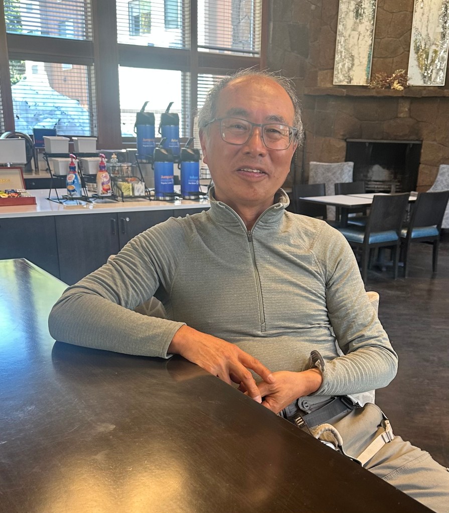
I’d hoped at least to catch up on sleep, what with the exhaustion, but there was too much on my mind. I completed yesterday’s post, hung out in the lobby and commiserated with Alex and his friend Richard, who are going on to do Mount Saint Helens today. Chatted with Chris, who was loading up his bike to do Hood to Coast, he had just completed his first year of Columbia law school. Two guys came in who had just summited this morning, it seems the slush had refrozen overnight. One of them, Ken, has put my peak-bagging to shame; a recently retired Silicon Valley engineer, he’s climbed over 800 major western peaks, shared his peakbagger.com page https://www.peakbagger.com/climber/climber.aspx?cid=25934 and encouraged me to set one up of my own. As if I need one more obsession.
Ken, his climbing harness still on
So climbers were successful the day before and the day after our debacle, so much was just the luck of the draw. So close, and yet so far. Maybe I’ll try again, I just don’t know.
Jane, ever my heroine, texted the perfect thing. “What next options are you thinking about? I know this has knocked the wind out of your sails but I think you’ll regret it if you come home.” She’s right. Both of us have made space in our lives for this summer’s grandiose expedition. She’s having a blast with our daughter Hope, touring Maine, picking out marble countertops, cruising antique fairs, and spending a week on Cape Cod with family. I’ve got my dream bike, newly tricked out with a dropper post, in one of the most beautiful parts of the country. The legendary TransAmerica Trail starts right here. What am I moping about? The horizon beckons.
Or as John Muir is often quoted, “Who has not felt the urge to throw a loaf of bread and a pound of tea in an old sack and jump over the back fence?”
Meriwether Lewis and William Clark had to come back from Oregon, and so do I, following their trail, which conveniently passes near most of the trailheads of the western peaks I’ve climbed. Closing the loop at the Paradise parking lot on Rainier really floated my boat, and so could the others. We could call it the Parking Lots Tour.
And so, as Meriwether often journaled, we proceeded on.
Midnight on May 15, I couldn’t get that exchange out of my head. In the end, it turned out better for me than for Julius, but we were both disappointed.
As planned, on Tuesday I met with my private guide, Laura Rae Berger, for an equipment check and ice climbing training clinic. She was satisfied with the gear I had brought, and supplied an ice axe, mountaineering boots, crampons, helmet, climbing harness, and down parka. The clinic was just across the parking lot in a steep gully that let us practice crampon footwork, belaying, and self arrest. I’d been through it all before, but it had been six years, and I was grateful for the refresher. Laura turned out to be an excellent fit, ebullient, patient, completely aware of my situation, which I had laid out in my application form. She’s from a small town in New Hampshire I was familiar with, started out in journalism at Saint Lawrence University, but found her true calling guiding and ski instructing in the Northwest. I’ve been blessed with many terrific guides over the years, but she was perhaps the most delightful. We had so much to talk about, and chatted incessantly throughout the experience. It turns out that was her in the group of guides snickering at me as I began my uphill trudge the day before, but they were laughing at my snowshoes, not my appearance. Nobody brings snowshoes to this mountain.
Also delightful was Alex, a fellow client who had hired his own private guide. He was a geologist from Slovakia, currently working in Houston with his wife, who was employed by the Johnson Space Flight Center. We talked for hours about Europe, academics, highpoints, healthcare, science, and could’ve talked much longer, but it was time to go to bed early.
It was no good, all my efforts to “jet lag” my schedule around to wake up before midnight. This is always been a challenge for me with early departures. I avoid caffeine and alcohol, have had no luck with zolpidem (Ambien), just get too keyed up to get more than a couple of hours of sleep. I greeted the 15th with a caesarean sense of dread, but recalled his line about a coward dying a thousand deaths.
I realized I made a couple of errors. I left that down parka in the climbing office. The training venue was a parabola of snow on a sunny day, I was diligently applying sunscreen but forgot lip balm, and developed a second-degree burn with blistering on my lower lip. Subsequent applications of balm only helped for a few minutes.
The day’s sleepy contingent of climbers and guides, about a dozen of us, clambered into the behemoth at 1:30 AM and were ushered noisily to the top of the Palmer lift. On went the crampons but not the climbing rope yet. The first 2000 feet were just a steep climb to the technical part. Right away I felt the altitude, my 70 years, my sleep deprivation, my bilateral disc surgeries that left me with only 20% of my calf muscle strength, my anemia (never fully resolved despite a celiac diet and IV and oral iron supplementation), and my general lack of fitness. I’d hoped my weight loss and ambitious bike riding would help, and they undoubtedly did, but not enough. Within minutes, I was lagging far behind the others. I had hired the private guide to avoid slowing the others down, and Laura did a great job, staying with me, kicking out steps, offering encouragement, but she gently said “this pace was not ideal”.
It has always been thus. I’ve never been athletic, my resumé notwithstanding. I avoided team sports in school, choosing solitary activities like hiking and cycling where I could set my own pace. Each day on the Camino, I was happy to be the first to start and the last to finish. My endurance and determination are great, my stamina not so much. I was hopeful the early start and great recent weather would make up for all that, that other party had summited successfully at 9 AM. But Laura said the conditions had worsened since then, and she wanted us on top before 7.
Huh? How could that be? The weather was perfect, warmer than ever. It was bizarre, huffing and puffing in the dark, our headlamps creating little islands of light in the gloom, the lights of Portland shimmering far below, the headlamps of the others far above. The steepness of the slope was just this side of scary. I felt I could maintain this pace forever, but now was anxious that might not be good enough. My lips hurt, aggravated by the heavy breathing. The wind gusts weren’t strong enough to knock me over, but didn’t help my crappy balance. My harness kept slipping down to my knees. I was a little chilly in all my layers, anxious it only got colder and windier as you climbed, anxious I’d forgotten that parka.
As a doctor, I know how anxiety can sap your strength. I knew, but I couldn’t get past it. That caesarean line was ringing in my ears. I gasped out to Laura, “I don’t know if I can make it,” but she showed her true professionalism, offering just the right amount of encouragement, saying “we’re almost at the Devil’s Kitchen, let’s head up there and talk about it.”
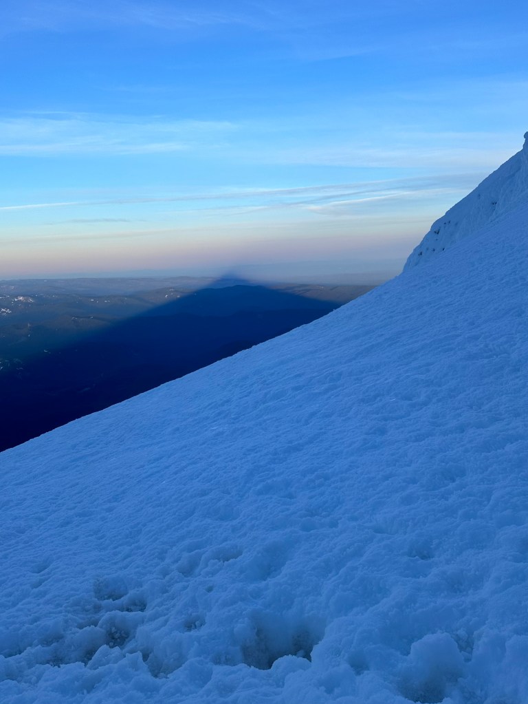
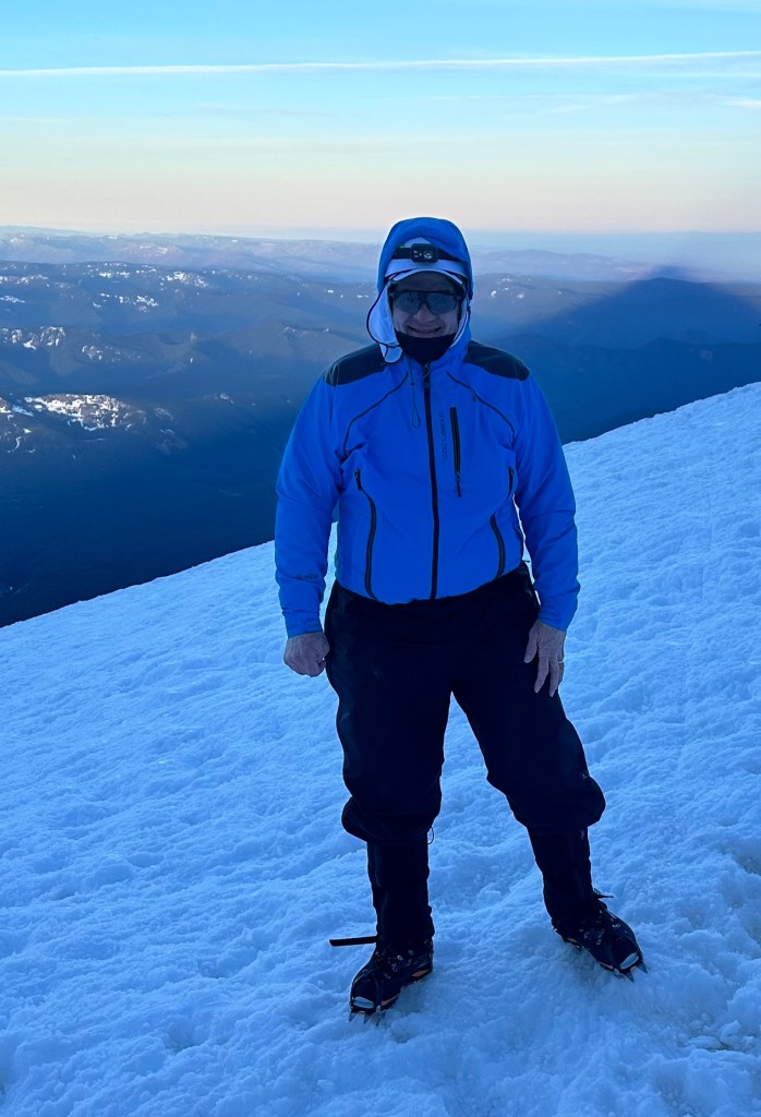
It was 5:45 AM. The sun had just risen. In all my anguish, I noticed the setting was beautiful. The mountain cast a massive triangular shadow past Portland, all the way to the Pacific.
Laura posed in front of the Kitchen, a hot rock surrounded by ice and snow, seething sulfurous fumes.
Elevation 10,157 feet
The group was gathered there, I thought they were far ahead. The guides had conferred and had an announcement: they were turning everybody around.
My first thought was OMG, was it because of me? But Laura reassured me, no, I had a private guide, I had nothing to do with it. The conditions, which looked so good, were deceiving. The usual route, the Pearly Gates, was closed by a bergschrund, a separation between mountain and glacier that I encountered on Denali and Gannett. There it was bypass-able, here it was not. The guides were using the less ideal Old Chute.
Those days of rain I suffered through last week fell here as wet snow, over 2 feet in Government Camp and much more up here. The last few days have been clear, but cold up here, in the single digits. The snow had frozen, and offered good footing for crampons and ice axes. But the warmer weather in the last 24 hours, so welcome below, was our undoing. The frozen snow had thawed and turned to slush. We noticed it less so far, the winds had kept things relatively cool. But the Chute was sheltered from the wind, and fully exposed to the sun. Treacherous under the best conditions, impassable now.
The other clients, who had made it to the Hogsback, had already been turned around. I felt a weird combination of disappointment, dismay, and profound relief. We were all going back. There is nothing we could’ve done. I had my “cover”. Even if I had been fully up to this, I still wouldn’t have made it. I felt bad for the other clients, who were clearly on a path to victory.
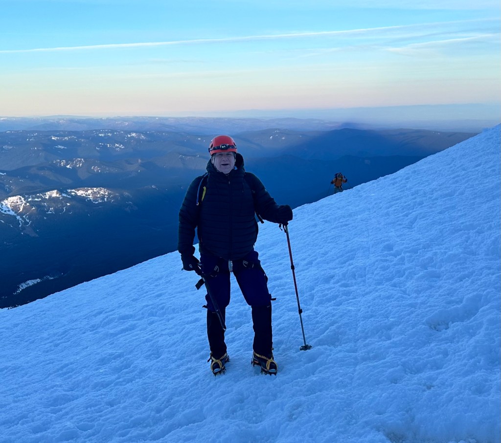
AlexDo I look disappointed?
On the long trudge down, I felt incongruously elated. All the anxiety was gone, a massive weight off my shoulders. I had time to exult in the spectacular beauty of the scene. Laura and I chatted amiably. I reflected on our obsession with mountains. It’s about the journey, not the summit we’re always told, and we all enthusiastically agree. But in our achievement-oriented culture, we give the lie to that. When I came down off of Denali, the trip of a lifetime, where three people had died, the first question everybody asked was “did you summit?”. You could argue this disconnect is emblematic of what’s wrong with our society.
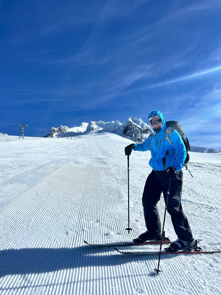
Through all these musings, I was rewarded with the ultimate Easter egg. Laura is also a certified ski instructor. Back at the top of the Palmer lift, where everybody else had to deal with the same interminable 2,500 foot slog to the base I had done two days ago, we had rented and stashed skis and boots. The slopes had been newly groomed to perfect corduroy, and the lifts wouldn’t open for an hour. We had it all to ourselves. I got a private lesson from the best in the business. It was the best skiing I’ve had all year. We could’ve been down in 15 minutes, but I kept stopping, not wanting to leave the glorious scene, wanting to get the full benefit of her lessons. Instead, it took almost an hour. We were still down by 9:30.
Oh yeah, I look seriously bummed out
So now it’s over. I failed. Strike two. Spent thousands of dollars, months of planning, weeks of cycling, and came up with diddly. Locomoted my sorry ass from the sea to over 10,000 feet, and got squat. Did the other great peaks, but can’t get the smallest of them done. How am I ever going to complete those 50 highpoints?
At the base, I talked with Catherine, 75 years old, who was one of the clients who was way ahead of me. So I can’t really blame my age. I asked Laura to be brutally honest, you’ve seen my abilities, do I have any chance on this mountain? She outlined a way (I won’t go into the details) that it could be done, and she’d be happy to guide me again. But It would be another big expense, again with no guarantee of the caprices of the weather.
When I would give my slideshows about Denali, I would remark that ultimately, I failed. I succeeded in reaching the summit, but I failed to turn around when my guide told me to. On this mountain, I failed, but had a wonderful experience. Can I be satisfied with that? What happens now? Stay tuned.
A parenthetical note. Just as we were all leaving the Devil’s Kitchen, another group, a different guide service, came up and started towards the Old Chute. Laura couldn’t believe they would be so reckless, our guides had briefed them of the conditions. But Alex thinks he saw them go through the Chute, and on the summit ridge. I don’t have confirmation of that, hope they’re OK.
So I don’t know.
Ice climbed 4 miles, 654 total. The skiing doesn’t count. Time 8 hours. Elevation gain 2,150 feet
As detailed in the previous pages, today is the fourth of five legs to climb Mt. Hood. The first was from Portland to Sandy at 1000 feet. The second from Sandy to Government Camp at 4000 feet. The third from Government Camp to Timberline Lodge at 6000 feet. I have hired a private guide, Laura Berger, for the final summit push on Wednesday. You take a snowcat to the top of the ski lift at 8500 feet, starting at 2 AM. With luck, I’ll be at the summit around 7:30.
Because of my insistence on climbing this mountain from the sea*, I feel the need to do the snowcat leg on foot. I had Jane mail me my snowshoes. Yesterday‘s dry run suggested I could make it up the 2500 feet in four hours. In fact, it took five. You follow a “climber’s trail” that skirts the right edge of the ski slope, just beyond the ski boundary, but it is typically broken up with snowcat tracks that make the going challenging. I had checked in at the guide office, they didn’t think I really needed snowshoes for this leg, but the snow was pretty soft in places, and I saw a fair amount of post-holing, I’m glad I brought them.
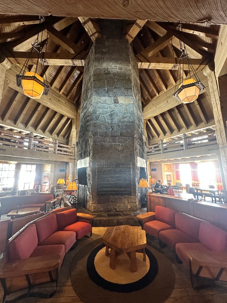
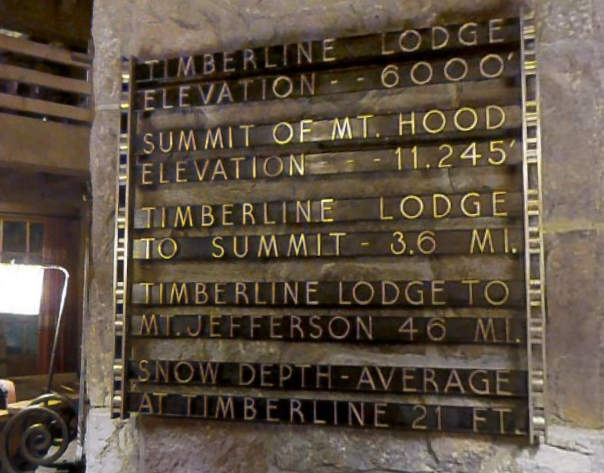
I had a sumptuous breakfast at Timberline Lodge to get me going. It’s really an amazing building, considering it was built as a New Deal project to get us out of the depression. Here is the main lobby, the sign at the bottom has some interesting statistics.
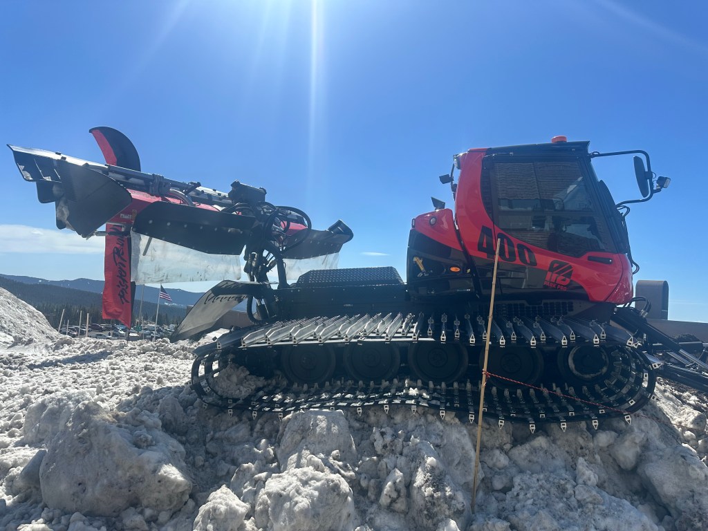
Parked outside was one of the behemoths I’ll be taking on Wednesday morning.
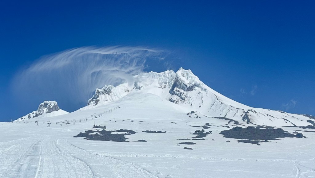
Had a nice long call with sister Anne as I trudged up, she couldn’t hear me very well because of the wind noise, but I could hear her fine, and she filled me in all about the family. My niece Martha is getting her PhD in linguistics from Berkeley today, she’ll be getting her hood while I’m climbing Hood! An interesting cirrus cloud formation developed around the mountain, and I texted Anne this picture.
Encountered two women, a guide and her client, coming down the mountain, they said it was fine up there, they summited at 9 AM, the snow was in good shape so she didn’t think they had to summit earlier than that. Encouraging.
Skiers and snowboarders would occasionally veer across the track, but the lifts closed at 3 PM. Just after, a ski patrol guy stopped by and said that if I needed a rescue after that, I would have a long wait. Geez, did I look that pathetic?
It wasn’t clear where I was actually headed. The guys in the guide office said just go to where the snowcat tracks stopped, roughly even with the top of the ski lift. Up that high, the wind had obscured most of the tracks. A low moraine blocked my view of the lift, but I believed I was even with it. I went up to the last of the ski boundary signs, my Apple Watch said I’d climbed 2,485 feet, so I called it good. Overall altitude almost 8,500 feet, I hadn’t been this high in quite a while. Maybe that’s why I was breathing so hard.
Coming down took longer than I hoped, I hadn’t used my snowshoes much recently, and it felt pretty precarious, negotiating the steep slope. I didn’t want to slip or twist an ankle, alone up here. A couple of times I sat down and just glissaded down the hill, but that’s easier to do with snow pants on, and without snowshoes. Sometimes I felt like a baby, butt-scooching across the floor, sometimes I got an icy wedgy. Charming.
Even this late in the day, I encountered a number of backcountry skiers skinning their way up the slope, one couple had funny looking skis, which turned out to be split snowboards. Interesting.
Halfway down, the broken snowcat-tracked trail turned into smooth corduroy. I was so touched. This was outside the ski area boundary, so some kind-hearted groomer must have spotted my predicament and smoothed the trail for me. And I wasn’t even a paying customer. Or maybe it wasn’t all about me. It made all the difference, suddenly I could skim along in smooth, gliding strides.
All told, it took three hours to come down, I limped into the parking lot at 6:30. My pants were soaked, but amazingly, my feet were dry. I guess my combination of Gore-Tex trail runners, waterproof, socks, and gaiters actually worked (I will be renting mountaineering boots for the climb). Noticed my balance was quite a bit better by the end, maybe this trip was therapeutic after all.
No question about it, there was no way I could have done this and the summit climb on the same day. Once again, dependent on fossil fuel. But in my convoluted way, I can also say I climbed it on foot.
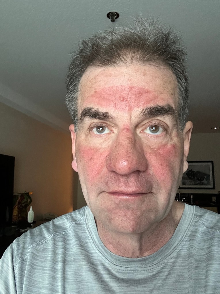
Back at the motel, I made a disturbing discovery. I had been reapplying sunscreen regularly, but my forehead was scorched.
And me with my history of melanoma! I’ve got to be more careful.
I don’t usually like to apply sunscreen there, it’s covered by the brim of my hat anyway, and when you sweat, it gets in your eyes. But I’d forgotten, on a snow slope, the sun is reflected back up at you. I now recalled on Denali, when you were gasping for air constantly, the roof of your mouth got sunburned.
Tomorrow will be a low-key day, I will meet with Laura at 10, she’ll check my equipment, and we’ll review ice climbing techniques for a few hours. Need to get to bed early, for the 1:45 AM start the next day. No blogging for tomorrow.
Snowshoed 9 miles, 650 total. Time 8 hours. Elevation gain 2,485 feet