North Shore Cinema

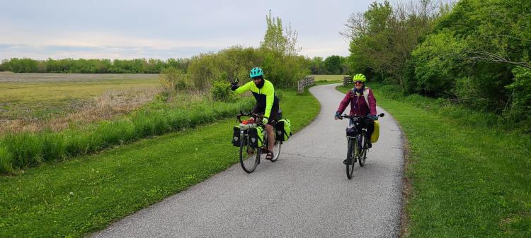
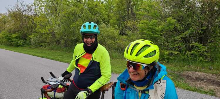
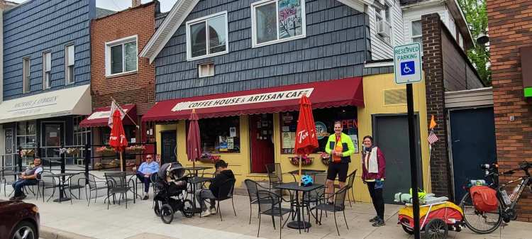
Chicago to Zion, Illinois Monday, May 17, 2021

Funny how, in the space of five years in the early 1980s, three iconic movies were made about the North Shore of Chicago: the aforementioned Ferris Bueller‘s Day Off, Ordinary People, and Risky Business, launching the careers of Matthew Broderick, Timothy Hutton, and Tom Cruise. This was the territory I was going to pass through today.

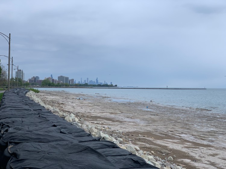
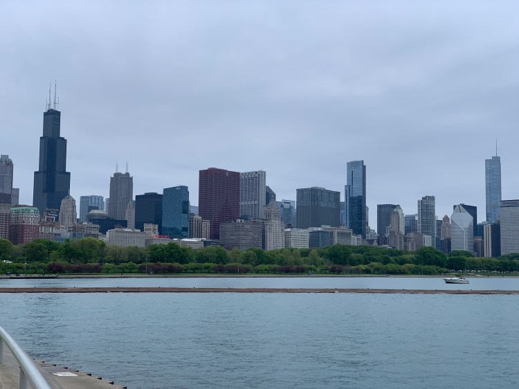
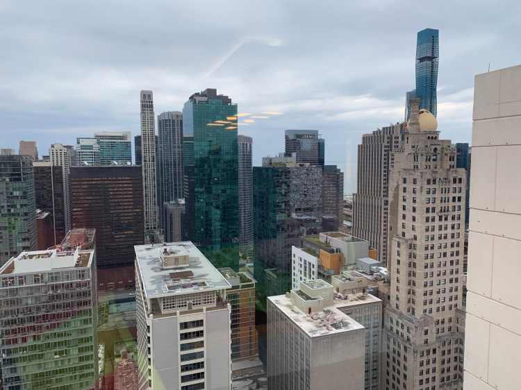
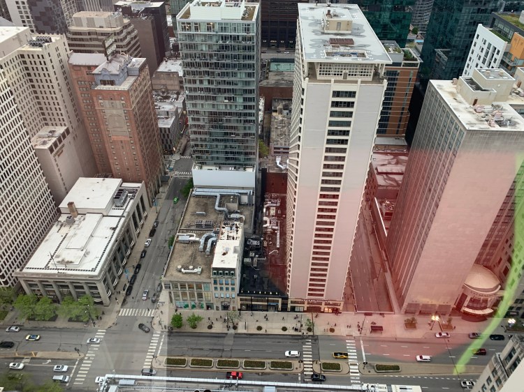
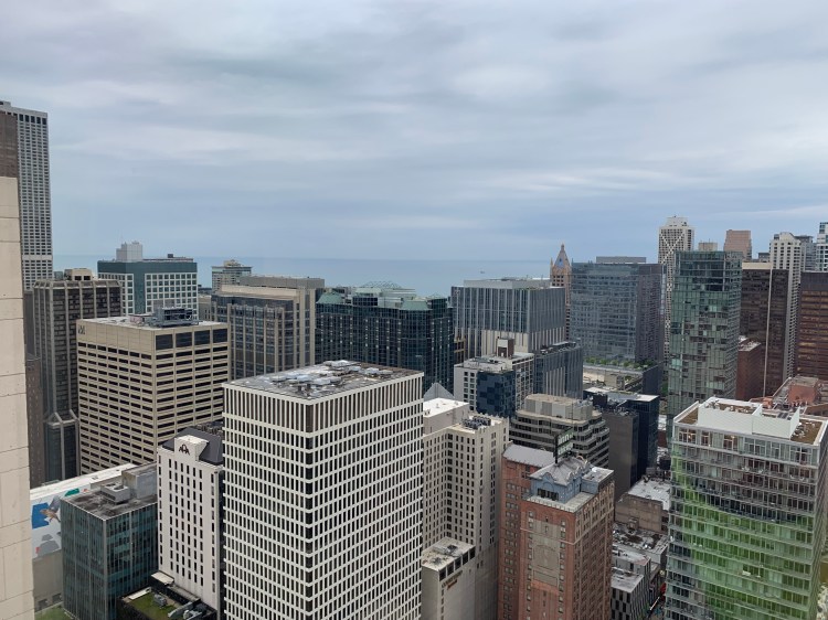
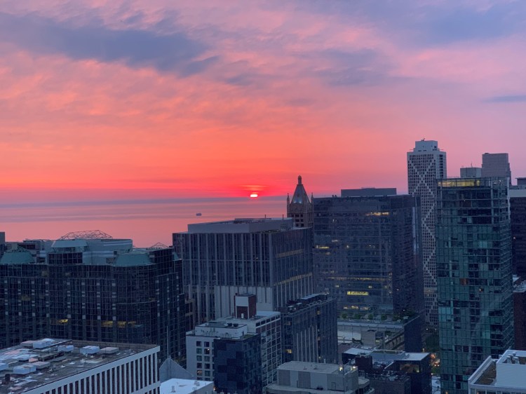
But not before the city of Chicago bid me poignantly farewell. I woke up to one of the most amazing sunrises I have ever seen, over Lake Michigan.

What a way to start the day

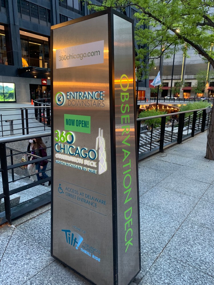
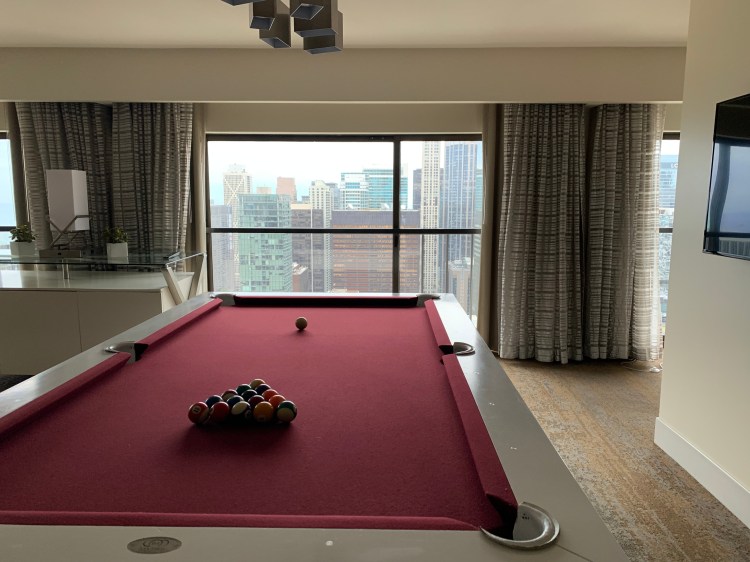
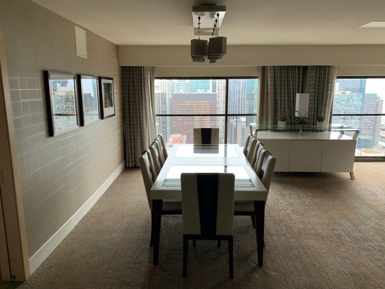
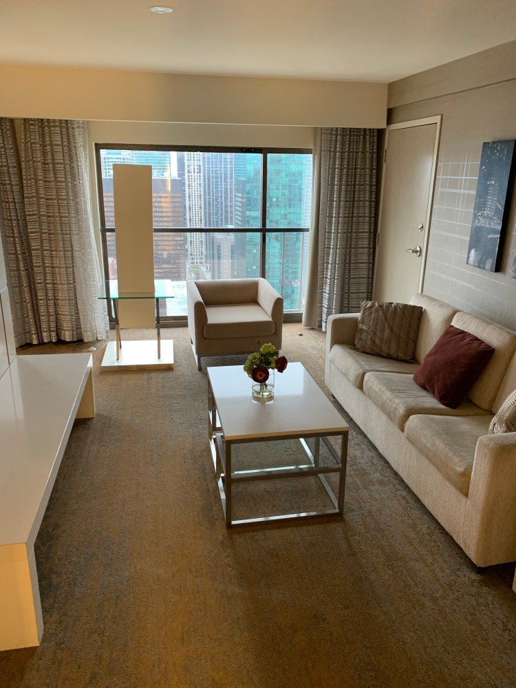
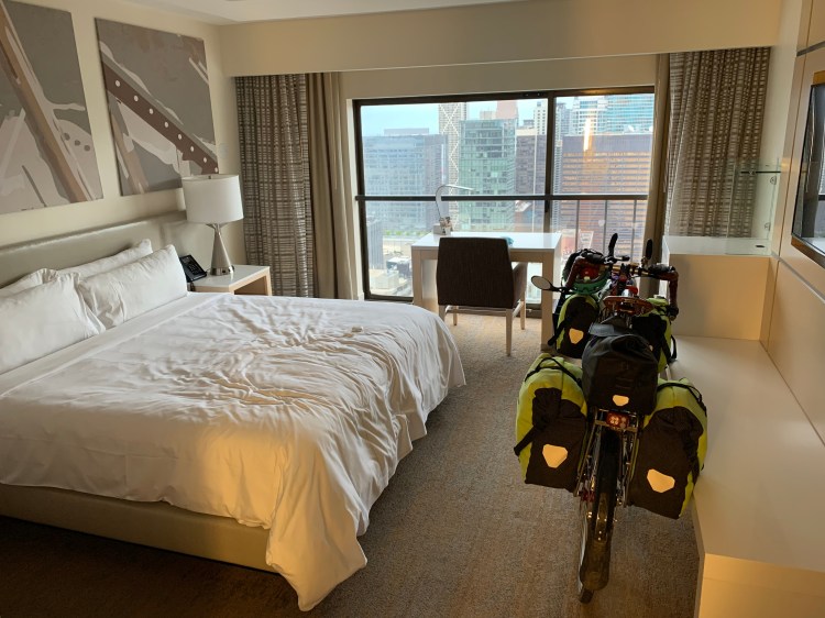
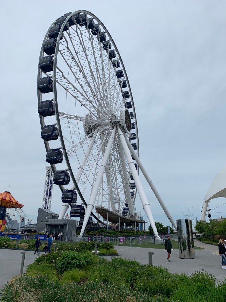
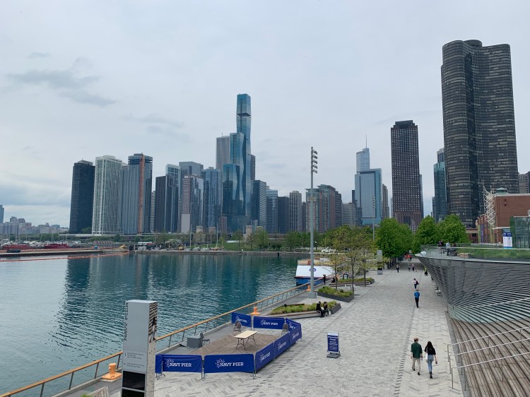
When you have a hotel suite this nice, you’re not in a hurry to leave. I didn’t get out till noon, and didn’t leave the city without checking out Navy Pier, with its iconic ferris wheel and views of the Chicago skyline.

A funhouse mirror, of sorts

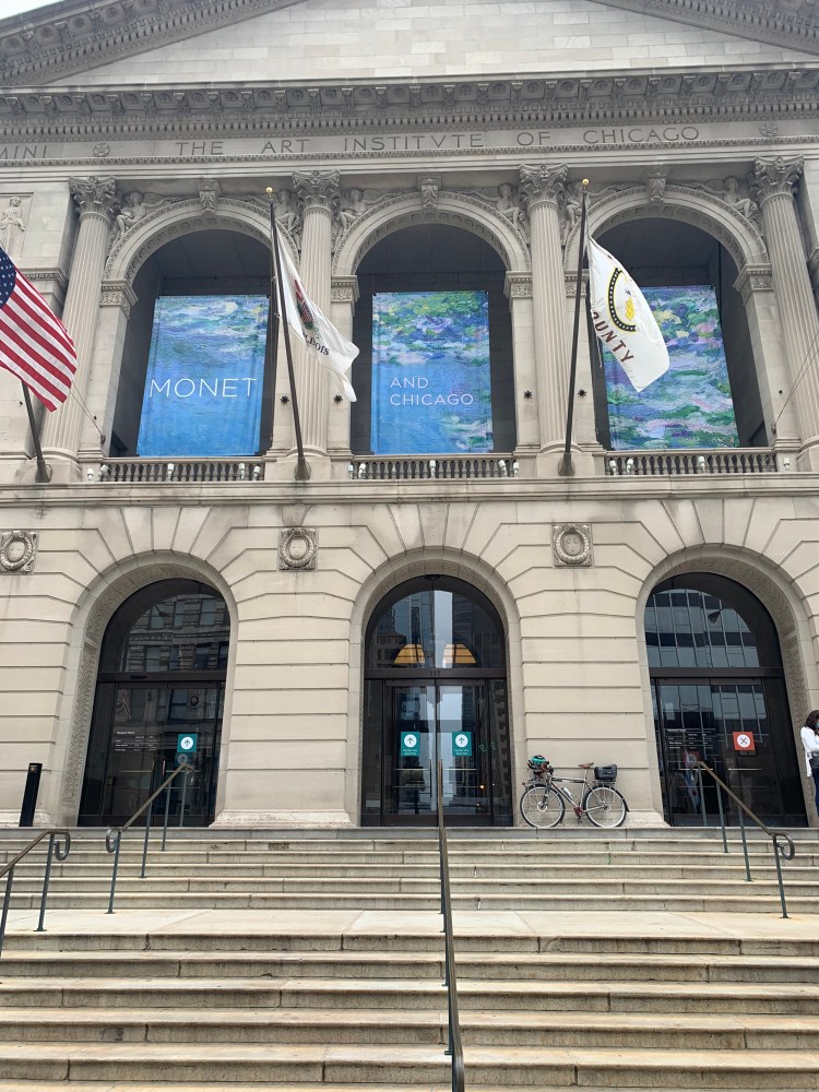
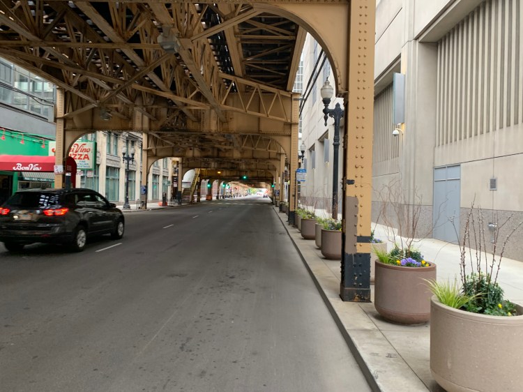
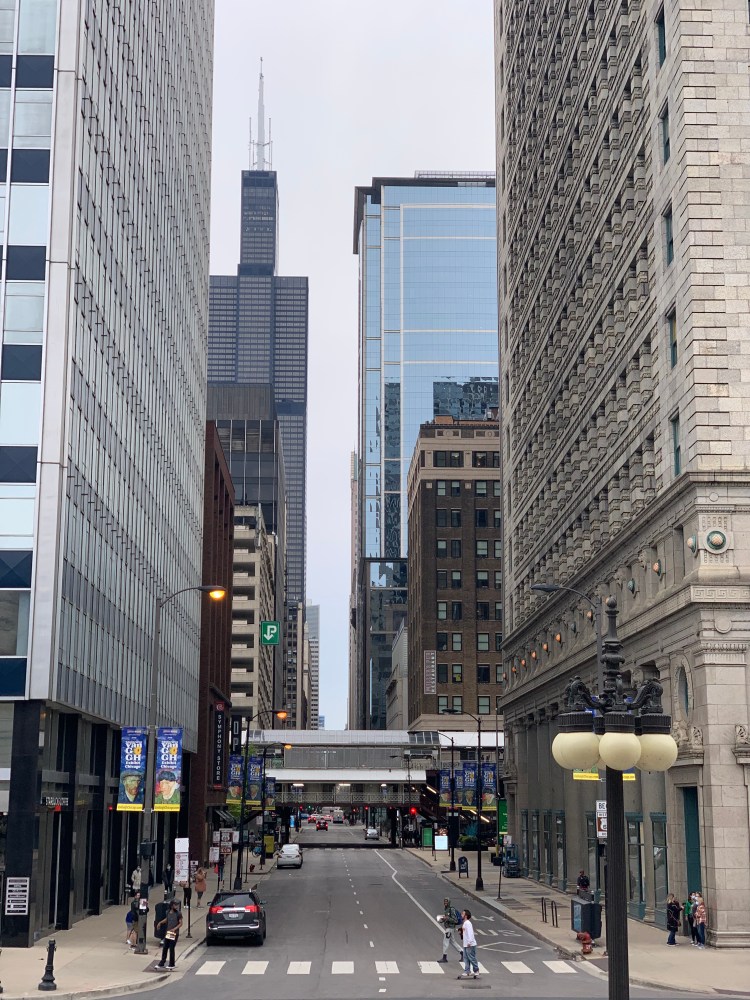
So it was 1:30 before I left the city, regretful about all the things I didn’t see. Not only did I miss the Monet exhibit at the Art Institute of Chicago, but also Hopper’s Nighthawks and Seurat’s A Sunday Afternoon on the Island of La Grande Jatte. I missed the Field Museum, the iconic University of Chicago, a boat trip along the Chicago River, and those views from the skyscrapers. At least I had a penthouse view from a pretty high building. I left thinking Chicago deserves a lot better than to be called the Second City. We’ll be back.

There was one icon that was kind of on the way out, Wrigley Field. As my navigator guided me through the crowded streets of northern Chicago, I came upon it suddenly, and surprised myself by almost shrieking with delight.

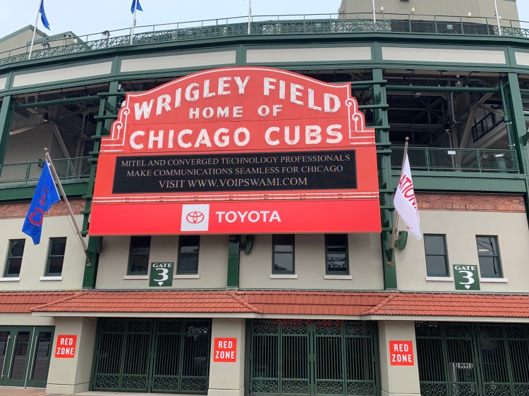
It’s not like I’m a baseball fan, and when I am, it’s about the Red Sox or the Nationals, certainly not the Chicago Cubs. But how can you not love the Cubbies? They had a World Series drought longer than the Red Sox, and the only ball park with ivy on its walls.

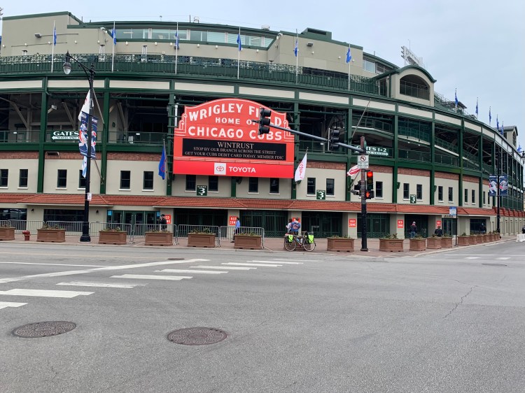
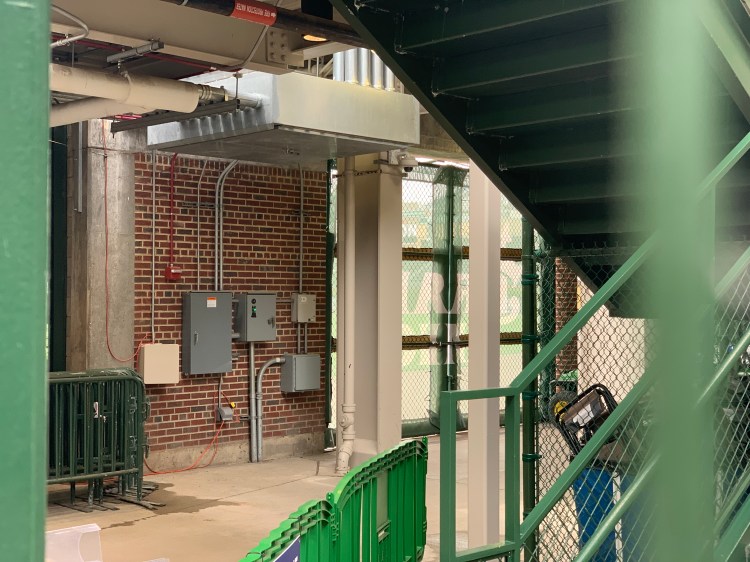
I love how, like Fenway park, Wrigley is wedged between city blocks, not surrounded by acres of parking. I really wanted to see that ivy. I circled the park, asking guards if I could sneak in for a peak and finally winding up with the head of security, who was unmoved by my “biked all the way from Vermont” story. The Cubs were playing at 8 o’clock that night, and if I wanted a look, I would have to buy a ticket.

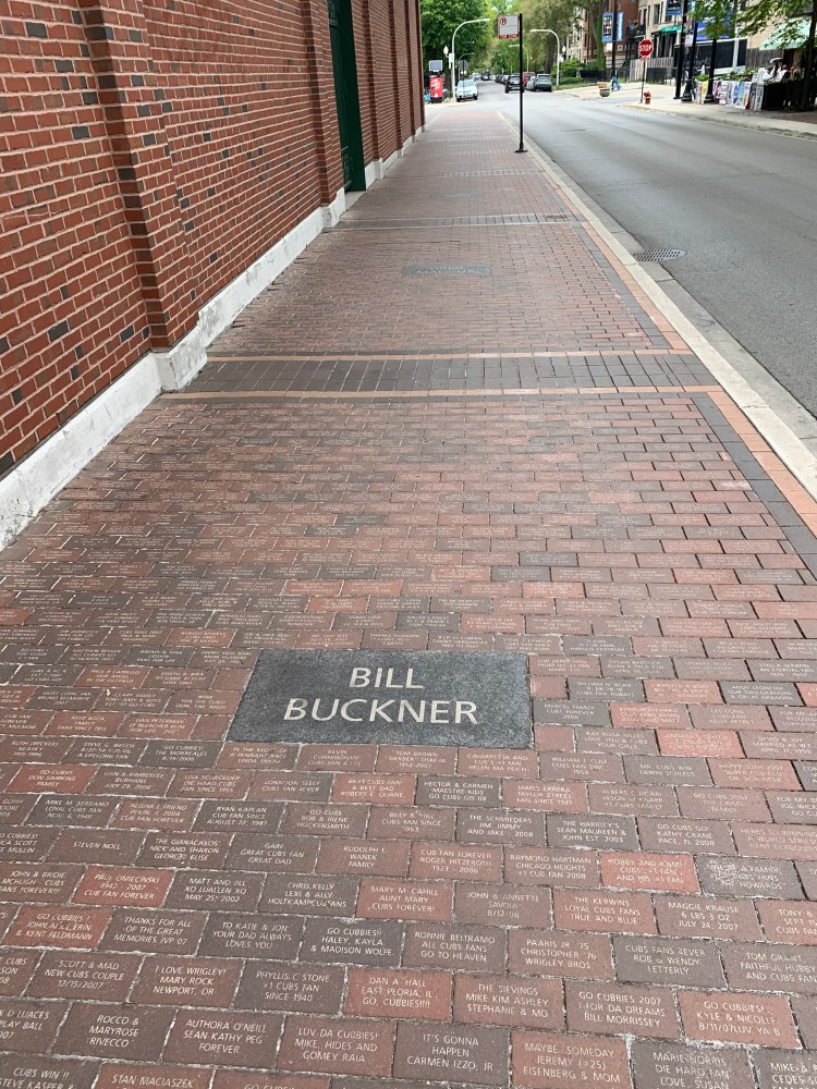
Oh well. I got a tiny glimpse of the infield, and had fun looking at the statues outside.

The barest peak

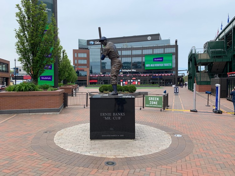
There was a kind of a “Hollywood walk of fame” on the bricks outside, including the much-maligned Bill Buckner, a great player whose career was sadly defined by a ground ball that got between his legs, and wound up costing the Red Sox a World Series victory in 1986. He also played for the Cubs, and at least they gave him his due.

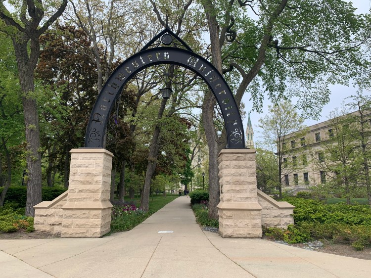
Next step was Northwestern University, which I had never seen but was the stomping grounds of three important doctors in my life. The first was George Reading, my uncle, the only doctor in my family, a plastic and hand surgeon who has retired to New Mexico, I hope to visit him and his wife this winter. I will be seeing his daughter, my cousin Annie, tomorrow in Milwaukee.

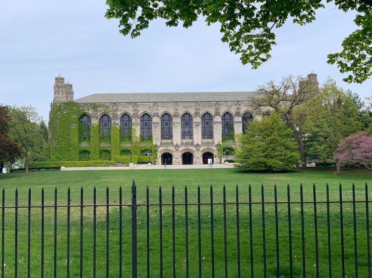
The second doctor was Harvey Washington, a great childhood friend with whom I delivered the Sunday New York Times by car for a couple of years at the end of high school. We listened constantly to America’s Top 40 with Casey Kasem, and memorized all the songs. He went to Northwestern undergrad, Johns Hopkins for medical school, and is still practicing primary care medicine at the VA in DC. While cycling today, we talked on the phone for almost an hour, reminiscing. It made the miles speed by.

I was also able to reach the third doctor, Floyd Russak, a Northwestern grad who was my classmate at GW medical school, we also did primary care residencies in Cambridge Massachusetts. He has moved to Denver where I have visited him a few times, he also invited me to his place in Aspen. I am really looking forward to seeing him again.

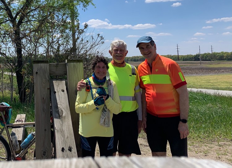
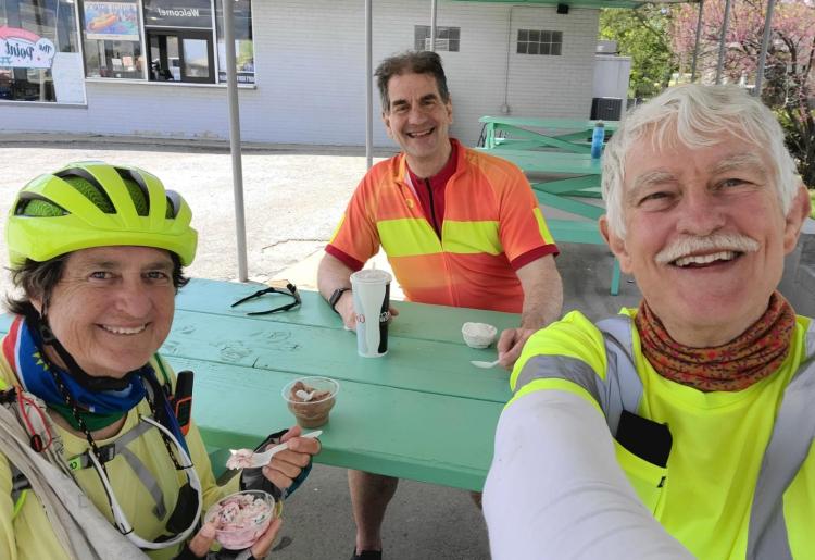
I was delighted to encounter an older woman on a bicycle named Erma, originally from Russia, 83 but looking much younger, said she had bicycled almost every day of her life. She took my picture and subscribed to my blog, as did a couple of racing cyclists on very fancy bikes, the exact opposite of what I’m riding.

I did notice I passed through Lake Forest, the setting for Ordinary People, but couldn’t identify where the other two movies were made. No matter, today was a movie-perfect day.

Distance 51 miles, 1,402 total. Time 7 hours with stops. Elevation gain 369 feet

Scott Luria’s Day Off

Chicago, Illinois. Sunday, May 16, 2021

A sunny Sunday in Chicago. A beautiful hotel room, right in the center of town. A planned down day—no schedule. Surely I could give Ferris Bueller a run for his money.

It didn’t quite work out that way. I slept late, had a leisurely Trader Joe’s breakfast, worked on my blog, luxuriated in this great suite, checked out the fitness center, and didn’t really get going until mid-afternoon. This would be the biggest city of the trip, a chance to pick up any hard-to-find bike supplies. I took everything off of the bicycle and looked it over, and was horrified to see I had broken another spoke, with a big wobble in the rear wheel. Funny, the same thing had happened as I was trying to leave my fancy hotel room in Cleveland.

Actually, not so funny. A broken spoke is a big deal, if not fixed quickly, the weakened wheel can easily lose more spokes. I had this wheel built specially, anticipating this problem as a heavy guy on a loaded bicycle. I even had a spare wheel waiting for me at home, for Jane to send if necessary. I had brought some extra spokes, but now I had already used two of them. Clearly, the thing to do was go to a bike shop where they could properly tension the wheel. But by now it was 3 o’clock, and the shops close by five. Indeed, the first shop, 2 1/2 miles away, didn’t have time to help me before it closed. The owner, John, did give me gratis an obscure piece I needed for my panniers, for which I was very grateful.

I got to the second shop at 4:15, it was disheartening to see that there was a line at the door, they were only letting people in one at a time as people within the shop left. When it was finally my turn, they said they could have the wheel for me sometime tomorrow. I sweet–talked them into letting me repair the spoke myself on their floor, and then just having them do the truing and tensioning, for which you need a special jig. Russ was very accommodating and helpful. Once again, the kindness of strangers.

I was finally free to see the city at 5:30. The famous Art Institute of Chicago closed at six, I was sorry to miss their big Monet exhibit, but I bought the coffee-table book to send home to Jane, and snapped a few pictures.

Two lions in front, like Patience and Fortitude at the New York Public Library
“INSTITVTE” is spelled the same way on the MIT Great Dome, always thought it was pretty pretentious
Not quite Winged Victory
Another work of art at the museum

Quite possibly the most-visited attraction in Chicago is Anish Kapoor’s Cloud Gate, a.k.a. The Bean. It is a dazzling sculpture, but mobbed with tourists and hard to get a clean picture. At some point they cordoned it off, I’ll bet it was amazing to stand underneath and see your unusual reflection.

My friends had given me a list of “must-sees” but I only had time for a few of them. One of them will only make sense to a few of you. Back in high school I saw a compelling film called Powers of Ten, that really piqued my interest in science. https://youtu.be/0fKBhvDjuy0 Frank pointed out that it was filmed on the waterfront of Chicago, so I had to go find the spot.

X marks the spot in the movie
The closest spot I could find on Google Maps
The spot now, obviously they have repaved and landscaped since then

And keeping to the theme of obscure spots of grass and trees, I had to take this photograph. This is Grant Park, home of the famous 1968 “Chicago 7” riots, and also Obama’s 2008 election acceptance speech, both scenes burned into my memory.

“The Whole World is Watching”

These are Chicago’s famous “L” tracks, featured in ER and many movies.

Even though everyone says the Hancock Tower has the better view, I had to go see the Sears Tower, which for much of my adult life was the tallest building in the world. The trouble is, when you’re right next to it, it is hard to convey its size in a picture.

The Sears/Willis tower from the Art Institute
Those little squares up there are glass-bottom skyboxes, that you can walk into and stare straight down
This is one of the entrances, I just had to include it because of the word Wacker

I didn’t go up, it was too crowded and expensive. Instead I raced over to the Hancock Tower, arriving right at 8 PM, sunset was at 8:05.

Lower, but prettier
Hmm, this looks intriguing

Alas, the guard told me that all the reservations were taken. Nothing to do but head back to the hotel and have my second Trader Joe’s dinner. Two days in Chicago, and the only money I spent was on that coffee-table book. It was also fun to realize that my unloaded bicycle is a great city bike, agile and perfect for the crowded streets of Chi-Town.

Ferris, your record is secure.

Danke schön, darling danke schön

Distance 12 miles, 1,351 total. Time 5 hours with stops. Elevation gain 246 feet

Just a little of that human touch

Rochester, Indiana to Chicago, Illinois. Saturday, May 15, 2021

Ben & Christine eat much healthier than I do. I announced I was going to Denny’s in the morning for a grand slam breakfast, and they politely demurred. It was actually pretty great, eight dollars for three eggs, three strips of bacon, and three pancakes. I could only make it halfway through the pancakes, and texted my friends that I was going to check in to the local ER to have my stomach pumped.

I was treated to another few hours of biking with Ben & Christine before our paths diverged. Again, I marveled at how much fun it was talking with them, how closely our paces matched, and how little I minded when Ben stopped for pictures. He sent me a few of the ones he took, and if you look at his website, you’ll see he took dozens more. I really have to start doing that myself.

Not quite “Daisy, Daisy”

Just like approaching Cleveland, when I stopped for coffee at a cute little town square in Painesville, today we stopped at a gorgeous courthouse square in the town of Crown Point, on the day when I was due to arrive in Chicago. We found a cute little coffee shop right across from the courthouse, and had a blast sipping café au lait and fancy sweet treats, theirs were organic, mine not so much.

A last cup of Joe

As we approached the point where we would split, I found myself getting clingy only after a couple of days with them. I tried to push them away by tunelessly belting out “Gary, Indiana” (supposedly on my route) from The Music Man, as a way of showing them how difficult it would be to travel with me if we were to stay together. I love to sing songs at the top of my lungs, mostly when I’m pretty sure no one else can hear.

We hugged, said our goodbyes, promised to keep in touch, then they went west, and I went north.

A parting gift, some Fireball Cinnamon Whiskey

The first few miles alone were bittersweet. I again realized how much I crave human contact, beyond just brief conversations with friendly people. Touring alone definitely has its advantages, you can keep your own pace, don’t need to consider anyone else’s preferences, no “getting on each other’s nerves”, and you are generally more approachable to outsiders, who are more reluctant to approach a group. Still, it can be lonely. As is so often the case, Bruce Springsteen said it best https://youtu.be/85cNRQo1m3A

The Adventures Cycling route I am following, part of their “NYC to Chicago” route, takes you up through bike paths to Lake Michigan (it actually does not quite hit Gary Indiana) which you then follow into the heart of Chicago. Ben & Christine diverged before this in part because they had heard that this route was not safe, in fact I did have some trepidations about coming through the infamous South Side of Chicago. Happily, though, I never felt uncomfortable at all. No sign of Bad Bad Leroy Brown. Instead, I was treated to a part of bicycle touring that I love, approaching a big city from the hinterlands. It’s fun to see the landscape gradually transform rural to semi rural, suburban, dense suburban, and finally urban. It feels like I’m approaching “the heart of the beast”. In this case, I was mostly following bike paths that were generally in quite good shape, only a couple of spots with the turns were confusing, but RideWithGPS saw me through. It started to gently rain, but there was a nice tail wind, so it was really quite easy. There was a nice sign as I crossed into Illinois, my fifth state line.

This gentleman was out for a stroll in his motorized wheelchair

Finally I popped out onto the shores of Lake Michigan, and got my first view of the skyscrapers of Chicago. I had only been there once before, on an overnight business trip where I didn’t get to see the city. I was thrilled I was going to have a full day there tomorrow.

Too bad the view was blocked somewhat by an ugly plastic levee

At this point I wished I had my GoPro up and running, so I could document the thrill of gradually getting closer and closer.

That’s the Willis Tower on the left, formerly the Sears Tower, the tallest building in the world for 25 years
I passed many interesting structures, but only photographed this one, an unusual bicycle and pedestrian bridge

I had enlisted the help of my buddies to tell me what to see in Chicago. Brian’s first suggestion was the Buckingham Fountain, and in fact that is where the Adventure Cycling route officially ends. It was impressive, but unfortunately it was turned off.

Even so, there were a couple of weddings wrapping up there

Frank said be sure to check out Ed Debevic’s restaurant, which was just around the corner from my hotel, and from the website indeed looked like lots of fun, a real Chicago institution. Unfortunately, all I found were these signs:

Another casualty of the pandemic

Great, I thought, I’m batting 0 for 2. I shuddered to think what would be awaiting me at the hotel check-in. Despite the fiasco two days ago with Priceline, I decided to give them another chance, and booked the cheapest room available at the Marriott Miracle Mile hotel downtown. It was $145 a night, but I figured, I’d just biked all the way to Chicago, it was worth a splurge.

It didn’t start out well. The lobby had 10 marble steps down to the check-in area, and I balked at carrying my hundred pound bike down them. Instead I left it at the top of the stairs, hoped it wouldn’t be stolen, and warily approached the check-in counter. The receptionist Hannah heard my story and said she would do what she could to upgrade my room. She said I could wheel my bike around to the other side of the hotel, where there was a ground-level check in. Luckily, it was still there at the top of the stairs.

I looked at my room number: 4618. Oh well, I guess the fourth floor won’t be too bad. But when I got to the elevator, there were no rooms on the fourth floor, however the elevator went as high as the 46 floor. I figured what the hell, I’ll try it.

Room 4618 was spaced quite a bit further from the other rooms, and had a title card under it: “Horizon”. Hmm.

OMG. OMFG. It was a five room suite, and the floor-plan on the door indicated it was THE penthouse suite of the hotel. It had a full-size pool table, a conference alcove with eight chairs, a separate living room, two luxurious bathrooms, and a dazzling view of the skyline and Lake Michigan. Are you kidding me? Is this a joke? Right away I called the desk to make sure there was no mistake, and that I wasn’t going to be hit with a massive upcharge for the room. No, they said, Hannah (who turns out to be the manager) just decided to do me a favor. In retrospect I wondered, God, did I look that pathetic?

With a capital T and that rhymes with P
I suppose you’re wondering why I brought you all here today
As fancy as it looks, there’s just a microwave and a refrigerator. Oh well.
Alas, that’s not a pull out couch
Now this is a bit more like what I’m used to, a crowded bedroom
The Second City. Chi-town. The Windy City. That Toddlin’ Town. The City of Broad Shoulders.
Hello down there
Maybe in the morning, I can see the fog come in on little cat feet

I feel ostentatious even posting these pictures. This is obscene. I’m like Eva Gabor, who “just adored a penthouse view” before her husband dragged her off to Green Acres (where I was this morning). Thank you, Hannah. Talk about a little of that human touch.

Right away, I thought I had to share it with somebody. Ben and Christine were staying somewhere south of here, perhaps I could entice them into coming up been sharing the second day here with me. Or maybe my cousin Annie Reading, with whom I will be staying in a few days in Milwaukee, would come down for Sunday night. Not surprisingly, both begged off. Who am I going to play pool with?

OK, what to do about dinner? Saturday night in downtown Chicago, shouldn’t be a problem finding a table. On my one previous night in Chicago I had the best steak of my life at Ruth’s Chris Steakhouse, but the one nearby was permanently closed. Hannah recommended Eddie V’s next-door, but the dress was business casual and they didn’t have any reservations until 9:30. Just as well, their basic sirloin was $48. In fact, I couldn’t find a table anywhere within a mile.

I was living too high on the hog anyway. Trader Joe’s was just around the corner, and I got enough food for two days for $52. Not exactly haute cuisine, but if you eat it on the 46 floor that’s pretty haute, isn’t it?

Distance 56 miles, 1,339 total. Time 8 hours with stops. Elevation gain 589 feet.

Looking at the numbers, I see I passed my previous longest bike ride, 1,325 miles with Jane from Vancouver to San Francisco, right before we moved to Vermont. So maybe celebrating in a nice hotel room isn’t TOO decadent…

Hail fellows, well met

Rochester to Dinwiddie, Indiana Friday, May 14, 2021

The spacing of the lodging options did not really work out today, my choice was to go 40 miles or 75 miles. It was supposed to be a beautiful day without much wind, so I opted for the longer trip. A bit concerning, because I hadn’t done this much so far on this tour, but worth a try. I surprised myself by getting out before 8:30, unheard of for me. My potential traveling companions, Ben and Christine of Namibia, Africa, had told me they wanted to get out by eight, so I presumed they had left before me.

Darn, I have been looking forward to company for once. I kept hoping I would catch up to them, but the road was always blank ahead. My sister Anne called, and warded off my loneliness by talking with me for half an hour as I rolled through the pastoral countryside. Along the way, I crossed the Tippecanoe River twice, further downstream was the battle that made William Henry Harrison famous and gave him that nickname.

23 miles in, at the tiny town of Monterey, I finally mailed my old iPhone back to Verizon, so I could receive credit. It had spent two more days in rice, and still wasn’t functioning well enough to transfer those Indiana High Point photos. I was just about to leave the post office, when I looked behind and there were Ben and Christine! They had left after me and were trying to catch up.

We rode for most of the day together. We were happily well matched in temperament and pace. They served me a healthy lunch of bagels, peanut butter, honey, beef jerky, and apples. I reciprocated by offering them a very unhealthy snack of ice cream and soda. It was great. I heard much more about their careers (Ben is a civil engineer, Christine is a journalist and editor), families, and what it was like to live in south western Africa, and in suburban DC. My knowledge of South Africa is quite rudimentary, but I’m so curious, it was lovely to have them fill in some details.

A healthy lunch on the rail trail
Empty calories in North Judson
It takes a big man to ride a big bike

They had initially planned to camp without facilities, 15 miles before my motel, but elected to join me at the motel after all. Those last 15 miles were pretty grueling, it had been a long day, but we got into the Super 8 before six. We had Italian meals delivered and talked for hours more. It made me realize how much I miss human contact. I’m meeting and chatting with people constantly, which I love, but they’re always brief interactions. My nightly talks with Jane are nourishing, but over the phone. Talking and sharing experiences with thoughtful and intelligent people with such different backgrounds, well, it just feeds my soul. Sadly, Ben and Christine will be heading west after this, they plan to bypass Chicago on their way to the Olympic Peninsula in Washington. I will miss them, and wish them luck.

Here is the link to Ben’s blog. https://bcbiketrip2021.blogspot.com As you can see, he is much better at taking photos than I am. He’s gotten into a rhythm of stopping for a photo every few miles, and it’s really not much of a disruption at all. I hope I will take his technique to heart.

One other cool thing about today. For the first time in my life, I crossed a time zone on my bicycle. Just an unmarked county line, but I glanced at my iPhone and watch, and they had already set themselves back. So we got a bonus hour to help complete this long day.

Distance 74.8 miles, 1,283 total. Time 11 1/2 hours with stops. Elevation gain 735 feet.

Four Bike Paths and a Fiasco

Marion to Rochester, Indiana Thursday, May 13, 2021

Instead of Four Weddings and a Funeral, get it?

Today started out so great. It’s the first really nice day I’ve had in weeks, sunny, light wind, almost 70, I could wear my shorts and sandals. Today I was treated to not one but four different bike paths: the final segment of my beloved Cardinal Greenway; the Sweetser Switch Trail, with more elaborate signage;

I forgot to photograph that every stream crossing had been made into a cute little covered bridge

the Converse Junction Trail that led to the little town of Converse, where I had a root beer float; and the last 15 miles were on the Nickel Plate Trail. Jane dismisses trails like these as “boring green tunnels” but I was enchanted. Along the way I chatted with many cyclists—Mike who bikes 2300 miles per year, Brad who ran nine Boston marathons, and after the final one in 1999 he biked from San Diego to Saint Augustine Florida, and finally Ben and his wife, the first long-distance bike tourists I’ve met who were going my way. Ben is originally from Namibia, but recently retired as a civil engineer after living in Annandale, Virginia for 19 years, they started at Rehoboth Beach, Delaware and are aiming for the Olympic Peninsula, following rail trails. Our paths will hopefully coincide for a few miles, they are making about the same distance per day as I am. They have already camped a few times, at non-official places. Appealing, and cheap, but I have to have a shower every night.

Once again, there was a 20 mile hiatus, but much less rough than yesterday and wind was less of a factor. For a while I was following the Mississinewa River,

leading to the town of Peru, which had the interesting Miami County Court House.

I had a lovely moment with Jane at 4:30 PM. That was the moment that she retired, her last day on the job as a nurse practitioner at Saint Michaels College student health. The end of a 43 year career in nursing. A momentous moment, I was joking that she turn off the lights before she left the room, just like that final episode of Mary Tyler Moore, which I had watched in her honor on YouTube this morning. She thought it was schmaltzy and dumb, but she did it, and sent me the video, which I watched while still pedaling on that last bike path. I was beaming for miles. She’s gonna make it after all.

So everything was great until I got to the motel, a Super 8 in Rochester. I’d seen some mixed reviews, so I wanted to look at the room before committing. It was OK, and I could get the best rate on Priceline; but this time the motel clerk, Joanne, wasn’t able to see the authorization, which usually comes through in seconds. Long story short, I wasn’t able to get into my room for an hour and a half. Thankfully, I wasn’t too chilled or exhausted, was able to eat my sub in the lobby; but the inconvenience was massive, and repeated phone calls to Priceline customer service requesting compensation only yielded a 5% discount on my next booking, an insult. I’ll have to decide if I’ll use Priceline again.

Still, the only stain on an otherwise delightful day.

Distance 57.9 miles, 1,208 total. Time 7 1/2 hours with stops. Elevation gain 738 feet.

Slave to technology

Muncie to Marion, Indiana Wednesday, May 12, 2021

I barely slept last night, worried about losing all of my data. How silly. One of my favorite movies is Deliverance, and the scene where the Burt Reynolds character is bragging about being a survivalist. “The system’s gonna fail” he says, as he impales a fish with a bow and arrow. The character is insufferable, but he has a point. I was perfectly capable of getting around with a paper map in days of yore, and taking pictures with my film camera, but using the technology is intoxicating. This is the price.

Even though the recording last night said that Apple Support would not open up until 11, I tried calling at 8. I got another angel, Josh, who sat with me for three hours while I successfully restored my previous back up. He was so clever. Even when we had to break off the call because I was updating the very phone we were using, he had me make a video-only Face Time connection on my iPad, hold the phone in front of it, and scrawled messages on the screen, with arrows pointing me where to touch. In response, I wrote my questions on paper and held them in front of the phone. With this Rube Goldberg technique, we got it done. He stayed with me until all the apps loaded, and we tested them to make sure they worked. Like you, I consider contacting Technical Support to be worse than having a root canal, but this guy was amazing. I wanted to leave a glowing review, but no link was forwarded. If you can see this, thank you Josh!

Bottom line, I have recovered everything except for the photos of the Indiana highpoint I had taken on Monday. Just a silly thing, really, but I went ahead and bought some rice and will keep the old phone in it for a couple of more days. I also stopped by Verizon to get a new screen protector, and had fun hearing stories about Ball State from recent grad Eric. I also saw that Muncie was the home of the National Model Aviation Museum, sadly it was closed. Darn, I had built dozens of model airplanes in my day, but these were the ones that you could actually fly by radio-control. It would’ve been fun to see them.

All of this kept me from hitting the road until almost 2. Today will have to be a half-day.

Back on the wonderful Cardinal Greenway, but there was a big hiatus where the Adventure Cycling maps (yes, I’m back on their routes) had me go to back roads. Most of them were smooth, but there was a 5 mile stretch that was particularly rough, and pointed right into the wind. The road was smoother in dead center, and I could increase my speed by 2 mph, but this required me to look constantly in my rearview mirror, since cars were speeding by. It felt so good to get back on the blessed Greenway.

Ah, heaven

So here I am in the town of Marion, Indiana for the night. I always try to find something interesting about the towns I pass through, so I found this tidbit from Wikipedia: “Marion is the birthplace of actor James Dean and cartoonist Jim Davis. It was the location of the wedding of actress Julia Roberts and singer Lyle Lovett in 1993”

Hmm. If I hit all of the destinations I hope for, I will be seeing James Dean’s life from start to end. Just my luck.

Distance 34.8 miles, 1,150 total. Time 4 hours with stops. Elevation gain 524 feet.

Hoosiers and zeros

Greenville, Ohio to Muncie, Indiana. Monday and Tuesday, May 10-11, 2021

My clothes dried out but not the cell phone, still couldn’t get it to work properly. Stopped by the Verizon office in Greenville, and Gina was very helpful, saying I had insurance protection and could get a new iPhone delivered, possibly the same day, once I arrived in Muncie. She pooh-poohed the idea of the rice, said better to ride with it all day in the sun and wind. I even turned it around on the handlebars, so the air could enter the charger and speaker holes at the bottom.

Navigating with the AirPods alone, from my iPad tucked in my rear panniers as I mentioned yesterday, was trickier. With audio but no video guidance I wouldn’t be able to handle a lot of backroad turns. So I elected to keep to larger highways, which was OK, the shoulders were narrow but smooth, though the rumble strips did not leave much margin for error. Stopped in Palestine for a snack, and talked to Austin, who said he used to drive by the sign pointing to the Indiana highpoint, but it never occurred to him to go over there.

The road got a bit rougher as I crossed into Indiana, the state line sign celebrated the state as the birthplace of Benjamin Harrison. One of our more obscure presidents, he is notable mainly for being the grandson of Tippecanoe, and the prez who served between the two terms of Grover Cleveland.

People have been joking about the Indiana highpoint for years, dismissing it as a “hump in a cornfield” and even less of an eminence than Campbell Hill. Always drawn to the underdog, I was determined to paint it in the best possible light. I took multiple pictures as I approached, but using my weakened iPhone.

Abruptly, next to a clump of trees, the navigator announced that I had arrived. There was just a short gravel driveway, the sign had been stolen off the bare signpost, but I knew to look for a thin path leading into the woods about 30 feet, and there was a small clearing that had been set up as an Eagle Scout project. Hoosier Hill consisted of a nicely engraved rock, a picnic table, a decorated mailbox containing the register, a fire ring, and one of those Highpointers Foundation benches. Quite sweet, really. A car pulled up to the driveway, and a guy got out and walked around his car taking pictures. I waited for him to come into the clearing so we could chat, but he abruptly drove away. I guess he was only following his GPS, didn’t know about the little “shrine” within. He didn’t even “bag” the highpoint, which was about three feet higher than the road. I scattered Dad’s ashes, left a link to my blog in the register, and departed feeling quite pleased.

As of this posting, I still can’t get my soggy iPhone to pass on the pictures I took. In the mailbox there were postcards about the highpoint, so I will photograph these and post them here, as a placeholder. If ever I get my original pictures, I will come back and replace them.

I still had 40 miles to go at 3PM, but most of that was on the delightful Cardinal Greenway, one of the smoothest and best graded rail trails I have seen. Even with a slight headwind, the miles just flew by. No need to worry about traffic, or dogs, or missing turns, nothing to do but enjoy the views of the pastoral farmland. I was tickled to find a sign indicating I was on the American Discovery Trail, that goes coast-to-coast and was scouted by my friend Eric and his wife Ellen. To me, it felt like hallowed ground.

It was almost 8 when I arrived in Muncie. Never been here before, but it has such a cute name, and some fun cultural connections. Ball State University is David Letterman’s alma mater. The beloved Bob Ross, the PBS painter, filmed his show here, and there’s a museum called The Bob Ross Experience. Muncie was the setting for the opening of my favorite space flick, Close Encounters of the Third Kind. I remember it came out right after the original Star Wars, and I much preferred it.

A nice Mexican meal, and I was sawing logs at the Holiday Inn by eleven. Morning, though brought bad news: the phone was still not working properly, despite ample time to dry out. I had to wait till 10 to call Verizon, but because of my insurance they were able to get a new phone delivered here by 6 PM. So, another zero day.

Too bad, it was sunny out, but only 50 and still with a moderate northwest wind. I never left the hotel. I swam, did laundry, bike repair (broken tension bolt for my Brooks saddle, I had brought two spares), made phone calls on the hotel phone, and used the fitness center, where I was thrilled to see I had lost 24 pounds already. Still could stand to lose a lot more. The Verizon guy, Angel, arrived on schedule with my new phone, but because the old one could not connect to Wi-Fi and kept resetting itself, I couldn’t transfer my photos, music, apps, data and contacts to the new one. I was on the phone or texting with Verizon customer service for hours, unable to connect to the iCloud to restore my last backup, and Apple Support won’t open until 11AM tomorrow.

How frustrating, to be sidelined by something so mundane. If I’d just stayed at that first pricier hotel Sunday night, not gone out again in the rain, none of this phone hassle would have happened. Penny wise and pound foolish. Live and learn.

Distance 63.4 miles, 1,115 total. Time 8 hours with stops. Elevation gain 1,324 feet.

Rain man

Bellefontaine to Greenville, Ohio. Sunday, May 9, 2021

Today I faced a dilemma (it’s my middle name). 30 miles to the northwest was Wapakoneta Ohio, birthplace of Neil Armstrong, one of my childhood heroes. We have all been recently reminded of his feat by the movies First Man and Armstrong, which commemorated the 50th anniversary of the moon landing. I remember watching it on TV like it was yesterday, I had built elaborate models of the spacecraft, and reenacted each maneuver for my family in real time, stuffing cotton into the rocket nozzles to indicate a burn. A first step on my path towards geekdom. I remember the jocular interviews with locals in Wapakoneta, America was fascinated that this tiny town was home to such a great man. I remember the context in that vivid summer of Stonewall, Woodstock, the Manson murders, and Chappaquiddick. I remember the controversy of spending so much for what was basically bragging rights. I remember Gil Scott-Heron’s satirical Whitey on the Moon. I remember it all. I wanted to pay tribute.

So what was the dilemma? It was in the wrong direction, would cost me a full day. It was pouring rain, so I would arrive at the cheesy museum soaking wet. I would wind up having to stay in the motel there, after only 30 miles. And besides, our corn-fed hero had eschewed MIT for Purdue, claiming he could get just as good an education there. The hell with him.

Who could smell the roses in this downpour anyway? No, the wind was blowing strongly southwest, in the direction of my next highpoint, which would make this freezing rain tolerable. My chance to put this fancy rain gear to the test. There was a cheap but well rated motel 60 miles down the road. Let’s go.

It went great at first. The gear was keeping me warm and reasonably dry, despite the two inches of predicted rain. The tailwind was a hoot, I was cruising at speeds up to 25 mph with only moderate effort. Try and catch me now, Fido. After 10 miles the odometer rolled over and I belted out The Proclaimers’ thumping song.

And. I. Would. Bike. Five. Hundred. Miles. And. I. Would. Bike. Five. Hundred. More. Just to be. The. Man. Who. Bikes. A. Thousand. Miles. To. Fall. Down. At. Your. Door.

The temperature never got above 40, and has been far lower than average this whole trip. I was concerned I would get really chilled when I stopped for lunch, but all of my clothing is synthetic and kept me warm enough in the quickstop, the bemused clerk Cathy was helpful with scads of paper towels as she watched me wring out my gloves. My mood would rise and fall with each bend in the road, a freezing crosswind or that blessed tailwind. I was really fine until close to the end. I saw that a fancier motel was just off to the side, and figured I’d go in to check to see if I could get a good price.

The cheerful receptionist gave me the best price she could, but it was still more than double. She didn’t mind if I sat my soaking body down on one of her couches as I tried Priceline, to no avail. My original motel was still 2 miles away. With great reluctance I went back out into the freezing rain, but I had gotten just enough off route that I needed Google Maps to show me the way.

After getting me started, my brave little cell phone finally gave up the ghost. Supposedly waterproof when I purchased it, I had had to repair a cracked screen and the serviceman said that they could no longer guarantee the water resistance. I had a special rain cover for the handlebar mount, which had worked well up to this point. However the repeated taking it on and off the bike and handling it with wet fingers ultimately to be proved too much. Suddenly I was in the middle of a smallish city, Greenville, shivering, exhausted, with no clue as to where to go. Not even the sun to tell me which was was North.

The nearest shelter was a pick-up pizza place. The counter guy was very busy as people came in and out, but he let me have a few paper towels and didn’t seem too annoyed as I stood in his lobby and attempted to resuscitate the cell phone. No luck. Finally I went out to the bike and got my iPad, which had been fully sheltered and was still working. It showed me the way, but I had to commit it to memory. I thought, all I need is a good old fashioned paper map, but good luck trying to find one of those. I’m sure the Luddites among you will get a kick out of my predicament.

Anyway, I made it without further drama, deeply disappointed that this was my first motel that did not have a washer and dryer. It was 63° in the room, and the little heater struggled all night to get it up to 72. I hung my soaking clothes around the room, the place looked like a tenement. However, a hot shower and a good sub from the delivery guy brightened my bedragglement, and at least was able to call Jane on the hotel phone. When’s the last time you used one of those?

The phone is partially working as of this morning, but none of the mapping software is. It keeps resetting itself. Uh oh. My route today has lots of tricky turns as I approach the Indiana highpoint, I’ll try to let my iPad navigate from my rear pannier, through my AirPods, while the phone continues to dry on my handlebars. We’ll see. What’s the next step, a bag of rice? I am reminded of that great scene from North by Northwest, where Cary Grant is standing at an isolated crossroads in Indiana, totally befuddled.

I guess Neil had the last laugh after all.

Distance 61.8 miles, 1,052 total. Time 7 hours with stops. Elevation gain 2,270 feet.

What’s the point?

Upper Sandusky to Bellefontaine, Ohio Saturday, May 8, 2021

Having reasonably recovered from yesterday‘s grind, I was looking forward to a more leisurely day today, only 48 miles to go and again, a northwest wind which would be just a little bit back of a crosswind. I was dawdling packing up, until I checked the website of the highpoint I was going to visit (my first for this trip), Campbell Hill. It is on the grounds of a vocational school, and they close at 3PM on Saturdays, not reopening until Monday. There were a number of posts of people who had come a long way to see it, only to be disappointed.

Oh shoot. Guess I’ll have to gut it out after all. I had allowed myself just enough time, with minimal stops, and no unanticipated curveballs, like the wind shifting again.

The wind held steady this time, and was a bit more of a help than a hindrance, but there was a new wrinkle—dogs.

I love dogs. I have had one for most of my life. Truly man’s best friend. But a potential problem on these trips. Dogs love to chase things, and bicycles are irresistible. Nine times out of ten they are just being friendly, but the other time, they can be dangerous. Trouble is, you never know. If they really are out to get you, you are quite vulnerable, especially on an unwieldy loaded bicycle with traffic speeding by. Serious injuries, even death have resulted.

One of the joys of bike touring in Vermont is that this never happens, for some reason. I guess it’s just a tacit understanding that bicycle tourism is so important to the economy, people just keep their dogs restrained if they tend to chase bicycles. Truly, I have toured tens of thousands of miles in Vermont and never had the slightest problem.

Things are very different as soon as you cross the state line, however. I have learned from experience to always be a bit on guard. If you see the dog coming, you have much more time to react and plan your strategy. Typically, this involves seeing whether you think you can outrun the dog, given the upcoming hills, wind, and your stamina at that instant. You don’t want to be wrong, and have the dog overtake you at a time when you are at your limit.

If there’s any doubt, the thing to do is to dismount, put the bike between you and the dog, and try to talk it down. This is successful in the vast majority of cases, although it can be quite time consuming, you have to walk away slowly until the dog (or the owner) decides to call it off and head home. For that very rare time that the dog is truly aggressive, you can squirt it with your water bottle, pretend to throw a rock at it, or use pepper spray. I do have pepper spray accessible, but I really, really, don’t want use it. I never have.

This strategy has worked for me for all these years. Still, the sense of hypervigilance take some of the fun out of the tour. Especially today, when I was in a hurry, and really couldn’t afford to take the time to dismount. I did get chased a couple of times, and made a run for it, although I think I was successful because the dog stopped at the property border, not because of my speed. Sometimes I crossed the street, dogs are generally trained not to do that although it does put you on the path of oncoming traffic. After each chase, I was exhausted from the adrenaline surge and the resultant tachycardia and hyperventilation. This is the one part of this big trip I am not looking forward to, unsure how things will be in different states.

Other than that, though, things went fine. Today’s “Easter egg” was passing through a bit of Amish country, with many horse-and-buggies, farming with no mechanized equipment, people in the classic period dress. I waved gaily to them all, but generally got no response. I imagine these good people are heartily sick of tourists. I didn’t dare take a picture.

I really didn’t know what to expect, approaching the highpoint. These minor highpoints intrigue me, I have done so few of them, but I hope they will be at least slightly prominent, stand out from the surrounding landscape, and be obviously a highpoint. The big ones are invariably impressive, I keep hoping the little ones will “step up”, so I don’t feel so foolish.

Alas, Campbell Hill did not “rise” to the challenge. As I approached it, I kept searching for something to see, but other than a cluster of antennas, nothing was visible until I was right there. The landscape had slowly changed from flat to undulating, and I was aware that each uphill was not fully matched by the next downhill; I did gain 1400 feet but it was all in that gradual way. I guess I was grateful, not to have a big climb at the end of this rush to make the deadline.

Anyway, I made it with five minutes to spare, good thing because the whole compound was protected by an imposing barbed wire fence. You go behind this vocational school and there was a small parking lot, with a bench, a flag, and a sign.

These benches are placed by the Highpointers Foundation, and are at many of the car- accessible highpoints.
The grand vista

The view, such as it was, was partially blocked by the surrounding antennas. As the sign indicates, this used to be a NORAD radar station, a relic of the cold war. My Dad’s line of work. Appropriate to scatter his ashes there.

This is technically illegal, scattering ashes on public land without a permit.

Another tourist, Sean, arrived in time to help me take my picture. He was from Florida, was mirthfully aware of its ridiculous highpoint, Britton Hill, the lowest of them all at 345 feet. Now that he had moved to Ohio, he wanted to bag one of the big boys.

We were shortly interrupted by the caretaker, who booted us off, she had to lock up. The hill is in the town of Bellefontaine, and it was an easy downhill for the 2 miles to my motel there. The motel clerk had never heard of it. I searched the horizon, and once again saw no eminence at all, nothing looming as I had hoped.

Nevertheless, I was thrilled. I had biked 22 days, come almost 1000 miles, and truly had “scaled” Campbell Hill from the bottom, from sea level at Troy, New York. That ugly picture of the boat ramp there was the true beginning of the climb. The summit was only 1549 feet, but adding up all of the elevation gains since Troy totals 13,800 feet. Eat your heart out, Sir Edmund Hillary.

Yeah. Uh huh. Whatever, dude. Surely some, if not most of you are wondering, what the hell is this clown doing? It’s the elephant in the room. One of a few, actually, along with my daddy issues, and my abandonment of Jane for a year while I pursue this, this, whatever it is.

It had been my intent, in my “gap year” between retirement and this trip, to explain myself. It never happened. Sure, there have been some attempts, in my very first post here, in the opening paragraphs of my long ago Denali journal, and in that Hamilton song, but they don’t really address the issue. Maybe it’s not possible. But I want to try, when I have down days in the near future. They will be “in between” posts, tentatively titled Elephant in the Room #1, #2, #3. Bear with me. If I ever turn this blog into a book, those will be the opening chapters.

Distance 48.8 miles, 990 total. Time 6 hours with stops. Elevation gain 1,453 feet.

Mama said there’ll be days like this

Huron to Upper Sandusky, Ohio. Friday, May 7, 2021

Serves me right. You get cocky, you deserve what’s coming to you.

I started the day a little more nervous than usual. Saying goodbye to Erie, and to the Adventure Cycling route, I was striking off on my own across Terra incognito. I have two versions of mapping software, the familiar Google Maps, and the bike-specific but less sophisticated Ride With GPS. The latter lets you edit the route, and I was using it to navigate the AC route. But the concern remains, from now on my route would be chosen by algorithm, rather than savvy locals.

I went out to the end of the pier for one last look at Lake Erie. The Cedar Point amusement park, the nation’s largest, was visible ten miles away (not in this picture).

One last look

The Google maps route to Campbell Hill, highpoint of Ohio, was more direct, it was only 102 miles away. It was sunny, in the 50s, and there would be a steady tailwind. I bet I could do a century, like the old days. Oh yeah. Oh yeah. We bad. We bad.

Bad is right. About 20 miles in, nimbocumulus clouds appeared ahead, the wind shifted around to a stiff headwind, and it shortly started to rain. Not a downpour, but a steady rain. I got my fancy rain gear on just in time, it did its job, but I was crawling at 6mph in a full tuck. Dress rehearsal for the Great Plains?

Century schmentury. I’d be lucky to make Upper Sandusky by dusk.

I was gutting it out, resigned to get my just deserts; after a while the rain and wind abated a bit, but by 6PM I was pretty bleared out and relieved I only had 5 miles to go. Road closed, the sign said. Aw, c’mon, a bike can sneak by, right?

Uh, no.

I guess the bridge is out

I stood there, flummoxed, for way longer than I should. I seriously considered trying to ford the creek over those stones on the left side, but then imagined myself dragging my hundred pound rig up that muddy bank on the other side, and came to my senses.

My gym teacher told us adversity builds character. Gee, thanks. This character had to backtrack two miles and take a detour that added five, but I got to the motel by 7:30. I’d rather take my lessons from the Shirelles.

Mama said they’ll be days like this, they’ll be days like this my mama said.

Distance 61.8 miles, 942 total. Time 9 hours with stops. Elevation gain 1,066 feet.