Who’s the dinosaur?

Vernal, Utah to Rangely, Colorado. Wednesday, July 3, 2024.

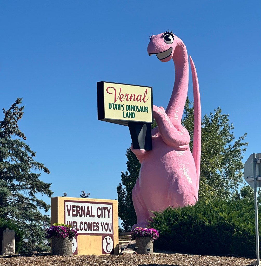
Saying goodbye at last to US 191, I climbed onto US 40, an iconic road if ever there was one. Once spanning the country from Atlantic City to San Francisco, parts of it were known as the National Road (America’s first highway), the Lincoln Highway—it was often called America’s Main Street. The western part has been subsumed into I 80, it now only goes as far as Salt Lake City. Still, it was pretty cool. Dinah the Pink Dinosaur bid me farewell, apparently those eyes used to follow the cars as they went by.

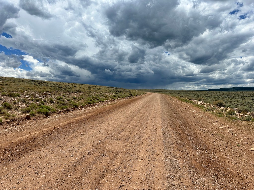
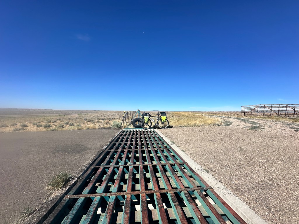
US 40 seemed glorious at first with a massive shoulder, but it vanished into nothing, worse than nothing, just 1 foot wide, and that foot was filled with rumble strips so deep that you would lose control if you ventured over them. I had no choice but to ride in the main lane, and this was a major highway. Not too much traffic yet, and every truck was accommodating as it blew by, but the situation unnerved me to the point where I considered bailing right there, taking an Uber 180 miles to the nearest Amtrak station and going home. If you’ve been following this blog, you see that I’m usually pretty imperturbable when it comes to traffic, with lots of strategies for dealing with challenging situations, but a motorist at a rest stop said things only got worse as I got into the Colorado mountains. I mulled my options at the turnoff for Dinosaur National Monument, where there was a visitor information center with a helpful ranger. She was much more encouraging than that motorist, said bikes come through here not infrequently, and she’s never heard of any trouble. One of her colleagues commutes on the road daily.

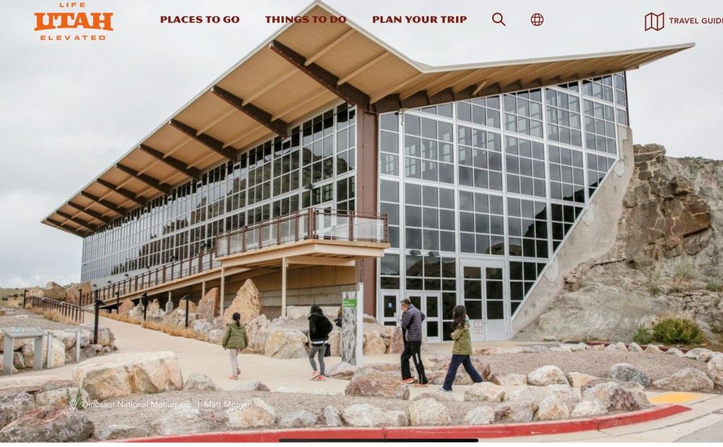
I really wanted to go to the Monument. It has one of the world’s largest collections of dinosaur fossils, having supplied many of the world’s museums, and the central structure houses a slope where excavations are ongoing—they have left the bones in place so visitors can see how they appeared as they were found. I got these photos off the web.

But going there would involve a 14 mile detour with lots of hills, I was behind schedule because I had to pick up those AirPods, I still had a long way to go on an uncertain road, it was already 90°, and I decided the detour wouldn’t be prudent. Who’s the dinosaur?

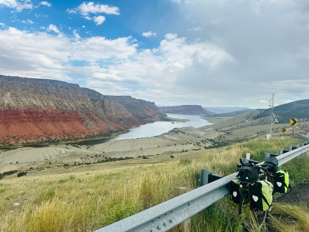
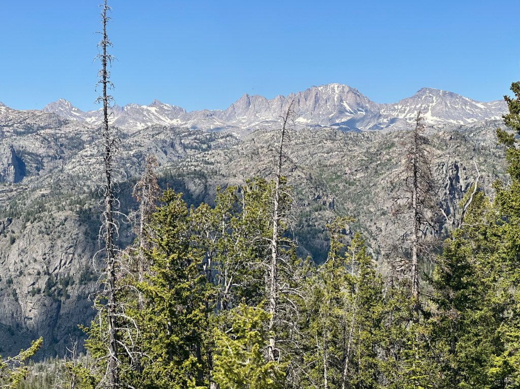
The ranger was right, the shoulder broadened and stayed good. A strong tailwind pushed me so much I didn’t even realize I was going uphill. And then, in 10 miles, I crossed into Colorado.

The sign was by the only tree for miles

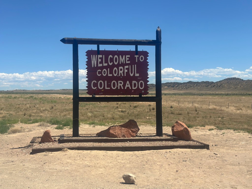
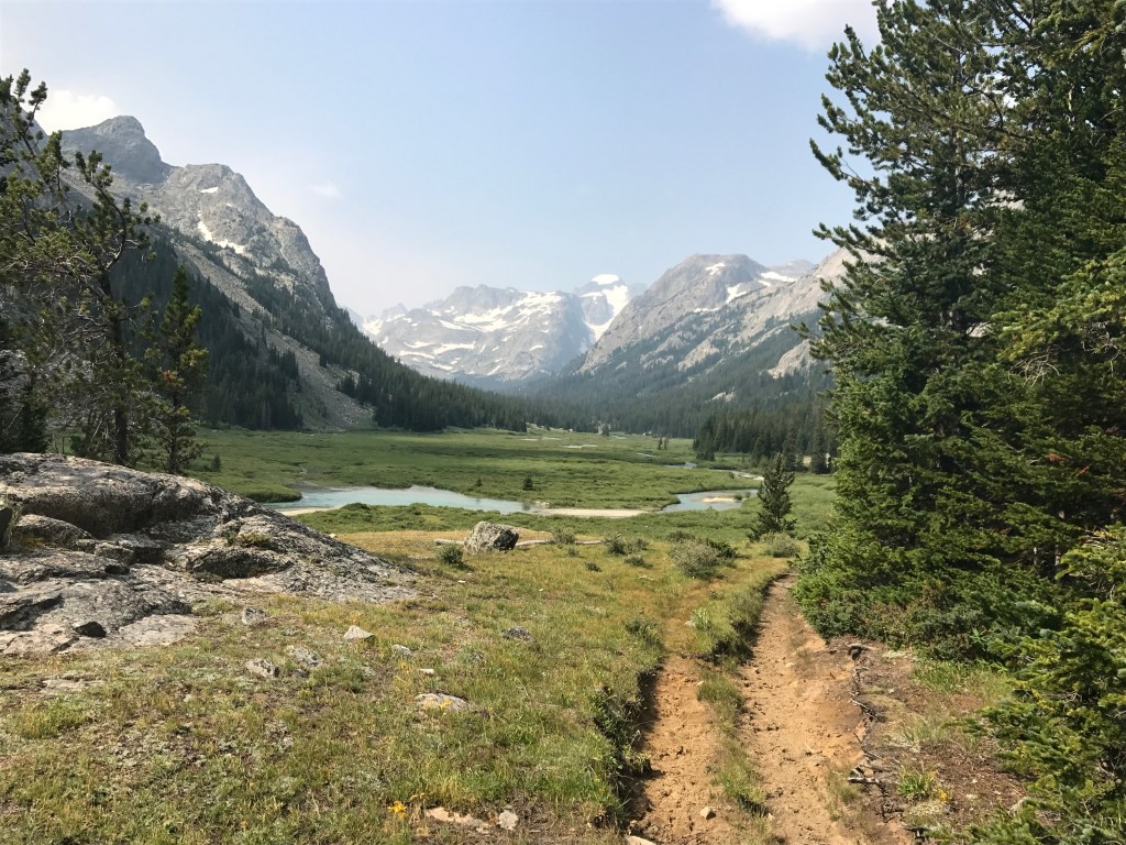
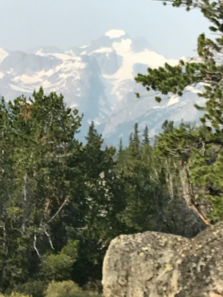
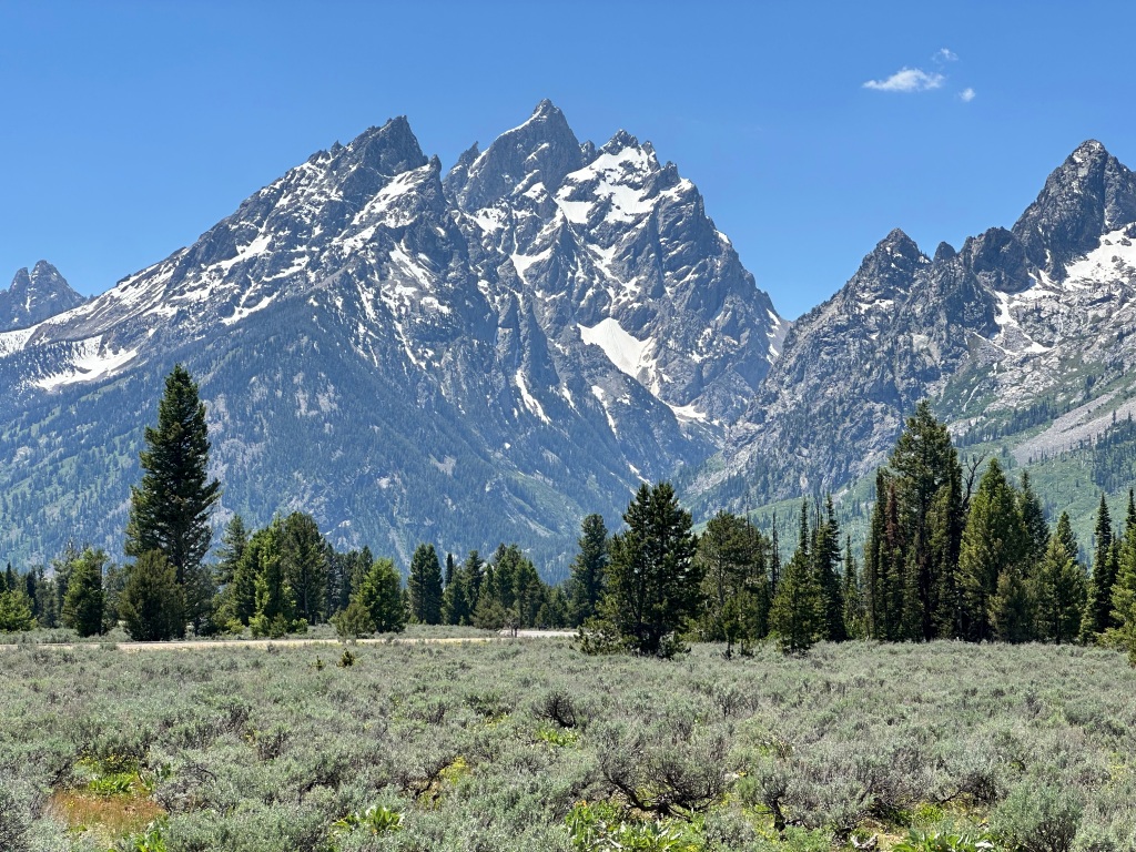
Colorado! I saw this same sign three years ago, when I entered the state coming from Vermont, and felt the same thrill. The healthiest state in the country, the most bicycle-friendly state, home to many friends I’m eagerly anticipating visiting soon, and the crown of the Rockies, with 54 peaks over 14,000 feet. Who can sum it up better than Harve Presnell, the hero of Music Man composer Meredith Willson’s other musical, The Unsinkable Molly Brown, singing “Colorado My Home”?
https://youtu.be/yp8Kx2R13DQ?si=eafFA-YPprJ_Nwmg

I have to digress here. Harve Presnell was the star of many musicals in the 60s, then dropped from sight until he surfaced almost unrecognizably as Wade, the grumpy father-in-law in the Coen Brothers classic film Fargo.

Back to Colorado. Seeing that sign was like a shot in the arm. Right away, things got easier. I had thought maybe I would stop short of my goal, in the town of Dinosaur, but some very helpful burger bar patrons, Troy, Jeff, and Wally, reassured me that the last 18 miles would be easy, and so they were. Cruising into Rangely, I stopped for my celebratory root beer, and the clerk Michael pointed out a fascinating detail of this town.

An abandoned, deteriorating water tank was converted by enterprising musicians (inspired by the Chautauqua movement) into the Tank Center for the Sonic Arts, an eclectic venue with perfect acoustics some have called the Carnegie Hall of the West. https://tanksounds.org/about

Amazing. This is the kind of stuff you only get when you’re traveling at 8 mph.

Distance 55 miles, 2,715 total. Time 9 hours with stops. Elevation gain 2,085 feet

©️ 2024 Scott Luria

Vernal in name only

Red Canyon Lodge to Vernal, Utah. Tuesday, July 2, 2024

Today I completed what I had hoped to do in one day yesterday, the remaining 43 miles to Vernal. Nowhere near as tough as yesterday, but still involved climbing the high walls of Flaming Gorge, summiting at 8,483 feet, followed by a very switchbacky 3,000 foot plunge to the lake-dotted flats of Vernal. The temperature went from the 50s to the 80s. I had rejoined an old friend, US 191, that had also been that scary stretch from Big Sky to Bozeman, and later from Yellowstone Lake through the Tetons, Jackson, and all the way to Pinedale.

I slept well, my mojo was back, but I still found it easier to walk on the steep stretches. My granny gear can let me go as slow as 2.5 mph, but I can walk at 2 mph, and not weave all over the highway. I can also have long phone conversations.

I am now in Utah’s red rock country, and though the scenes are not as spectacular as at Bryce Canyon or Zion, they are still quite arresting.

Arresting, but after many miles, the redness of the rock seems to melt into the endless glare of the sun. Beautiful to visit, but hard to imagine living there.

Vernal is a gateway town of sorts to the Dinosaur National Monument. I didn’t see much green there, just many blocks of suburban sprawl. Mr. Rex welcomed me.

The day ended with a redux of the “AirPods Kerfuffle” episode in Buffalo, three years ago. This time I arrived at the hotel with the pods, but not the charger case. The “Find My” feature on my iPhone has a little used section called Devices, and there I saw that the case was 2 miles back at my restaurant. I called them, they confirmed it was there, and that I can stop by the back door at 9 AM to pick it up.

Excited to be entering Colorado tomorrow.

Distance 43 miles, 2,660 total. Time 7 hours with stops. Elevation gain 2,338 feet

©️ 2024 Scott Luria

Flamed out

Manila to Red Canyon Lodge, Utah. Monday, July 1, 2024.

I was so touched. BFF Eric, who loves to pull my chain and who has dissed this Parking Lots Tour as inane and contrived, nevertheless tried mightily to get me to go back and tag the Henry’s Fork/Kings Peak trailhead after all. Leave your heavy stuff at the motel, bring only minimalist camping gear, camp at the trailhead campsite and get it done. Think how good I’d feel. Silly to bike 2,500 miles and blow this off.

I just couldn’t get my head around it. I didn’t mention that yesterday’s ride ended with a thousand-foot plunge into Flaming Gorge, so steep I hit 41 mph on half-deflated tires. Going back into that same west wind, that same crappy road, up that plunge I just did, and the same chance of thunderstorms was more than I could countenance. I have to go back anyway to do Hood, perhaps Jane and I will take a Western campervan tour with a rented mountain bike, and I can pick up where I left off. I did Gannett in three stages, didn’t I?

Jane and Eric were unconvinced, but I have to listen to my body (a great wimp-out line). Instead I climbed out of the other side of Flaming Gorge, at least with the wind behind me. It didn’t matter. The road was so steep, often a 10% grade, that I wound up pushing it for 5 miles. That’s a lot of pushing. Most of the way was under construction, which sounds awful but is actually a blessing. Tyra the flag woman saw me puffing up to her, and gave me TWO bottles of water. Brock the job boss kept offering me a ride in his pickup. I was sorely tempted, but didn’t want to “break the chain” from the ocean. Even if I did blow off Kings Peak. He allowed me to push my bike unmolested in the closed lane, skirting around the construction vehicles. It was almost pleasant. I only stopped for one picture, rain came in and dulled the colors of this incredible gorge I’d never heard of.

I’d hoped to go another 62 miles to Vernal, but that climb and the rain poofed me enough that I bailed at Red Canyon Lodge, only 26 miles in. In my current enfeebled state, no way could I have gone back to Kings. Crashing early, hope to get my mojo back tomorrow.

Distance 26 miles, 2,617 total. Time 7 hours with stops. Elevation gain 3,100 feet

©️ 2024 Scott Luria

Not this time

Lyman, Wyoming to Manila, Utah. Sunday, June 30, 2024

Well, I gave it my best shot. I knew this one was going to be a stretch.

The wind, the spacing of the accommodations, and the road conditions were just too much. Despite an early start, I had to turn around short of the goal.

The goal was the Henry’s Fork trailhead (just across the Utah state line), starting point for our climb up Kings Peak, 20 years ago. Unlike the drama of the Granite and Gannett climbs, this one had gone smoothly, a three day trip involving overnights at Dollar Lake up and down, and a long summit day through Gunsight Pass. What stood out to me was the huge flock of sheep that shepherds brought by at our campsite, complete with border collies and bellwethers—showing me the origin of that term, lead sheep were hung with a bell to better keep track of the flock.

So the original climb had gone smoothly, tagging the highpoint parking lot had not. It would involve an 82 mile day, my longest yet, and a 32 mile out-and-back on a steep dirt road. To make it work, conditions would have to be perfect.

The dirt road seemed OK at first, but 2 miles in the gravel got very soft and I was swarmed by biting horseflies. I had to backtrack to where I stashed my bags to get my bug repellent, and also to bleed 20 pounds of tire pressure. That seemed to do the trick, but it put me behind schedule. I had remembered that the access road was wooded, but in fact it was wide open to the full force of those Wyoming winds. I was averaging 3 mph, dolefully calculating I’d be lucky to get in before dark, when I looked up.

Uh oh

There had been no rain in the forecast, but I had forgotten the Rocky Mountain Way. The mountains make their own weather, afternoon thunderstorms are common, it’s the reason why climbs start early, to get off the summit by noon. The road was soft enough, a storm would turn it impassable. Ten miles short of the trailhead, I quickly turned around.

With the wind and slope suddenly in my favor, I was flying down at 30 mph when I hit one of those hidden soft spots and took a tumble, my first in three years. I was lucky to get away with a scraped knee. As I was hurriedly reattaching my bags at the road junction, a farmer kindly stopped by and offered his shed to wait out the storm. There, I filtered some irrigation-ditch water to refill my bottles on this hot day. It was discolored, but tasted OK.

My turnaround had shaved 20 miles off the total, but I was enervated by the drama and my determination not to resort to caffeine, and had to push up some of those last hills.

I was happy to be done with windy Wyoming

Limping in to my motel, I was so rubber-legged I was grateful I’d turned around, could only imagine what a mess I’d be if I’d persisted. The room was cheap and nice but comically full of moths, the proprietress said they’d had an infestation, she vacuumed up thirty and I was swatting them all night.

So now I’ve struck out twice, on Hood and at Henry’s Fork. Another one I’ll have to return to, this time with a mountain bike (Jane had suggested I rent one for today, but the nearest bike shop was 60 miles away). I keep reminding myself, it’s about the journey, not the destination. Hmm.

Distance 62 miles, 2,591 total. Time 11 hours with stops. Elevation gain 3,525 feet

©️ 2024 Scott Luria

Not much more to say

Kemmerer to Lyman, Wyoming. Saturday, June 29, 2024

Today was kind of repeat of yesterday, minus the winds. Rolling rangeland with not much to look at,

although I did see a few pronghorn antelope and prairie dogs crossing the road, too quickly to get a photograph. If you zoom in, you can see my next destination, the High Uinta range in Utah, including its highpoint, Kings Peak.

My destination was the small town of Lyman, which did not believe in putting on airs. Here is my restaurant and convenience store.

My motel was the same, no-frills, but all the amenities. The town did have some civic pride, there were bouquets on every lamp post, and an inspiring eagle sculpture in the town square,

With the Uintas looming ever closer over the main street.

Minimalist post today, need to rest up for the big push to the Kings Peak trailhead tomorrow.

Distance 41 miles, 2,529 total. Time 5 hours with stops. Elevation gain 1,931 feet

©️ 2024 Scott Luria

It’s your attitude

LaBarge to Kemmerer, Wyoming Friday, June 28, 2024


The problem with most blogs is the boring detail and the whining. I am no exception. And if I’m whining, it’s usually about the wind. Especially if it’s unanticipated.

I knew today was going to be a battle against the wind, so at least I was prepared for it. I managed to leave at 6:40 AM and log some miles before it got too intense. Still, there was quite a stretch when I was crawling uphill against a 30 mph headwind. When you’re in your lowest gear, just struggling to stay on the shoulder takes all your concentration. Maintaining a full tuck with a death grip on the handlebars, unable to shift around on your seat, look at the scenery, or hear anything on your headphones above the wind noise—well, it’s easier if you knew it was coming. Or as Carly Simon said,

It don’t really matter
What steps you choose to do
The only thing matters is your attitude

Not that there was really any scenery to look at. Or any place to stop. The best I could find was a cattle guard, where at least I could prop my bicycle up, and sit on the tire on the other side and have a snack. This photo says it all.

On the right is one of the thousands of snow fences I saw.

At least it was cool, starting out at 48° and never getting above 70. At the top of that big hill I was hoping for a view back to the Wind River Range, but it was lost in the haze. I caught myself starting to bitch and moan about the bleakness all around me, when I recalled some wise words from my Denver hostess three years ago, after my snarky comments about a different part of Wyoming.

Last night….since this journey of yours appears to be about discovery of all sorts, and not just high points…I almost commented/called you out for your choice of words “weird” and “barren wasteland”.

Au contraire mon frère. Having lived in the West for a while, I’ve come to appreciate even the beauty of the dry, flat, and seemingly unfruitful. In that spirit, I offer a little Proust….

“A pair of wings, a different mode of breathing, which would enable us to traverse infinite space, would in no way help us, for, if we visited Mars or Venus keeping the same senses, they would clothe in the same aspect as the things of the earth everything that we should be capable of seeing. The only true voyage of discovery, the only fountain of Eternal Youth, would be not to visit strange lands but to possess other eyes, to behold the universe through the eyes of another, of a hundred others, to behold the hundred universes that each of them beholds, that each of them is; and this we can contrive with an Elstir, with a Vinteuil; with men like these we do really fly from star to star.”

I had to look up those names—they are two of Proust’s characters, one an abstract impressionist, the other a sonata composer— but my Denver friend was right, you have to look at alien landscapes with new eyes, with the eyes of another, and imagine the perspective of the people who chose to live here. Once again, it’s your attitude.

Arriving at last at Kemmerer (population 2,415), largest town and seat of sprawling Lincoln County, home of James Cash Penney, who founded the department store; I had fun talking with Dave and James, a father and son from Salt Lake City, who come up here every summer to fish in the Hams Fork River. James is one of those awesome long distance motorcyclists, who did 48 states in less than a month. Dave is a bus driver, touchingly concerned about my safety, since he’s seen so many bike riders behaving irresponsibly.

Dave and James

Approaching my Best Western motel, I had to laugh. I always want to book ahead, especially over the weekend, but in so doing I miss a lot of small motels that would be cheaper. This one in particular was obviously open, but did not appear on any search engines or Google maps. I’m sure it’s a fleabag, but that’s fine. All I want is a shower and a bed.

Distance 52 miles, 2,488 total. Time 7 hours with stops. Elevation gain 2,187 feet

©️ 2024 Scott Luria

On the marge of Lake LaBarge

Pinedale to Labarge, Wyoming, Wednesday-Thursday June 26-27, 2024

Many of you are familiar with the classic poem, The Cremation of Sam McGee, by Robert W. Service, about a Tennessee boy freezing to death while prospecting for gold in the Yukon. The story is both hilarious and ghoulish, the rhymes and meter so melodious that is often memorized and recited around campfires, especially in the winter. The boy’s dying request is that he be cremated, which the narrator does by stuffing his corpse into a burning boat on the marge (margin?) of Lake LeBarge. Nobody reads it better than the Man in Black. https://youtu.be/yJNZwuamwj0?si=K7EhwWzcgFQ0b1wL

Today I am pinned down in the tiny Wyoming town of LaBarge, population 493, because of wind, weather, and geography. My next destination is the trailhead for Kings Peak, the highpoint of Utah, which we climbed in 2004. It is due south of Pinedale, and the roads leading to it are circuitous, poorly shouldered, and subject to the intense winds that blow across southern Wyoming. Not sure why the winds are so strong, possibly because of a natural gap in the Rockies, the location of South Pass, the crossing of the Oregon Trail. I remember struggling to keep my car on the road when driving I 80 in the area, struck by the proliferation of snow fences to keep blowing snow off the highway in the winter.

It’s one thing to control your car in the wind, another when you’re on a bicycle with panniers that act like sails. I thought yesterday’s trip would be easy, more downhill than up, but the winds turned southerly for the last 25 miles, and I really struggled. I’ve now gotten used to prolonged periods on the aero bars, which help a lot, but it’s hard to steer the bike precisely, and the shoulders narrowed to 2 feet between rumble strip and gravel. I limped to LaBarge utterly exhausted.

I woke early to get a jumpstart on today’s winds, but saw that thunderstorms were predicted, and the winds would be gusting to 40 mph right from the direction I was going. After a series of taxing days, I decided it would be prudent to “take a zero” today. The motel here is cheap, tomorrow’s motel willing to push back my nonrefundable reservation, so I was happy to stay. The winds will be a little less intense tomorrow.

One of the challenges is that this is another accommodations and services desert, I have to pick my food and overnight stops carefully. Even the water here doesn’t know where to go. I am in the Great Divide Basin, where the sparse rainfall does not drain into the Atlantic or the Pacific, but just seeps into the ground. Weird.

This all gives me a chance to talk a little bit more about the remainder of my time in Pinedale. As I left the Gannett trailhead, there was a viewpoint of the Wind River Range, the prominent rounded peak is Fremont, Gannett was nowhere in view.

I had dinner at the local brewhouse, same place I had my bittersweet “victory dinner” back in 2016. It felt better this time. It was fun to hang out with the crowd at the Warmshowers house, full of family, friends, and other bicyclists. It’s chaos, but Clay and Kristi make it work. Their daughter Camille has just graduated from high school, among the celebrants was a mannequin named Archer.

Jimmy, Camille, Kristi, Clay, and Drew
Archer

The other guest were bicyclists on the dirt Continental Divide Trail. I’ve encountered many of these gravel bikers, but almost no road tourists. Maybe mine is a dying breed. Backpacking is the new thing, not with racks and panniers, but with frame bags and stuff lashed to handlebars, forks, and exaggerated seat packs. Minimalist, but lighter and more agile.

Simon was heading south, Chloe was heading north, they are typically camping in the wild and were very happy to stay in such a comfortable, welcoming home. I’m sorry I neglected to get their pictures.

The only other intriguing spot on yesterday’s voyage was an obscure one, the Green River Rendezvous. This was featured prominently in Michener’s novel Centennial, and it was cool to see the desolate location where it actually happened.

The 1830s version of the Burning Man festival?

On this “zero day” I took a brief walking tour of LaBarge.

The Sinclair Oil Corporation, you may remember, was at the heart of the Teapot Dome affair of the Harding administration—until Watergate, the biggest government scandal. The Teapot Dome oil fields were in Wyoming.

The main drag, such as it is
My motel
The Eagle Bar, where I was invited to watch the debates. I was too chicken.
The door was locked. Are they hiring?
Small deli in the back, the only place serving food in this town
A dry creek bed, and the surrounding badlands.

Up early tomorrow once again, to get a jump on those headwinds.

Distance 58 miles, 2,436 total. Time 8 hours with stops. Elevation gain 753 feet

©️ 2024 Scott Luria

Dammit, Gannett

Pinedale, Wyoming. Tuesday, June 25, 2024

[This blog post title will only make sense to fans of the bizarro movie The Rocky Horror Picture Show]

34 feet. 34 measly feet. That’s how much higher Gannett Peak was than the Grand Teton. But it meant I had to climb it. It’s a five day hike and requires some pretty intense ice climbing.

It took me four tries, although the first two weren’t even really tries. In 1989 we went hiking in the Wind River Range, I was only 35 then and figured we could do it without any experience. I did buy a rope and some crampons, and we got close to where the actual climbing began, but my friends weren’t into it and nothing came of it. We did Fremont Peak instead, the third highest in Wyoming.

We had proposed to do it along with Granite Peak in 2004, but after the tribulations on Granite, we decided not to take an even riskier hike. So we never even started.

At the Highpointers Convention in 2016, where a bunch of us succeeded on Granite Peak, there was another guided climb up Gannett the week afterwards. Everybody but me made it. My rented crampon fell off on a steep ice slope; I was immobilized with fear, balancing on one crampon while the guide came down and reattached the other. I was slower than the rest of the group anyway, but that episode delayed me enough that the guide turned me around on the summit ridge, with worrisome clouds approaching, about a mile short of the top.

Already disappointed, I was further demoralized when the successful summiteers passed me on the way down. I didn’t get back to camp myself until midnight, having to negotiate a treacherous scree slope, with one guide patiently helping me, in the dark. Hiking back out took two additional days; I tried not to act too glum around the other celebrants, even at the “victory dinner” back in Pinedale.

Demoralized, but not daunted. After all, I had been successful on Granite Peak the week before. I decided the best thing to do in the future was to hire a private guide, so that my slowness did not affect the rest of the climbers. The patient guide on the scree slope was Eddie Schoen, he was so kind and competent that I hired him privately the next year, 2017. Gannett was the last of the really hard highpoints (Hood notwithstanding) and I figured I’d better get it done sooner rather than later.

Eddie proposed a different approach. Most of the climbs leave from Pinedale, but that route entails going over an icy scree slope, Bonney Pass, 1200 feet up-and-down on Summit Day, which is difficult enough without that hurdle. It was the reason I didn’t get back until after midnight.

Bonney Pass can be bypassed by an eastern approach, from the town of Crowheart, but that is on the Shoshone reservation, and requires a permit fee, and a 20 mile ATV ride to the trailhead, by a member of the Nation. The hike is still quite challenging, you have to go over Scenic Pass, a hurdle in its own right, but you do that on the first day, not summit day. The entire climb still takes five days.

I dug up a couple of photos of that climb. It does have the advantage of giving you a view of Gannett Peak, not visible on the other approach until you are right there.

Aha! So there you are.
A blurry photo, but you can see: it may be higher, but the Grand Teton sure looks more impressive
Our final camp before the summit push
The Wind River Range does have a stark beauty, I guess. You could also say it’s pretty bleak.

I didn’t take many photos, I got these off the web. That tower is called Gooseneck, and the bergschrund was the most challenging part of the climb.

A-l-m-o-s-t there
Ta Da!

I zoomed in on the left background, and identified the aforementioned Fremont Peak, the third highest in Wyoming, and Bonney Pass, the hurdle on the approach from Pinedale.

OK, so I climbed it. But I climbed it from the east side, through Crowheart, and I can’t exactly cross Native lands and bike that super rough ATV track to the trailhead. How can I say I climbed this one from the sea?

Well the track of the two climbs converge on Summit day, after the Pinedale route gets over Bonney Pass. I did get to the summit ridge on that earlier attempt. So if I go to the Pinedale trailhead, I can plausibly claim to have sea-to-summited in three stages. Circuitous, sure; roundabout, absolutely; but it’s simply an extension of the “parking lots” two-step I’ve been doing all along. OK?

Well, nobody really cares except for me, and I’m happy.

OK, so all that remains is for me to bike up to the Pinedale trailhead today. Should be easy, just a 2,400 foot ascent, 16 miles each way. I left my bags with my Warmshowers hosts, and it wasn’t too hard. But Gannett wasn’t done messing with me. My navigation software assured me it was paved all the way, but the last 4 miles was “under construction” and turned out to be the roughest dirt road, with nonstop washboarding, I have encountered so far. I had to walk about half of it, and drink every drop of water I was carrying. I thought I remembered a water tap at the trailhead, but no such luck. Just a sign, that doesn’t even acknowledge that the Pole Creek Trail is the first part of the Gannett climb.

Not much to look at, but this establishes Gannet Peak as my 23rd highpoint from sea level, out of 37 total

Then, as a final gift from Gannett, I discovered my fancy Oakley photochromatic sunglasses, which I hang securely from my handlebars on sweaty uphill climbs, had rattled off from the washboarding. I found them 4 miles back. They had been run over and were in pieces, but salvageable. Scratched up, but usable. I’ll have to order another pair to be shipped ahead to Denver, but these will suffice in the interim.

The road was long but I ran it, Gannett. I am so done with you.

Distance 33 miles, 2,378 total. Time 6 hours with stops. Elevation gain 2,400 feet

©️ 2024Scott Luria

Pushing through to Pinedale

Jackson to Pinedale, Wyoming. Monday, June 24, 2024

This will be a short entry for my longest day so far, in terms of distance. Pinedale, the base for my climb up the Wyoming highpoint Gannett Peak, was 78 miles south of here. Because of today yesterday’s blistering headwind, I thought it would be a big struggle. But it turned out the wind was shifting to the west, and would actually push me a lot of the way. Good thing, because the ride included a scary, twisting canyon and a steep climb up to a plateau.

It was smooth sailing once I got up there, but I feared it would be rude to get in too late. My Warmshowers hosts, Kristi and Clayton, assured me they stayed up late every night, so I felt I had time to slow down a bit and take a couple of pictures.

I hadn’t seen a highway overpass since I left I 90 in Montana. Curious to see this one, in the middle of rangeland without another road in sight.

Turns out it’s a wildlife overpass https://beingwildjh.com/wildlife-champions/wildlife-advocates/success-stories/wildlife-overpasses/ Cool.

As I approached Pinedale, I was looking forward to a killer view of Gannett Peak. I mean, if it’s higher than the Grand Teton, it will be even more spectacular, right?

Wrong.

It’s in there somewhere

The Wind River Range is beautiful once you get inside it, but not much to look at from far away. The highpoint, I now recall, isn’t visible at all until you get quite close to it; there are lots of intervening ridges. If you’re the king, I guess, you can afford to be coy.

Along the way, I met Tim, who has hiked the Continental Divide Trail and teaches long distance shooting; Arnie, who opened up the convenience store at the top of my plateau climb so I could grab a much-needed snack; and of course my gracious hosts, who share their large home with scores of bikers passing through. I’m told I will meet a couple more tomorrow night.

Distance 78 miles, 2,345 total. Time 11 hours with stops. Elevation gain 3,197 feet

©️ 2024 Scott Luria

Sliding on out the back door

Jackson Lake Lodge to Jackson, Wyoming. Sunday, June 23, 2024

Today I thought would be easy, just slide on out the back door of Yellowstone and the Tetons, downhill most of the way into Jackson. Brought to mind a favorite blues number by Lane Tietgen, continuing the religious theme on this Sunday, with a little Heisinger and Schrödinger thrown in. https://youtu.be/1ml3Xf64APQ?si=Nuk87D2rYToZEAYs

But the wind had other ideas. Focused by the contours of Jackson Hole, it compelled me to get into a full tuck and pedal hard just to go downhill. At least it was cooling on this hot day, and the scenery was so dazzling I didn’t mind much. Hard to take my eyes off of the Cathedral Group as I slowly slid past.

I blew right by the Chapel of the Transfiguration, a favorite tourist photo op with its view from the altar, so I had to cage these images off the web.

My buddy Eric used to say, when we came upon a great view during a Sunday hike, “we didn’t go to church today, but you can’t have a better sermon than this.”

I was following the Snake River, the major tributary of the Columbia, which starts right above Jackson Lake and is impounded by this dam.

and continues its journey through Idaho Falls and Lewiston, where I’d seen it before. A roadside stand warned us that bears were still a problem this far from Yellowstone.

It was fun to pass the trailhead of my 1977 climb of the Grand Teton, so now I can claim to have done that peak from the sea as well. I know, it’s only the second highest in Wyoming.

Jackson was a little schlockier than I remembered, with its wooden sidewalks, stagecoach rides, and the town square framed in elk antlers. Even the cheapest motels were crazy expensive, and no tent camping was allowed. Ah well, it will be my last Gateway town for a while.

Distance 39 miles, 2,267 total. Time 7 hours with stops. Elevation gain 612 feet

©️ 2024 Scott Luria