The Back Side of the Tetons

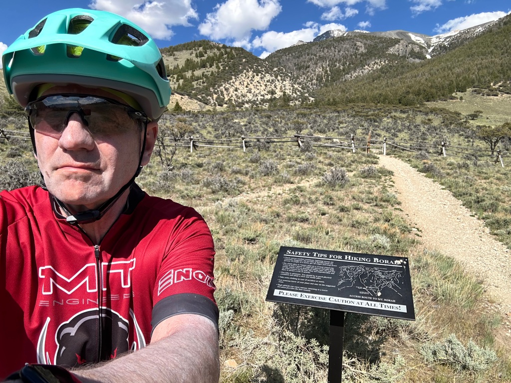
Idaho Falls to Ashton, Idaho. Tuesday, June 11, 2024

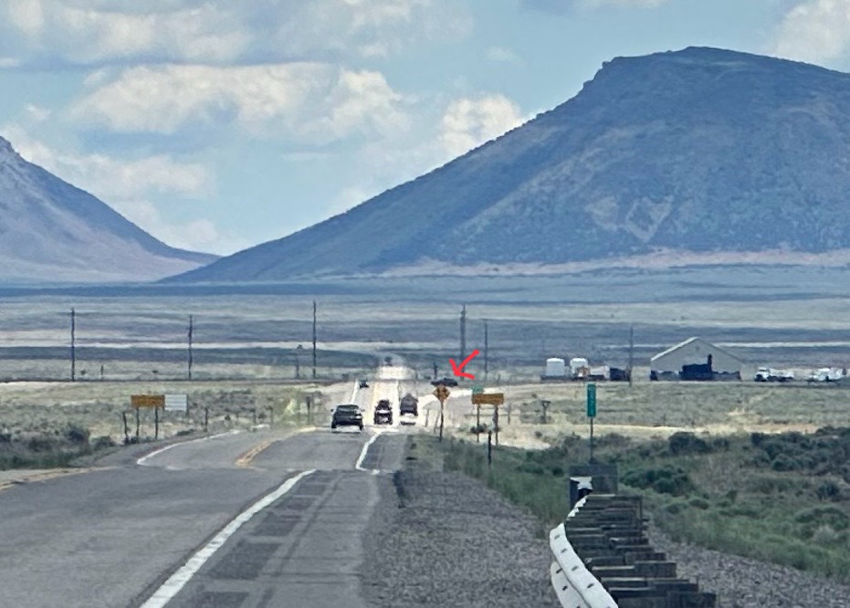
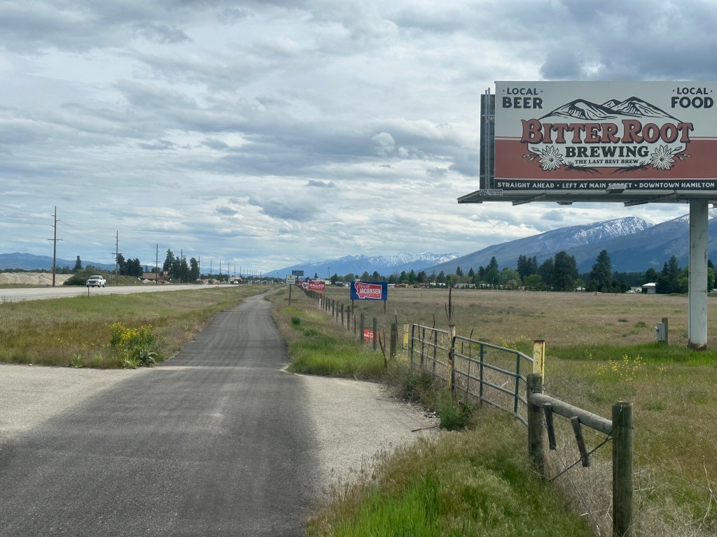
OK, I’m not proud of this. After yesterday‘s wonderful–but–grueling day, I just decided to just let the wind blow me up US 20, rather than taking a longer bike route, which would’ve shown me more of the back roads. Much of it was a limited-access highway, but those are legal for bicycles in Idaho and 10 other states. Although traffic was heavy, there was an excellent shoulder all the way, I just had to be careful about off-ramps and on-ramps. The result is not many interesting stories or pictures.

There was one picture I was hoping to get. I have never seen the back side of the Tetons. The front side, the view from Jackson Hole, is legendary and changed my life. I remember the day, August 20, 1970–we were on the stereotypical “family trip out west” with a pop-up camper in tow. Up until that day, I was indifferent about mountains. I had been forced to hike a few in summer camp and came to dread the experience. This was mitigated somewhat when Glenn T. Seaborg took me on my first hike up Old Rag Mountain in Shenandoah National Park, but I was still unconvinced.

On that day, we crested Togwotee Pass, and got our first eye popping view of the Tetons.

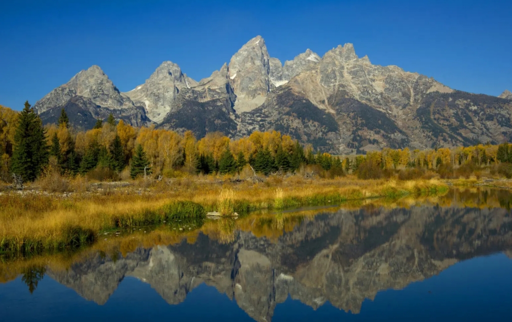
And in that instant, I was hooked on mountains. I looked up the geology:

Between six and nine million years ago, stretching and thinning of the earth’s crust caused movement along the Teton fault. The west block along the fault line rose to form the Teton Range, creating the youngest mountain range in the Rocky Mountains. The fault’s east block fell to form the valley called Jackson Hole. This simultaneous rising and falling created a range that sprang 7,000 feet above the valley floor with no foothills. There are higher mountains in the Rockies, but none as spectacular.

I was obsessed. I had to climb the highest one, the Grand Teton. Seven years later, just before medical school, I signed up with the Exum guide service and did just that. You spent two days learning the basics of rock climbing and rappelling, then hiked up to a camp at the base of the Grand, and did the actual rock climb early the next morning. As is the tradition for western peaks, you were on the summit by 7 AM. I have great slides of that trip, and will look into getting them transferred to this blog. I remember the simultaneous thrill and disappointment of being on the summit. This was the second highest peak in Wyoming; Gannett Peak in the Wind River Range, was 34 feet higher. It would be 40 years before I summitted that one, after three failed attempts. More on that later.

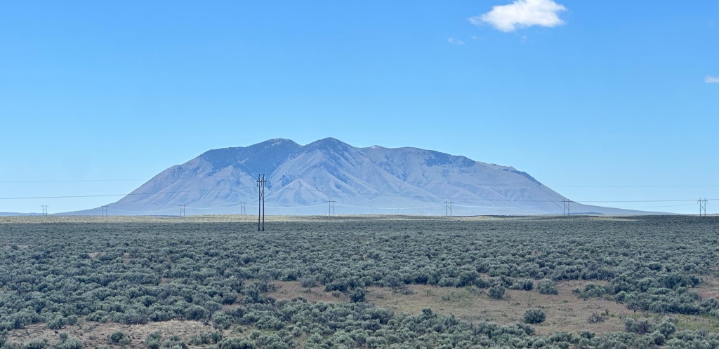
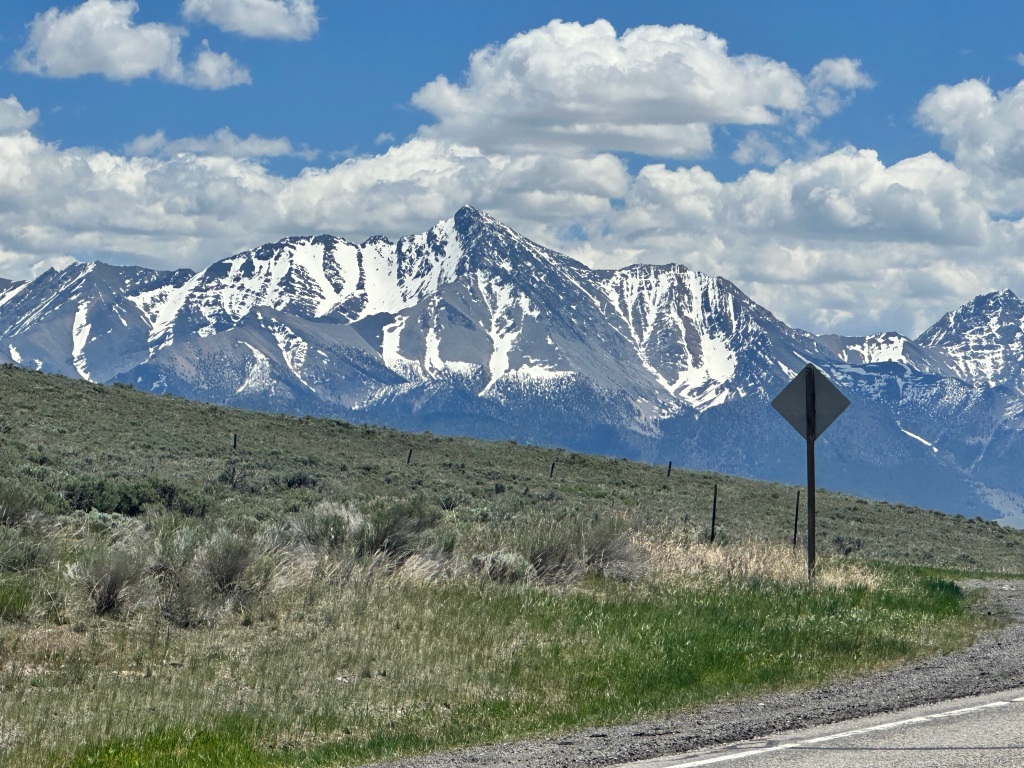
Anyway, I always wondered how the Tetons would look from the other side, the side that didn’t have that benefit of the sudden rise. This was the best picture I could get today—less dramatic than I hoped, not much contrast between the gray peaks 40 miles away and the dull blue sky. Not bad, but a little underwhelming.

From the left Mount Teewinot, Grand, Middle, and South Tetons. A mirror image of the previous view..

This was the view that inspired early French trappers to give the range its name, Les Trois Tetons, the three breasts. I guess they’d been away from home a while.

Anyway, that’s all I have to report. Hope to make West Yellowstone tomorrow.

Addendum: I just edited this post to change backside to back side. Otherwise, my post about Tetons and backsides sounds like T & A.

Distance 54 miles, 1,678 total. Time 7 hours with stops. Elevation gain 743 feet

©️ 2024 Scott Luria

The Mother of all Easter Eggs

Arco to Idaho Falls, Idaho Monday, June 10, 2024.

Dedicated followers of this blog may remember my delight on finding “Easter eggs”—unexpected bits of wonderfulness. From the free upgrade to a penthouse suite in Chicago, to a private tour of Bob Dylan’s boyhood home in Hibbing, to all the wonderful friends, family, and Warmshowers hosts I’ve stayed with along the way, I’ve been blessed to have many of these. But the one today may have taken the cake.

I’ll get to that in a minute. The day started off great anyway, I left US 93 after 10 days and got onto an iconic highway, US 20, the longest road in the nation. It starts in Kenmore Square, Boston, right next to Fenway Park and just a half mile from my alma mater, and ends after 3,365 miles on the Oregon coast in Newport. The map indicated it had a decent shoulder the whole way, although there was quite a bit of truck traffic I always felt protected by a rumble strip.

After 20 miles, I faced a decision. A 4-mile detour would take me to EBR-1, the world’s first nuclear power plant. How could I pass that up?

It sure didn’t look like a nuke, no cooling towers, just a boxy structure sitting alone on a vast desert plain.

Our tour guide was enthusiastic but in over her head, a communications major from BYU on a summer internship, she struggled to explain nuclear physics. It’s been 50 years, but I took four semesters of chemistry at MIT, decided to keep my mouth shut.

Perhaps a wise decision, she appeared to have the ability to decapitate tourists.

She was good at explaining the origin of the SCRAM button, the instant shutdown mechanism, if you zoom in you can read the story.

It’s the red button at bottom center. No sign of Homer Simpson.

Actually, I guess you can’t. In the original nuclear reactor at the University of Chicago, a cadmium control rod was suspended by a rope. In the event of an emergency, a strong young student standing by would swing an axe, cut the rope, and drop the control rod into the core, shutting it down. He was the Safety Control Rod Axe Man, or SCRAM.

It was fun to do the touristy stuff, but the highlight of the visit for me was the photo of my friend’s dad, Glenn T. Seaborg, receiving an award from President LBJ.

I guess I had arrived there just in time, as I was leaving, multiple busloads of foreign tourists arrived, and our guide had her hands full.

Outside, I talked with two lab employees, Liza Raley and Taylor Wilhelm, who were much more knowledgeable, and also pointed out some of the local geography.

Among the failed prototypes of the lab were two nuclear powered airplane engines, the hope was that the planes could fly for much longer periods without refueling, but they were so heavy the project never got off the ground, so to speak.

A few miles down the road I stopped at a guardrail, so I could prop up my bicycle, reapply sunscreen, and grab a quick snack. This gave me the opportunity to photograph some of the geographic features that Liza and Taylor had pointed out.

Great Southern Butte, the world‘s largest
East and Middle Buttes, US 20 would take me right past these.

I later discovered that this last photo actually showed my upcoming Easter egg. An extreme close-up shows a car waiting by the highway.

The car appeared to be waiting to turn left, but didn’t move as I approached. I waved for him to go ahead, but instead a man and woman got out of the car and waved back.

I couldn’t believe it. It was Ben and Christine Gericke, that lovely couple from Namibia and South Africa I had ridden with for a couple of days in Indiana, three years ago. Their narrative begins in the middle of this post and continues for the next two. https://scottluria.org/2021/05/13/four-bike-paths-and-a-fiasco/

They were the only people I ever rode with. I encounter bike tourists fairly often, but they’re generally going in the other direction or on a diverging path. Although I choose to tour alone, just riding with them for a couple of days made me realize how much I missed having traveling companions. Chris had given me a little souvenir when we parted, a tiny bottle of Fireball whiskey, and I have preserved it to this day.

They went on to complete their coast to coast Rail Trail bike trek, but not before having a couple of accidents—Ben had head injury and Chris sustained grievous wound to her leg. They had since moved to Coeur d’Alene, Idaho, and had regretted that they were going to be traveling in Scotland when I was passing through.

Well my progress has been so slow that they had returned from Scotland, and decided to surprise me. I was nowhere near their home, but they were reading my daily posts, and that map of my future route I had included. They don’t have iPhones, so could not track me in real time, but they managed to figure out where I was likely to be, and have been waiting at that intersection for quite some time.

I was so surprised and delighted I almost burst into tears. We had been keeping in touch all this time, and they had given me many encouraging messages. They said they were heading down this way anyway, en route to a rafting trip on the Grand Canyon, but I charted the route from Coeur d’Alene to Arizona, and I could see they had taken a significant detour. They shared their ice, lots of healthy snacks, and we caught up, talking for almost an hour. I just couldn’t believe anybody could be so thoughtful.


Ben took this picture of me approaching, still unawares. Nice to see my
headlight is so bright, even in daylight.
My reluctant departure


I still had 45 miles to go, and was mindful of potential wind shifts and that “don’t count your chickens” lesson I had learned a few days ago, but I didn’t care, that visit was so worth it, it felt like I was riding on air.

Other than passing those buttes, US 20 was pretty featureless, and sure enough the wind shifted to a 90° crosswind, not slowing me down exactly but not helping, and always threatening to blow me into traffic. The sun was unrelenting. I searched in vain for a place to rest and refuel, finally found what looked like an abandoned barn, where I could get some shade and sit on a hay bale. While I was there, a couple of pickups drove by slowly, I was aware I was trespassing, but nobody bothered me. Further on, I passed a lava field called Hell’s Half Acre, but didn’t stop. I pulled into my motel in Idaho Falls after a 12 hour day and my highest mileage so far, but all I have is happy memories.

Thank you, thank you, Ben and Chris. Have a wonderful time on that rafting trip!

Distance 71 miles, 1,624 total. Time 12 hours with stops. Elevation gain 1,414 feet

©️ 2024 Scott Luria


Atomic City

MacKay to Arco, Idaho. Sunday, June 9, 2024.

Easy day today, after yesterday’s suffer-fest. Downhill all the way, smooth shoulders, gentle tailwind, only 27 miles. A big storm and wind shift was brewing, but not until 10 AM, so I left early. Took advantage of the time zone difference to call Brian, Jane, and sister Anne; their conversations sustained me for the entire ride, and were easy since there was no traffic or wind noise. Would that every day could be like this!

Arco (no relation to the oil company) is known as the Atomic City.

It’s located in a stretch of desert so vast and self-contained that it was a safe place to conduct nuclear experiments, and the world‘s first nuclear reactor, EBR-1, was just a few miles from here. Borah is part of the Lost River Range, the river so-named because it flows nowhere, just seeps into an aquifer. This also reduces risk from nuclear contamination. Its population less than 1000, but it has a lot going on.

Incongruously rising from the desert is the sail of the USS Hawkbill, a nuclear powered submarine that was captained by a local resident; when it was decommissioned he arranged to have the sail transferred here.

Known as the Devil Ship because of its hull number, 666, it is a centerpiece of the Idaho Science Center, a cute collection of buildings. The docent was an engaging submarine veteran named Harvey, a cornucopia of information about the area.

One of the photos on the wall was familiar. Glenn T Seaborg, who won the Nobel prize for discovering (synthesizing actually) plutonium, later discovered many other trans-uranium elements, including Americium, Californium, and Berkelium. An element is named in his honor, Seaborgium. He is BFF Eric Seaborg’s father, and I knew him. An outdoor enthusiast, he took me on many hikes, and showed me his Nobel prize. Solid gold, it weighed a ton. In the 60s, he was chairman of the Atomic Energy Commission, and is shown with LBJ decommissioning the EBR-1 plant.

Seaborg is in the center

Behind the science center is Number Hill, where every graduating high school class since 1920 has painted their graduating year. This part of the west is big on defacing local mountains, I guess.

The storm arrived as predicted, but I was snug in my cheap motel, catching up on naps, planning the route, blogging, and watching the Celtics beat Dallas in the NBA finals. Can’t get much better than this.

Distance 27 miles, 1,553 total. Time 2 hours with stops. Elevation gain 26 feet (whee!)

©️ 2024 Scott Luria

Borah! Borah! Borah!

Challis to MacKay, Idaho. Saturday, June 8, 2024

This was to be the biggest day in quite a while. Climbing over another high mountain pass, and then heading up to the trailhead of Borah Peak, highpoint of Idaho.

The climb up to Willow Creek Summit was not as steep as some have been, but unrelenting for 25 miles. As you can see, the shoulders were minimal (mostly gravel), and at one point it went through a narrow and dark slot canyon with limited sight distances. More of a hazard when you’re crawling uphill, and struggling to keep from weaving back-and-forth.

After four hours, I reached the first summit

Hallelujah

and swooped down to the beginning of the second climb, a steeper 3 mile side road to the trailhead. Here, I faced a dilemma. My mapping software had indicated this would be paved, but it was gnarly gravel. Also, I had miscalculated the amount of water I would need, on that first climb I consumed more than I had intended. I only had a liter left, for a big climb and 27 more miles to my destination. If I skipped this detour, it would only be 21 miles, mostly downhill. Tempting.

But skip the detour? Getting to the trailhead was the main reason for this 250 mile loop southward, otherwise I could have taken a huge shortcut.

If I was going to skip Borah, I could have taken the shortcut indicated by the green line.

It had taken me a full week to get from Missoula to this point. I was not going to quit now, with just 3 miles to go. I am not throwing away my shot.

Near the intersection was a cluster of motorhomes and trailers, perhaps I could get water there. It turned out to be a construction site, not active during the weekend, and the trailers were all deserted.

Hello? Anybody home?

The one on the left had a large red cistern, sort of a rain barrel.

I called out and knocked on the door, no answer. The cistern was about 1/4 full, I could just barely immerse my empty water bottles and fill them. The water looked clear, tasted of plastic, but it was better than nothing. And I did have that water filter Jane gave me for my birthday, never used.

I didn’t want to drink it until I had to. I found a place to remove my panniers and hide them out of sight, and proceeded up the gnarly road 100 pounds lighter. Dehydrated and bonking (the food I had needed water to wash it down), I had to stop multiple times.

Thank God

The campground at the trailhead was deserted and swarming with mosquitoes; no water, just outhouses. But I recognized my departure point; another highpoint climbed from the ocean! 37 highpoints total, 21 climbed from the sea.

Never could take a decent selfie

Here is where I digress, to talk about my original hike. It was on the same trip in 1994 when I climbed Rainier, I was scheduled for a conference in Coeur d’Alene, Idaho. I flew into Spokane and drove nonstop to the trailhead, doing in eight hours what took me two weeks on a bicycle. I had just turned 40, which seemed old at the time, but I was comparatively young and strong.

Borah is a class 3 hike. Class 1 is a hike that might be long and steep, but you can do it with your hands in your pockets. Class 2 requires scrambling, using your hands as well as your feet. Class 4 is rock climbing, requiring rope and equipment. Class 3 is somewhere in between—you don’t need a climbing rope, but you might wish you had one. The best example is the chimney section of the Knife Edge on Katahdin in Maine.

The locals appear to call it Mt. Borah, I’ve always known it as Borah Peak.

As the sign explains, the trail is unremittingly steep, climbing 5,100 feet in less than 3.5 miles. The class 3 section is Chicken Out Ridge, many people balk here. At one point you have to put your foot down to a ledge you can’t see, it takes a leap of faith. After that, however, it’s just a steep uphill slog. And for me, coming down a steep trail is worse than going up.

I did it alone on 8/8/94, and then with friends Eric and Brian on 8/8/04, when I was 50. I certainly see no need to do it a third time.

Borah Peak, 12,662 feet; Chicken Out Ridge is the rounded ridge to the right

The other interesting thing about Borah Peak is the earthquake that happened there 41 years ago. Only two people were killed, by falling masonry in Challis. 6.9 on the Richter scale. You can still see the scar the fault line left along the base of the mountain.

OK, back to now. I got out Jane‘s filter for that cistern water, and was horrified to see that it didn’t work. But no, you had to saturate the filter of water first, then by squeezing hard, you could get a trickle of filtered water. It didn’t taste great, but it let me eat my power bars and get some strength back. Heading down, I came across a beautiful stream I hadn’t noticed before, and filtered two more liters of water right on the spot, drinking it all right there, throwing out the plastic water. Cool, clear, and delicious.

It was all downhill from there, that’s the thing about highpoints. Still, it was 20 more miles and I didn’t arrive till almost 9, just getting into a restaurant before it closed.

The father of the proprietor was there, a nice gentleman named Gordon, and it turned out he owned the ranch right at the corner where I was having my water dilemma. He said he would’ve been happy to give me all the water I needed. He spotted me then, and was very interested in my story and my blog. I don’t remember seeing a ranch at that corner; I had passed a number of them, but they were all down long driveways. I never dreamed of imposing on one of them. Silly. I forgotten how nice people are in Idaho, and honestly everywhere along my trip.

Distance 62 miles, 1,526 total. Time 12 hours with stops. Elevation gain 3,997 feet

©️ 2024 Scott Luria

Fight no more forever

Challis, Idaho. Friday, June 7, 2024.

The weather and my state of exhaustion weren’t conducive to making the big ride today, so I’m taking another rest day. Ah, the joys of retirement. I caught up on my sleep, got supplies, confirmed logistics, and watched a great movie that I wanted to share with you.

For weeks I’ve been following the poignant odyssey of Chief Joseph and the Nez Perce, chased across the northwest and the newly founded Yellowstone National Park by Oliver Otis Howard, an otherwise fairly heroic Civil War general. On the plus side, he founded Howard University, possibly the nation’s foremost HBCU, and the Freedman’s Bureau, an important component of Reconstruction. He later settled in my hometown, a number of institutions in Burlington are named for him, and he is buried in our local cemetery.

On the negative side, he bought the brunt of Stonewall Jackson’s brilliant flanking maneuver at the battle of Chancellorsville, considered one of the most lopsided victories in history; Jackson was fatally wounded in the battle, which was the basis for The Red Badge of Courage. He was also one of the chief perpetrators of Sherman’s march to the sea. And of course, his role in the Chief Joseph story is problematic. When Joseph was finally caught, 40 miles from the Canadian border and safety, he pronounced his famous line, “I will fight no more forever.”

This is a made-for-TV movie from 1975–somewhat dated, but really well done. It features a very young Sam Elliott as Captain Wood. If you have the kind of free time I do, I think you’ll enjoy it. And hey, the price is right. I hope embedding this video is not too problematic.

Don’t count your chickens

Salmon to Challis, Idaho. Thursday, June 6, 2024.

You’d think I would know better, after all these decades of touring.

Today was going to be such a pleasant ride. 60 miles and 2,300 feet of climbing, sure, but following the Salmon River and with a nice tail wind all day.

I took my time leaving this morning. Chatted with Brandon, my Warmshowers host. Called the family of a friend, whose aunt had died. Tarried at lunch talking with the waitresses and patrons. I had plenty of time.

But then, with something as capricious as a wind shift, everything changed. Suddenly, the tailwind had turned to a headwind, focused by the walls of the canyon. I still had 35 miles to go, and 15–20 mph headwinds the whole way. No major hills, but a headwind is like a constant hill. I’d splurged on a deluxe hamburger salad for lunch, forgetting that hamburgers always make me feel logy. Used every one of my five bottles of water. For the last stretch to the motel, I was taking rests every mile, and barely crawling. Didn’t get in till 8:30.

The “easy” day turned out to be one of the most challenging of the trip. I should’ve known better. I try not to make these posts just a recitation of the days events, try to throw in some interesting photos or historical/cultural context. No time for that today. Apologies. Big day tomorrow.

Distance 60 miles, 1,464 total. Time 10 hours with stops. Elevation gain 2,279 feet

©️ 2024 Scott Luria

Civil engineering

Sula, Montana to Salmon, Idaho. Wednesday, June 5, 2024.

I went to college surrounded by engineers. I was even going to be an electrical engineer myself, until I changed to biology. In the early 70s, engineers were a dime a dozen, so the field did not seem particularly glamorous. It wasn’t until I graduated that I realized just how special they can be. Simply put, they take science and apply it to real life situations.

My roommate was going to be a civil engineer, a field I didn’t understand. What was he going to do, move earth around? I remember a joke going around (please skip the next four paragraphs if you’ve heard this one)

Three engineers were having a discussion: what kind of an engineer was God?

The mechanical engineer marveled at the design of the human body. All those muscles, bones, joints, tendons, and how they all function in a coordinated, elegant manner. Clearly God was a mechanical engineer.

The electrical engineer countered that there is nothing more intricate than the human brain. Even the fanciest super computer can’t hope to approach the bandwidth, the learning, the adaptability. God was obviously an electrical engineer.

The civil engineer said “You’re both nuts. Who else, who else would run a sewer line right down the middle of a major recreational area?”

So maybe civil engineering, like Rodney Dangerfield, didn’t get no respect. Well, I sure respected it today. US 93 was built in 1934. I followed it as it climbed 2,600 feet through a tortured landscape. Around every bend I would see canyons, crags, impossibly steep slopes, snow capped mountains and wonder how are we going to get through that? Yet through a series of switchbacks, trestles, and graded banks the road kept going, smooth, never greater than 6% grade. It was just amazing. Built almost a century ago, it had been repaved and repaired, but the basic design was preserved intact. Wow.

My imperfect body struggled over this perfect highway. I can’t count the number of times I stopped to rest. Luckily, the traffic wasn’t bad, and there was always a decent shoulder. My dropper post made it easier to get going again. Despite two Frappuccinos as rocket fuel, it took me almost 5 hours to climb those 13 miles, topping out at Lost Trail Pass, 7,021 feet, the highest I’ve ridden my bike on this trip. The splendor was all around me, but nothing I could capture in a photograph, my only pic was a selfie at the pass, where I crossed back into Idaho.

After that, it was Easy Street. Still quite a bit of snow at the pass, but in the valley it was over 80°. I even had a tailwind. The narrative of Chief Joseph and the Nez Perce’s heartbreaking odyssey accompanied me by audiobook as I followed the Salmon River to its eponymous town. Stayed in my most rustic Warm Showers accommodation to date, an old trailer that had been rehabbed. But hey, it was comfortable and Brandon let me take a shower in the main house.

Brandon


Distance 62 miles, 1,404 total. Time 10 hours with stops. Elevation gain 3,271 feet

©️ 2024 Scott Luria

Shoulder strategies

Hamilton to Sula, Montana Tuesday, June 4, 2024.

Today would be the easiest of the next four days, no major climbs, just 36 miles; would’ve liked to go further, but that’s how the lodging worked out. There was a big challenge today, however, 7 miles of a scary twisty road, busier US 93 this time, with no shoulder.

At least I’d been forewarned. Montana has an excellent resource, a highway map tailored to bicyclists, indicating the width of shoulders, presence of rumble strips, and traffic density, along with big climbs.

In the map detail, you can see today’s route with Hamilton towards the top and Sula, most of the way to the bottom. If you look at the legend, you can see that most of the route has rumble strips and wide shoulders, but the neon green arrow points to a 7 mile stretch where there is no shoulder at all, and that gets 1404 vehicles and 105 trucks a day.

It helped to know that other people had done this, and that in fact it was part of the Transamerica Trail, so soon it will be the site of thousands of bicyclists. But I am ahead of the crowd and did not see another cyclist all day.

Most people would not even dream of tackling a road like this. Of all the potential ways you could get hit by a car, people seem to most fear being run down from behind. In fact, this is a tiny fraction of car/bicycle accidents, most of the collisions come from cars that are in front of you*.

One of the greatest lessons I got from MIT had nothing to do with biology. A traffic engineer, John Forester, had studied car/bicycle accidents for 40 years, and compiled his findings in a seminal book called Effective Cycling (MIT Press). It’s still in print.

I have no financial relationship with Dr. Forester or the MIT Press

Bicycling has been my primary mode of transportation my entire life. Between commuting and touring I have ridden over 200,000 miles, through many Vermont winters, and many cities—such as DC, Boston, New York, London, and Paris—and never had an accident, or even a close call. I credit this book with keeping me alive. Forester took his data and compiled many pages of strategies for dealing with just about every challenging traffic situation: storm drains, parked cars, exit ramps, left-hand turns, poor shoulders etc. They have become my mantra, second nature to me. They have kept me safe.

Forester’s central premise is that bicycles are vehicles, subject to the rules of the road, and entitled to their protections. Like any slow moving vehicle, they should stay to the right as much as they safely can, and faster cars should pass them in the adjacent lane.

The key phrase is “as much as they safely can”. For bicycle, that means about 2 feet out from the edge of the pavement or obstructions such as potholes or storm drains, or a car door’s length out from parked cars. I’m always looking ahead for these obstructions, and take that safety margin ahead of time, so that I don’t have to swerve suddenly into traffic.

Most states require vehicles to pass bicycles with 3–4 feet of clearance. It’s all about visibility. With my dynamo generator my headlight and taillight are on 24/7, my panniers and clothing are high-visibility, and I use that crazy bright flasher in dicey situations like today’s poor shoulders. Nevertheless, I assume that cars ahead of me don’t see me unless I establish eye contact, and behave accordingly.

All of this often means that I am “taking the lane” more than the typical bicyclist does, but because I behave predictably and always follow the rules of the road, I almost never get attitude from drivers. I can count on one hand the number of times per year I get honked or yelled at.

Whenever a friend or patient has an accident, or whenever there is a bicycle fatality in Vermont, I try to get all the details. With the exception of drunk or distracted drivers, I feel my strategies would have avoided that accident.

For today’s scary shoulderless 7 miles, I turned off my audiobook, changed my AirPods from “noise canceling” to “transparency” (actually amplifies, like a hearing aid) and had my eye on the rearview mirror almost constantly. When blind curves approached, I tried to position myself so that cars behind me could see me as far away as possible, then pulled over to my safety margin as they approached. I tried to think like a driver. I made it with no incident, no honking.

The only accommodation on the stretch was Camp Sula, campground and cabins. The general store was closed.

Looks like that far bank could collapse any moment

My campsite looked inviting, and had an electrical hook up

but I didn’t like the look of those clouds,

and I opted for a cozy cabin, heated and with linens, for only $30 more.

Moses, site owner, and former Navy seal. 

I need to get an early start tomorrow. The Bitterroot River, babbling just outside my window, lulled me to sleep. Yup, a river runs through it.

Distance 36 miles, 1,342 total. Time 6 hours with stops. Elevation gain 1,438 feet

©️ 2024 Scott Luria

* the most common accidents are the left cross, where an oncoming vehicle turns left into you, the right hook, where passing vehicle makes a right hand turn right in front of you, and the T-bone, where a vehicle on the side street doesn’t see you.

Future plans

Hamilton, Montana. Monday, June 3, 2024

Heavy rain and a wind advisory once again compelled me to take a down day, just as well since I really need to firm up my plans over the next few weeks.

Jane and I refer to this plan dismissively as the “parking lots tour”—biking to the trailheads of the major Rocky Mountain peaks I’ve climbed, thereby closing the loop between the sea and the summits. Trouble is, they don’t line up very well, not on a flat map and certainly not considering all the intervening topography. After struggling with this Gordian knot, I finally came up with this as the most straightforward plan.

The blue dots represent the highpoints of Idaho, Montana, Wyoming, Utah, and Colorado

Hardly straightforward— over 1,700 miles and 88,000 feet of climbing, just to get to Denver. It will need further tweaking and revising, but at least it gives me a template.

The first step is to get to Borah Peak trailhead in Idaho, almost due south of here, all on US 93. I know, it seemed crazy to me also to swing into Montana just to go back to Idaho, but that’s how the mountain ridges work. I was happy this afforded me the chance to see Missoula.

So with stops at Sula, Salmon, and Challis, and three more steep climbs, I should get there in about four days. I checked in at a local bike shop, one of the guys has ridden 93 the whole way, and says it’s doable, although the shoulders are sub optimal.

Let’s see if this flies.

©️ Scott Luria

A river runs through it

Missoula to Hamilton, Montana. June 2, 2024.

Sister Anne, once she heard I was in Montana, sent a link to a Henry John Deutschendorf Jr. (AKA John Denver) song Wild Montana Skies that I’d never heard before https://youtu.be/wztUGHnSmAM?si=IJUFJiuU1QE-3wJ5. Never been a big Deutschendorf fan, but I had to admit the song was compelling. The first line was “He was born in the Bitterroot Valley” and I realized, that was the valley I would be biking up today.

There was nothing bitter about this route. The Bitterroot River was a placid stream compared to the continuous rapids of the Clearwater and the Lochsa.

I was going upriver, sure, but only rising 1200 feet in 50 miles, so the slope was so shallow as to be inpreceptable. I was following US 93 now, much busier and wider than US 12, but there was a bike path the whole way. This was a typical scene, hardly the spectacular landscape and nonstop flapping eagles of the video.

I didn’t take many pictures, but was inspired nonetheless. The Missoula area was the setting for the novella and movie A River Runs Through It. Norman MacLean’s sensitive story, Robert Redford’s direction, and Brad Pitt’s film debut made quite a sensation decades ago, but the real star was the beauty and grace of fly fishing. This video captures the spirit. https://youtu.be/dzyzAXVBioY?si=UbT0xWUiTThLZZvk

I’ve been fortunate to go on two llama-and-fly-fishing treks with my good buddy John, and can personally attest to the magnificence and serenity the sport evokes, even to a total newbie. Not to mention the great eating.

Distance 50 miles, 1,306 total. Time 6 hours with stops. Elevation gain 1,151 feet

©️ 2024 Scott Luria